

Cape Lookout Trail


Cape Lookout is a slender finger of volcanic rock that extends over two miles out into the Pacific Ocean. The hiking trail that runs the length of the cape isn’t long, but it’s also not easy, and I think people tend to underestimate it. Tree roots and mud puddles make the second half of the journey a slog. If you squelch your way through to the end, the viewpoint at the tip of the cape feels like being far out at sea. Here’s everything you need to know about hiking the Cape Lookout Trail.
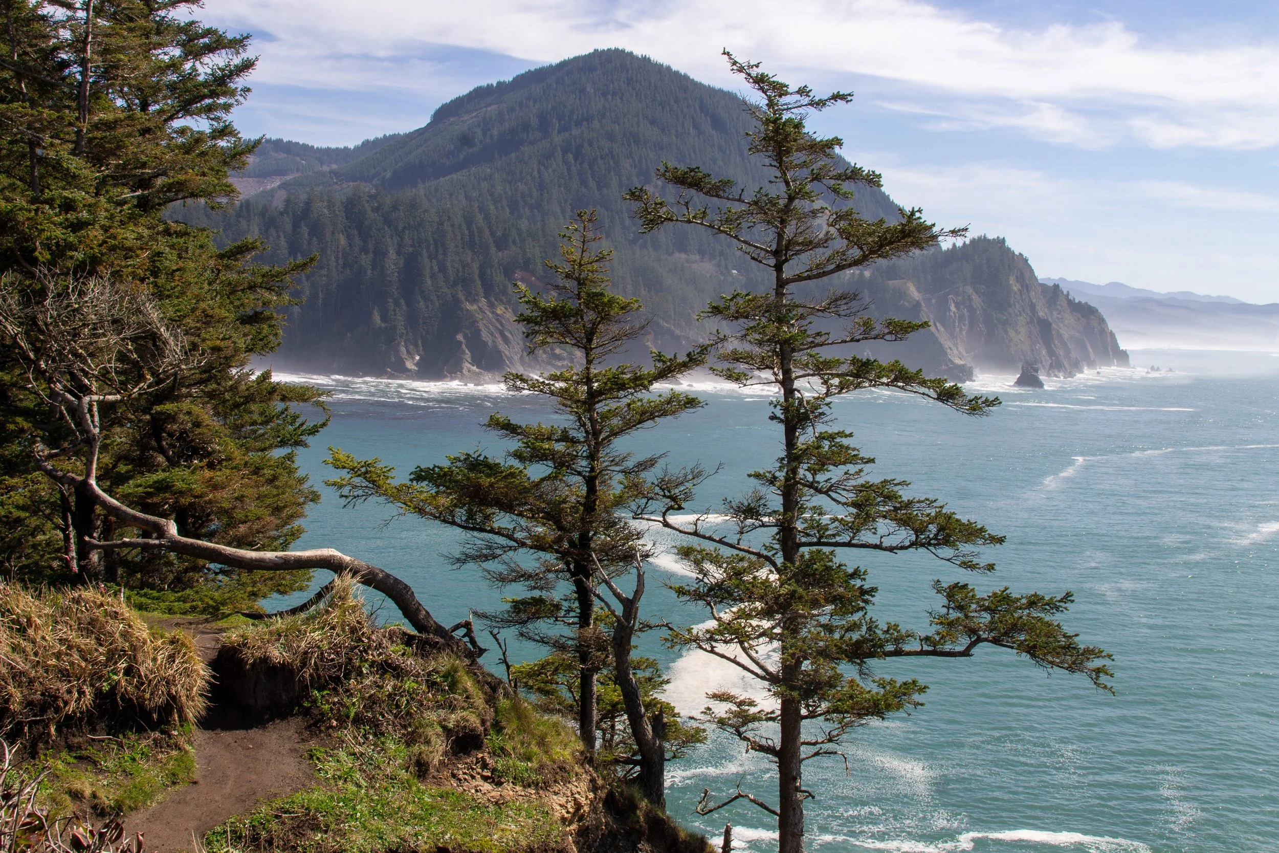
The most beautiful tree on the Cape Lookout Trail
Know before you go
It’s free to hike the Cape Lookout Trail. You don’t need a pass to park at the trailhead.
This trail is popular. The parking lot is large and usually keeps up with demand. It may fill up on beautiful summer weekends. I had no issues parking late morning on a summer Sunday.
Restrooms are at the parking lot.
Leashed dogs are welcome on the Cape Lookout Trail.
The trail is usually muddy and has tons of tree roots. Wear hiking boots, not sneakers.
The Cape Lookout Trail isn’t very family-friendly. It’s near drop-offs and has rough terrain. Older kids would be fine, but I’d skip it with younger ones.

Cape Lookout Trail
On the trail to Cape Lookout
Distance: 5 miles out and back
Elevation gain: 900 feet
Difficulty: Moderate
Pass required: None
Dog friendly: Yes, leashed dogs are welcome on the trail.
ADA access: No
Season: All year
The details
The Cape Lookout Trail starts next to the big sign with the map. Take the trail closest to the sign, following the arrows toward the Cape Trail and South Trail. Ignore the North Trail farther to the right, which leads to Cape Lookout State Park. It’s closed for the foreseeable future due to damage to a footbridge.

Start here
After starting the trail, you’ll reach the hike’s only junction in about 0.1 miles. Keep right to stay on the Cape Trail. To the left is the South Trail that heads down to the beach beneath Cape Lookout. It’s also a cool destination and could be a good side trip on the way back if you have time and energy after the lookout hike.

Stay on the Cape Trail
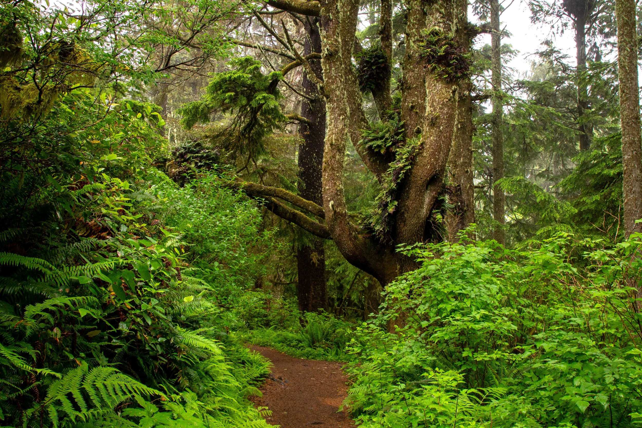
We’ll take the Cape Trail. You’ll start heading gradually downhill through a forest that feels like a dense jungle. Ferns, salal, and evergreen huckleberry fill the undergrowth. Sitka spruce and hemlock tower overhead. In spring and summer, look for blooms like false lily of the valley, trillium, monkeyflower, and goat’s beard. Salmonberries ripen along the trail in summer.

Misty morning on the Cape Lookout Trail
In about half a mile is a memorial plaque for the victims of a 1943 plane crash. While flying through dense fog, a B-17 bomber on a routine flight crashed into Cape Lookout, which stands about 900 feet above the ocean. Of the ten men on board, only one survived.

Memorial plaque
Near the memorial, a gap in the tree cover offers one of the first good views of the coastline to the south. Look for Cape Kiwanda and Haystack Rock in the distance.

View to the south
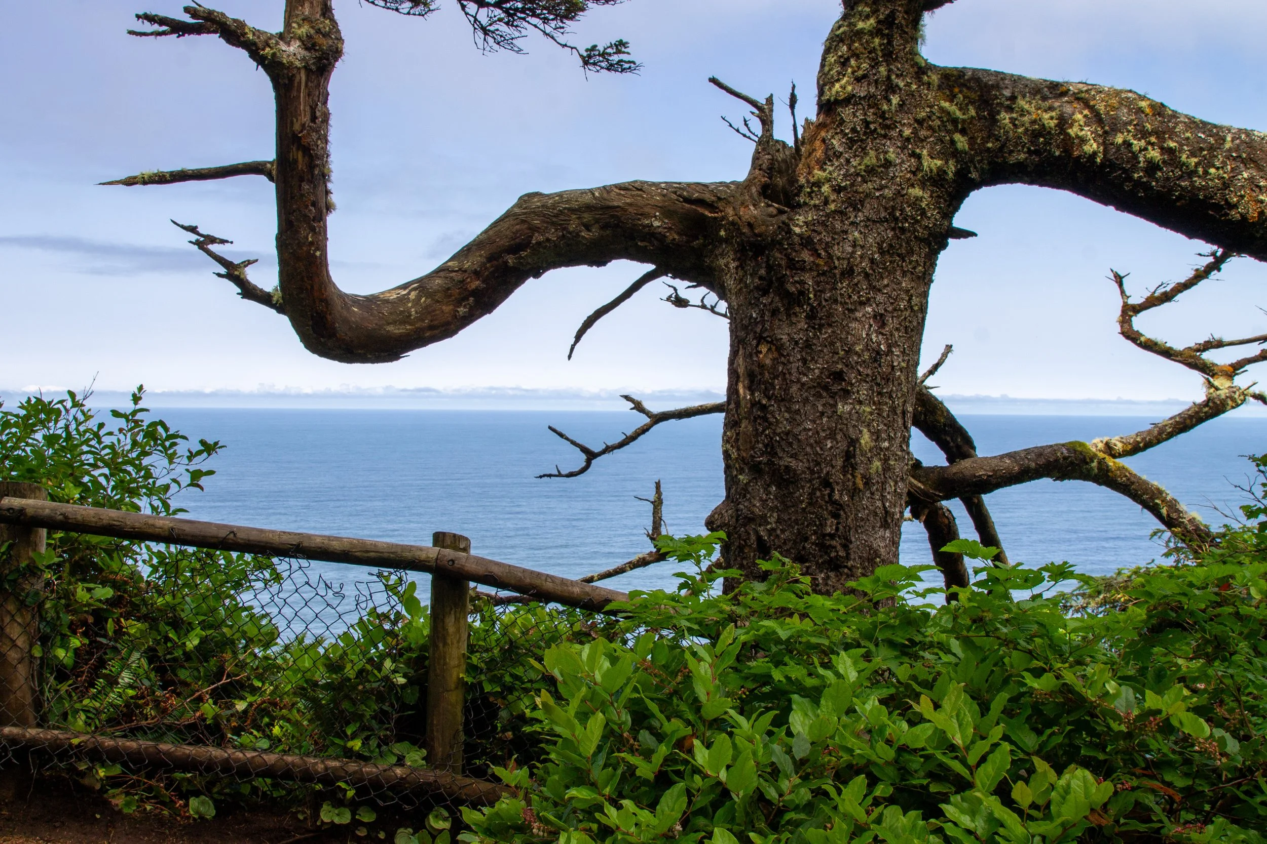
About a mile from the trailhead is a fence in front of a gnarled Sitka spruce and an ocean view. Looking past the branches, you can see some of the coastline to the north, including Three Arch Rocks in Oceanside. People were resting here both on my way out and back. The trail gets harder after this viewpoint, and I started seeing fewer hikers after passing it. It’s a decent turnaround point if you want to avoid the quagmire up ahead.
End of the easy part
I’m calling this hike moderate intensity, but that doesn’t fully describe it. The first half is pretty easy with mostly even terrain. The second half is a mess of tree roots and mud puddles. We now begin part two, the swamp.
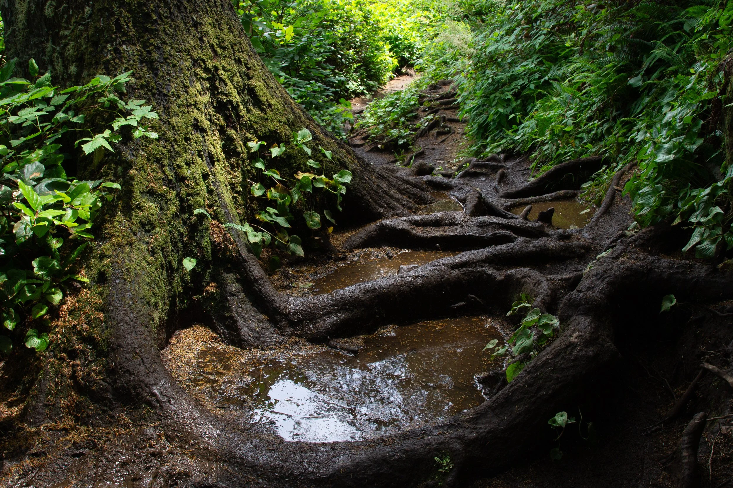
Trail conditions worsen
A little after the halfway point, you’ll pass a notch in the north side of Cape Lookout called Wells Cove. It’s hard to get a clear view through the brush, but you can glimpse the waves crashing below. Cape Meares is to the north.

Wells Cove almost-viewpoint
The second half of the Cape Lookout Trail has more breaks in the tree cover, revealing lovely ocean panoramas. Good thing, too, since it helps take your mind off the swampy trail and the fact you’ve got mud splatter up past your knees. The trail has a few boardwalk sections. I appreciated them, but wondered at the point of having 100 feet of nice boardwalk along a mile of tree root soup.

Looking south toward Cape Kiwanda
Once you reach the cable fence, you’re at the western tip of Cape Lookout. The trail ends along a rocky ledge almost 400 feet above the Pacific. Yarrow, paintbrush, and wild roses bloom on the ledge just before it drops off. Salal and thimbleberries ripen at the end of the cape in summer (as do inedible twinberries that look a lot like salal).
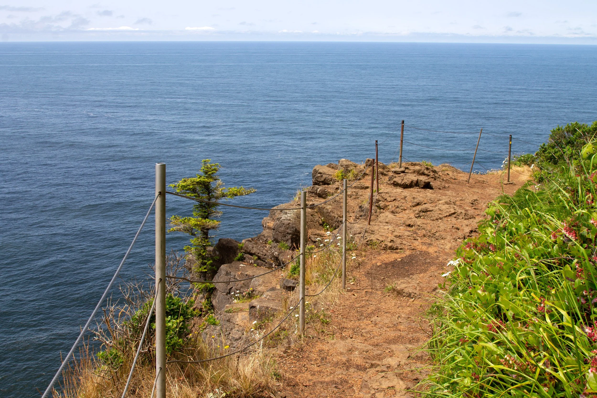
End of the Cape Lookout Trail
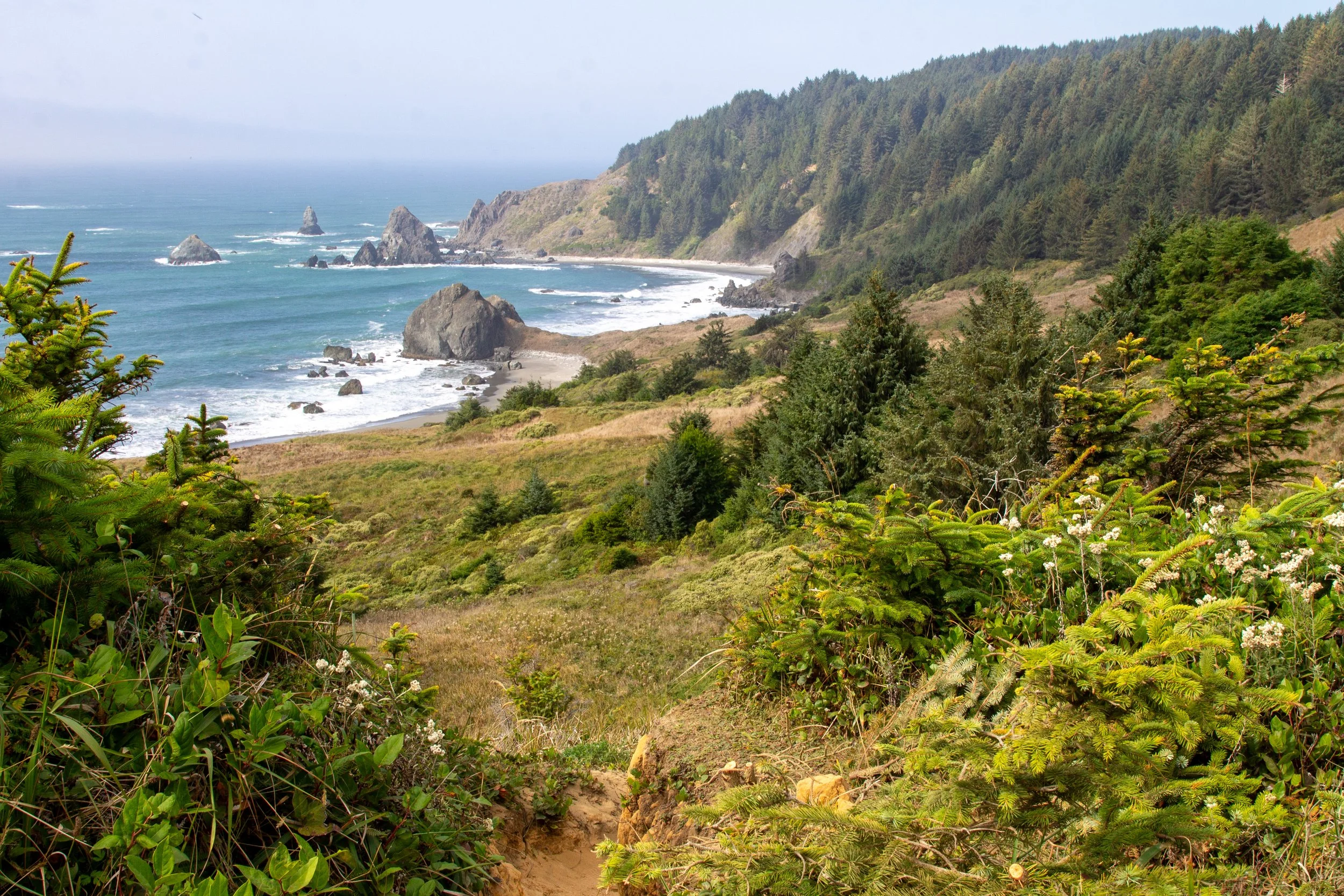
Looking south, you’ll see 40 miles of coastline from your perch on Cape Lookout to Cascade Head. Between them are Sand Lake, Cape Kiwanda, and Haystack Rock.

Sparrow admires the view of Haystack Rock
The end of Cape Lookout is a perfect place for a snack break. After passing tons of hikers on a busy Sunday, I had the viewpoint to myself for a surprisingly long time. I think the mud encouraged many people to turn around early. If you make it to the end, there’s a little bench and some mud-free rocks to have a rest and watch the waves. Cape Lookout is theoretically a great whale-watching spot. Whales come close to shore to navigate around the cape. I haven’t seen whales here, but I've seen plenty of birds. Gulls and crows make regular passes overhead. Sparrows hop up, angling to join the snack break. Pelicans and cormorants fly over the waves. Look for them perched on the cliffs beneath the viewpoint.

Cape Lookout viewpoint
When you’re ready to head back, return the way you came.
Beach access at Cape Lookout

Cape Lookout State Park
After hiking the Cape Lookout Trail, you have a few options for beach access nearby.
On the way back from the end of Cape Lookout, you can take the South Trail to the beach. It’s about 3.5 miles round-trip with a lot of uphill walking on the return trip. The payoff is spending time on the harder-to-reach and more secluded side of Cape Lookout.
If, like me, you’re pretty tired after the Cape Lookout hike, you can drive a few miles to Cape Lookout State Park for instant beach access. You’ll need the Oregon State Park Pass ($10/day) to park. The park will be under construction from the fall of 2025 into 2026. Check here for updates and closure information.
Normally, the North Trail connects the Cape Lookout Trail to the state park. It’s closed for now because damage to a bridge makes it unsafe for hikers.
Enjoy your hike on the Cape Lookout Trail!
With love,
Emma
Getting there
To reach the Cape Lookout Trail from Portland, take Highway 26 W until Banks, then take US 6 W to Tillamook. Once you’re in Tillamook, turn left onto Main St. Then, in two blocks, make a right onto OR-131 W. In 4.9 miles, make a slight left onto Whiskey Creek Road. In 5.2 miles, continue onto Cape Lookout Rd. In 2.7 miles, the Cape Lookout Trailhead will be on your right.
The drive from Portland takes a little under 2 hours. The roads are paved and in good condition.
Explore nearby
Find another incredible Oregon Coast viewpoint and so much more mud on the Cape Falcon Trail.
Check out the best hikes on the Oregon Coast.
Drive the Three Capes Scenic Loop, one of the best Oregon Coast road trips.