
Visiting Cape Perpetua by the Tide

Disclosure: post contains affiliate links.
Cape Perpetua Scenic Area on the Oregon Coast is a place I would happily visit twice on the same day. And have. Depending on the weather, the currents, and the season, it’s never quite the same, no matter how many times you go. Few things will impact your experience quite so much as the tide. The crashing waves at high tide bring out the drama and geologic wackiness of the rocky coastline. Low tide reveals a wild abundance of tidepool life. Here’s everything you need to know about visiting Cape Perpetua.
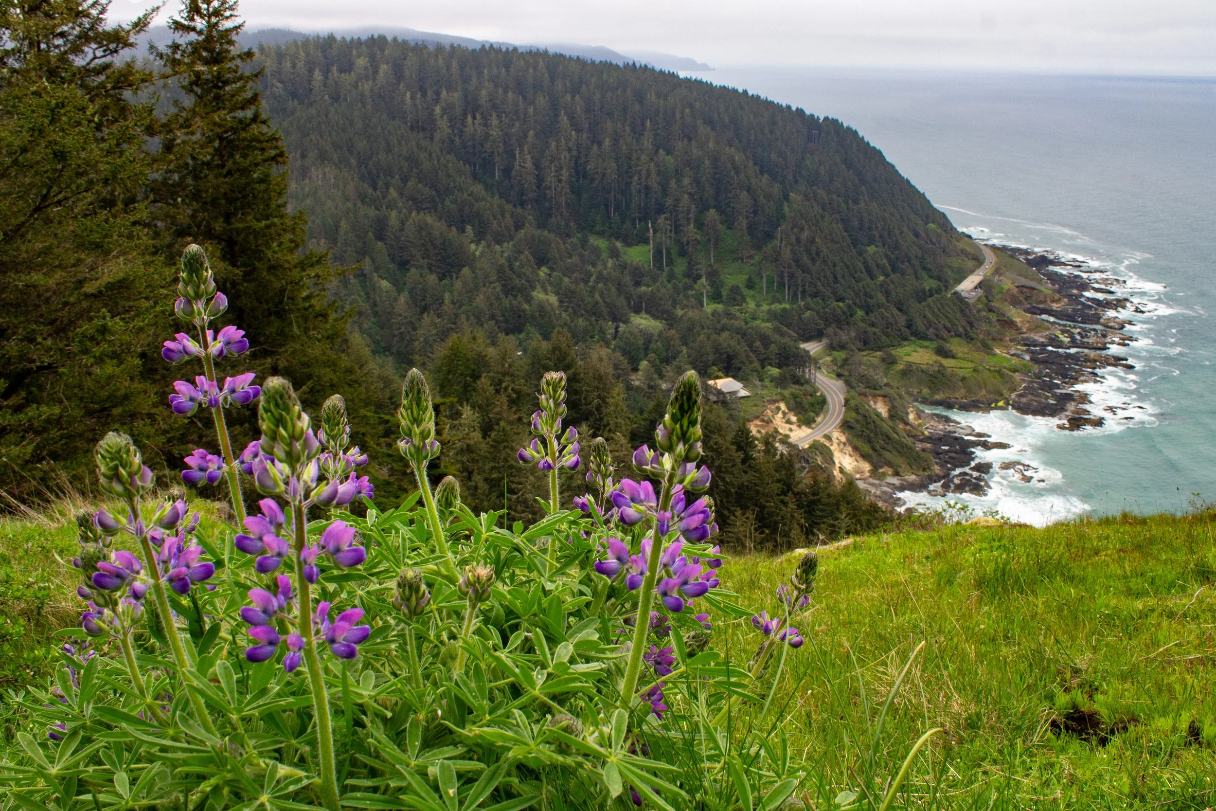
Lupines bloom near the Cape Perpetua Overlook
Know before you go
Cost: Parking at Cape Perpetua costs $5/day. You can use the NW Forest Pass, America the Beautiful Pass, or Oregon Pacific Coast Passport. If you don’t have a pass, you can buy one from the Cape Perpetua Visitor Center.
Parking: Cape Perpetua has multiple parking areas. They can fill up during popular times. Arrive early or late in the day in the summer, especially on weekends.
Restrooms are at the Cape Perpetua Visitor Center, Devils Churn, and the Cape Perpetua Overlook.
Dogs: Leashed dogs are welcome at Cape Perpetua.
Accessibility: If you use a wheelchair, check out the views from the Cape Perpetua Visitor Center observation deck. There’s also an accessible overlook closer to the coastline beside the parking area just off Highway 101. The trail down to the coast is paved, but has steep grades and stairs at the end.
Safety: Be cautious and aware of your surroundings when you’re near the ocean. Waves can come onto the shore without warning, no matter the tide. Cape Perpetua is a place where I see people making questionable decisions, especially near Thor’s Well.
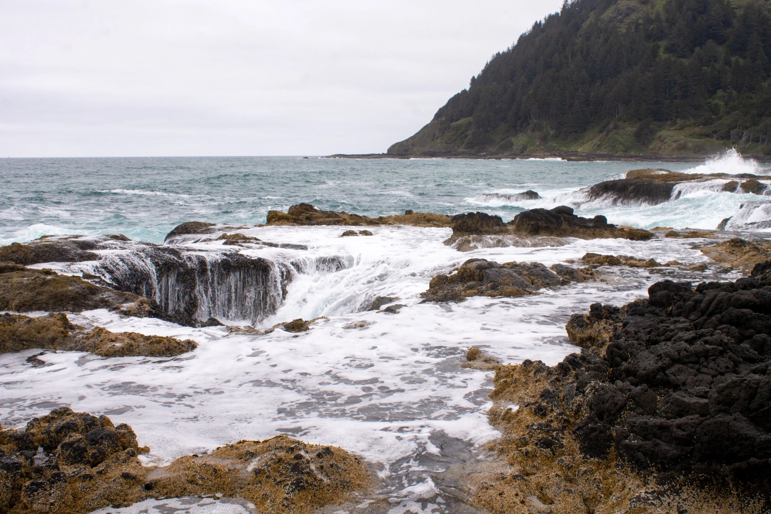
Thor’s Well
Quick geology
The rocks at Cape Perpetua have a history that began over 30 million years ago with an offshore volcanic eruption. It deposited thick layers of basaltic lava that, along with millions of years of erosion and uplift, created the headland and marine platform at Cape Perpetua. Waves crashing against the broad rocky shore shaped it in ways that can be memorable and unexpected. The most distinctive sights are the Devils Churn, Spouting Horn, and Thor’s Well.
Tides and tide tables
Best at high tide: Devils Churn, Cook’s Chasm, Thor’s Well, and Spouting Horn
Best at low tide: Tidepools and Cape Cove Beach
Any tide: Cape Perpetua Overlook, visitor center, and inland hiking trails
If you visit Cape Perpetua Scenic Area based on the tide, you’ll want to use a tide table. Tide tables are predictions similar to weather forecasts that tell you when to expect high and low tides each day. The lower the number, the lower the tide. Tides at or below zero are very low. Note whether a tide is rising or falling during your visit so you aren’t surprised by encroaching waves. Don’t worry about arriving right at high or low tide. Cape Perpetua is never boring.
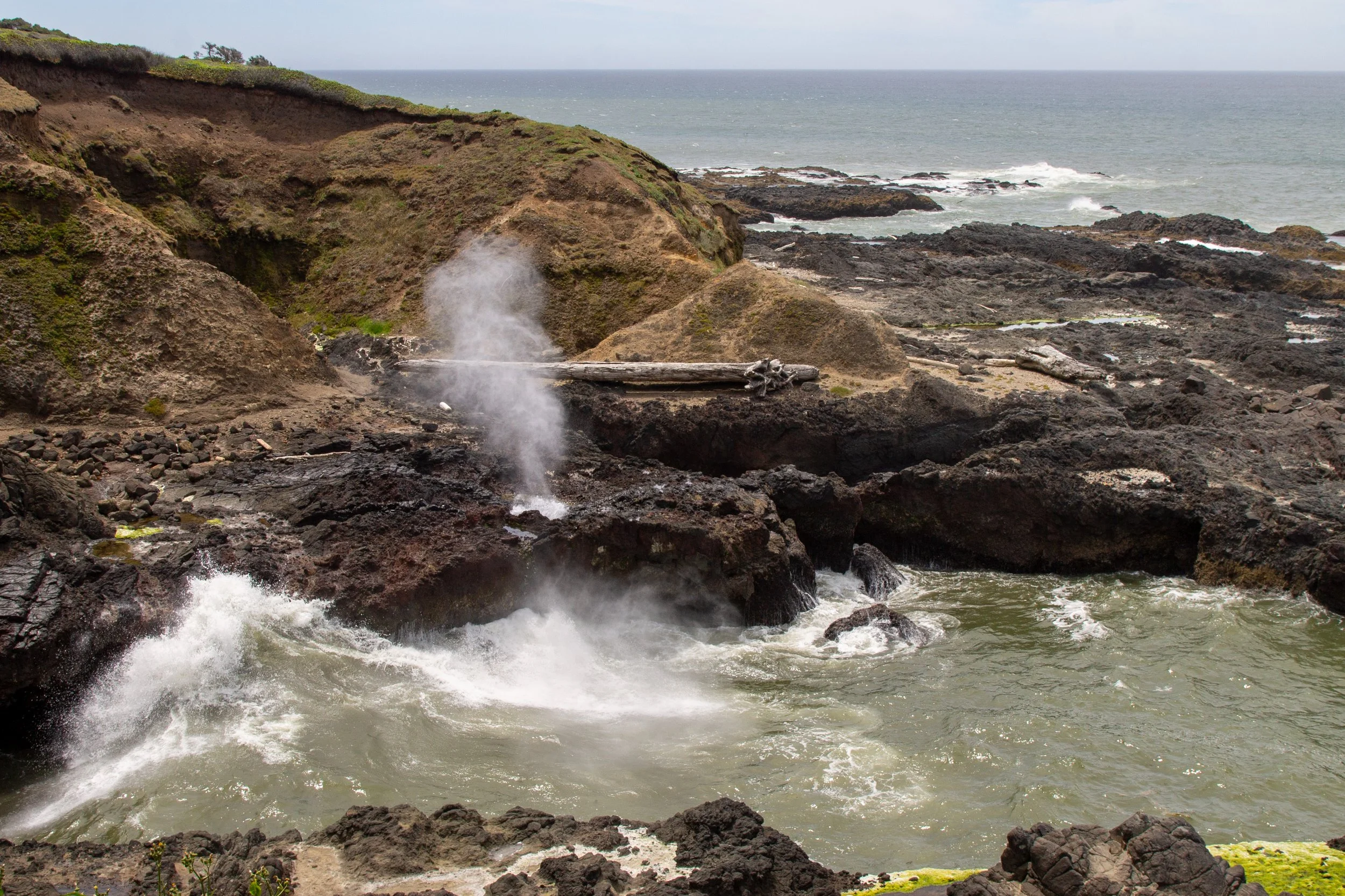
Spouting Horn at high tide
High tide
Cape Perpetua’s most famous features can be a little underwhelming at low tide. Spouting Horn doesn’t spout. Thor’s Well is just a hole. High tide is a different story. Here are the coolest sights in Cape Perpetua when the tide rises.
Devils Churn
If you’re driving south from Yachats, the Devils Churn is the first stop in the Cape Perpetua Scenic Area. The parking lot is just off Highway 101. If you aren’t staying long, you can use one of the 15-minute parking spots and skip the recreation pass. You’ll be able to see Devils Churn from above at an overlook next to the parking lot. It’s fenced and family-friendly, unlike the area below.
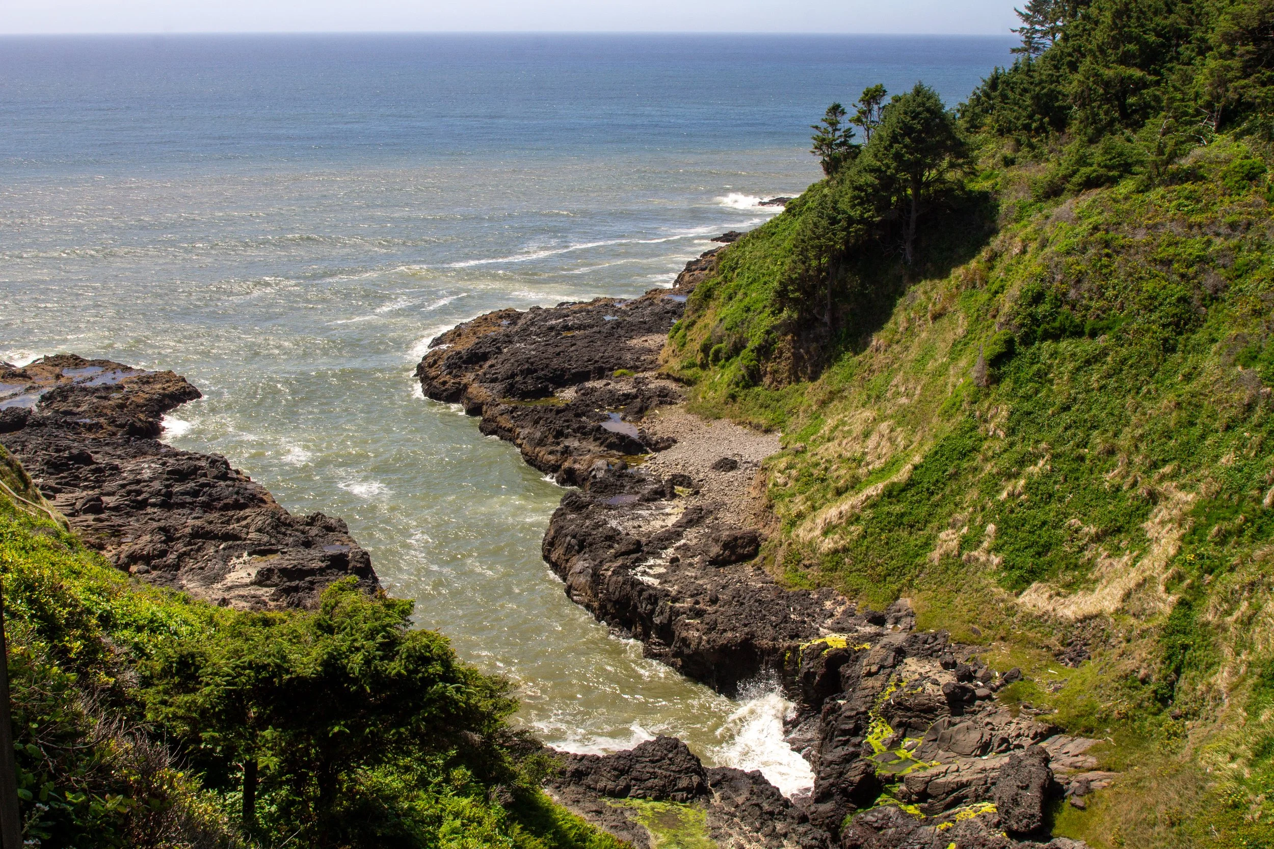
Devils Churn
It’s worth taking the short (about 0.25-mile) trail down to the water to see the Devils Churn up close. When you reach the end of the staircase, you’ll be next to the huge channel that began as a crack a long, long time ago. Standing next to the Devils Churn, you’ll hear the sound of waves rolling in from the ocean, amplified by the narrowness of the channel. At low tide on a calm day, they‘re almost gentle. At high tide, they crash with startling booms. You may see a few sea stars clinging to the walls of the Churn despite its powerful waves, a testament to their grip.
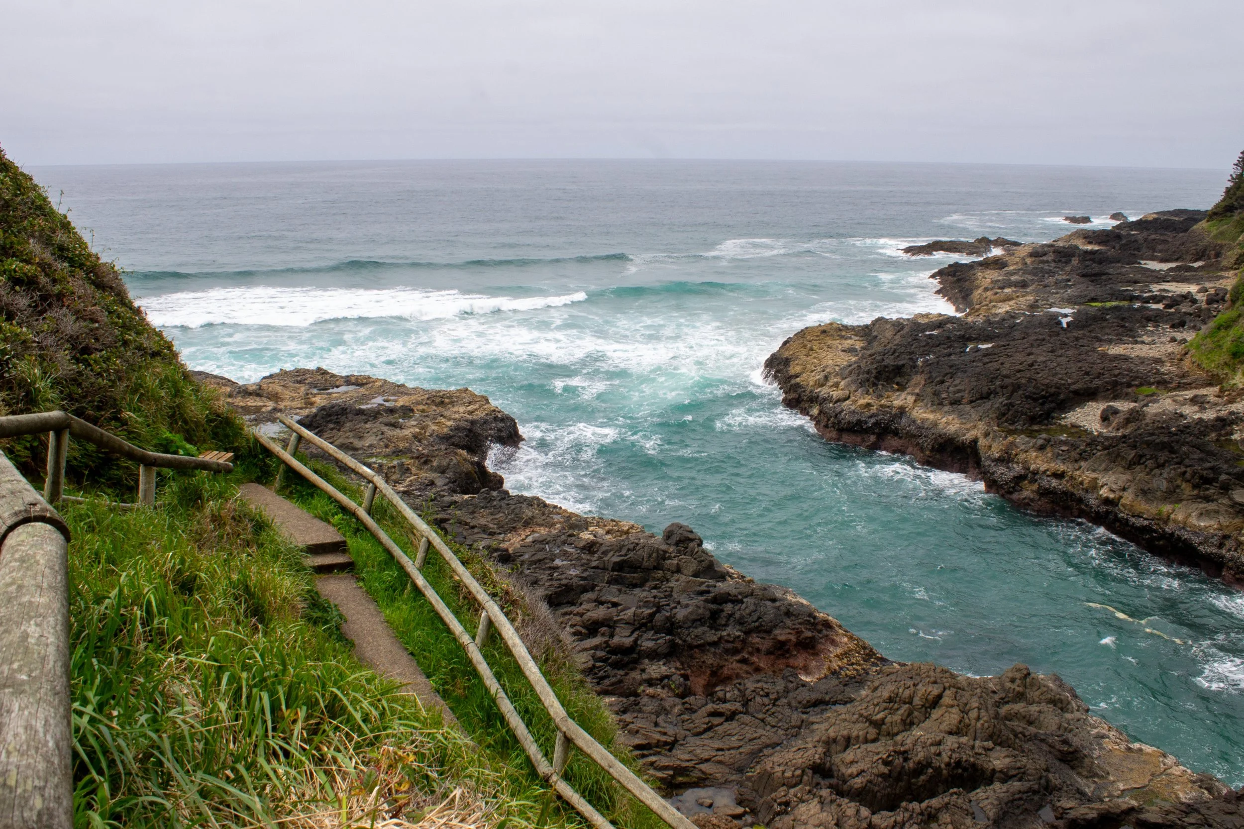
Stairs lead down to the Devils Churn
If you head south from the Devils Churn, a faint and rocky trail will take you around the base of a headland to secluded Cape Cove Beach. Visitors to Cape Perpetua often overlook it. Unlike the Devils Churn, it’s better to visit at low tide when the ocean doesn’t limit access to the shore.
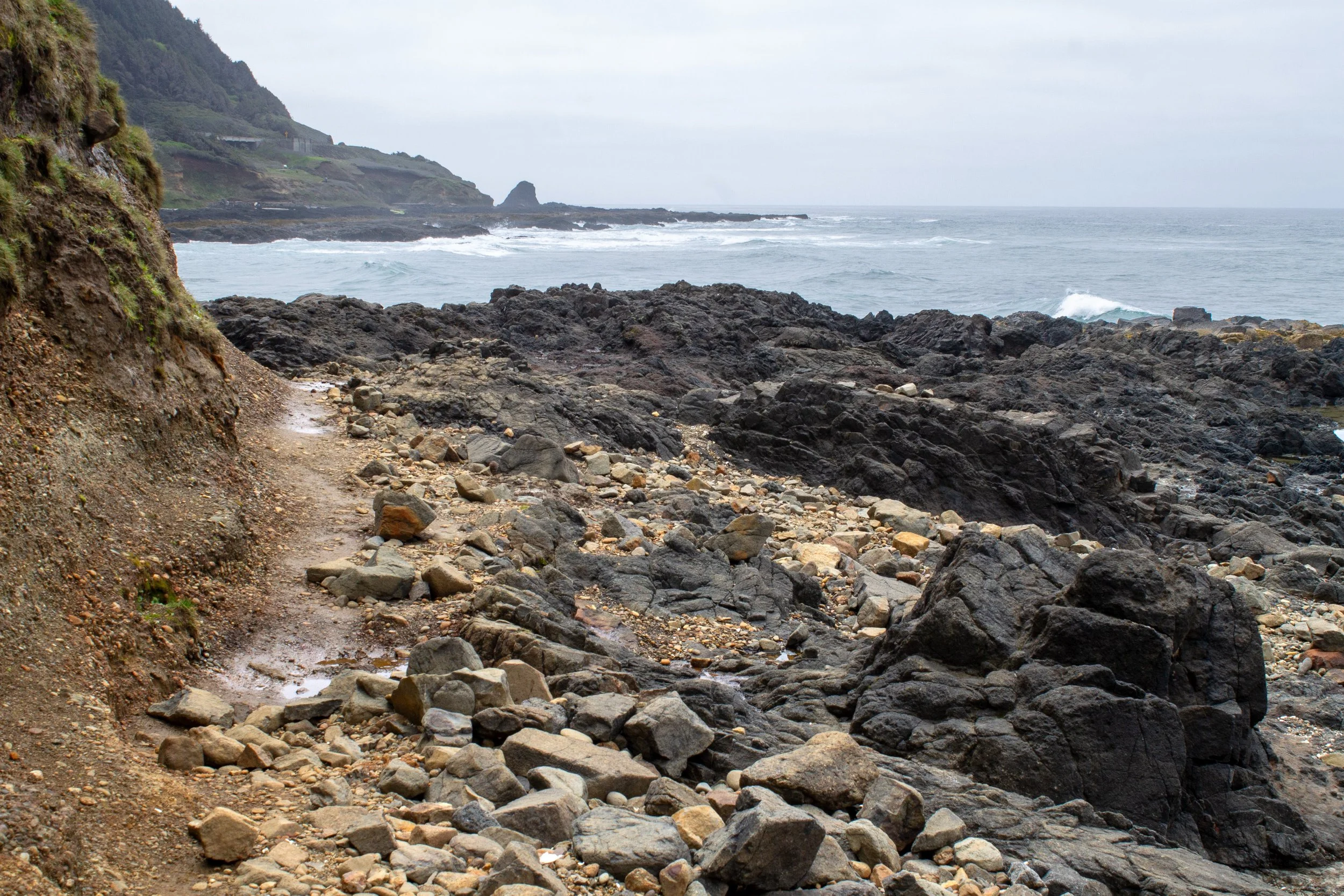
Trail from Devils Churn
Cook’s Chasm and Spouting Horn
If you only do one thing at Cape Perpetua, take the Captain Cook Trail down to the shore. If you start at the visitor center, the hike is a fairly easy 1-mile loop that will take you past the tidepool area, Cook’s Chasm, Spouting Horn, and Thor’s Well. If you park in the small lot off Highway 101, the trail is only 0.6 miles. When you get down to the shore, you’ll be at Cook’s Chasm and Spouting Horn.
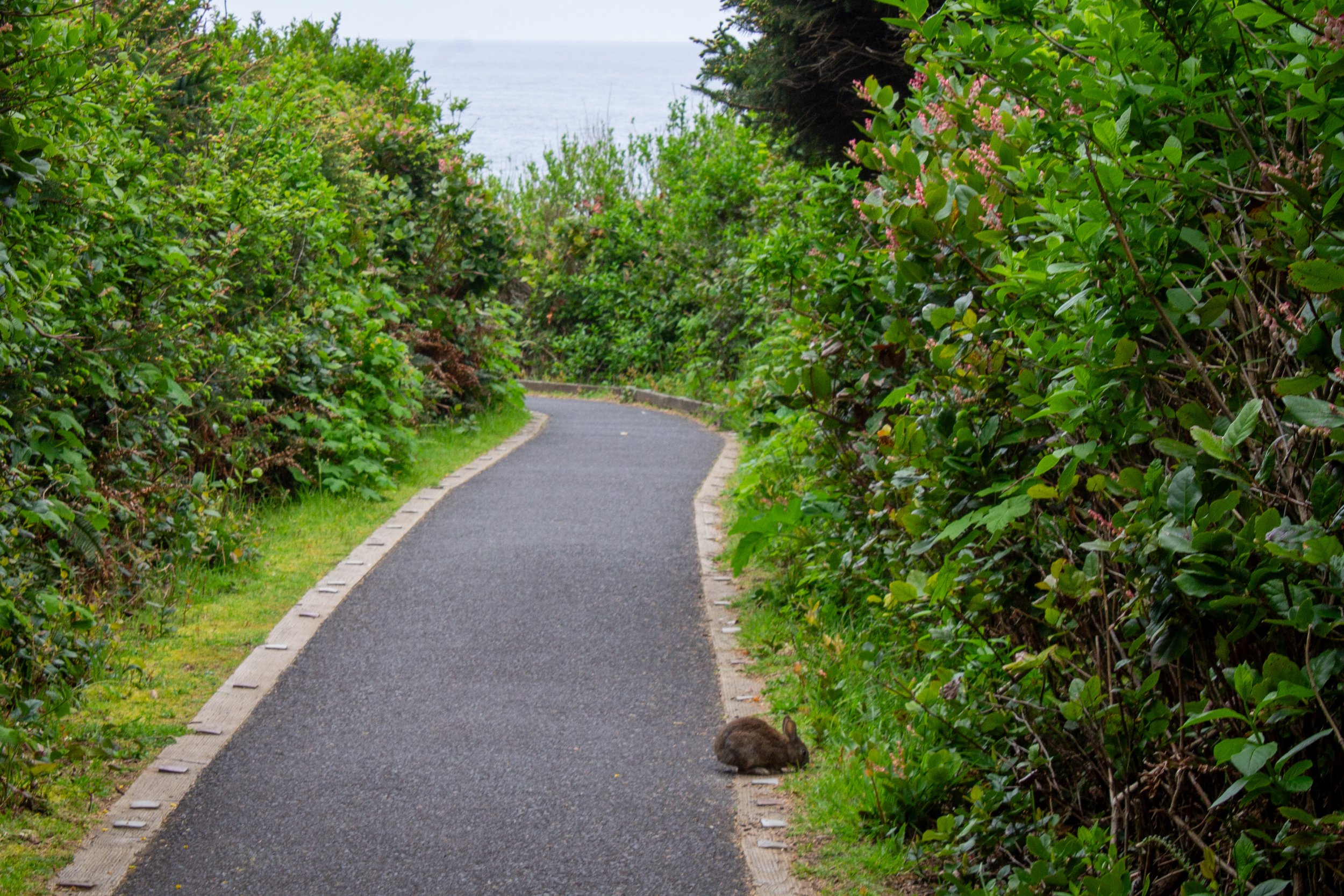
Rabbit on the Captain Cook Trail
Much like the Devils Churn, Cook’s Chasm is a giant channel in the shore that began as a crack. Ocean waves have widened it over time. As waves enter Cook’s Chasm, their power becomes concentrated as they roll in and crash against the rough basalt walls. During high tide, water enters Spouting Horn, a small fissure in the rock. The force of the water makes it shoot up like a geyser, sending out a fine mist.

Spouting Horn
Thor’s Well
Nearby Spouting Horn, Thor’s Well is one of the weirdest and coolest rock formations on the Oregon Coast. The gaping pit looks like a path to a watery netherworld. Barnacles and mussels cover every inch of Thor’s Well, and yet, the life thriving in such a harsh home only makes the pit feel more alien and forbidding.
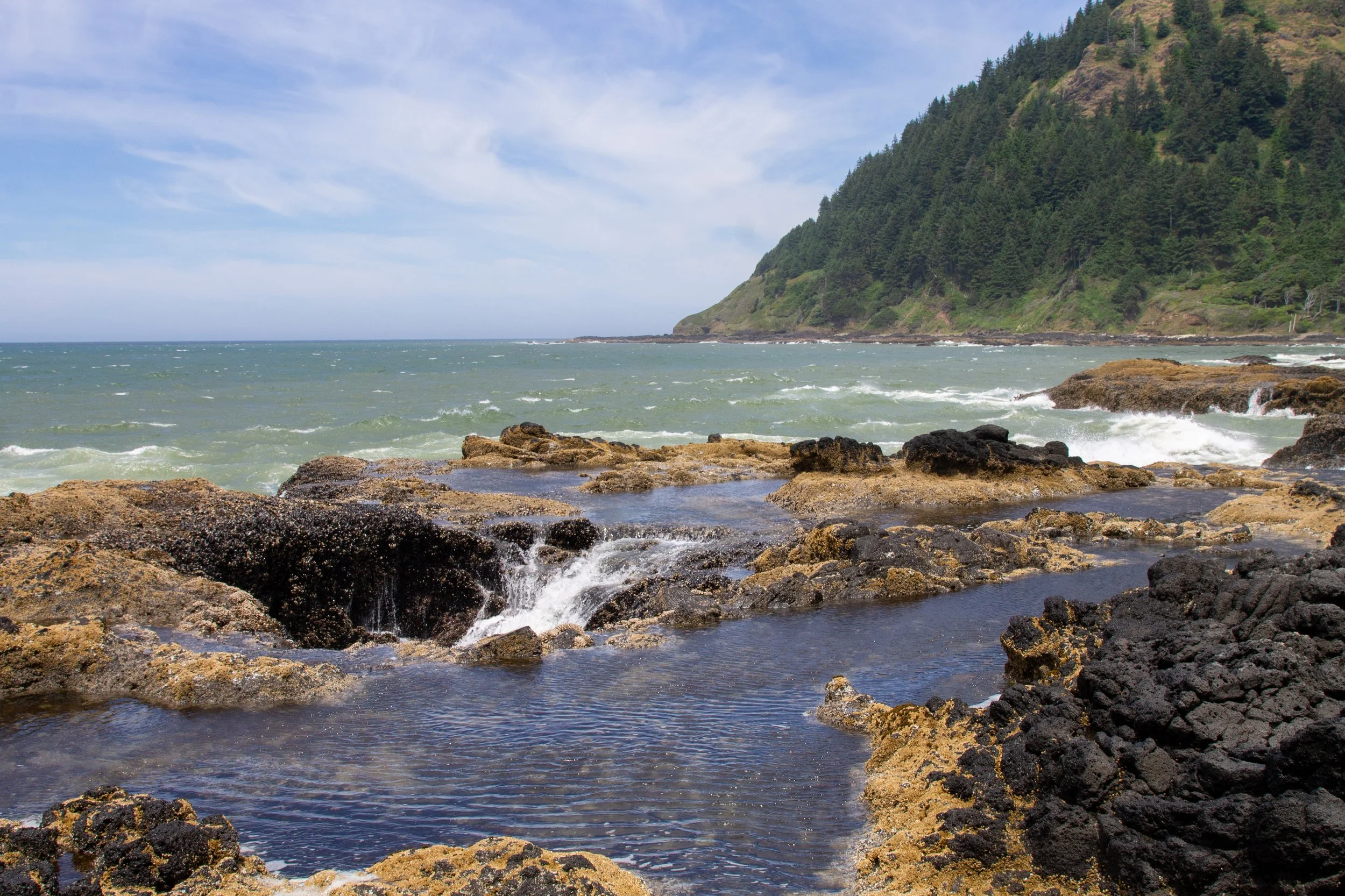
Thor’s Well
Geologists believe Thor’s Well may have started as a slender channel like Spouting Horn that has grown over time. I’ve also seen it called a possible collapsed sea cave. In either case, we can credit the erosive action of the ocean. At high tide, waves surge up through Thor’s Well as if to warn of a watery reckoning, then drain back down just as quickly. If Poseidon had an elevator, this would be it.
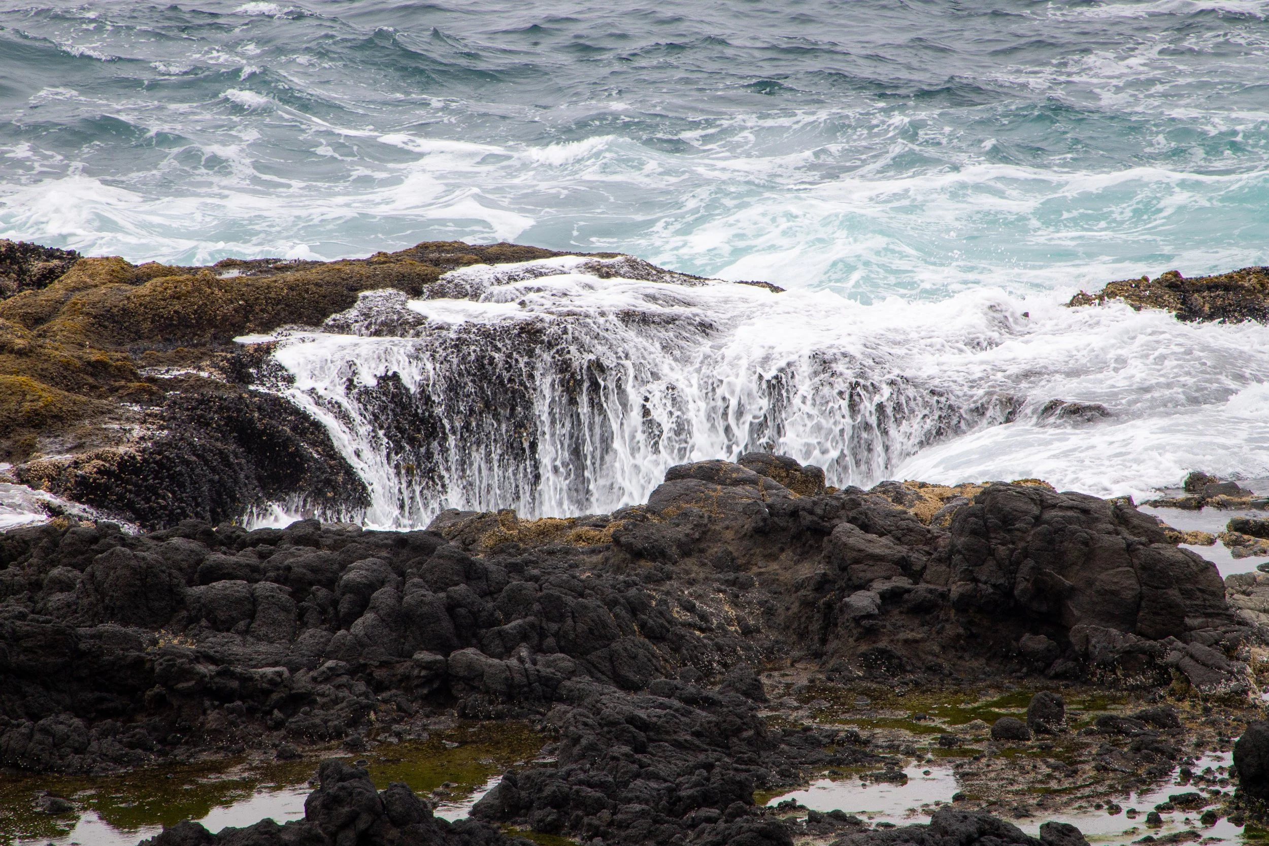
Thor’s Well
Thor’s Well has a reputation for being dangerous, which is true if you get too close. Keep your distance, watch the waves, and use common sense, even if you see others making questionable decisions. Besides the safety risk, intertidal life covers the rocks around Thor’s Well, so stepping too close can injure the critters.
Low tide
Tidepools
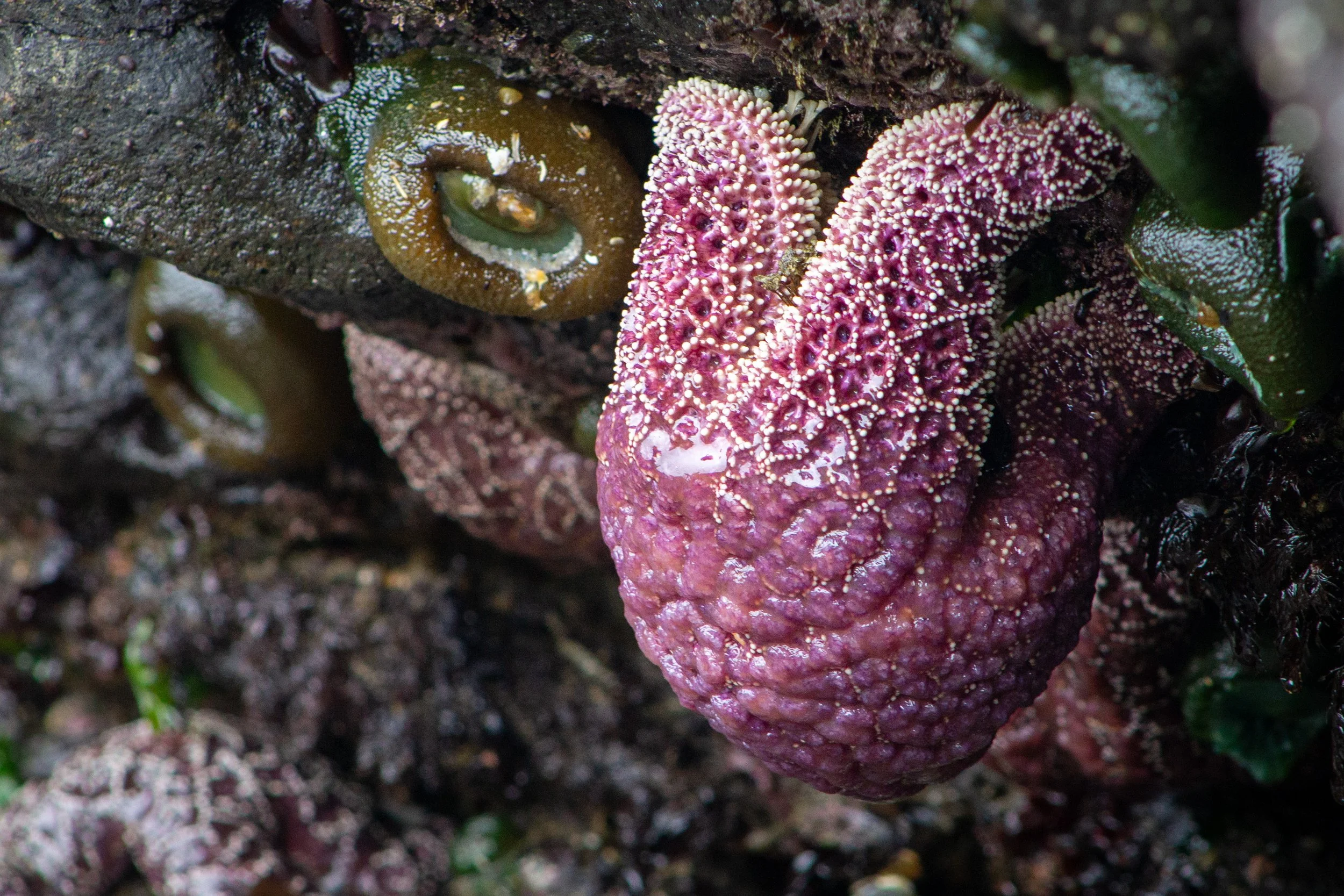
Sea star at Cape Perpetua
When a receding tide starts to make Cape Perpetua’s most famous sights a bit lackluster, it’s a good time to check out the tidepools. The marine garden at Cape Perpetua is one of the most critter-filled and easiest-to-reach intertidal areas on the Oregon Coast. It’s a perfect place to look for sea stars, anemones, barnacles, mussels, crabs, and spiny purple urchins.

Tidepool at Cape Perpetua
The longer I stare at a tidepool, the harder it is to look away. Anemones close suddenly at some real or imagined disturbance. Seemingly inert barnacles send out tiny grasping filaments to collect nutrients from the pool. Sand shifts as hermit crabs scuttle along the bottom. As I crouch by the pool, my legs go numb long before my interest wanes.

Spiny purple urchins
Besides the plants and animals in the tidepools, sea palms grow along the edge of the rocky coast. They’re easiest to see during low tide, and are my vote for the real-life plant that most resembles Dr. Seuss’s Truffula trees.

Sea palms at Cape Perpetua
As with any intertidal area, explore Cape Perpetua’s marine garden with caution and respect. Step only on bare rock to avoid injuring the animals living there. It’s generally okay to gently touch tidepool critters, but don’t touch the inside of an anemone (its digestive tract) or remove anything from the pool. If something is outside the pool, it’s best not to touch it. When in doubt, leave it be. Even at low tide, keep an eye on the waves to stay safe in the tidepool area.
Any tide
Cape Perpetua Overlook
At 800 feet, the Cape Perpetua Overlook is the highest point you can drive to on the Oregon Coast. From the parking area, a 0.2-mile hiking trail makes a loop around the top of the headland. The views are stunning in any tide and any weather other than thick fog.
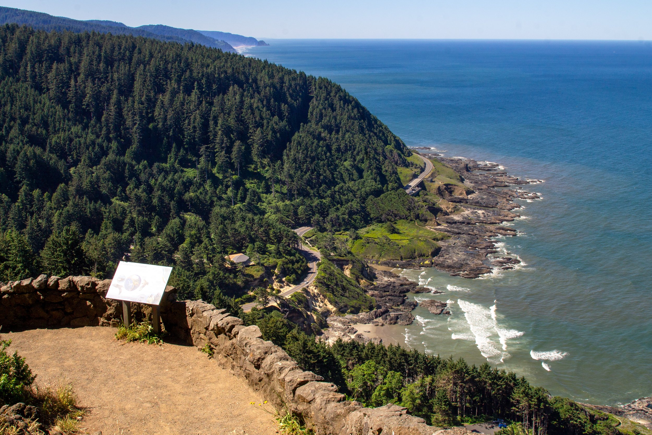
Cape Perpetua Overlook
In late spring and early summer, lupines bloom on the grassy slopes of Cape Perpetua, followed by foxgloves. The highlight of the trail is a stone shelter with panoramic ocean views. You’ll get a great look at the marine platform below. Looking closely, you can see Thor’s Well and Devils Churn. It’s also an excellent whale-watching spot.

Cape Perpetua Stone Shelter
For a more active day, you can hike rather than drive up to the Cape Perpetua Overlook.
Starting from the town of Yachats, a 7.4-mile hike on Amanda’s Trail leads to the Cape Perpetua Overlook.
From the south, the 2.8-mile Saint Perpetua Trail starts at the Cape Perpetua Visitor Center and climbs to the overlook.
Inland hiking trails

Hiking trails in Cape Perpetua Scenic Area explore the Siuslaw National Forest
If you’re visiting Cape Perpetua for the first time, take the Captain Cook Trail to explore the marine garden. If you’re up for more hiking, head up to the Cape Perpetua Overlook. If you still have more time and energy, check out the inland forested hiking trails. Don’t get me wrong, these trails are beautiful and worth exploring. They just don’t have the same uniqueness and wow factor as the sights by the ocean.
The Giant Spruce Trail is a rewarding 2-mile out-and-back hike that leads to a 185-foot, 500-year-old Sitka spruce tree.
The Cook’s Ridge & Gwynn Creek Loop Trail is a 6-mile loop hike through a beautiful old-growth forest. Although mostly inland, you’ll get a few ocean views along the way.
What to bring to Cape Perpetua
Trail snacks
Recreation pass for parking (or buy one at the Cape Perpetua Visitor Center). To learn more about Oregon and Washington recreation passes, check out my guide here.
The trails around Cape Perpetua are doable with sneakers, but between the water, rocks, and possible mud, you’ll be happier in hiking boots. My Keen hiking boots worked out great when I visited.
Getting there
Cape Perpetua Scenic Area is 5 minutes south of Yachats on Highway 101. You’ll first reach the Devils Churn, which has a parking lot on the west side of Highway 101.
To reach the Cape Perpetua Overlook, head 0.4 miles south of Devils Churn and make a left turn onto Cape Perpetua Lookout/NFD-55. Continue for 0.8 miles, then make another left onto a road called Cape Perpetua Lookout. Follow the road to the end, a little under a mile.
To reach the Cape Perpetua Visitor Center and the beginning of the Captain Cook Trail, return to Highway 101 S and make the next left turn.
You can also reach the Captain Cook Trail from the small parking lot on the right side of Highway 101 just south of the turn for the visitor center. Although convenient, parking here is limited.
Enjoy your trip to Cape Perpetua!
With love,
Emma
Explore nearby

Learn more about the best things to do around Yachats.

Find out which Oregon Coast beaches have the best tidepools.
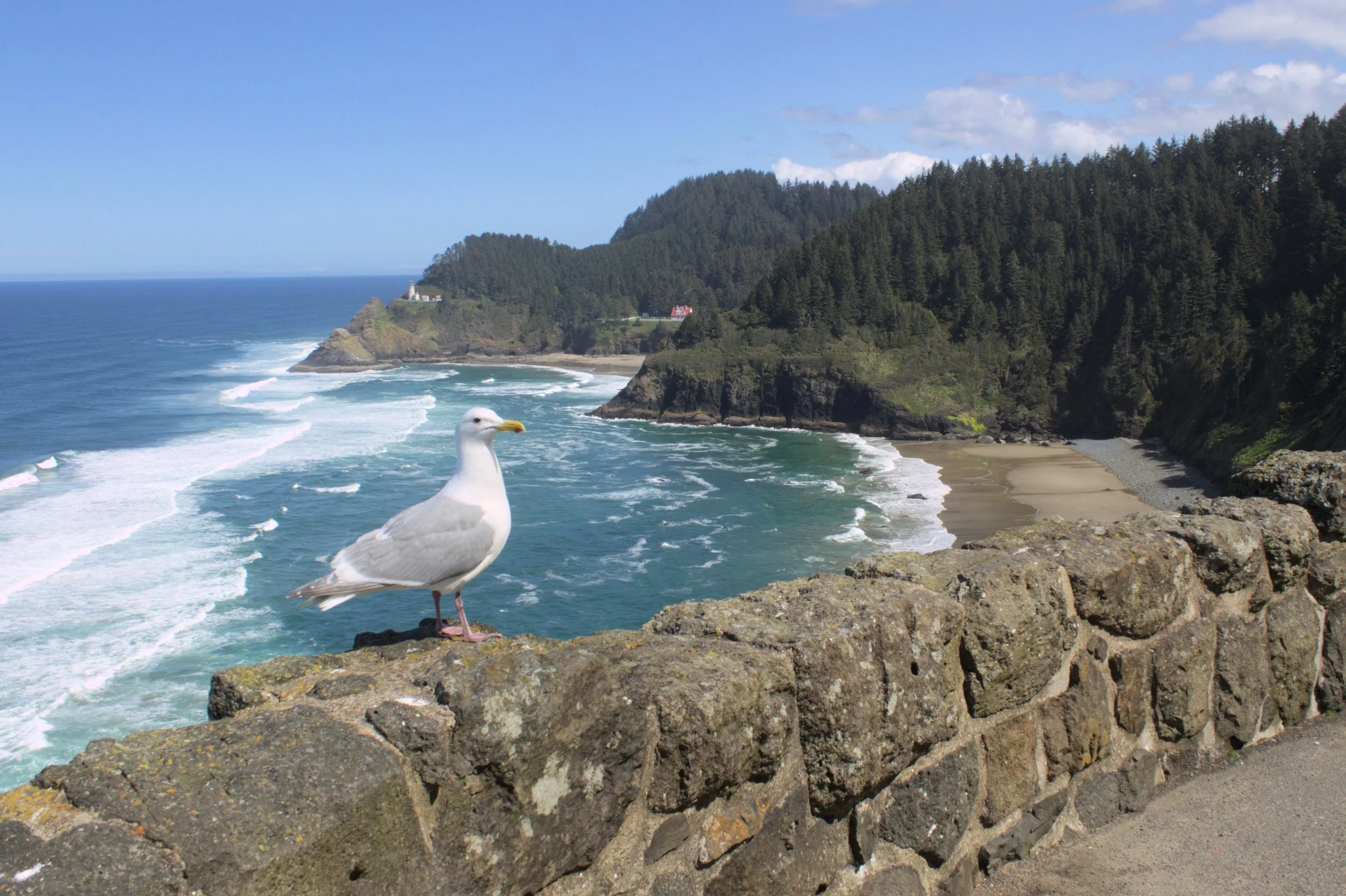
Visit Heceta Head Lighthouse.
References:
Learn more about the geology of Cape Perpetua and the Oregon Coast:
Marli Miller’s Roadside Geology of Oregon
This YouTube video by the Cape Perpetua Collaborative