

Cape Sebastian Hiking Guide


Towering 700 feet above the ocean, Cape Sebastian is the highest overlook on the southern Oregon Coast that you can reach on a paved road. The views extend from Humbug Mountain to Northern California when the skies are clear. The two viewpoints are great quick stops on a road trip. If you have 10 minutes to spare, the short and easy beginning of the Cape Sebastian Trail has unforgettable vistas. If you have a few hours, continuing to the end of the trail brings you to beautiful and secluded Hunter’s Cove on the south end of the cape. Since the Cape Sebastian State Scenic Corridor doesn’t have a map or signs, it helps to know where you’re going before you arrive. Here’s everything you need to know about hiking at Cape Sebastian.
Cape Sebastian Trail
Know before you go
Parking at Cape Sebastian is free. You don’t need a pass.
Cape Sebastian has two viewpoints with separate parking areas. Neither has restrooms. The hiking trails start from the south viewpoint.
Leashed dogs are welcome at Cape Sebastian.
The first half mile of the Cape Sebastian Trail is easy and family-friendly. The end of the hike is close to dangerous areas. Stay safe by staying on the trail.
When I visited, a downed tree blocked the trail just before Hunter’s Cove. I made it through by crawling underneath. The beach access is a bit of a scramble, with ropes to make it easier.
There’s poison oak near the end of the Cape Sebastian Trail. Wear long pants.
The viewpoints

South viewpoint
After you turn off Highway 101 into Cape Sebastian, you’ll have a choice between driving to the north or south viewpoint. I like the south viewpoint better. From the parking area, you can see up to 50 miles to the south on a clear day. The hiking trails also start from here:
The Cape Sebastian Trail is a 3.5-mile out-and-back hike to Hunter’s Cove at the south side of the cape. On the way are several earlier turnaround points for shorter hiking options. This trail is the main event of the Cape Sebastian State Scenic Corridor.
The Oregon Coast Trail descends the north side of the cape. It’s 2 miles out and back to an okay viewpoint, or about 8 miles out and back to beach access.
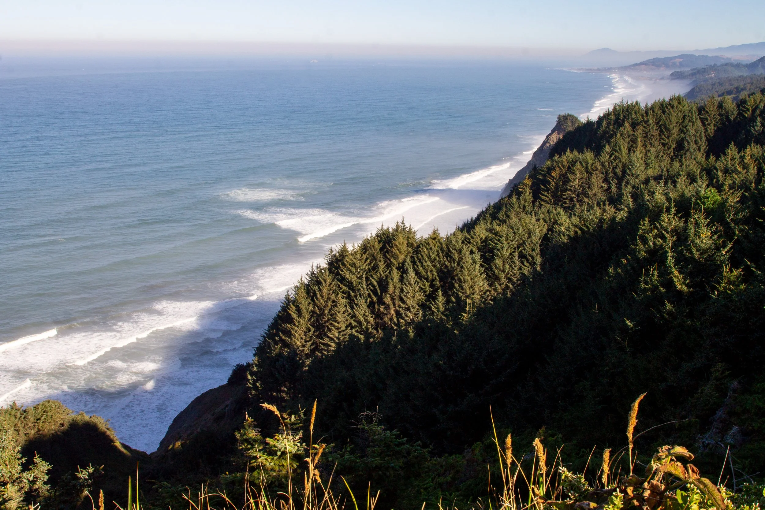
Even if you aren’t interested in hiking, I’d suggest walking a short distance on the Cape Sebastian Trail. You’ll reach a spectacular view of the coastline to the north in less than a quarter mile.
At the north viewpoint, you really only see a patch of the ocean. It’s still pretty, just not quite as interesting. If you’re not in a hurry, check out both viewpoints. They’re close together. The viewpoints are great whale-watching spots. I saw several gray whales on my last visit. One of the cool things about Cape Sebastian is that it’s so high up that when the marine layer obscures the views at lower elevations, you feel like you’re above the clouds.

North viewpoint
Cape Sebastian Trail to Hunter’s Cove
Distance: 3.5 miles out and back
Elevation gain: 700 feet
Difficulty: Moderate
Pass required: None
Dog friendly: Yes, leashed dogs are welcome on the trail.
ADA access: No
Season: Any
The details
Two trails start from the south viewpoint. Keep left to start the Cape Sebastian Trail to Hunter’s Cove.

Start here
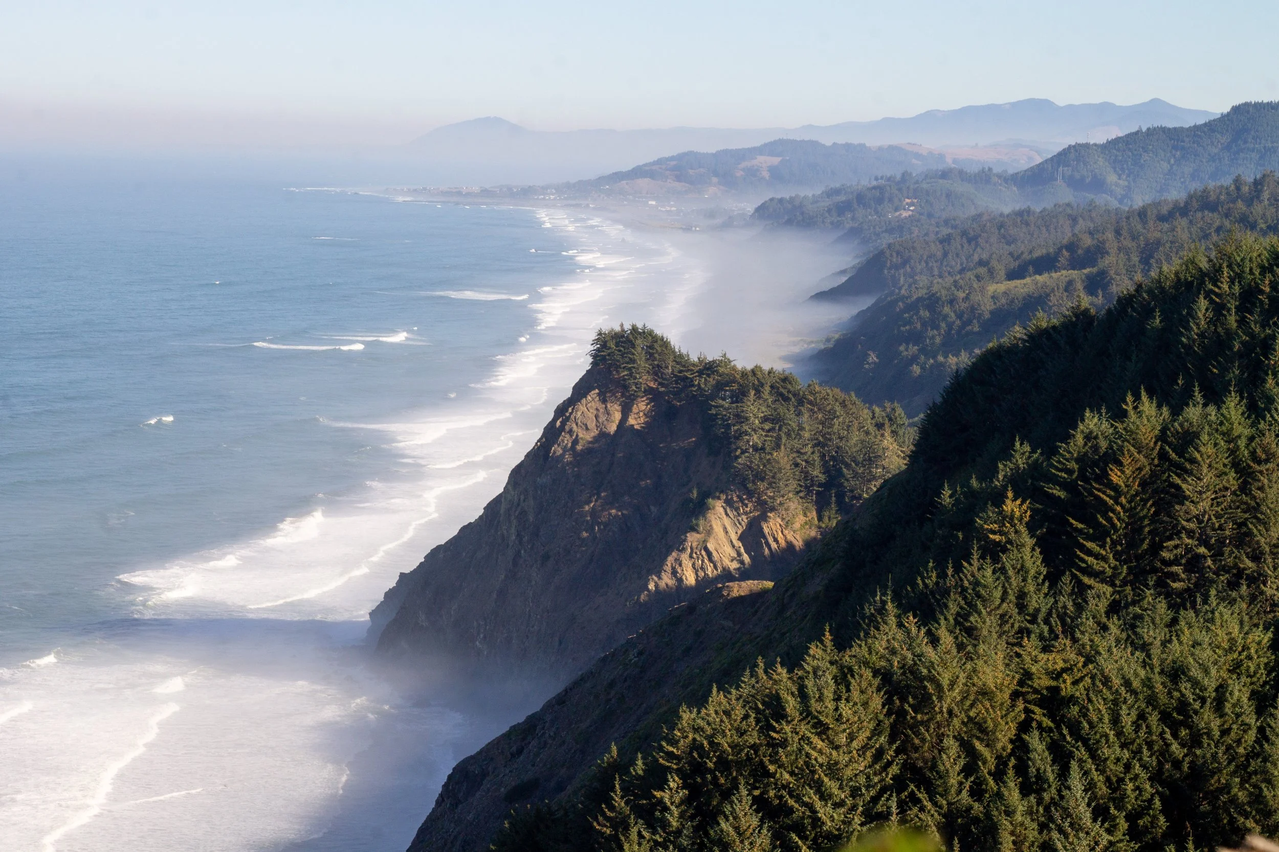
Almost immediately, you’ll reach a much better view of the coastline to the north than you had from the parking lot. On a clear day, you can see as far as Humbug Mountain.
View north
The first half mile of the trail is my favorite. You pass through a dense, tunnel-like coastal forest with breaks in the tree cover that open to excellent views of the cliffs along the ocean. This part of the hike is beginner-friendly and mostly flat.

Sitka spruce forest on the Cape Sebastian Trail
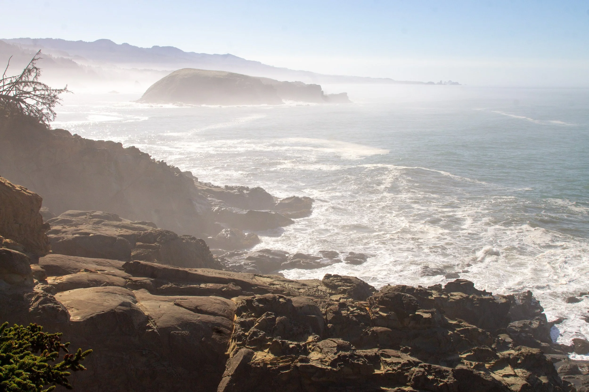
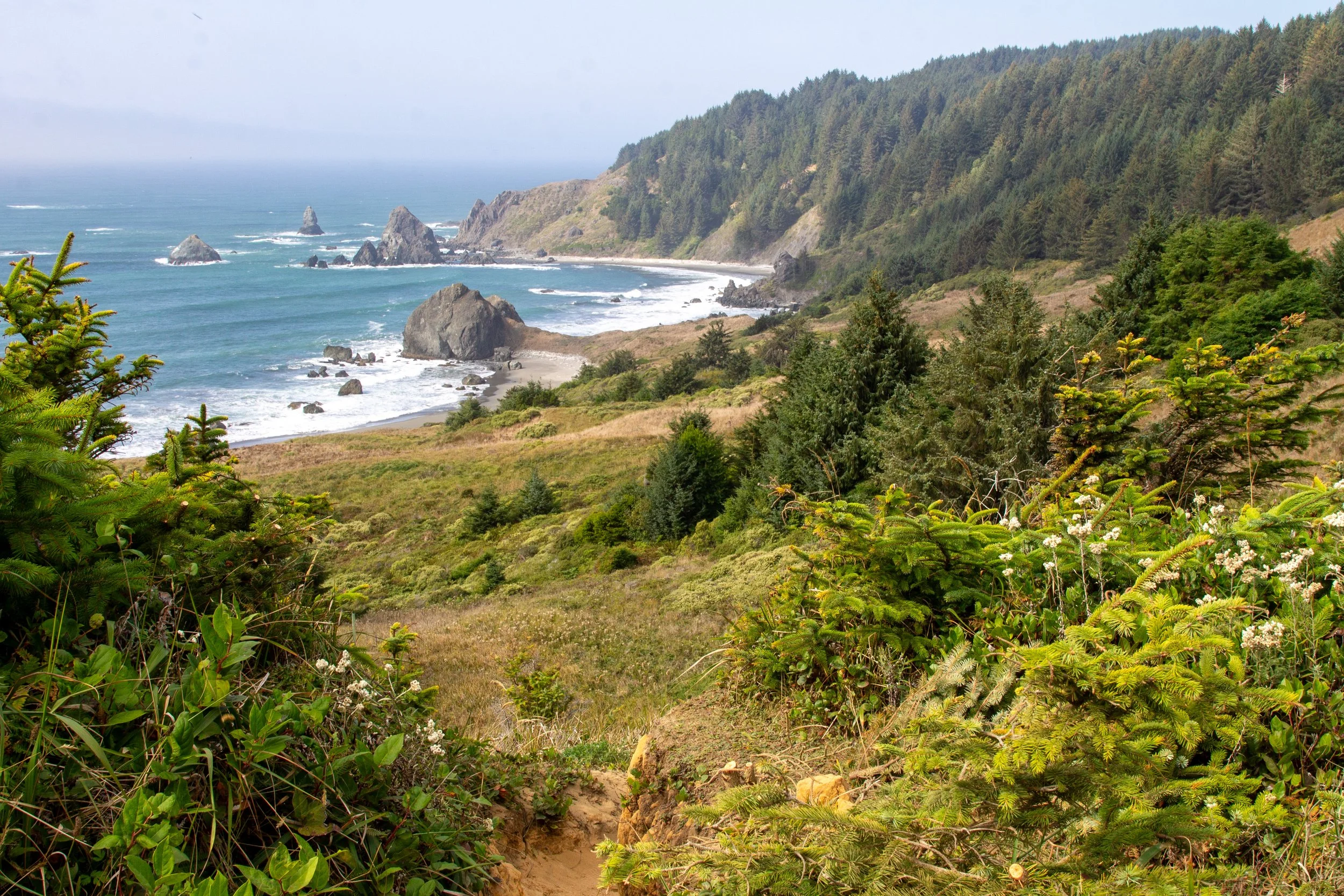
When you reach the first fenced viewpoint, you’ll see the last views of Gold Beach before the trail turns towards the south.

Views to Gold Beach and Humbug Mountain
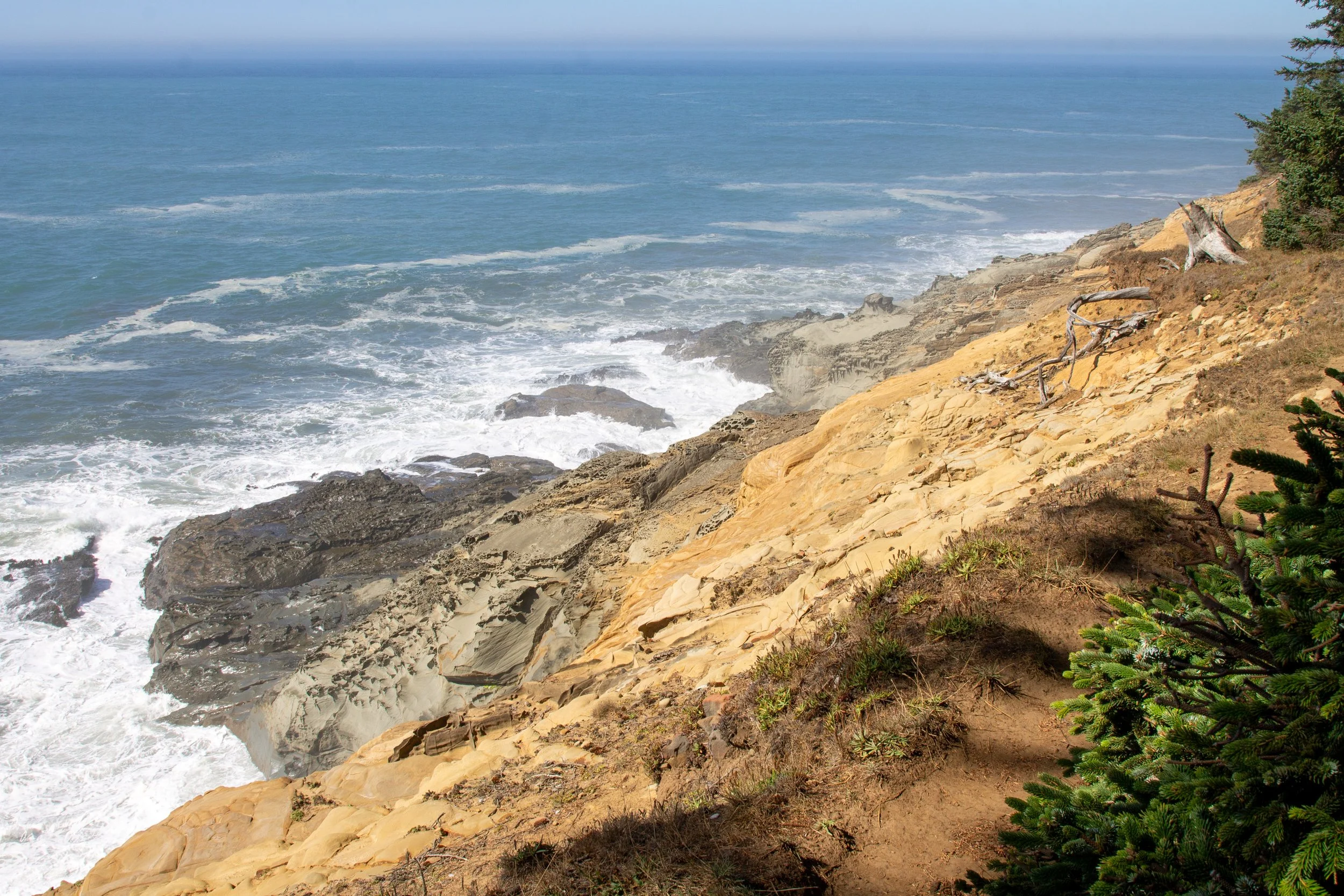
Just ahead is another fenced viewpoint, this one overlooking a beautiful cliff of weathered red and orange sandstone. Beyond the cliff is a sweeping view of the Pacific. I saw several whales in the distance here. After this cliff, the Cape Sebastian Trail gets steeper. It’s a good turnaround point if you’re hiking with children or want to keep the hike an easy road trip stop. It’d be about a mile round-trip.

Cape Sebastian sandstone is about 80 million years old
After the cliff viewpoint, the trail begins descending toward Hunter’s Cove. A set of switchbacks keeps it from getting intense. Chances are you’ll be the only one on the trail. I was the first hiker of the day around 11 AM, which I know because of the density of spider webs.

Cape Sebastian Trail
You’ll start seeing glimpses of the coastline to the south through the trees. The large island nearest Cape Sebastian is Hunter’s Island. Beyond it are the sea stacks near Meyers Creek.

Meyers Creek sea stacks
After the switchbacks, the trail levels out and follows the south side of Cape Sebastian toward Hunter’s Cove. You’ll pass an unmarked fork in the trail. To the right is a sketchy path to a narrow inlet where waves crash on either side of a sandstone outcropping. Don’t bring kids or dogs if you explore it, and stay on top of the outcropping.

The outcropping
Otherwise, keep left at the fork to head towards Hunter’s Cove. False lily of the valley covers the ground beneath the Sitka spruce forest. You can see the ocean through the trees for most of the way.

Cape Sebastian Trail
Most of the wildflowers were gone by fall, but a few asters lingered during my late September hike. Look for paintbrush, iris, lupines, and snow queen earlier in the season.

Asters
The last half mile of the trail follows a ridge above cliffs where waves crash against pockmarked sandstone. Stay on the trail. Most of the reason I don’t consider this hike beginner-friendly is that dangerous areas are a few steps away from the trail.
Waves churn against the rocky shore near the trail
A fallen tree blocked the way just before I made it to Hunter’s Cove. It wasn’t something I could walk around. I crawled under.

The obstacle
I started seeing lots of poison oak near the end of the Cape Sebastian Trail. Between that and the hands and knees crawl under the tree, long pants are a good idea.

Hunter’s Cove
When you make it to the end, ropes assist the descent to the beach.
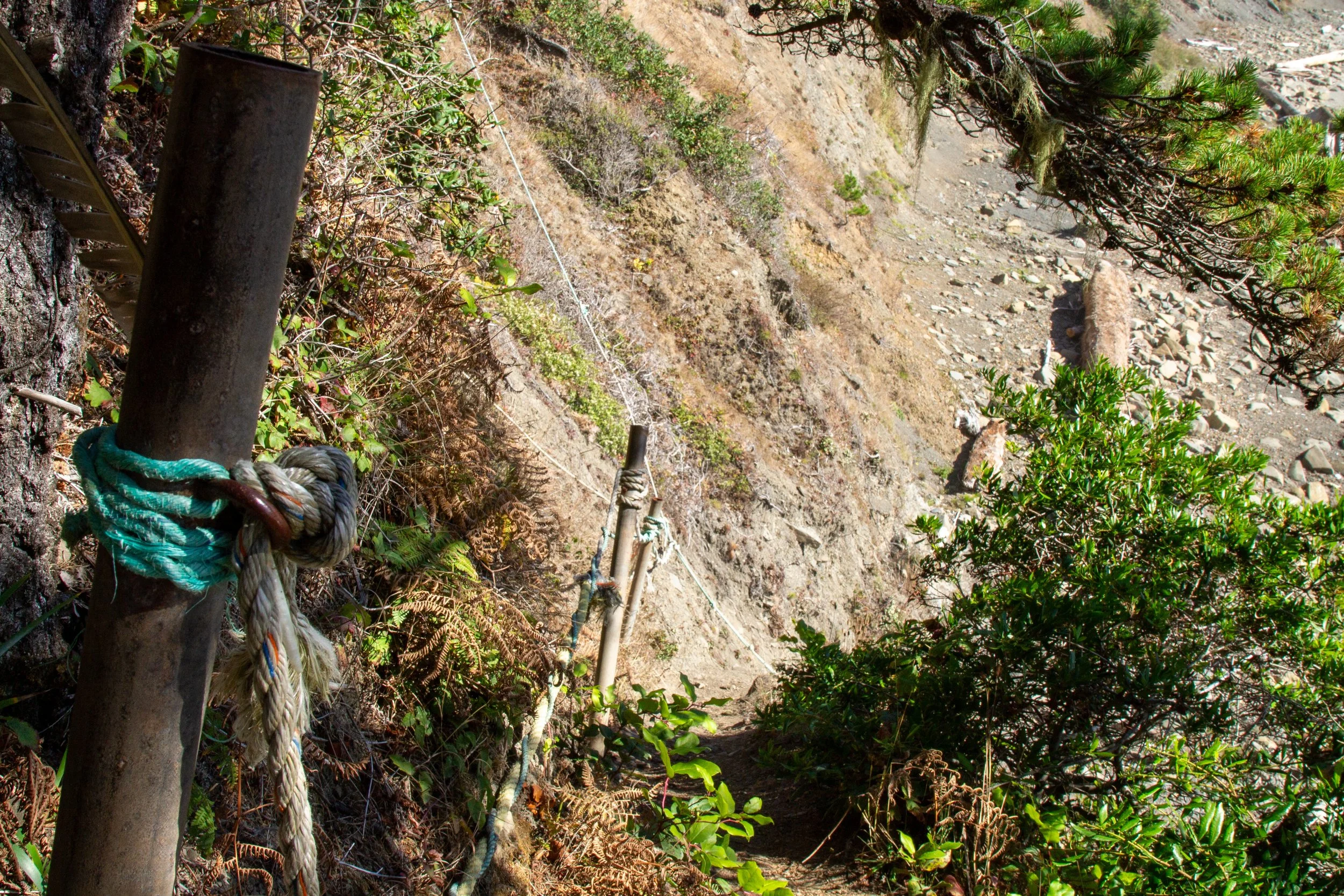
Beach access
Hunter’s Cove has a stunning beach that starts on the south side of Cape Sebastian and extends south to Meyers Creek. Other than seal swimming near the shore, no one was around but me. You don’t have to time your visit around low tide, but I’d avoid it during very high tides. The waves were approaching the access trail when the tide was about +6. At low tide, look for some tidepool critters on the rocks below Cape Sebastian.

Hunter’s Cove
Hunter’s Island is the large island nearest the cape. It’s named for a sad legacy, otter hunters who contributed to their extinction on the Oregon Coast.

Hunter’s Island
Along the beach, the cliffs have an unusual pattern. Warped layers of sandstone and shale called turbidites formed from sediments deposited around 75 million years ago.
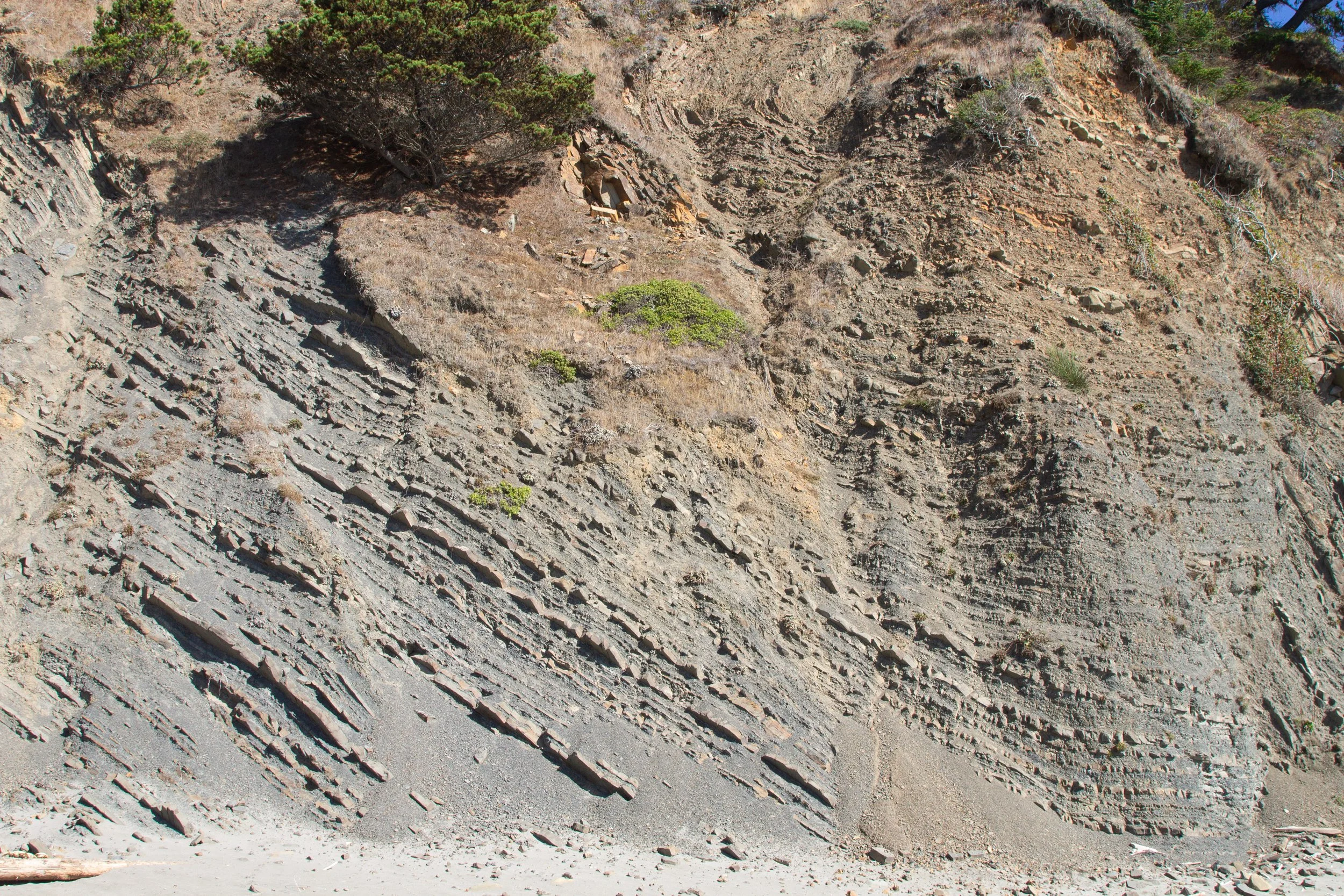
Sandstone and shale layers of the Hunter’s Cove Formation
You can turn around after seeing Hunter’s Cove or walk along the beach as far as you like before heading back up Cape Sebastian. About a mile to the south are the sea stacks of Meyers Creek. You can also drive there, so feel encouraged to save your energy. It’s a lot of uphill walking back up to the top of the cape.
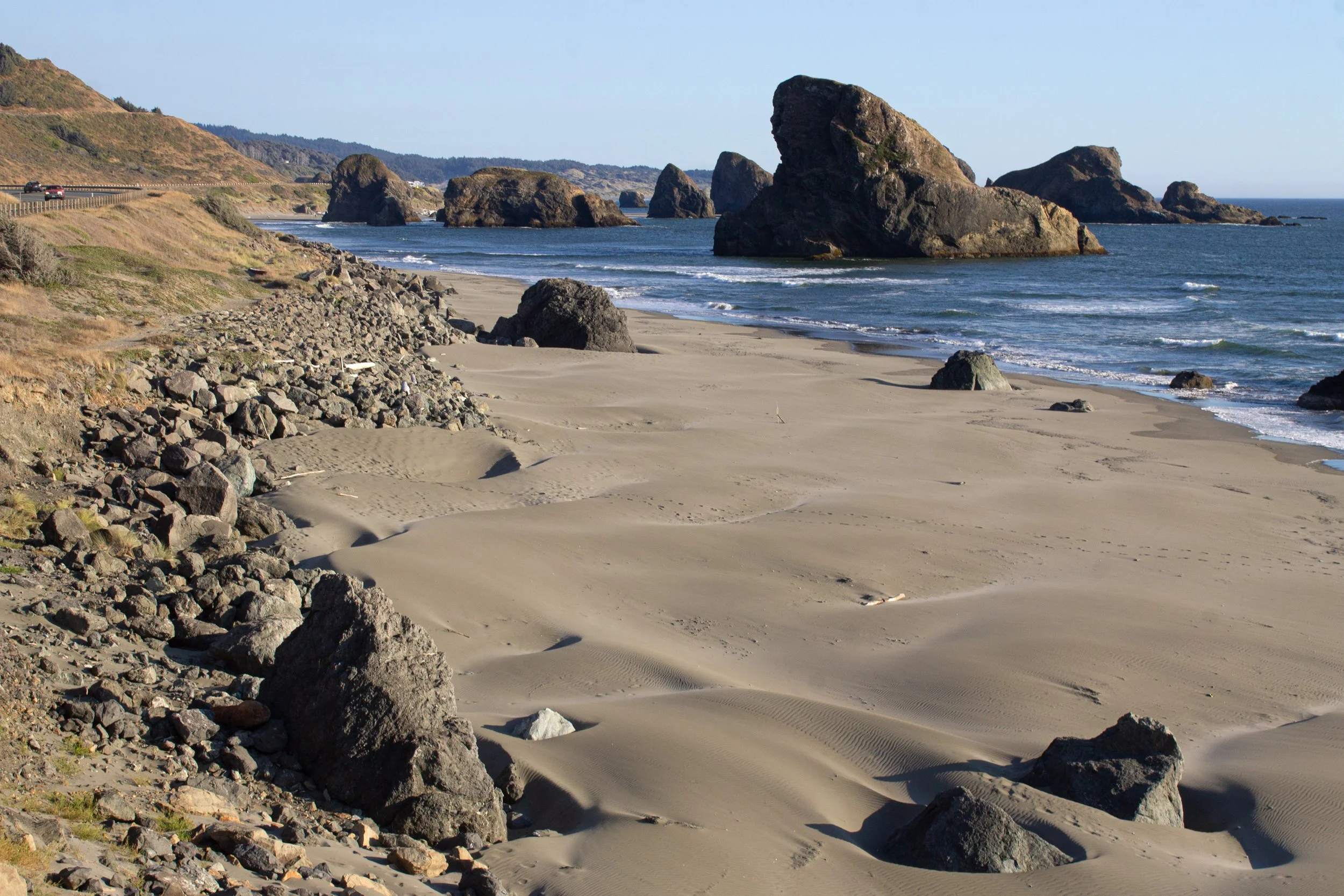
Meyers Creek Viewpoint
The other trail (Oregon Coast Trail)
Distance: 2+ miles out and back
Elevation gain: 500+ feet
Difficulty: Moderate
Pass required: None
Dog friendly: Yes, leashed dogs are welcome on the trail.
ADA access: No
Season: Any
If, when you finish the trudge back up Cape Sebastian from Hunter’s Cove, you think, I’d really like to climb up it again but have fewer viewpoints, consider taking the Oregon Coast Trail north. Back at the south viewpoint parking lot, look for the somewhat overgrown trail that branches off to the right at the fork.

This trail heads to north side of Cape Sebastian
You’ll start a steep descent almost from the beginning. If you just returned from Hunter’s Cove, you will not be excited about another uphill journey to get back. While not a bad hike, it’s less interesting than the Cape Sebastian Trail. The path through the Sitka spruce, fern, and salal forest is in decent shape but gets faint at times. In classic Oregon Coast Trail fashion, I started wondering if I had lost the trail, only to reach a nice set of steps along an otherwise unmaintained route.

Oregon Coast Trail
After about a mile, you reach the first ocean viewpoint, which is as far as I went. You don’t see as much as you did from the top of Cape Sebastian. Waves roll onto the beach in a little cove from about 100 feet below the viewpoint. There’s no beach access.

The viewpoint
If you keep going another 2 miles, you’ll reach the junction with the beach access trail. From here, it’s another mile to the beach on the north side of Cape Sebastian. Round-trip, it’d be about 7-8 miles from the parking lot. There’s a shorter and easier route to this beach starting from Bellview Lane, so I wouldn’t necessarily recommend tackling this one unless you’re looking for a long hike.

Getting there
Look for the turn from Highway 101 into the Cape Sebastian Viewpoint about 10 minutes south of Gold Beach. A sign marks the turn from either direction. The road to the parking areas is paved and in good condition. Cape Sebastian is about 5.5 hours from Portland.
Enjoy your trip to Cape Sebastian!
With love,
Emma
Explore nearby

Check out all the best stops in the Samuel Boardman Corridor.
Find the best things to do in Gold Beach.
Find the best hikes on the Oregon Coast.