

Explore the Mosier Twin Tunnels

Once a highway, now a car-free road between Hood River and Mosier, Oregon, the trail to the Mosier Twin Tunnels is one of the most underrated hikes in the Columbia Gorge. This paved hiking and biking trail is packed with highlights from spectacular viewpoints to spring wildflowers. The biggest surprise is a pair of early 20th-century tunnels that pass through a basalt cliff. The trail is 9 miles roundtrip, but you can see the tunnels on an easy 2-mile hike. Here’s everything you need to know about visiting the Mosier Twin Tunnels.

Mosier Twin Tunnels Trail follows the Columbia River
Quick stats
Distance: 9 miles out and back
Elevation gain: 400 feet
Difficulty: Easy
Pass required: Oregon State Park Pass
Know before you go
Trailheads and parking: The Mosier Twin Tunnels are on a segment of the Historic Columbia River Highway State Trail. You can start from the Mark O. Hatfield West Trailhead in Hood River or the Mark O. Hatfield East Trailhead in Mosier. To park, you need the Oregon State Park Pass ($10/day or $60/year). You can buy a day pass with a credit card at either trailhead. The west trailhead sells annual passes when the office is open (10 AM - 2 PM).
Amenities: The trailheads have restrooms and picnic tables. The west trailhead is more developed and has flush toilets and drinking fountains.
Dogs: Leashed dogs are welcome on the trail to the Mosier Twin Tunnels.
Bikes: The Historic Columbia River Highway State Trail is shared between bikes and pedestrians. Because it’s fairly long and paved, it’s at least as good a bike ride as a hike. There are some gentle hills, but it never gets steep and is a fun outing with kids. The trail is stroller-friendly.
Accessibility: This trail is one of the most accessible in the Columbia Gorge. It’s paved and in good condition. The grade is up to 5%. The width is 10-18 feet. Both trailheads have accessible parking. The west trailhead has easier bathroom access. If you start from the east trailhead and have a disabled parking placard, park next to the trailhead, not in the main parking lot.
Season: All year. Wildflowers bloom along the trail in April and May.

Mark O. Hatfield East Trailhead and ADA parking (the main parking lot is down the road)
About the Mosier Twin Tunnels

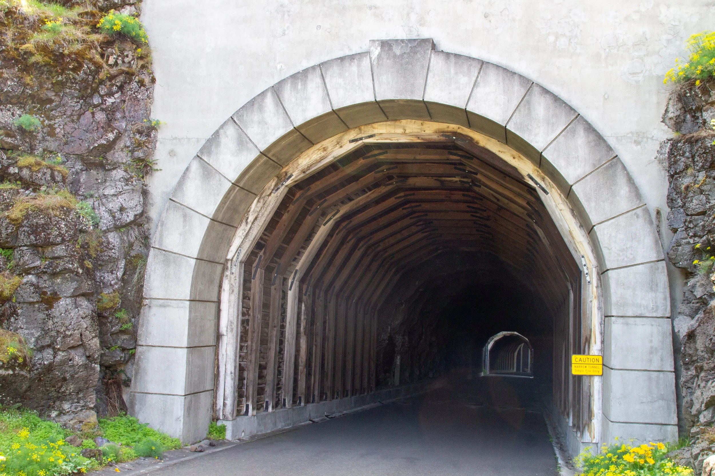
Inside the Mosier Twin Tunnels
Before there was Interstate 84, the Historic Columbia River Highway was the main route of car travel through the Columbia Gorge in the early 20th century. Equal parts art and engineering, the design of the road emphasizes the beauty of the landscape by connecting its highlights and capitalizing on the views. The goal of its construction was more about recreation than efficiency. Most motorists in the road’s heyday were taking sightseeing car tours rather than commuting from point to point.

The Mosier Twin Tunnels
The Mosier Twin Tunnels were part of the Historic Columbia River Highway. Completed in 1921, workers built them by dynamiting through a basalt cliff to make a path for the road. Over the years, the tunnels needed revisions to accommodate larger car sizes. Eventually, the construction of I-84 replaced the Historic Columbia River Highway, which closed cars in 1950. In the years that followed, the tunnels fell into disrepair.

East tunnel
The tunnels had a rebirth thanks to a massive restoration project in the 1990s. They’re now part of a car-free road between Hood River and Mosier that, like the original Historic Columbia River Highway, shows off the scenery of the Columbia Gorge. Large beams of wood and steel reinforce the impressive arches inside the tunnels. The 288-foot east tunnel also has some natural surface. If you look closely, you can see tiny stalactites forming on the ceiling. Two viewing windows look out onto the Columbia River and the Washington side of the Columbia Gorge, making the tunnels feel a bit like castle turrets.

Window inside the east tunnel
Mosier Twin Tunnels Trail
The trailheads
If you aren’t sure you want to do the entire trail, start at the Mark O. Hatfield East Trailhead in Mosier. It has incredible views from the beginning. You’ll reach an awesome viewpoint and the tunnel entrance within about a mile.
The Mark O. Hatfield West Trailhead in Hood River is more developed. It has drinking water, better restrooms, more picnic tables, lots of interpretative information, and a park office. If you’re doing the entire trail, you might want to start here and save the Mosier Twin Tunnels for the finale. They’re about 3 miles from this trailhead.
From Mosier
The Mark O. Hatfield East parking lot is down the road from the trailhead. After parking, walk on the shoulder of Rock Creek Rd for about 0.1 miles until the crosswalk. Cross and then follow the paved trail to the trailhead gate, about another 0.1 miles.

Walk along this shoulder from the parking lot
I like starting from the east trailhead because the views are phenomenal right away. The trail spans an interesting part of the Columbia Gorge where forests transition to grassland. The sparse tree cover on the Mosier side means big vistas and great spring wildflowers. In April and May, look for balsamroot, lupines, larkspur, cluster lilies, prairie stars, fiddleneck, golden poppies, and so, so much desert parsley.

Melissa blue butterfly on desert parsley
The beginning of the trail passes through a field of lava rocks. You’ll soon see great views of the Columbia River to the east.

Columbia River
Across the river, the cliffs have a diagonal slant. In this area known as the Yakima Fold Belt, tectonic plates push Oregon toward a more stable Washington, compressing the crust. This pressure creates diagonal ups and downs, synclines and anticlines, in the basalt cliffs around Mosier. Washington’s Coyote Wall is the most dramatic of them.

Desert parsley blooms in front of Coyote Wall
You’ll reach one of my favorite spots on the trail a little less than a mile, a tear-shaped viewpoint overlooking the Columbia River. In late April and early May, the wildflowers bring it to the next level. A picnic table near the viewpoint is a great place to stop for a snack and a water break.

Balsamroot blooms at my favorite viewpoint
After another quarter mile or so, you’ll reach the entrance to the Mosier Twin Tunnels. The east tunnel starts with a wood beam interior and transitions to natural rock. Look for the viewing windows once you’re inside.
Mosier Twin Tunnels entrance
The 81-foot west tunnel is right after the east tunnel. Since they’re so close together, people sometimes mistake them for one. A small gap with a metal fence separates them. After the Twin Tunnels, you’ll head through a more modern concrete underpass, then return aboveground.

Head through this underpass after the Mosier Twin Tunnels
The Twin Tunnels make a good turnaround point for a short hike, about 2 miles roundtrip. Another option is the viewpoint a bit less than a mile past the tunnels. It’s arguably the best on the Mosier Twin Tunnels trail, with low stone walls reflecting the beautiful masonry typical of the Historic Columbia River Highway.

Eighteen Mile Island from the viewpoint
To the east is Eighteen Mile Island in the Columbia River. Looking west, you’ll see the town of Bingen, Washington.

View to the west
After the Mosier Twin Tunnels, the trail becomes more forested, and views are more obscured by tree cover. The second viewpoint makes a good turnaround point for a 3-ish mile hike. If you continue, you’ll reach a rocky outcropping around the trail’s halfway point. Signs warn about the area being prone to burns. Some scorched fence posts drive home the point.
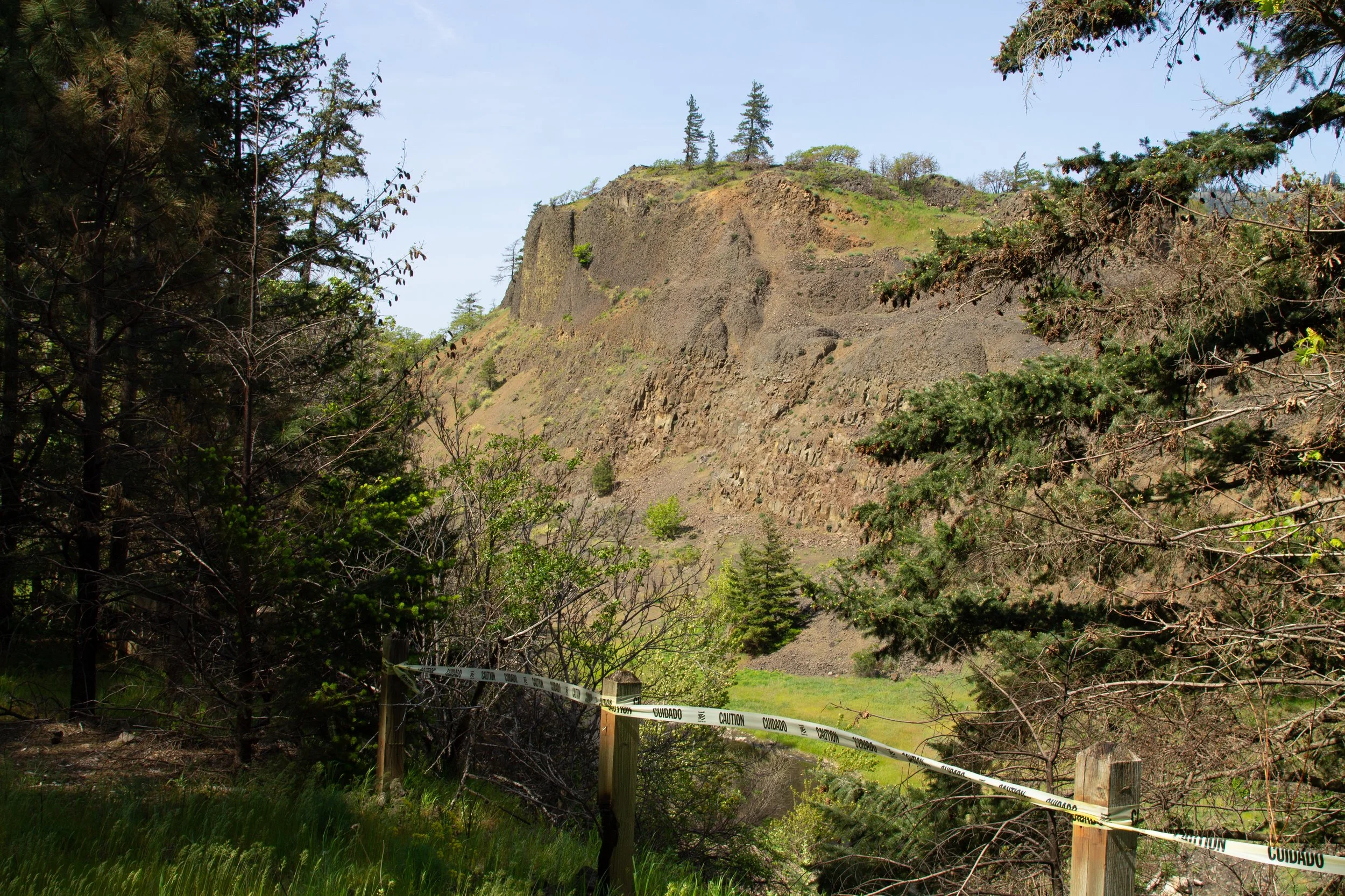
The fence here has had a hard time
The Historic Columbia River Highway State Trail continues another couple of miles through the woods to the west trailhead.
From Hood River

The Hood River trailhead
The Mark O. Hatfield West Trailhead in Hood River feels more like a visitor center. Unlike the east trailhead, there’s no sketchy walk down the shoulder to reach the trail. It starts right from the parking lot. A sign points towards an overlook on the west side of the lot, which is pretty overgrown. I’d just go ahead and start the trail instead.

Start here
A paved walking path runs parallel to a car-free road for about 0.1 miles, then merges with it.

Golden poppies and lupines bloom along the trail in spring
The western part of the Mosier Twin Tunnels trail feels like a different world than the east side. Gone are the lava rocks and scrubland. Instead, a dense forest shades the trail. Unlike the ponderosa pines farther east, the trees are mostly big-leaf maples and Doug firs, some of them enormous.

The western side of the Mosier Twin Tunnels trail is forested and shady
After about a mile on the trail, the tree cover starts becoming thinner. You’ll see glimpses of the Columbia River through the screen of maple leaves. Behind the town of Bingen is a quick peek-a-boo appearance from Mount Adams. You’ll reach the Mosier Twin Tunnels after about 3 miles on the trail.

Glimpse of Mount Adams through the trees
Getting there
Mark Hatfield West Trailhead
Take I-84 East until Exit 64 in Hood River. Turn right onto Button Bridge Road from the exit, then turn left onto Old Columbia River Drive at the four-way stop. Follow Old Columbia River Drive a little over a mile to the parking lot. The drive from Portland takes about an hour.
Mark Hatfield East Trailhead
Take I-84 East until Exit 69 towards Mosier. Turn left onto Highway 30 and then take another left onto Rock Creek Road. A sign marks the turn for the Mosier Twin Tunnels hike. Follow Rock Creek Rd for a little over a half mile and the parking lot will be on your left. The drive from Portland takes about 70 minutes.
Enjoy your trip to the Mosier Twin Tunnels!
With love,
Emma
Explore nearby


Explore the best things to do in Hood River.

Check out the best things to do in The Dalles.