

Dog Mountain Hike: Permits, Tips, and What to Expect
Dog Mountain is hands down the most popular wildflower hike in the Columbia Gorge. I’ve heard people describe it as a rite of passage or as their yearly ritual. I came at it the opposite way, after visiting around 20 other Columbia Gorge wildflower trails. The verdict? It didn’t become my new favorite, but the views at the top are spectacular and not overhyped. For balsamroot abundance, I can’t think of another trail that tops it. The two main considerations are crowds and trail difficulty. Here’s what to expect on the Dog Mountain Trail.
Balsamroot on Dog Mountain
Quick stats
Distance: 6.3 miles out and back (or 6-mile lollipop loop)
Elevation gain: 2,800 feet
Difficulty: Hard
ADA access: No
Parking and permits
We’ll get the ugly part out of the way first. Hiking up Dog Mountain is challenging, but I think the parking situation is the hardest part.
Parking at the Dog Mountain Trailhead requires these permits:
The Northwest Forest Pass is required every day, all year. You can buy a day pass ($5) with a credit card from the payment machine in the parking lot, or use an annual NW Forest Pass or America the Beautiful Pass.
On weekends and holidays during wildflower season (mid-April to early June), you’ll also need a Dog Mountain Trail System Vehicle Reservation ($2). If you don’t have a reservation, you can still hike up Dog Mountain by taking the free shuttle.
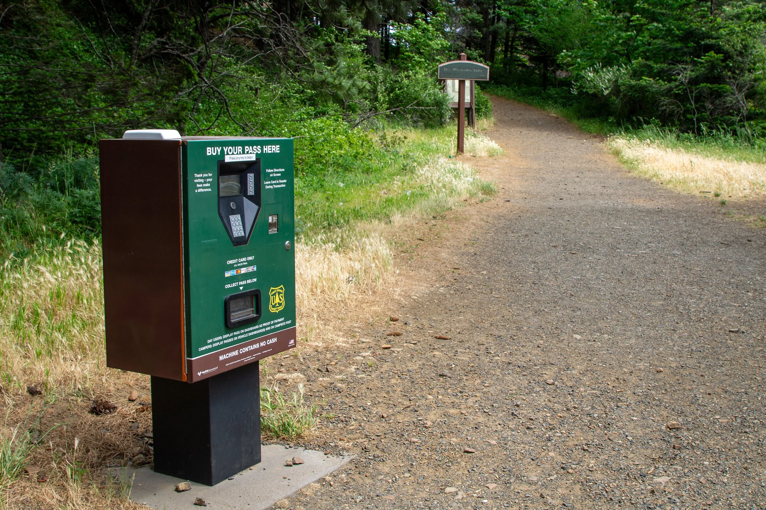
Trailhead payment machine
How to get a weekend reservation
The first Dog Mountain Trail System Permits become available in March. More are released throughout the season. The recreation.gov website says it releases a batch at 7 AM four days before the permit date, but when I looked on Tuesday, the weekend permits hadn’t been released yet, so I think it’s really three days before. The permits go fast. When I checked on Thursday at 9 AM, they were sold out for the weekend.
Reservations are good for the day. You don’t need to arrive at any specific time. They don’t guarantee a parking spot, so it’s still a good idea to arrive early or late in the day. To make a reservation, head to recreation.gov.
Dog Mountain shuttle
If you’re hiking up Dog Mountain on a spring weekend, the shuttle is a great alternative to parking at the trailhead. Here’s what to know:
It’s free. There’s no charge for the ride, and you can skip the trailhead parking fees.
You don’t need a reservation.
The shuttle runs on weekends only during wildflower season (mid-April through early June, including Memorial Day).
It runs about every 30 minutes. The last departure for drop-off at Dog Mountain is 1 PM. The last pick up for the return trip is 5 PM.
Parking for the shuttle is at the Skamania County Fairgrounds, 520 SW Rock Creek Dr.
You can learn more about the Dog Mountain shuttle at the Columbia Area Transit website.
Weekday visits
You don’t need a reservation to park at Dog Mountain on weekdays, but finding a spot is still challenging during wildflower season. To have the trail to yourself, I’d recommend arriving by 6 AM. To find parking, arrive by 9 AM or after 4 PM. I went on a rainy Thursday and got the only available spot at 1 PM. When I returned a few hours later, the lot was still mostly full.
Off-season hiking
If you visit Dog Mountain outside of wildflower season, you only need a NW Forest Pass to park, not a reservation. I doubt you’ll have trouble getting a spot, even on weekends.
Wildflower season is the busy season on Dog Mountain
Know before you go
Amenities: Vault toilets are near the parking lot. Head up the trail about 100 feet to find them. Wait times can be long on the weekends.
Dog-friendly: Dogs are welcome on the Dog Mountain Trail. Please keep them on leash to avoid contact with poison oak and to protect the wildflowers.
Hazards: Watch for poison oak, ticks, and rattlesnakes. The trail gets close to some drop-offs and isn’t a good destination with younger kids.
Leave no trace: Please stay on the trail. Don’t step on or pick the wildflowers.
Season: All year, best in spring. Expect snow towards the top in the winter.
What to bring: Lots of water, snacks, sunscreen, closed-toed shoes, long pants, and layers. If you have hiking poles, it’s a good trail to use them.
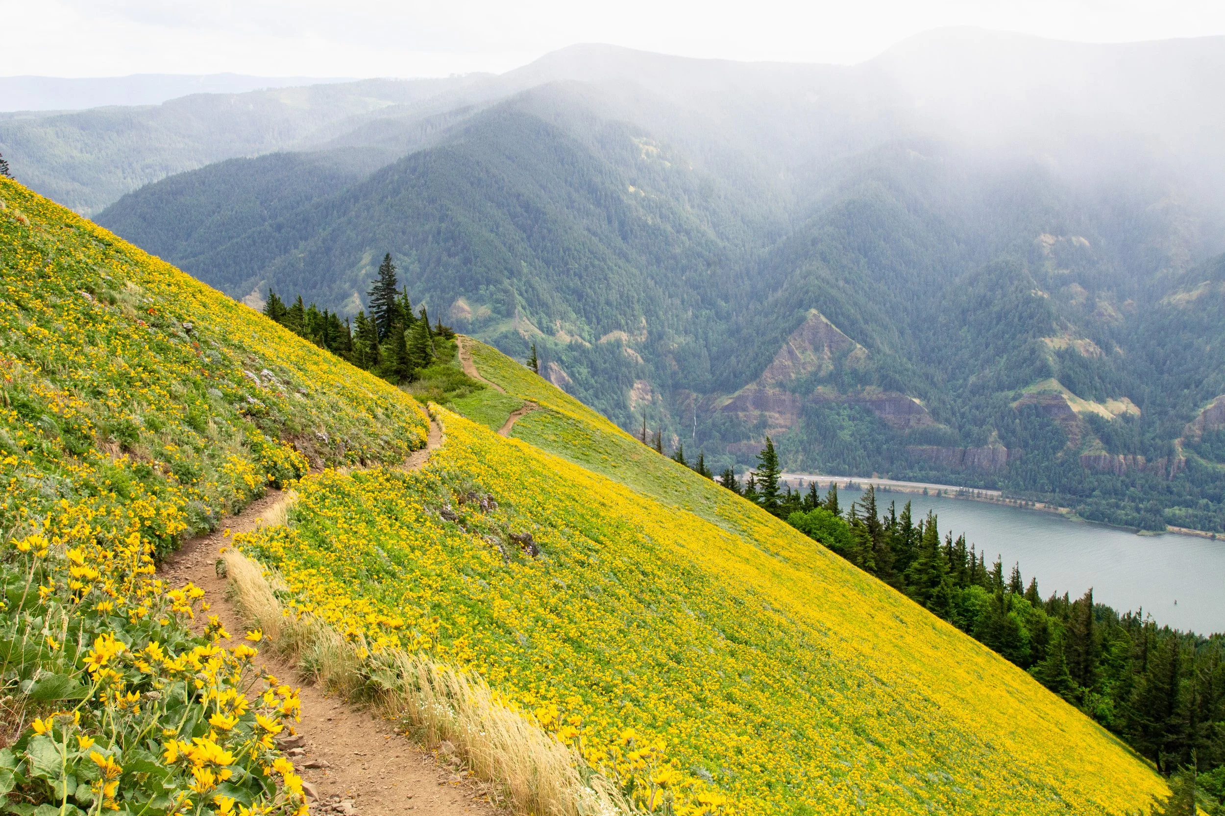
Dog Mountain wildflowers
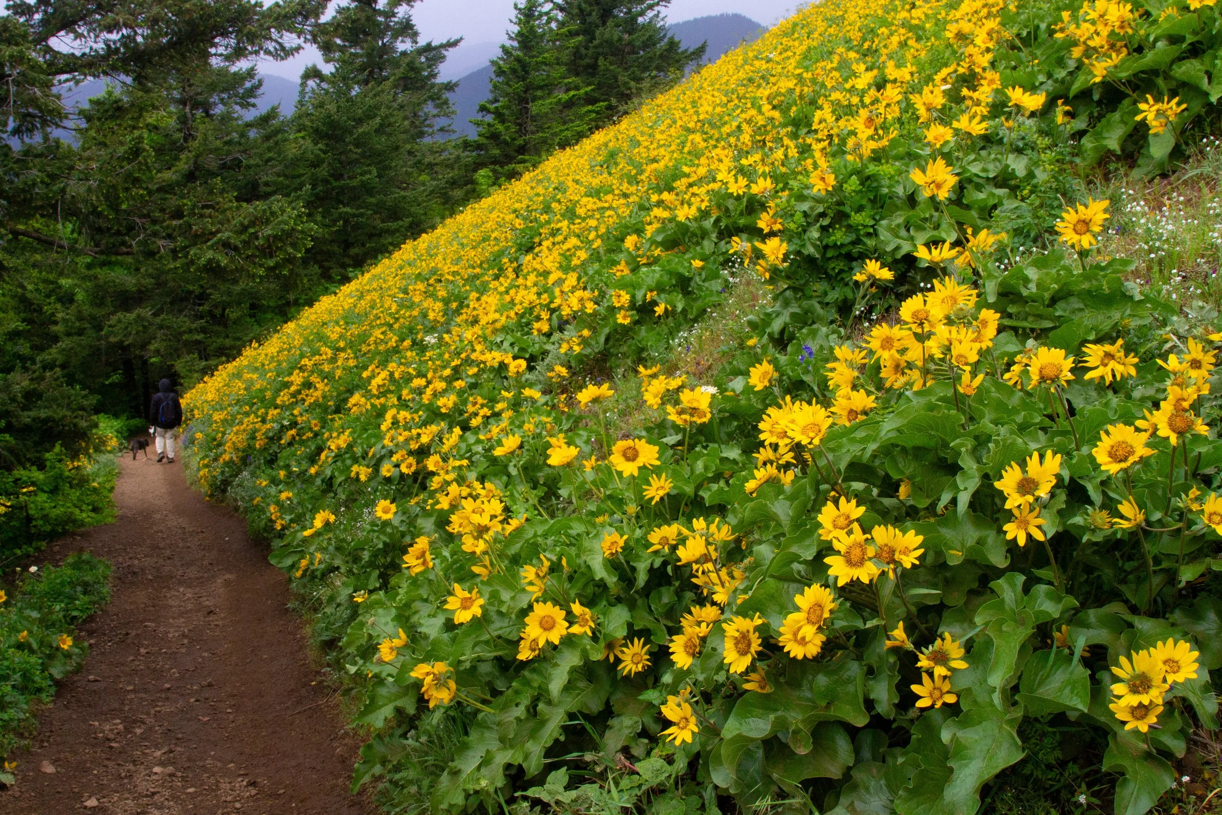
Balsamroot on Dog Mountain in mid-May
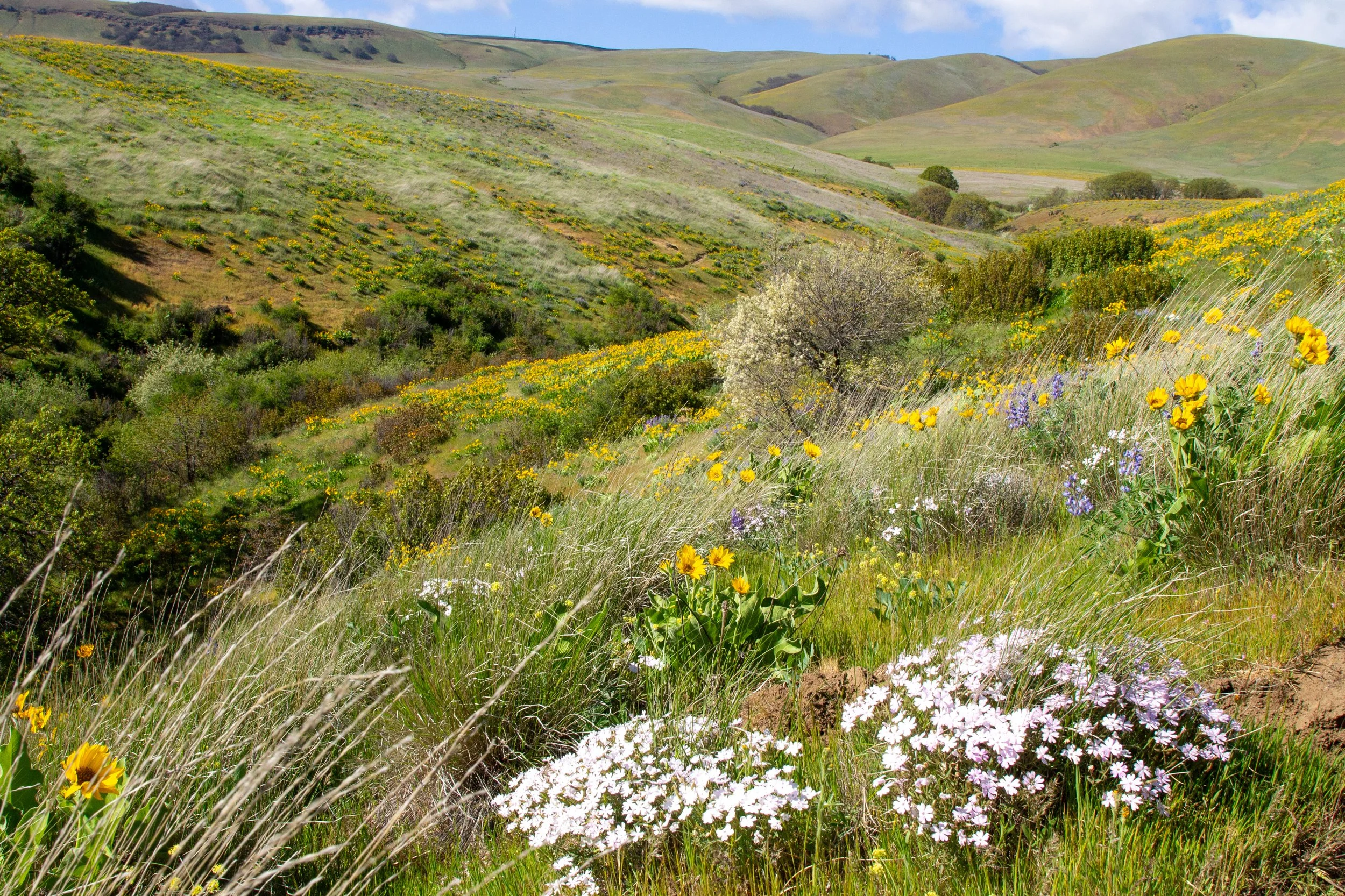
Because of its elevation, Dog Mountain has some of the latest-blooming wildflowers in the Columbia Gorge. The main event is the balsamroot, which blankets the slopes near the summit beginning in May. Peak bloom varies year to year. Mid to late May is usually a good bet. While the balsamroot is what brings most people to the trail, over 100 wildflower species bloom on Dog Mountain in the spring. To name a few: larkspur, ookow, popcorn flower, lupines, paintbrush, phlox, phantom orchid, desert parsley, and buckwheat. I’d expect the earliest blooms to open in April and the latest to hang around into early June.
How hard is the Dog Mountain hike?
Real talk, the Dog Mountain hike is hard. In less than 7 miles of round-trip distance, it gains over 2,800 feet of elevation, making it one of the steepest trails in the Columbia Gorge. For comparison, it’s like walking up to the top of Multnomah Falls three times in a row. I write a hiking blog, and it confuses me a bit why so many more people hike this trail than others in the Columbia Gorge. It’s cool, just more effort for the reward than most.
That being said, other than the elevation gain, conditions on the trail are good. It’s shaded most of the way, well-maintained, and doesn’t have obstacles like downed trees. The challenge is hiking up an unrelenting, steep trail without great options to stop and rest. Bring plenty of water and wear sturdy shoes, preferably hiking boots. Have an offline map with you. If you don’t hike often, consider tackling a few easier trails to get comfortable with it first. You don’t need to be an amazing athlete to make it to the top. My bum leg and I got there. Just know that it’s tough.
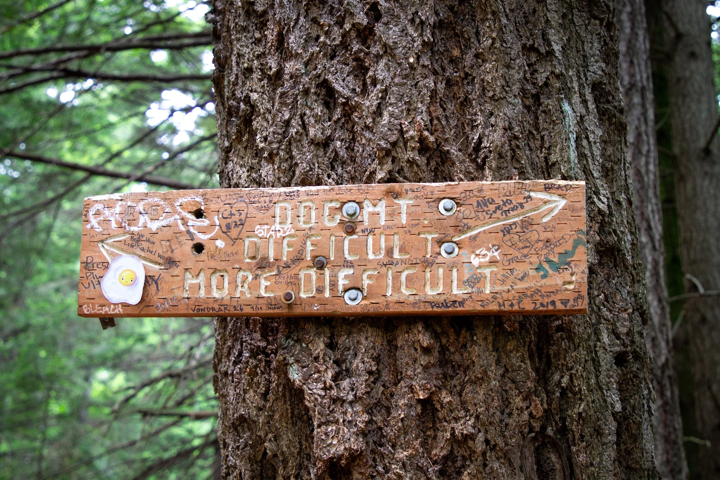
This sign sums it up. You get to choose between difficult and more difficult.
Route options
Dog Mountain has a trail system rather than a single hike. I’d say there are two main routes.
The 6.3-mile hike up to Dog Mountain’s summit and back is the most popular. After about a mile, you choose between trails labeled “difficult” and “more difficult.” I’d suggest the less difficult route. It’s not as steep and has an extra viewpoint. The trails meet back up before the big views, so it’s not that important which one you take. You can also go up one and down the other to make a lollipop loop.
You can connect the Dog Mountain and Augspurger Mountain trails to make a 7-mile loop. Although longer, the Augspurger Mountain section is less steep and less crowded.
I did version #1, partly because the wind and rain made an earlier turnaround appealing, and partly to accommodate my bum leg, which struggles with distance. When you’re choosing, I’d say there are no wrong answers. All the trails are beautiful, and all the trails are hard.
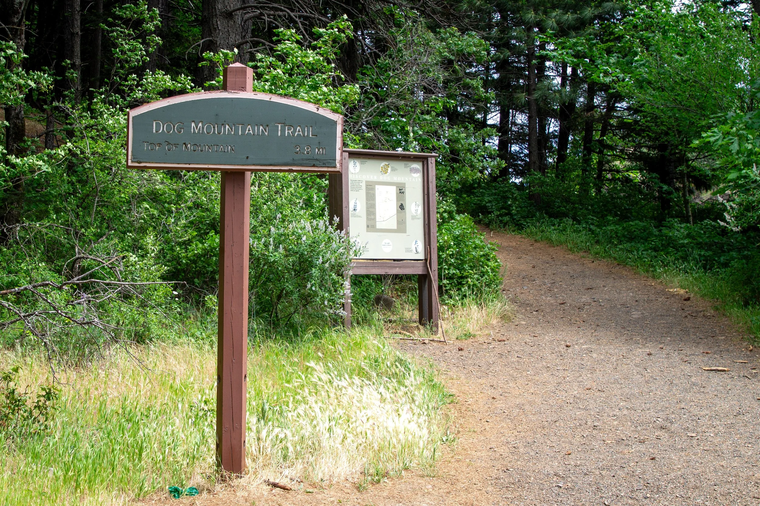
The Dog Mountain Trail
Two trails start from the parking lot, one for Dog Mountain and the other for Augspurger Mountain. We’ll take the Dog Mountain Trail. It begins as a steep uphill and stays that way until the summit.
Start here
The restrooms are about 100 feet up the trail. I’d say it’s worth the (possibly long) wait. You’ll be on a crowded trail for the next several hours.
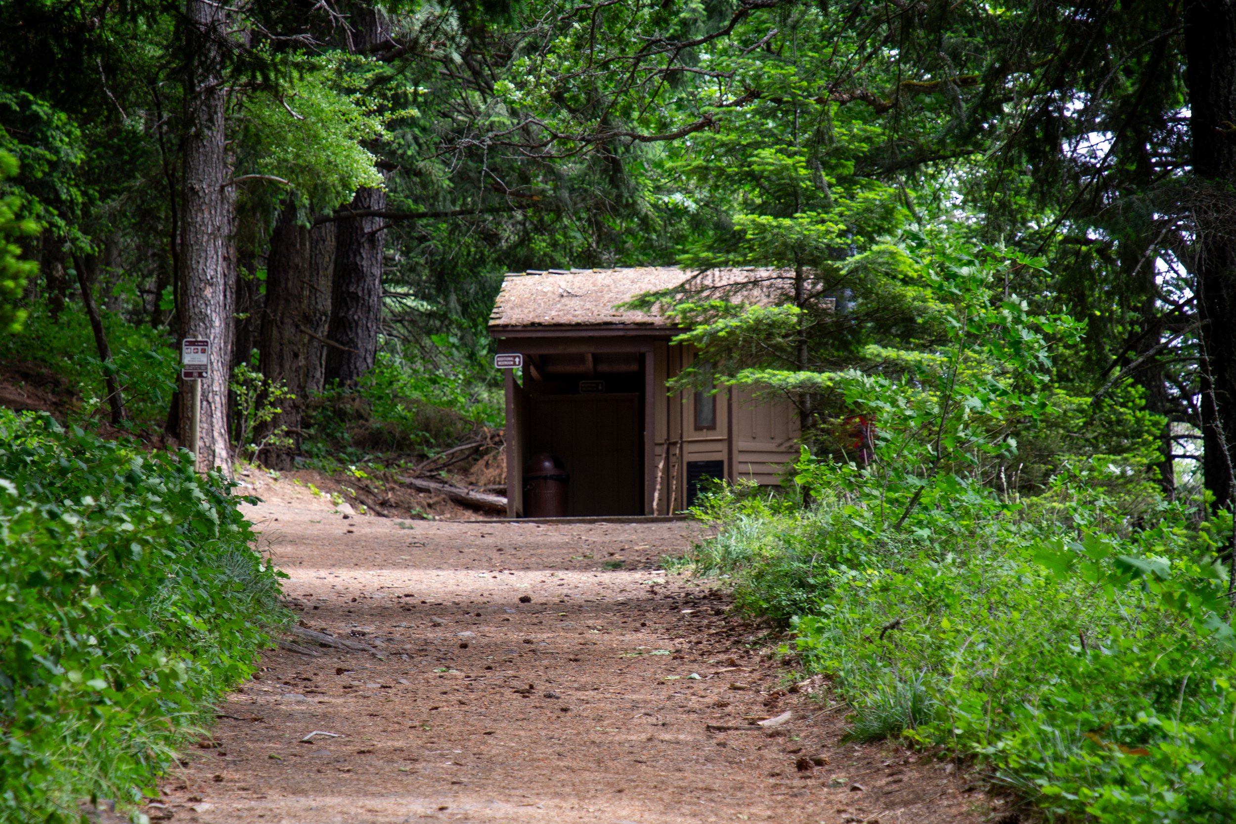
Restrooms
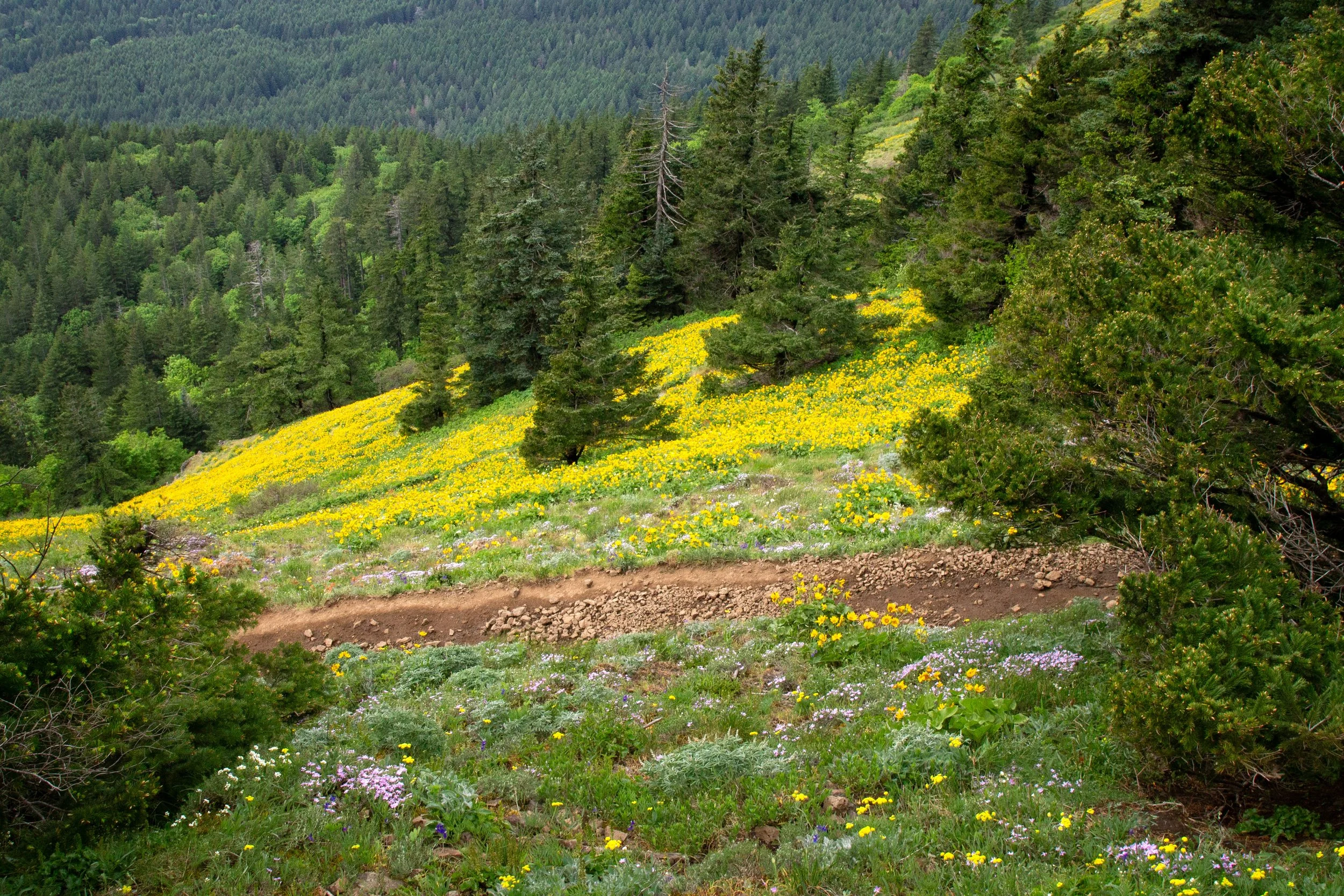
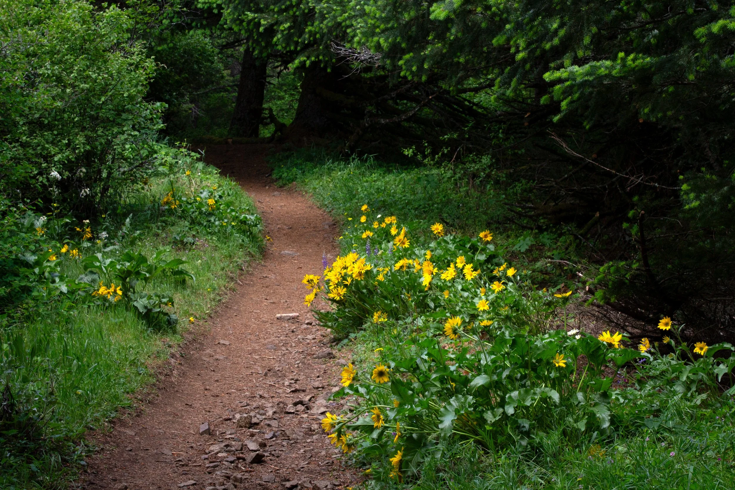
A transitional forest of Doug fir, hemlock, big-leaf maples, and oak shades the Dog Mountain Trail as you make your way up switchbacks. Wildflowers bloom in the undergrowth, but it’ll be a while before the first balsamroot. Watch your step. Poison oak grows along the trail, especially towards the beginning.
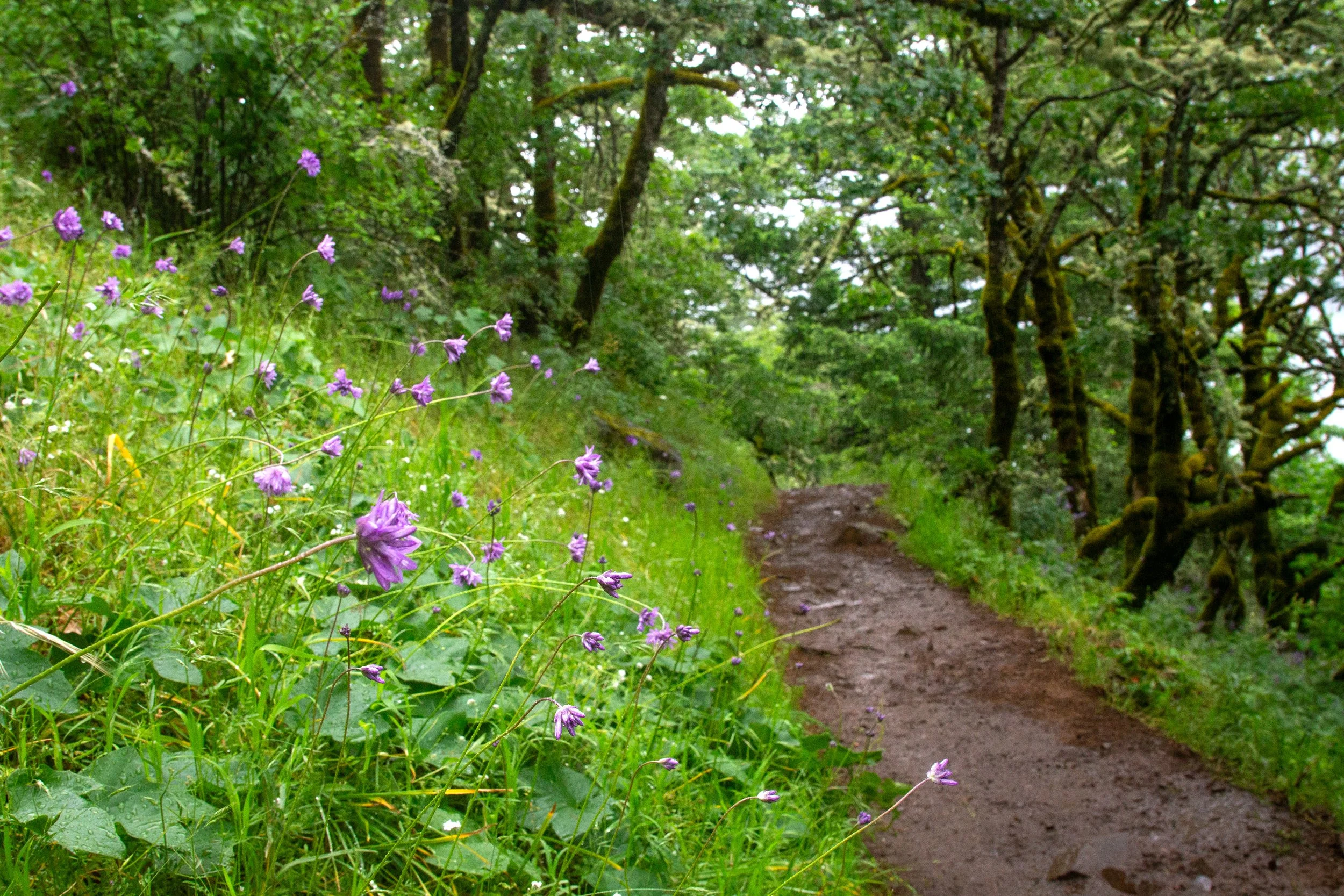
Ookow blooms along the trail
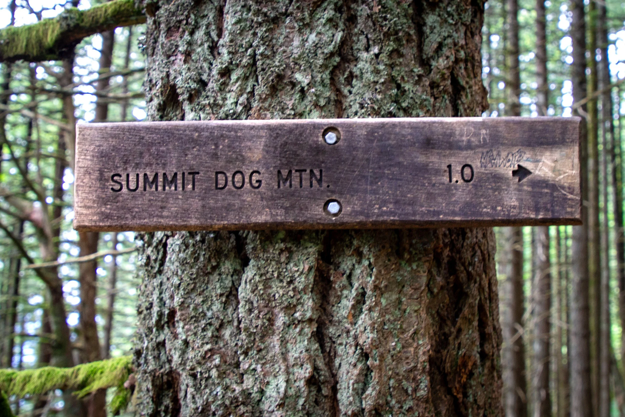
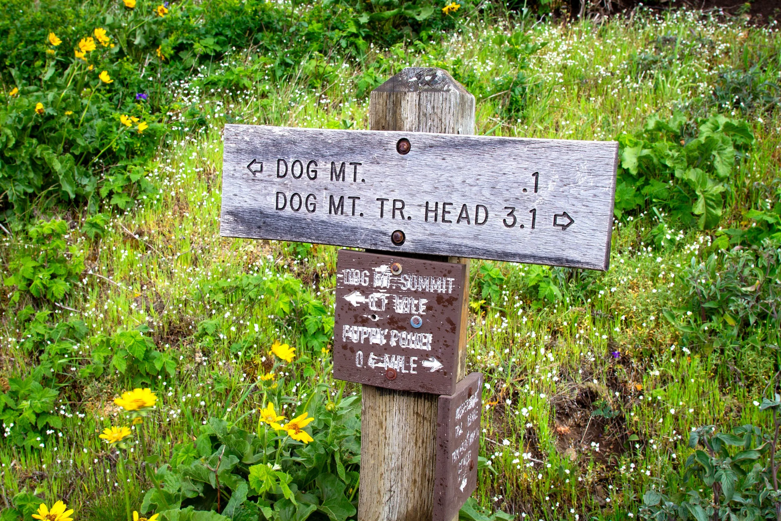
In less than a mile, you’ll reach a fork where the hike splits between the difficult and more difficult legs. I’d suggest the difficult direction to the right. I’ll be more crowded, but it’s a little less steep and has an extra viewpoint on the way.
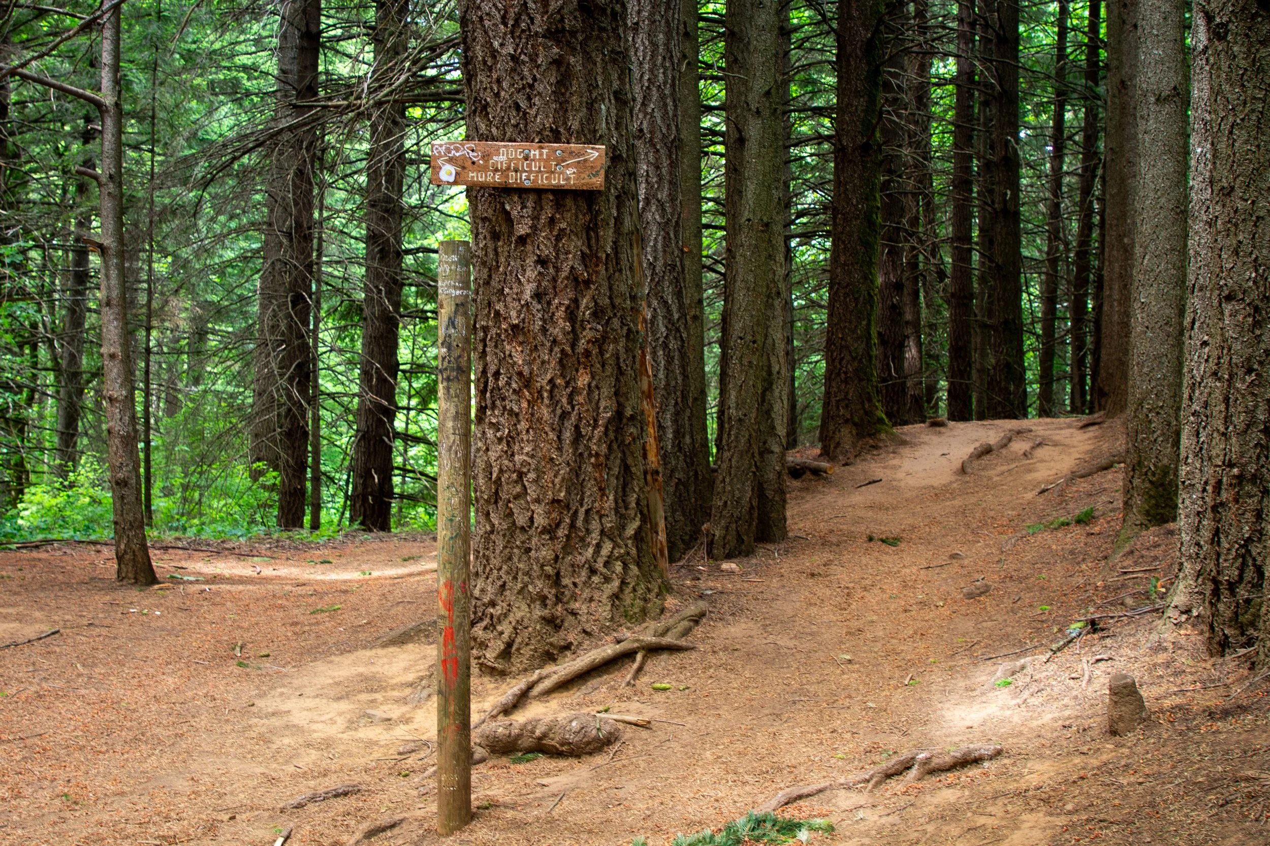
Pick your poison
The just-plain-old difficult trail continues up more switchbacks through the woods. Watching for wildflowers is a good distraction from the uphill climb.
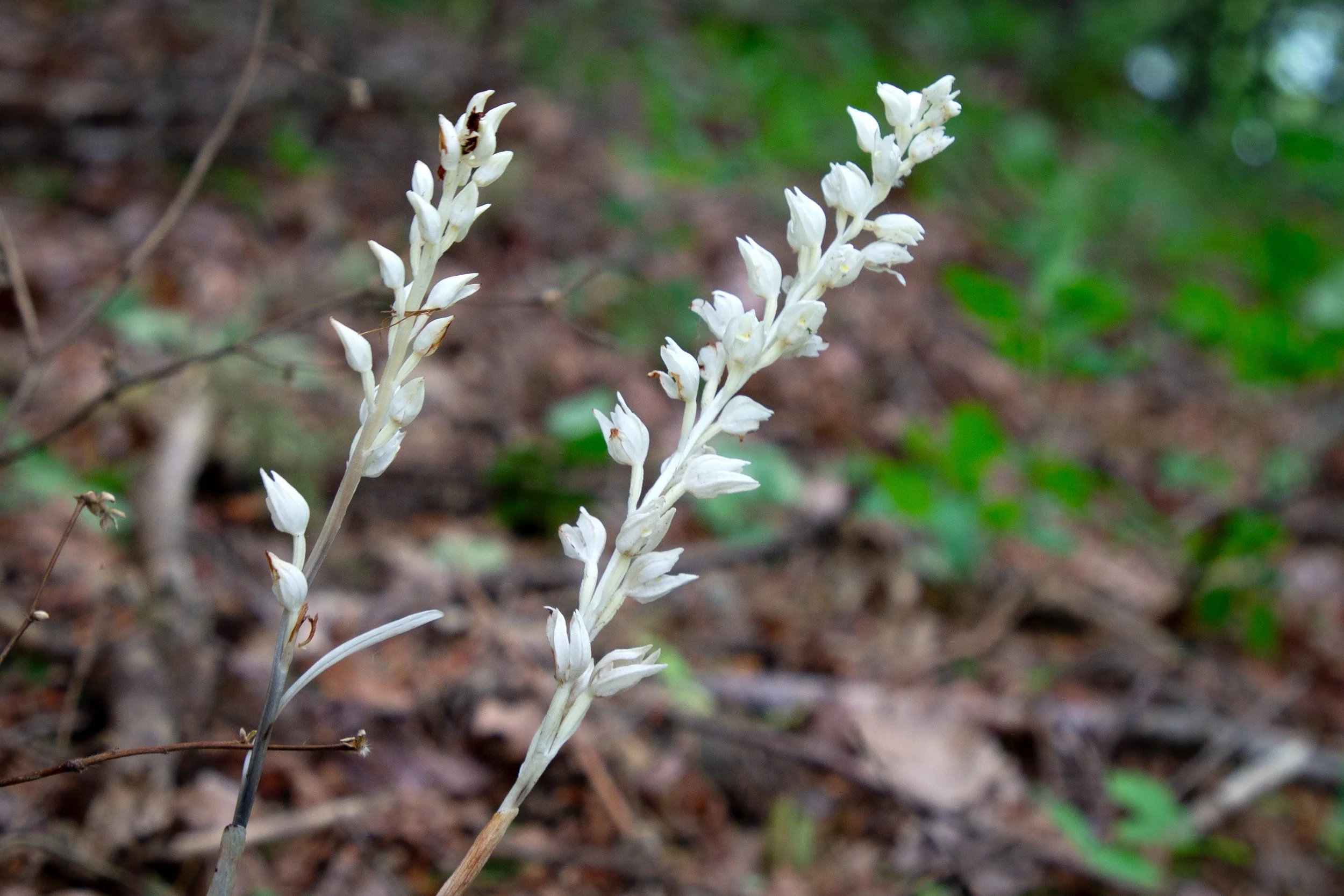
Phantom orchids
Around the halfway point, you get the first great Columbia Gorge view and a good reminder of why you chose this trail in the first place.
Approaching the first viewpoint
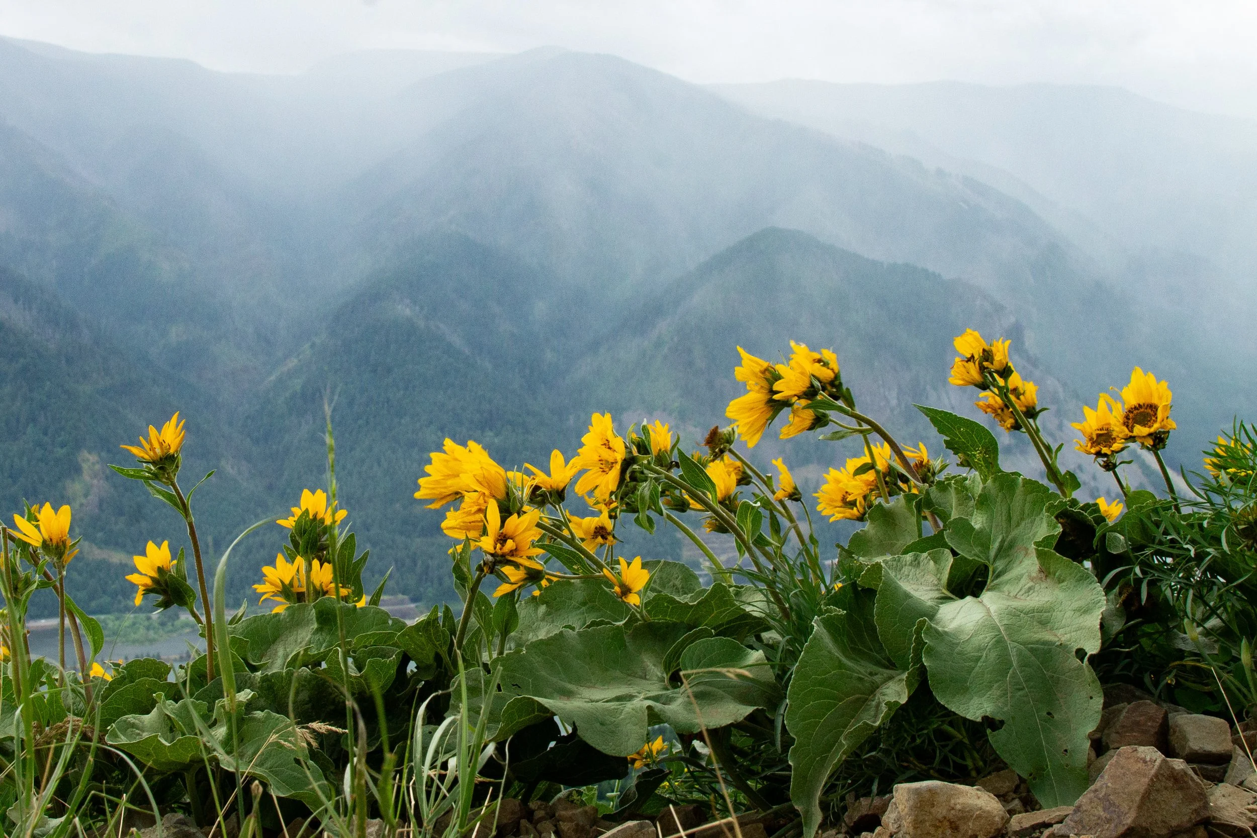
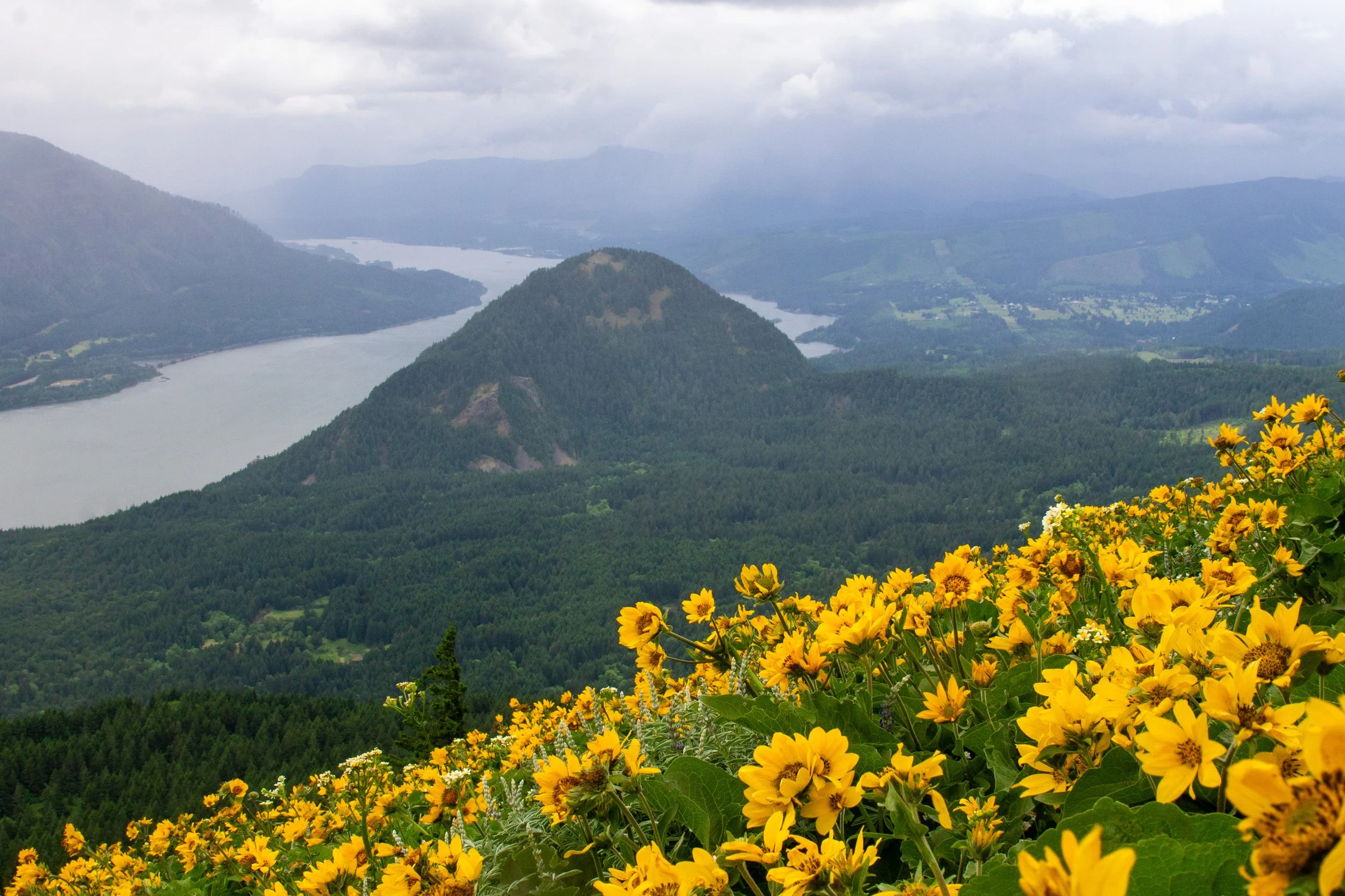
Balsamroot, lupines, yarrow, and paintbrush bloom in a small clearing that overlooks the Columbia River, Wind Mountain, and Mount Defiance.
Much needed morale boost
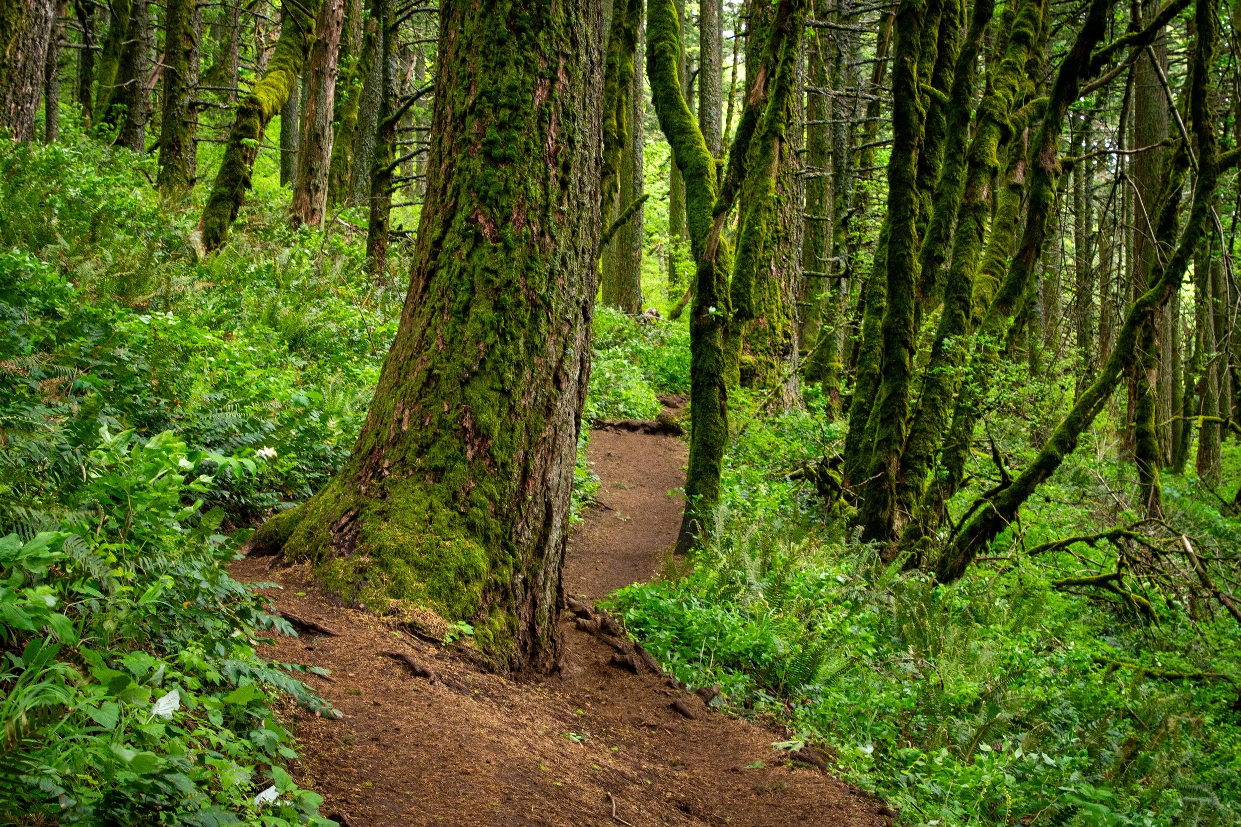
After taking a minute to enjoy the views and catch your breath, follow the trail back into the forest.
Dog Mountain Trail
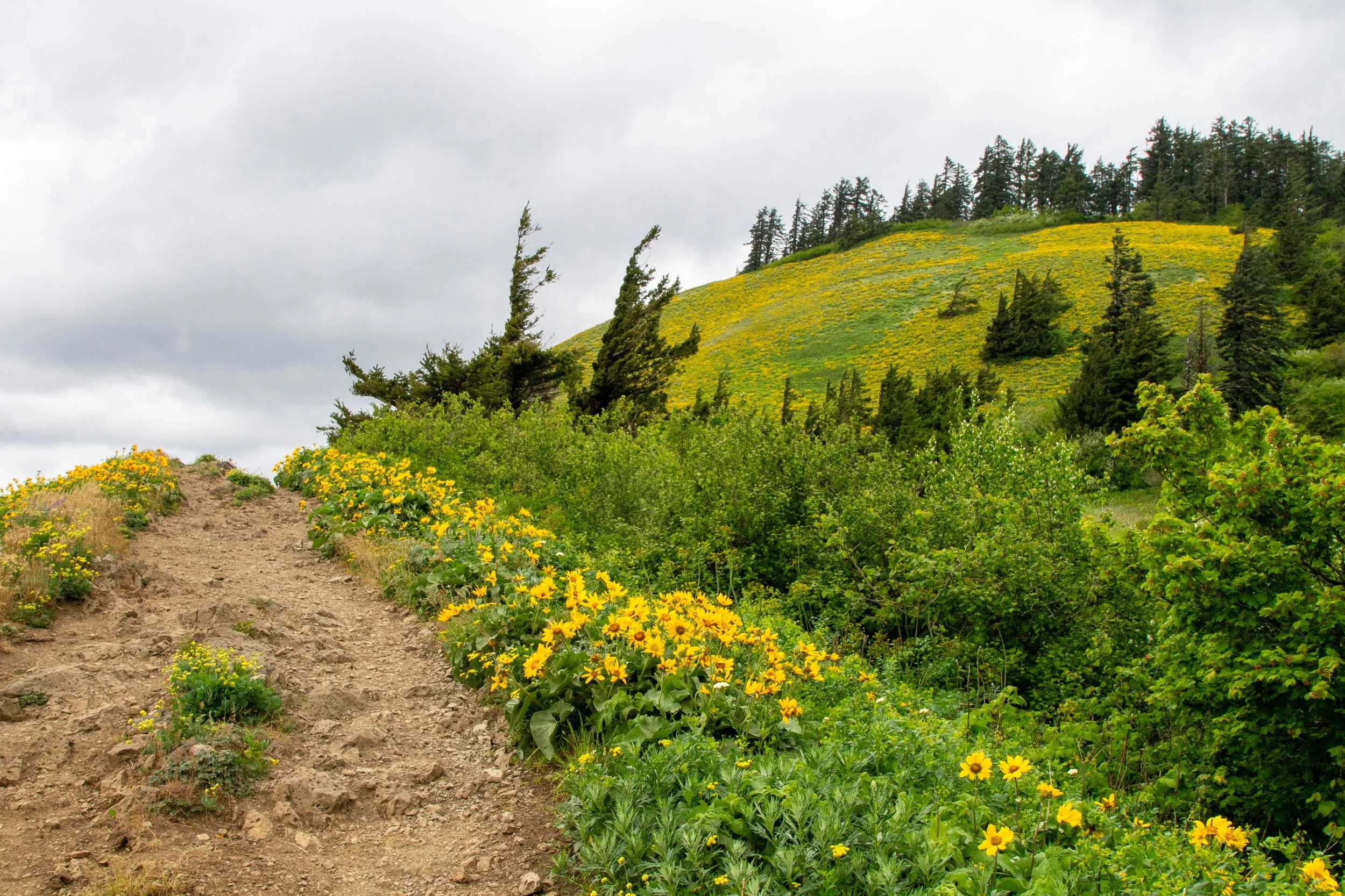
The Dog Mountain Trail ascends more gradually for the next half mile or so. Things change again when the difficult and more difficult trails meet back up. When you reach the junction, keep right, following the sign towards Dog Mountain’s summit.
The difficult and more difficult trails merge a mile from the summit
After the trails merge, you’re within a half mile of the big views, but it’s the steepest part of the hike and goes by very, very slowly.
Getting close
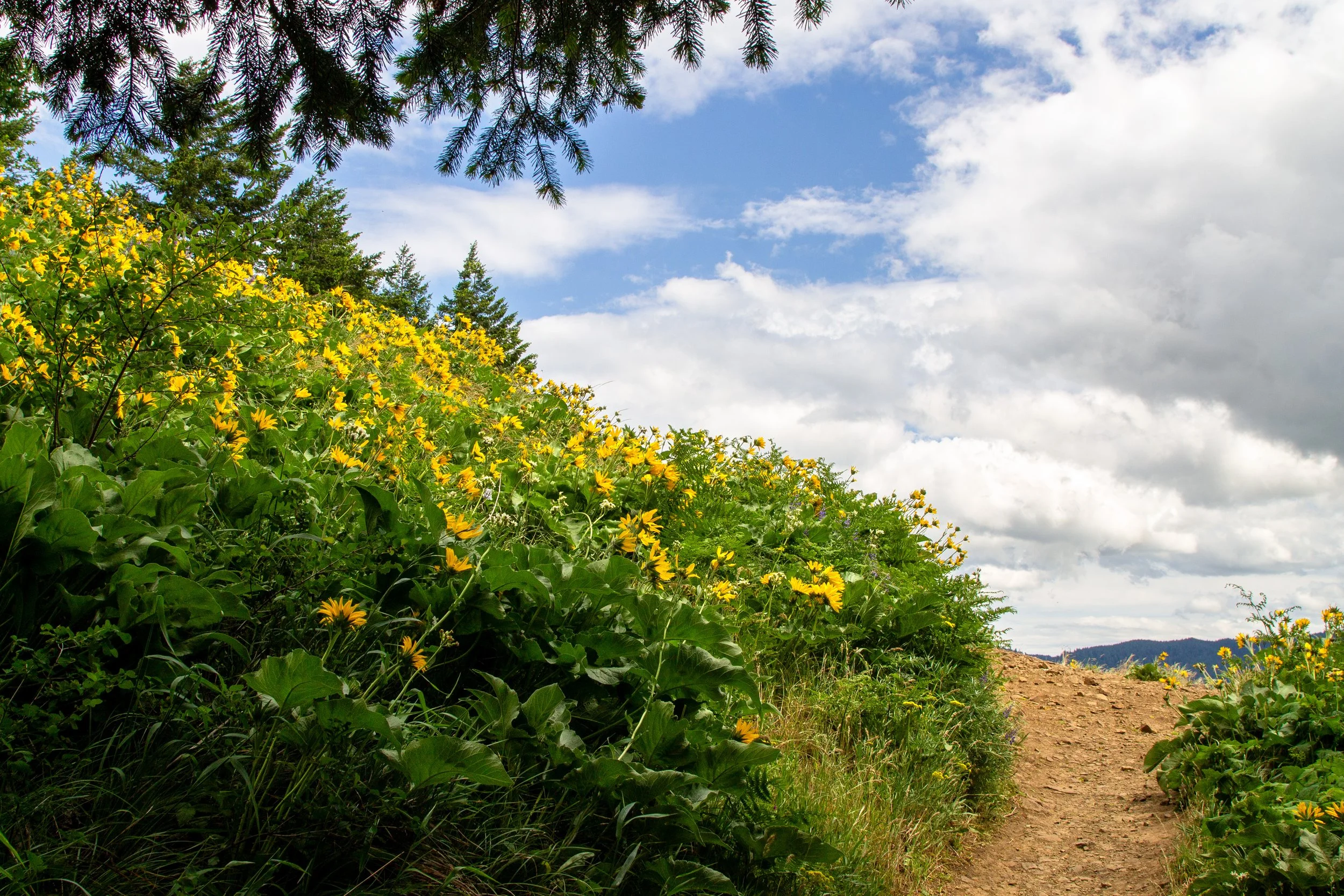
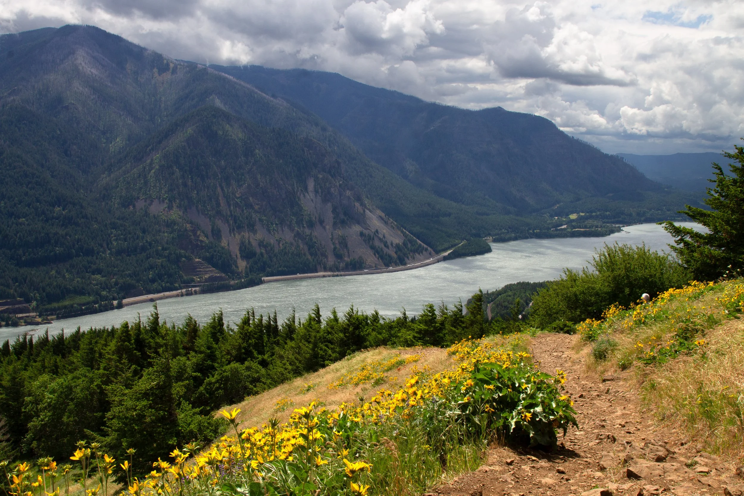
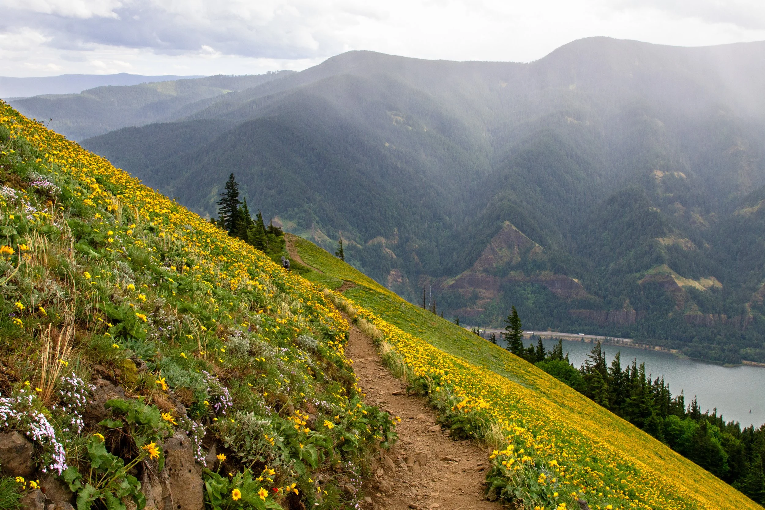
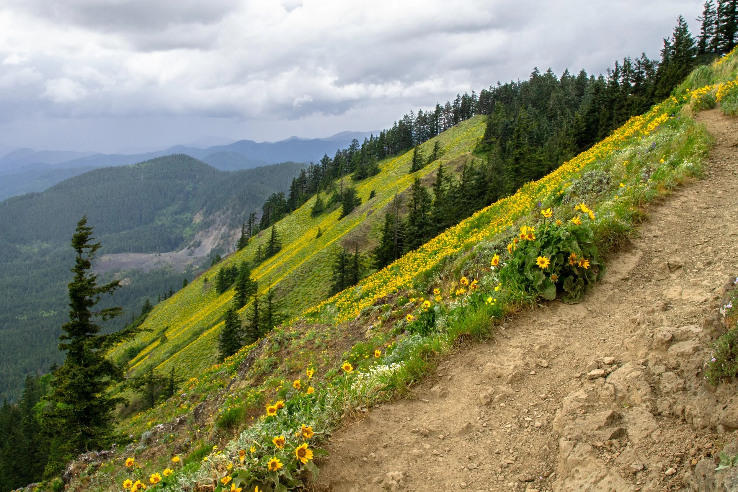
Just about the time you’ve resigned yourself to your new reality of endless trudging, the forest opens up, and the wildflower bonanza makes you forget the weariness of your legs. Balsamroot is so thick on the upper slopes of Dog Mountain that they’re almost solid yellow. Looking closer, you’ll see other blooms: lupines, paintbrush, phlox, yarrow, desert parsley. Beyond the flowers is an expansive view of the Columbia Gorge to the west, with Wind Mountain as its centerpiece. You’ll soon reach a viewpoint on a rocky outcropping called Puppy Dog. It’s a good place to take a breather and soak in the scenery.
Views from Dog Mountain
At Puppy Dog, the trail splits. The two forks are the start and end of an optional mini loop on the way to the summit. We’ll keep left to head up the more scenic direction.
Trail from the Puppy Dog viewpoint
The last half mile has incredible views every step of the way. And yeah, you’re still going uphill, steeply, but you won’t really care. Wildflowers surround the trail, especially showy balsamroot blooms. On the moody day of my hike, clouds hung low over the mountains. To the west, the Columbia Gorge makes a gentle bend towards Stevenson. When it’s clear, you can see the tippy top of Mount Hood. While stunning, it may not be pleasant. The top of Dog Mountain is usually very windy. When I was there, it was also cold and raining.
Dog Mountain Trail
When you reach the next trail junction, where the Augspurger Mountain Trail meets up with the Dog Mountain Trail, follow the sign toward Dog Mountain. The summit is only 0.1 miles ahead.
Almost there
The end of the hike brings you to views of the wildflower-covered slopes to the northwest. Then, you reach the summit of Dog Mountain. The clearing at the top is a beautiful, if crowded, place to have a snack break. One advantage of cold rain is that it opens up places to sit. The disadvantage, of course, is that you won’t want to.
Dog Mountain Trail
To return, you have a few options:
Head back the way you came for the 6.3-mile out-and-back hike.
Follow the mini loop back to Puppy Dog, then return the way you came. It’s a little less scenic, but it adds variety.
Return the way you came, but follow the “more difficult” trail for a lollipop loop. It’ll be harder on the knees but less crowded.
Take the Augspurger Mountain Trail back to the parking lot. This way is the longer, 7-mile loop.
Not to keep bringing up the weather, but if it’s dreadful, I suspect that, like me, you’ll want to take the fastest route down (first option).
Getting there
The Dog Mountain parking lot is directly off WA-14. Coming from Portland, you can take WA-14 E from Vancouver or take I-84 E and cross at the Hood River Bridge, then follow WA-14 W for about 12 miles. The bridge costs $3.50 and saves about 10 minutes each way. The drive from Portland takes about an hour.
Explore nearby
Check out the best wildflower hikes in the Columbia Gorge.

To see similar views with less than half the hike, check out the trail up Wind Mountain. Not too many wildflowers here, but vistas galore.