

Hood River Mountain Hike
Hood River Mountain is a fairly laid-back hike with big rewards. After a short initial climb, you reach incredible views of Hood River Valley and the Columbia Gorge. On clear days, Mount Hood rises behind the orchards and vineyards. Mount Adams is across the Columbia River. While the scenery is great all year, spring wildflowers make it mind-blowing. The contrast always gets me. The mountains: huge, ancient, and volcanic. The flowers: fragile and fleeting. Here’s how to hike on Hood River Mountain.
Hood River Mountain
Quick stats
Distance: 3-mile loop
Elevation gain: 600 feet
Difficulty: Moderate
ADA access: No
Know before you go
Cost: It’s free to hike at Hood River Mountain. You don’t need a parking pass.
Parking: Finding the parking lot can be tricky. It’s here. I have detailed directions at the end.
Amenities: None. Panorama Point is a convenient restroom stop nearby with beautiful views.
Dog-friendly: Yes, leashed dogs are welcome on the trails.
Hazards: Watch for rattlesnakes, ticks, and poison oak.
Leave no trace: Please stay on the trail and don’t pick the wildflowers. Pack out any trash.
Season: Spring through fall. Best in spring when the wildflowers are blooming.
What to bring: Layers and sunscreen. The trail doesn’t have much shade, and the wind can be strong.
Wildflowers on Hood River Mountain
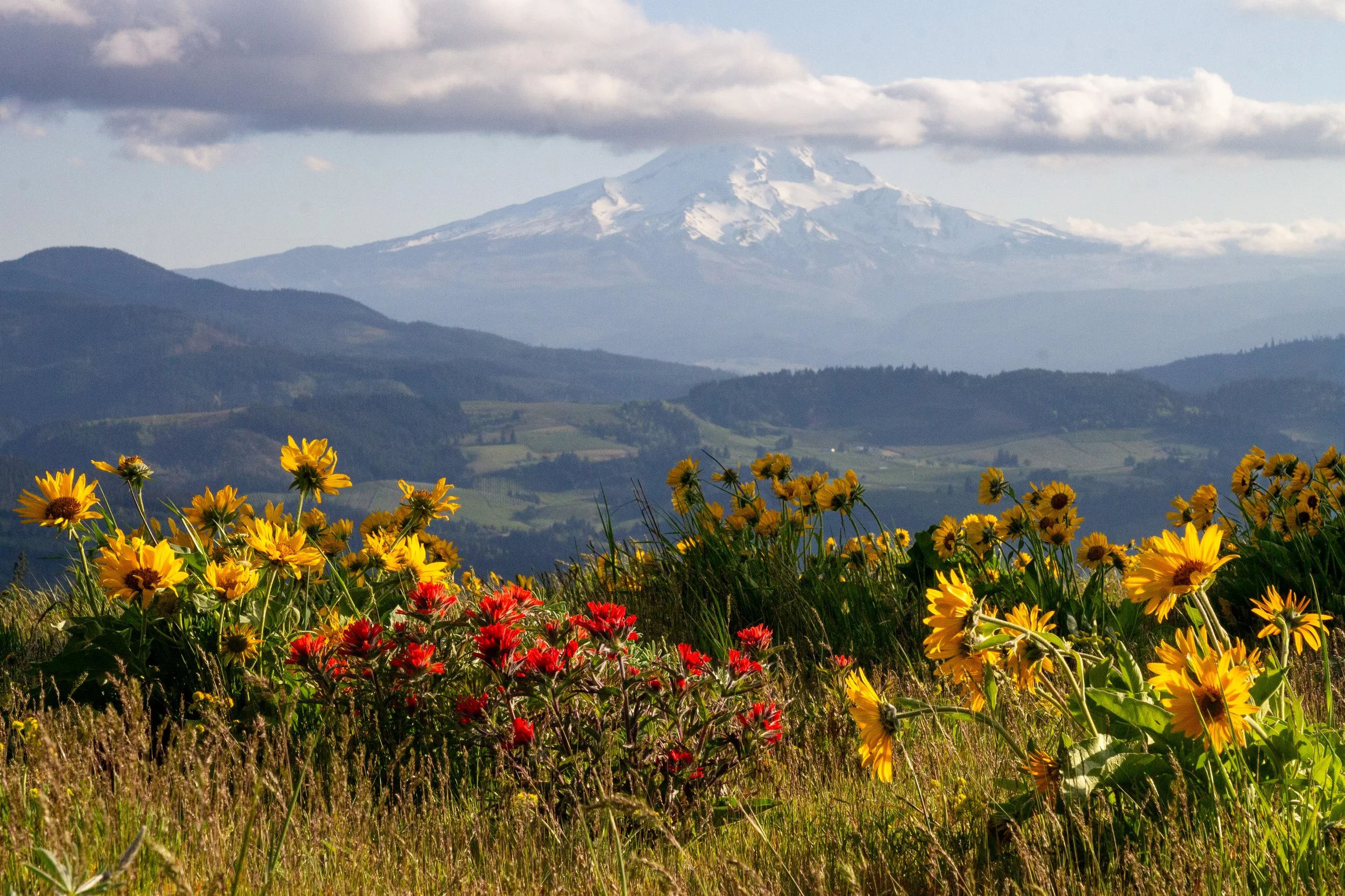
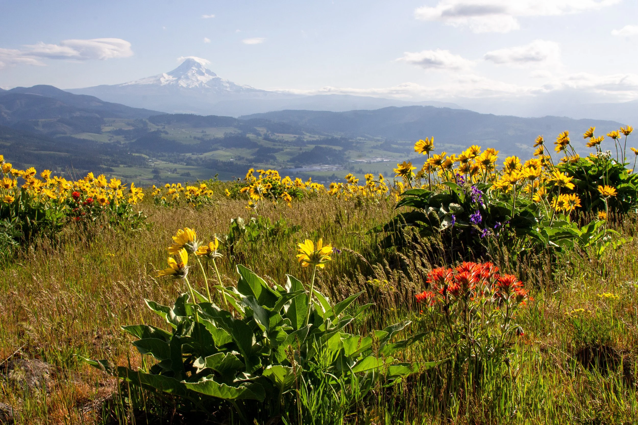
Paintbrush, balsamroot, and Mount Hood
Wildflowers bloom on Hood River Mountain from around mid-April through late May. The hike is at a slightly higher elevation than most Columbia Gorge wildflower destinations, so it’s a good one to tackle when the blooms at sea level start to fade. Balsamroot is the star here, along with lupines and paintbrush. Most years, I’d expect May to be a good time to see them blooming together. Depending on when you visit, you might also see grass widows, shooting stars, prairie stars, larkspur, fiddleneck, desert parsley, ballhead waterleaf, bighead clover, and yarrow. Early blooms appear around the beginning of April. Late blooms stick around into June.
End of April on Hood River Mountain
Hike options
Hood River Mountain has a confusing network of unmarked trails and gravel roads. Whichever version of the hike you do, I’d strongly suggest an offline map.
The AllTrails version of the hike is a 3-mile loop.
To maximize the views, you can start the AllTrails version and turn around at the last viewpoint. It’s still 3 miles, but it gives you more time with the best scenery and avoids walking on a road at the end.
Oregon Hikers describes a 6-mile loop, which begins the same way as versions 1 & 2, but adds trails farther east. They’re on the property of a logging company that allows public access. Don’t hike if active logging is happening.
All the versions take you to the most impressive scenery at the summit of Hood River Mountain. I’ll talk more about the first two.
Hood River Mountain Loop Hike
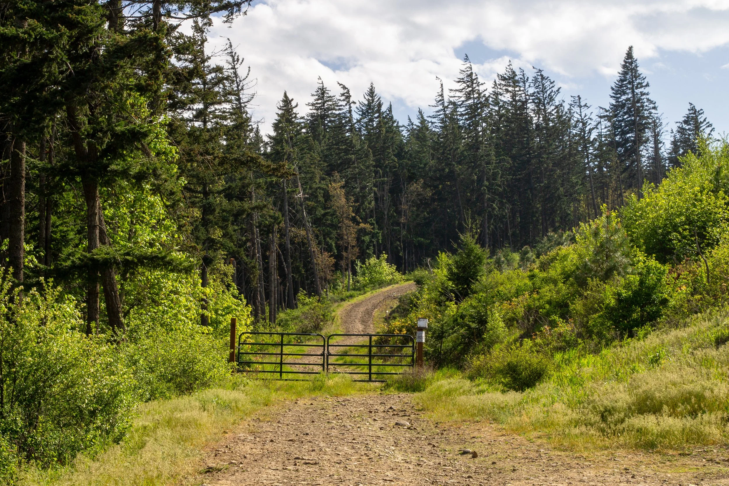
Start here
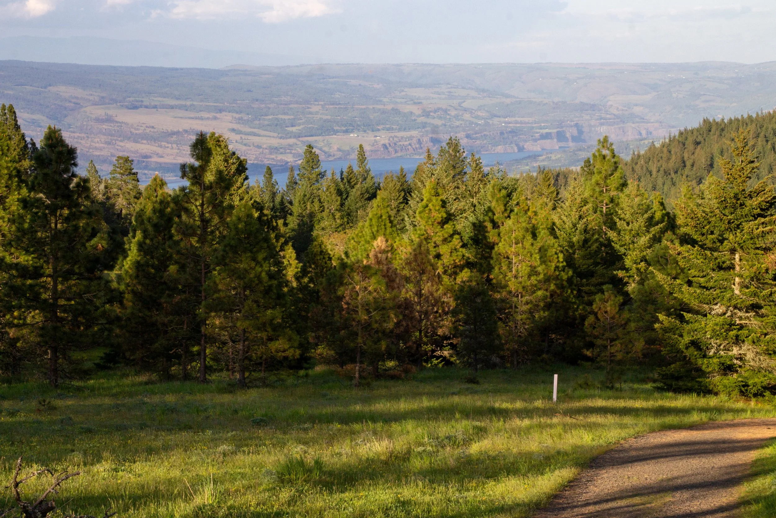
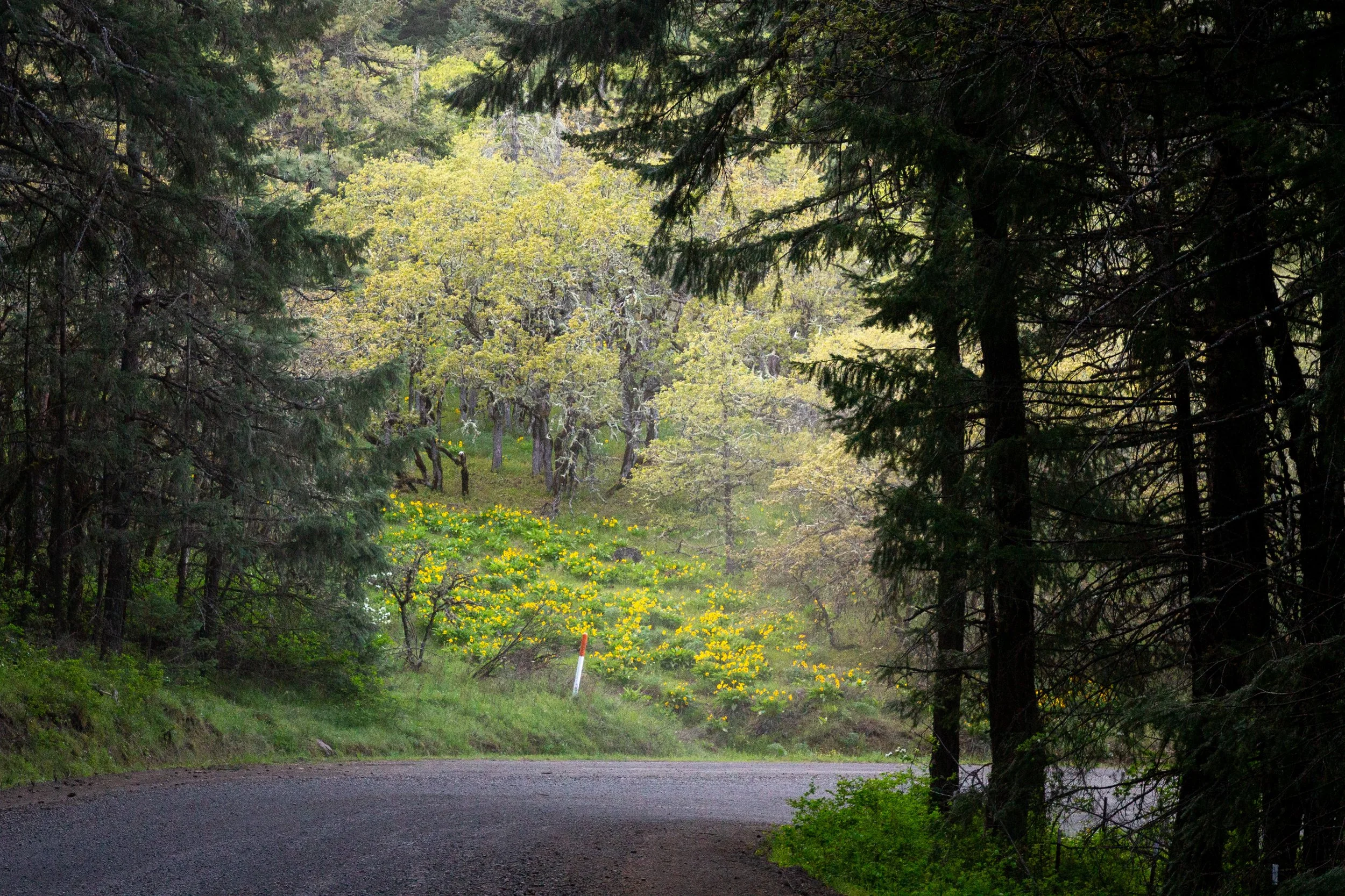
From the parking lot, walk around the gate and start up the hill. The beginning of the Hood River Mountain Trail is a slog. It gains almost all its elevation in the first mile. Not too many wildflowers at first, although some Oregon grape blooms around the trail. You start to see a sliver of the Columbia River to the east behind the hills as you climb.
The boring part
On clear days, Mount Adams comes into view after about a half mile, a nice distraction from the uphill walking. It was partly hidden behind clouds when I visited, but you kinda get the idea from the picture. When the visibility is good, you can also see Mount Rainier.
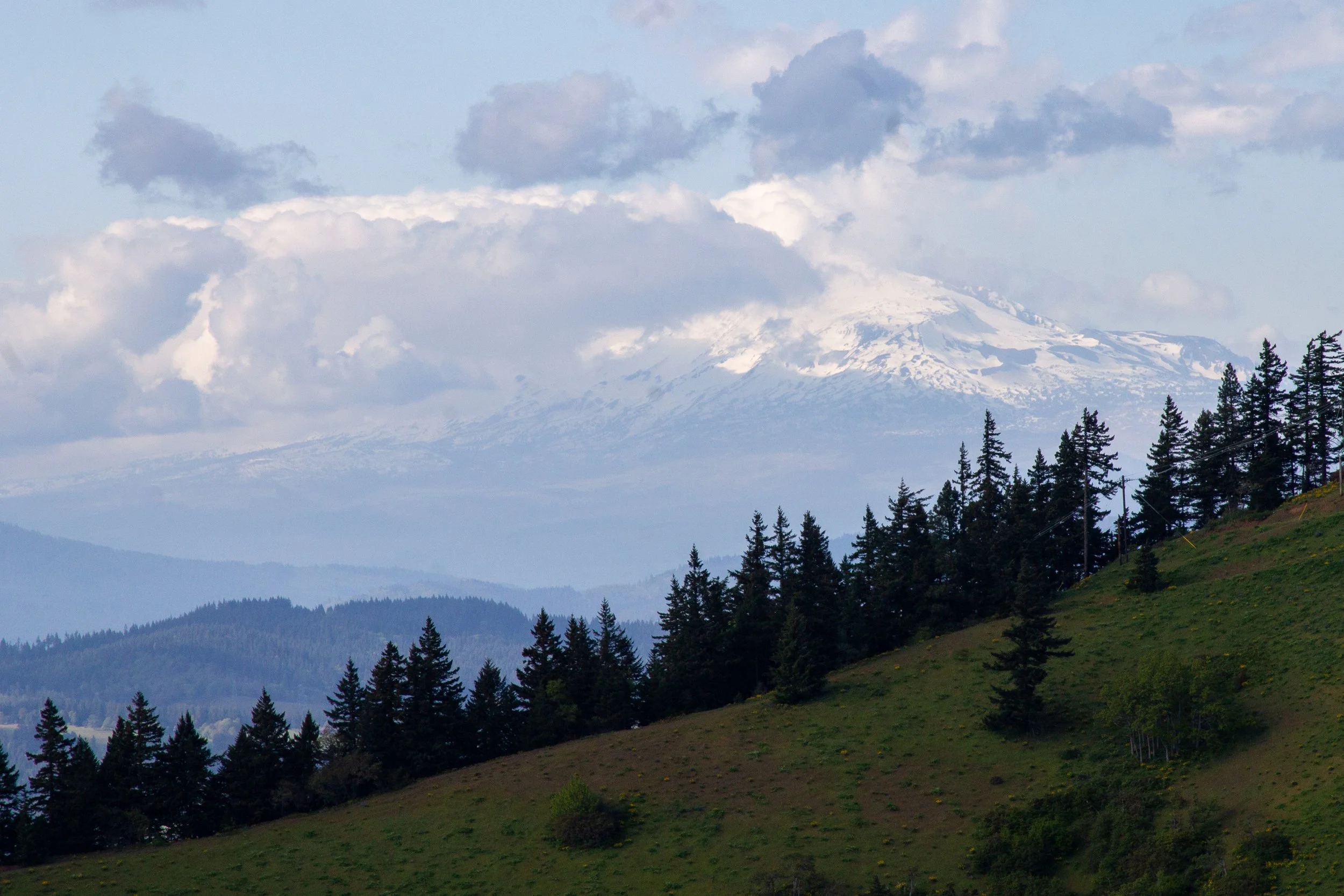
Mount Adams, with some imagination
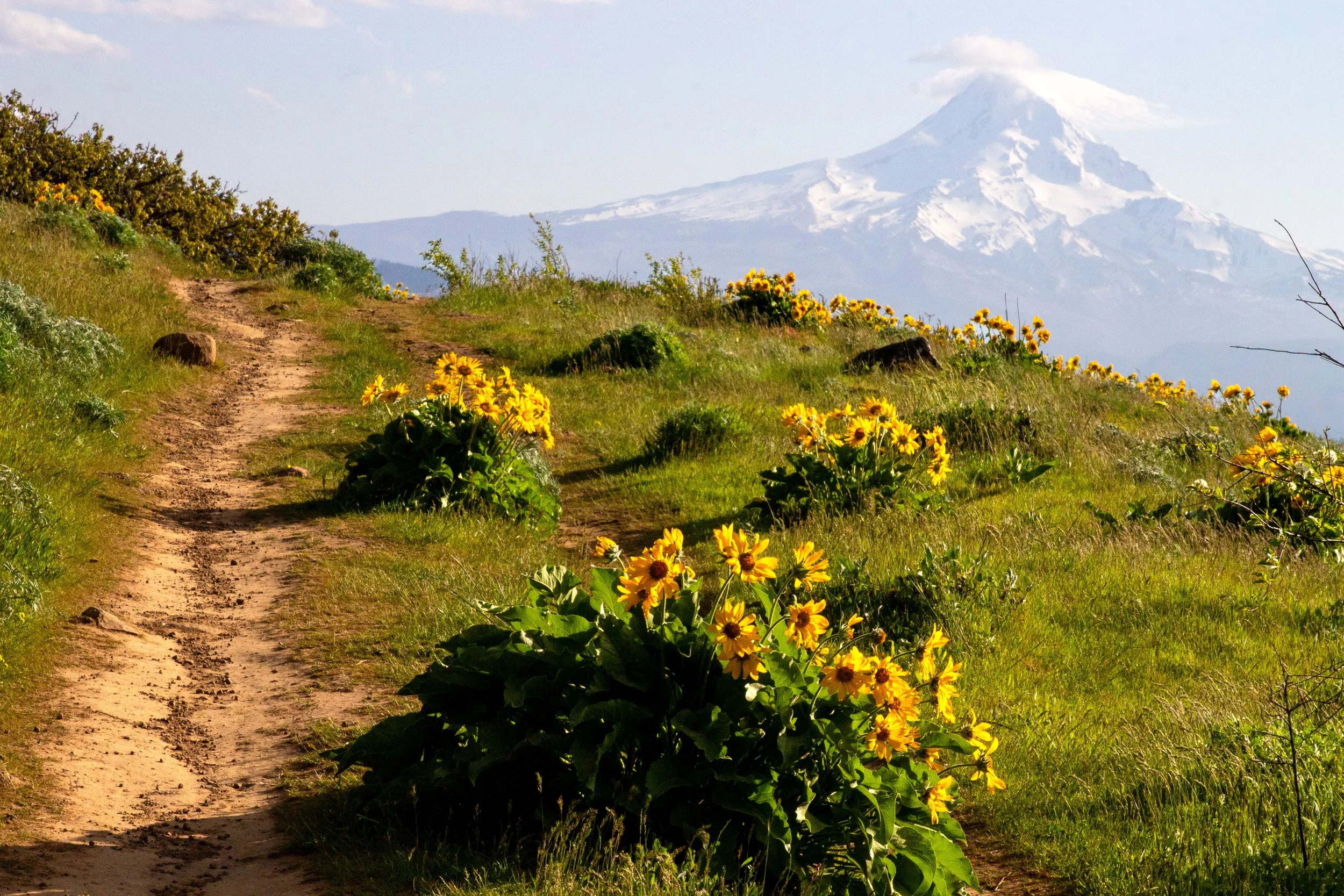
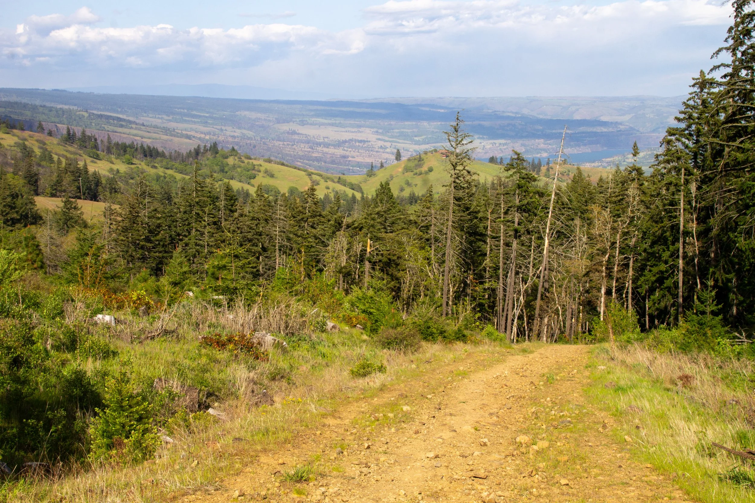
Just ahead, you can see the Columbia River to the west. The buildings in Hood River look tiny next to it. Wildflowers get more plentiful as you climb. Once the balsamroot starts appearing, you’re close to the great views.
Hood River Mountain Trail
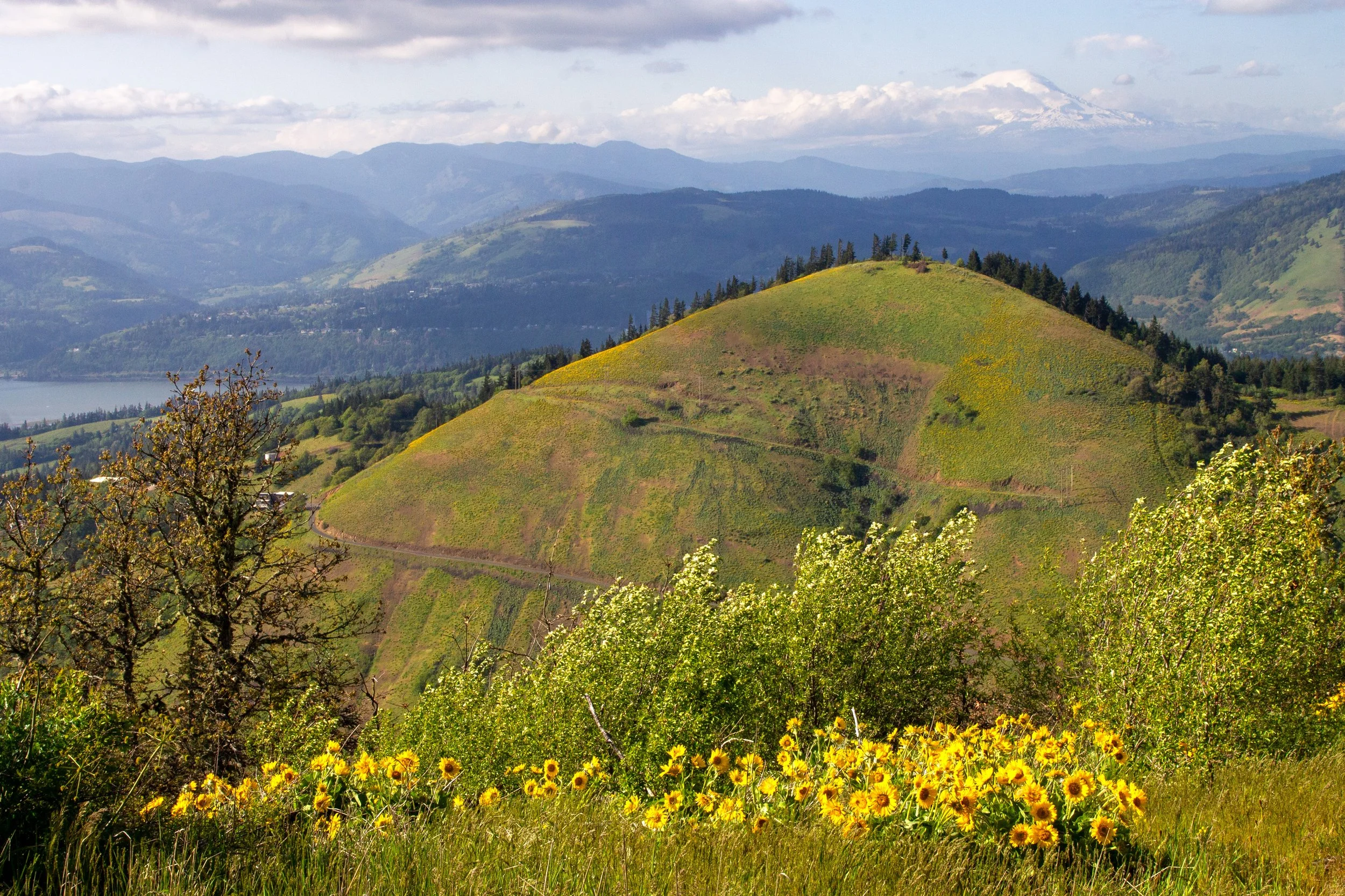
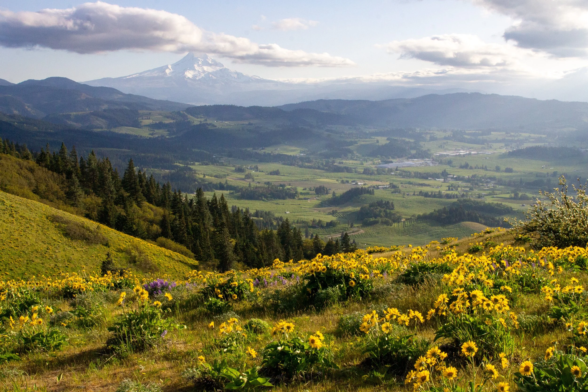
After about a mile, the trail widens at a viewpoint. To the north is Mount Adams and the Columbia Gorge. To the south is Mount Hood behind a valley filled with orchards and vineyards. Wildflowers, mostly balsamroot, cover the western slopes of Hood River Mountain.
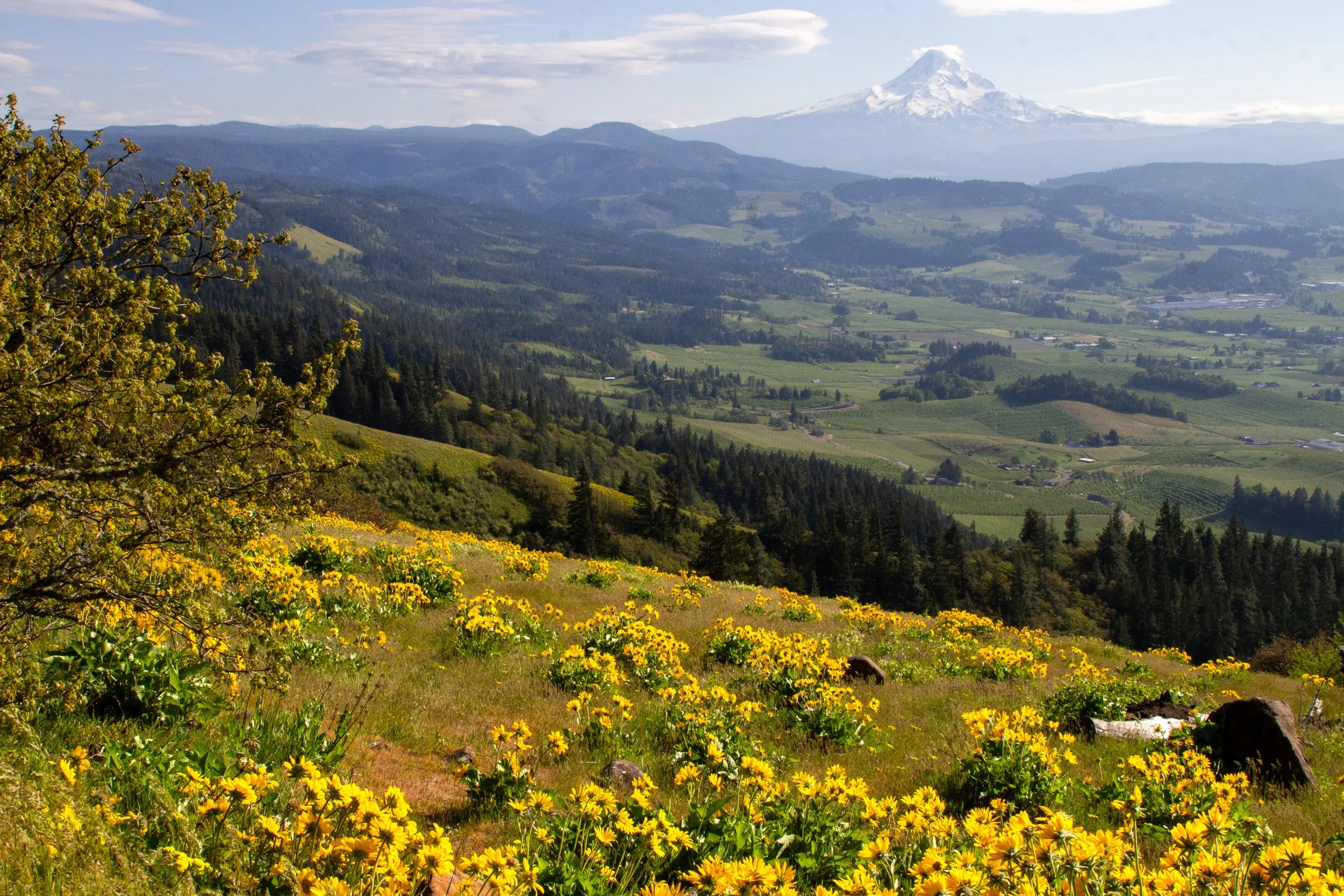
First viewpoint
From here, the trail heads south along the top of Hood River Mountain. To the left is a transitional forest of oak, ponderosa pine, and Doug fir. To the right are fields of wildflowers.
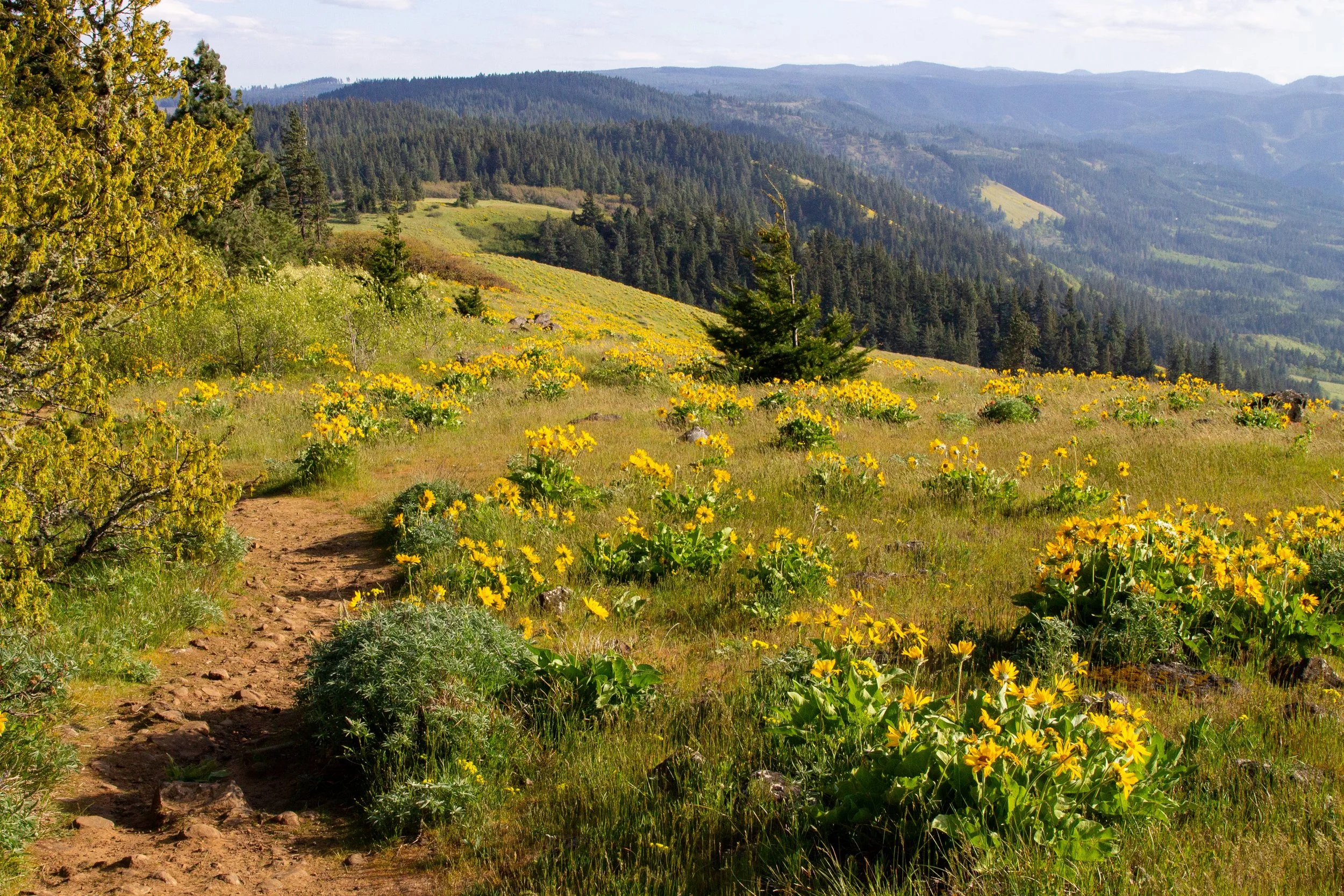
Hood River Mountain Trail
Paintbrush, larkspur, and the first of the lupines bloom alongside the balsamroot at the end of April. In May, more lupines enter the mix.
Wildflowers on Hood River Mountain
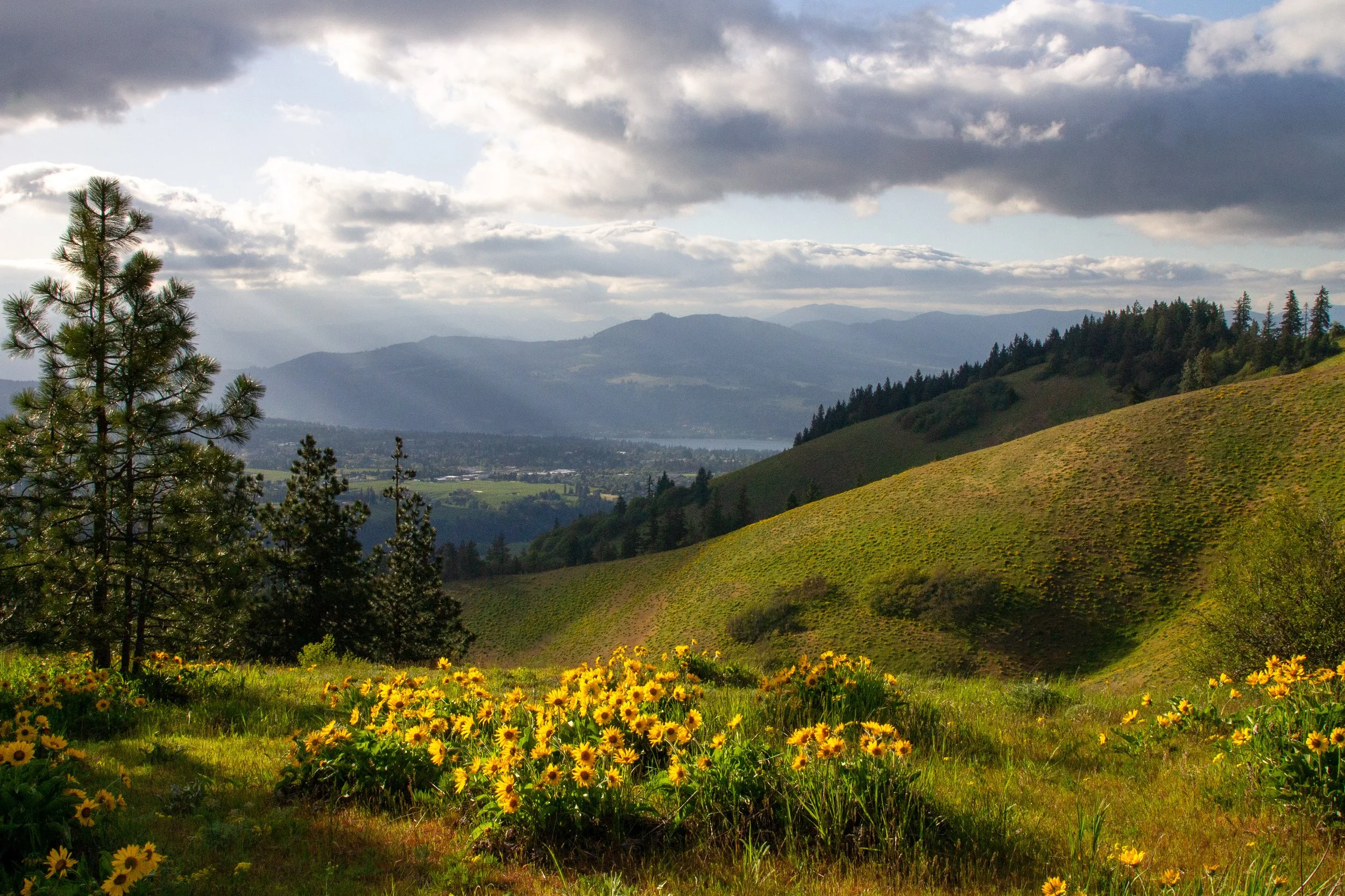
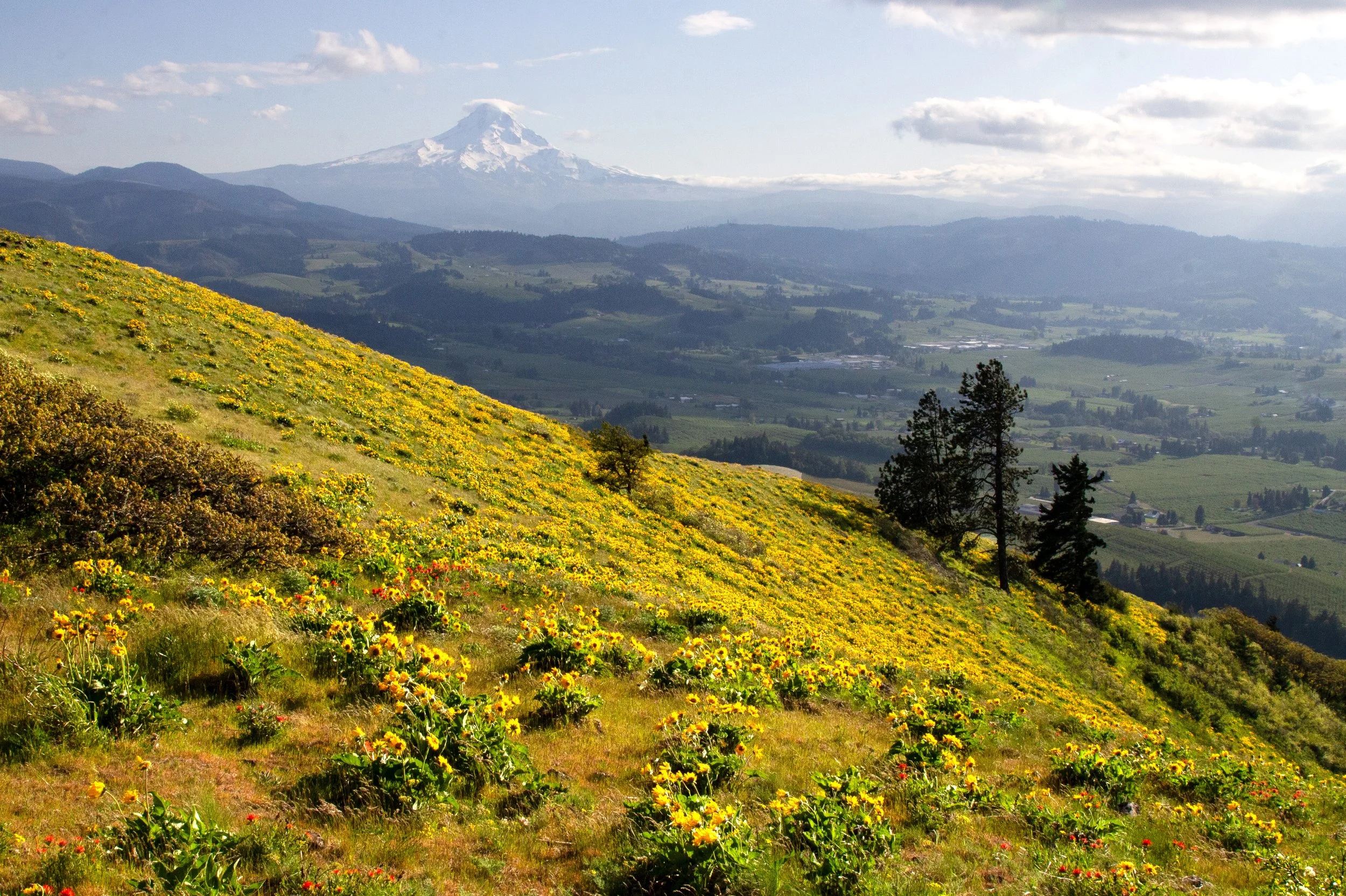
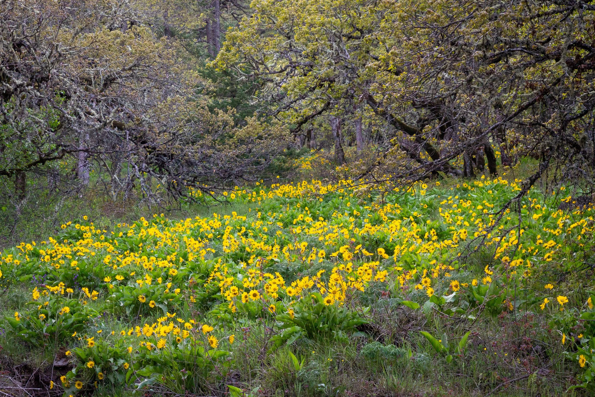
The next half-mile of the hike has nonstop spectacular views. The trail rises and falls gently as you make your way across the top of Hood River Mountain. Balsamroot covers the slopes with yellow in spring.
Hood River Mountain Trail
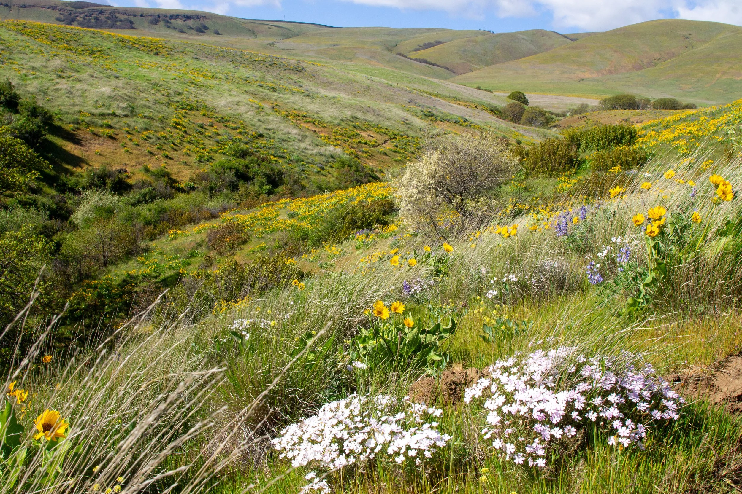
Around 1.5 miles, you’ll reach a final viewpoint overlooking Mount Hood and the valley below. Paintbrush, lupines, and balsamroot surround the trail. If the wind isn’t too strong, it’s the perfect place for a snack break. Even when it is, my numb fingers managed to pry open a bag of trail mix.
Last viewpoint
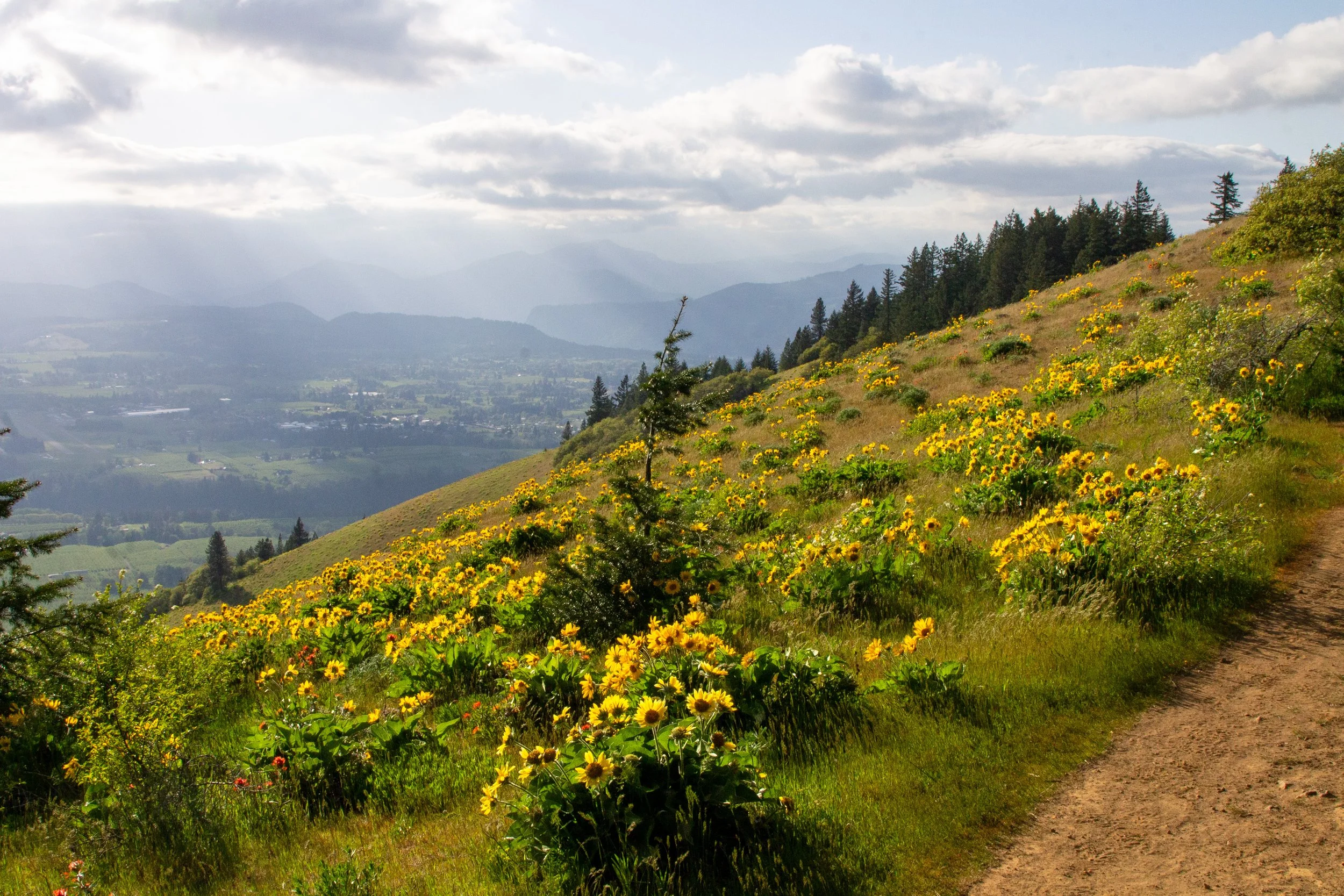
From here, you can turn around for the 3-mile out-and-back version of the hike or continue on the loop. If you’re doing the loop, the trail makes a turn to the east, heading away from Mount Hood. You’ll pass a dirt trail heading south that continues the Oregon Hikers version of the hike. We’ll keep left for the shorter loop.
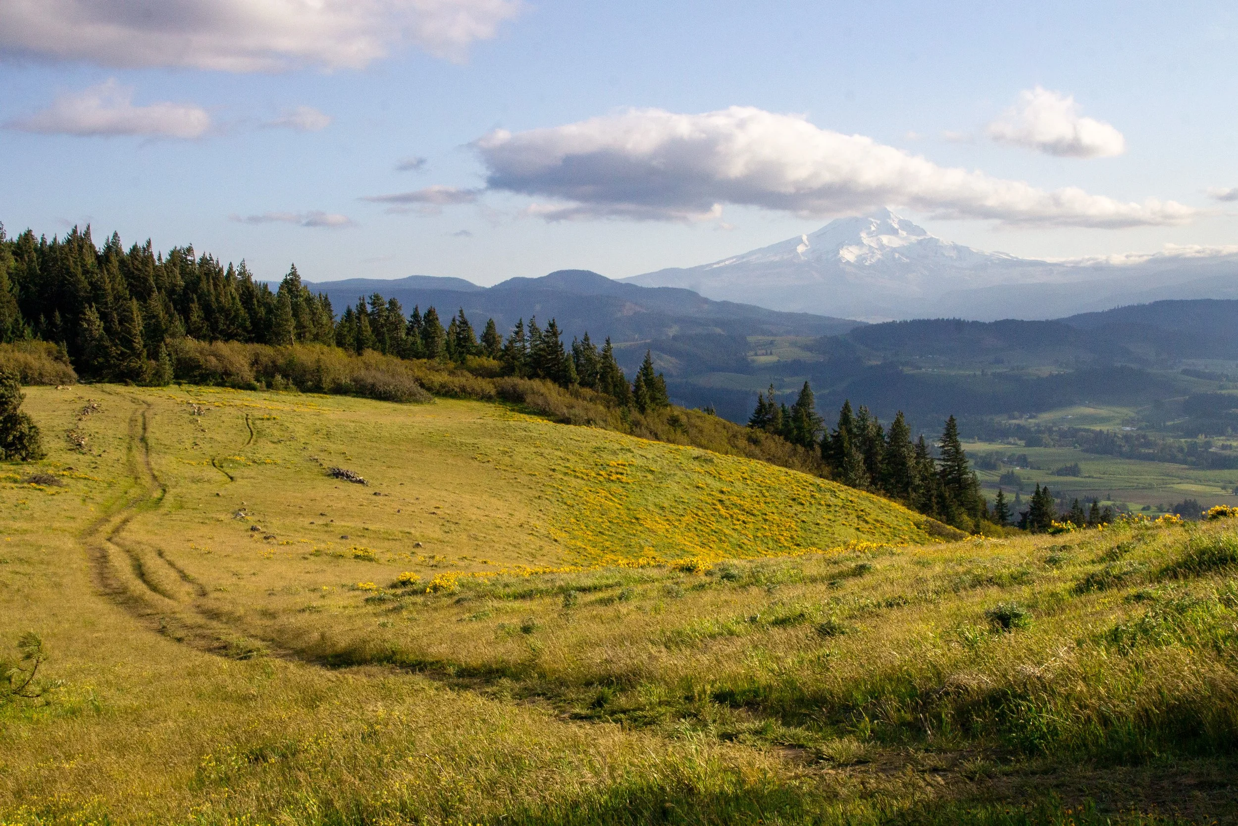
Walk past this trail for the shorter loop
After the last viewpoint, the Hood River Mountain Trail heads steadily downhill. Buttercups and miniature lupines bloom in fields surrounded by conifers.
Hood River Mountain Trail
When you reach the gate, head left. You’re now on Elder Road. The shoulder next to the gate is an alternate parking area.
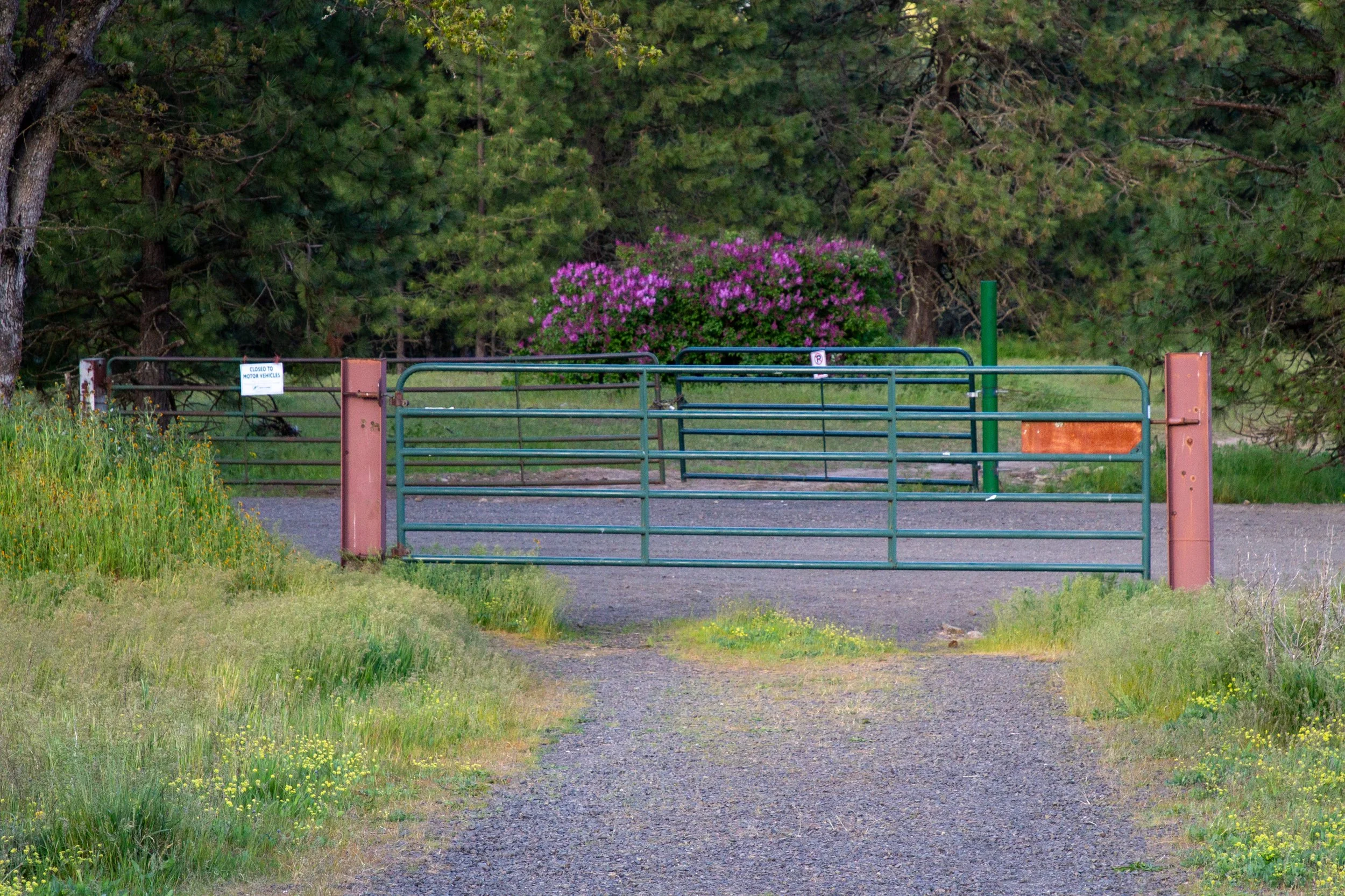
Go left at the gate
The last mile of the loop hike is on Elder Road. It’s a pleasant walk with some shade and trees to block the wind. The downside is watching for cars.
Elder Road
You see a few patches of wildflowers as you go. A deer retreated into the cover of the oaks as I passed. After about a mile on Elder Road, you’ll be back at the parking lot.
Roadside balsamroot
Panorama Point

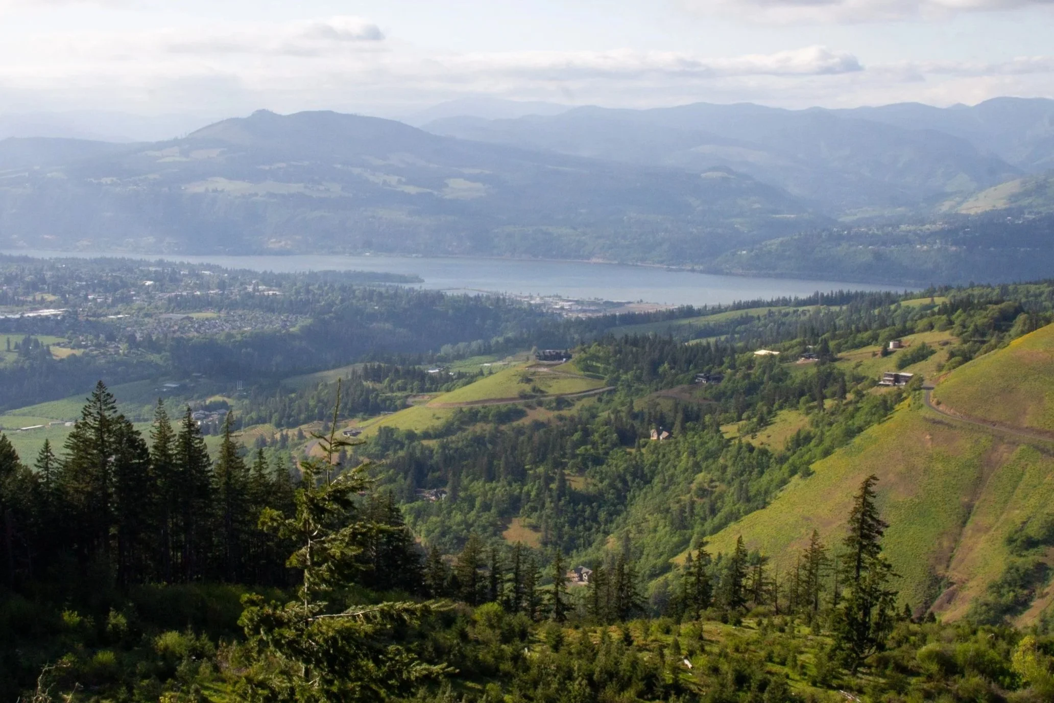
Mount Hood from Panorama Point
Panorama Point is a cool viewpoint stop that’s only about a half mile out of the way as you drive to or from the Hood River Mountain Trail. It has two main draws. One is practical. It’s a convenient bathroom stop. The other is seeing Mount Hood and the vineyards of Hood River.
Getting there
Navigate to: 45.676100, -121.461900
The parking lot for Hood River Mountain can be hard to find. It isn’t labeled in Google Maps. It’s on Old Dalles Dr, where it meets Elder Rd. The drive from Portland takes about 75 minutes.
From Hood River, take I-84 to OR-35 S and continue for 2 miles. Look for a left turn onto Whiskey Creek Dr. There’s no turn lane, and it’s a bit stressful. In 0.5 miles, turn left onto Eastside Rd. Then, in 0.2 miles, turn left onto Old Dalles Dr. Continue for 2 miles until you see an unmarked parking area in front of a gate. The last mile or so of the drive is unpaved. It’s bumpy but doable in a compact car.
If the parking lot is full, you can continue on Elder Road to a gate, which is an alternate trailhead for Hood River Mountain. Park on the shoulder of the gravel road next to the gate.
Enjoy your hike on Hood River Mountain!
With love,
Emma
Explore nearby
Check out the best wildflower hikes in the Columbia Gorge.
Find other cool hikes near Hood River.

Find the best things to do in Hood River.