

Silver Star Mountain in Any Car [Grouse Vista Trail]


Silver Star Mountain has some of the best views of the Cascade Mountains within an easy drive from Portland. At the summit, you’ll have a jaw-dropping 360-degree panorama overlooking five peaks: St Helens, Rainier, Adams, Hood, and Jefferson. It took me a while to get here, partly because the hiking distance pushes the abilities of my bum leg, but mostly because I’d heard horror stories about the rocky drive to the trailhead. My Honda Fit has many benefits. High clearance isn’t one of them. If you’re also concerned about the drive, don’t be. You can reach the Grouse Vista Trailhead in any car. While the hike that starts here isn’t the shortest or most scenic route up the mountain, you’ll have the same gorgeous views at the top. And it’s still pretty darn scenic. Wildflowers and berries are a bonus in summer. Here’s everything you need to know about the hike up Silver Star Mountain.

Mount Hood from Silver Star Mountain
Know before you go
To park at the Grouse Vista Trailhead, you need the Washington Discover Pass ($10/day or $30/year). Buy a pass before arriving. The trailhead doesn’t have a pay station or phone reception to buy one online.
Silver Star Mountain is popular. I was surprised to find the parking lot mostly full on a hot weekday afternoon. Consider starting early on summer weekends.
A vault toilet is at the trailhead.
Leashed dogs are welcome on the hike up Silver Star Mountain.
Bugs can be a nuisance in the summer. I’d use bug spray if I went again.
Silver Star Mountain isn’t a great destination with small kids because of the steep inclines and rocky terrain. Older kids would do fine.
Trails and trailheads
Around half a dozen trails lead up to the summit of Silver Star Mountain. You need a high-clearance 4WD vehicle to reach most trailheads. Oregon Hikers does a great job of breaking them all down in detail. Here are my quick and dirty shortcut recommendations:
If you have a low-clearance vehicle, take the Grouse Vista Trail. The road to the trailhead is unpaved for the last seven miles. It has a few potholes, but nothing intense. My Honda Fit did just fine. I’ll talk more about this trail here.
If you have a high-clearance 4WD vehicle, take Ed’s Trail Loop. It’s shorter and has less intense elevation gain than the Grouse Mountain Trail. By reputation, it’s also the prettiest approach to the summit.

Mount Adams from Silver Star Mountain
On the Grouse Vista Trail
Distance: 6.5 miles out and back
Elevation gain: 2,000 feet
Difficulty: Moderate/hard
Pass required: Washington Discover Pass
Dog friendly: Yes, leashed dogs are welcome on the trail.
ADA access: No
Season: Late spring through fall. Snow usually blocks access to the trailhead in winter.
The details
Two trails start from the Grouse Vista Trailhead parking lot. Take the one with the sign pointing toward Silver Star Mountain. It’s by the big panel of signs. If you don’t have a trail map downloaded, take a picture of the map on the panel. The directions are pretty straightforward, but you’ll pass an unmarked trail or two.

Start here
The Grouse Vista Trail begins with a steep uphill climb. If you have trekking poles, they’ll help out here more than on most hikes. In about 0.1 miles, you’ll reach a trail junction. Keep right to follow the sign toward Silver Star Mountain.
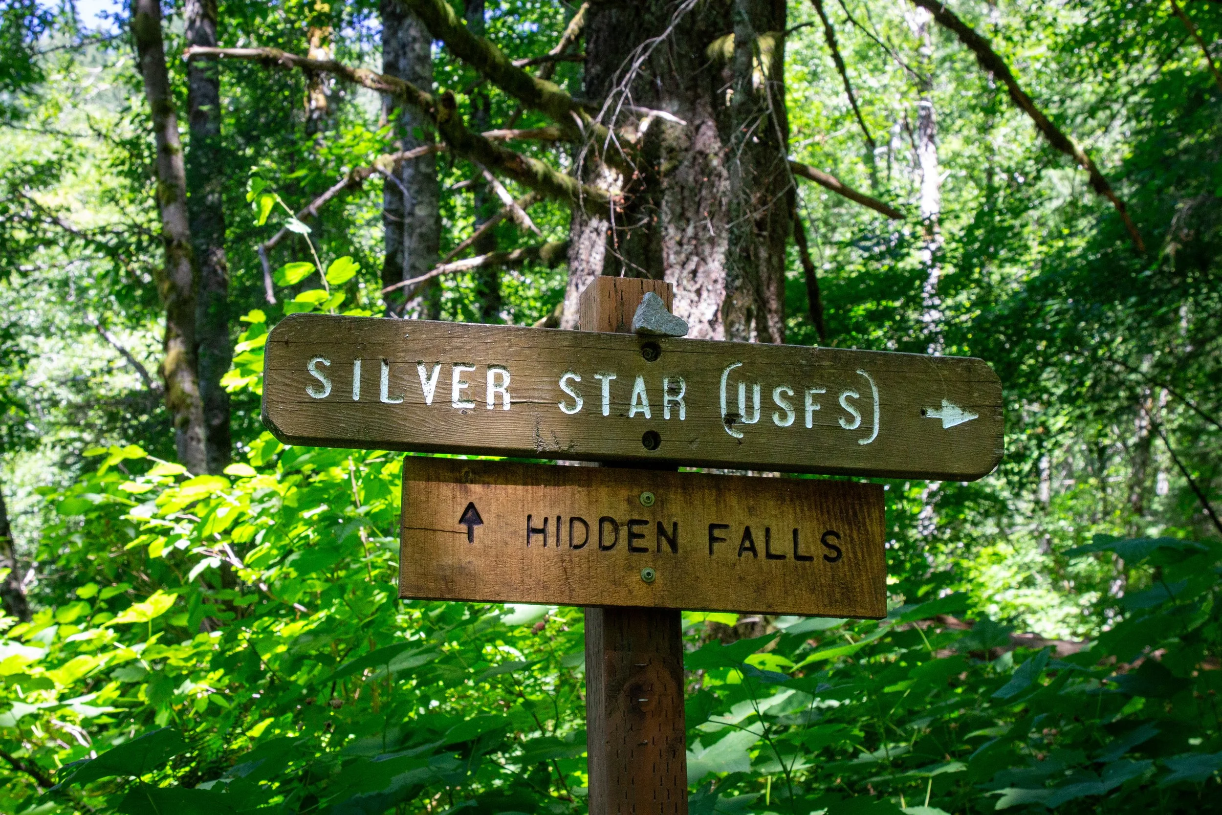
Keep right for Silver Star Mountain
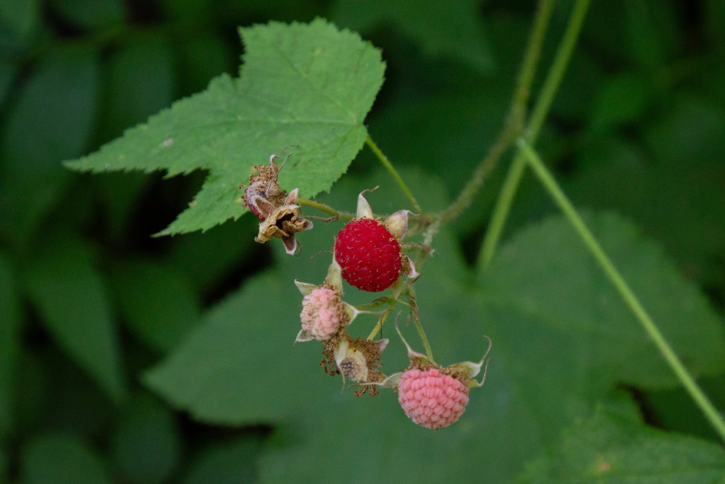
I’d describe the Grouse Vista Trail as having three parts. The first mile is a tedious uphill slog on loose rocks that roll under your feet as you walk. The second mile levels off and opens up to some lovely views, making you remember that you don’t actually hate hiking. The last mile is uphill again, but at least it’s close to the top. In other words, don’t be discouraged by the beginning. Things get better. While the first part of the hike lacks the big views, you’ll have shade from tall Doug firs and hemlocks. The undergrowth is packed with berries in the summer. I shamelessly bribed myself with trailside huckleberries, thimbleberries, and salmonberries as I trudged.
Thimbleberries on the Grouse Vista Trail
I was on Silver Star Mountain in late July, which was a little past peak wildflower season and perfect for berries. I’d love to go again in late June or early July to catch the beargrass flowering. In the fall, vine maples provide great color along the trail. Wildflowers start popping up in late spring and continue into the beginning of August. Tiger lilies, paintbrush, gentian, lupines, and penstemon were some July highlights.

Tiger lily
After the first mile, the trail starts getting a lot more fun. It will be rocky the whole time, but you’ll get a welcome break from the steep uphill grade. The tree cover thins, revealing rolling hills stretching out into the distance and wildflowers galore. Trailing blackberries enter the snack mix.

Views from the Grouse Vista Trail
Around the halfway point, you’ll start passing cool rock formations, beginning with Pyramid Rock. A short spur trail leads up to the top of it, which I skipped. You’ll have more impressive views from the top of Silver Star Mountain.

Pyramid Rock
Past Pyramid Rock, you’ll follow a ridge with interesting outcroppings and talus slopes.

Rock formations along the trail
The rest of the Grouse Vista Trail weaves in and out and the forest. The trees transition from mostly Doug firs to noble and silver firs. Frequent clearings make for great views and plentiful wildflowers. Bees and butterflies flit between them. This part of the hike is where the beargrass starts getting great in early summer. I know because of the many spent stalks along the trail. Insert tragic sigh.

Fritillary on hawksbeard
As you start getting close to Silver Star Mountain’s summit, the trail becomes steeper again. You’ll pass the junction with the Indian Pits Trail and the Sturgeon Trail. Keep going straight to stay on the Grouse Vista Trail.

Keep left here
Then, take a right at the rock pile with the sign for Silver Star summit.

Go right here
After the rock pile, it’s a quarter mile to the summit. When you reach the top of Silver Star Mountain, all grievances will be forgotten. The long and bumpy drive to the trailhead, the uphill trudging, the loose rocks, the stifling late afternoon heat, the persistent buzzing flies, gone. Now it’s just views for days. The trail splits in two at the end. You’ll have a whizbang view of Mount Adams at the fork. Go either direction to see the rest of the peaks. Silver Star Mountain’s official summit is to the left. A similar but slightly shorter almost-summit is to the right. Go ahead and stop by both. You won’t be in any hurry to leave once you get here.
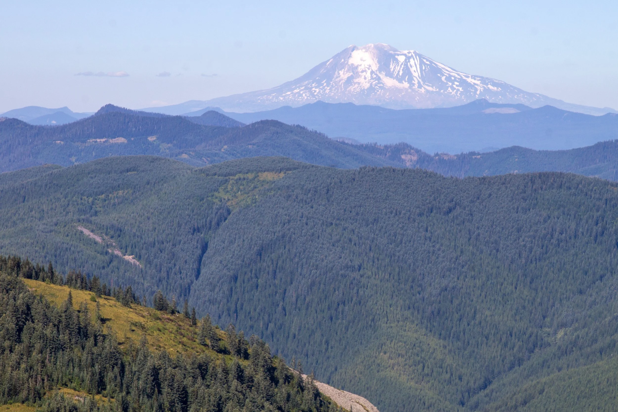
Mount Adams
We’ll head right first. You’ll start seeing Mount Hood as you make a short climb up the almost-summit.

The almost-summit on Silver Star Mountain
At the top are mountains in every direction. Looking straight out on a clear day, you’ll see Mount Hood and Mount Jefferson. Behind you are Mount Adams, Mount Rainier, and Mount St Helens. Beargrass covers the slopes in early summer. Other blooms linger into August. Since this viewpoint isn’t the true summit, it’s less crowded and your best bet for finding solitude with the peaks.

Mount from the almost-summit
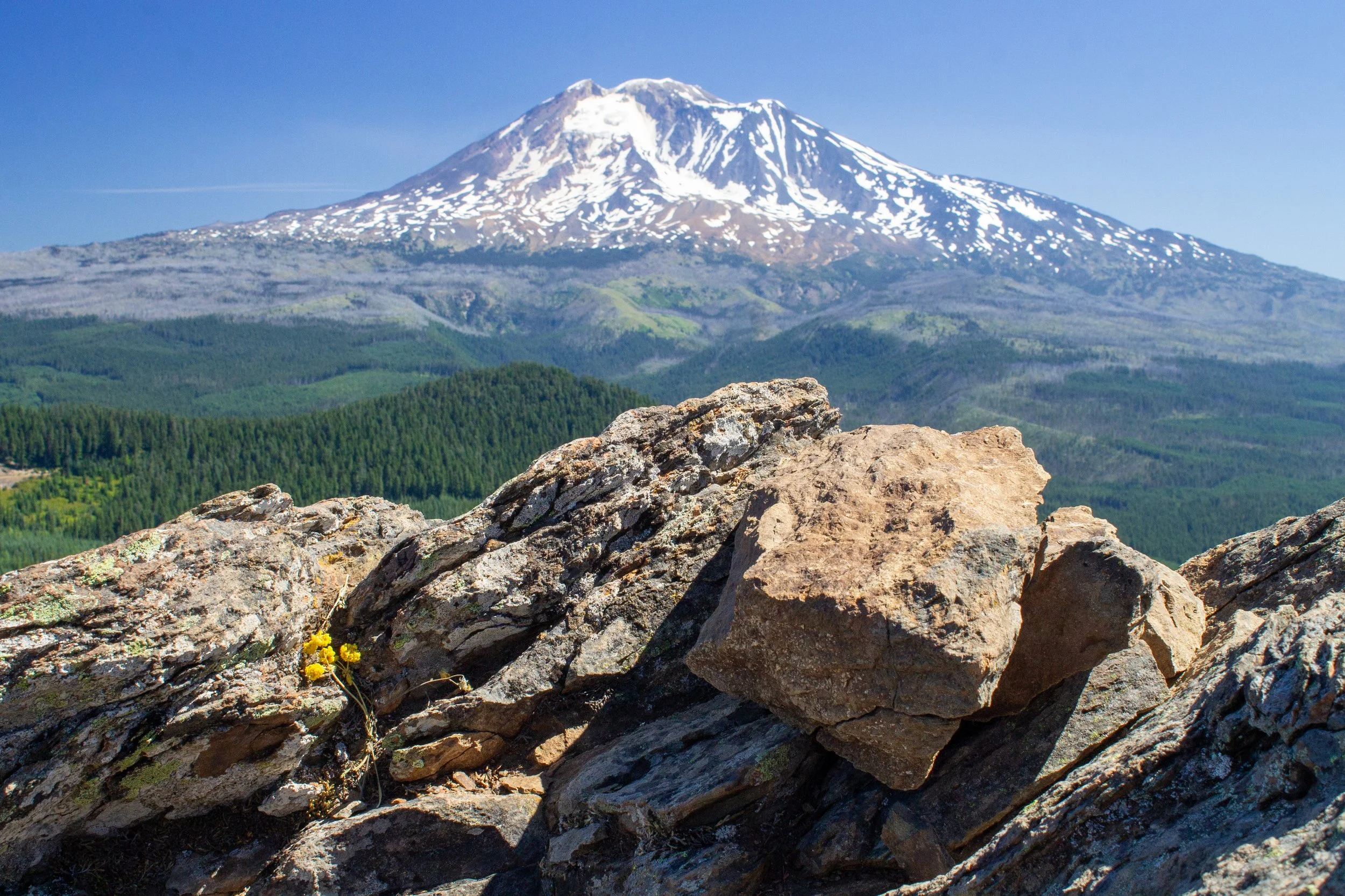
Next, head the other direction to reach the official summit of Silver Star Mountain, where more spectacular views await. A concrete platform at the top is what remains of an old lookout.

Silver Star Mountain summit
Silver Star Mountain has a 360-degree panorama overlooking the Cascade Mountains from over 4,300 feet of elevation. Unlike most great alpine vistas, there isn’t one peak that’s the clear showstopper, but four. Mount St Helens, Rainier, Adams, and Hood all look huge as you turn in circles and scan the horizon. Definitely, definitely bring a snack. I came late in the day to have evening light for pictures and still found myself looking for excuses to linger. The landscape feels so wild and remote that it’s hard to believe how close Silver Star is to the city.

Mount St Helens and Mount Rainier
After taking in the views on top of Silver Star Mountain, head back down the Grouse Vista Trail. The return journey goes a lot faster, but the rolling rocks keep it, shall we say, interesting.
Getting there
To reach the Grouse Vista Trailhead from Portland, cross the river into Vancouver and take WA-14 E to Washougal. At the traffic circle, take the third exit onto Washougal River Rd. In 6.8 miles, turn left onto NE Hughes Rd. In 2 miles, turn right onto NE 28th St, then go straight to continue onto Miller Rd. In 0.9 miles, take a right onto NE 39th St, then an immediate left onto 412th Ave. In 0.2 miles, turn right onto 1200 Rd. Continue on 1200 Rd until the Grouse Vista Trailhead. The last seven miles of the road are unpaved. It’s a little bumpy, but not a problem in a low-clearance vehicle. The drive from Portland takes a little over an hour.
Enjoy your hike up Silver Star Mountain!
With love,
Emma
Explore nearby

Find the best short hikes near Mount Hood.
Find the best things to do near Mount Adams.

Visit the stunning swimming hole beneath Dougan Falls.
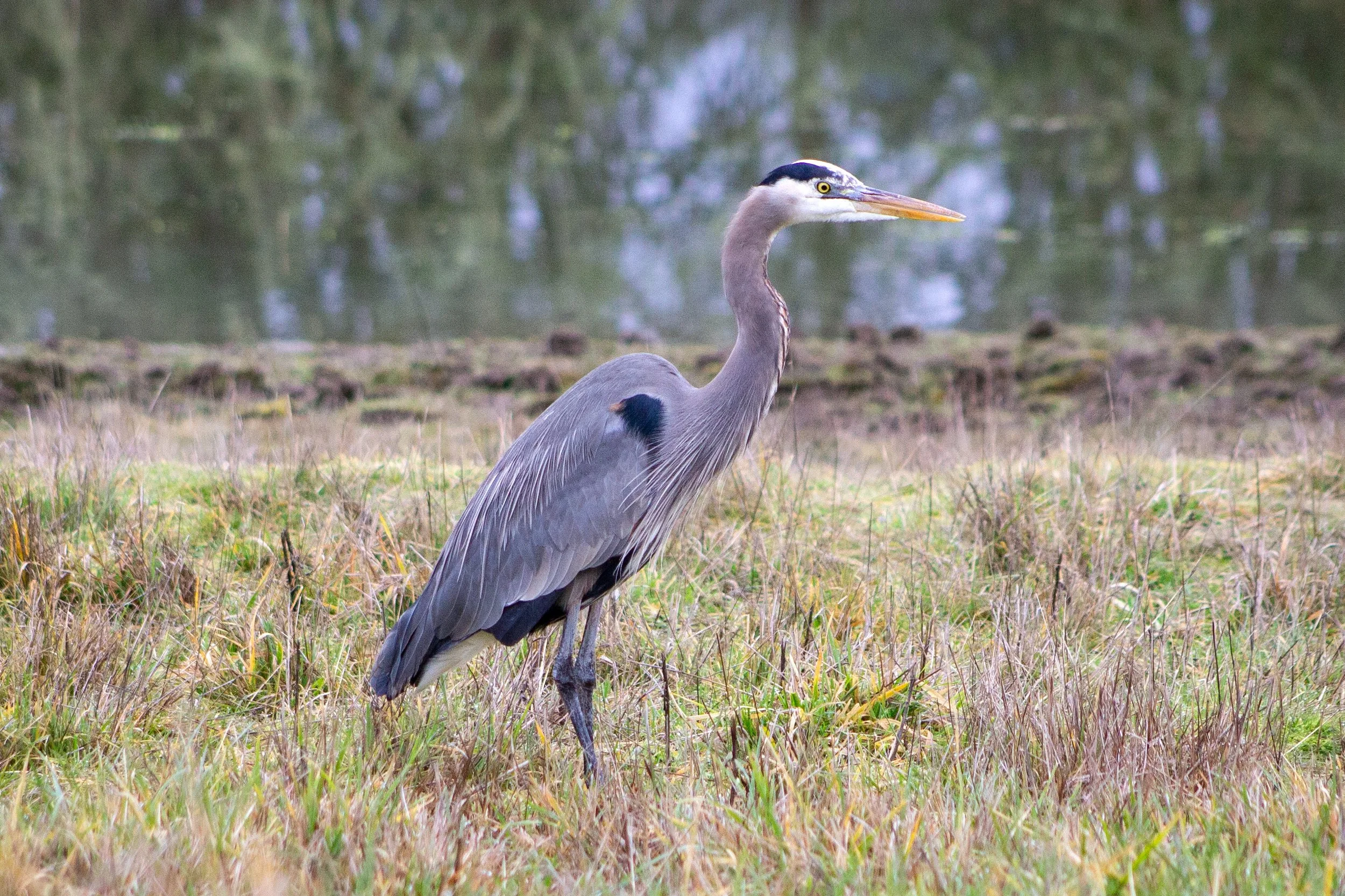
See the birds at Ridgefield National Wildlife Refuge.