

Zigzag Canyon Overlook Hike on Mt Hood


Despite its imposing scenery, the hike to Zigzag Canyon stands out as one of the most approachable hikes on Mt Hood. It begins at an elevation of 6,000 feet at the rustic-chic Timberline ski lodge. From here, you’ll follow the Pacific Crest Trail through fields of wildflowers and canyons carved by alpine glaciers to reach the enormous chasm that is Zigzag Canyon. After the hike, kick back at the lodge with a beer or hot chocolate. Here’s everything you need to know about hiking to the Zigzag Canyon Overlook.
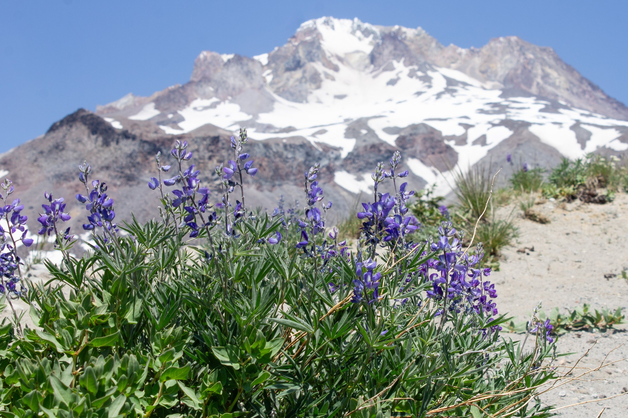
Lupines bloom at Zigzag Canyon Overlook
Know before you go
Parking is free at Timberline Lodge from May 1st - October 31st. You don’t need a pass or permit. The parking lot closest to the lodge is for hotel guests. Use either of the two lower parking lots for day use.
If you visit during winter (November 1st - April 30th), you need a Sno-Park Pass to park. You can purchase a pass on-site from Timberline Guest Services or at the Wy’East Day Lodge.
Once you start the hike and reach the permit station on the trail, fill out a free self-issued wilderness permit.
Leashed dogs are welcome on the trail. Only service animals are allowed inside Timberline Lodge.
Indoor restrooms are inside Timberline Lodge.
Visit from July until October to avoid snow on the trail. There may be small patches of snow in summer, but it will be doable with ordinary hiking boots. If you hike this trail before the snow melts, make sure you have a plan for navigation and the right gear.
Stay on the trails. Many wildflowers bloom on Mt Hood, and they are more delicate than people sometimes realize. If they’re damaged, they often don’t grow back.
The hike to Zigzag Canyon has very little shade.
Find a helpful PDF trail map here.
This hike is very popular. Expect others on the trail, especially near the lodge. Parking may be a challenge on weekends. Consider arriving early on weekends.
Wildflowers bloom along the trail to Zigzag Canyon in mid-summer to early fall
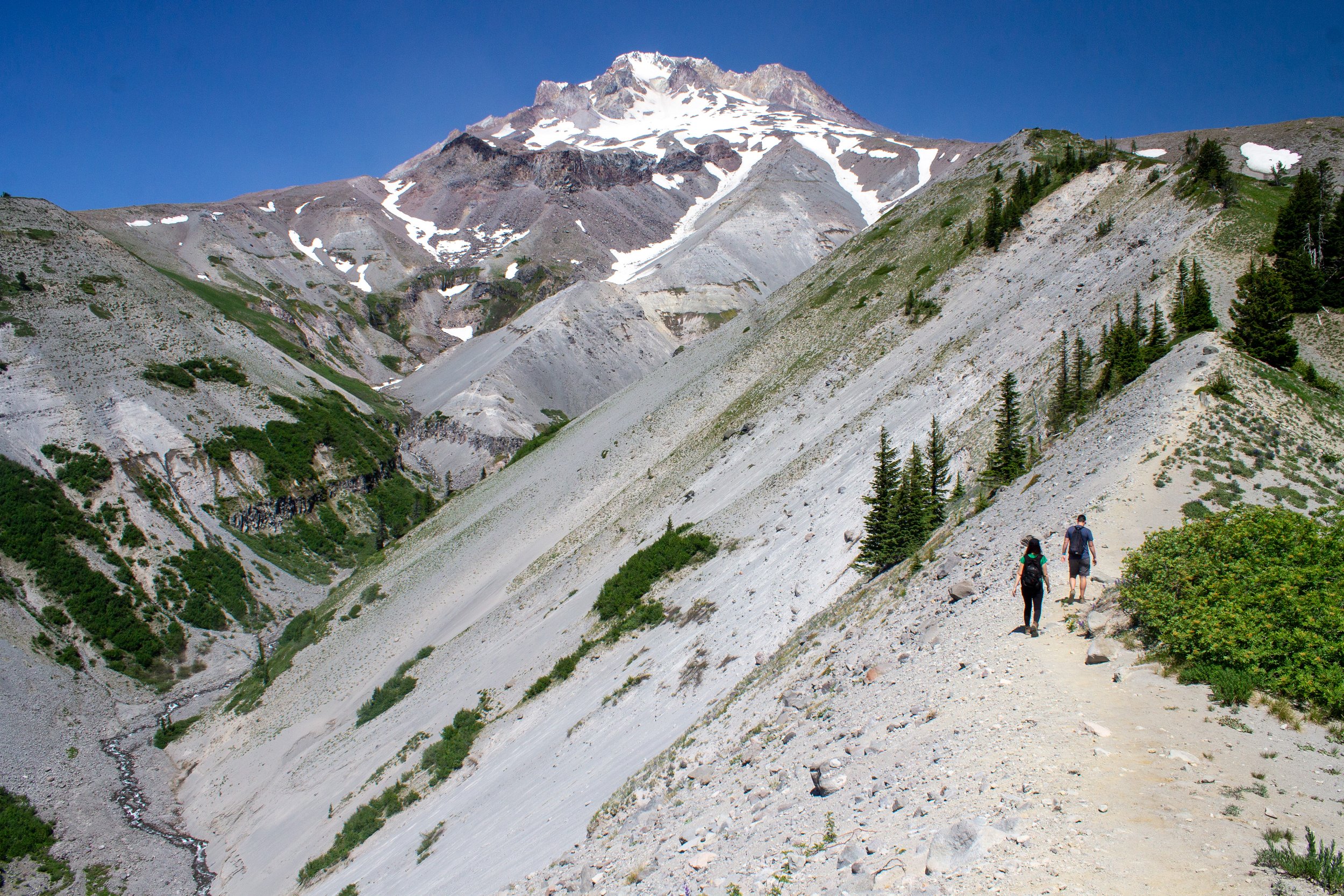
Pacific Crest Trail to Zigzag Canyon
Quick stats
Distance: 4.7 miles out and back
Elevation gain: 850 feet
Difficulty: Moderate
Pass required: Free self-issued wilderness permit
Dog friendly: Yes, leashed dogs are welcome on the trails.
ADA access: No, not beyond Timberline Lodge.
The details
One of the great things about hiking near Timberline Lodge is that you get high-elevation alpine views starting from the parking lot. When you step out of the car, look north for a view of Mt Hood’s summit and then south to see the forested hills of the Mt Hood Wilderness and a distant Mt Jefferson.
The mountain views begin at the Timberline Lodge parking lot
From Timberline Lodge, there are two ways to start the hike to Zigzag Canyon. The two trails meet up after about 0.5 miles, so it doesn’t matter much which one you take. Here are the options:
1) Walk to the far west side of the parking lot and look for a trailhead at the end of it. You’ll pass in front of Timberline Lodge and its swimming pool on your way.
2) Take the wooden stairs up the hill on the east side of Timberline Lodge. Keep heading up the hill until you reach the Pacific Crest Trail. Follow it to the left. You’ll be heading toward the chairlift.
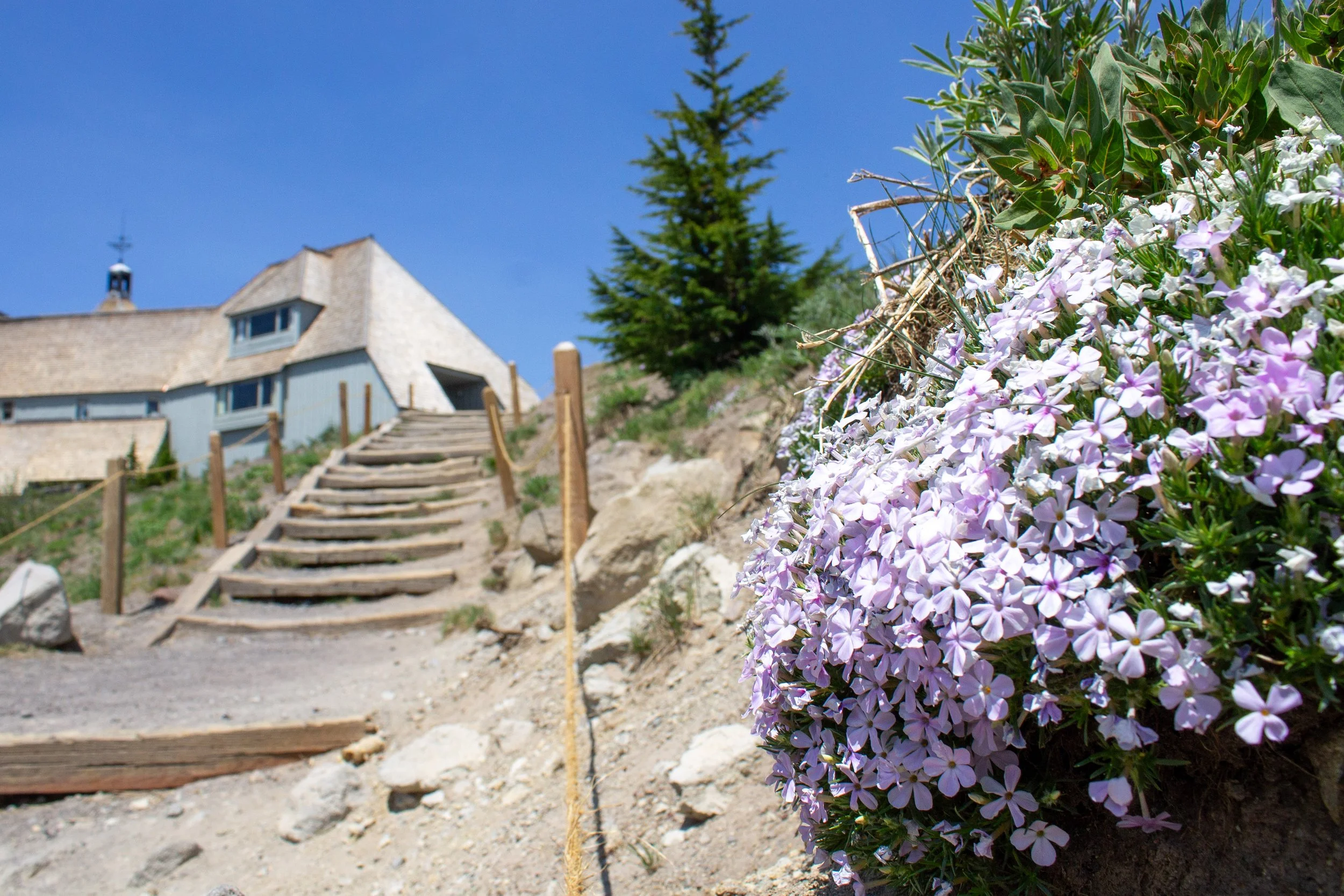
Climb these stairs next to spreading phlox for option #2
Whichever way you take, you should be heading west. If you pass under a chairlift, you’re going the right way. If you take the first way, you’ll pass under two chairlifts. Timberline Lodge has a small and confusing network of trails behind it, so an offline map might be helpful at the beginning of the hike to get you on the Pacific Crest Trail. The area around the lodge is a great place to see wildflowers in summer. Look for phlox early in the season, followed by buckwheat, asters, and lupines.
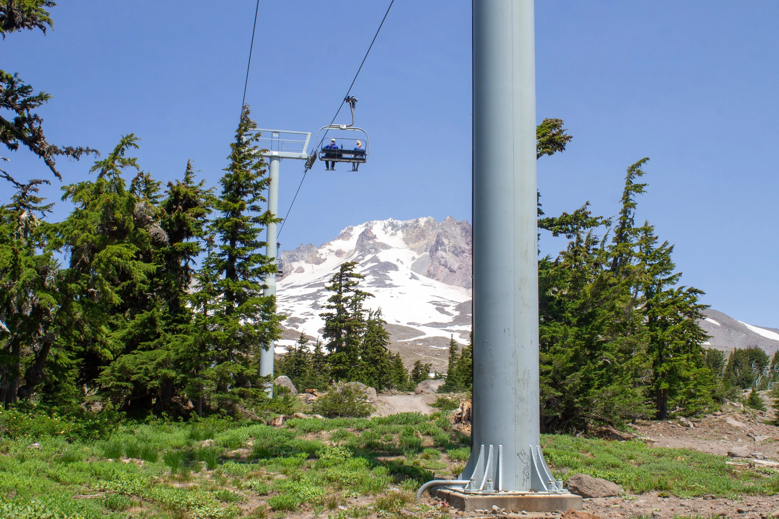
The Magic Mile lift
After about 0.5 miles, you’ll reach a trail junction where the trails merge. Take the Timberline/Pacific Crest Trail to head toward Zigzag Canyon. Signs pointing toward Paradise Park will also steer you in the right direction. You’ll soon reach a station to fill out a self-issued wilderness permit. Take a moment to fill out the permit and then enter the Mt Hood Wilderness.
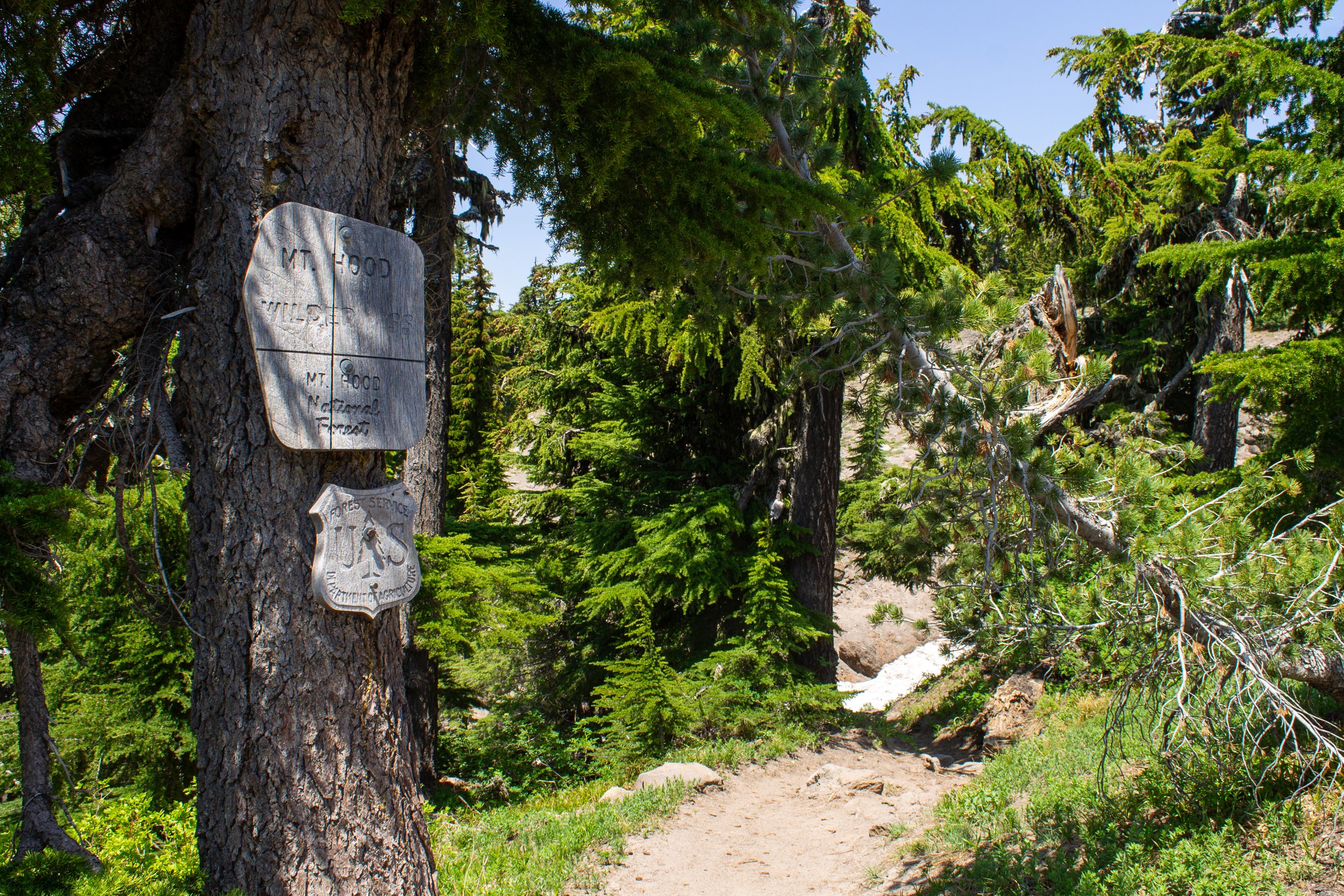
A sign marks the boundary for the Mt Hood Wilderness
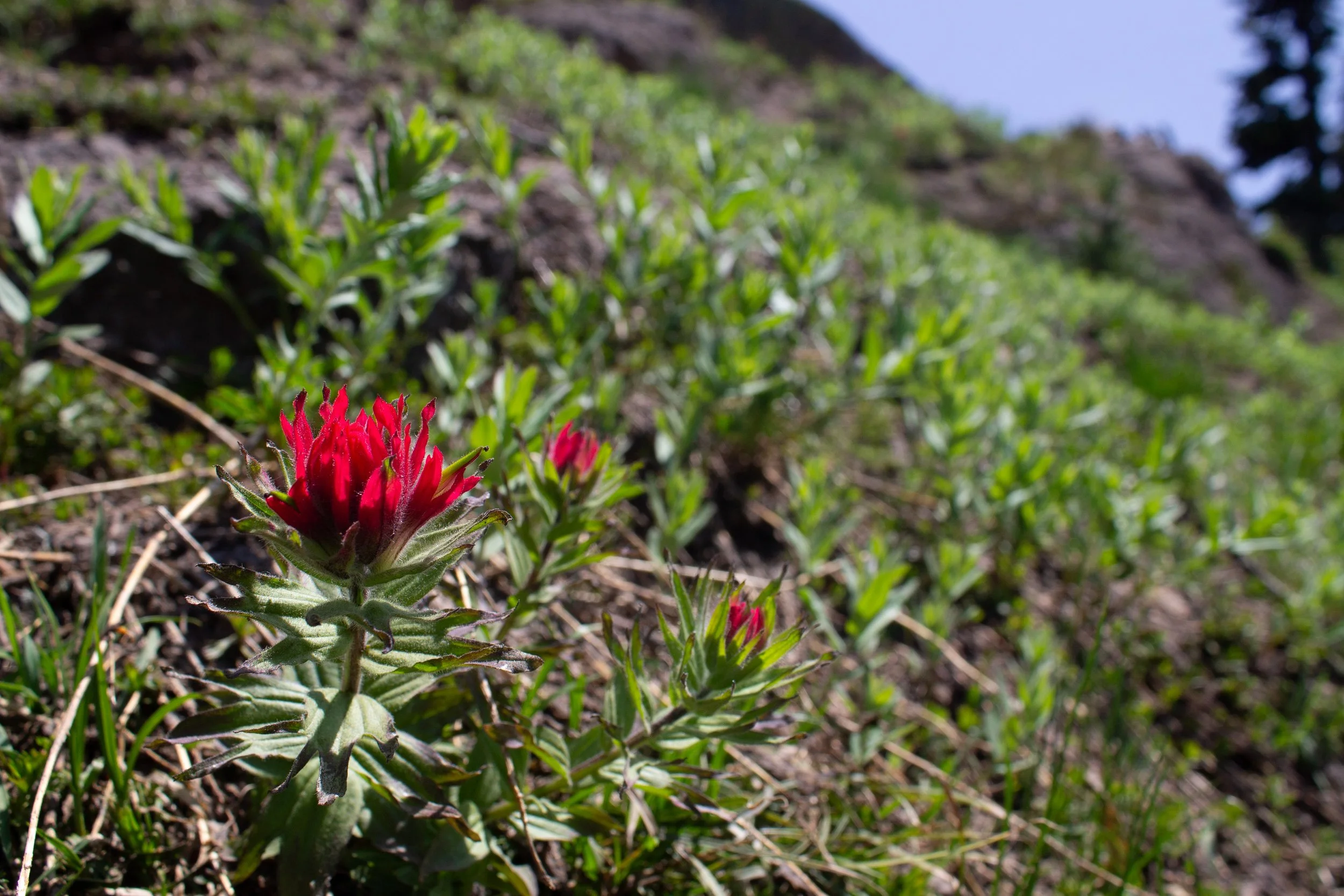
Wildflowers bloom along the trail beginning in June. Expect peak bloom from about late July into August. Look for flowers like lupines, paintbrush, Jacob’s ladder, mariposa lilies, false hellebore, asters, avalanche lilies, and teeny tiny desert parsley.
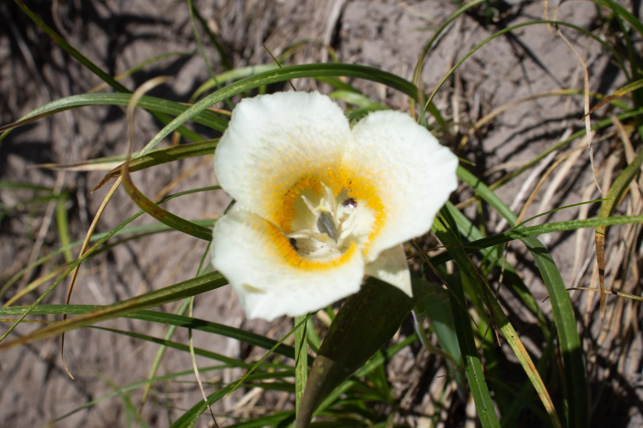
Subalpine mariposa lily
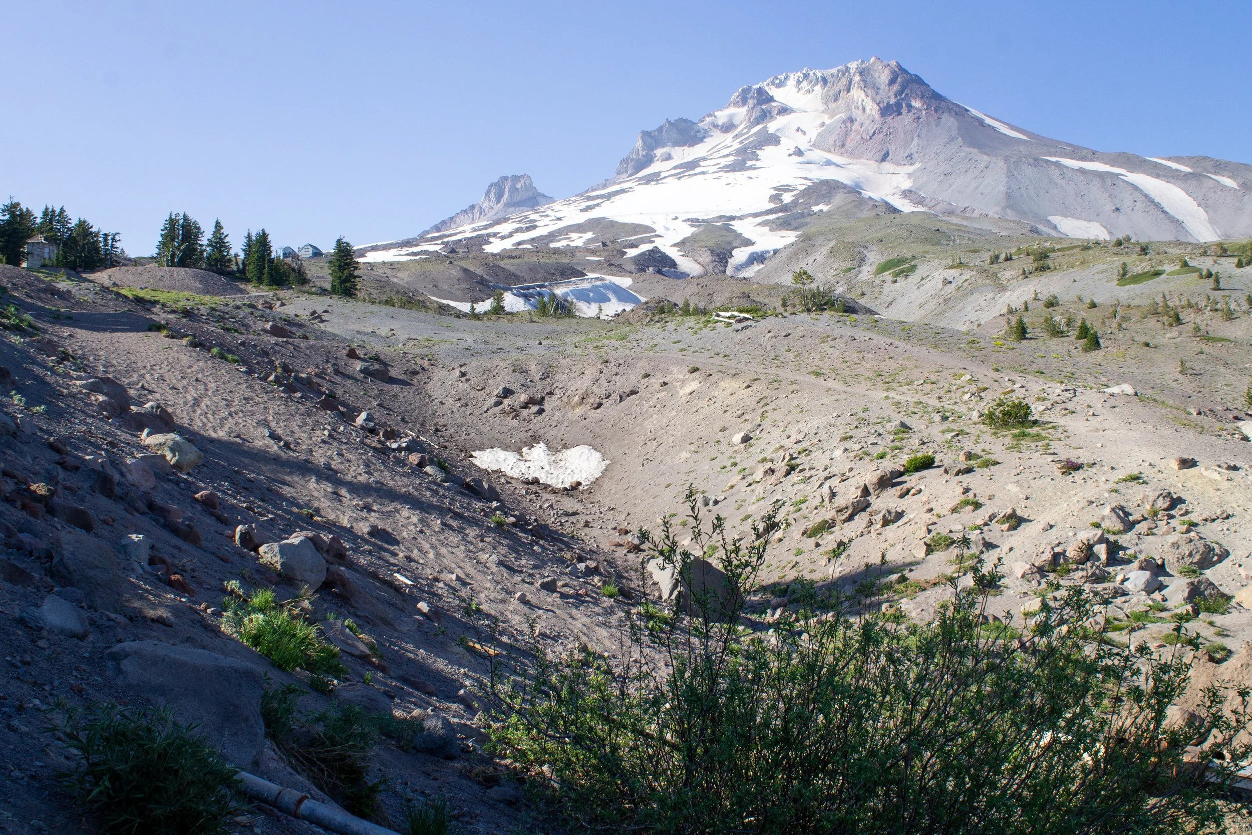
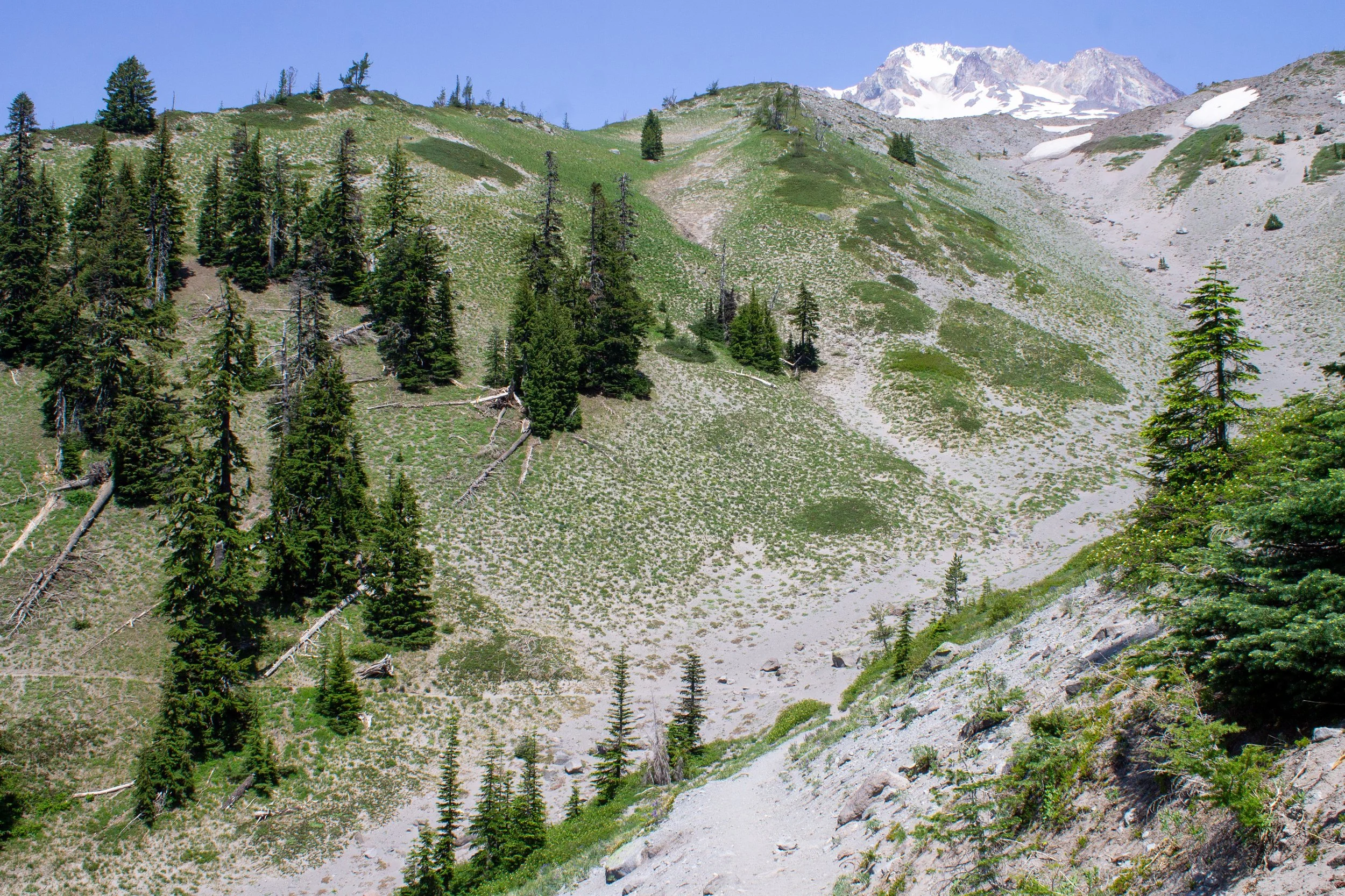
Expect mostly sparse tree cover along the trail with a few sections of forest. These shady areas are where you’ll find the last patches of snow. The thin tree cover throughout most of the hike provides expansive views to the south. You’ll see Mt Hood’s foothills and Mt Jefferson. To the north, you’ll have many chances to glimpse Mt Hood’s summit. You’ll cross several small canyons, likely containing some melting snow, which are great places to take in the mountain views. The largest of these is Little Zigzag Canyon, which you’ll cross around halfway to your destination.
Little Zigzag Canyon
After Little Zigzag Canyon, you’ll reach an area of denser forest. Don’t be discouraged if there are a few lingering snow piles. It’s as deep as they will get.
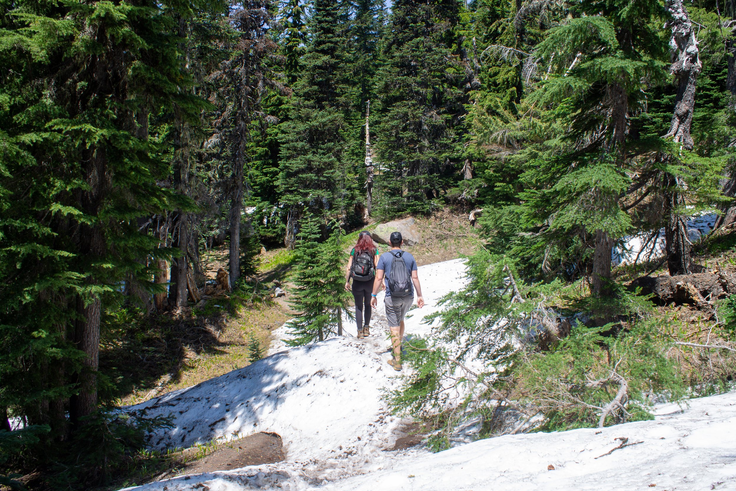
Patches of snow on the trail linger into summer
Forested areas are also a good place to look for avalanche lilies in the undergrowth.
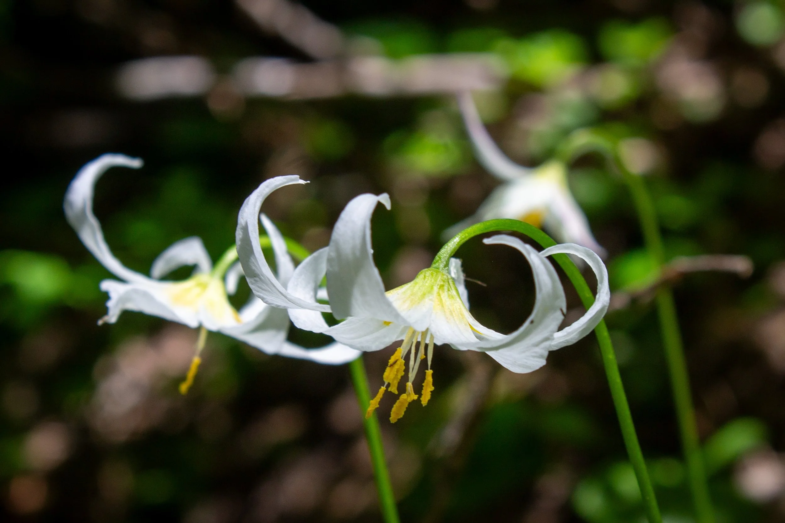
Avalanche lilies
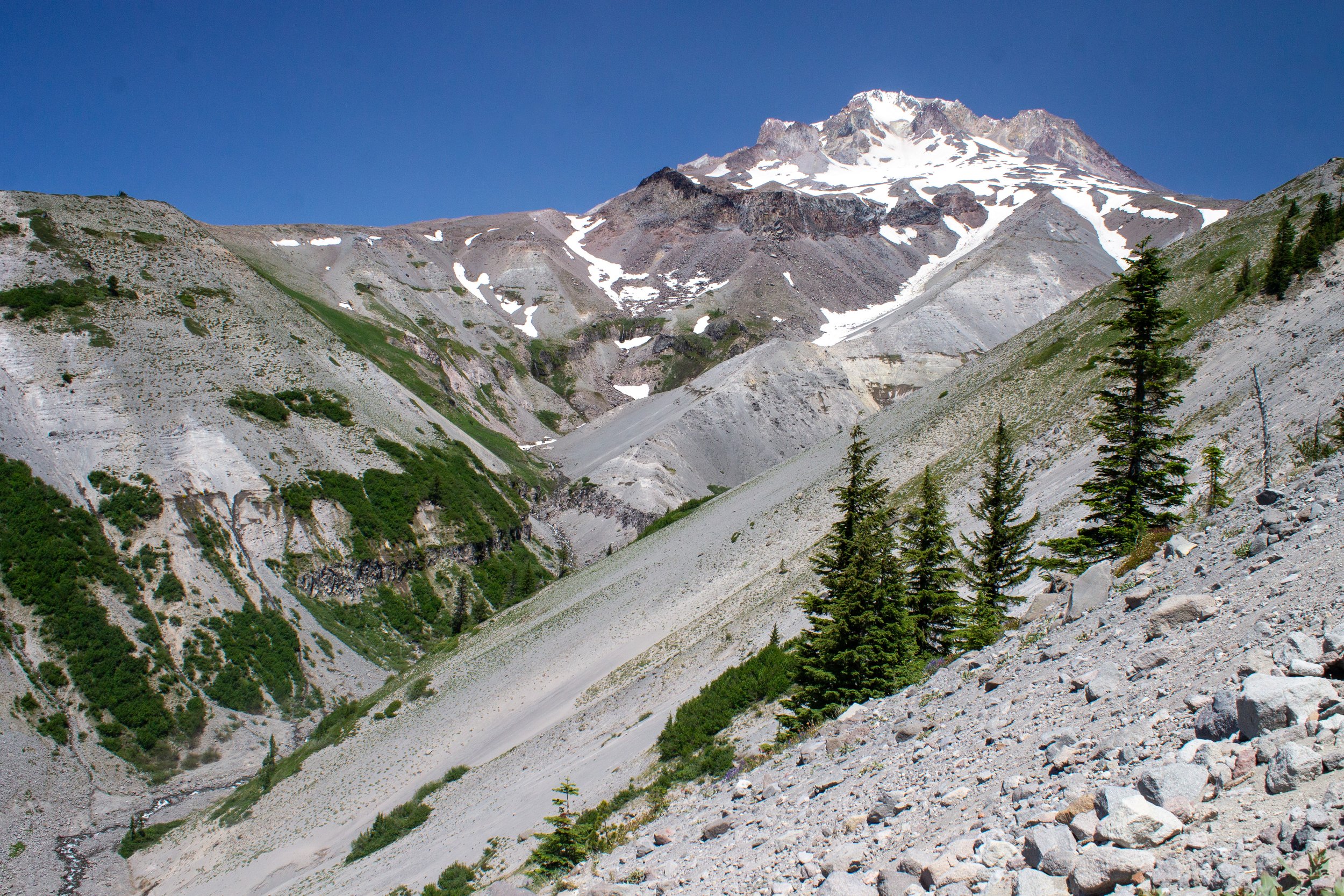
You’ll soon round a corner and see sweeping views of a large ridge backed by the summit of Mt Hood. Once you climb the ridge, you will be almost to the Zigzag Canyon Overlook.
The Zigzag Canyon Overlook is on the other side of the ridge
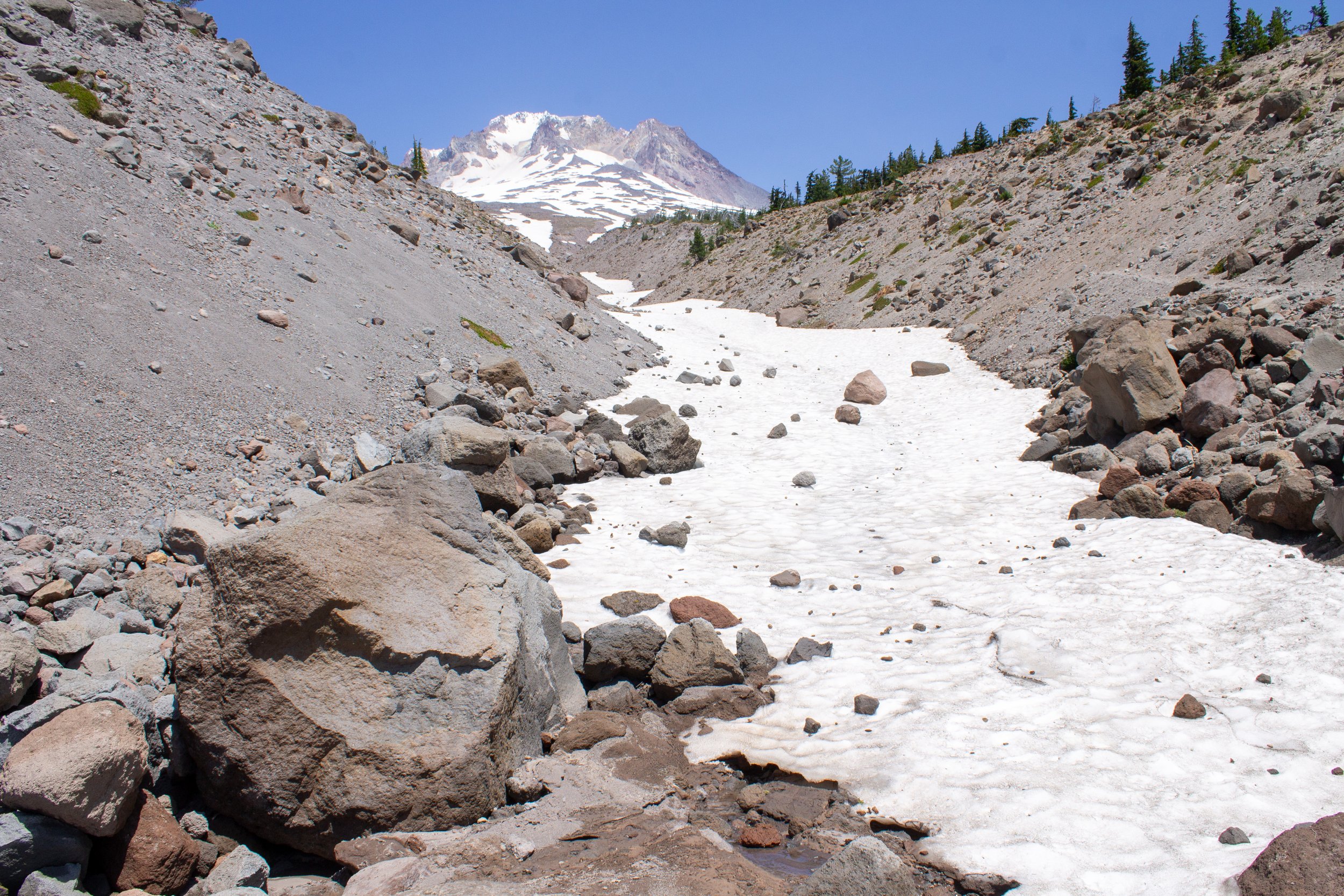
After what feels like a long, dusty uphill march, you’ll reach the Zigzag Canyon Overlook and the incredible views from the edge of the canyon down to its base. The colossal scale of the canyon is guaranteed to make you feel like an insignificant grain of sand. Boulders become pebbles and trees mere toothpicks. At the bottom of the canyon, the Zigzag River flows out from the Zigzag Glacier like a tiny ribbon.
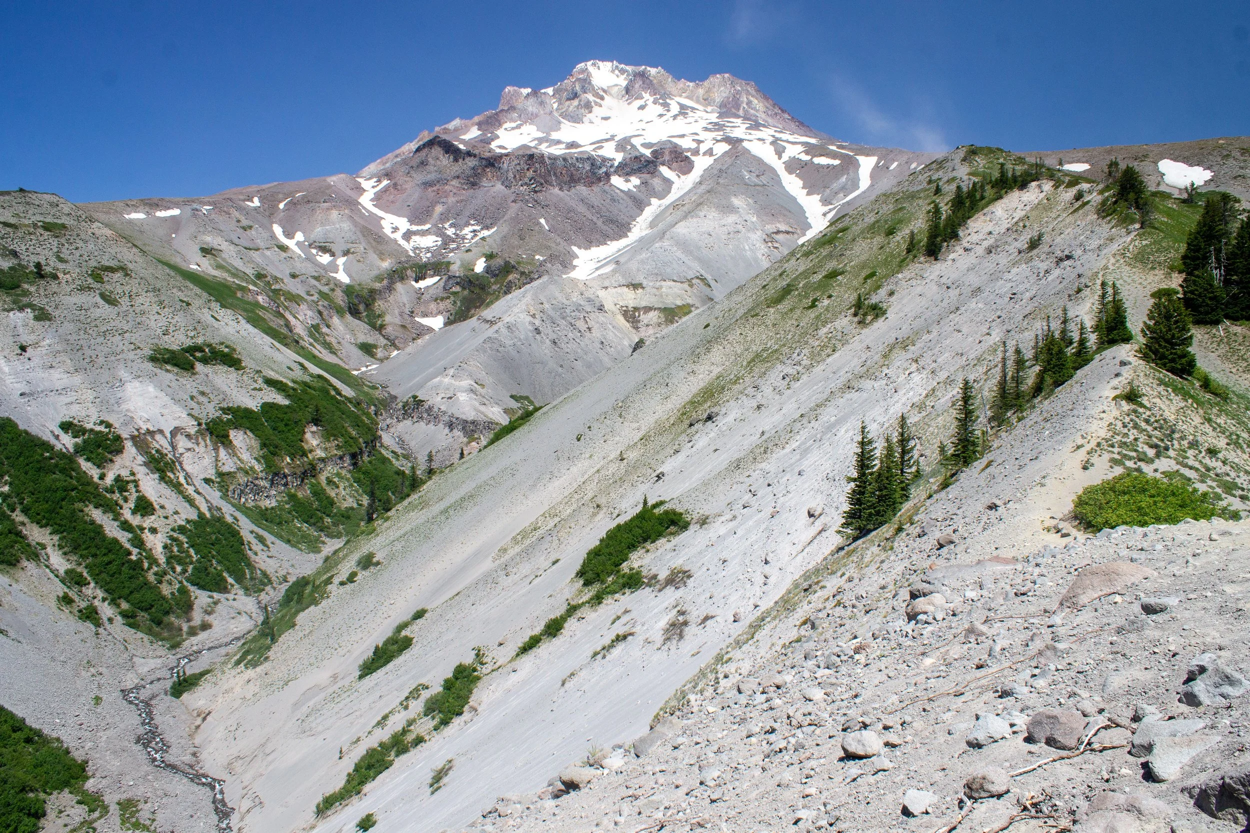
Zigzag Canyon
Wildflowers bloom at the overlook, providing a delicate counterpoint to the rugged volcanic landscape.
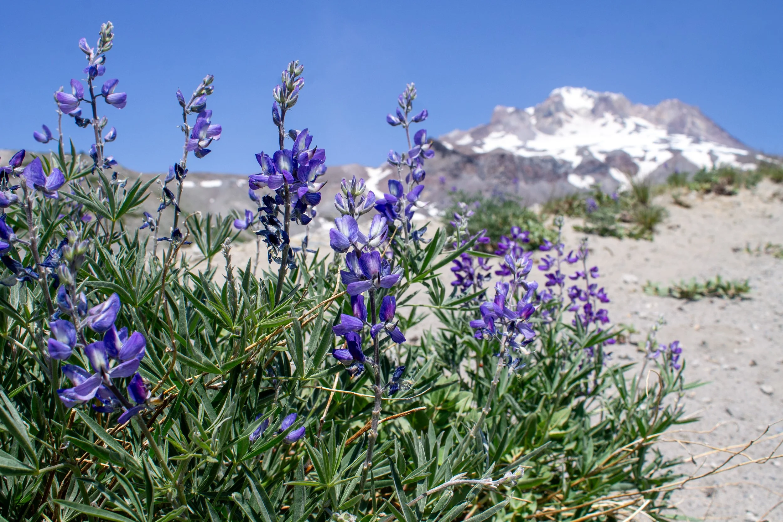
Lupines bloom at the Zigzag Canyon Overlook
The Zigzag Canyon Overlook is a good turnaround point, but the trail does continue if you’re looking for a longer and more strenuous hike. Paradise Park is a popular destination farther along the trail and would be an extra 7 miles round-trip hike with 1,500 or so more feet of elevation gain. From the overlook, the trail descends 600 feet into the canyon and then climbs 900 feet to leave it, so it’s a bit of a commitment to continue past here. When you’re ready to head back, follow the trail back the way you came to return to Timberline Lodge.
Geology of Zigzag Canyon
Zigzag Canyon
As the Juan de Fuca tectonic plate subducts under North America, it forms a volcanic arc that extends from northern California into British Columbia. Volcanic activity at this subduction zone created the Cascade Mountains, including Mt Hood. At 11,250 feet, Mt Hood is the highest peak in Oregon as well as its most recently active volcano. Unlike the runny basaltic lava flows that covered many parts of Oregon, like the Columbia Gorge, Mt Hood is made of mostly andesite and dacite, volcanic rocks with more silica content than basalt. Having more silica makes lava more viscous and creates taller peaks. Andesite tends to be lighter in color than basalt and often breaks apart into plate-like chunks.
Most of Mt Hood, including the rock that makes up the walls of Zigzag Canyon, was formed by volcanic activity within the past 500,000 years or so. Minor eruptive events occurred as recently as the mid-1800s. The deep valley at Zigzag Canyon exists thanks to the erosive action of Mt Hood’s Zigzag Glacier. As the glacier melts in summer, it feeds the Zigzag River at the bottom of the canyon, which then flows into the Sandy River.
Timberline Lodge
Timberline Lodge
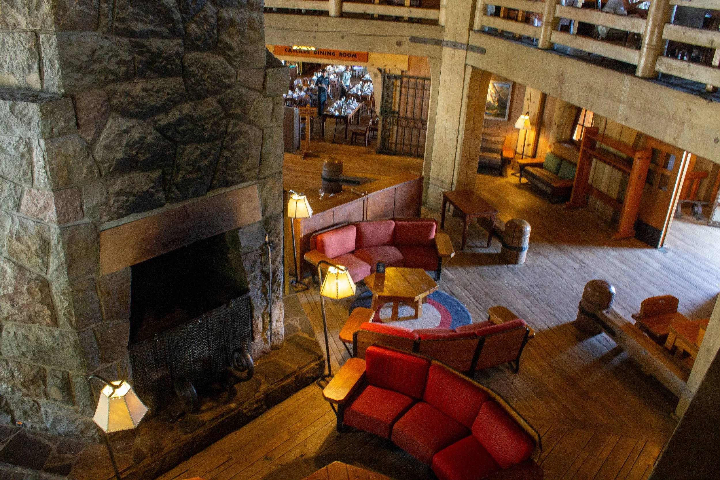
After returning from Zigzag Canyon, it’s worth checking out Timberline Lodge. Skilled craftsmen built the lodge in 1937 as part of the Works Progress Administration, and it’s been operating as a ski lodge since. At 6,000 feet of elevation, Timberline Lodge has some truly spectacular views of Mt Hood and the Mt Hood Wilderness.
Sitting on the Adirondack chairs on the back patio of the lodge is a treat if you’re lucky enough to find them free on a nice day. You can also find some squashy armchairs inside if you’re ready for some shade. The lodge has historical exhibits, a 92-foot-tall fireplace, nice indoor restrooms, and a couple of restaurants. The food and drinks are pretty good, if pricey. Expect to pay around $20 for a sandwich or salad. As you explore, you may run across one of Timberline’s resident St. Bernards, Heidi and Bruno. I never have, but never stop hoping.
Getting there
To reach Timberline Lodge from Portland, take Highway 26 East just past Government Camp. Turn left onto Timberline Highway and follow it up the mountain for about 5 miles until you reach the large parking area near the lodge. The drive from Portland takes about 1.5 hours.
Use chains or traction tires when driving to the lodge during winter. Lighted signs on Highway 26 will indicate when they are required.
Getting to Timberline Lodge and its trails is also possible without a car. Find details here. Plan for 2-3 hours of travel time from Portland.
Explore nearby

Find other short hikes at Timberline Lodge.

See incredible Mt Hood views from Lookout Mountain.

Try out Mt Hood’s best short hikes.

See five Cascade peaks from the overlook at Larch Mountain’s Sherrard Point.
References
Miller, Marli Bryant. Roadside Geology of Oregon. Missoula, Montana: Mountain Press Publishing Company, 2014.
Scott, William Edward, C. A. Gardner, D. R. Sherrod, R. I. Tilling, M. A. Lanphere, and R. M. Conrey. Geologic history of Mount Hood Volcano, Oregon: A Field-trip Guidebook. Vol. 97. US Department of the Interior, US Geological Survey, 1997.