

Columbia Hills Vista Loop Hike
Perhaps more than any other hike, the Columbia Hills Vista Loop shows off the grandeur of the eastern Columbia Gorge. The trail is a long ramble across wide open spaces, where views stretch for miles in every direction. In spring, wildflowers cover the rolling hills with bright yellow, pink, and purple. Other highlights are Columbia River and Mount Hood views, a picturesque waterfall, wildlife sightings, and a detour to an atmospheric old ranch. Here’s how to hike the Vista Loop in Columbia Hills State Park.
Wildflowers on the Columbia Hills Vista Loop
Quick stats
Distance: 7-mile loop
Elevation gain: 1,000 feet
Difficulty: Moderate
Pass required: Washington Discover Pass
ADA access: No
Know before you go
Cost: Parking at Columbia Hills State Park requires the Washington Discover Pass ($10/day or $45/year). You can use an annual pass or buy a day pass at the Horsethief Butte parking lot.
Parking: The Columbia Hills Vista Loop starts from the Crawford Oaks Trailhead. It has a nice paved lot, but spaces are limited. Arrive early on weekends in the spring.
Amenities: Vault toilet and covered picnic table are by the parking lot.
Dogs: Leashed dogs are welcome on the trails at Columbia Hills State Park.
Hazards: Watch for rattlesnakes, ticks, and poison oak.
Season: All year. Best in spring when the wildflowers bloom. The trails don’t have shade and get hot in the summer.
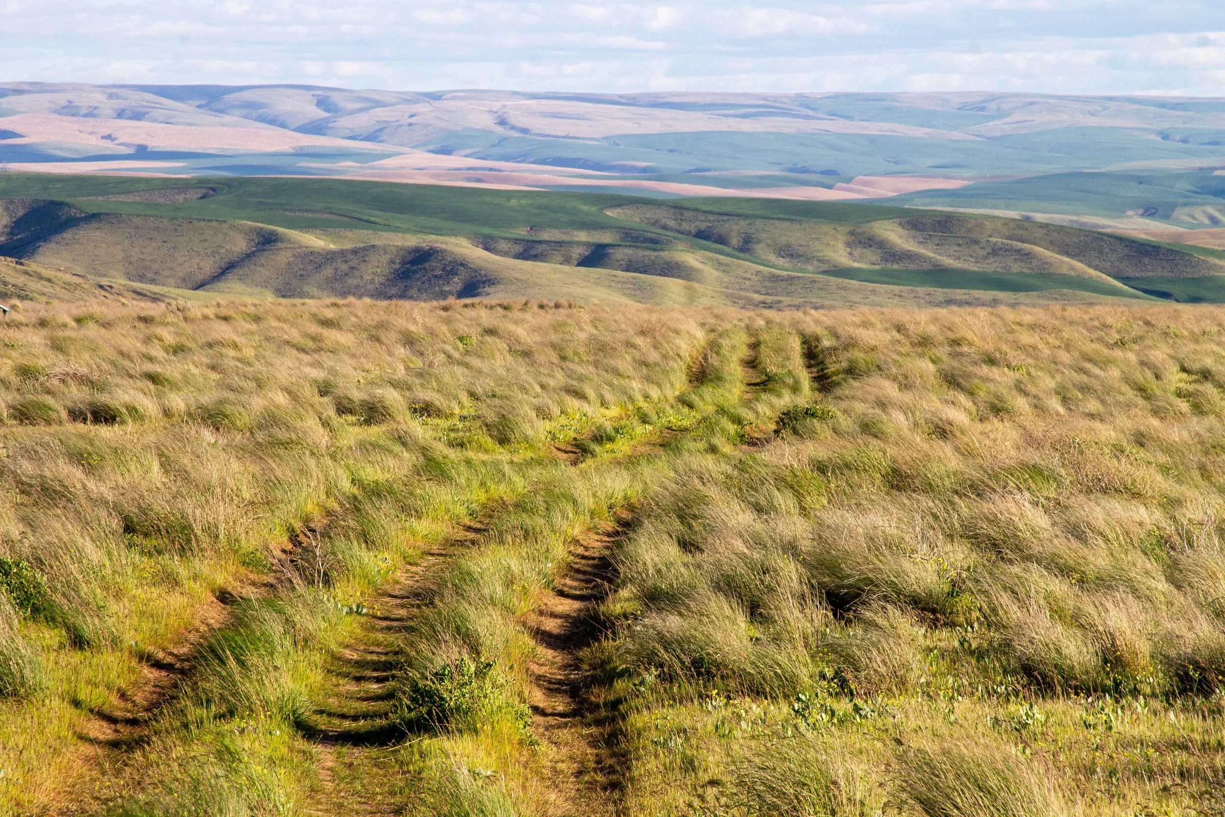
Navigation: The trails in Columbia Hills State Park can be confusing. Have an offline map with you.
Kids: The Columbia Hills Vista Loop is a family-friendly hike. If the full 7-mile loop is too much distance, there are shorter versions.
Wildflowers at Columbia Hills State Park
Columbia Hills Vista Loop in mid-April
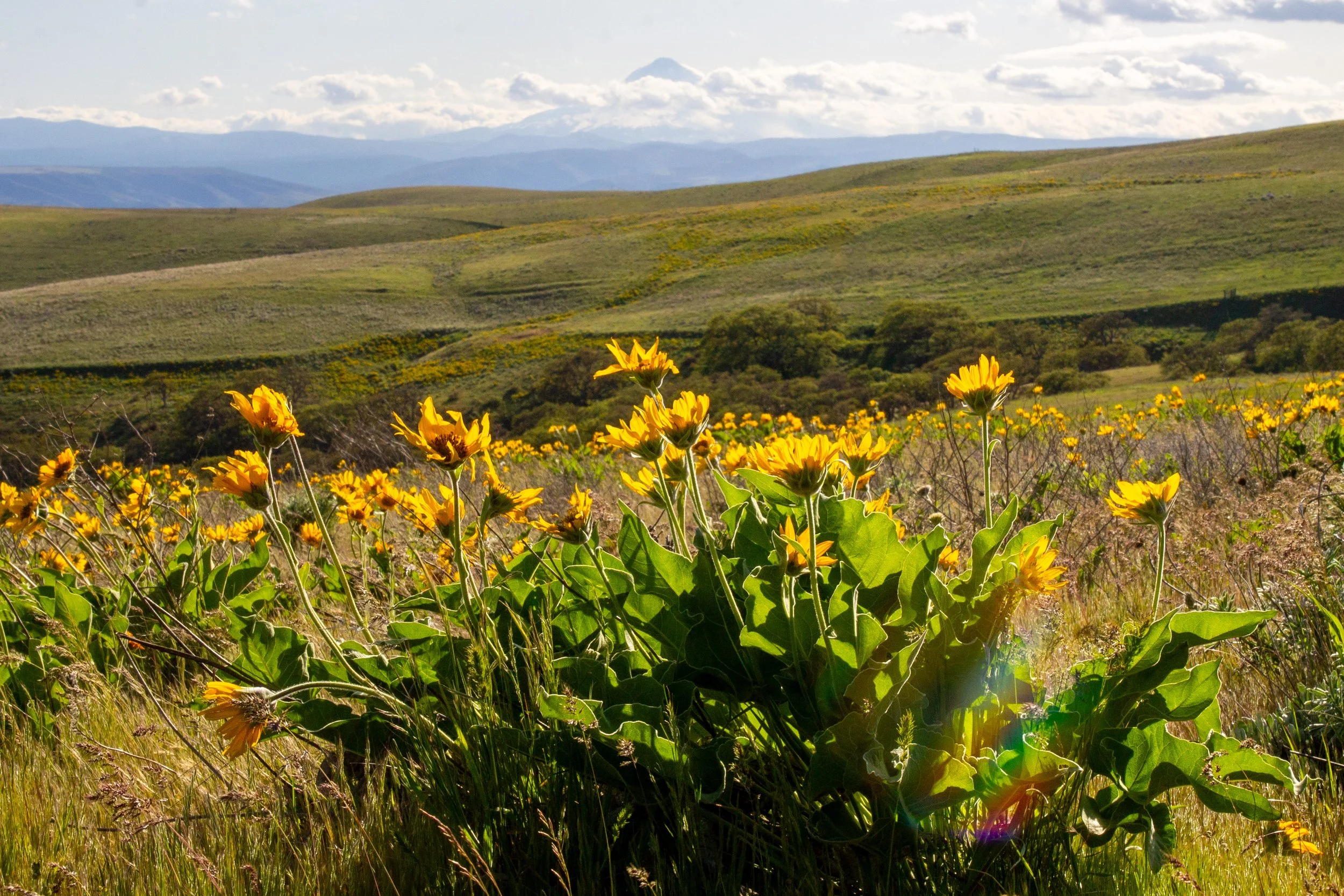
Wildflowers bloom in Columbia Hills State Park from around late March through May. The earliest blooms appear around the beginning of March. Most years, late April is a good time to see impressive displays of balsamroot and lupines. Phlox is a fun addition to the wildflower mix that I don’t see blooming alongside balsamroot in many other places. You’ll also see other species, like yarrow, poppies, buckwheat, cluster lilies, and coastal manroot.
Hike options
The full Columbia Hills Vista Loop is a 7-mile hike. The far end of the loop takes you past the Dalles Mountain Ranch, which has a bunch of cool old buildings and farm equipment.
There’s also a shortcut version that makes a smaller loop, about 5 miles total. This version won’t take you to the ranch.
Both versions are great for wildflowers. You’ll see the Columbia River and, on clear days, Mount Hood.
Columbia Hills Vista Loop
Entry Road Trail
From the parking lot, look for the trailhead by the sign with the park map. A wide gravel path, called the Entry Road Trail, climbs gradually uphill. If it’s not too cloudy, your first Mount Hood sighting will be just ahead. A few informational signs discuss the glacial floods that transformed the land around 15,000 years ago. At their height, the trail would have been hundreds of feet underwater.
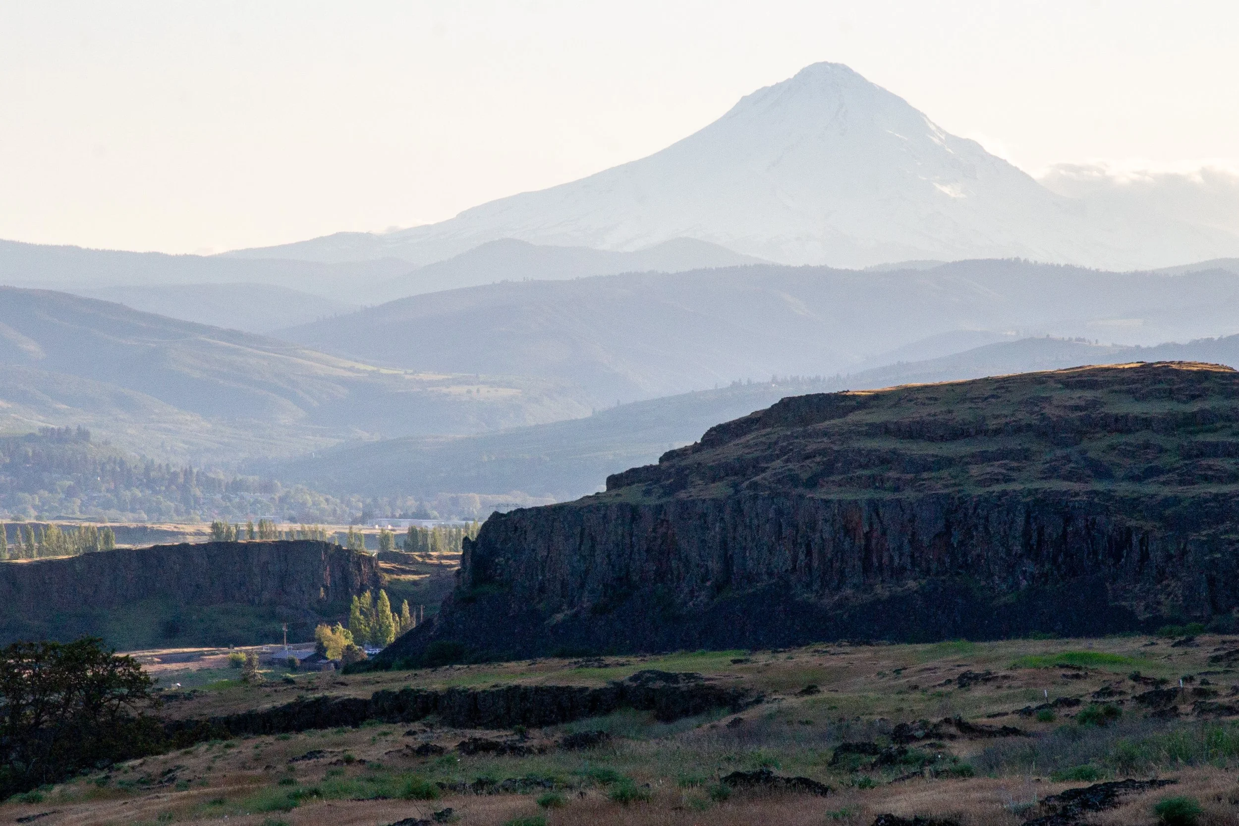
Mount Hood at the first viewpoint
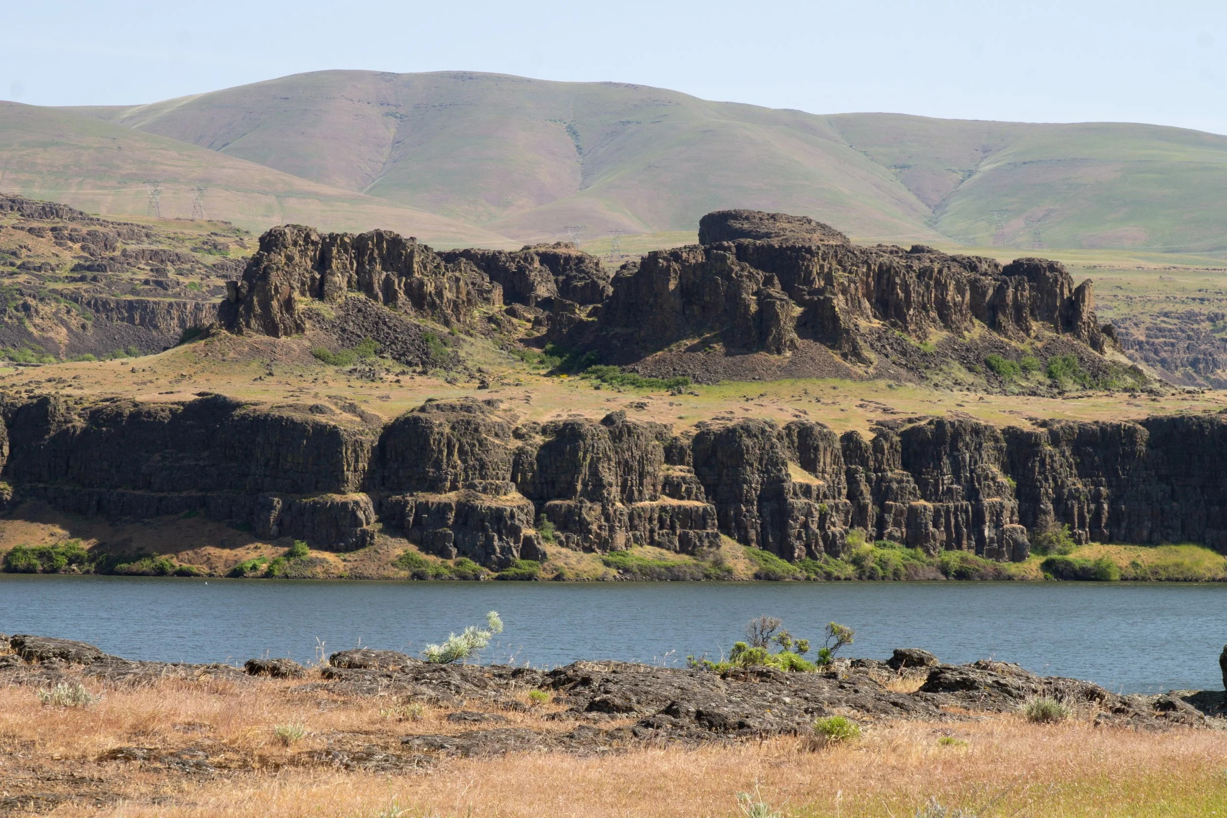
Across WA 14, you’ll see Horsethief Butte in front of the Columbia River. In mid-April, bitter cherry bushes were blooming along the trail while buckwheat was starting to open up.
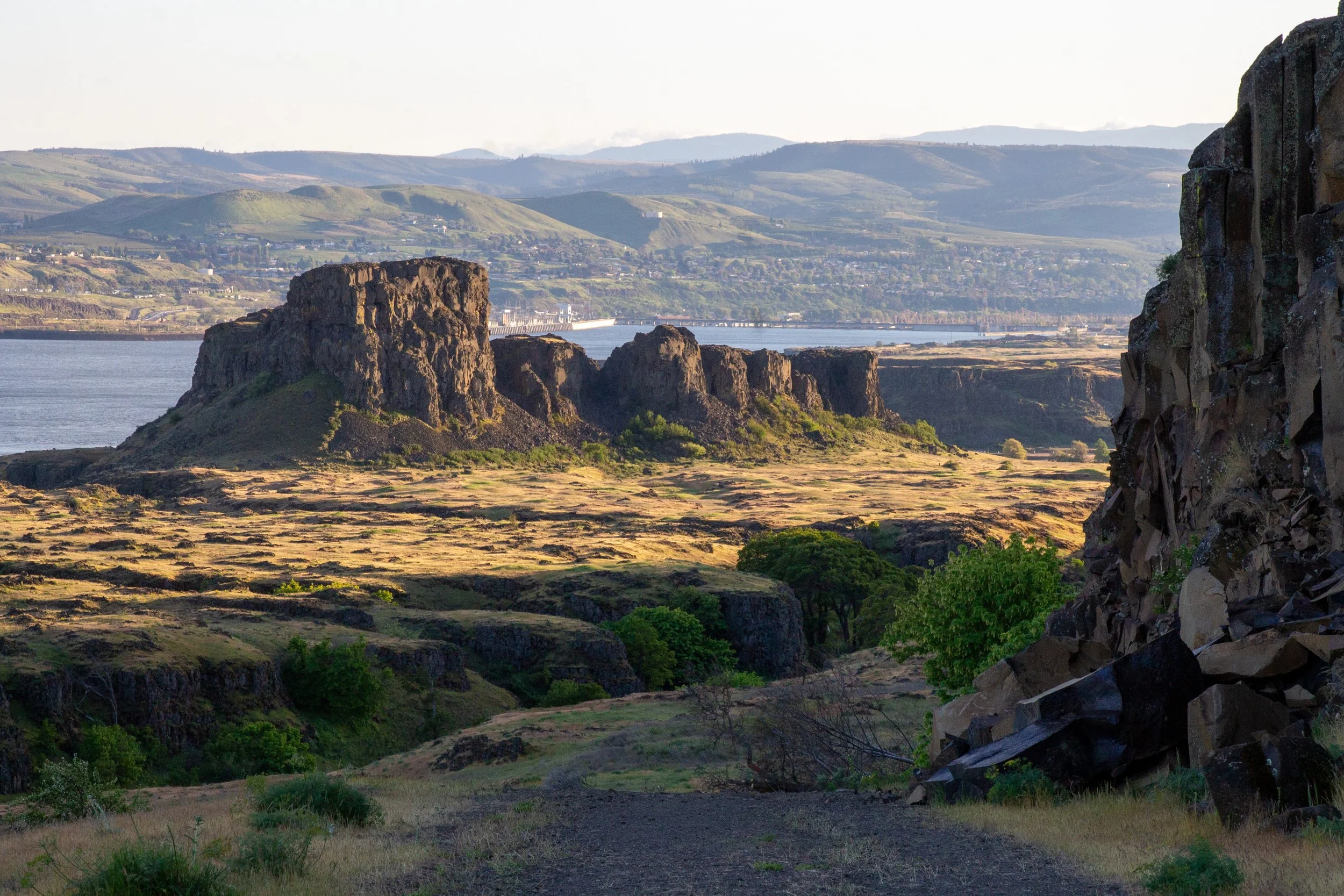
Horsethief Butte
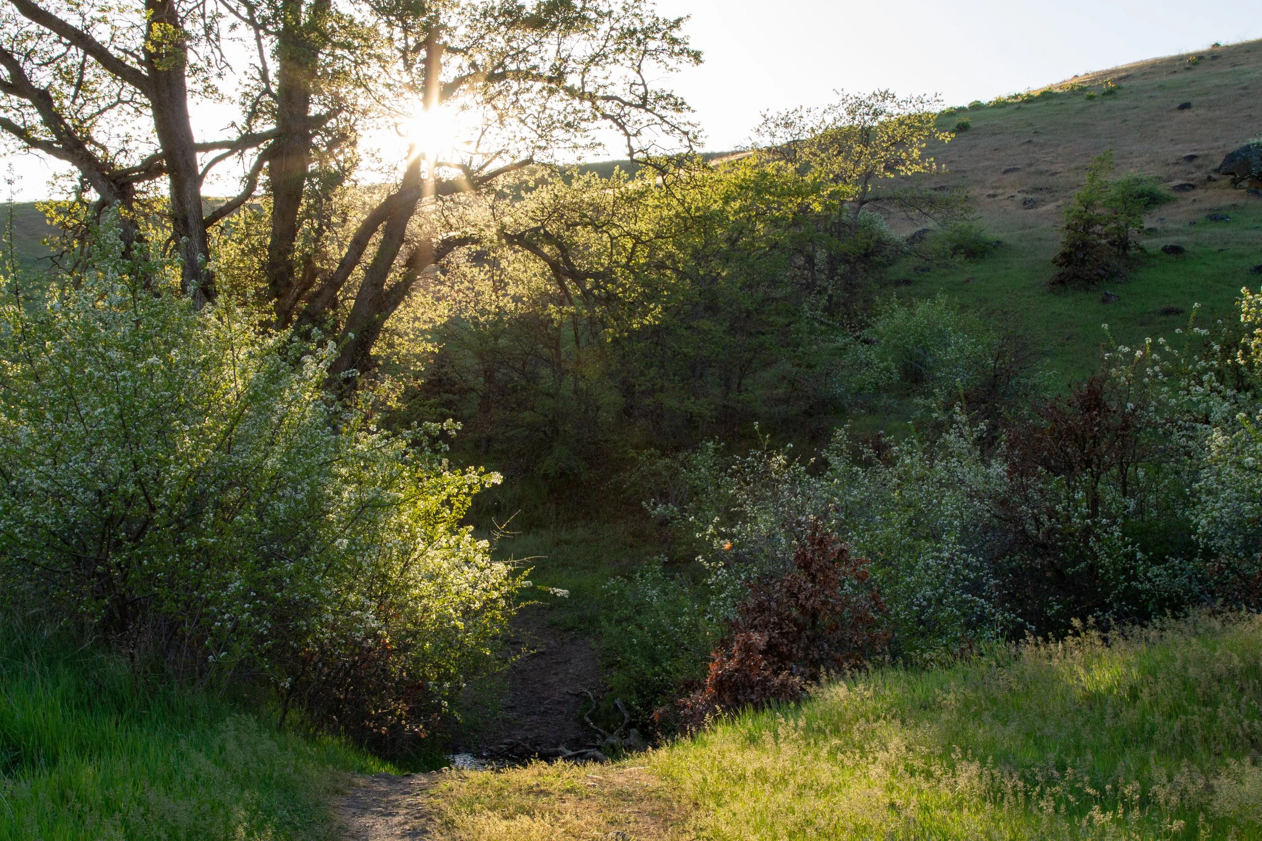
After about a quarter mile, you’ll pass a ledge where you can see Eightmile Creek Falls. In spring, it has a decent amount of water passing over it. In late summer, it can dry up. I had trouble finding an exact height, but it’s probably around 100 feet.
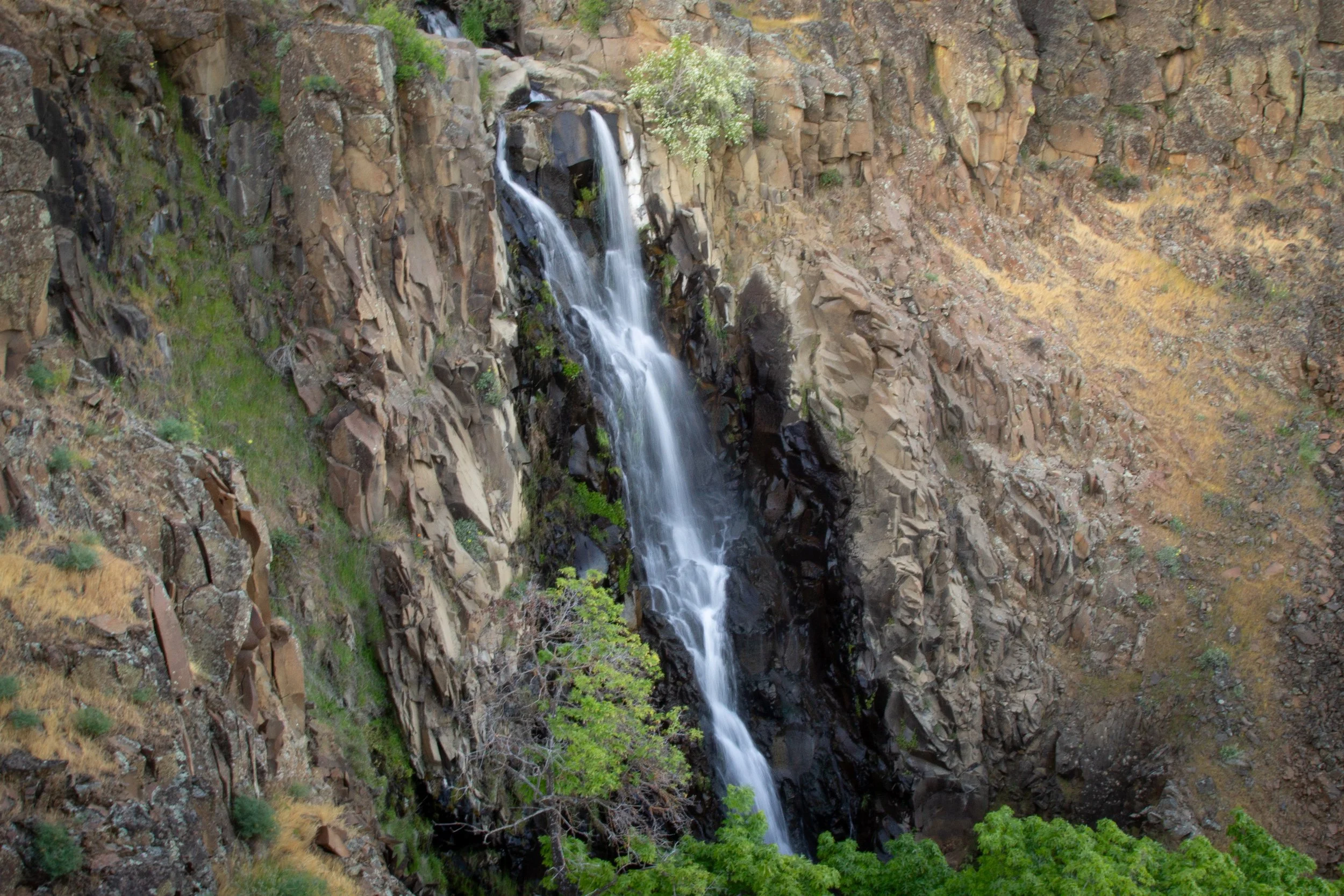
Eightmile Creek Falls
The Entry Road Trail continues for about a mile before you begin the loop part of the hike. You’ll hear Eightmile Creek next to you as you walk. Oaks and big-leaf maples mostly screen it from view.
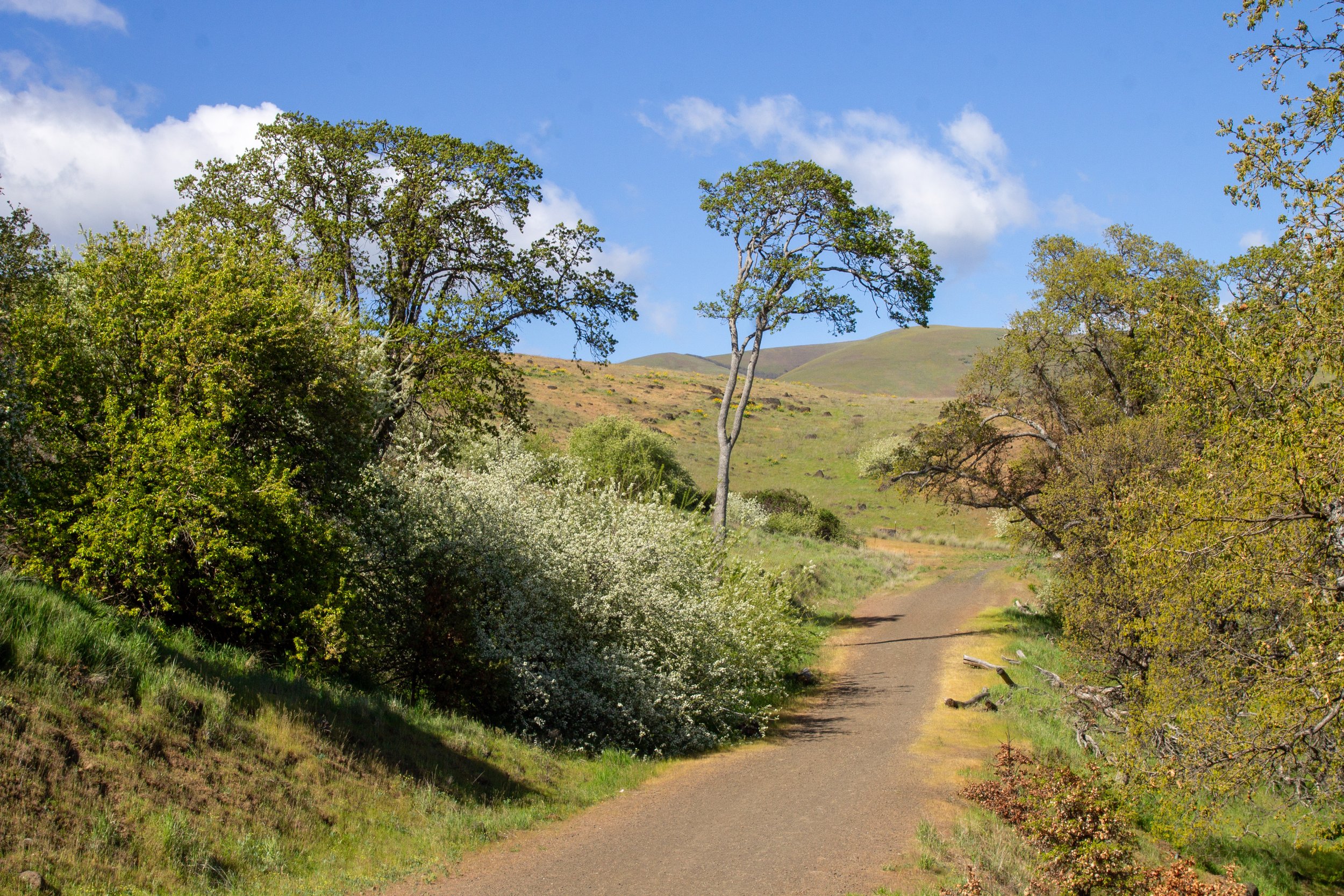
Entry Road Trail
At the end of the Entry Road Trail, you’ll cross the creek. It’s doable if a bit awkward using the makeshift bridge of piled-up sticks.
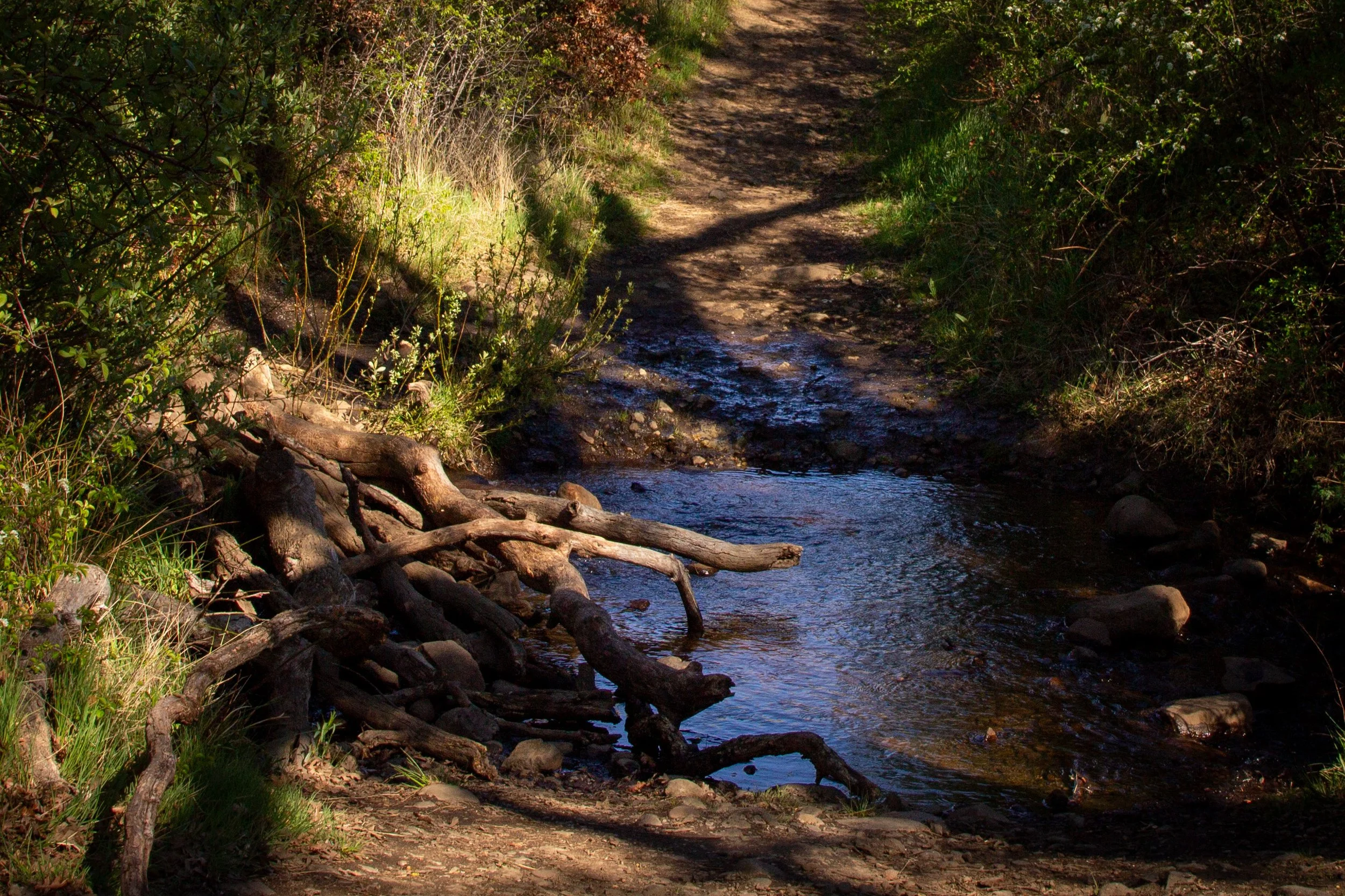
Cross here
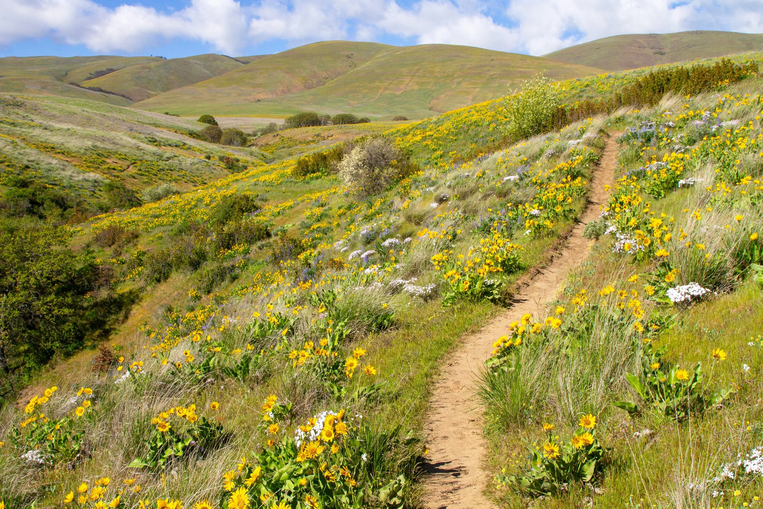
On the other side of the creek, you’ll reach a trail junction, which begins the Vista Loop. You can go either direction. We’ll go left, onto the Eightmile Alternate Trail. I think this direction gives you better views at the end of the hike since you’ll be facing Mount Hood.
The loop begins
Once you start the Vista Loop, patches of balsamroot and lupines dot the hills around the trail. In the distance, you’ll see the first glimpse of the Dalles Mountain Ranch.
Balsamroot along the Eightmile Alternate Trail
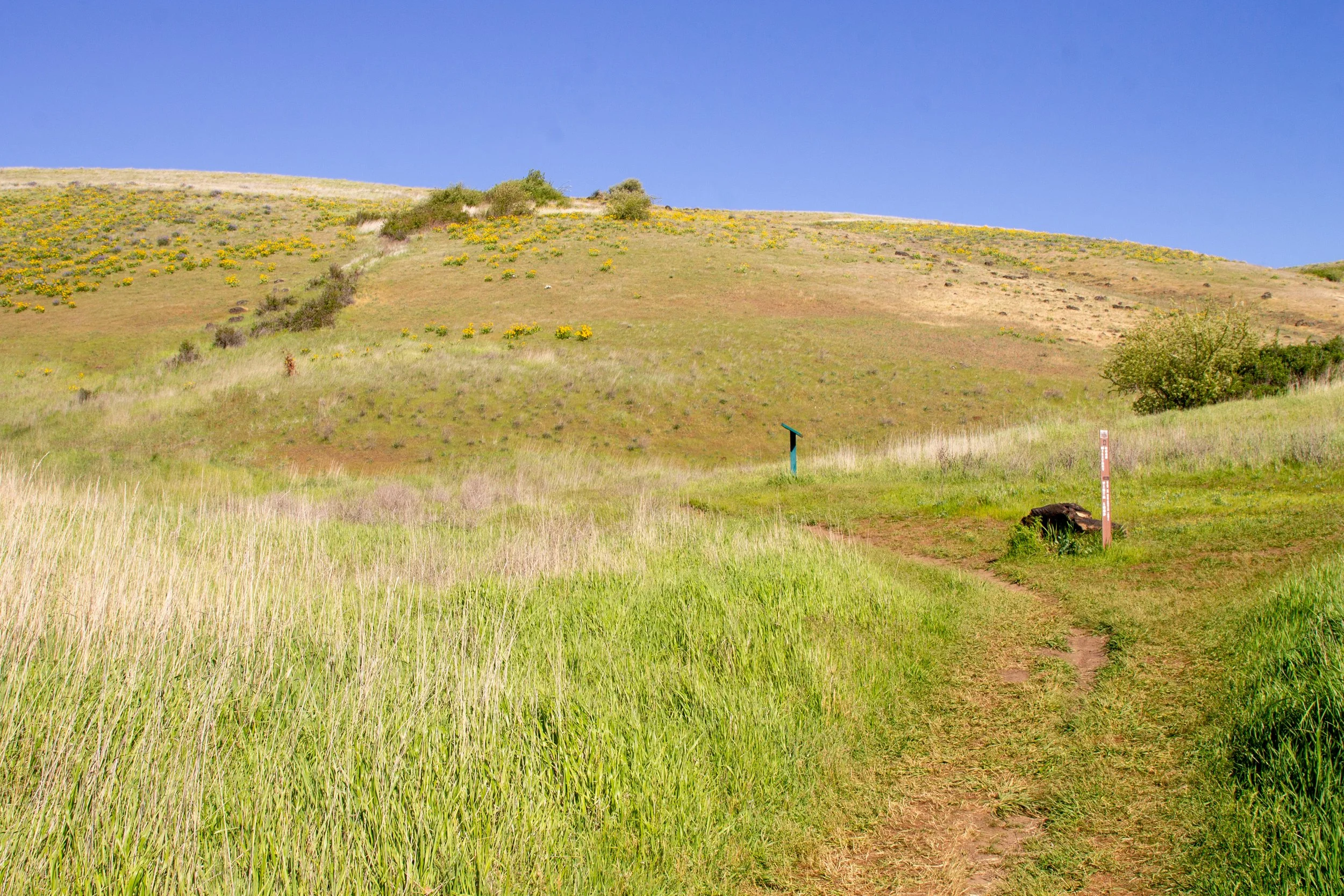
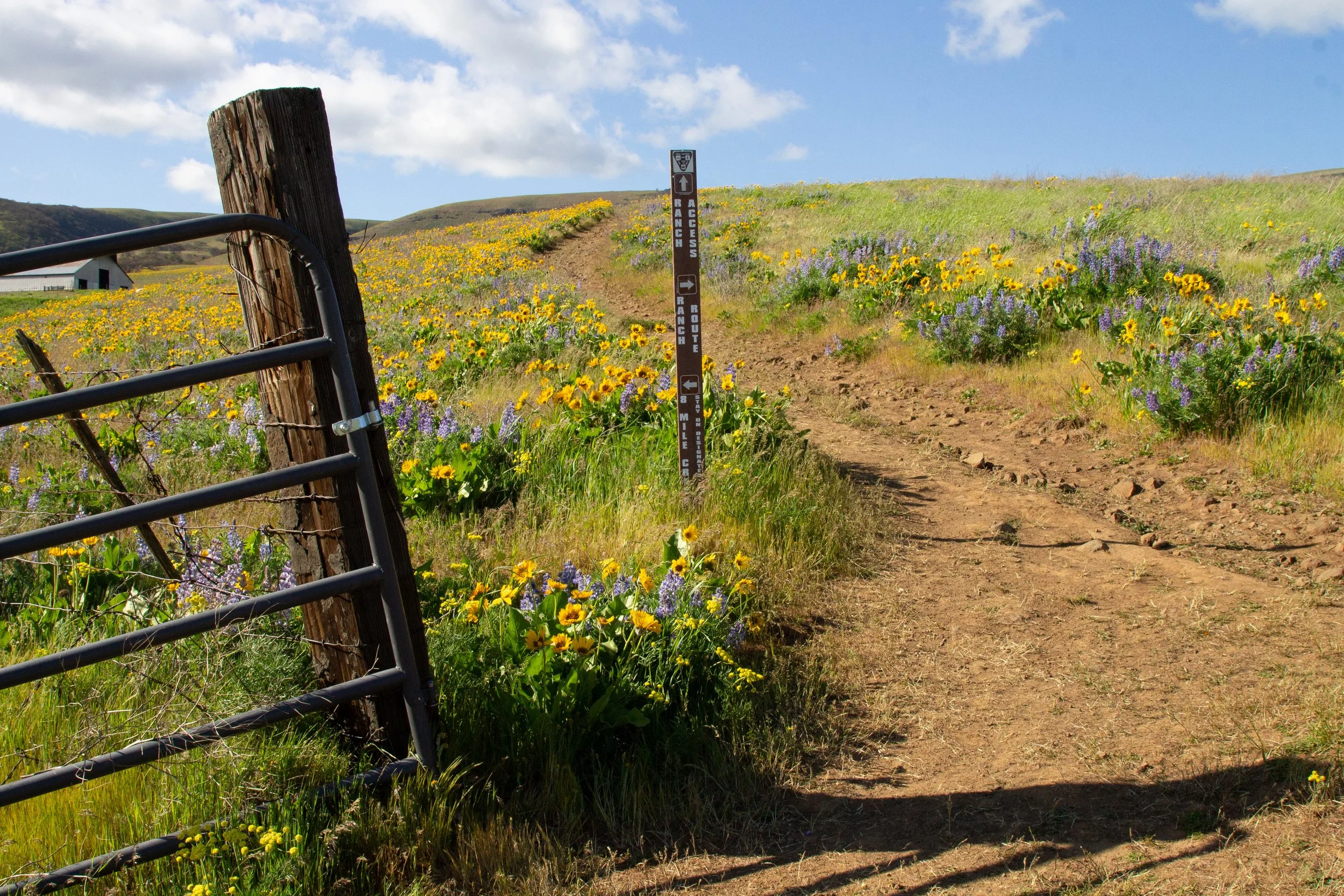
After about a quarter mile on the Eightmile Alternate Trail, you’ll reach a trail junction. To do the full Columbia Hills Vista Loop, keep left. The trail to the right (Military Road Trail) is the shortcut.
Short and long versions of the hike split
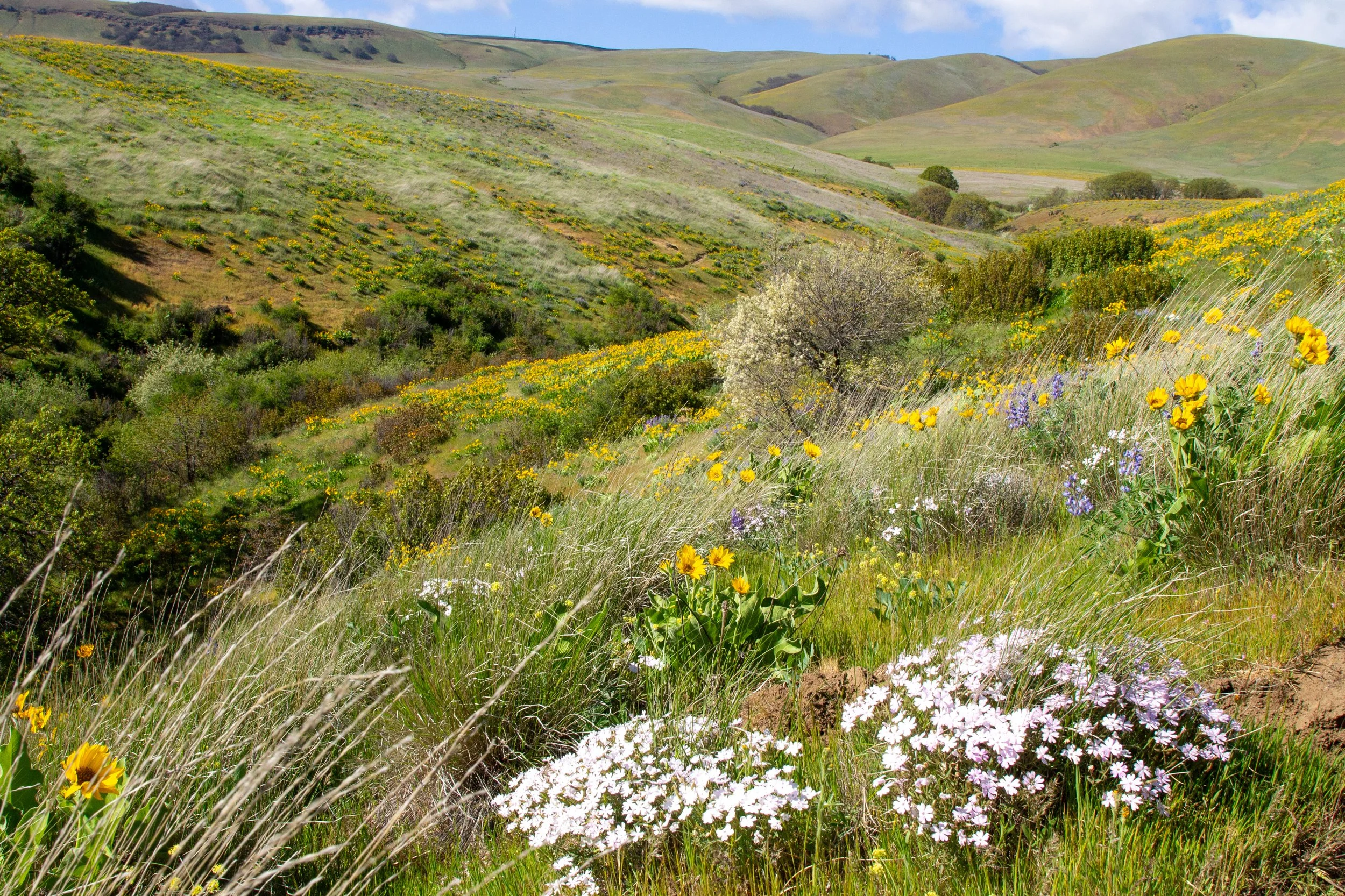
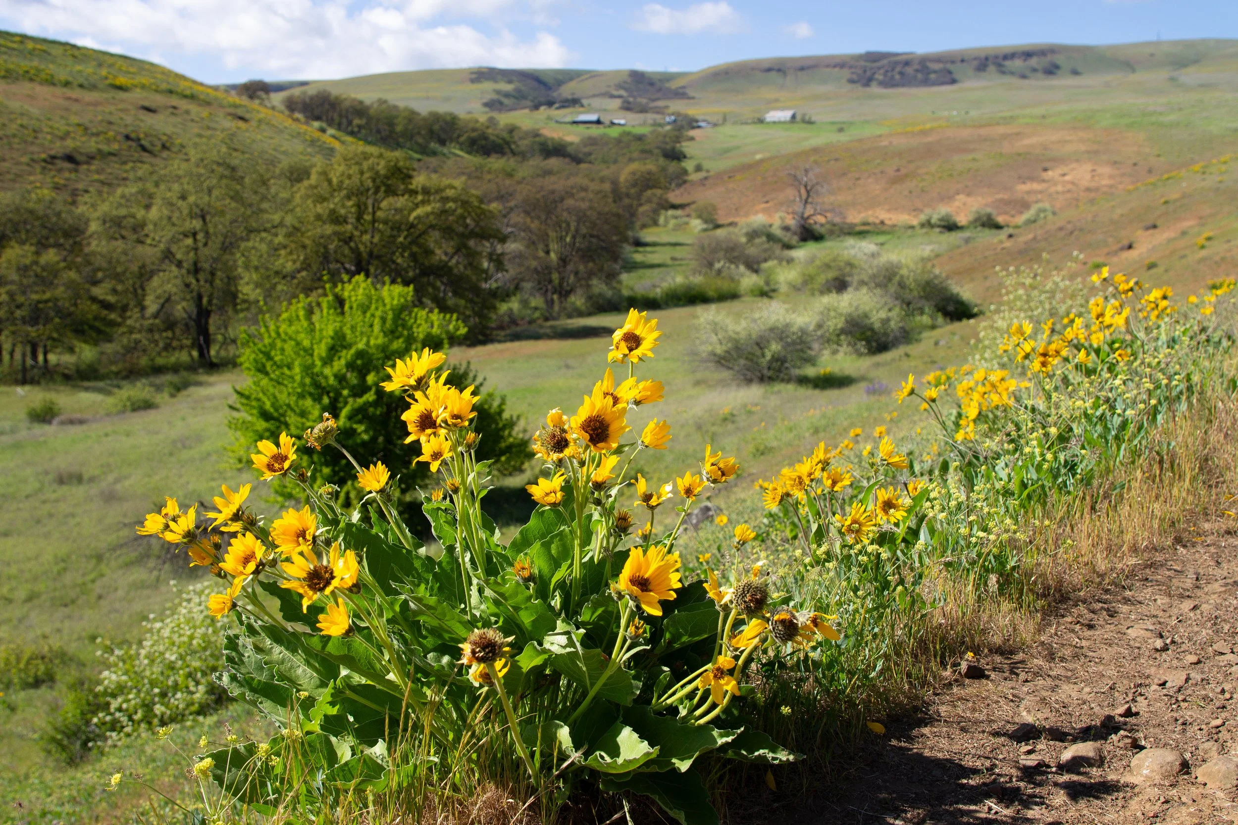
One of my favorite parts of the Columbia Hills Vista Loop is just ahead. Wildflower-covered slopes rise gently on either side of a picturesque stream. Phlox starts appearing among the balsamroot and lupines, adding touches of pale lavender to the scenery.
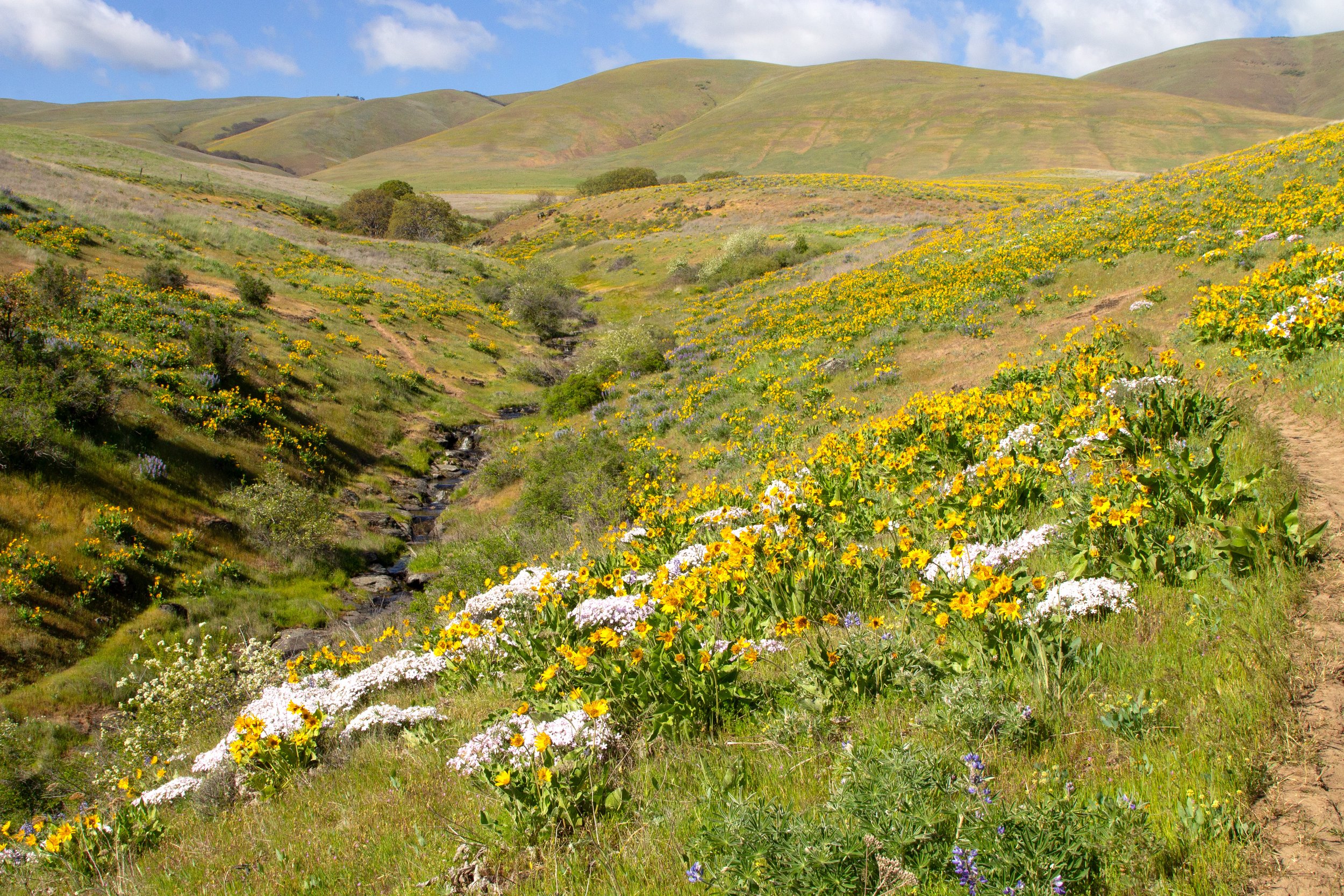
Phlox and balsamroot bloom near Eightmile Creek
The trail wraps around to an easy stream crossing and then heads along the other bank. You’ll soon spot the Dalles Mountain Ranch again behind a balsamroot-covered field.
Cross here
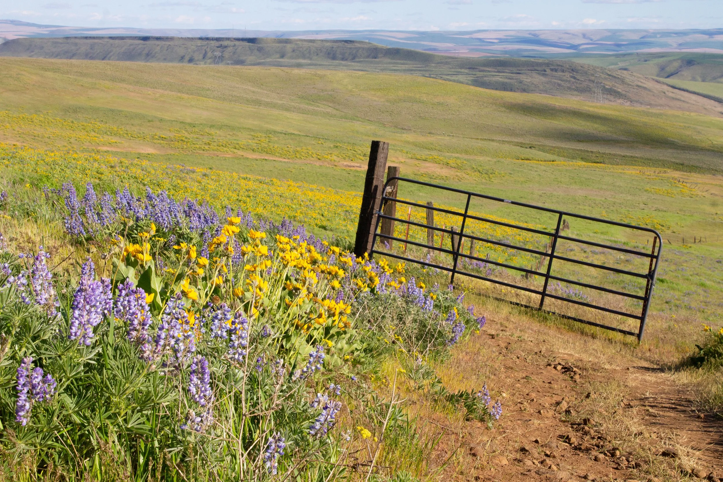
The trail gets steeper as you approach the Dalles Mountain Ranch. When you reach the open gate, head on through.
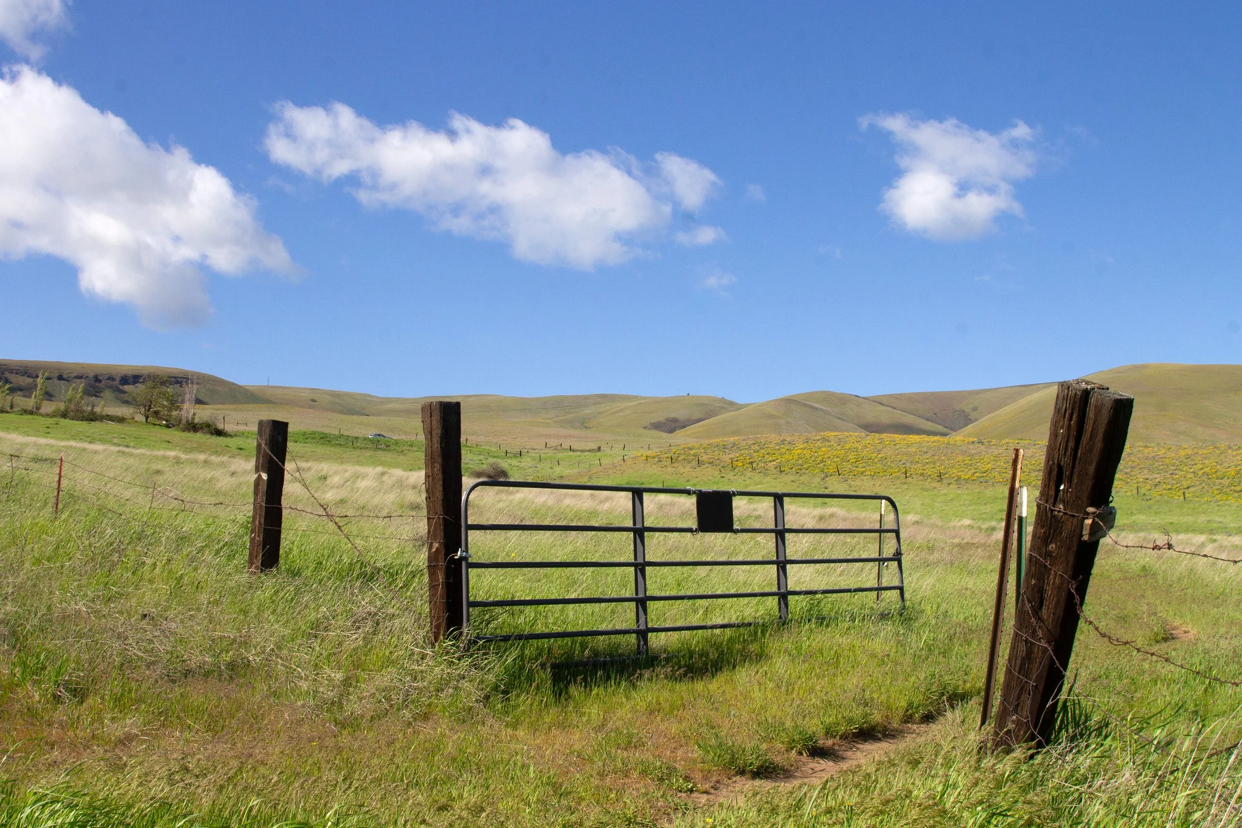
Head through the gate
You’ll cross a field and then pass through another gate. The AllTrails version of the Columbia Hills Vista Loop bypasses the Dalles Mountain Ranch, but it’s only a quarter-mile out of the way and worth a little detour. The trail splits after the gate. The branch to the right continues the Vista Loop. We’ll go left to explore the ranch.
Head left for the Dalles Mountain Ranch
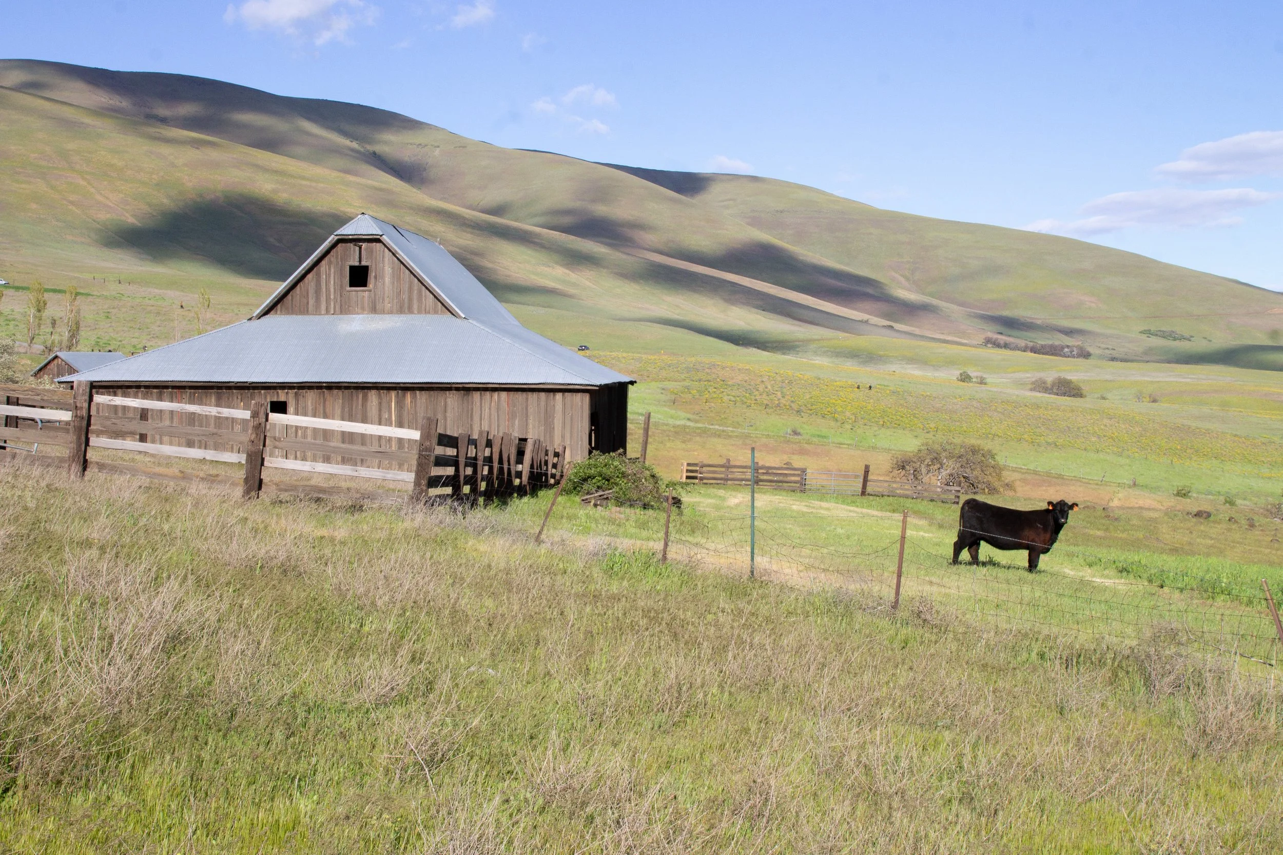
The Dalles Mountain Ranch is the quirkiest attraction in Columbia Hills State Park. The collection of old buildings was a family ranch until the 1990s. The owners donated the property to Washington State Parks when they retired. You can’t enter the buildings, but you can wander around the outside.
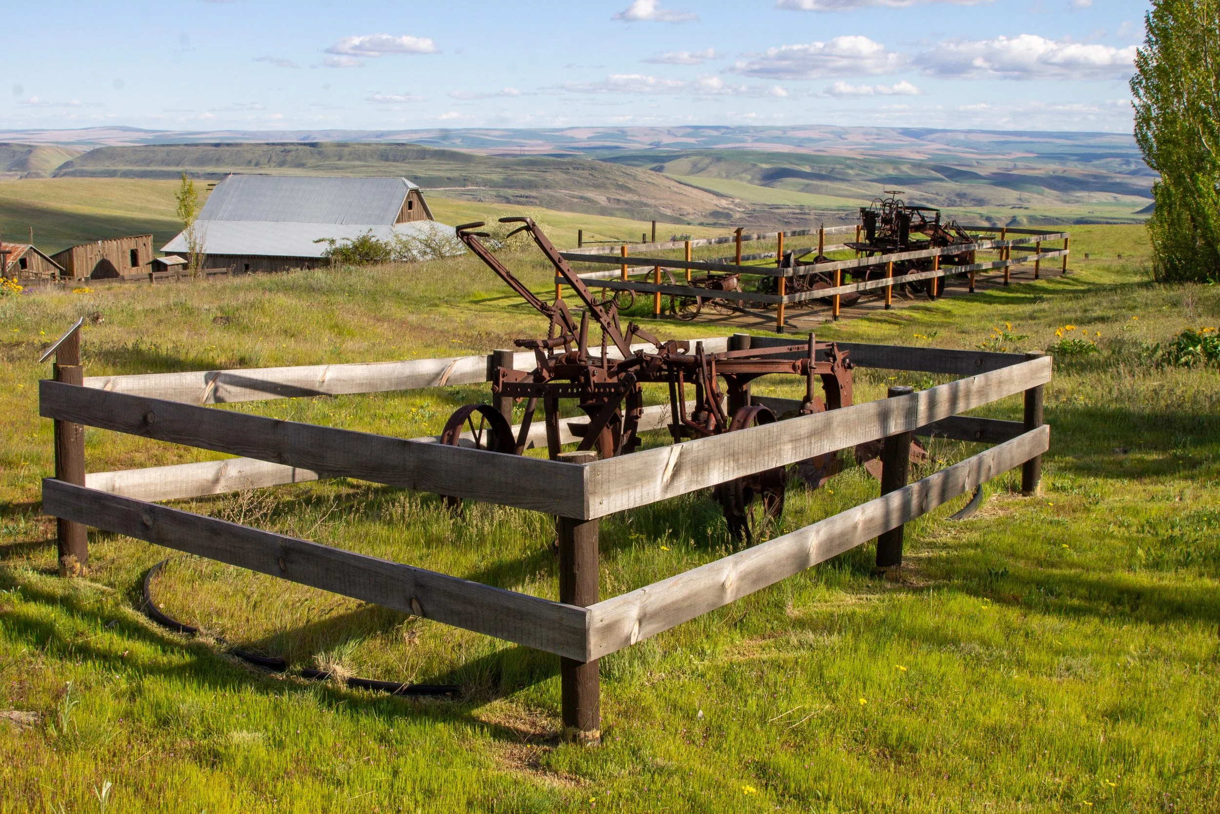
Farm equipment displays at the Dalles Mountain Ranch
The feeling at the ranch is something between an abandoned property and a museum. Cows graze in the fields. Mount Hood looms above the hills to the west. Wildflowers blooming around antique farm equipment create many artsy photo possibilities. The famous rusty car is in a field nearby, which was temporarily closed to the public when I visited.
Dalles Mountain Ranch
After seeing the Dalles Mountain Ranch, head back to the gate and take a left to continue the loop hike. You’re now on the Vista Loop Trail.
Head left at the gate for the Vista Loop Trail
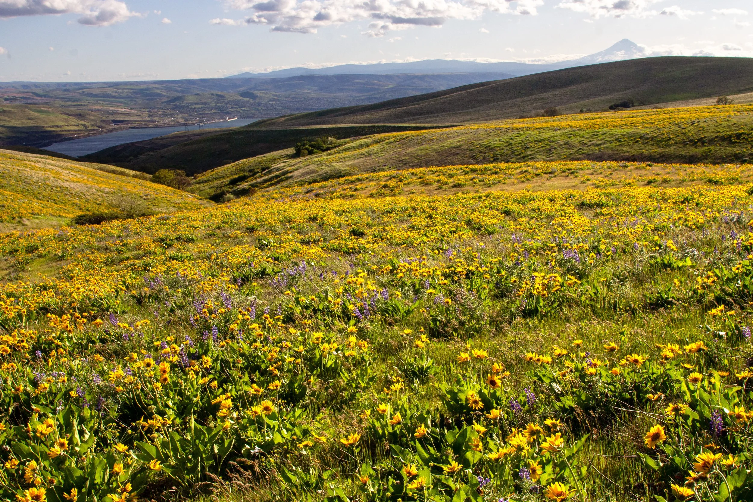
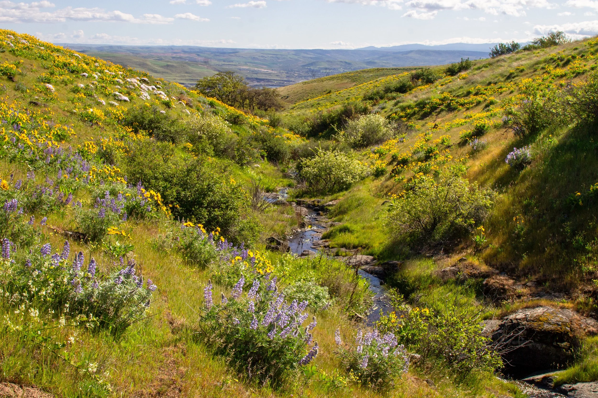
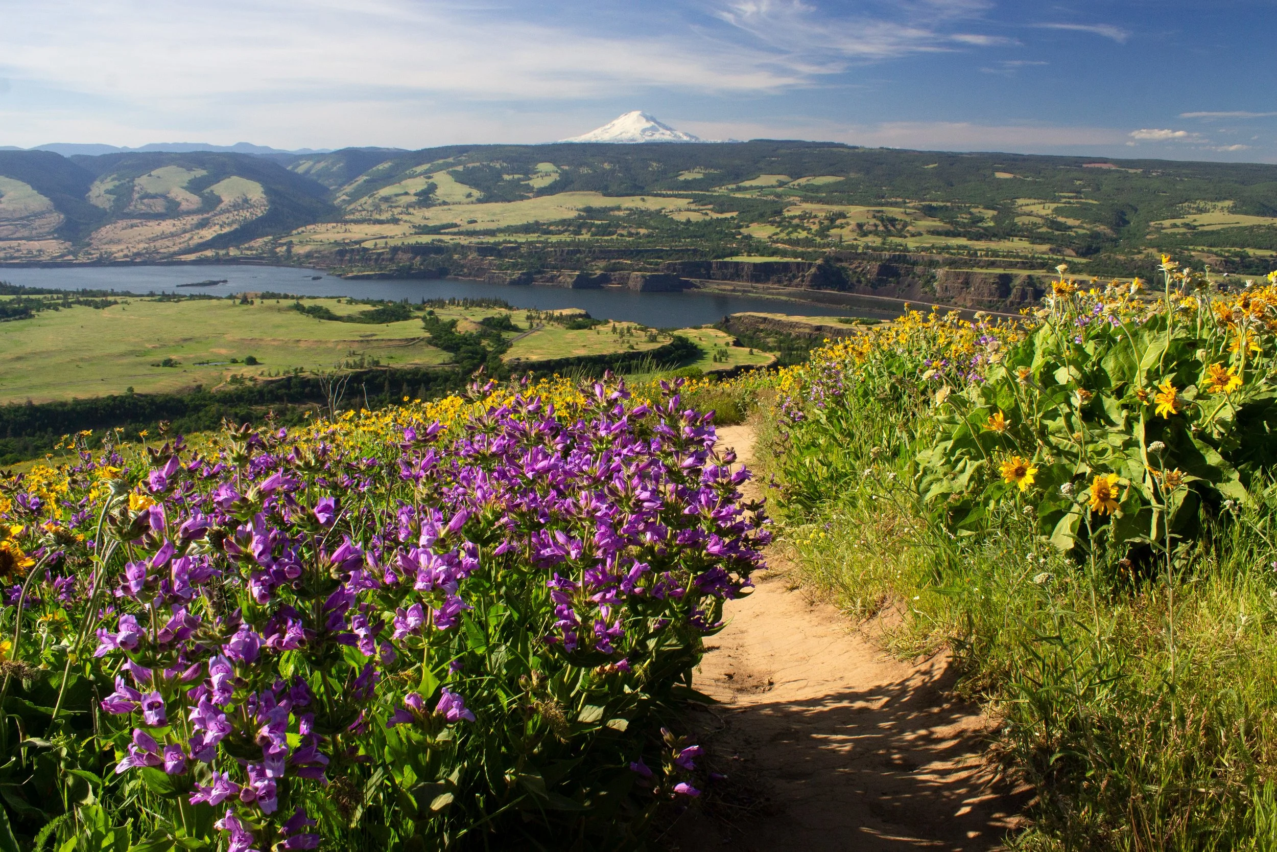
When you reach the next junction in about a mile, keep right to stay on the Vista Loop. The trail to the left heads back to Dalles Mountain Rd. You’ll have Mount Hood in sight for most of the time you're on the east side of the loop. Wildflowers come and go from view, sometimes in patches and sometimes carpeting the hillsides.
Balsamroot and Mount Hood on the Vista Loop Trail
This part of the hike shows off the contours of the Columbia Hills. Balsamroot flowers mix yellow with the bright green of new spring grass. Within a month or two, the hills will turn straw-colored.
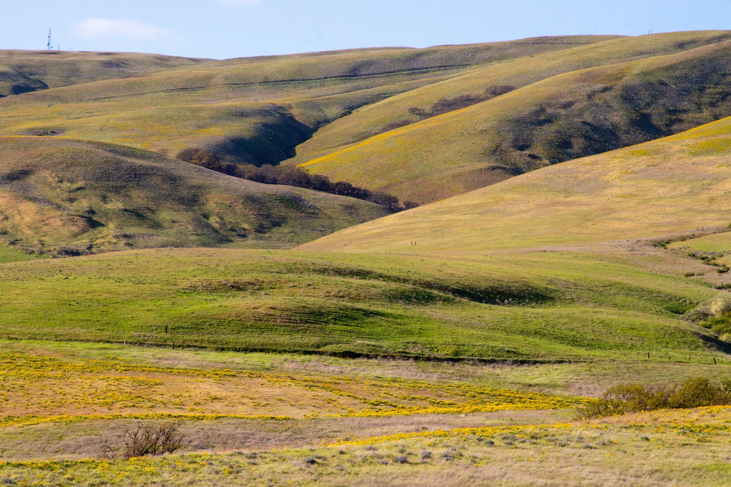
Columbia Hills from the Vista Loop
Looking south, you see a staggering expanse of Oregon’s high desert hills behind the Columbia River. Clouds cast wide shadows as they pass overhead.
Vista Loop Trail
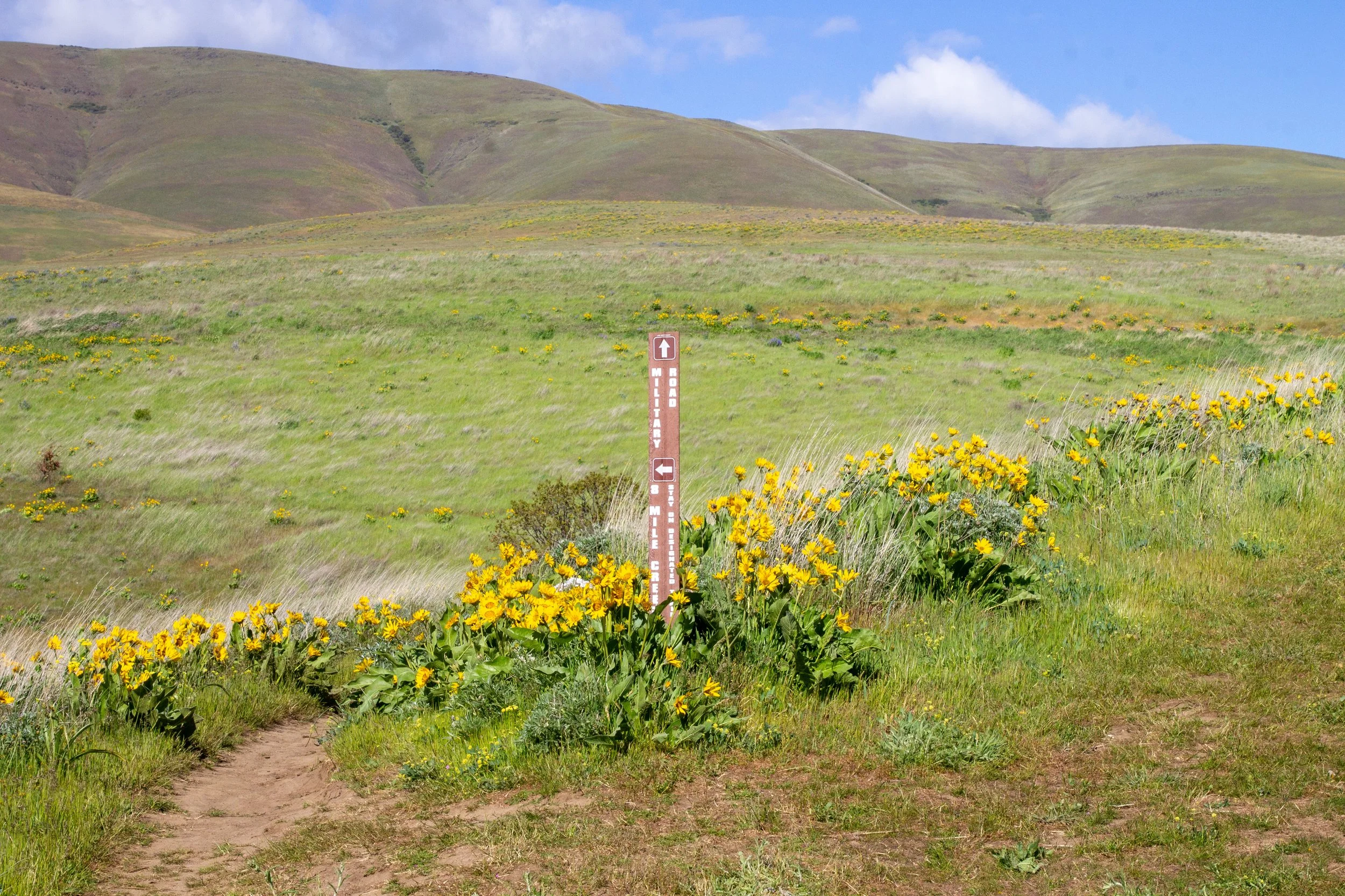
You’ll reach the trail junction where the Military Road trail meets back up with the Vista Loop. Keep left here. You’ll soon see a viewpoint overlooking Browns Island and the Columbia River to the east. Looking down, you can spot Cascade Cliffs Winery.
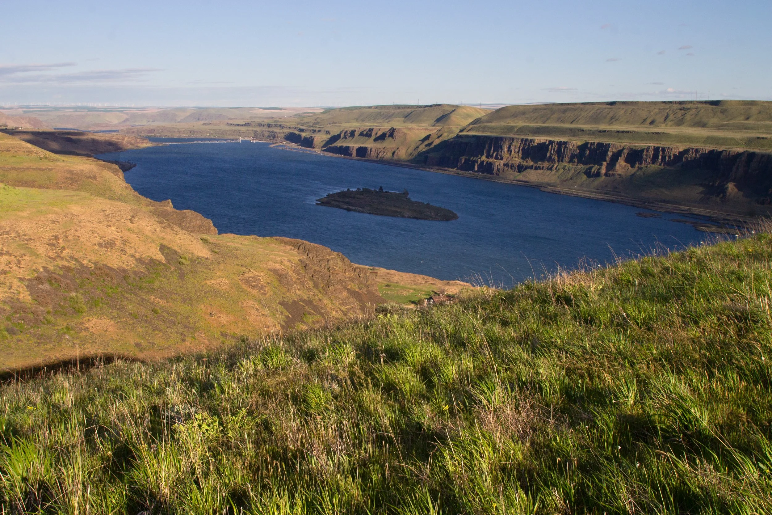
Columbia River viewpoint
Past the viewpoint, the trail wraps back toward the west, sticking close to a power line corridor. Along the trail are wildflowers and glacial erratics. In the distance, you see Horsethief Butte and Mount Hood.
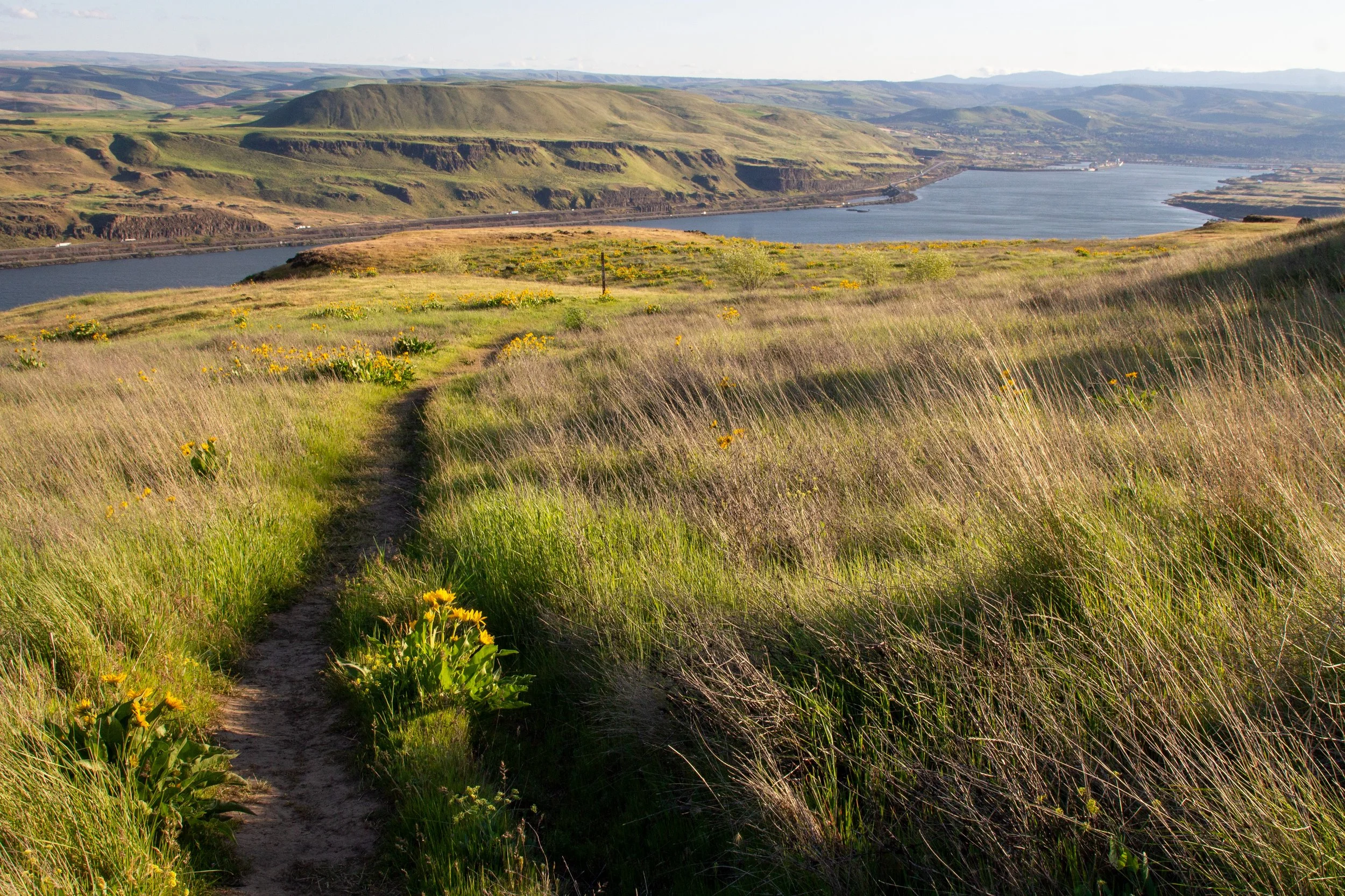
Vista Loop Trail
After crossing a broad plateau along the Columbia River, the trail turns north and brings you back to the start of the loop. At the junction, take a left to cross back over Eightmile Creek and return on the Entry Road Trail.
Return across the creek to the Entry Road Trail
Getting there
Navigate to: Crawford Oaks Trailhead, 8695 Lewis and Clark Hwy, Centerville, WA 98613
To reach Columbia Hills State Park from Portland, take I-84 E to The Dalles. Take Exit 87, then turn left onto US 197 N to cross the Dalles Bridge into Washington. After 3.4 miles on US 197 N, take a right onto WA 14 E. Continue for 3.6 miles. The turn into the Crawford Oaks Trailhead parking lot will be on your left in 3.6 miles. It’s paved and no problem for a low clearance vehicle. The drive from Portland takes about 90 minutes.
Enjoy your hike on the Vista Loop!
With love,
Emma
More in Columbia Hills State Park
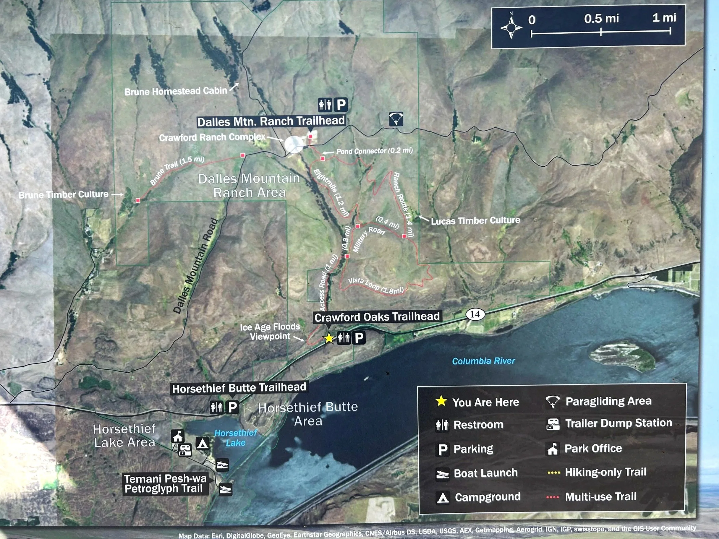
Columbia Hills State Park map
Columbia Hills State Park has several different areas. They’re spread out enough that you need to drive between them, and the layout can be confusing at first. These are the places you can go:
Driving east on WA 14, you’ll first reach the right turn for the Columbia Hills Petroglyphs. Besides the stunning collection of petroglyphs and pictographs, this area has a campground, shaded picnic tables, drinking water, and access to Horsethief Lake. It’s open seasonally from April through October.
The next right turn from WA 14 is for Horsethief Butte. You can go for a short hike here, up to about 1.5 miles. It’s also a popular climbing spot.
The last turn (a left) from WA 14 is for the Crawfords Oaks Trailhead, which begins the Columbia Hills Vista Loop.
Rather than hiking from the Crawford Oaks Trailhead, you can drive to the Dalles Mountain Ranch by turning off WA 14 onto a gravel road called Dalles Mountain Rd. Continue on it for several miles until you reach the parking area for the ranch. It’s also the beginning of the Dalles Mountain Ranch Trail.
Learn more about visiting Horsethief Butte and the Columbia Hills Petroglyphs.
Explore nearby

Check out the best wildflower hikes in the Columbia Gorge.