

Indian Sands Loop Hike


It took me almost half a dozen trips to the Samuel Boardman Corridor before making it to Indian Sands. In a land of marvels like Natural Bridges and Cape Ferrelo, it’s easy to overlook. The descriptions of it online and in my guidebooks were underwhelming, along the lines of “this is a place where you can go and see some sand and water.” Now that I’ve been, I think it’s one of the most underrated places on the Oregon Coast. I also think it’s one of the places where it would be easiest to run into trouble. A trail skirts the edge of cliffs above crashing waves. The beauty of the scenery makes it tempting to stray into dangerous areas. Even when you’re trying to stay on the trail, the sandy terrain is tiring and makes it easy to lose your way. Don’t get me wrong, it’s absolutely worth visiting. It’s just a place you’ll want to approach with caution and respect. Here’s everything you need to know about hiking at Indian Sands.
Indian Sands
Know before you go
It’s free to visit Indian Sands. You don’t need a pass to park.
The trailhead doesn’t have restrooms or other amenities.
Leashed dogs are welcome on the trail, but be cautious about bringing dogs here. It’s close to unfenced cliffs.
The Indian Sands hike is not family-friendly. The trail is near cliffs and crumbly, sandy terrain. I’d skip this one with kids younger than 10.
The trail is hard to follow. Have an offline map with you.
Cliffs beneath the Indian Sands trail
Indian Sands Loop Trail
Distance: 1.1-loop
Elevation gain: 300 feet
Difficulty: Moderate
Pass required: None
Dog friendly: Leashed dogs are allowed on the trail. I wouldn’t necessarily recommend bringing a dog here because of the cliffs.
ADA access: No
Season: Any
The details
The parking lot at Indian Sands has an overlook with a partial view of the coastline below, a hint of what’s to come on the hike. When I arrived mid-morning, my car was the only one in the lot.

Parking lot viewpoint
Two trailheads begin from the Indian Sands parking lot. They are the start and end of the loop hike. I’d suggest taking the trail at the south end, which is easier to follow. From here, you’ll do the loop clockwise.

Start here
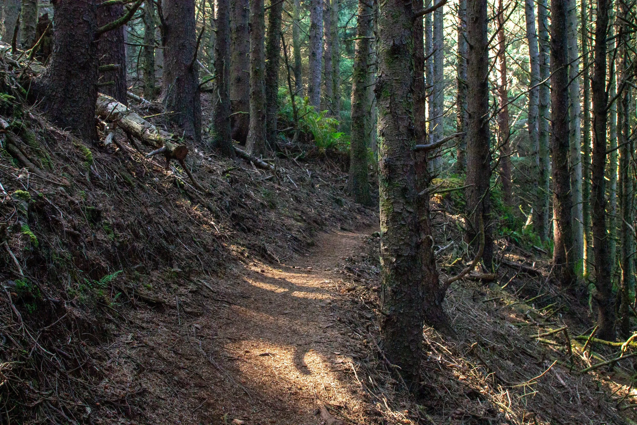
The short hiking distance at Indian Sands is a bit misleading. It’s not an easy route. The trail begins with a steep descent through Sitka spruce, ferns, and salal.

The hike begins in the woods
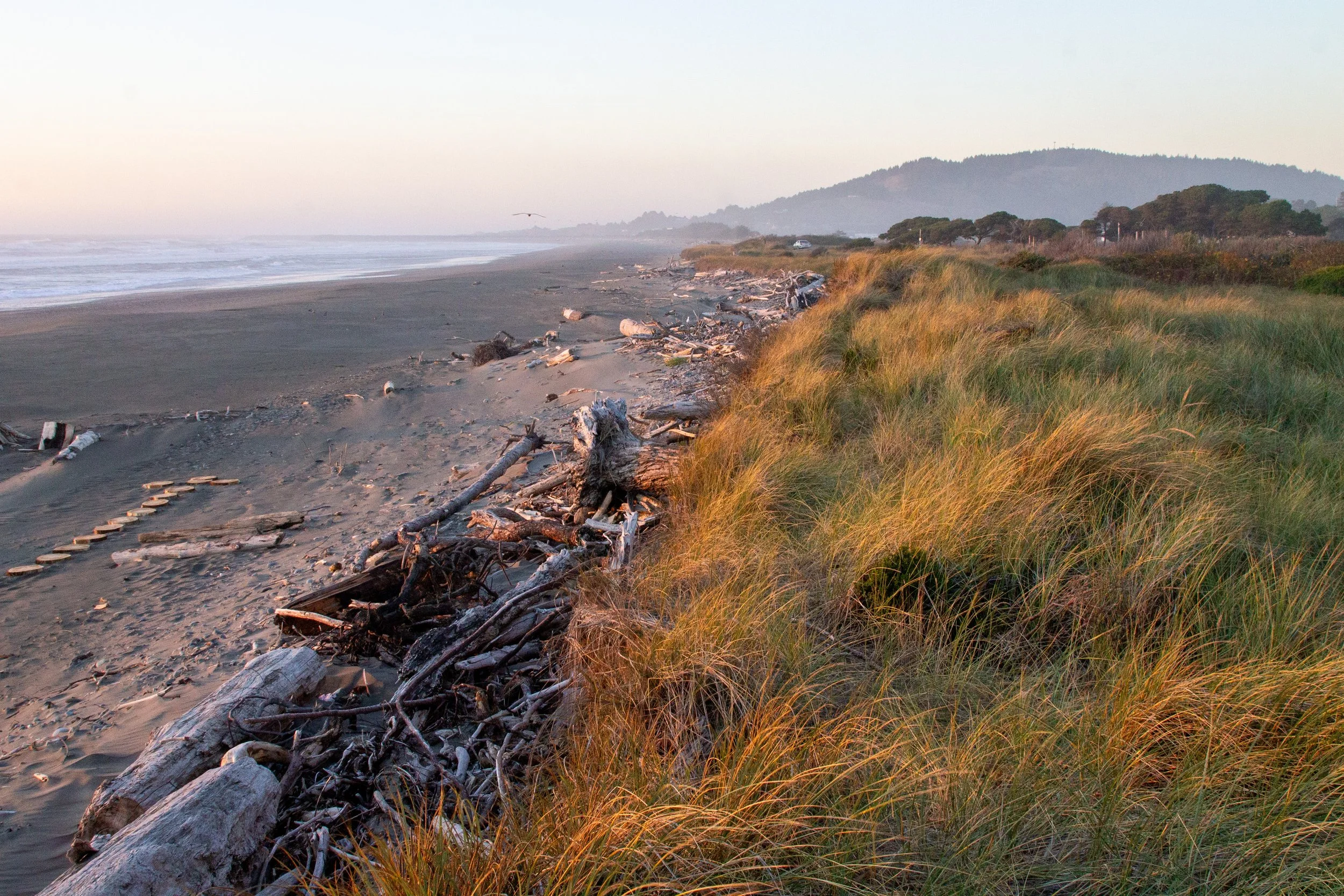
After about 0.2 miles, you’ll leave the forest and have a clear view of the ocean. The trail levels to a gradual downhill. It also becomes more tiring and harder to follow after changing from dirt to sand. Once you leave the tree cover, you’ll veer gently left toward the sea arch at the edge of the shore.
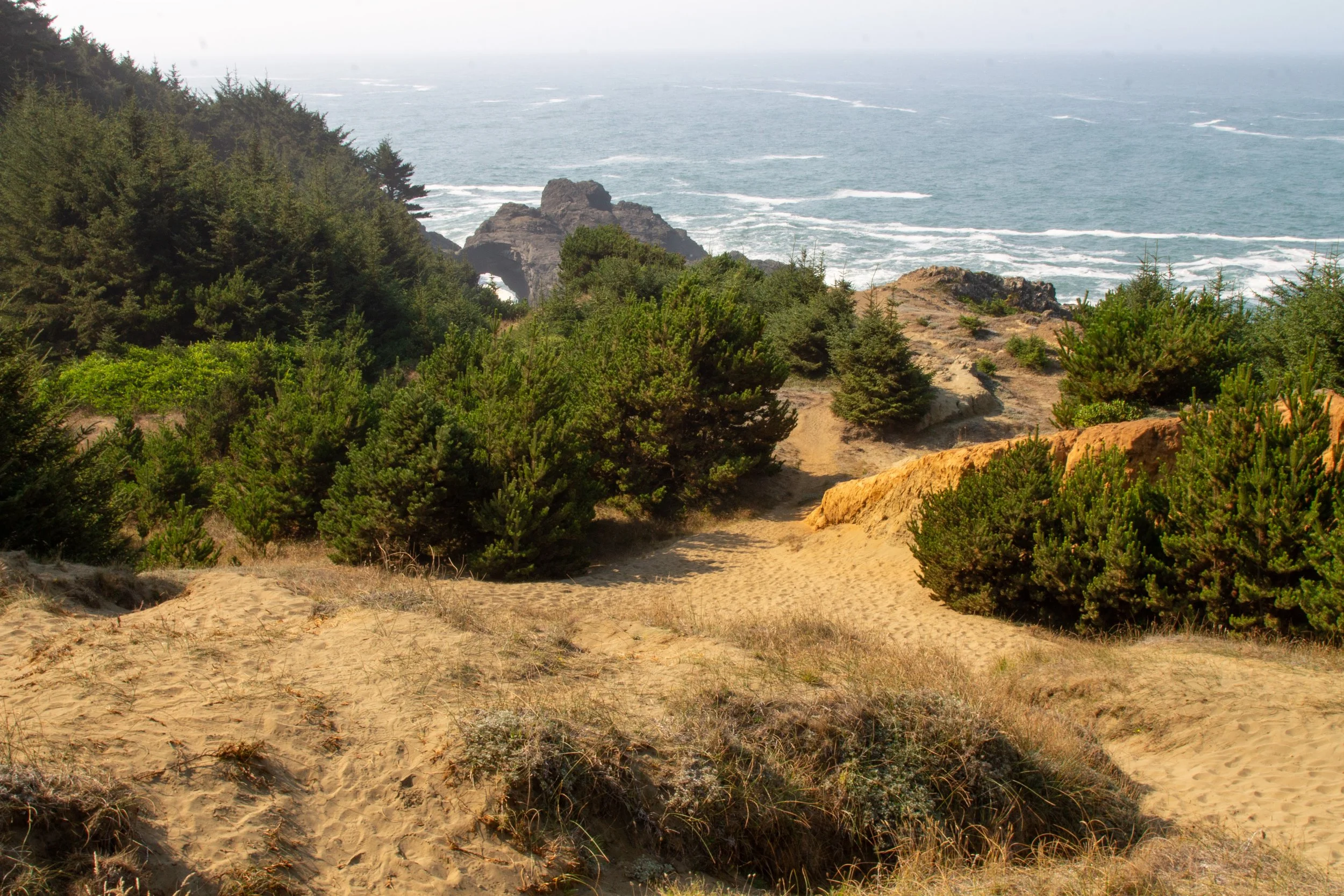
Follow the trail to the sea arch
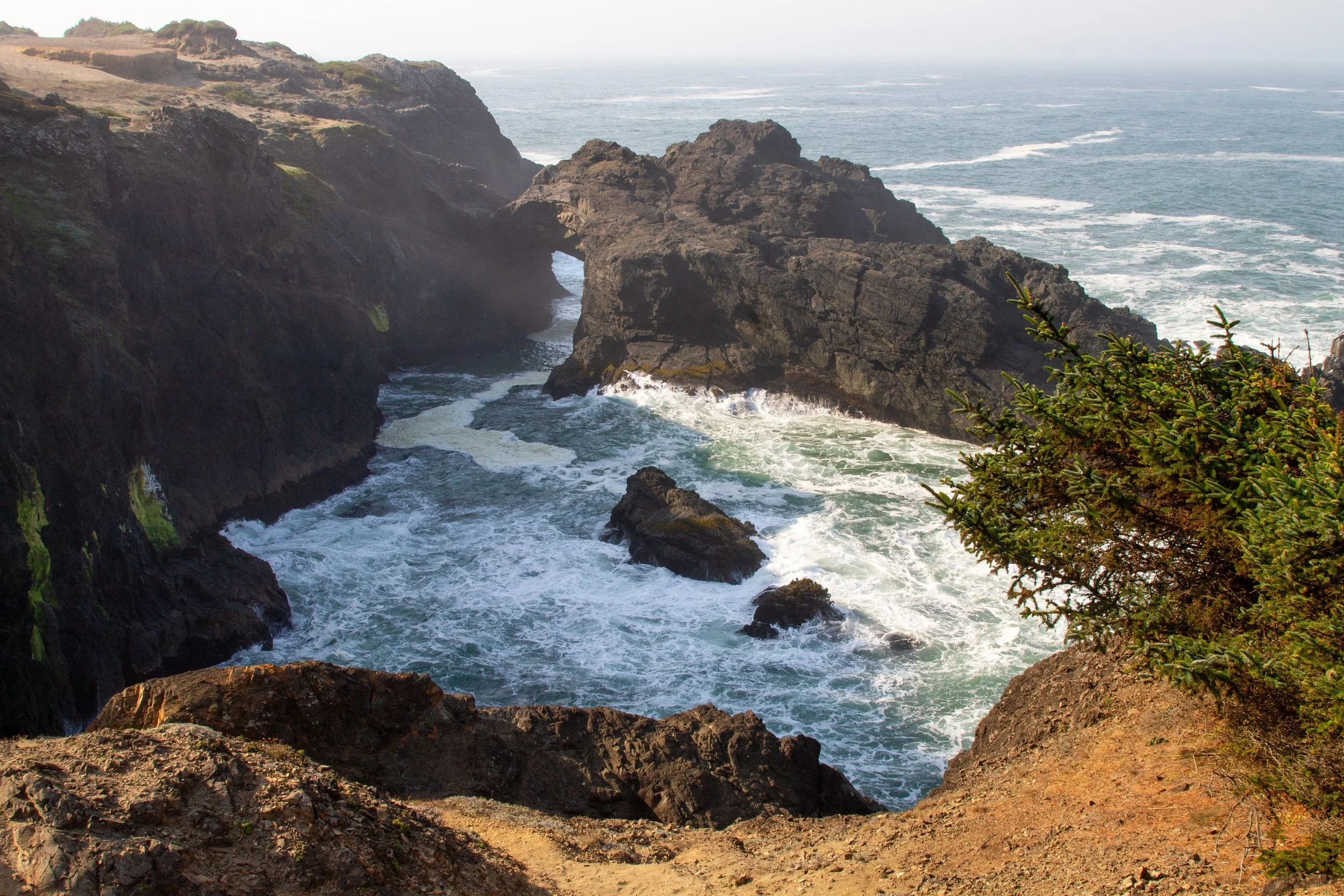
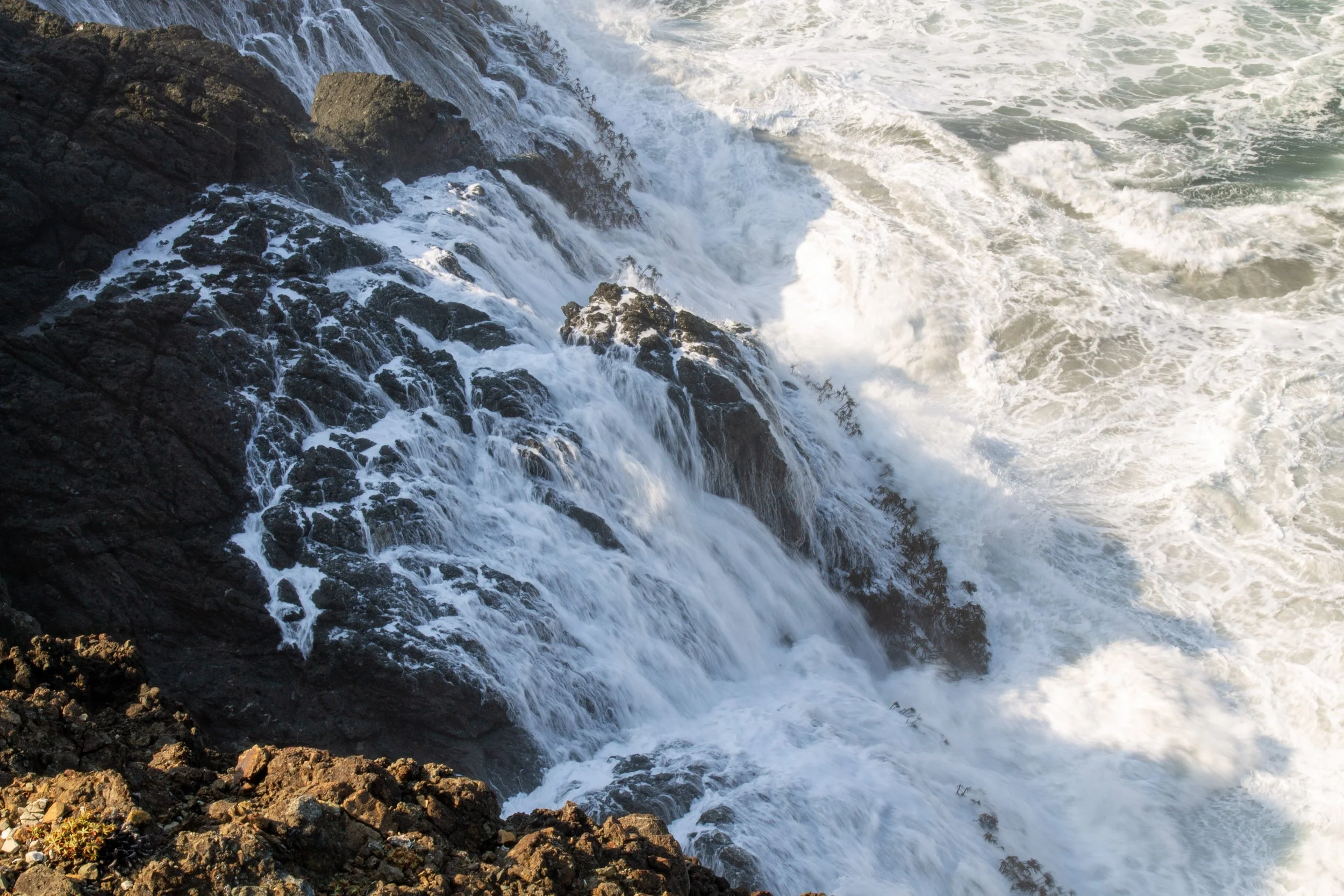
As you approach the cliffs, you’ll get a great view of the natural rock arch that resembles a sea dragon rising from the water. The mostly sandstone arch began as ocean floor deposits around 150 million years ago. The slanted rock layers have become almost vertical with time, forming what looks like the dragon’s backbone. Between the arch and the rest of the shore is a chasm where waves enter and churn. It’s most dramatic at high tide when they crash against the cliffs. Keep a healthy distance from the edge here. It pitches steeply on loose sand toward sheer drop-offs.
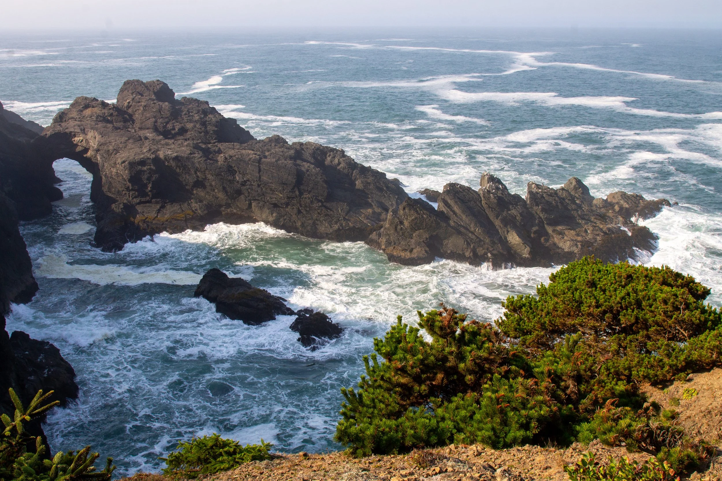
Sea arch at Indian Sands
After taking a minute to admire the sea arch, follow the trail north along the cliffs.

The trail continues
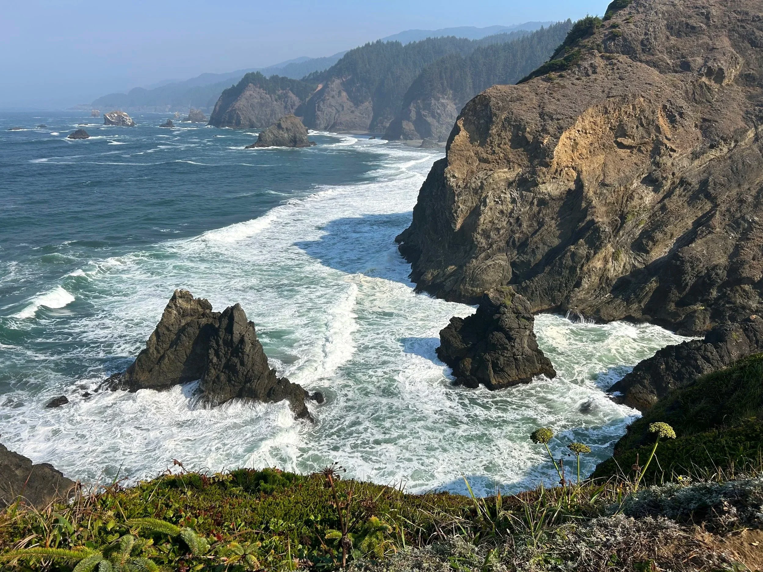
Erosion has carved intriguing inlets and jagged sea stacks in the coastline at Indian Sands. Wildflowers bloom along the trail in summer. By my late September hike, a few asters and yarrow were all that remained of the blooms. Beneath the cliffs, tenacious sea palms grow on half-submerged rocks, swaying with each new wave.

Indian Sands is a great spot for birdwatching and a decent one to look for whales out in the ocean. You’ll see a few places where people have left the trail to get closer to the cliffs. Ignore them. Not worth it.

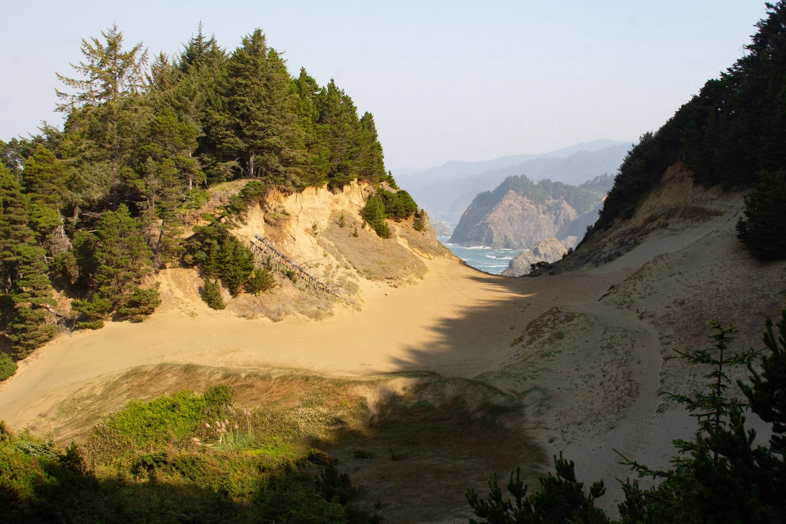
After about a quarter mile along the cliffs, the trail turns inland and heads up a large dune. It’s also the point in the hike where the trail can be hard to follow. I saw as many animal prints here as human footprints. The crisp outlines of bird, squirrel, and snake tracks told me they’d been here more recently than the last hiker.
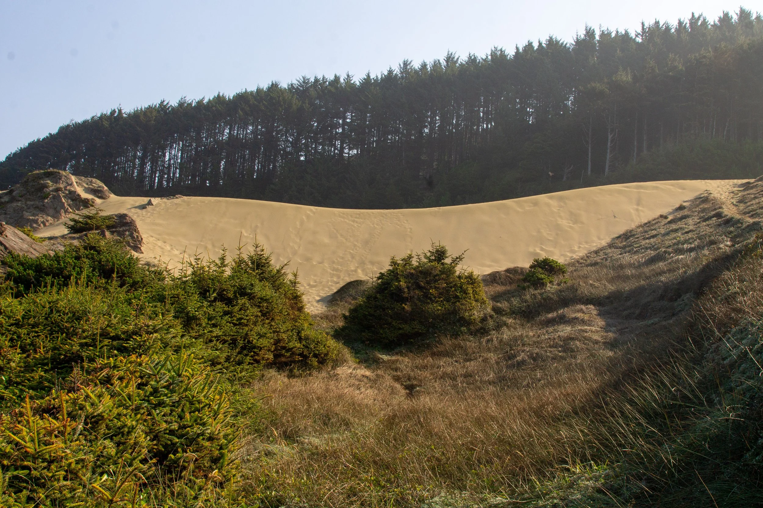
The hike heads up the dune
Indian Sands is one of the few places on the Oregon Coast where dunes cover hard sandstone. Along the top of the dunes, you’ll see the crumbling ridge where the loose sand forms.

The hike heads up to the top of the dune. Looking north, you’ll see a dip in the headland and cliffs in the distance. Head towards the dip to continue the hike. The sandy ground means there isn’t a clearly defined trail, but you’ll see footprints.
Head toward the dip
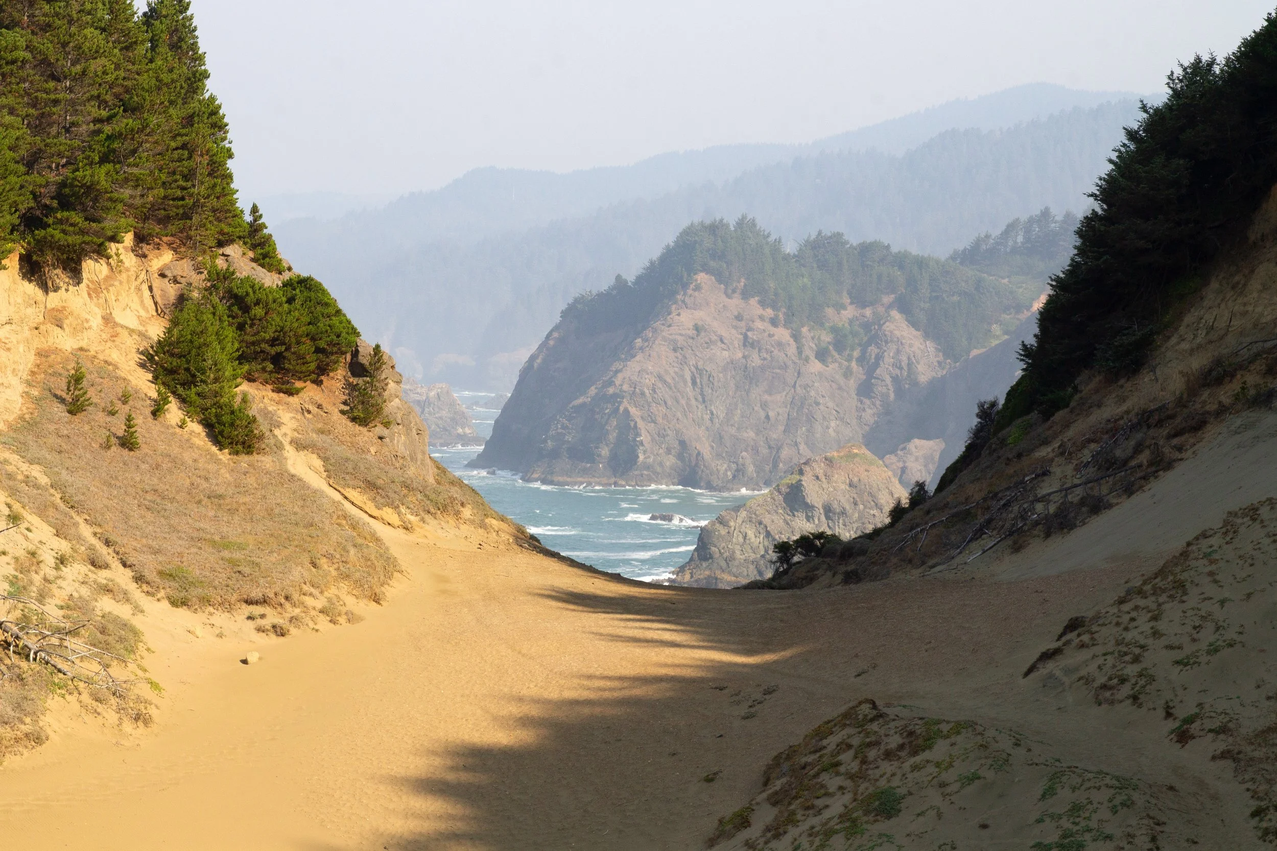
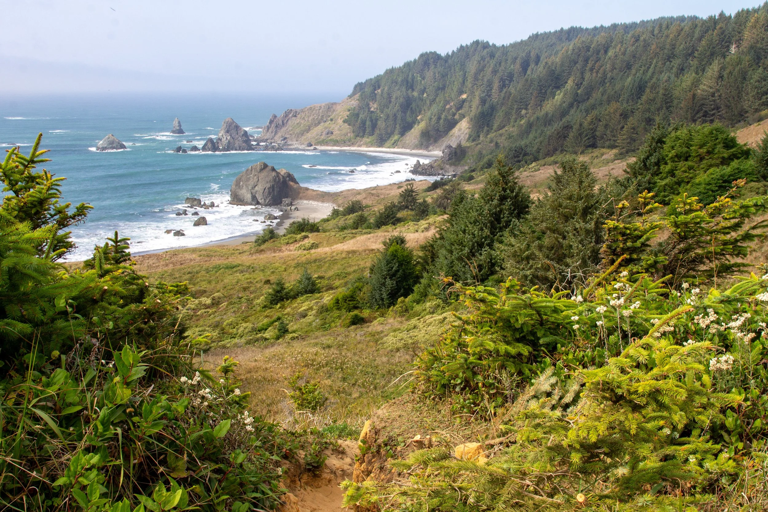
When you reach the cliffs at the north end of Indian Sands, you’ll have incredible views of the Samuel Boardman Corridor. In the cove below the viewpoint, waves crash against spiky sea stacks. Thomas Point and China Beach are in the distance.
North viewpoint
From this viewpoint, it’s easy to miss the continuation of the trail. Look for a faint path heading inland and uphill. You’ll pass through dense vegetation that looks like a natural tunnel.

The trail continues
A little past the viewpoint, the trail starts to look like a trail again. It’ll be narrow and a bit overgrown, but clearly intentional. You’ll get some great views of the cove below Indian Sands as you walk along the edge of the cliffs.

Toward the end of the hike, the trail reenters the forest and starts heading back uphill.

You’ll reach an unmarked fork when you’re close to the end. Keep right to head toward the parking lot. The trail to the left is the continuation of the Oregon Coast Trail. After the fork, you’ll be back at the Indian Sands parking lot in 0.1 miles.
Enjoy your hike at Indian Sands!
With love,
Emma
Getting there
Indian Sands is in the Samuel Boardman Corridor, about 10 minutes north of Brookings, OR. The parking area is directly off Highway 101. Driving south, look for a right turn just after the Thomas Creek Bridge. A sign marks the turn into the parking area.
Explore nearby

Check out all the best stops in the Samuel Boardman Corridor.

Find the best things to do in Brookings.
Find the best things to do in Gold Beach.
Check out the best hikes on the Oregon Coast.