

Multnomah Falls - Wahkeena Falls Loop Hike


Five miles, six waterfalls. It’s not so much a hike as THE hike. I live in Portland and have been hiking all over the Columbia Gorge. The Multnomah Falls-Wahkeena Falls Loop is special. Among the six named waterfalls are the 620-foot Multnomah Falls and the 240-foot Wahkeena Falls. Throw in a few seasonal waterfalls, cascading creeks, and basalt cliffs in a forest where sprites and gnomes would not look out of place, and you’ve got the makings of an unforgettable day. Major considerations are crowds in summer and snow in winter. Here’s everything you need to know about hiking the Multnomah Falls-Wahkeena Falls Loop.
Multnomah Falls
Where to start
You can start the hike from either Multnomah Falls or Wahkeena Falls. I’d recommend starting from Multnomah Falls. It has a lot more parking, nice indoor restrooms, and a water bottle filling station.
Parking at the larger parking lot for Multnomah Falls off I-84 requires a $2 Multnomah Falls Timed Entry Permit from Memorial Day through Labor Day, 9 AM - 6 PM. Outside these times, it’s free.
Parking at Wahkeena Falls is free, but the lot is very small and often full. Restrooms near the parking lot are open seasonally.
You can do the loop clockwise or counterclockwise. I’ve done it both ways. The experience is similar. These directions will be the clockwise version.
Wahkeena Falls
Know before you go
Leashed dogs are welcome on the trail.
This hike can get muddy. A few small streams cross the trail. Wear hiking boots if possible. In winter, you might encounter snow, especially at higher elevations. It’s a good idea to bring microspikes in January and February.
Do not leave valuables in the car. Sadly, this area is a target for car break-ins.
The Multnomah Falls-Wahkeena Falls Loop is easy to follow. Every junction has a map and signs.
There’s a lot of uphill walking and some steep drop-offs, making it not the most family-friendly trail. It would be better for older children.
Allow for 3-5 hours to complete the hike.
When to go
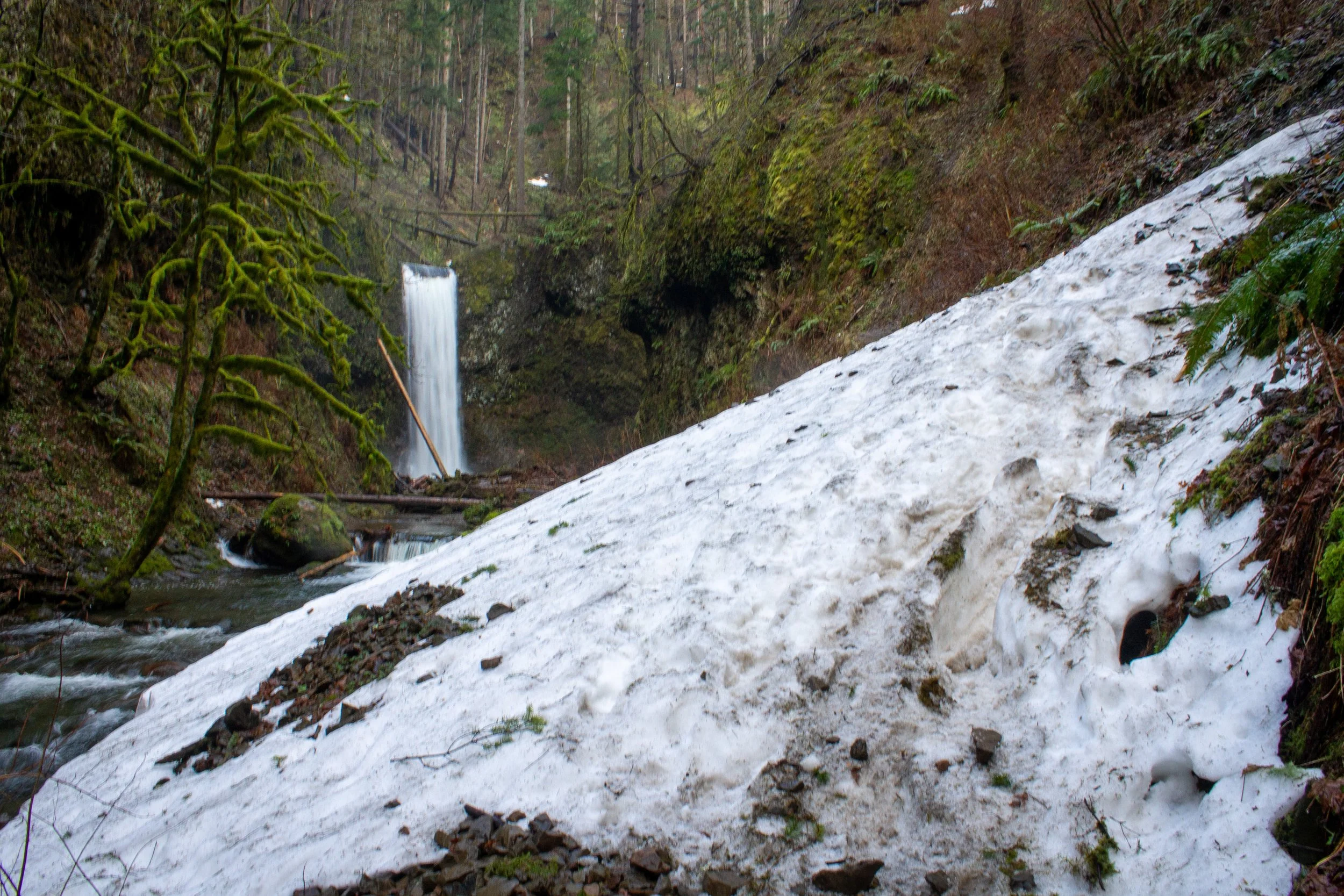
Trail conditions can be difficult in winter (January)
The Multnomah Falls-Wahkeena Falls Loop is one of the most popular hikes in the Columbia Gorge. Since I live so close and can visit anytime, I go in the winter to avoid the crowds. It does mean carrying microspikes for snow, but I think it’s worth it to have the forest (almost) to myself.
Summer is the busiest season. The weather is usually good, the greenery will be at its finest, and you can spot wildflowers along the trail. If you go in the summer, go early, especially on the weekend. If you arrive before 9 AM, you don’t need a timed entry permit to park at Multnomah Falls.
Spring and fall can be good times to visit to avoid the worst of the crowds of summer and the constant drizzle of winter. The waterfalls will be more impressive in early spring and late fall than in the summer. Begin looking for wildflowers along the trail in late spring. Expect to see fall colors in late October and early November.
Winter can be a beautiful and relatively quiet time to visit, although it may come with challenging trail conditions and a lot of rainy days. I’ve gotten rained on here, which, besides making me cold and wet, also made the ice more slippery. On the other hand, the waterfalls and creeks look stunning in winter.
The Multnomah Falls - Wahkeena Falls Loop Trail

Multnomah Creek
Distance: 5-mile loop
Elevation gain: 1600 feet
Difficulty: Moderate
Pass required: Multnomah Falls timed entry permit, seasonally
Dog friendly: Yes, leashed dogs are allowed on the trail.
ADA access: No, not beyond the viewpoints for Multnomah Falls and Wahkeena Falls.
Basic directions
Take the paved trail starting from the base of Multnomah Falls to the top of the falls, about 1 mile.
Take the Larch Mountain Trail (#441) for about 0.8 miles until the junction with the Wahkeena Trail.
Take a right onto the Wahkeena Trail (#420). Continue for a little over a mile.
Take a right to stay on the Wahkeena Trail. Continue until the base of Wahkeena Falls, about 1 mile.
From the base of Wahkeena Falls, take the Return Trail (#442) about 0.5 miles to return to Multnomah Falls.
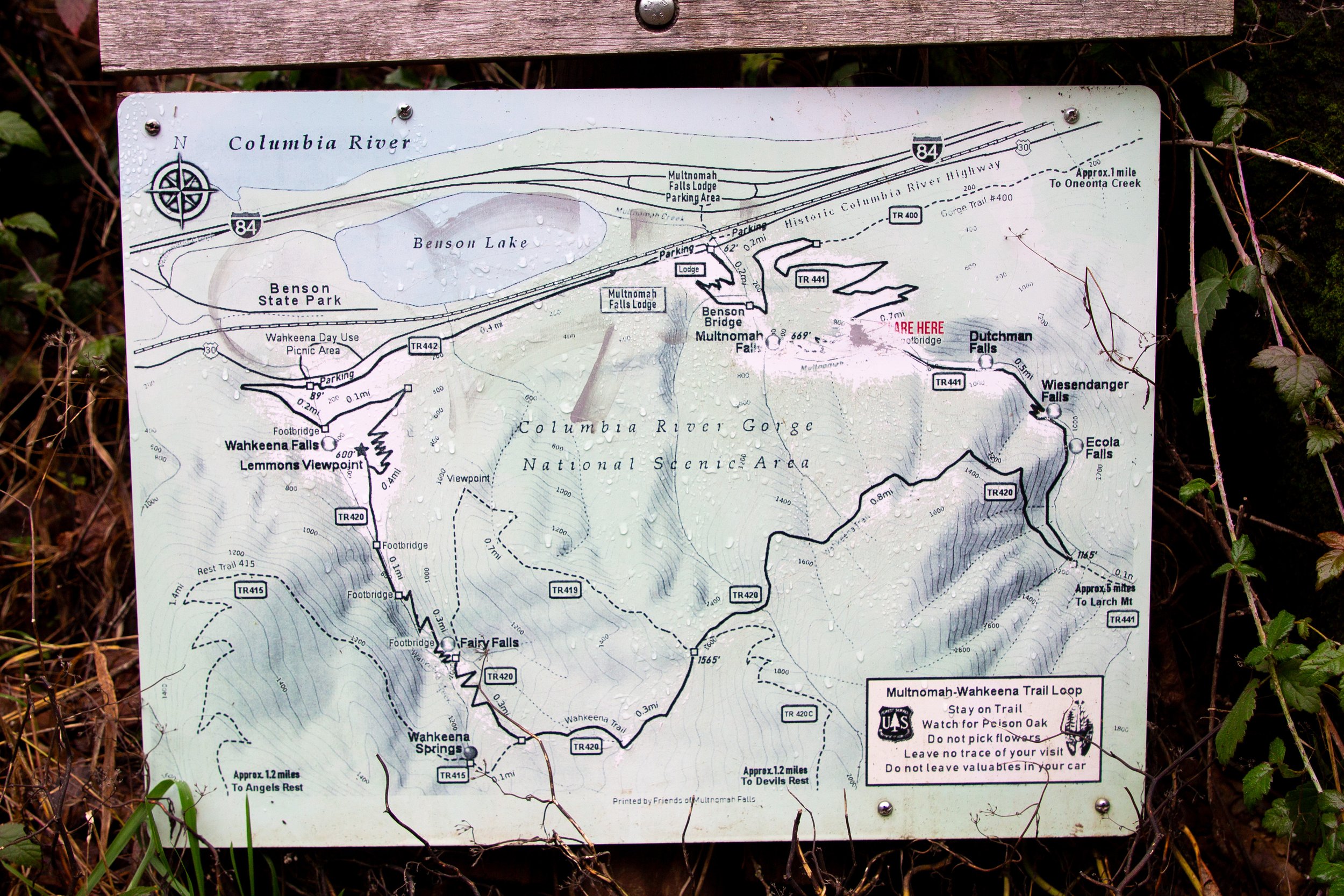
Every junction has a trail a map
The details
From the parking lot off I-84, cross the Historic Columbia River Highway and take the path past the Multnomah Falls Lodge to reach the base of Multnomah Falls. Take a moment to get photos. This viewpoint is more impressive than those higher up.

Multnomah Falls
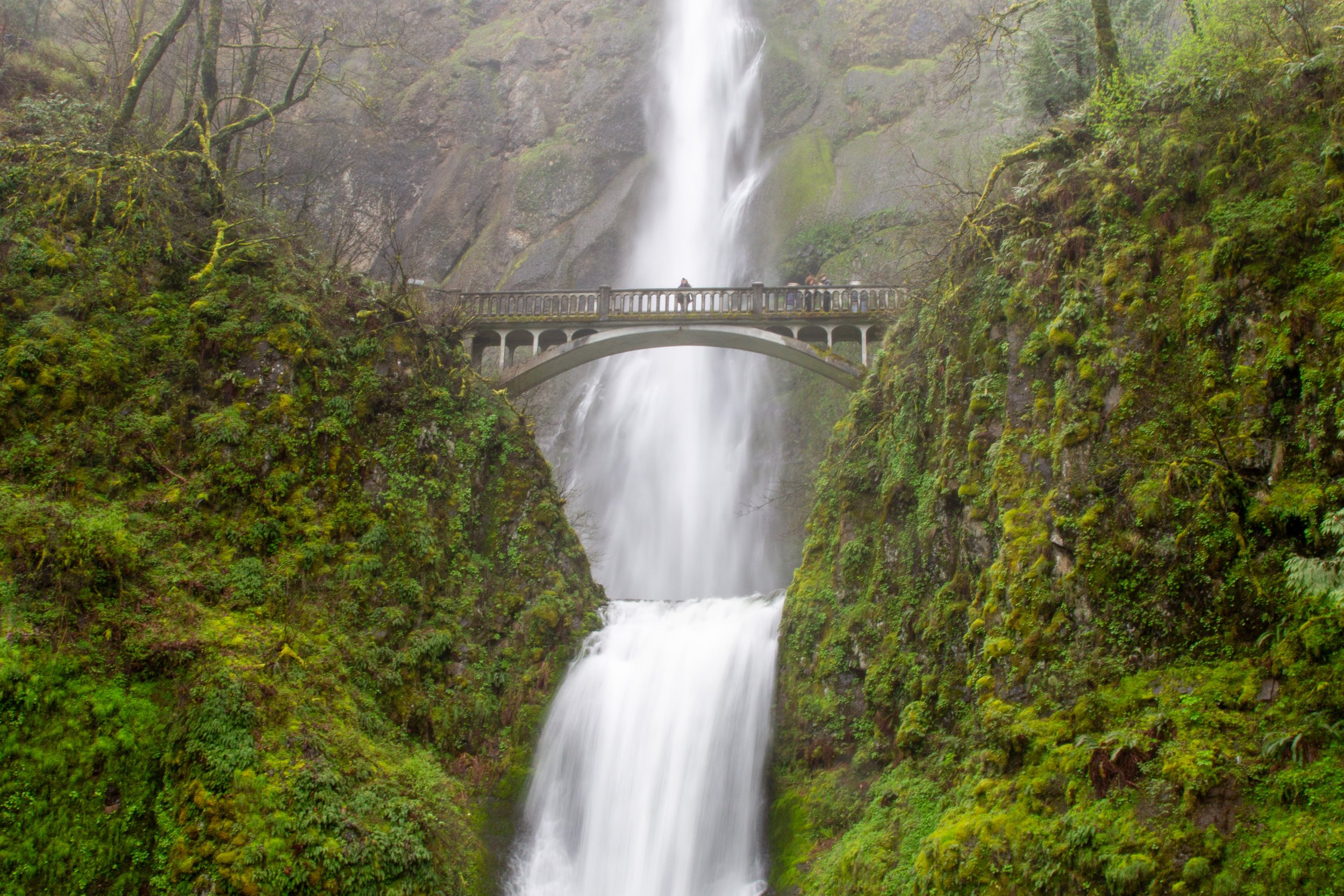
To start the Multnomah Falls-Wahkeena Falls Loop, follow the paved trail up the hill. Cross Benson Bridge, the stone bridge in front of Multnomah Falls. On the other side, a viewpoint looks onto the upper tier of the falls.
Benson Bridge
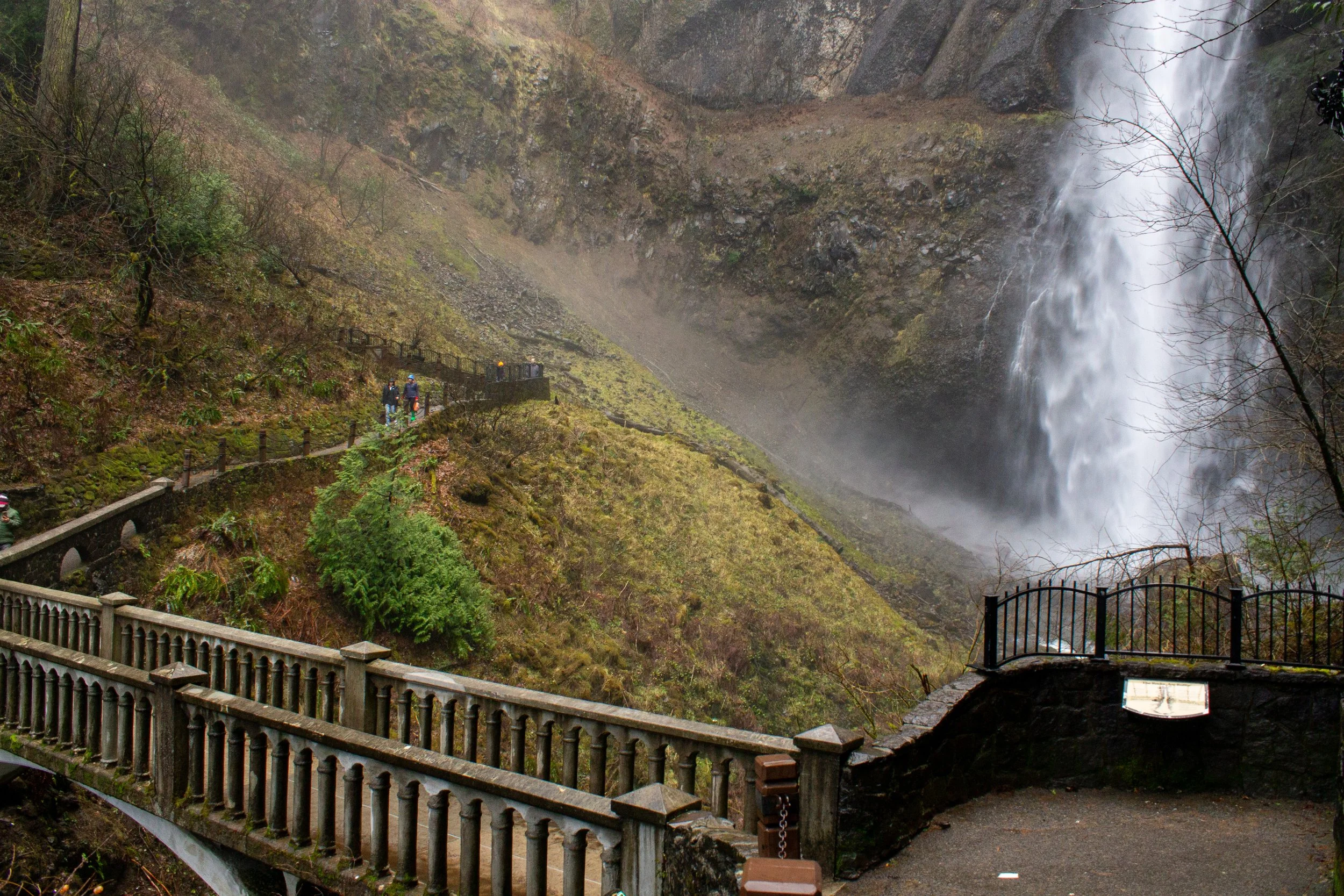
After the viewpoint, you’ll start the infamous 11 switchbacks that lead to the top of the falls. They are not dangerous, just tiring. Numbered signs along the trail let you know how many switchbacks remain. They go by a lot more slowly than you’d like. I swear some of them repeat. Like, say, as a prank. To take your mind off the climb, look for Beacon Rock across the Columbia River. At switchback 10, you’ll reach a trail junction marked with a sign. Take the unpaved trail to the right to reach the top of Multnomah Falls. The viewpoint is fenced and safe with kids.
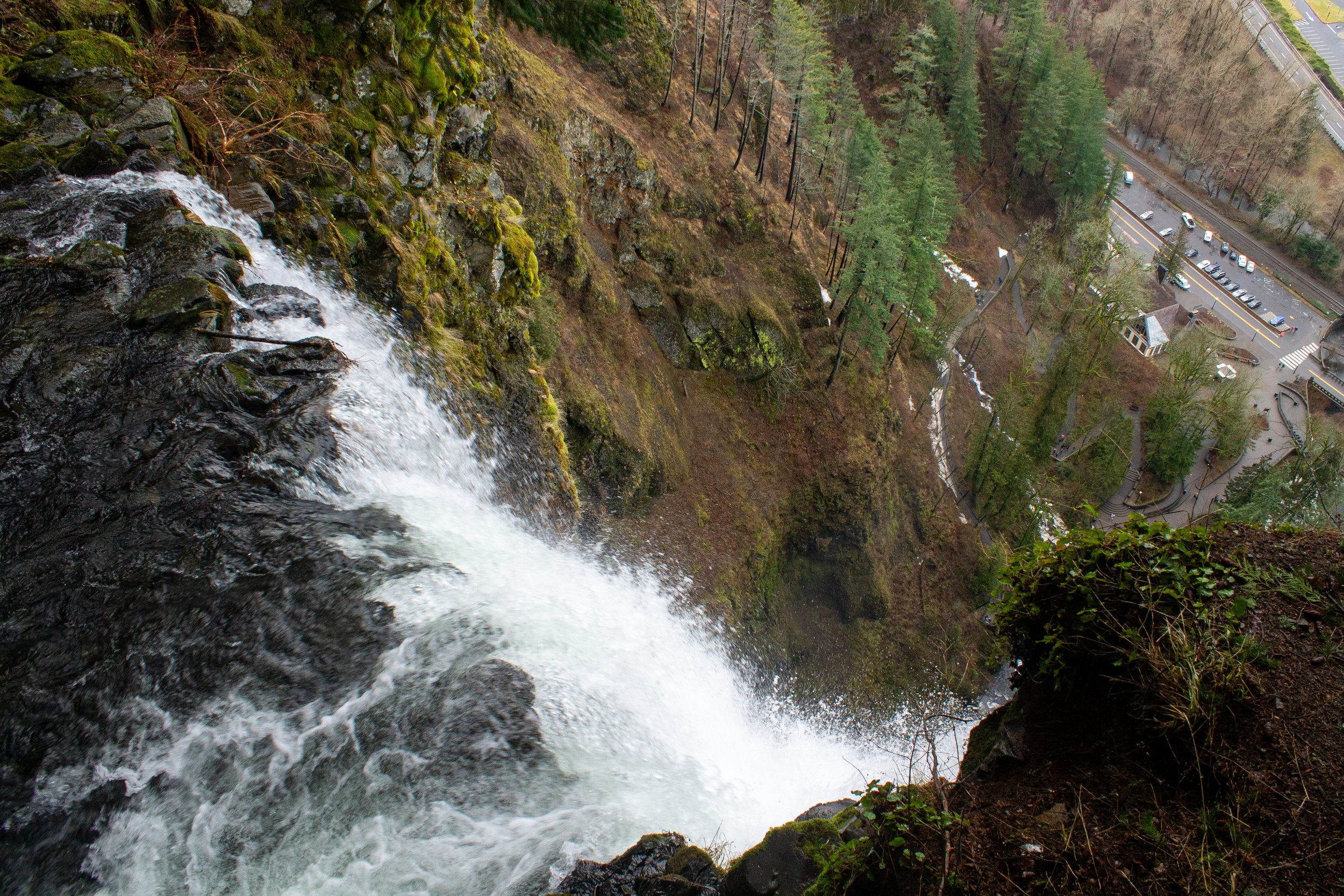
Top of Multnomah Falls
The top of the falls is less impressive than I was expecting. You can only see the lip before the plunge. You do get a sense of the height (and how far you’ve walked) by seeing the tiny car specks in the parking lot below. Although definitely worth a look, the views from the lower viewpoints are more photogenic and interesting. Just upstream of Multnomah Falls is a lovely little bonus waterfall, which I think is the best part of the viewpoint.
Bonus waterfall
Return on the short spur from the top of Multnomah Falls to the trail junction. Then, take a right onto the Larch Mountain Trail (#441). I love this moment in the Multnomah Falls-Wahkeena Falls Loop when the crowds suddenly thin. The trail gets less steep but rougher. It starts feeling less like a major tourist destination and more like the wilderness. You’ll cross a mossy stone footbridge as you follow Multnomah Creek.
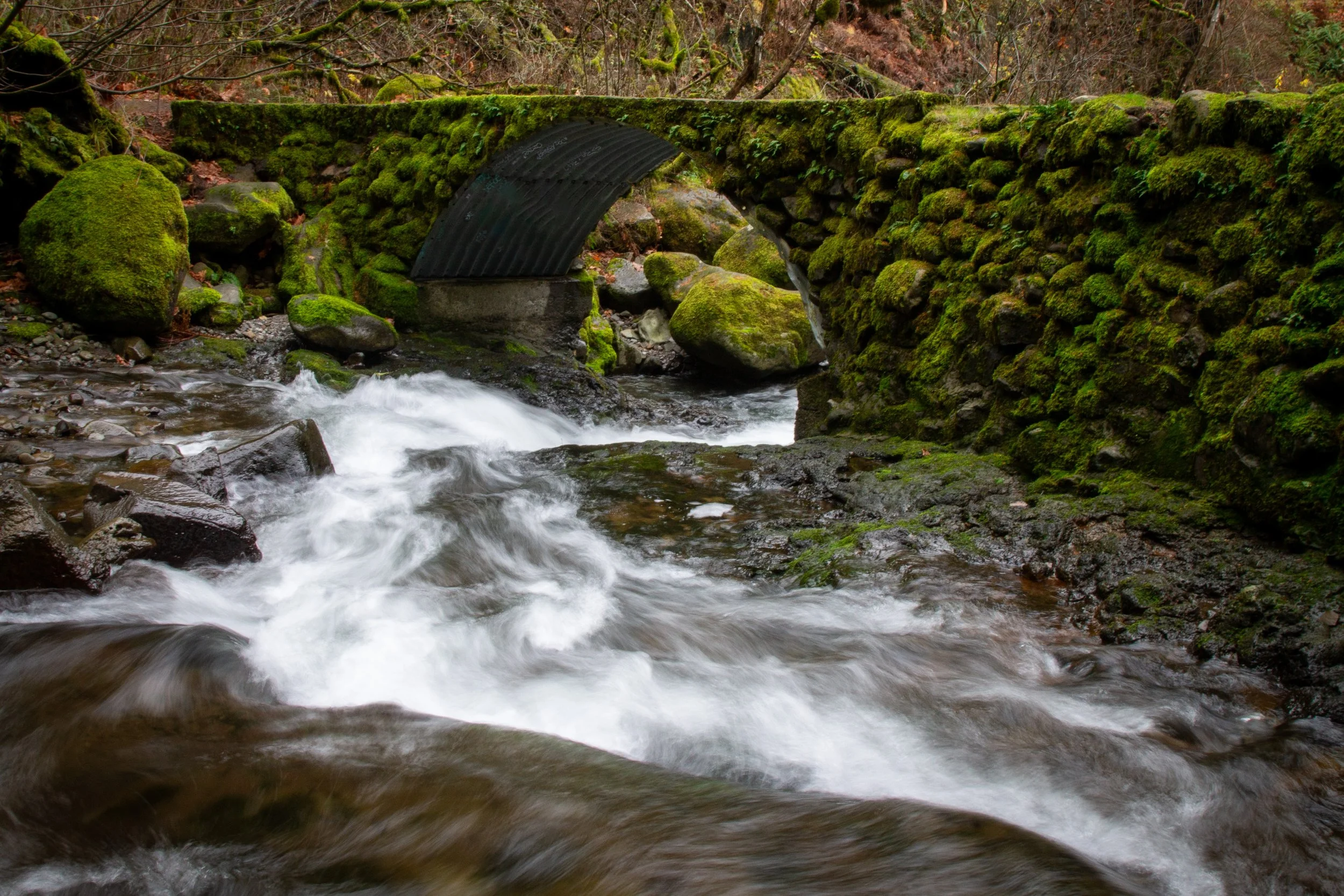
The prettiest bridge on the Multnomah Falls-Wahkeena Falls Loop
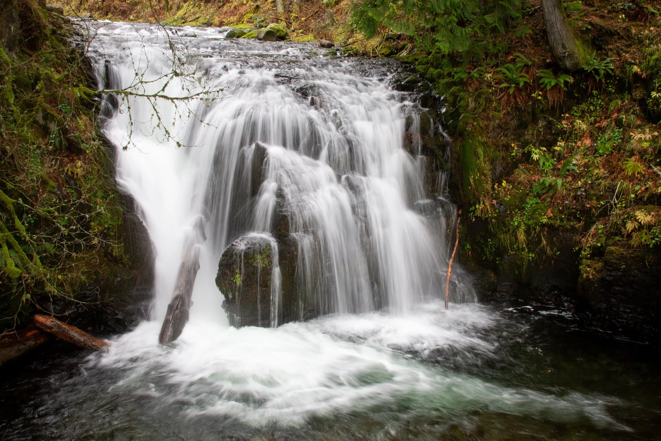
A little past the footbridge, you’ll reach three waterfalls, one right after another. The first is the short and squat Dutchman Falls. Its tiers blend in with the cascades of Multnomah Creek.
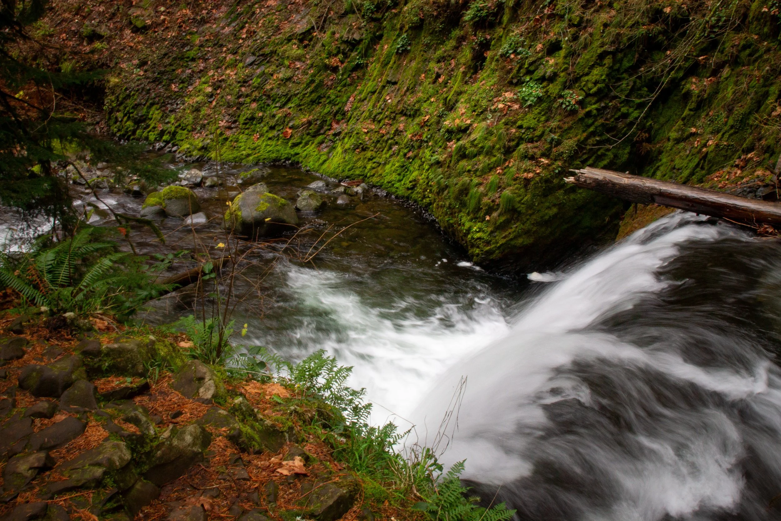
Dutchman Falls
Past Dutchman Falls, the trail passes underneath a recessed basalt cliff. The chunky columns of rock are legacies of ancient lava flows. Beyond the cliff, you’ll see the elegant, 55-foot plunge of Weisendanger Falls in its bowl-shaped amphitheater.
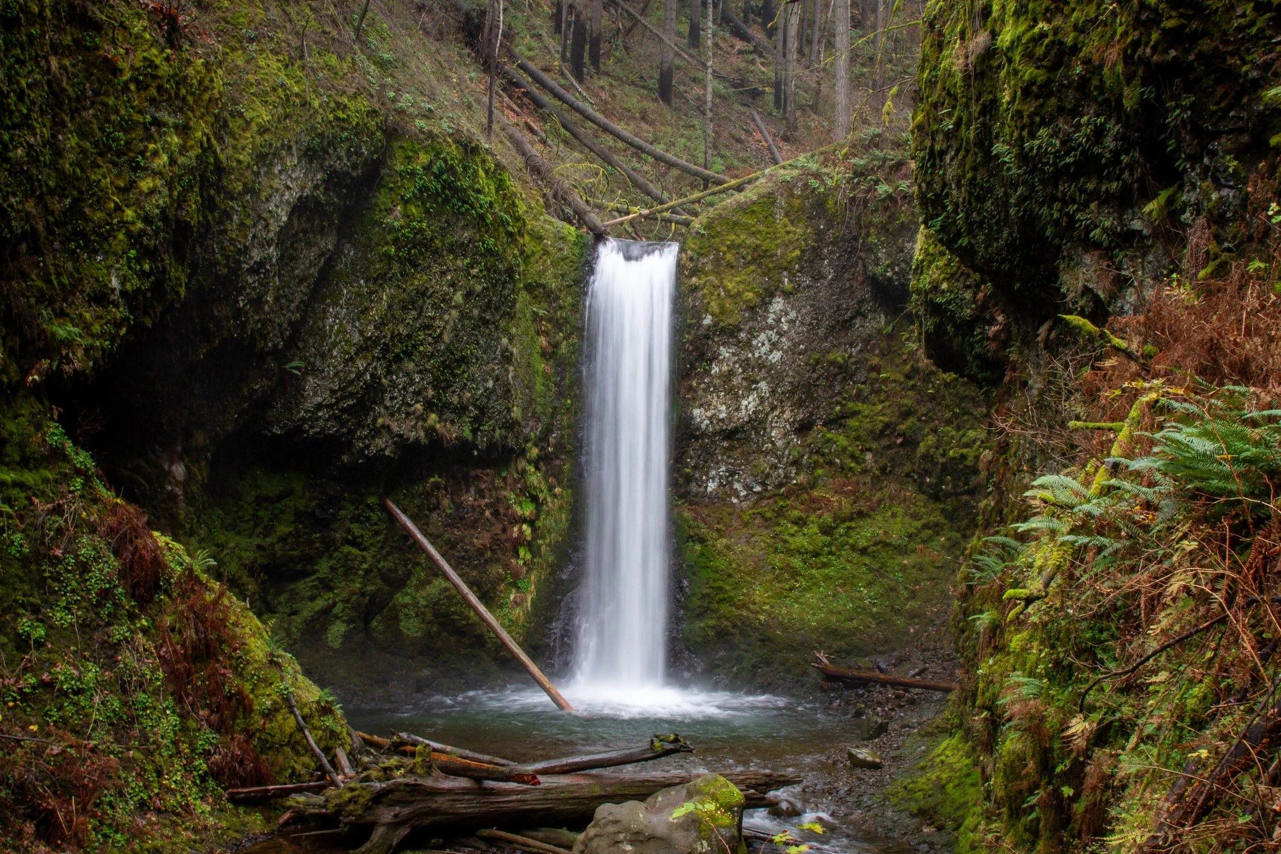
Weisendanger Falls
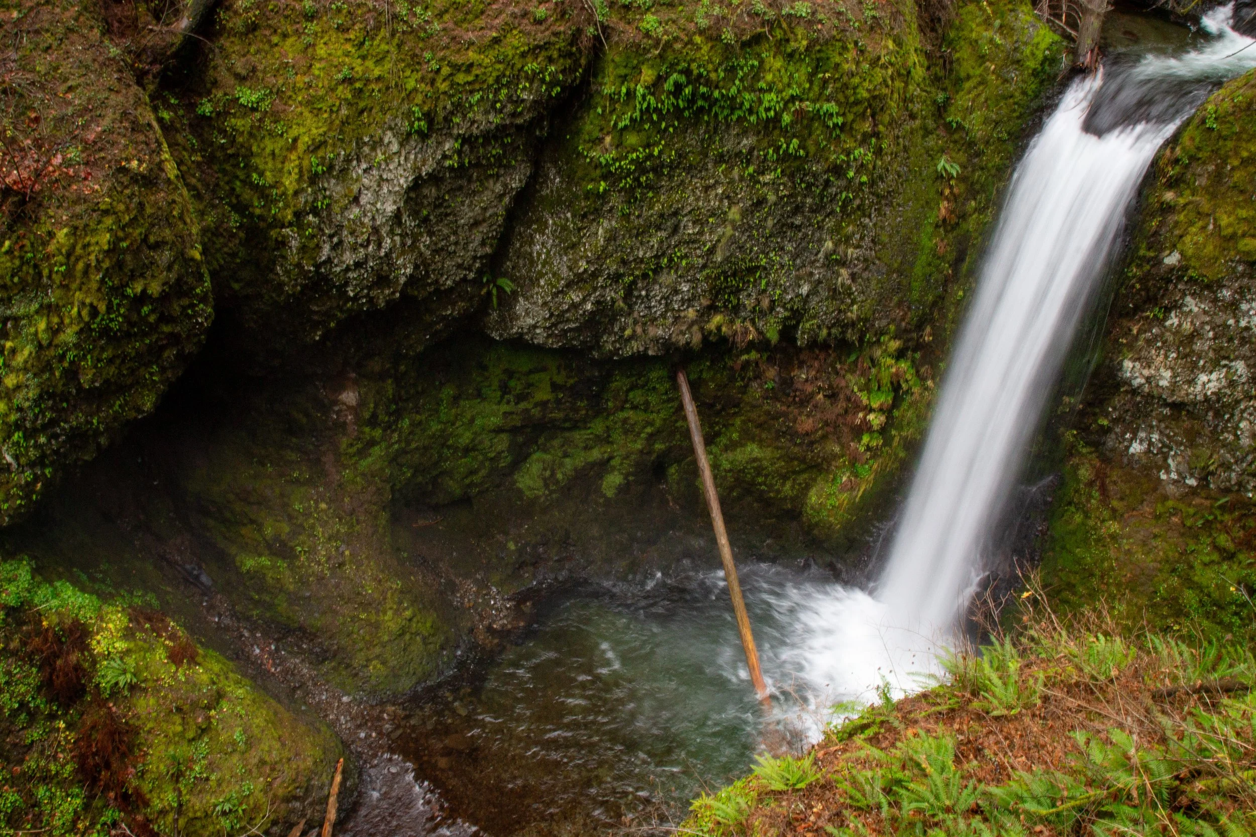
Last is Ecola Falls. Its 55-foot plunge is almost hidden behind a cliff, stubbornly defying landscape orientation in photos.
Ecola Falls
Shortly after Ecola Falls is a trail junction. Take a right onto the Wahkeena Trail (#420). Most of the uphill walking is finally behind you. The trail winds through a burnt forest, the aftermath of the 2017 Eagle Creek wildfire. You’ll see glimpses of the Washington side of the Columbia Gorge through charred branches. On my last hike, a low-hanging cloud settled around the trail, making things eerier than usual.

Wahkeena Trail
When you reach the junction with the Devil’s Rest Trail, go straight to stay on the Wahkeena Trail. After 0.3 miles, you’ll reach another trail junction. Consider a brief (0.1-mile) detour onto the Angel’s Rest Trail to see Wahkeena Springs. It’s weird-looking. Wahkeena Creek starts more or less underneath the hiking trail. You’ll see no creek on one side of the trail and definitely a creek on the other. After having a look, return to the Wahkeena Trail to continue the Multnomah Falls-Wahkeena Falls Loop.
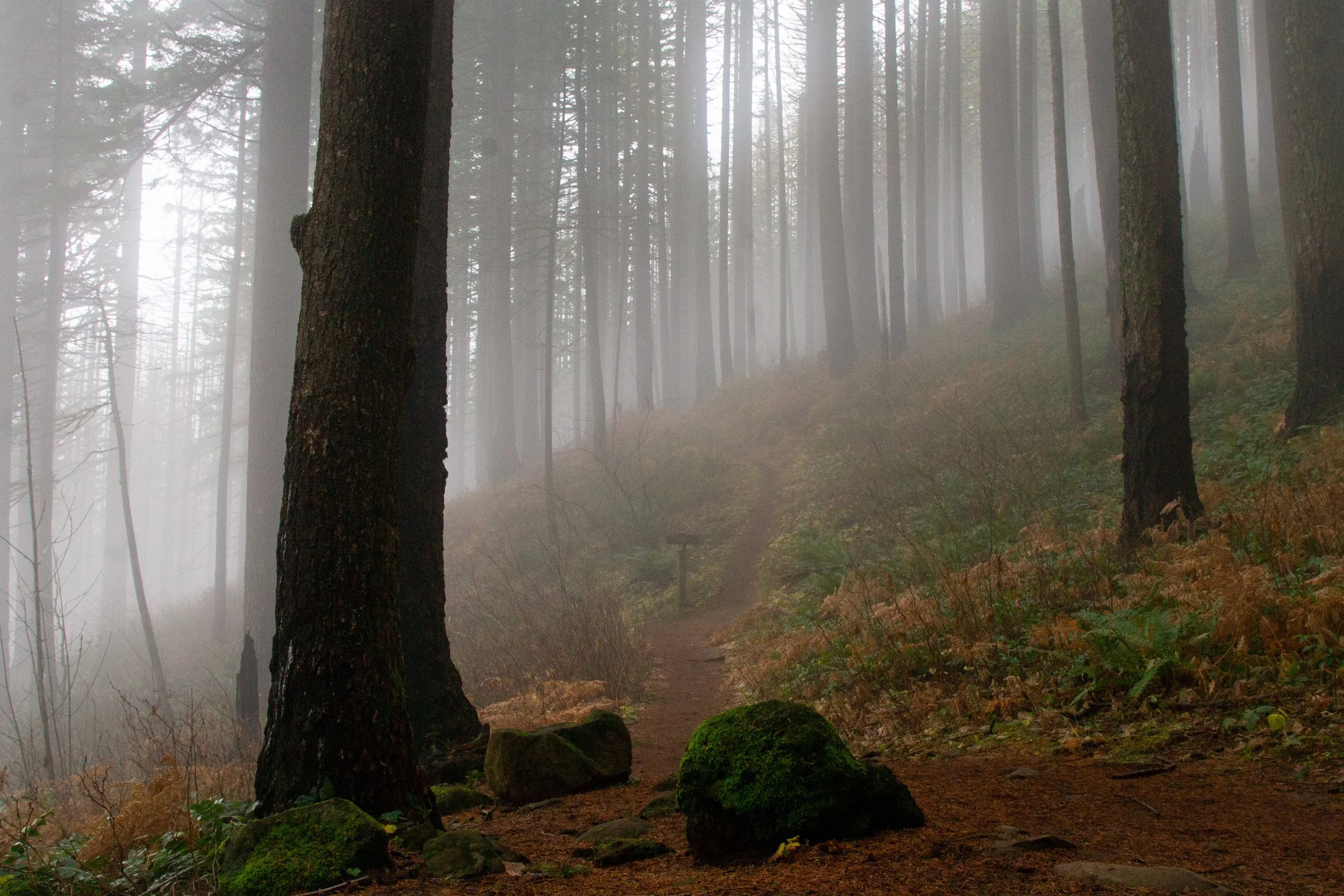
Walking through a cloud on the Wahkeena Trail
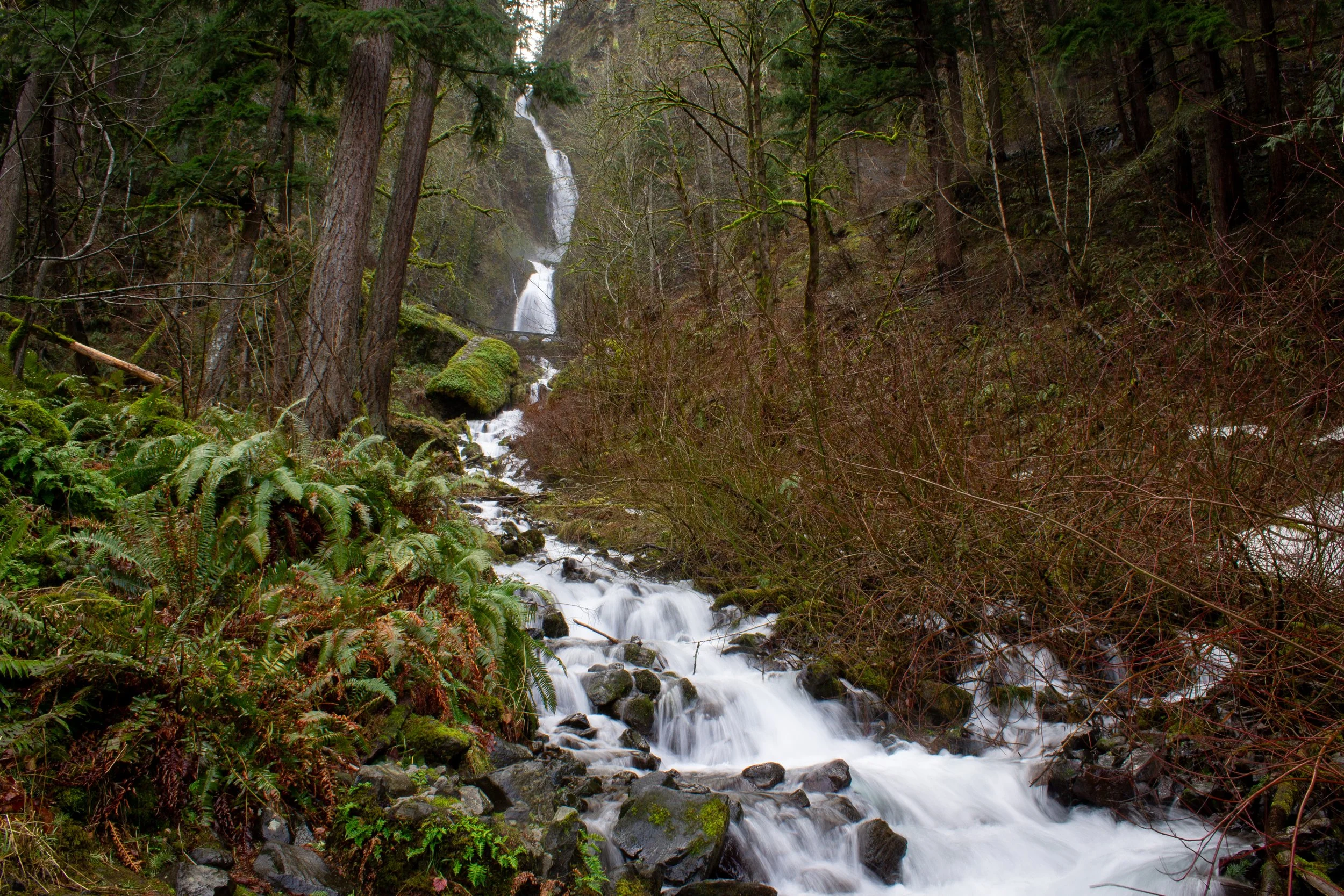
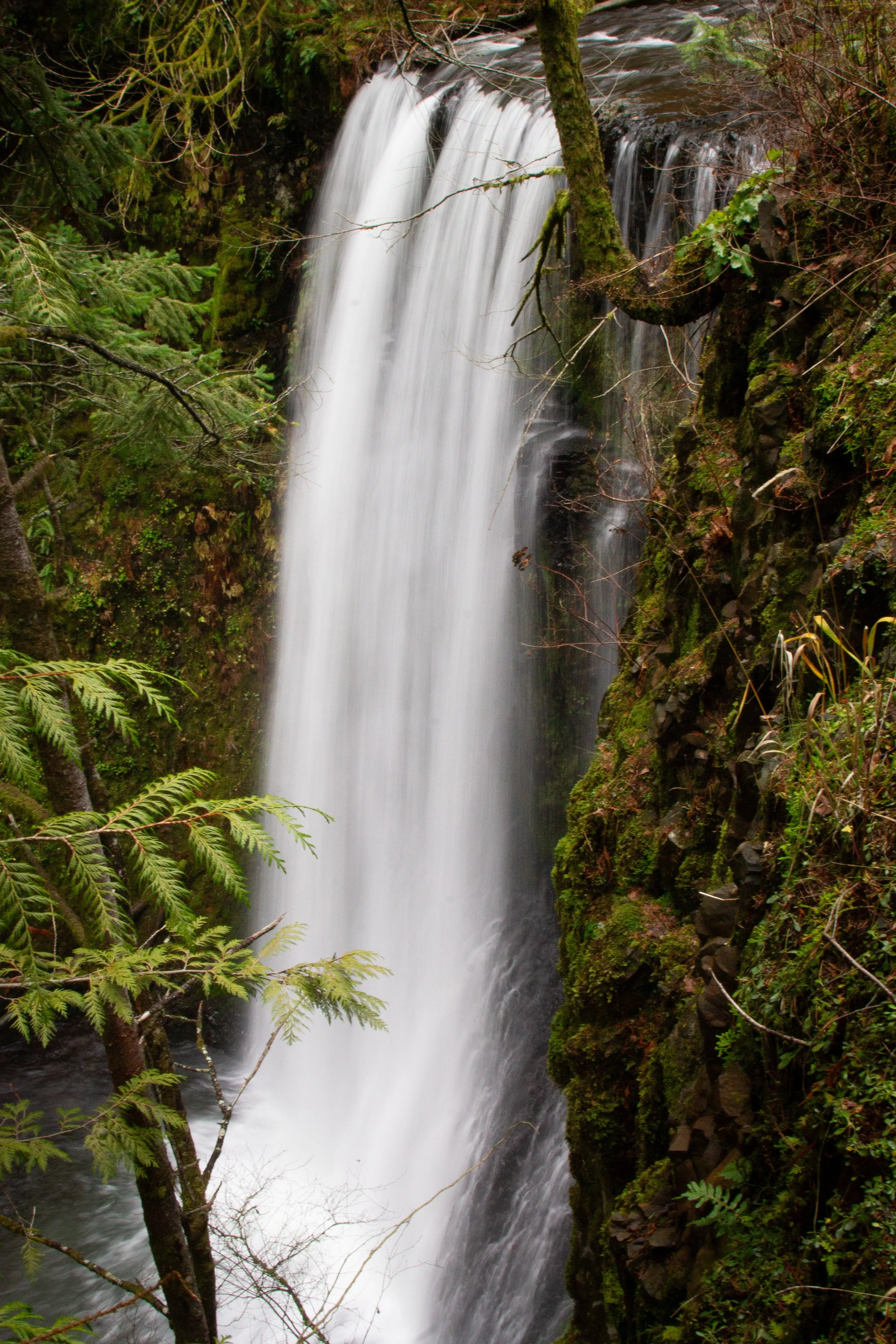
The trail follows Wahkeena Creek to the ethereal Fairy Falls. It’s only 20 feet high, but memorable for having an understated beauty.

Fairy Falls
Continue down a few switchbacks and stop for a moment at Lemmons Viewpoint. It honors Keith Lemmons, a firefighter who died battling a wildfire. Lemmons Viewpoint overlooks the Columbia River and Washington State, with views extending to Beacon Rock.
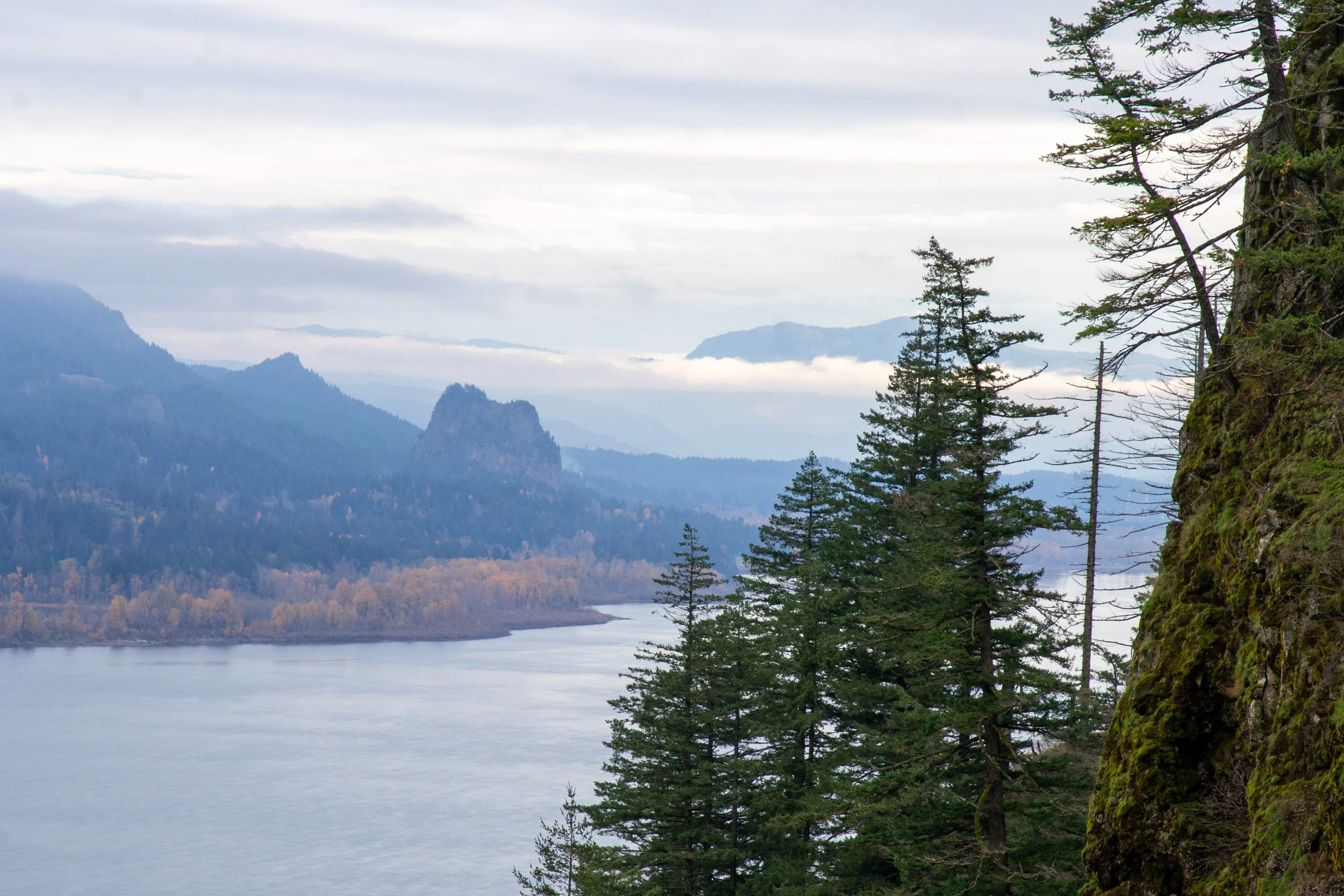
Beacon Rock from Lemmons Viewpoint
The rest of the trail is paved switchbacks. You’ll cross a stone bridge in front of the upper tier of Wahkeena Falls. Then, continue downhill until you reach the viewpoint at the base of the falls.

Upper Wahkeena Falls
Although quite tall, it’s difficult to see the full height of Wahkeena Falls at once. Portions are hidden by the undergrowth and its snaking course. In winter, the absence of greenery makes it easier to see the many tiers. After admiring Wahkeena Falls, take the mostly flat 0.5-mile Return Trail (#442) back to Multnomah Falls.

Take the Return Trail back to Multnomah Falls
Getting there
From Portland, take I-84 East until Exit 31. This exit will take you directly to the parking lot. Present your timed entry permit if needed. The drive from Portland will take about 35 minutes.
From Hood River, take I-84 to Exit 31. This exit will take you to the parking lot. Present your timed entry permit if needed. The drive from Hood River will take about 35 minutes.
Enjoy your hike on the Multnomah Falls - Wahkeena Falls Loop!
With love,
Emma
Explore nearby

Check out the best hikes near Multnomah Falls.

Find the best short hikes in the Columbia Gorge.

Check out my comprehensive list of Columbia Gorge waterfalls.