

10 Spectacular Waterfall Hikes near Multnomah Falls
With so many interconnecting trails around Multnomah Falls, it can be hard to know where to start when you’re looking for an amazing waterfall hike. I live in Portland and visit the Columbia Gorge on an almost-weekly basis. Here I break down my favorite waterfall hikes near Multnomah Falls, listed from west to east and all in the ballpark of 30-40 minutes from Portland, Oregon. Whether you’re searching for grandeur or delicate beauty, conifer forests or wildflowers, you can find it on one of these hikes. Enjoy!
Benson Bridge at Multnomah Falls
Tips for hiking near Multnomah Falls
Parking will likely be a challenge during popular times at any of the trailheads near Multnomah Falls. Arrive early on summer weekends.
If you begin your hike at Multnomah Falls, you need a timed entry permit from Memorial Day through Labor Day, 9 AM - 6 PM. Learn more here.
Leashed dogs are welcome on the trails.
Do not leave valuables in your car. Sadly, all of the trailheads near Multnomah Falls have been targets for car break-ins.
Most of these hikes are doable throughout the year unless the Columbia Gorge gets a winter storm. Check local conditions before heading out in winter.
The trails near Multnomah Falls tend to be well-marked with signs, but it’s always a good idea to have an offline trail map. I found this map helpful.
1. Latourell Falls

Latourell Falls
Number of waterfalls: 2
Distance: 2.4-mile loop
Elevation gain: 600 feet
Difficulty: Easy
Dog friendly: Yes
Pass required: Oregon State Park Pass
ADA access: The parking lot has a partial view of Latourell Falls. The hiking trail has steep sections and stairs.
Restrooms: Yes
Driving distance from Portland: 30 minutes

Upper Latourell Falls
The hike at Latourell Falls connects two incredible waterfalls along Latourell Creek. The first is majestic Latourell Falls, which plunges 224 feet over a lichen-adorned basalt cliff. You’ll find a viewpoint for the falls only a few steps away from the parking lot. From here, you can take the loop trail to explore the base of Latourell Falls, remarkable for the basalt columns that make up the cliff near its base. These columns suggest that basaltic lava cooled evenly as it hardened into rock.
The trail continues to Upper Latourell Falls, a lovely two-tiered waterfall that plunges over a smaller but equally intriguing basalt cliff. Upper Latourell Falls is easier to explore up close and you can get behind the falls if you tread carefully over some slippery rocks. After admiring the waterfall, cross the footbridge in front of Upper Latourell Falls and take the return trail that follows Latourell Creek along its other side. This hike is a good place to spot trillium blooms in late spring.
2. Bridal Veil Falls

Bridal Veil Falls
Number of waterfalls: 1
Distance: There is a 0.6-mile out-and-back trail to reach Bridal Veil Falls and a separate 0.5-mile loop trail to a viewpoint of the Columbia Gorge.
Elevation gain: 100 feet
Difficulty: Easy
Dog friendly: Yes, leashed dogs are welcome on the trails.
Pass required: Oregon State Park Pass
ADA access: Some. There’s a flat paved trail to the viewpoint, but not to the falls. Accessible restrooms.
Restrooms: Yes
Driving distance from Portland: 30 minutes
Bridal Veil Falls
The trail to Bridal Veil Falls is one of the shortest and sweetest waterfall hikes near Multnomah Falls. It’s a good destination if you have some energy left after a longer hike or if you’re looking for a short excursion with a satisfying payoff.
Two trails start from the Bridal Veil Trailhead, each about 0.5 miles in length. Both are good for beginners and family-friendly. Look for the trail junction near the restroom building by the parking lot. If you keep right at the trail junction, you’ll follow an unpaved trail downhill to the stunning, two-tiered Bridal Veil Falls. The trail makes a couple of switchbacks, crosses a creek on a wooden footbridge, and then climbs a few stairs to reach a fenced viewpoint for the falls.
If you take a left at the junction near the trailhead, you’ll follow a flat, even, paved trail to reach a couple of viewpoints that overlook the Columbia Gorge. You’ll see some picnic tables along the trail that can be good places to stop for a snack. Look for wildflowers here in the spring. You can combine both short trails for a total distance of about a mile.
3. Angel’s Rest
Upper Coopey Falls
Number of waterfalls: 1
Distance: 4.8 miles out and back
Elevation gain: 1500 feet
Difficulty: Moderate
Dog friendly: Yes, leashed dogs are welcome on the trail.
Pass required: Oregon State Park Pass. This trail is very popular, and parking is limited. Arrive early on summer weekends (by 8:00 - 8:30 AM).
ADA access: No
Restrooms: No, the closest restrooms are at the parking lot for Bridal Veil Falls.
Driving distance from Portland: 30 minutes

Angel’s Rest
When I moved to Portland years ago, I asked a lot of people for hiking recommendations. Soon, I stopped asking because I kept getting the same answers: Angel’s Rest and Dog Mountain. While these are great hikes in beautiful places, they get really, really crowded. And there are so many wonderful hikes in Oregon! I digress. In any case, I hesitate to turn around and suggest the hike to Angel’s Rest myself, but it’s a cool hike near Multnomah Falls with a pretty waterfall along the way, so here goes.
Although not generally thought of as a waterfall hike, the trail to the top of Angel’s Rest has a lovely waterfall on the way to the famous viewpoint. You’ll get a partial view of Coopey Falls from an overlook along the trail, but the better waterfall scenery will be at Upper Coopey Falls, about a mile into the hike. It takes a short muddy scramble to get to the base of the falls, where you’ll be rewarded with a photogenic waterfall as it makes its graceful plunge to Coopey Creek below. Continue on the trail another 1.5 miles, and you’ll reach an andesite plateau made from lavas of the Boring Volcanics. These ledges offer panoramic views of the Columbia River and the slopes of the Gorge. Take care near the top. There are steep drop-offs that can be hazardous, especially on windy days.
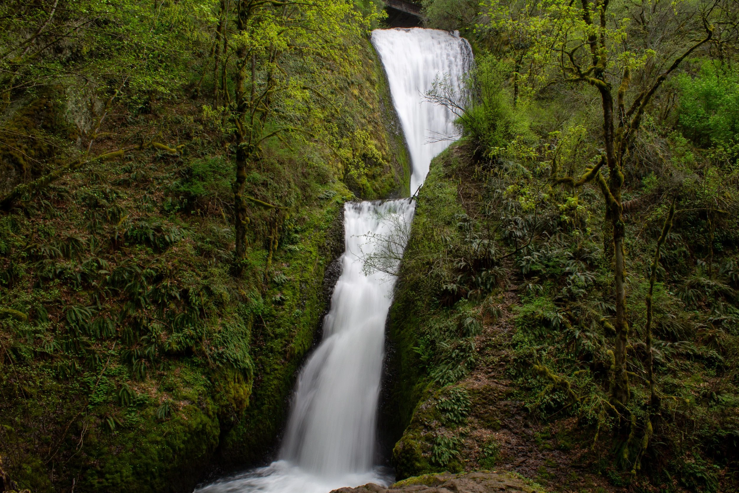
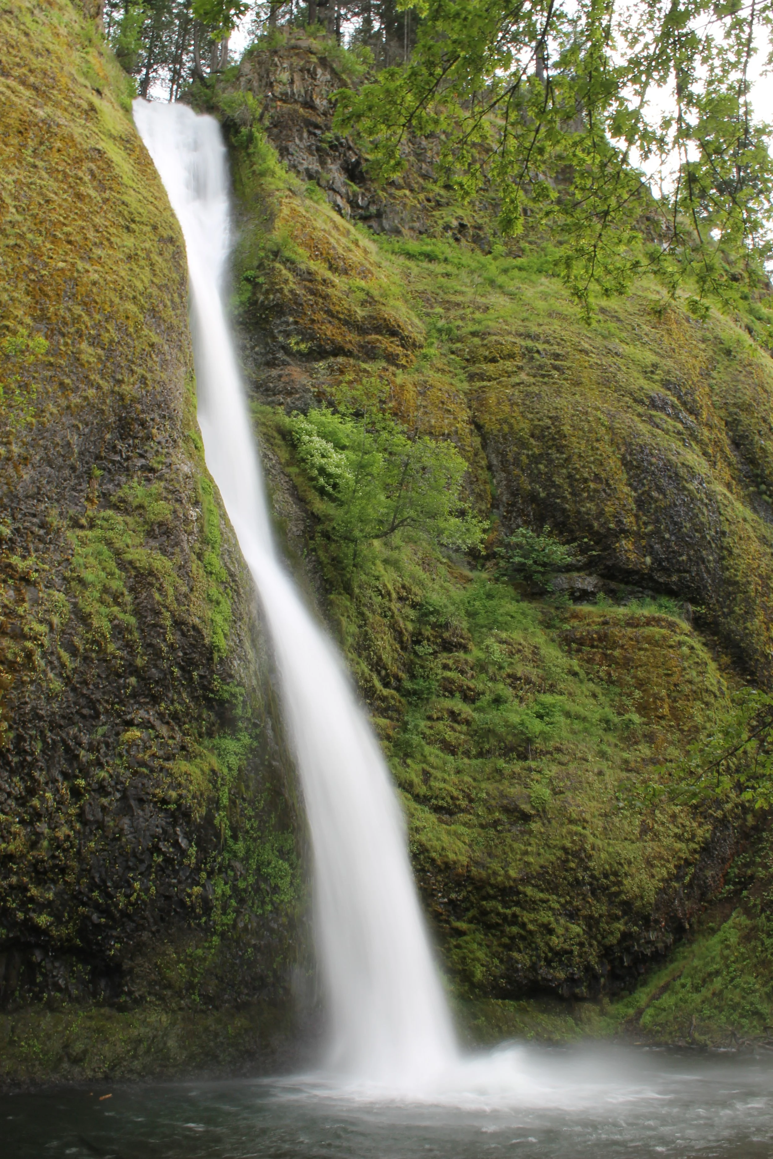
4. Wahkeena Falls to Fairy Falls

Wahkeena Falls
Number of waterfalls: 2
Distance: 2 miles out and back
Elevation gain: 800 feet
Difficulty: Moderate
Dog friendly: Yes, leashed dogs are welcome on the trail.
Pass required: None
ADA access: Not on the hiking trail. There is a paved ramp to the viewpoint at the base of Wahkeena Falls.
Restrooms: Restrooms are open seasonally near the picnic area. In winter, head to the Multnomah Falls Lodge.
Driving distance from Portland: 35 minutes
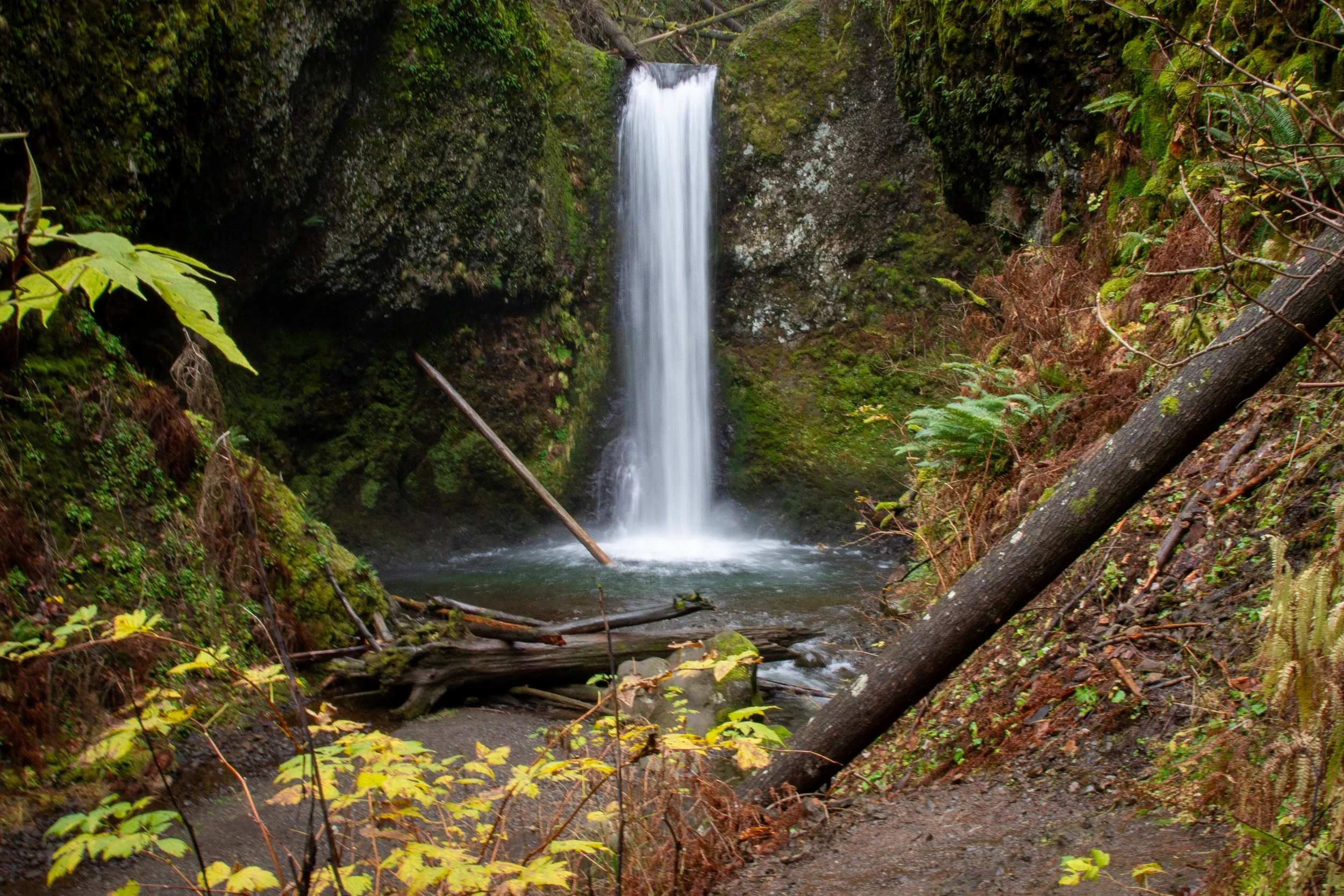
Fairy Falls
The trail from Wahkeena Falls to Fairy Falls connects two very different, but equally wonderful waterfalls. Wahkeena Falls is 242 feet tall and tumbles over multiple tiers and cascades before reaching the viewpoint at its base. The full scale of the falls is hard to appreciate from any one vantage point because of the undergrowth that obscures it from view. Winter is the best time to get a sense of the height of Wahkeena Falls, although it’s hard not to miss the prettiness of the greenery.
Starting from the trailhead at the base of Wahkeena Falls, a paved trail makes a few switchbacks to reach a stone bridge across Upper Wahkeena Falls. Although not the longest hike near Multnomah Falls, this trail still feels like a workout thanks to the elevation gain. After a little less than a mile, you’ll reach Lemmons Viewpoint, an overlook honoring firefighter Keith Lemmons. Here you’ll find fantastic views of the Columbia Gorge to both the east and west. Continue about 0.3 miles from here on an unpaved trail to reach 20-foot Fairy Falls, memorable for the delicate beauty of its rivulets of water as they fall over blocks of craggy basalt.
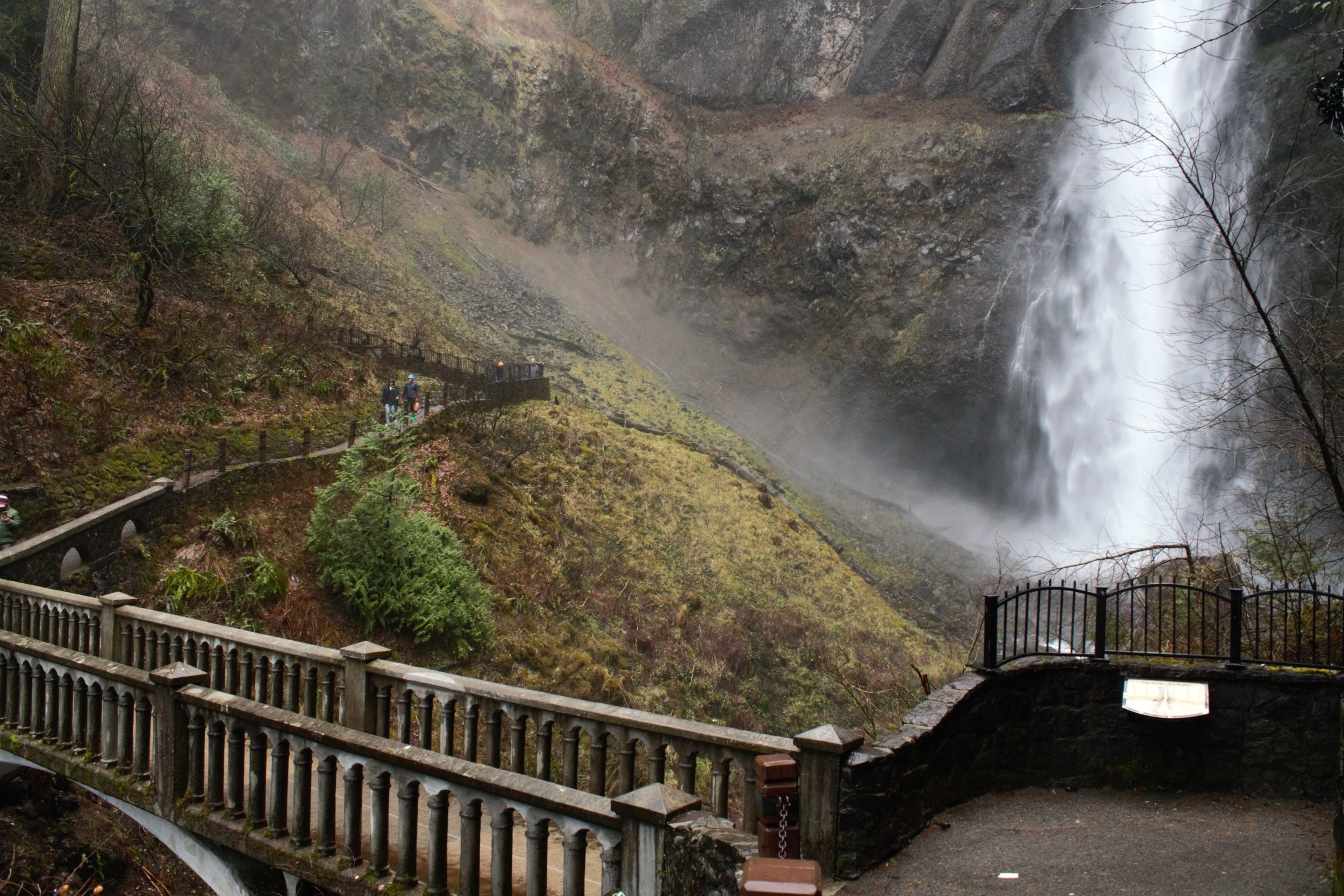
5. Multnomah Falls

Multnomah Falls
Number of waterfalls: 1 really, really tall one
Distance: 2 miles out and back
Elevation gain: 800 feet
Difficulty: Moderate
Dog friendly: Yes, leashed dogs are welcome on the trail.
Pass required: It depends. The larger parking lot requires a Multnomah Falls Timed Entry Permit from Memorial Day through Labor Day. Learn all about Multnomah Falls Timed Entry Permits here.
ADA access: The viewpoint at the base of Multnomah Falls is flat and paved. The restrooms in the lodge are on the ground floor. There are a few stairs to climb to reach the paved trail to Benson Bridge.
Restrooms: Yes, in the Multnomah Falls Lodge.
Driving distance from Portland: 30 minutes

Top of Multnomah Falls
If you’re visiting the area or it’s your first time in the Columbia Gorge, it’s worth it to hike up to the top of Multnomah Falls. Living here, I tend to dismiss this hike as being too crowded, often forgetting that seeing Multnomah Falls was one of the first things that made me fall in love with Oregon.
The hike is straightforward. Start at the viewpoint at the base of the falls, which is also the best photo opportunity. Then, head up the paved trail and cross Benson Bridge in front of Multnomah Falls. After the bridge, there will be another viewpoint followed by 11 switchbacks to the top of the falls, all of which are labeled with numbered signs. At the top, you’ll see the edge of the cliff where Multnomah Creek turns into 620-foot Multnomah Falls. On the hike up, you’ll have multiple opportunities to admire this cliff, which was formed by five different lava flows through the Gorge around 16 million years ago. Look for the rounded pillow basalt around the top of the falls with columnar basalt lower down.
This hike is often crowded, especially in recent years. Here are tips to avoid the worst of it:
Go in spring, fall, or winter rather than summer. Winter occasionally sees icy trail conditions, but the trail to the top of Multnomah Falls is usually a year-round hike.
Go on a weekday if you can.
Go early. If you arrive before 9 AM, you’ll beat most of the crowds.
Go late. During summer, long days mean there is time at the end of the day to squeeze in a hike in the evening.
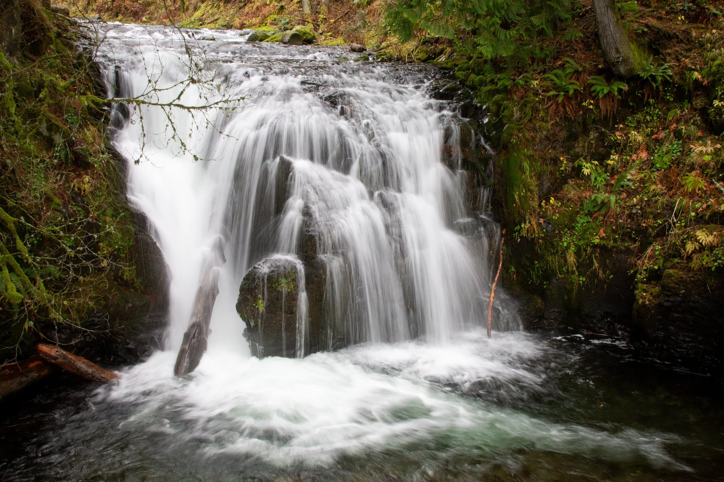
6. Wahkeena Falls - Multnomah Falls Loop
Weisendanger Falls
Number of waterfalls: 6
Distance: 5-mile loop
Elevation gain: 1600 feet
Difficulty: Moderate
Dog friendly: Yes, leashed dogs are allowed on the trail.
Pass required: It depends. The larger parking lot requires a Multnomah Falls Timed Entry Permit from Memorial Day through Labor Day. Learn all about Multnomah Falls Timed Entry Permits here.
ADA access: The viewpoints at the bases of Multnomah Falls and Wahkeena Falls are universally accessible, but not the hiking trail.
Restrooms: Yes, at the Multnomah Falls Lodge.
Driving distance from Portland: 30 minutes
Bonus waterfall behind Multnomah Falls
The Wahkeena Falls - Multnomah Falls loop is one of the best hikes in Oregon. This trail connects some of the most memorable Pacific Northwest scenery, including six waterfalls, picturesque bridges, cascading streams, and weeping basalt cliffs, all surrounded by a canopy of Doug firs and an undergrowth dense with sword ferns.
Although not extremely long in terms of distance, this hike is so full of wonders (and elevation gain) that you won’t want to hurry through it. Plan to spend at least 3-5 hours on the trail. You can start at either Multnomah Falls or Wahkeena Falls. You’ll make a loop that will bring you to the top of Multnomah Falls, Dutchman Falls, Weisendanger Falls, Ecola Falls, Fairy Falls, and the tiers of Wahkeena Falls. Between the waterfalls, the trail often follows Multnomah Creek or Wahkeena Creek, both replete with boulders and cascades.
Learn more about the Wahkeena Falls - Multnomah Falls loop hike in my detailed guide here.
7. Multnomah Falls to Larch Mountain

Mt Hood seen from Larch Mountain
Number of waterfalls: 4
Distance: 14 miles out and back
Elevation gain: 4,000 feet
Difficulty: Difficult
Seasons: Late spring - early fall
Dog friendly: Yes, leashed dogs are welcome on the trail.
Pass required: It depends. The larger parking lot requires a Multnomah Falls Timed Entry Permit from Memorial Day through Labor Day. Learn all about Multnomah Falls Timed Entry Permits here.
ADA access: No
Restrooms: Yes, at the Multnomah Falls Lodge.
Driving distance from Portland: 30 minutes

Mt Adams seen from Larch Mountain
The hike up Larch Mountain is an all-day adventure that starts with incredible waterfall scenery and ends with panoramic views of the Cascade Mountains. Make sure to get an early start and plan to spend the whole day tackling this one. The hike is just over 14 miles long and gains over 4,000 feet in elevation. While never extremely strenuous at any given point, you’ll be going steadily uphill until you reach the Sherrard Point viewpoint at the top of Larch Mountain.
The hike begins at the base of Multnomah Falls and leads to the top of the falls, which is where most people visiting here will turn around. Continue onto the Larch Mountain Trail from here and you’ll pass Dutchman Falls, Weisendanger Falls, and Ecola Falls along Multnomah Creek. The remainder of the hike will take you through a forest of pines and sword ferns. You’ll leave behind the areas of wildfire damage as you go. About 0.5 miles from the top, you’ll pass the parking lot for Sherrard Point and take the trail to the viewpoint. Here you’ll be rewarded with unobstructed views of Cascade Mountain scenery, including the peaks of Mt Hood, Mt Saint Helens, Mt Adams, Mt Rainier, and Mt Jefferson.
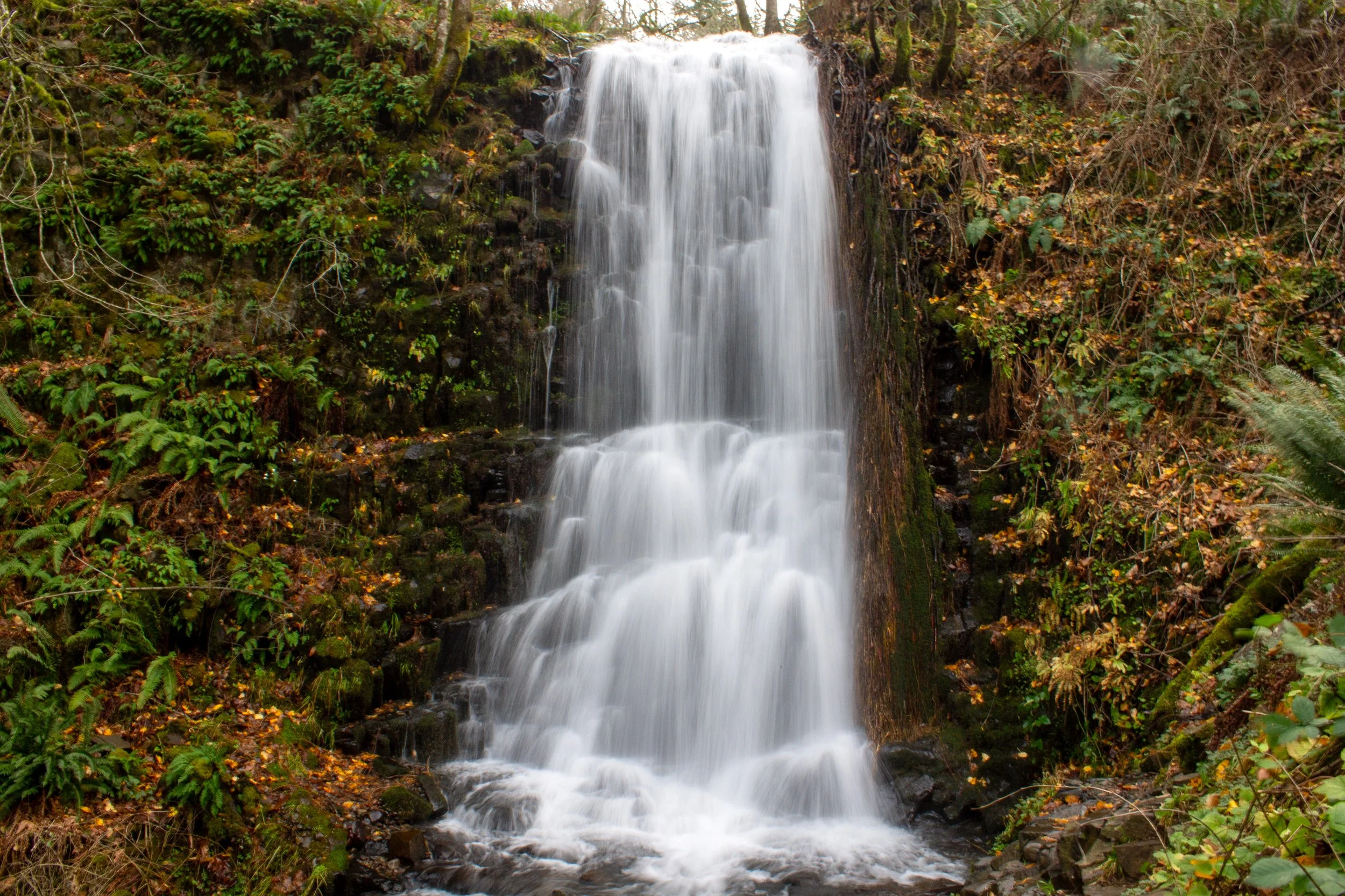
8. Ponytail Falls
Horsetail Falls
Number of waterfalls: 2
Distance: 0.8 miles out and back
Elevation gain: 300 feet
Difficulty: Easy
Dog friendly: Yes, leashed dogs are allowed on the trail.
Pass required: None, but the parking lot is small at the trailhead. Arrive early on summer weekends.
ADA access: No, not beyond the viewpoint at the base of Horsetail Falls.
Restrooms: No
Driving distance from Portland: 40 minutes

Ponytail Falls
The short hike leading to Ponytail Falls has one of the prettiest trailheads in Oregon. The trail begins at Horsetail Falls, a 176-foot waterfall that plunges down a mossy basalt cliff. A stone wall frames the pool at the base of the falls, making for a particularly appealing viewpoint. A short set of stairs leads down to the water if you want to get closer to the mist coming off the falls.
You’ll find the hiking trail just to the left of the Horsetail Falls. This trail offers the most waterfall beauty for the least walking of the waterfall hikes near Multnomah Falls. In less than a half mile, you will reach Ponytail Falls, a charming 88-foot waterfall that is essentially an upper tier of Horsetail Falls along Horsetail Creek. The hiking trail passes behind Ponytail Falls, and it’s irresistible to walk under the eroded basalt outcropping to admire the falls from all angles. You can turn around at this point or continue on the trail towards the Oneonta Gorge and Triple Falls.
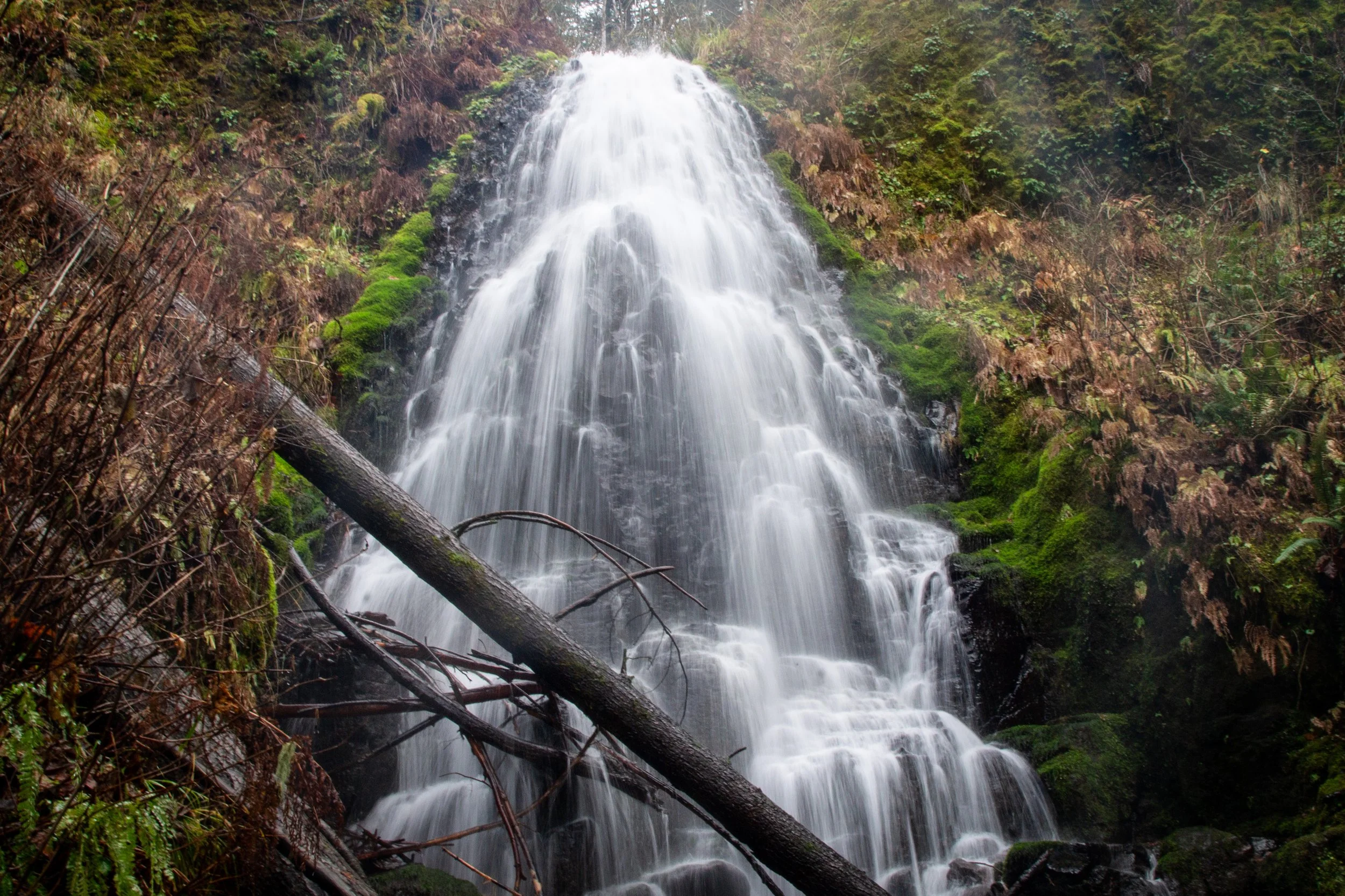
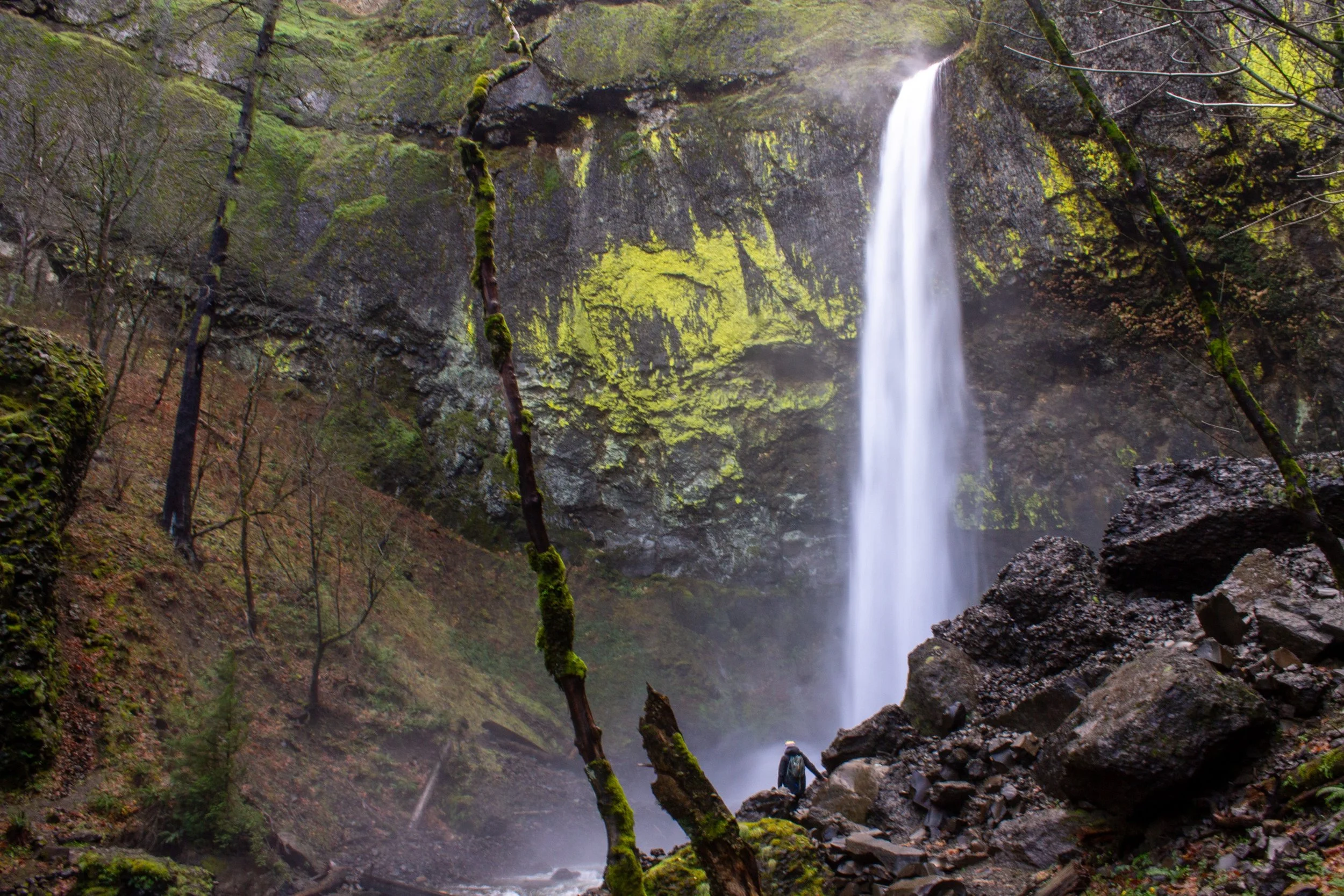
9. Triple Falls

Middle Oneonta Falls
Number of waterfalls: 4 (starting from Horsetail Falls)
Distance: 3.6 miles out and back starting from the Oneonta Gorge Trailhead or 4.2 miles out and back from Horsetail Falls
Elevation gain: 700 feet
Difficulty: Moderate
Dog friendly: Yes, leashed dogs are allowed on the trail.
Pass required: None, but parking is limited at both potential trailheads. Arrive early on summer weekends.
ADA access: No
Restrooms: No
Driving distance from Portland: 40 minutes

Triple Falls
Triple Falls is a waterfall you can recognize with a single glance. Its distinctive shape as it plunges over a lip of basalt in three separate streams makes it unique and memorable amongst the waterfalls of the Columbia Gorge. Access to Triple Falls was disrupted for years by the 2017 Eagle Creek wildfire and has been reestablished only recently. While the surrounding landscape is poignantly altered by the fire, Triple Falls looks exactly the same.
There are two possible hikes that will bring you to Triple Falls. Most directions I’ve seen start at the Oneonta Trailhead and head directly to Triple Falls, a round-trip of about 3.6 miles. Parking spaces permitting, I prefer starting at Horsetail Falls to hike to Triple Falls. It adds a little distance (around 0.5 miles), but it will take you past beautiful Horsetail Falls at the trailhead, Ponytail Falls, Middle Oneonta Falls, the Oneonta Gorge, and a viewpoint for the Columbia Gorge. Alternatively, you can see both trails by doing part of the hike as a loop, but you’ll need to walk along the Historic Columbia River Highway about 0.5 miles to return to your car.
Learn more about the trail to Triple Falls in my detailed guide here.
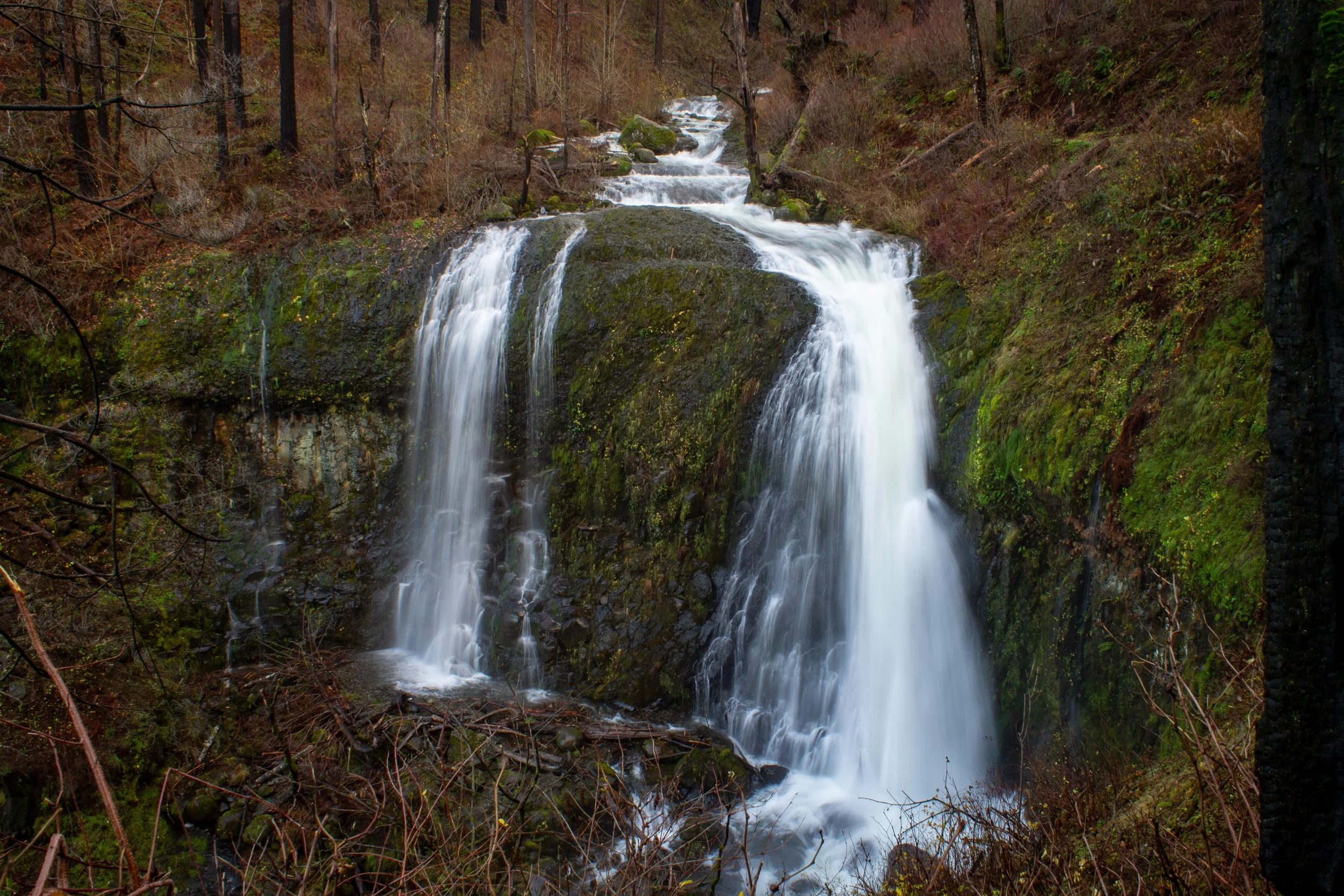
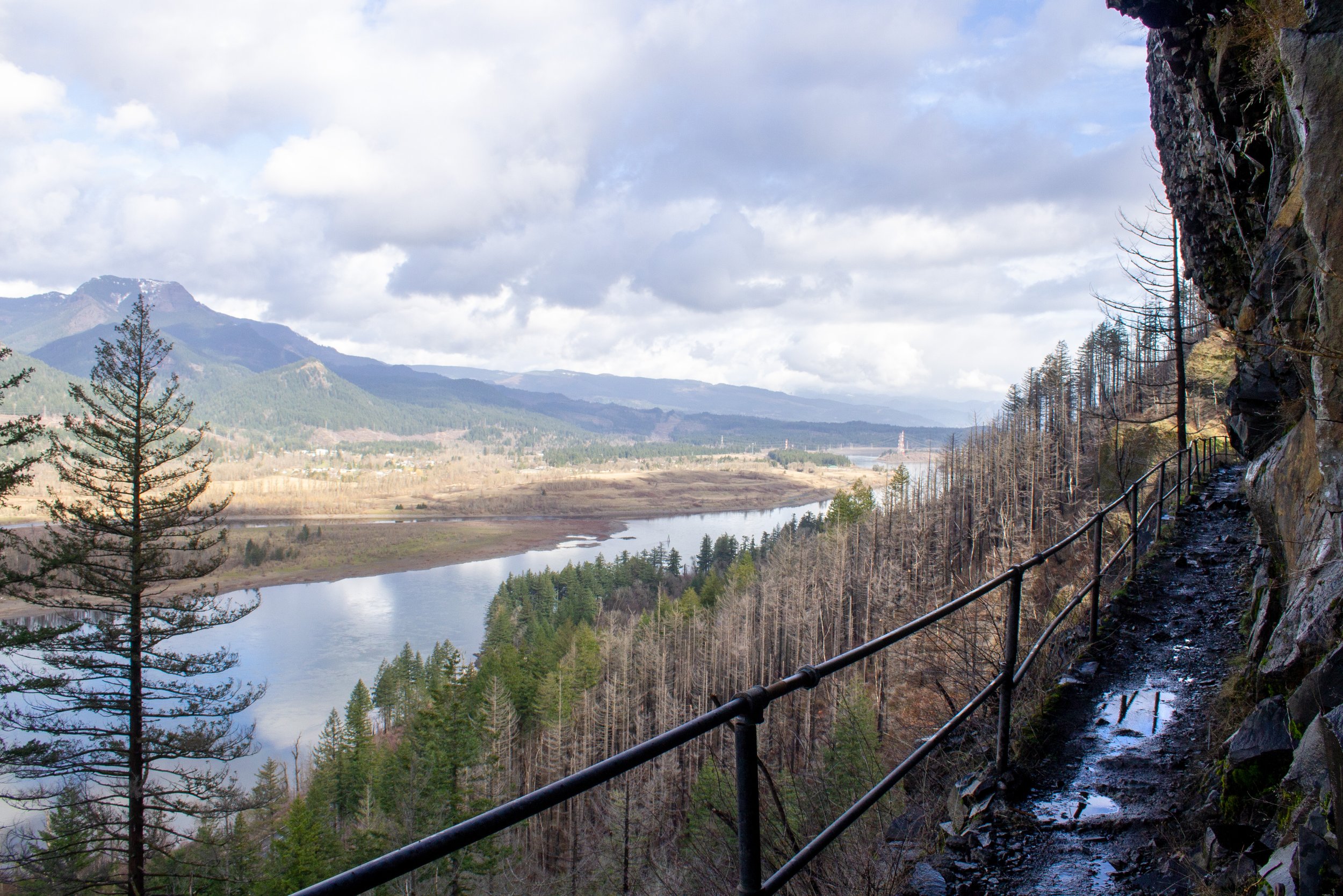
10. Elowah Falls and Upper McCord Creek Falls
Elowah Falls
Number of waterfalls: 2
Distance: 3 miles out and back, done as two short spurs
Elevation gain: 800 feet
Difficulty: Easy/moderate
Dog friendly: Yes, leashed dogs are allowed on the trail.
Pass required: None, but the parking lot is very small. Arrive early on summer weekends.
ADA access: No
Restrooms: No
Driving distance from Portland: 40 minutes
Upper McCord Creek Falls
The trail to Elowah Falls and Upper McCord Creek Falls is the waterfall hike near Multnomah Falls that tends to get overlooked despite being just as majestic as its neighbors. It begins at the John B Yeon trailhead, a few miles east of Horsetail Falls. The hike is made up of two short spur trails, one for each waterfall along McCord Creek. If you do both spurs, it’s about 3 miles round-trip. Be aware that parking at the trailhead is very limited, which I suspect is one of the reasons it gets skipped by most visitors exploring the waterfall corridor.
From the trailhead, walk until you reach an unmarked trail junction. Going left leads down the hill to the base of Elowah Falls and its lichen-covered basalt amphitheater. Going right heads uphill to Upper McCord Creek Falls. Along the way, you will see Elowah Falls from above and incredible views of the Columbia Gorge. Part of the trail on this hike is carved from a basalt cliff and lined with guardrails for safety along a precipitous drop-off. For me, this part of the trail alone would be worth the trip.
Learn more about the trail to Elowah Falls and Upper McCord Creek Falls in my detailed guide here.
Trail to Upper McCord Creek Falls
In summary, these are the best waterfall hikes near Multnomah Falls:
Latourell Falls
Bridal Veil Falls
Angel’s Rest
Wahkeena Falls to Fairy Falls
Multnomah Falls
Wahkeena Falls - Multnomah Falls Loop
Larch Mountain
Ponytail Falls
Triple Falls
Elowah Falls and Upper McCord Creek Falls
Enjoy the waterfalls!
With love,
Emma
Explore nearby


Check out the best short hikes in the Columbia Gorge.
Reference:
Miller, Marli B. Oregon Rocks! A Guide to 60 Amazing Geologic Sites. Missoula, Montana: Mountain Press Publishing Company, 2021.