

Ramona Falls Hike


It’s easy to see what makes Ramona Falls one of Mount Hood’s most popular hikes. After a short drive from Portland, a gently graded trail makes a loop through a lichen-covered forest to a waterfall that looks like something straight out of a fairytale. Towering cedars frame the cascading water as it flows over steps of broken basalt columns. It’s an elegant and understated counterpoint to the roaring drama of Mount Hood’s other famous waterfall, Tamanawas Falls. The catch? You cross the Sandy River to reach Ramona Falls, which is dangerous when the water level is high. Dry season explorers, here’s how to hike to Ramona Falls safely.

Ramona Falls
Safety note
Tons of hikers visit Ramona Falls each year, and I worry that people confuse popular with safe. Once upon a time, the Forest Service installed seasonal footbridges across the Sandy River. They stopped after storms repeatedly destroyed the bridges. Now, you either need to find a log to cross or wade through the water.

Sandy River crossing in September
In late summer and early fall, it’s not too bad. When the river is raging in spring and early summer, the game isn’t worth the candle. People have died here. Proceed with caution and be ready to bail on the hike if the river is too high. Don’t bring kids or dogs. Ramona Falls is pretty, but Mount Hood has tons of great hikes. The Burnt Lake Trail is a good alternative nearby, as is the Top Spur Trail. Or, check out my list of the 20 best waterfall hikes near Portland. Don’t die for Ramona Falls is what I’m saying.
Ramona Falls
Know before you go
Parking at the Ramona Falls Trailhead requires the NW Forest Pass ($5/day) or America the Beautiful Pass. Buy a pass before arriving. The payment machine was broken when I visited.
The parking lot for Ramona Falls is large, but it sometimes fills up on summer weekends.
The trailhead doesn’t have restrooms or other amenities.
The road to the Ramona Falls Trailhead is in bad shape with large potholes. The last quarter mile is the worst of it. Bring a vehicle with clearance if you can. Otherwise, I made it, unhappily, in my Honda Fit.
Biting flies can be a nuisance in the summer. They were gone by my mid-September hike.
Some of the trails on the Ramona Falls Loop are shared with horses. Watch your step.
People camp near Ramona Falls. I was surprised that most sites were full on the cold and foggy weekday I visited. Camping isn’t allowed within 500 feet of the falls, but you’ll pass spots along the trail that are a little farther away.
Trail to Ramona Falls
Ramona Falls Loop
Distance: 7.5-mile lollipop loop
Elevation gain: 1,000 feet
Difficulty: Moderate
Pass required: NW Forest Pass or America the Beautiful Pass
Dog friendly: No. Leashed dogs are allowed on the trail, but I wouldn’t suggest bringing your dog because of the river crossing.
ADA access: No
Season: Late summer and early fall
The details
Two trails start from the Ramona Falls parking lot. They meet up in about a quarter mile. The official trailhead is the one that starts next to the wooden sign.

Ramona Falls Trailhead
You’ll pass a memorial plaque for a hiker who died at the Sandy River crossing. It has helpful safety tips for fording rivers. Past the sign is the junction with the other trail from the parking lot. Keep right.

Keep right past the big ol’ rock
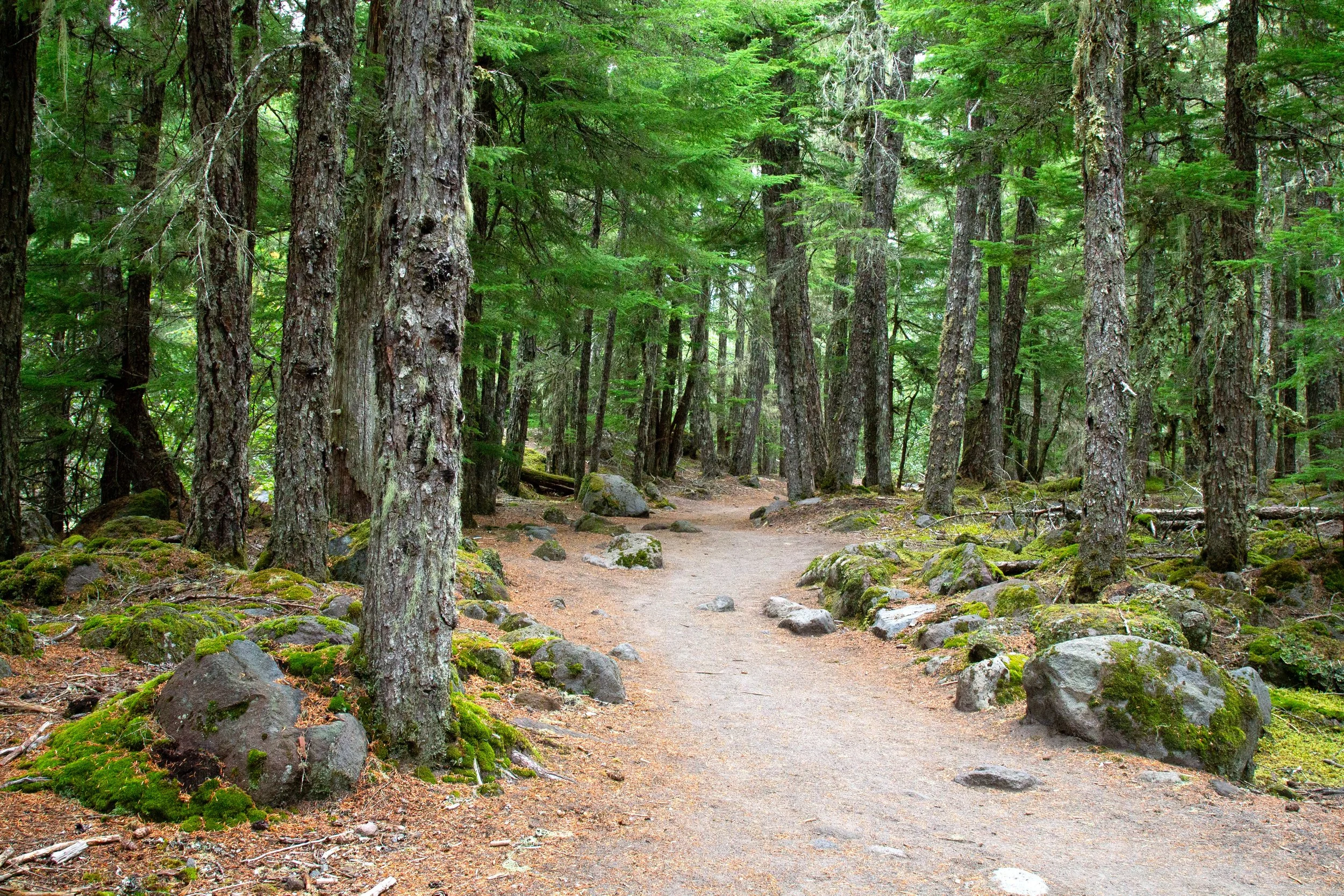
The wilderness permit station is just ahead. Fill out a free permit if they’re in the box. They’re required from May through October. The hike begins next to the Sandy River, which you can hear but not quite see from the trail. The forest is Doug fir, hemlock, cedar, and lodgepole pine. The many rhododendrons in the undergrowth are a bit of a tease since they bloom when the Sandy River is high. In early fall, red huckleberries are ripe on the bushes. Moss and kinnikinnick cover the sandy soil.
Sandy River Trail
One of the great things about the hike to Ramona Falls is the gradual grade. You’ll be walking uphill from the beginning until you arrive at the waterfall, but it feels almost flat the whole time. You’ll reach the Sandy River crossing about 1.5 miles from the trailhead. If it’s nice and low, look for a log to cross. On a clear day, Mount Hood’s summit is visible upriver.

Sandy River
The river moves the logs around every year, so there’s not an established crossing. Just look for something big and stable. I enjoy walking on logs, but I saw a couple of other hikers hesitate and wade through the river instead. That’s also an option. Just know that it’s fast and cold.

Good crossing log
Once you’re on the other side, you’ve finished that hardest part of the hike. The trail continues across the Sandy River flood plain and then heads back into the forest. You’ll see Mount Hood to the north on clear days.

Mount Hood
About a half mile from the river crossing, you’ll reach the start of the loop portion of the Ramona Falls hike. You can go either way. We’ll keep right at the junction to do it counterclockwise.
Ramona Falls Loop
This part of the hike follows the Pacific Crest Trail. It gains elevation gradually, rising above the river level as you go.

Sandy River Valley
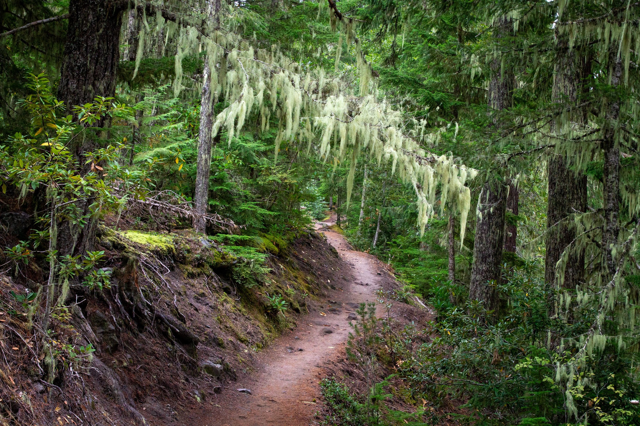
Although you’re following the river, the forest mostly screens it from view. Thick clumps of lichen droop from the trees. Douglas squirrels chitter from the branches.

Pacific Crest Trail
A few breaks in the trees allow for glimpses of the Sandy River from above. Glaciers and volcanic activity shaped its course. Mount Hood's most recent significant eruption in the 1780s sent muddy debris flows, called lahars, down the glacially-carved valley. The steep banks of pyroclastic material on either side of the river are legacies of the eruption. Glacial meltwater feeds the river, especially in spring and early summer.

Sandy River looking tiny from above
Toward the far end of the loop, the vegetation changes, becoming denser with taller trees. Lodgepole pines disappear. Salal and vine maples enter the mix.

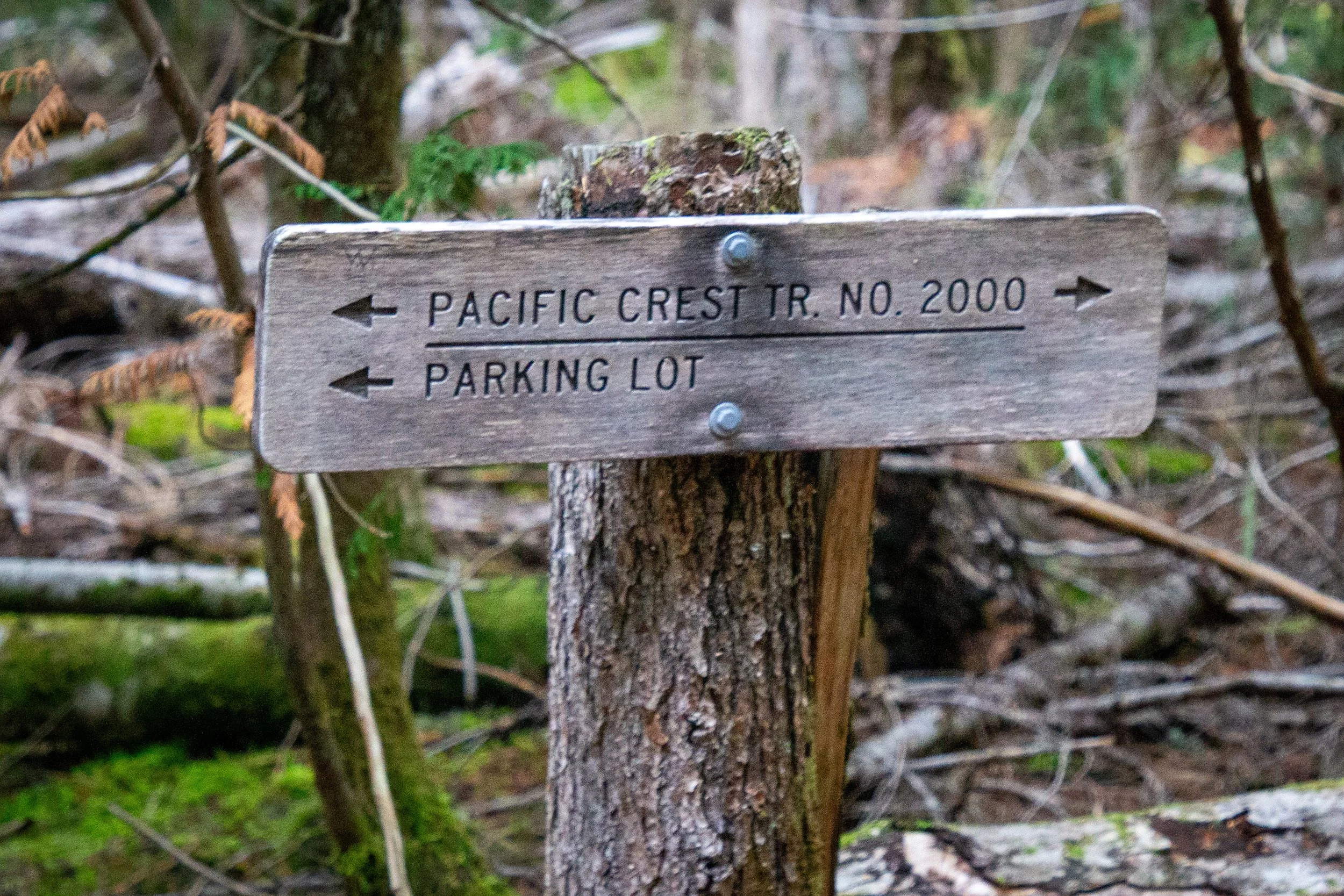
Pacific Crest Trail
After about 1.5 miles on the PCT, you’ll reach a junction. Take a left onto the Timberline Trail to head toward Ramona Falls.

Keep left for Ramona Falls
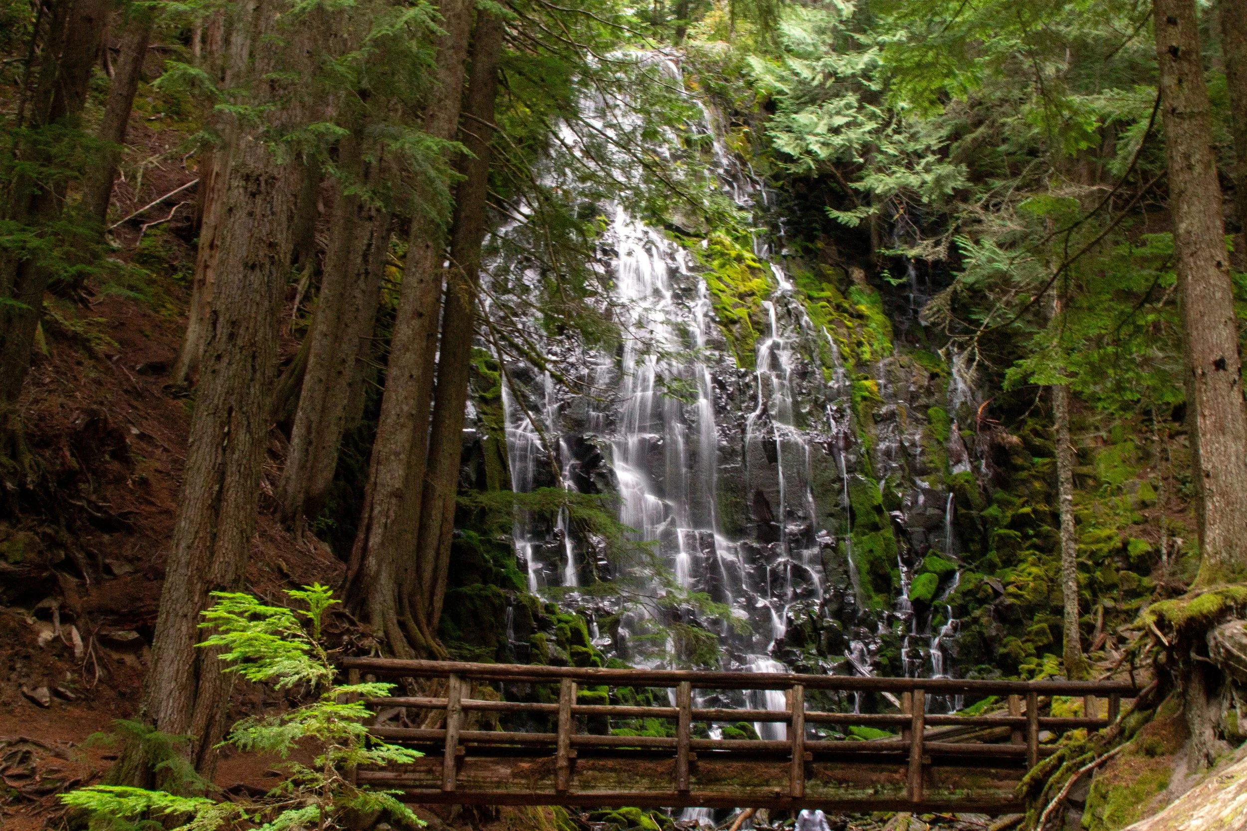
The waterfall is about a half mile past the junction. First, it’s just a hint of tumbling water behind tall cedar trunks. You’ll feel the temperature drop about ten degrees. Then, a clearing opens up to an unobstructed view of the 100-foot Ramona Falls. Next to the clearing is a cluster of rocks that make excellent benches for a snack break. Just be sure to stay behind the ropes protecting the vegetation around the waterfall.

Ramona Falls
Ramona Falls is Mount Hood’s prettiest waterfall. Starting from a narrow channel at the top, water branches into a latticework of cascading streams as it tumbles down a chunky basalt cliff. The streams fan out in the shape of a horsetail only to come together again before hitting the rocky stream below. The wooden footbridge in front of Ramona Falls is the perfect place to admire it up close.

Ramona Falls
As a side note, it was a big deal for me to make it to Ramona Falls on my bum leg. I’d been here once a long time ago. It would have been before my bike accident. The distance is farther than I’m usually able to walk, but my body’s been rising to the occasion this summer, at least sometimes. The hike involved about a thousand more stretch breaks than it used to, but seeing the waterfall again was lovely. It’s as beautiful as ever, and a bit taller than in my memories.

Ramona Falls
After taking a moment to sit by Ramona Falls, cross the footbridge over the creek to finish the loop. It’s about the same distance as the out-and-back version and will take you past some new and interesting scenery. Just after the footbridge is a fork. Keep left onto the Ramona Falls Trail.

Keep left for the Ramona Falls Trail
The Ramona Falls Trail follows Ramona Creek as it makes lazy cascades over mossy stones. If you visit on a hot day, it’s a great place to wade.

Ramona Creek
You’ll be walking parallel to a wall of andesite cliffs across Ramona Creek. The rock is blush pink with streaks of slate gray. Vine maples growing from the talus slope beneath the cliffs had the first signs of orange in mid-September.

Cliffs along the Ramona Falls Trail
The cliffs taper off slowly as you go. Once they’re gone, you’ll be near the end of the loop. You’ll also cross back over Ramona Creek.

Ramona Falls Trail
When you reach the junction with the Pacific Crest Trail, take a left back towards the parking lot.
Take a left
Follow the PCT for 0.5 miles, then take a right onto the Sandy River Trail. It’ll bring you back across the Sandy River and to the parking lot.

Take a right
Enjoy your hike to Ramona Falls!
With love,
Emma
Getting there
To reach Ramona Falls from Portland, take Highway 26 E until Zigzag, then take a left onto Lolo Pass Rd. Continue for 4.2 miles, then take a right onto Muddy Fork Rd. In 0.7 miles, make a slight right to cross the bridge and continue on Muddy Fork Rd. In 0.3 miles, keep left to stay on Muddy Fork Rd. Then, you’ll reach the trailhead in 0.2 miles.
The road is in good condition until the last half mile. It’s okay until the last quarter mile, then terrible. You can still make it in a low-clearance vehicle. It’s just tedious. The drive from Portland takes about 75 minutes.
Explore nearby

The Burnt Lake Trail is a few minutes from the Ramona Falls Trailhead.

Find the best short hikes near Mount Hood.

Check out all the best waterfall hikes near Portland.