

Black Butte Trail


Black Butte may be one of the smaller peaks in the Cascade Mountains, but it’s surrounded by giants. The trail to the top of this extinct volcano offers a rare chance to reach high-elevation vistas with a relatively short and approachable hike. After a two-mile trek up, you’ll reach a 360-degree panorama at over 6,000 feet. On a clear day, the views from Black Butte’s summit stretch from central Oregon to southern Washington, looking onto about ten mountain peaks. Here’s everything you need to know about hiking the Black Butte Trail.

Black Butte has incredible views of the Cascade Mountains
Know before you go
Parking at the Black Butte Trailhead requires the NW Forest Pass ($5/day) or America the Beautiful Pass. The payment machine at the trailhead wasn’t working when I was there, so I’d buy a pass before arriving.
The road to the trailhead is unpaved and bumpy. You can make it in any vehicle, but it’s less stressful in one with more clearance.
Snow makes the road impassable for part of the year. By my mid-April visit, only a few small patches remained.
The trailhead has a vault toilet and picnic table.
Leashed dogs are welcome on the trail up Black Butte.
The hike doesn’t have steep drop-offs. Besides all the uphill walking, it’s kid-friendly.
If you hike early in the season, the top of Black Butte might still have snow. I ran into a little in April but made it fine without snowshoes or microspikes. The trail can be hot in summer, especially higher up when you lose the shade.
I’ll talk about the 4-mile hike from the Black Butte Upper Trailhead. If you start from the lower trailhead, it’s about 10 miles.

Three Fingered Jack from the Black Butte Trail
Black Butte Trail
Distance: 4 miles out and back
Elevation gain: 1,500 feet
Difficulty: Moderate
Pass required: NW Forest Pass or America the Beautiful Pass
Dog friendly: Yes, leashed dogs are welcome on the trail.
ADA access: No
Season: April-ish through around November
The details
From the parking area, look for the big sign that marks the Black Butte Trailhead. Start heading up the hill.

Start here
The trail begins through the woods. It’s a steady climb that never really lets up until the top. A few downed trees were on the trail when I visited. They were easy to get around. Every so often, you’ll pass little signs identifying the plants on Black Butte, like ponderosa pine, quaking aspen, and whitebark pine.
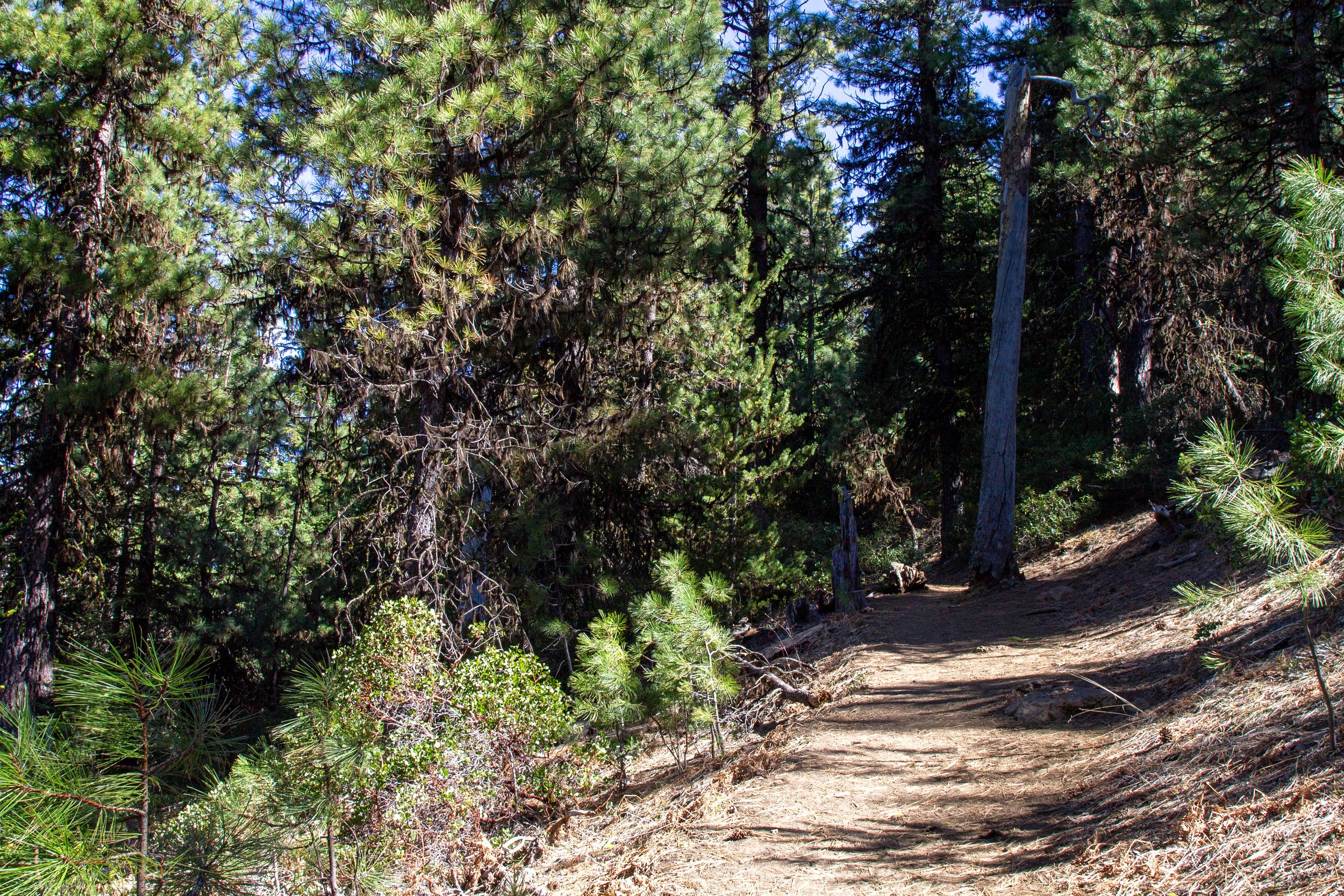
The Black Butte Trail begins through the forest
About halfway up, the trees start to thin with elevation. Through the gaps, you’ll get the first glimpse of Mount Washington. Just ahead is where the views start knocking your socks off.

Mount Washington
Once you get above the tree line, the views open up to a broad panorama of Cascade peaks. Looking south, you’ll see Broken Top and the Three Sisters. East is Mount Washington and the Belknap Crater. Behind you, Three Fingered Jack looms over the trail to the north.

Broken Top and the Three Sisters from the Black Butte Trail
At Black Butte’s higher elevations, the ponderosa pines give way to whitebark pines. These gnarled trees are among the few that can survive the extreme temperatures and high winds this high up. The Black Butte Trail is a good place to spot Clark’s nutcrackers. These birds eat whitebark pine cone seeds and help the trees propagate by spreading them.

Clark’s nutcracker
Toward the top of Black Butte, the trail makes a gentle curve to the north.

Getting close
This part of the trail is where I ran into snow. It started a little above 6,000 feet. The snow-covered part lasted less than a quarter mile and was packed down enough by mid-April to get by with hiking boots alone. On this side of Black Butte, you can see Mount Jefferson, Mount Hood, and a dinky-looking Mount Adams when the sky is clear.

Me at the snowy part
I realize I look comically underprepared in the picture, but the conditions look more rugged than they were, at least on a beautiful spring day. Don’t worry if the trail isn’t obvious in the snow. You’re heading up toward the fire lookout tower on top of Black Butte.

Head toward the fire tower (left)
Look for Mount Jefferson looming large to the north as you go. By the time I got to the fire tower, melted patches began appearing in the snow.

Mount Jefferson
The trail levels out once you reach the fire tower. Below the tower is a yurt, which is for summer park staff. The yurt and the tower aren’t open to the public. Keep walking past them to find the mountain views that make this hike unforgettable.

Fire watchtower on Black Butte
Behind the fire tower, you’ll see a broad vista of central Cascades peaks, including Broken Top, the Three Sisters, and Mount Washington. For an even wider panorama, continue about 0.2 miles past the tower. Perched on Black Butte’s summit is a fire-lookout cabin from 1922 with unbeatable mountain views. The cabin isn’t open to the public but you can read up on its history on the sign outside. Black Butte was the first fire lookout site in the Deschutes National Forest, dating back to 1910.

Cabin in front of Three Fingered Jack
To the left of the cabin is a viewpoint with a bench. It has the same great views but with the bonus of signs that identify the mountains you’re seeing. From south to north: Diamond Peak, Broken Top, the Three Sisters, Belknap Crater, Mount Washington, Three Fingered Jack, Mount Jefferson, Mount Hood, and Mount Adams.

Signs at the viewpoint help identify the peaks
Black Butte is an extinct volcano that erupted basaltic lava about 1.4 million years ago. Its shape is unusual for the Cascade Mountains, a symmetrical cone that looks like a big rock pile. The viewpoint at the summit is around 6,400 feet above sea level. Bring trail snacks. You’ll want to spend some time here.

Broken Top and North and South Sister
Once you’ve taken in the views at Black Butte’s summit, return the way you came.
Getting there
From US-20, turn onto NF-11. It’s a left turn coming from Portland or Salem. From Bend or Sisters, a right. Continue on NF-11 for 3.8 miles, then turn left onto NF-1110. A sign marks the turn. Take NF-1110 for about 5 miles. The road ends at the parking lot for Black Butte Trailhead.
The drive from Portland to Black Butte takes about 3 hours. From Bend, it’s about an hour.
Enjoy your hike up the Black Butte Trail!
With love,
Emma
Explore nearby

Visit the extraordinary Tamolitch Blue Pool.

See two spectacular waterfalls on the Proxy Falls Trail.

Spend the perfect day in Sisters, Oregon.

Check out the best short hikes near Bend.