

Fort Rock, Oregon


Rising from a broad expanse of flatlands, Fort Rock is a giant. This volcanic cone was once an island in a vast lake of glacial meltwater. Today, it’s an obscure and peaceful park where you’ll see a lot more lizards and birds than other people. A short and easy hiking trail makes a loop around Fort Rock’s interior, bringing you up close to its craggy cliffs that form the shape of a crescent moon. If you’re looking for an off-the-radar hike near Bend, it’s a great choice. Fort Rock has a lot of the same wow factor as Smith Rock with a fraction of the visitors. Here’s everything you need to know about visiting Fort Rock State Natural Area.
Fort Rock
Know before you go
It’s free to visit Fort Rock State Natural Area. You don’t need a pass to park.
Restrooms and picnic tables are next to the parking lot.
Leashed dogs are welcome at Fort Rock.
Raptors nest in Fort Rock’s cliffs. A couple of small areas close from February through August to protect the birds. You can still do the hike. Just stay behind the signs that mark the closed areas.
Fort Rock has no shade. Wear sunscreen and bring lots of water. Spring and fall are the best times to visit when the temperatures are less extreme.
Fort Rock State Natural Area is open from 6 AM to 7 PM. You can stay later if you have a stargazing permit. It’s free through Oregon State Parks. You can stay up to 2 hours after the park closes with a permit on your dashboard.
About Fort Rock

Volcanic activity formed Fort Rock
Fort Rock is the remains of an extinct volcano. When it erupted around 50,000 to 100,000 years ago, the land looked very different from what it does today. Rather than arid grasslands, the volcano erupted in a lakebed, where molten glassy lava and ash mixed with mud and groundwater. The volcanic debris hardened into a ring of rock called tuff. The original ring was higher and formed an island in a prehistoric lake. Glacial meltwater filled Fort Rock Lake until about 10,000 years ago. At its peak, it would have been about 30 miles across and up to 250 feet deep. The water carried away loose volcanic debris and collapsed part of Fort Rock’s wall, leaving behind the incomplete circle seen today. It’s about 0.75 miles in diameter with walls up to around 300 feet high.

Fort Rock
People have been visiting Fort Rock for a long, long time. The first humans to arrive probably found lush wetlands full of wildlife rather than a desert. It’s hard to believe looking at the dry landscape today, but waves lapped against Fort Rock thousands of years ago. Archeologists found dozens of pairs of 10,000-year-old sagebrush sandals here, the world’s oldest known footwear. Sizes range from child to adult. They also found stone tools up to 15,000 years old. These artifacts suggest that Fort Rock is one of the earliest places humans inhabited in North America.
Fort Rock Hike
Distance: 1-mile loop
Elevation gain: 100 feet
Difficulty: Easy
Pass required: None
Dog friendly: Yes, leashed dogs are welcome on the trail.
ADA access: The trail is narrow and uneven. The picnic area next to Fort Rock is flat with wide paths. Accessible parking and restrooms. You’ll still get a good look at Fort Rock without hiking.
Season: All year. Best in spring and fall.
The details
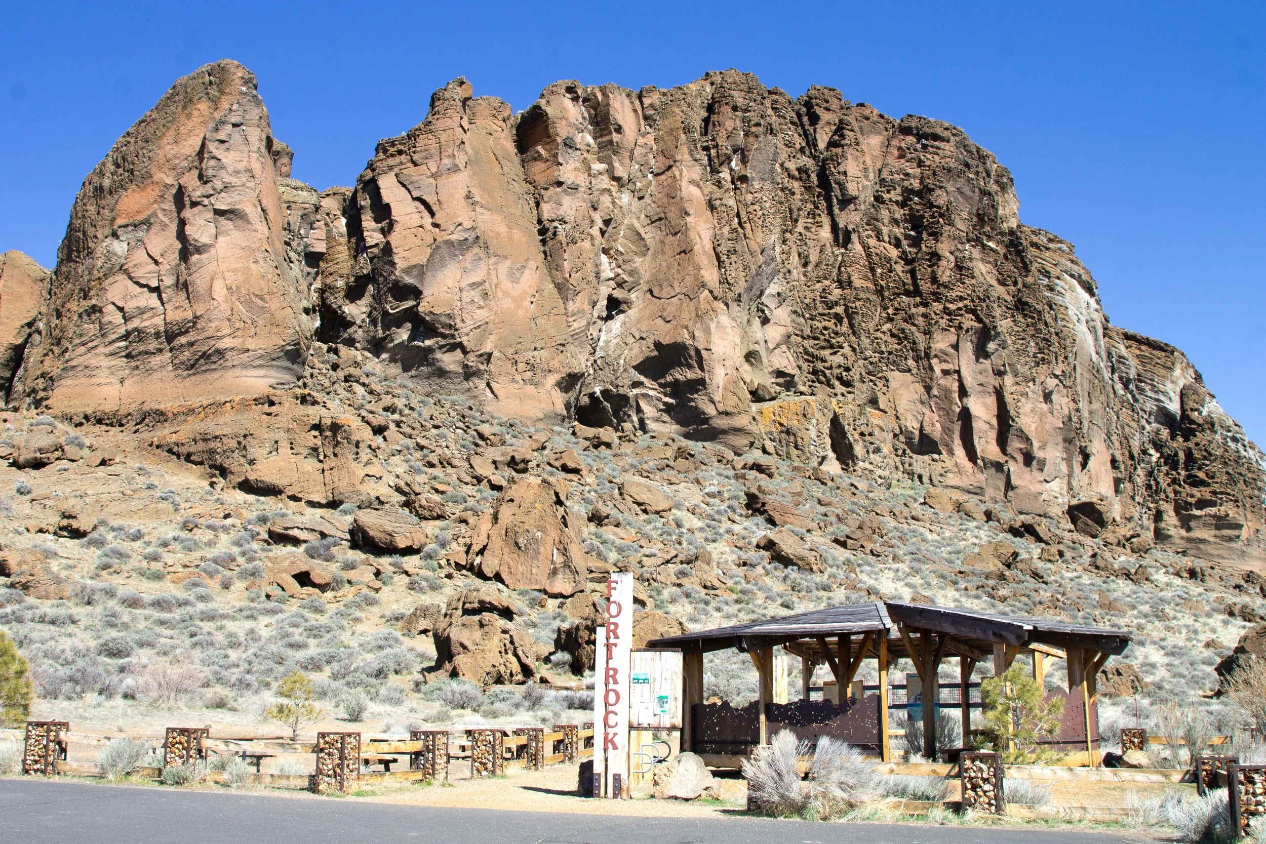
Since the landscape is so flat and open, you can see the end of the Fort Rock Trail from its beginning. The hike is not so much about surprises as admiring the towering rock walls up close. You’ll start at the big sign that says Fort Rock and walk past the picnic area. Shaded pavilions have information about Fort Rock’s formation and ecology.
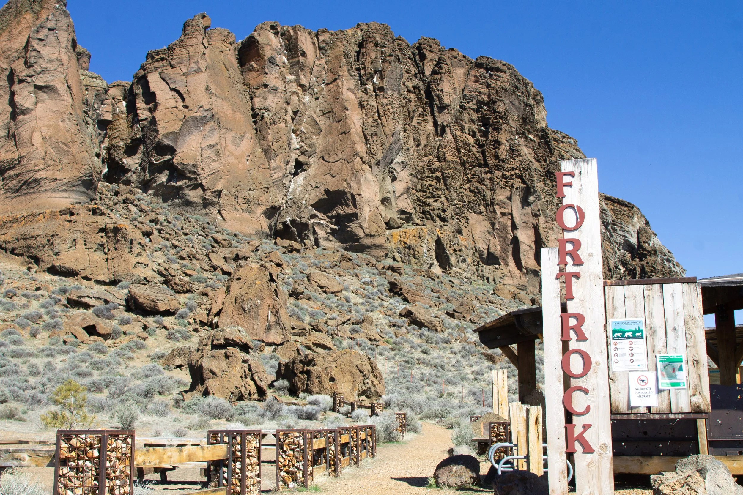
Start here
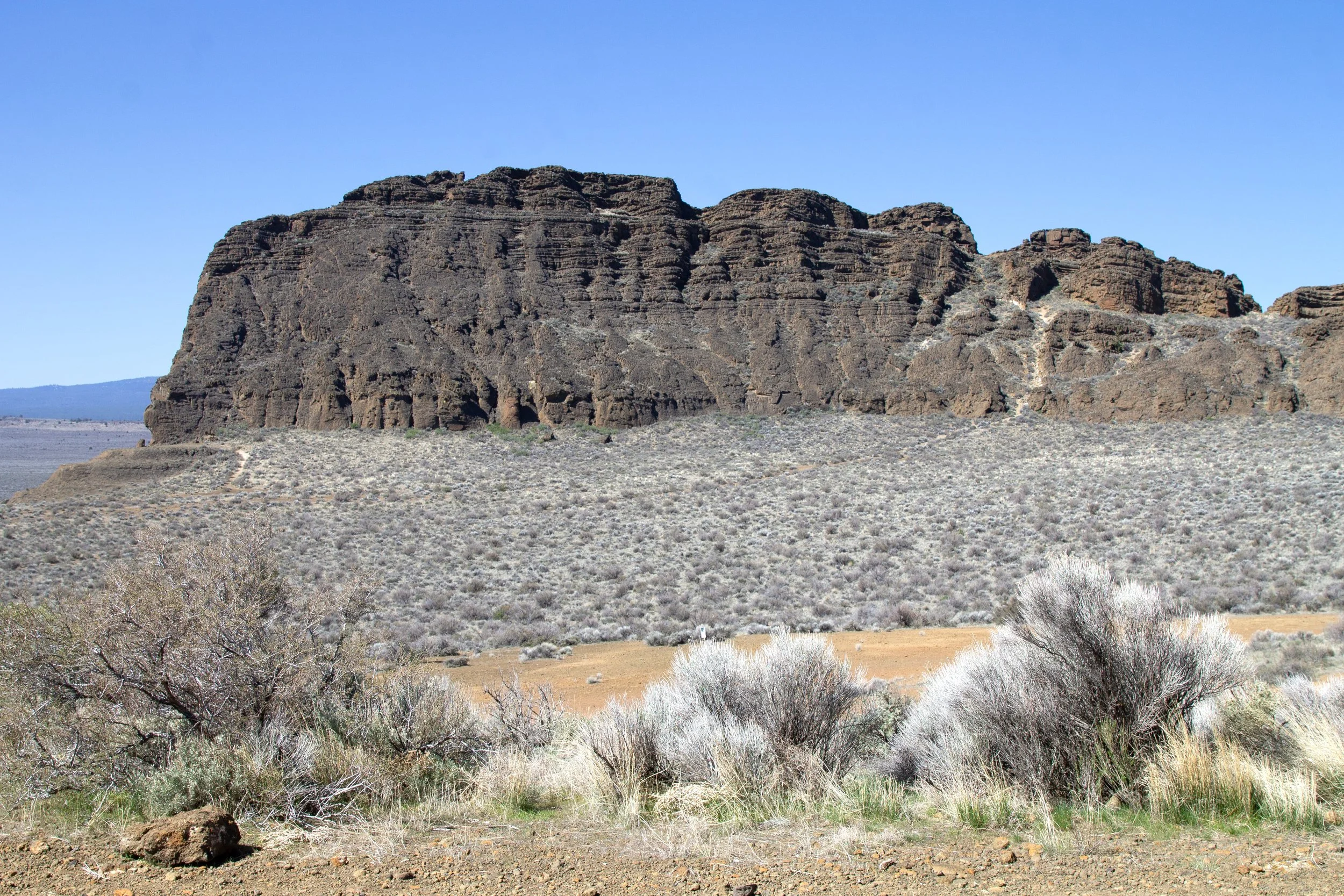
Once you start the Fort Rock Trail, you’ll get a better sense of its massive scale. The pictures don’t do it justice. Rocks that looked small and insignificant from a distance become huge boulders up close. Fort Rock’s honeycombed cliffs are nesting sites for eagles and falcons. Watch for them overhead as you walk.

I admire the boulders on the Fort Rock Trail
The beginning of the trail is a short almost-hill that levels off quickly. You’ll reach a notch in the rock where waves used to strike Fort Rock before the lake dried up. Even at this small amount of elevation, you’ll be standing above miles of flatlands. Being from Portland, I’m used to a city surrounded by forests and mountains. The open space around Fort Rock is both thrilling and intimidating. It’s the feeling of freedom and vulnerability at once. The quiet is profound. In the distance, you can see the tiny town of Fort Rock. If a farmer is stirring up dust in a field miles away, you’ll know about it.

So. Much. Nothing.
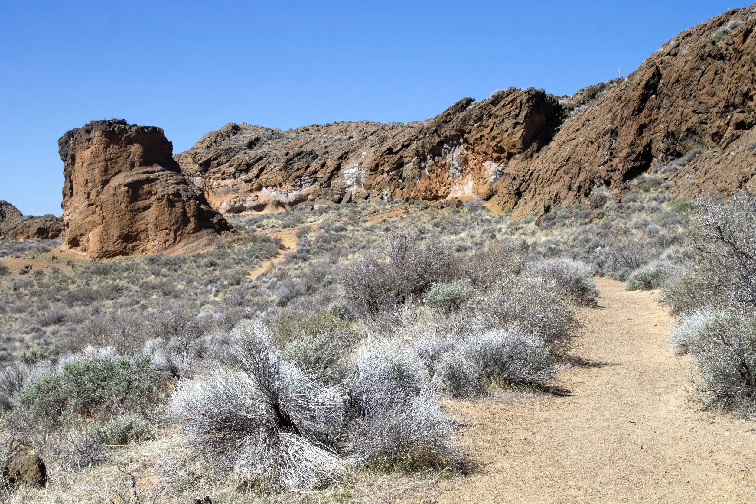
The Fort Rock Trail is straightforward. You’re making a loop around the inside of the rock circle. In late summer, blooming rabbitbrush adds yellows to the landscape. A few wildflowers start popping up in spring.
Western cliffs of Fort Rock
The tuff that makes up Fort Rock is rough and craggy. It ranges from buff-colored to rust-red to dark brown. Lichen growing on the rocks adds splashes of bright orange.
Fort Rock Trail
At first glance, Fort Rock looks barren. The longer you stay, the more life you notice. It’s a great place to see birds, especially raptors. Sparrows, shrikes, quail, and owls are also frequent visitors. Rabbits hop around the sagebrush. Lizards scurry across the trail. I watched a side-blotched lizard munch on one of the first small spring wildflowers to appear. Fence lizards are common, too.

Side-blotched lizard
Partway around the circle, you’ll pass a little scramble trail that leads to the top of the rock. If you’re curious, you can climb up and have a look over the top to the north. It’s just as flat that way. The one rock formation in the distance sticking up above the flatlands is the entrance to Fort Rock Cave, the site where the famous sagebrush sandals were found. More on that to come.

A scramble trail leads up Fort Rock’s cliffs
Continuing around the circle, you’ll soon reach the end of Fort Rock’s cliffs. The spur trail leading up to the ledge at the base is closed during nesting season. Keep your distance from the cliffs if you see the closure sign.

The trail continues along the western cliffs
Once you’re past the cliffs, you can follow the trail to the right to have a look at Fort Rock’s outside wall. Around the corner, you reach a barbed wire fence, which is a good turnaround point.

Almost done
To finish the loop, take the trail across the sagebrush field back to your starting point.

Trail heads back to eastern side of Fort Rock
Fort Rock Cave Tours
Unlike Fort Rock, you need to make a reservation for a guided tour to see Fort Rock Cave. In theory, it’s easy. You go to the Oregon State Park website and book a tour. In practice, it’s tricky to get a reservation. Only a handful of tours happen during the spring and summer. I looked twice and didn’t see any openings. I’m looking a third time now and seeing one single opening on one tour. I’m guessing slots open on a rolling basis but I haven’t been able to find the specifics.
Anyway, if you have more luck than me in getting a reservation, here’s what to expect:
Tours of Fort Rock Cave last about 2 hours and cost $20.
You’ll meet at the Fort Rock State Natural Area parking lot. From here, a van shuttle will bring you to Fort Rock Cave, about a half-mile away.
Don’t bring your dog. They aren’t allowed on the tours and it’s too hot to leave them in the car.
Tours have a five-person minimum. It may get canceled if enough people don’t sign up. You’ll get a refund if it is.
You’ll walk about 0.75 miles on the tour. The terrain is uneven.
If you do manage to go on a tour of Fort Rock Cave, it sounds fascinating. The cave is the site of Fort Rock’s most important archeological discoveries, including the collection of ancient sandals.

Standing at the top of Fort Rock, you can see the Fort Rock Cave entrance. It’s the only blip in the flatness.
Getting there
Fort Rock State Natural Area is in central Oregon. Take Highway 97 south from Bend until OR-31 S. Then, take a left. Follow OR-31 S for 30 miles, then turn left onto County Rd 5-10. Take County Rd 5-10 for 6.4 miles. Turn left onto Cabin Lake Rd once you reach the small town of Fort Rock. After one mile, turn left onto County Rd 5-11A. Continue for one mile. Fort Rock will be on your right.
The drive from Bend to Fort Rock takes about an hour. From Portland, it’s about 4.5 hours. The area is remote but the town of Fort Rock has a couple of restaurants and a small museum.
Enjoy your trip to Fort Rock!
With love,
Emma
Explore nearby

Find the best short hikes near Bend.

See Oregon’s most impressive volcanic caldera at Crater Lake National Park.

See more awesome tuff formations at Smith Rock State Park.