

Cleetwood Cove Trail in Crater Lake


Closure update: The Cleetwood Cove Trail is closed for improvements. It’s expected to reopen in 2029. See the NPS website for updates.
Crater Lake fills the volcanic caldera that opened up after the eruption of Mount Mazama, once one of the tallest peaks in the Cascade Mountains. Despite the drama of its creation, Crater Lake today is a tranquil escape. Pale rocky slopes and a high desert forest surround the sapphire blue water. Birds call from the branches of lodgepole pines while golden-mantled ground squirrels scurry over the roots. The road around Crater Lake National Park will take you to many viewpoints and hiking trails, but only the Cleetwood Cove Trail will bring you down to the water. Whether you’re taking a boat ride, going for a swim, or just want to see the lake up close, here’s everything you need to know about hiking the Cleetwood Cove Trail.
Cleetwood Cove Trail
Know before you go
You need an entrance pass to visit Crater Lake National Park. It’s $30, and good for 7 days. You can also use the America the Beautiful Pass ($80/year) or the park-specific Crater Lake annual pass ($55/year).
The Cleetwood Cove Trail is usually open from mid-June until late October.
Dogs can visit Crater Lake National Park but aren’t allowed on the Cleetwood Cove Trail. It’s not safe to leave them in the car. If you have a dog, try out the Rim Village Promenade, Lady of the Woods, Godfrey Glen, Annie Spur Trail, Grayback Drive, or Pacific Crest Trail.
Restrooms are at the park entrance, the Cleetwood Cove parking lot, and the lakeshore.
Bring plenty of water. There’s none at the trailhead.
Although not very long, the hike back up the hill is steep and tiring. The National Park Service describes the return trip as being similar to climbing 65 flights of stairs.
Swimming and fishing at Crater Lake
The Cleetwood Cove Trail will take you to the shore of Crater Lake
You can wade and swim in Crater Lake within 100 yards of Cleetwood Cove. Bathing suits are okay, but do not bring anything else into the lake. Goggles, snorkels, wet suits, flotation devices, and boats aren’t allowed. The water is cold. Expect the temperature to be around 57°F (14°C) in the summer.
Fishing is allowed at Cleetwood Cove as long as you use an artificial lure. You don’t need a permit to fish. Read more about fishing regulations from the National Park Service here.
On the Cleetwood Cove Trail
Quick facts
Distance: 2.2 miles out and back
Elevation gain: 600 feet
Difficulty: Moderate due to uphill walking on the return trip.
Pass required: America the Beautiful Pass, $30 for 7 days or $80/year.
Dog friendly: No, dogs are not allowed on the trail.
ADA access: No, not past the viewpoint at the top due to steep grades.
The details
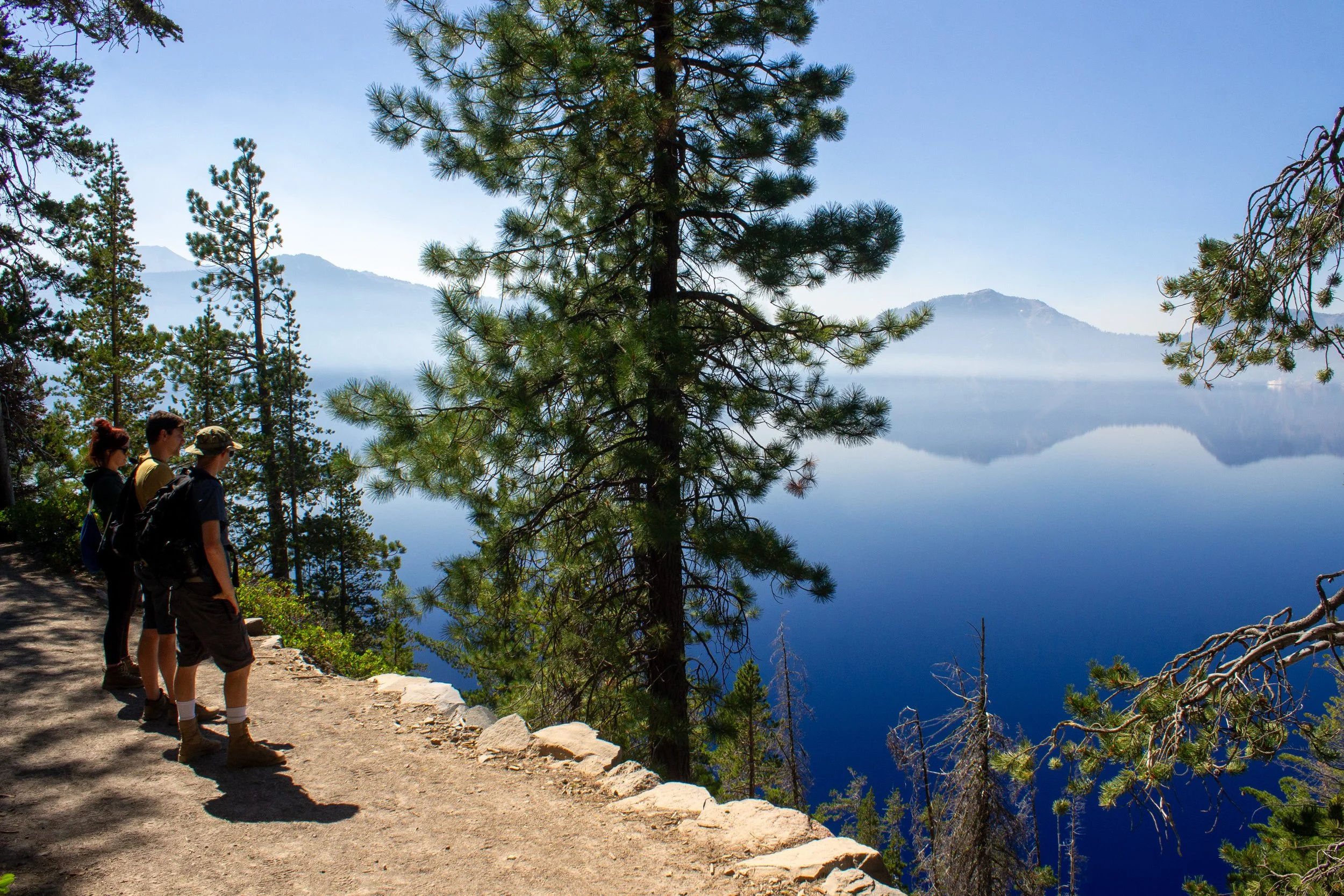
The Cleetwood Cove Trail will bring you, via switchbacks, straight from the trailhead down to the boat dock and shore of Crater Lake. The crushed pumice trail is wide and well-maintained from start to finish. Without any trail junctions and with your destination in view for most of the hike, you can’t get lost. Make sure to stay on the trail to protect vegetation and limit the erosion of the hillside.
Views of the lake and Mt Scott start at the beginning of the hike
From the parking lot, you’ll cross Rim Drive to reach the trailhead. A viewpoint with an impressive stone wall is at the beginning of the trail. Better views are just ahead. After a switchback, you’ll reach the first bench and an unobstructed view of the lake.
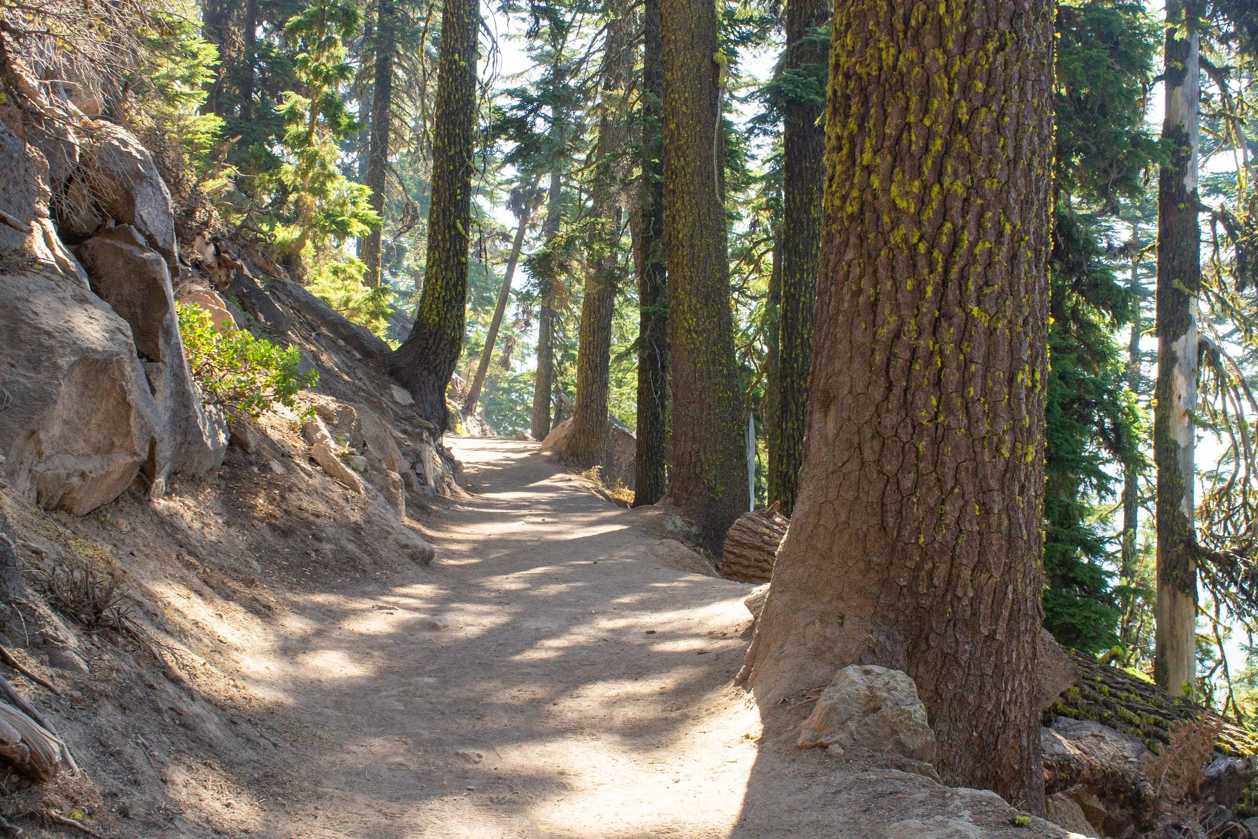
Some large trees provide shade on the trail
You’ll have some shade at the beginning of the hike. Look for tall lodgepole pines and mountain hemlocks, some of which are growing on top of boulders. With so little soil to anchor them, their exposed root systems appear to defy gravity.

Cleetwood Cove Trail
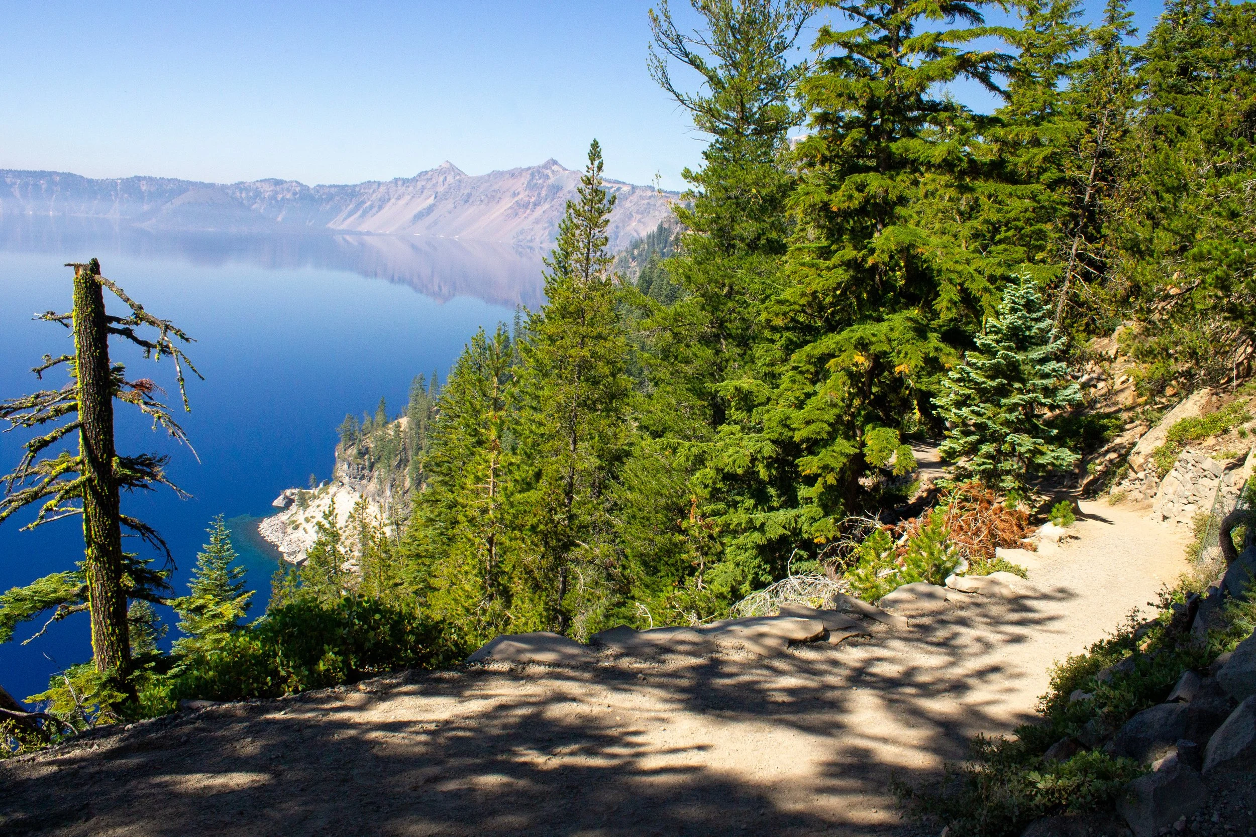
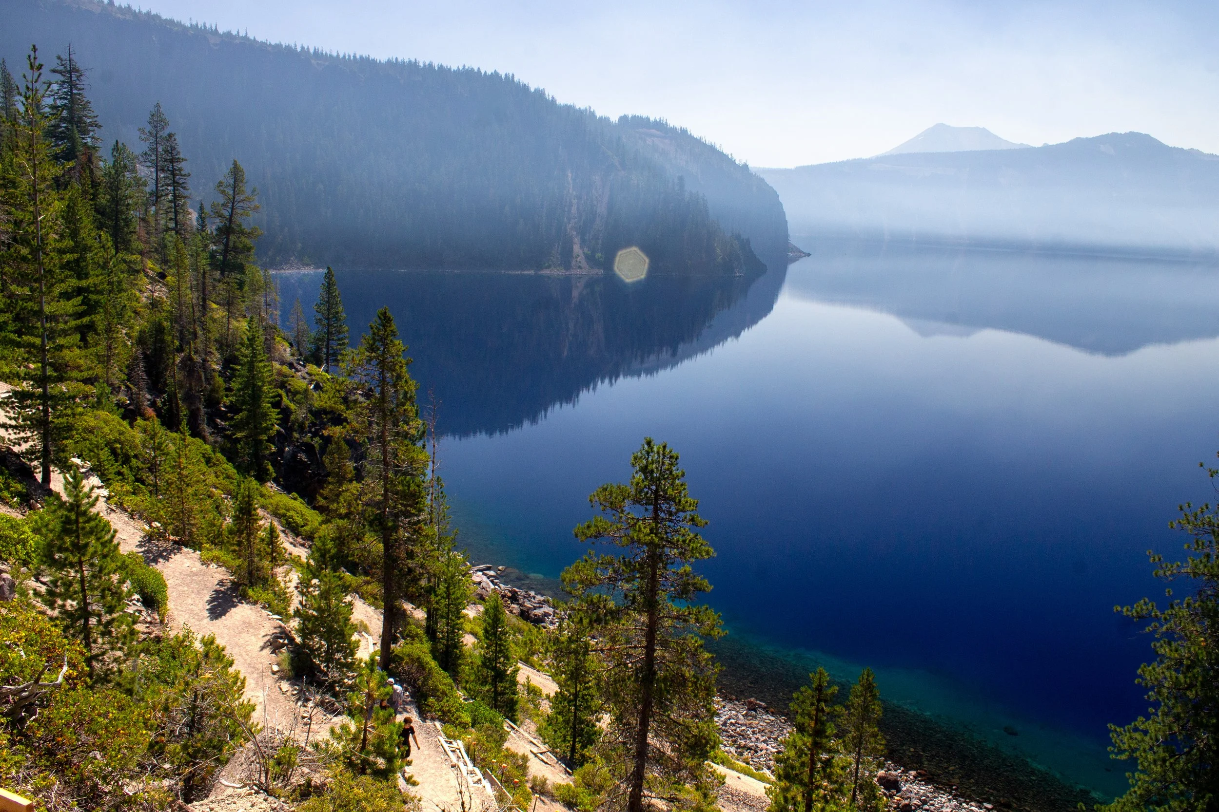
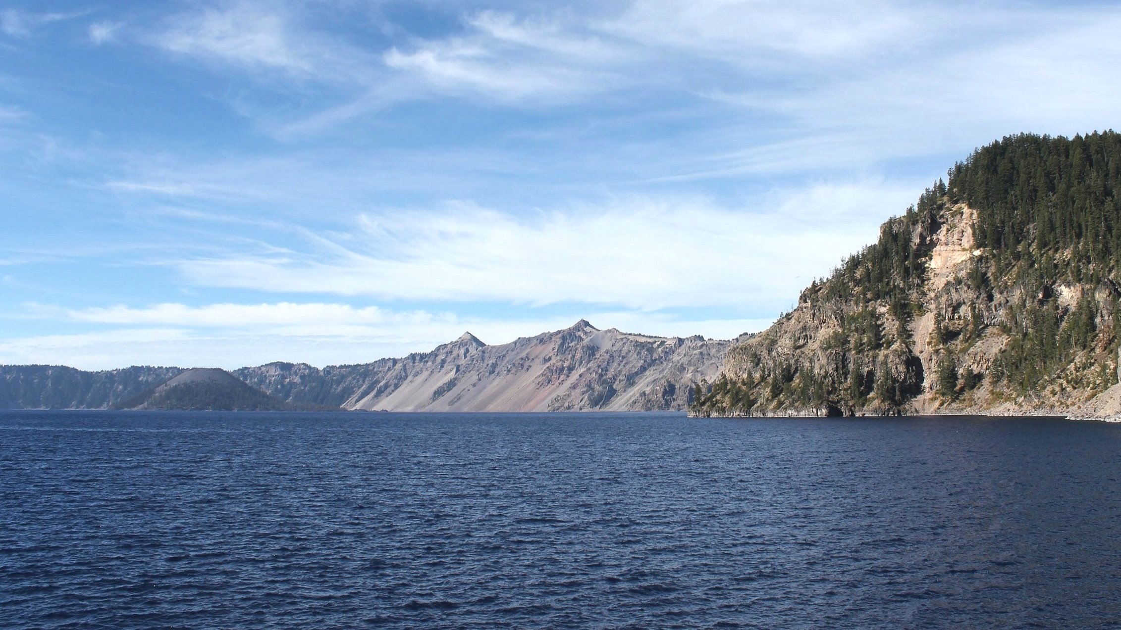
Regular breaks in the tree cover provide stunning views of Crater Lake. Circling the lake are the steep volcanic slopes of the caldera’s rim. The rocks you see are andesite, dacite, and rhyolite. Look for the dacite peak of Mt Scott across the lake. It’s the highest point in Crater Lake National Park at 8,929 feet. You’ll pass a few more benches along the trail if you’d like to take your time admiring the views.
Cleetwood Cove Trail
Toward the end of the hike, you’ll lose most of the shade as you descend a final set of switchbacks. You’ll also see your destination, the dock on the rocky shore of Crater Lake. You may see tiny-looking boats out in the water.
A boat waits near the dock at Crater Lake
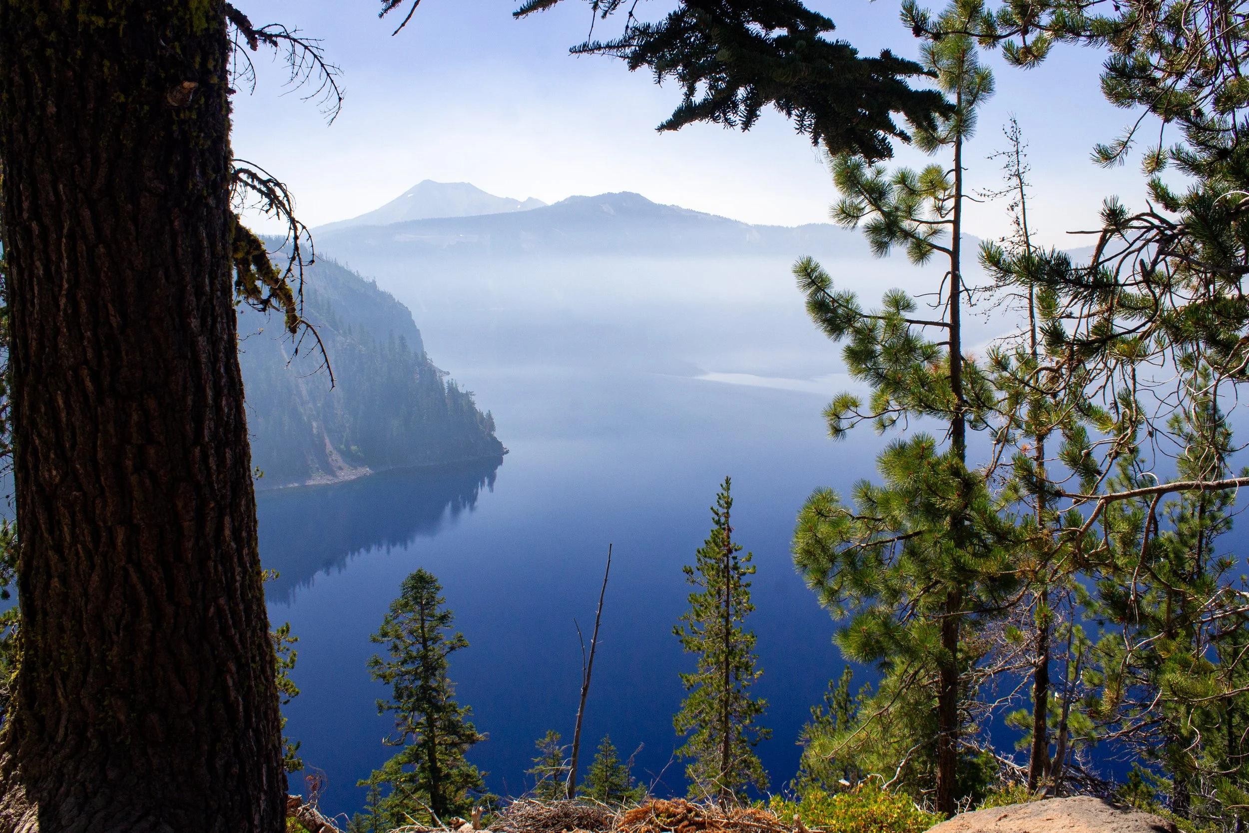
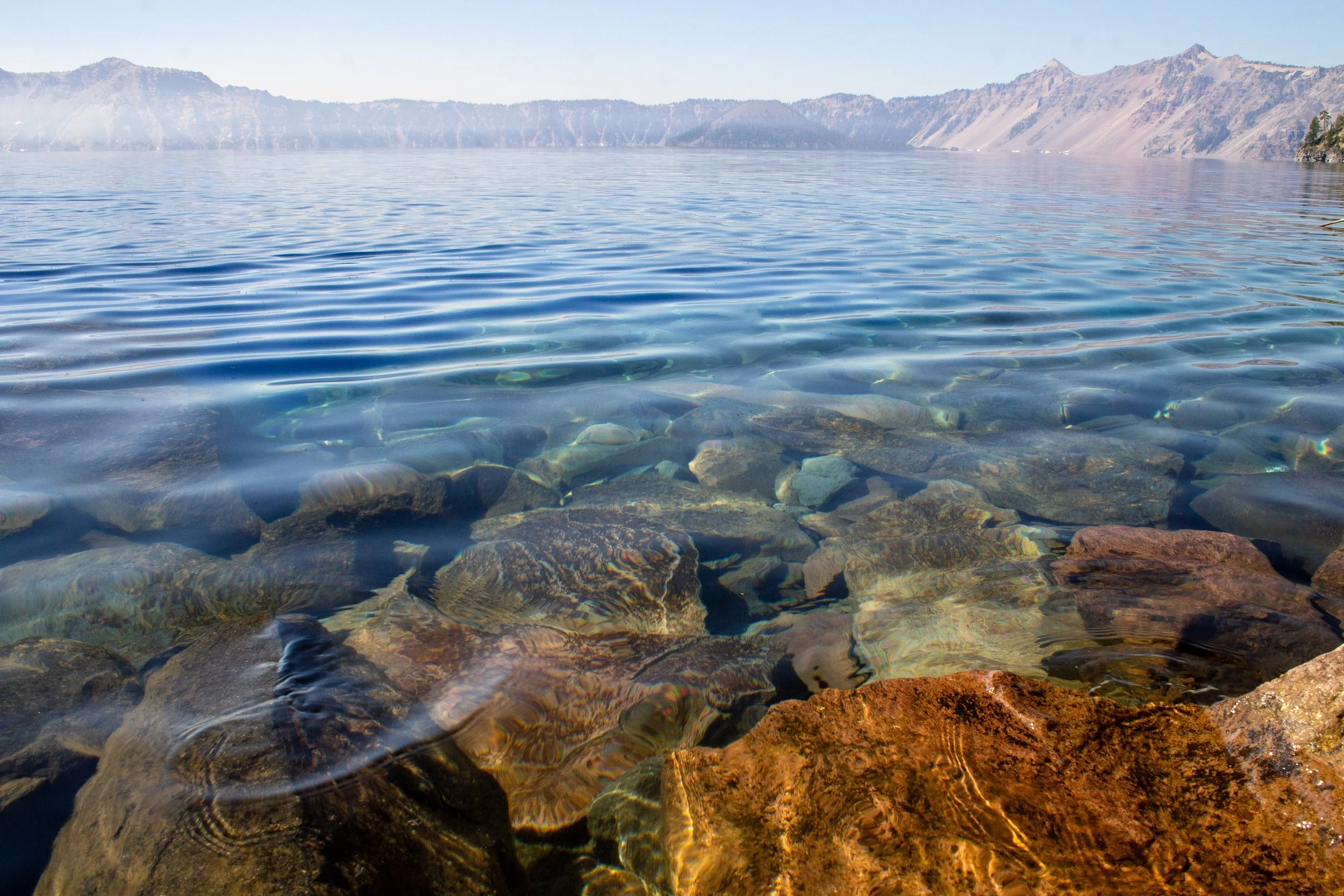
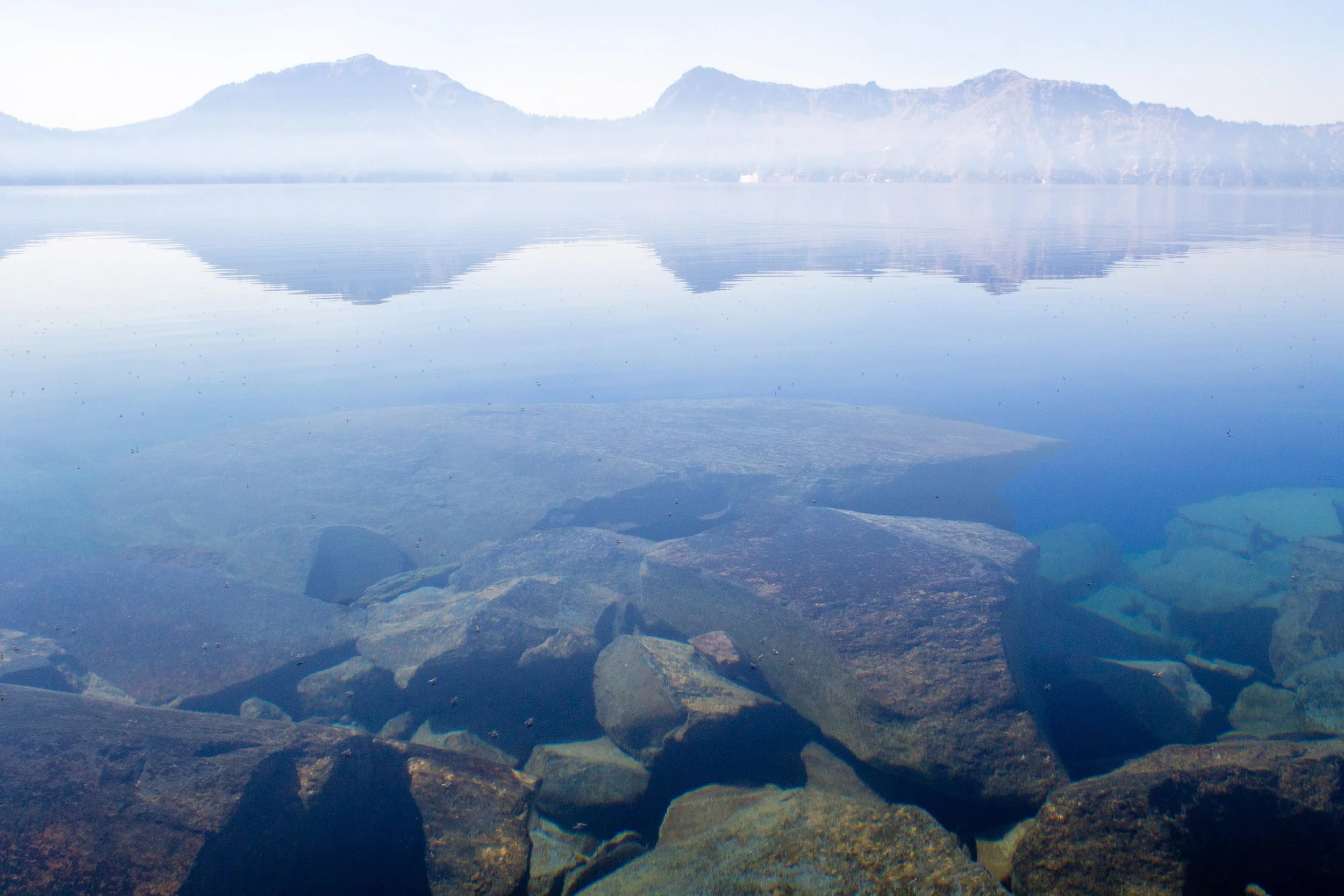
Just before you reach the shore, it’s worth taking a moment to admire the lake from above. The unusual clarity of Crater Lake allows you to glimpse the contours of the lakebed, formed by the eruption of Mount Mazama. Since only rain and snowmelt feed the lake, no rivers or streams reduce its clarity by transporting sediment to it. The Crater Lake boat dock sits on a bed of andesite.
Crater Lake
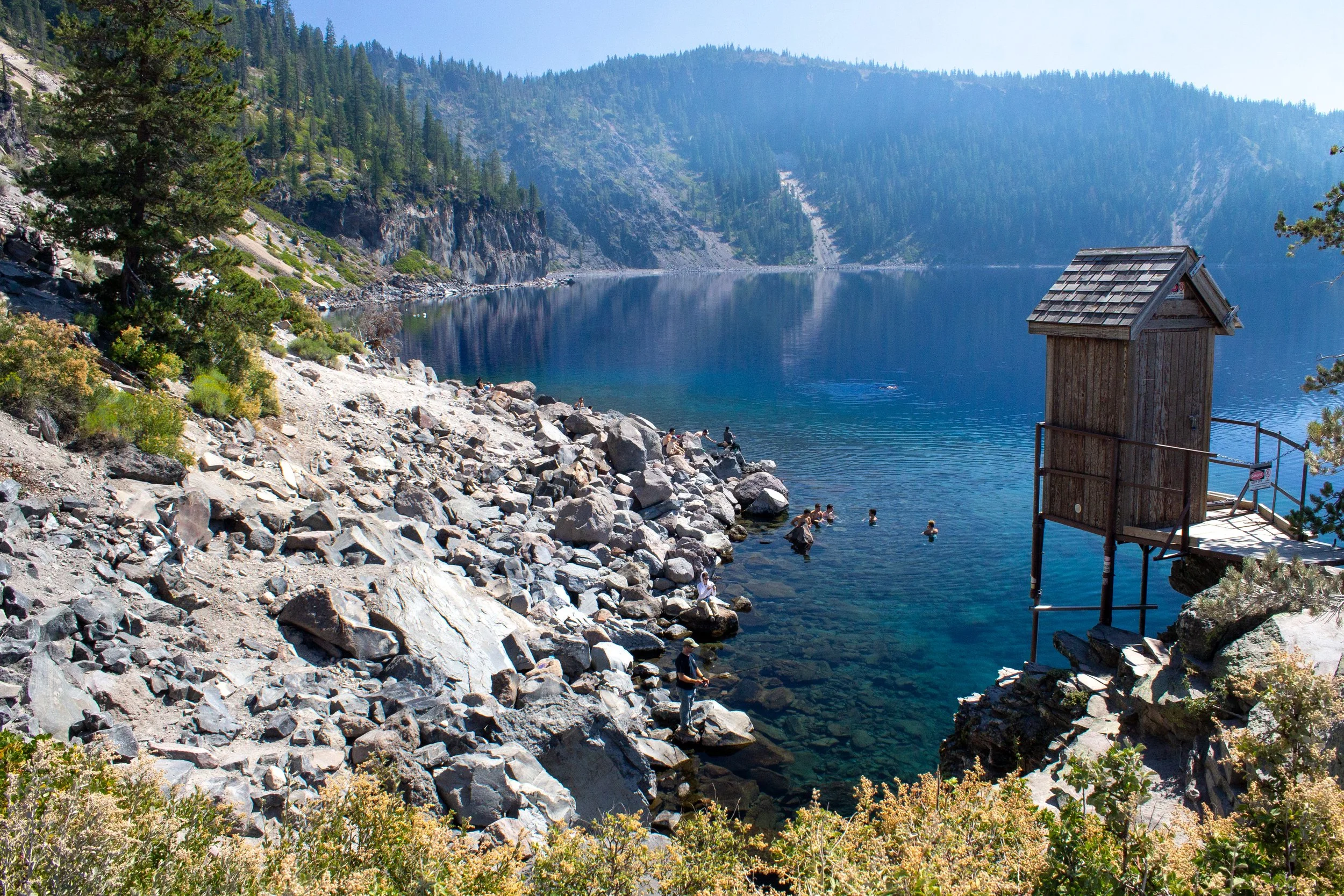
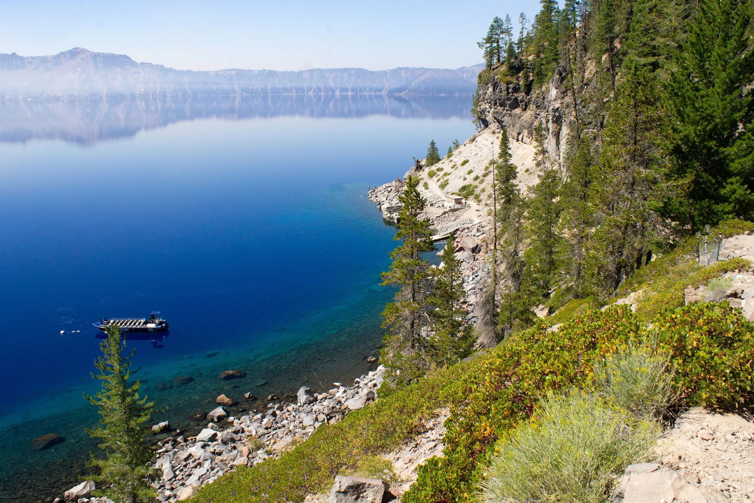
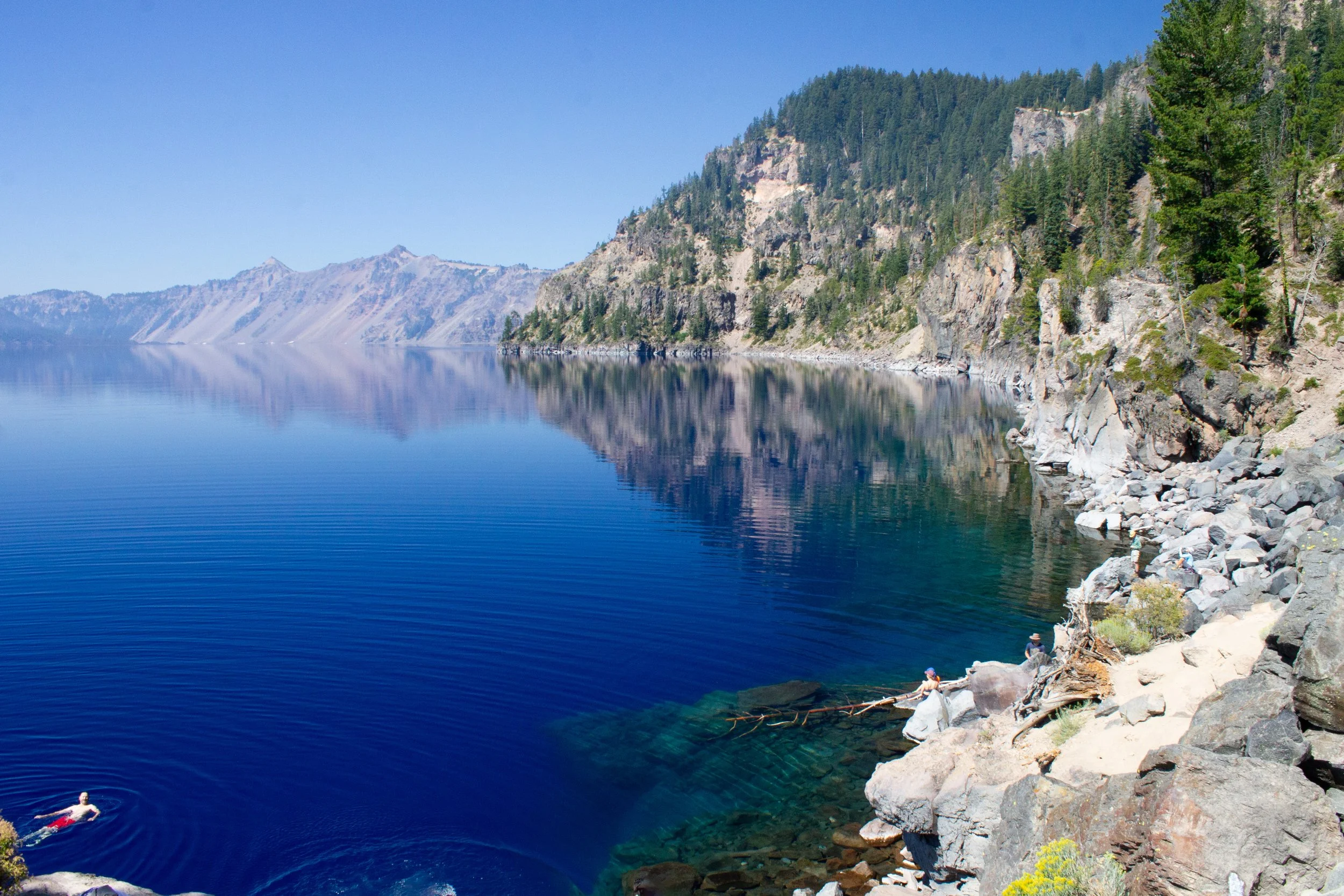
At the bottom of the trail is the boat dock. The boulder-strewn shore to the left of the dock is a popular spot for fishing and swimming. Beyond it, you’ll see the cliffs of Palisade Point. If you follow the trail just past the dock, you can reach an outcropping that leads to a surprisingly picturesque utility shed (closed to the public). This last bit of trail also leads to a restroom building where you can change if you plan on swimming. Take the set of stairs alongside it to find the doors.
Pumice Point and caldera rim to the south
The trail ends here, although you can reach the shore below the restroom building if you climb down the rocks. It’s a bit of a scramble, but you’ll find more swimmers here as well as a view of Wizard Island in the distance.
Crater Lake
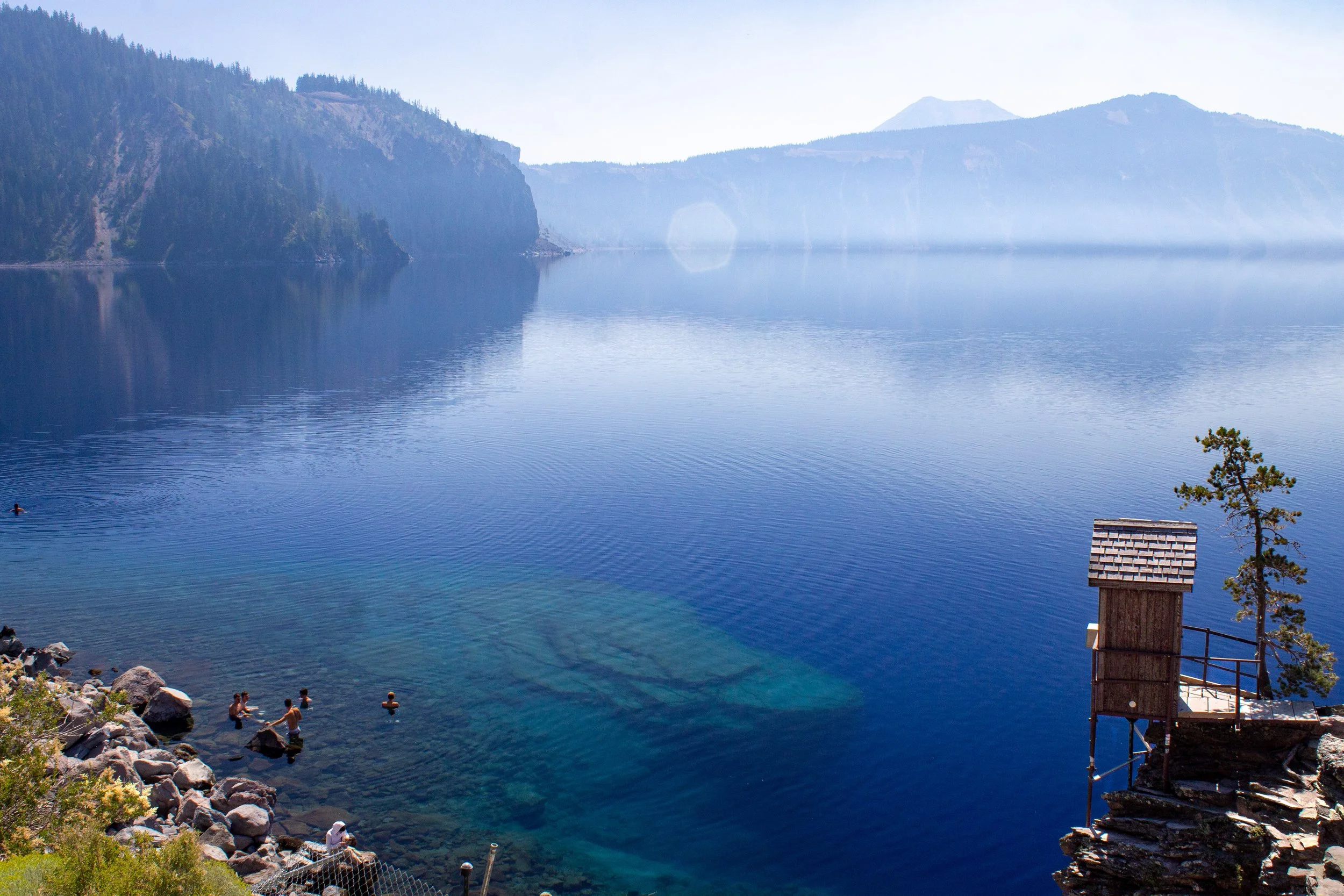
Getting close to the water reveals its glassy clarity. Piles of fallen rocks are easily visible beneath the ripples of the surface. I waded as far as my knees and found the water cold and refreshing on a hot day. Tread carefully. The rocks underwater are slippery. A passing swimmer described the water to me as numbing. If you sit long enough, there’s a good chance of spotting a fish or two. Crater Lake doesn’t have native fish, but kokanee salmon and rainbow trout populations have survived here after people stocked the lake in the late 1800s and early 1900s.
Wizard Island blending in with the slopes of the caldera
I’ll mention, although this is not a recommendation, that there’s a spot people use for cliff jumping near the restroom building. The jump is about 30 feet high. If you do it, make sure you’re in the right place to avoid the shallow water nearby. Watching where other people jump is a good way to find the deeper water if you haven’t been before. When you’re done exploring the lakeshore, begin the steep trek back up the hill to the parking lot. The benches on the trail are good places to catch your breath and enjoy the views on the way back.
Geology of Crater Lake
Crater Lake
Crater Lake was once Mount Mazama, a Cascade mountain similar to Mount Hood or Mount Jefferson. Mount Mazama’s volcanic history began around 400,000 years ago. Many eruptions and lava flows, mostly andesite and dacite, helped build its walls. Geologists estimate that it was about 10,000 - 11,000 feet high before the eruption that collapsed its peak. Like other large mountains in the Cascades, Mount Mazama would have had glaciers and valleys.
Around 7,700 years ago, Mount Mazama had a catastrophic eruption that transformed it from a mountain to a caldera. Rather than steady lava flows, the volcano released huge amounts of explosive, high-silica pumice and ash that traveled as far as 75 miles from the volcano. The eruption was so large that Mount Mazama collapsed down into its magma chamber, leaving behind a huge caldera. Over time, the caldera filled with water from rain and snowmelt, creating Crater Lake. No streams feed the lake, which means that it has very little sediment to cloud its waters. The lake’s clarity impacts its light absorption, resulting in its remarkable color. At 1,943 feet deep, it is the deepest lake in the United States.
Within the lake, the andesite peak of Wizard Island rises 500 feet above the water. Measured from its base underwater, it’s over 2,000 feet tall. This island is a cinder cone that erupted a few hundred years after Mount Mazama’s implosion. Some of the other striking features around Crater Lake are products of Mount Mazama’s earlier volcanic activity. Dacite lava flows around 420,000 years ago formed Mount Scott, and 400,000-year-old andesite spires form the Phantom Ship island. Mount Mazama still has the potential for volcanic activity, although since it released so much of its magma chamber in its major eruption, any future events would likely be on a much smaller scale.
Boat tours on Crater Lake

Wizard Island
Boat tours around Crater Lake and out to Wizard Island depart from the dock at Cleetwood Cove. The only way to reach the dock is by hiking the Cleetwood Cove Trail. Boat tours usually operate daily during the summer and cost around $40-55/person, depending on the tour. Children 3 and older are allowed on the boats. These tours will take you to places you can’t reach by car or on foot, like close-up views of the Phantom Ship and the shores of Wizard Island. If you take a boat tour to Wizard Island, you can hike to its summit, a 2.4-mile out-and-back trek. It’s a good idea to reserve tickets ahead of time since tours can fill up fast. Learn more about boat tours here.
Getting there
The roads leading to the Cleetwood Cove Trailhead are paved and in good condition. The drive is no problem with a low-clearance vehicle during the summer. Rim Drive, the 33-mile scenic byway that circles the lake, is closed much of the year due to snow. Check conditions and closure status before heading out.
The Cleetwood Cove Trail is on the north end of Crater Lake. If you enter the park on North Entrance Road (coming from Portland, Salem, Eugene, or Bend), take a left when you reach the junction with Rim Drive and continue for about 4.5 miles. The parking lot will be on your left. The lot is large and has plenty of room. Cross the road from the parking lot to reach the trailhead. The drive from Portland takes about 4-4.5 hours. From Bend, it’ll be about 2 hours.
Coming from the south entrance (Annie Spring Entrance Station), you will be on the opposite side of the lake from Cleetwood Cove. Head either way on Rim Drive, although turning left will get you there a little faster.
Enjoy your trip to Crater Lake National Park!
With love,
Emma
Explore nearby
Find more hiking suggestions at Crater Lake National Park.

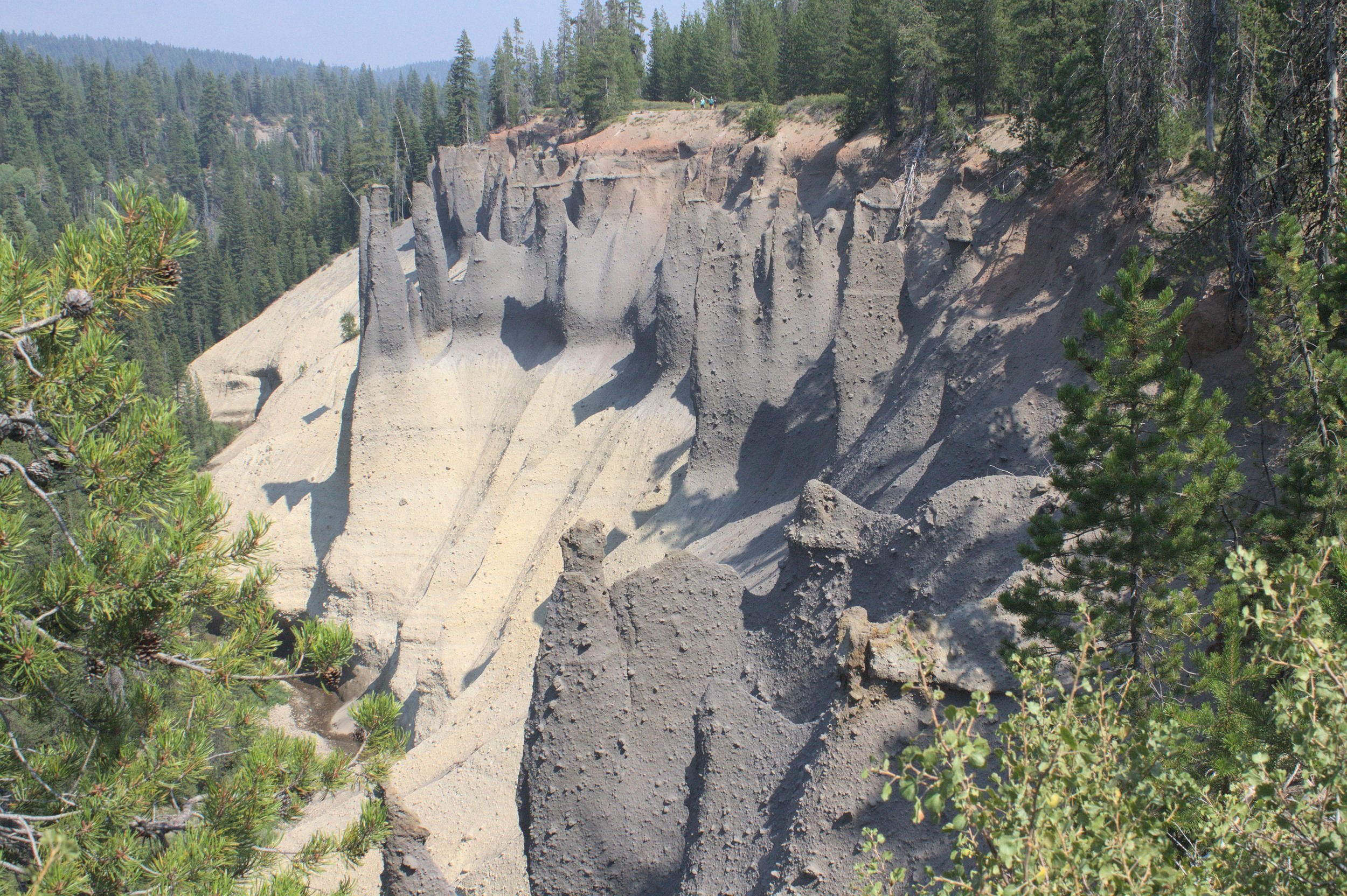
Journey through another massive caldera at Newberry National Volcanic Monument.
Find more things to do in Central and Eastern Oregon.

Find more things to do in the Cascade Mountains.
References:
Bacon, Charles R., ed. Geologic map of Mount Mazama and Crater Lake caldera, Oregon. USGS, 2008.
Miller, Marli Bryant. Roadside Geology of Oregon. Missoula, Montana: Mountain Press Publishing Company, 2014.
For more information about visiting Crater Lake National Park, including updates on closures, visit the National Park Service’s website.