

Gillette Lake Hike


The hike to Gillette Lake is one of the most polarizing in the Columbia Gorge. Comments in All Trails will tell you it’s either boring or beautiful. I’d say it comes down to expectations. If you’re looking for the kind of grandeur that borders on a religious experience, like, say, standing at the bottom of Latourell Falls, you’ll probably be disappointed. That being said, I really enjoyed my hike here. The trail was almost deserted, and Gillette Lake is a rewarding finale. A few clearings give you cool views of the mountains. Here’s what to expect on the trail to Gillette Lake. I’ll throw in a bunch of pictures to help you decide if you want to check it out.
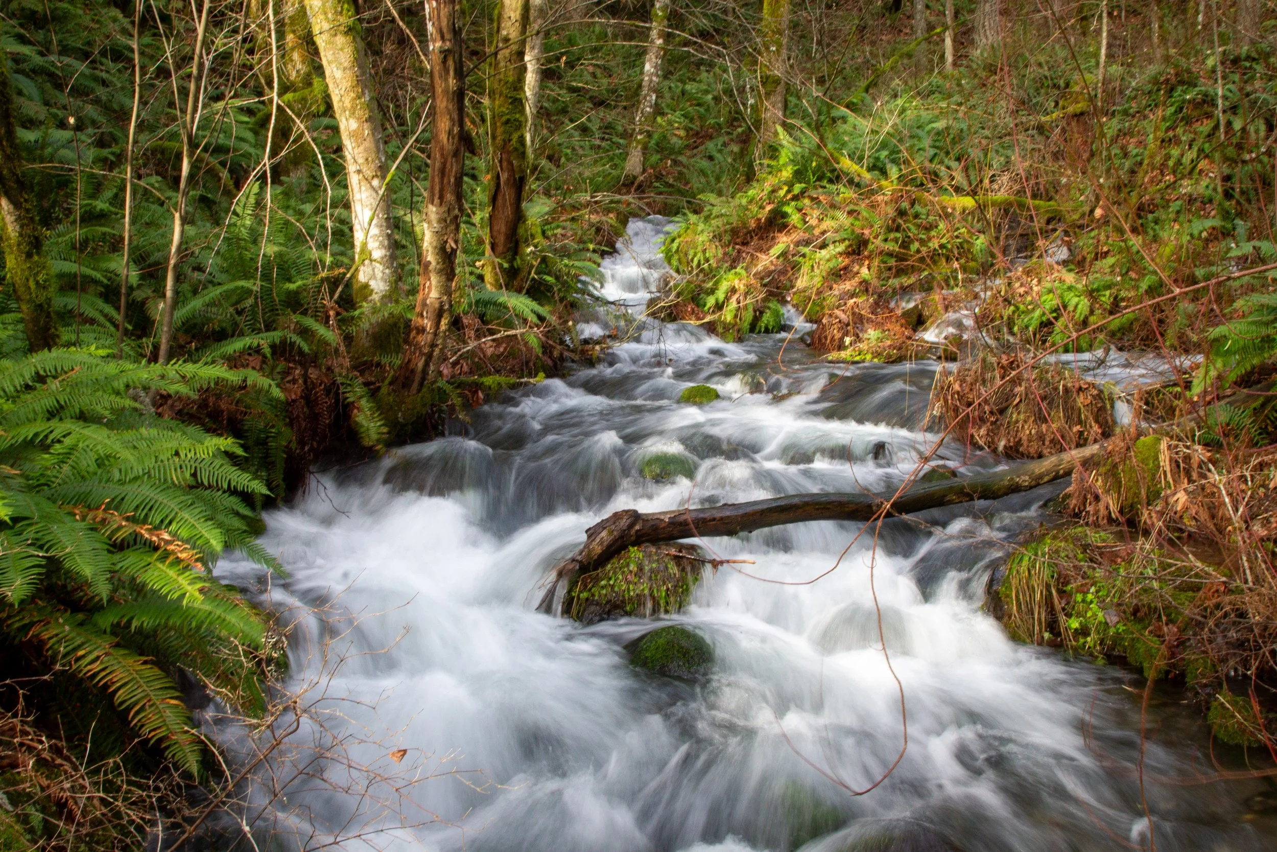
Gilette Creek
Know before you go
The hike to Gillette Lake starts at the North Bonneville Trailhead. To park, you need the NW Forest Pass ($5/day) or America the Beautiful Pass. I’d suggest buying a pass before arriving. Otherwise, use exact change in the deposit envelopes.
Vault toilets and picnic tables are next to the parking lot.
This trail is less crowded than many in the Columbia Gorge, but the parking lot sometimes fills up on summer weekends.
Leashed dogs are welcome on the trail.
Stay on the trail. It gets close to private property.
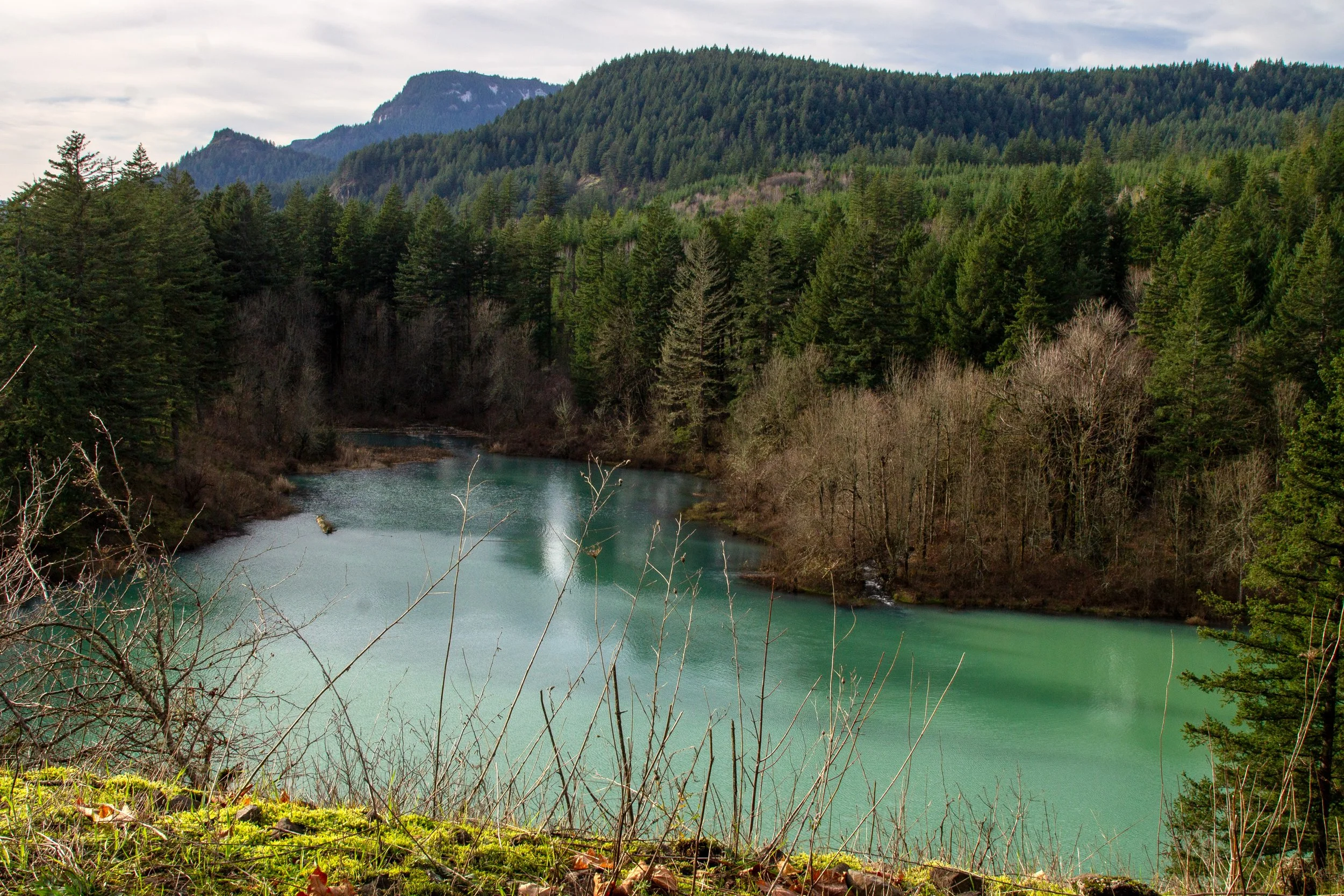
Gillette Lake
On the trail to Gillette Lake
Quick stats
Distance: 6 miles out and back
Elevation gain: 800 feet
Difficulty: Moderate
Pass required: NW Forest Pass or America the Beautiful Pass
Dog friendly: Yes, leashed dogs are welcome on the trail.
ADA access: No
Season: Any
The details
Start here
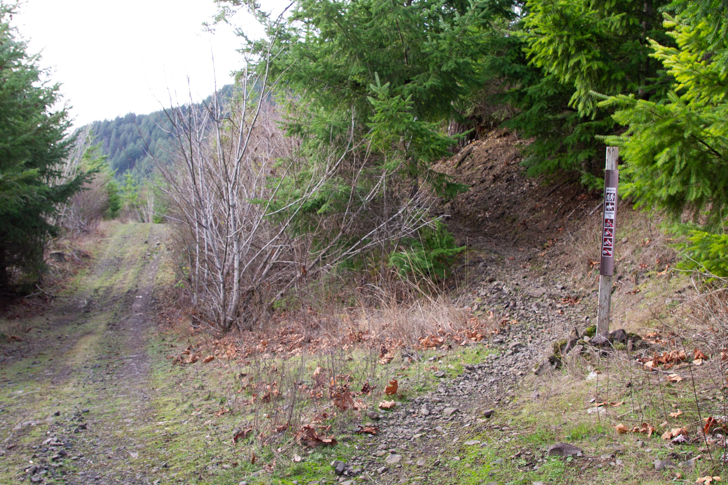
From the parking lot, head to the gate and walk around it. There’s no sign, but it’s the only trail-looking thing around. In about 100 feet, take a left onto the Tamanous Trail #27, which has a sign.
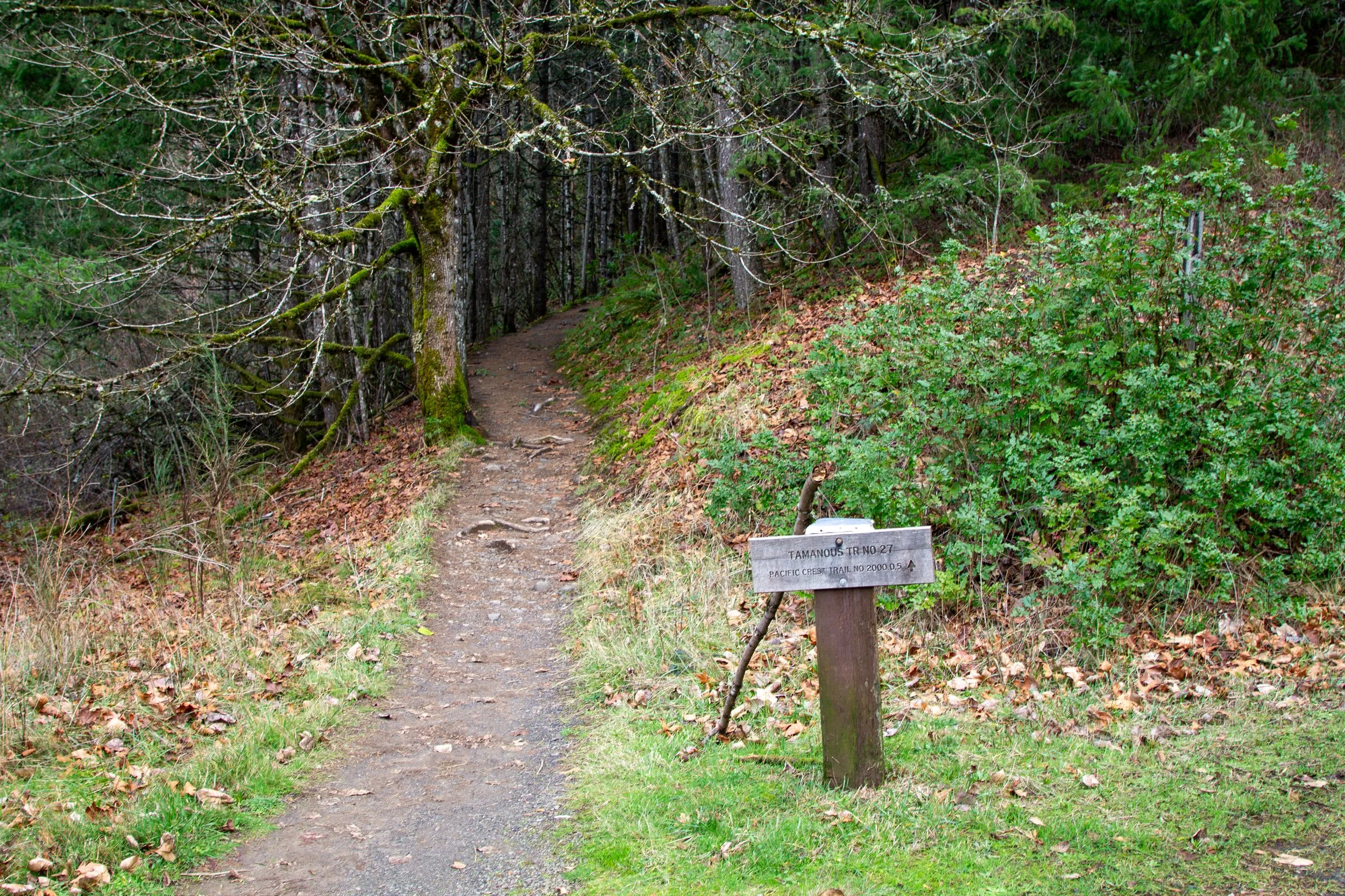
Take the Tamanous Trail
Follow the Tamanous Trail for 0.5 miles. It starts uphill, and the beginning of the hike is as steep as the trail gets. It has a lot of ups and downs throughout without ever being intense. The forest is mostly Doug firs and big-leaf maples. It’s pretty, if young, on the scale of decades old. Ferns in the undergrowth add a lot to the atmosphere. Look for Oregon grape blooming in spring and the maple leaves changing in late October. After about a quarter mile, you’ll see a glimpse of an unnamed pond through the trees. It’s not Gillette Lake, and the trail doesn’t get close to it.
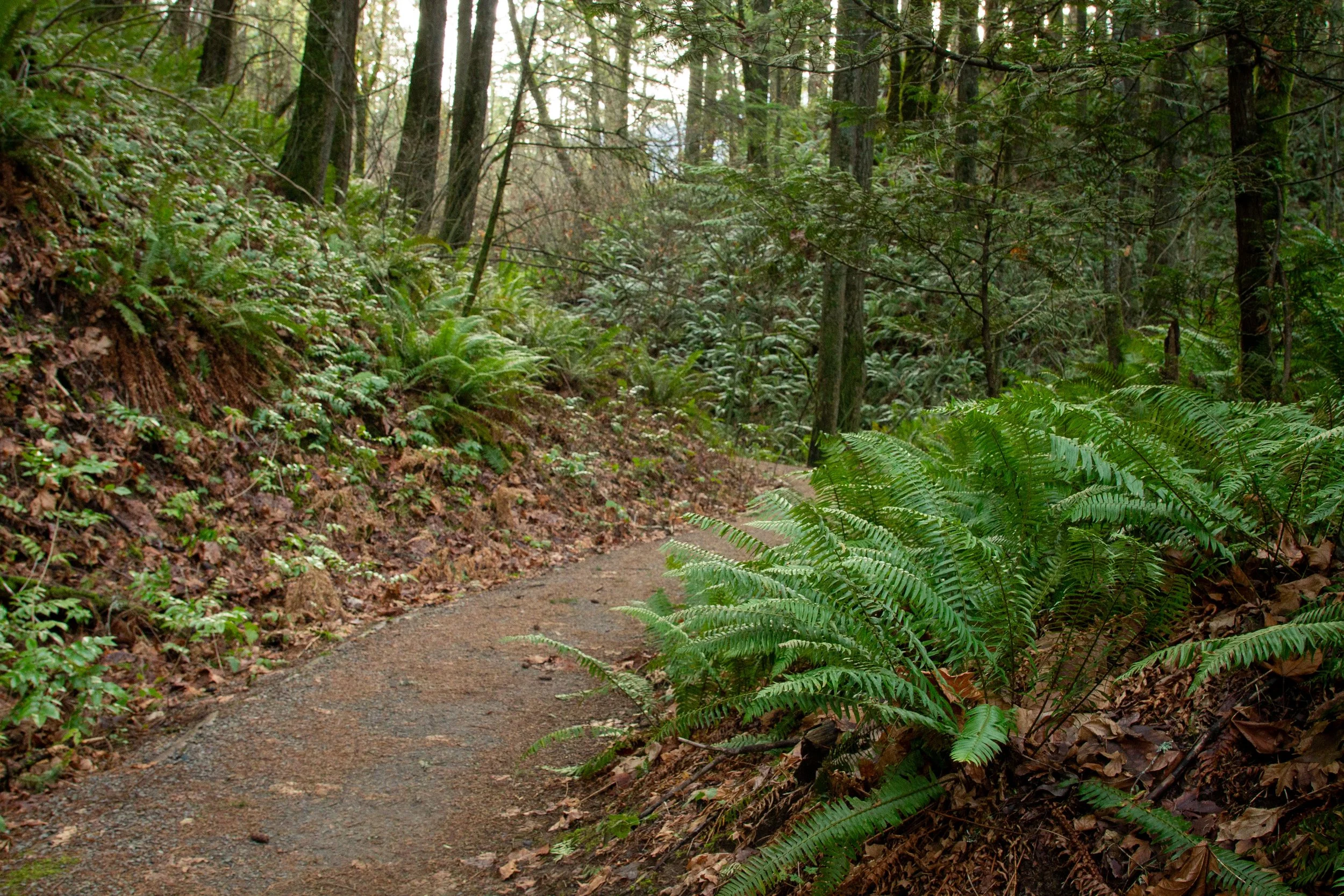
Tamanous Trail
After a half mile, take a left at the trail junction onto the Pacific Crest Trail (PCT). A sign points the way to Gillette Lake. The PCT will take you the rest of the way.
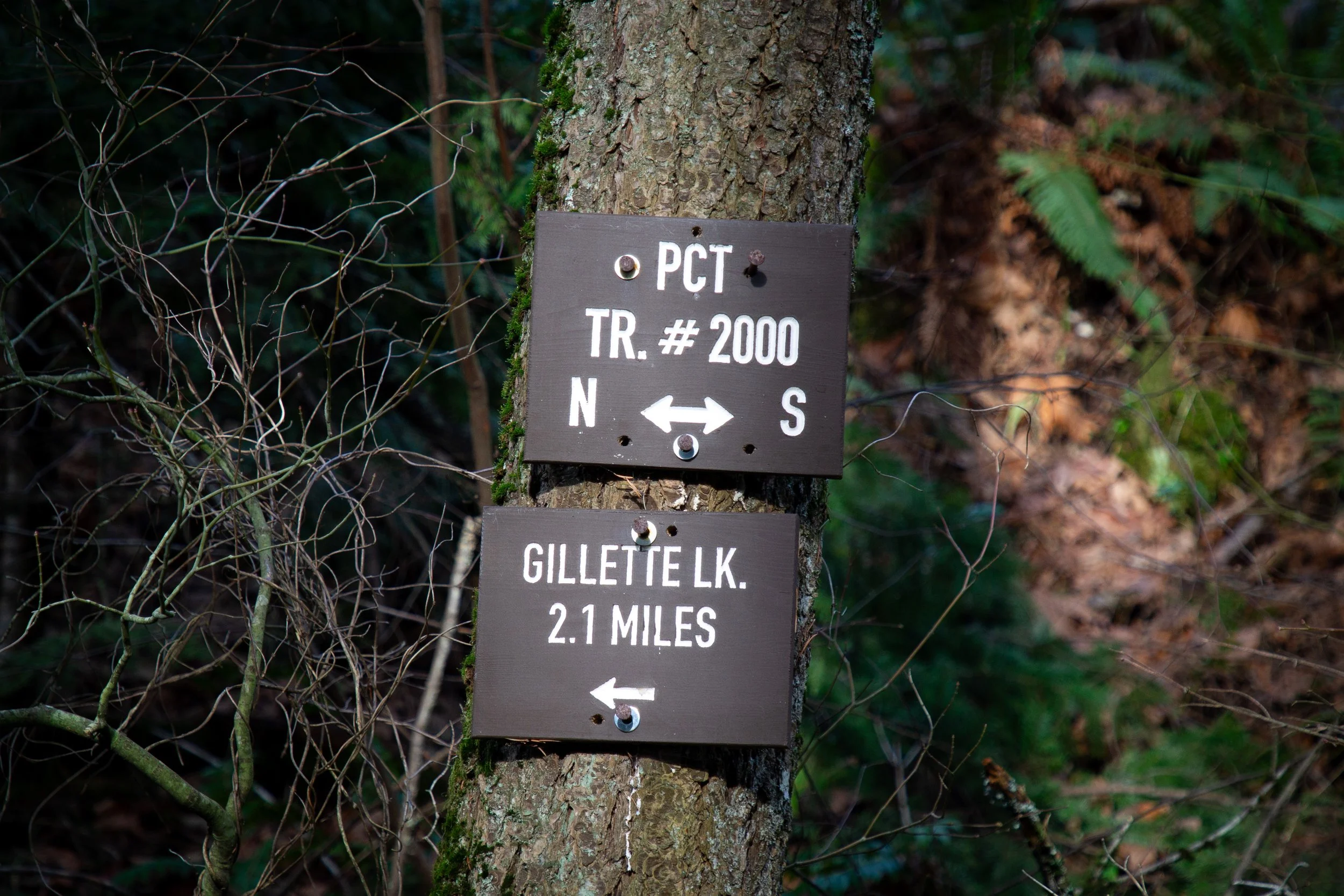
Take a left onto the PCT
The PCT continues much like the Tamanous Trail. This area has a history of logging, so you won’t see many old trees. If there’s a silver lining, it’s that you’ll get some far-reaching views up ahead.
PCT
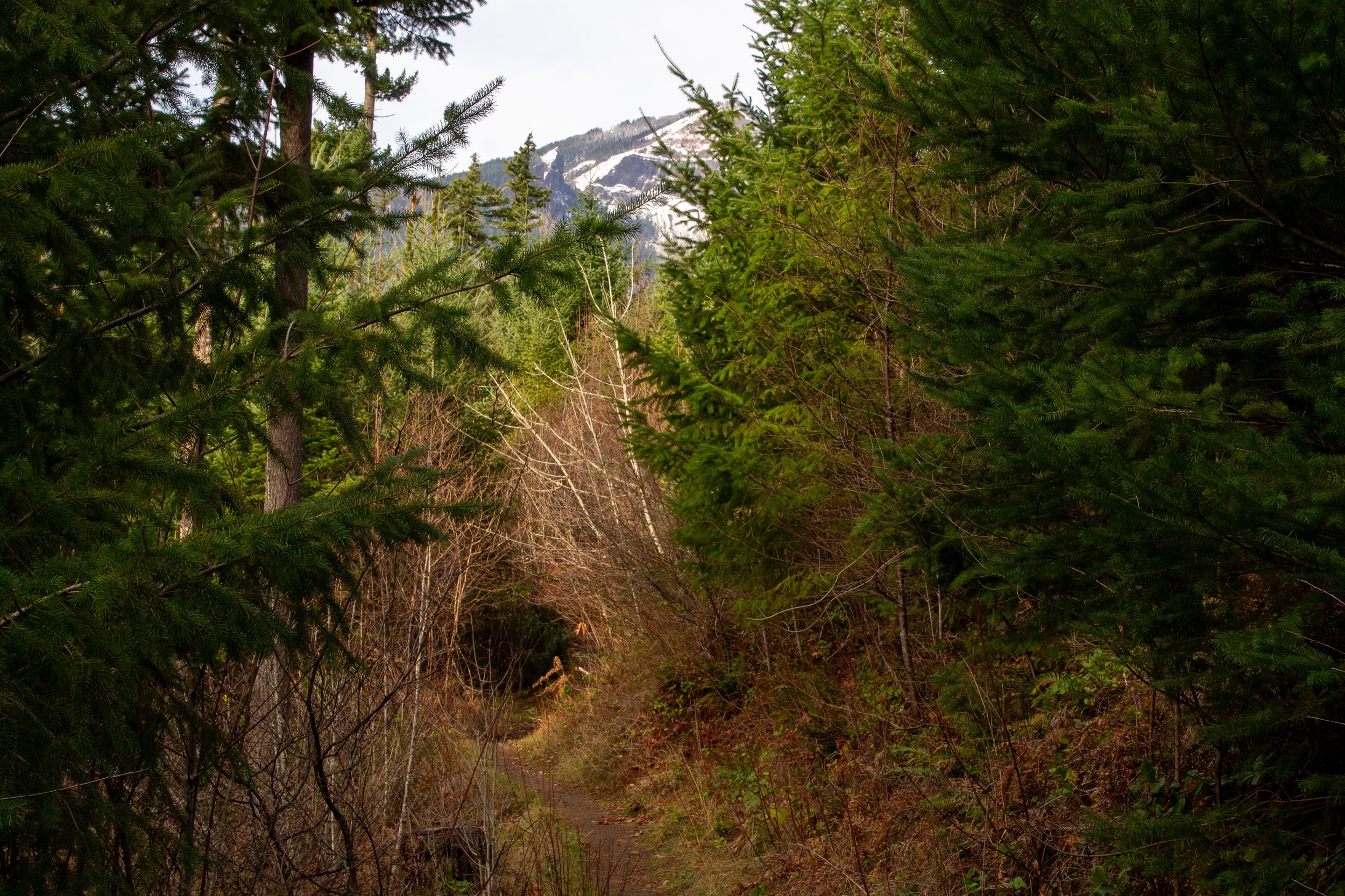
After about a half mile on the PCT, you reach the first clearing with views of some of the nearby peaks, including Table Mountain and Hamilton Mountain. Keep walking straight past an old grassy road.
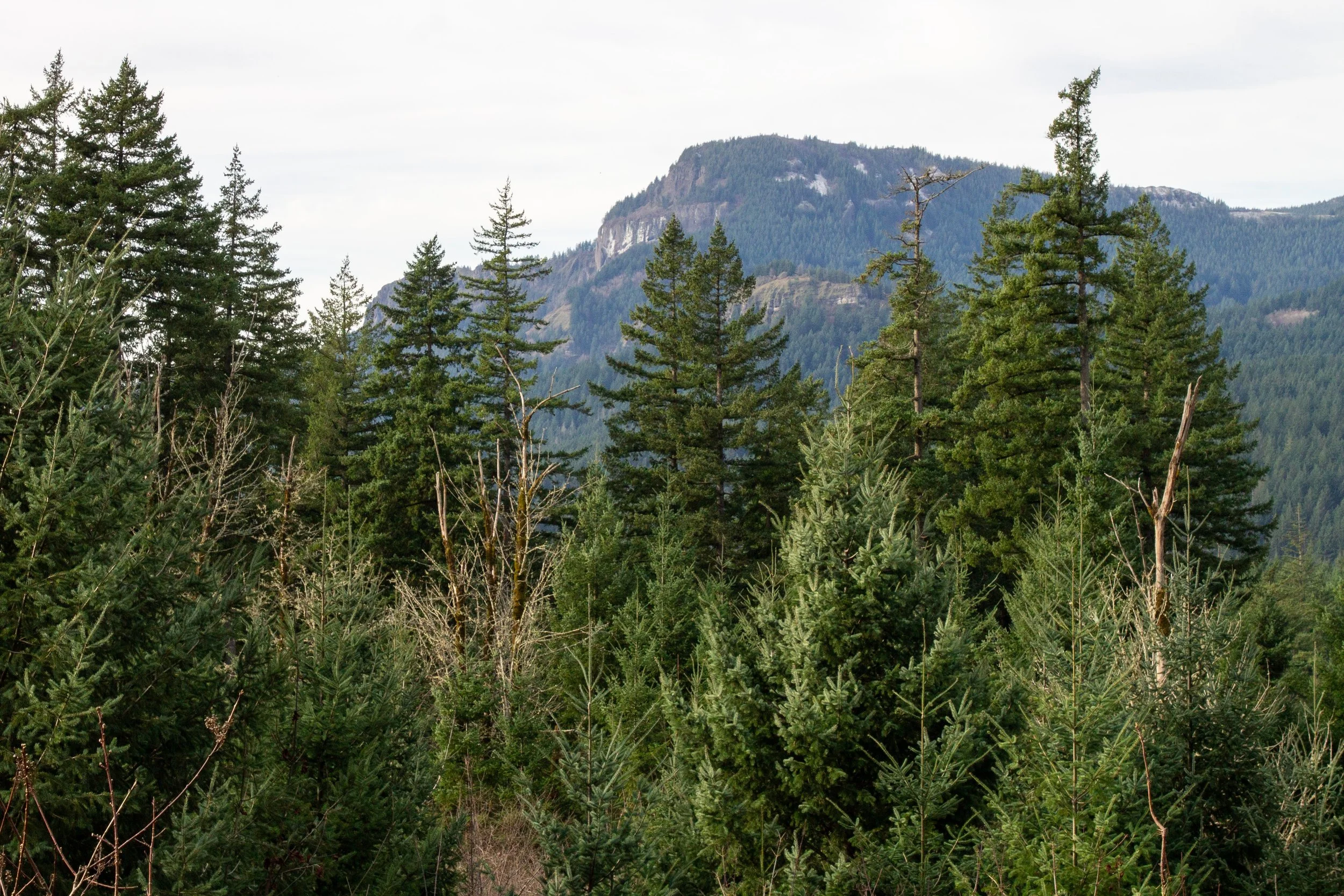
Hamilton Mountain
For the next 1.5 miles, the PCT winds through the forest with a few clearings along the way. You’ll see the Oregon side of the Columbia Gorge, Hamilton Mountain, and Table Mountain. At some point, I saw the tippy top of Beacon Rock and a glimpse of Bonneville Dam. Besides logging, a landslide impacted this area around 700 years ago, making it more open than most of the Columbia Gorge.
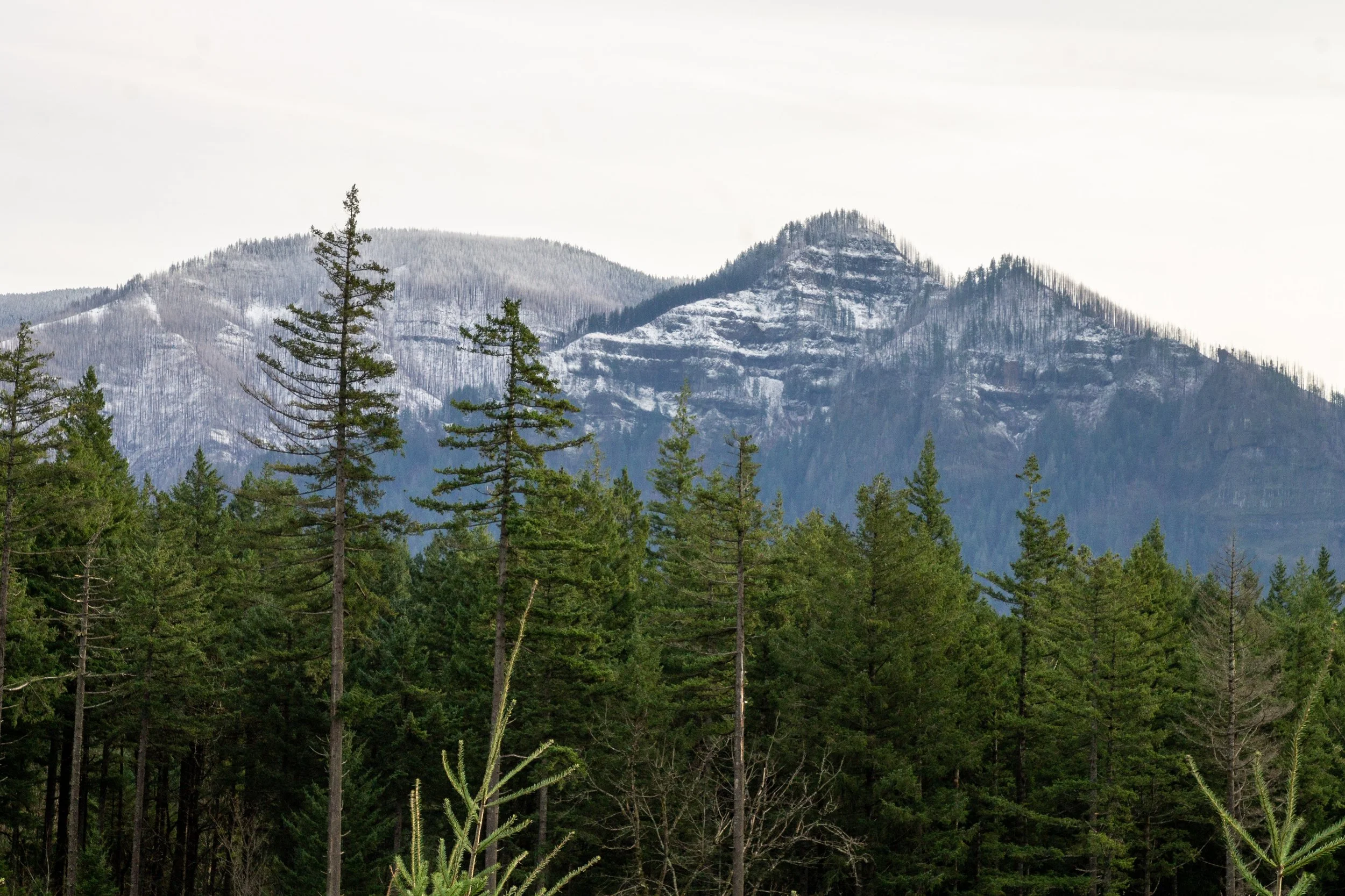
Snowy peaks in Oregon
As you get close to Gillette Lake, you’ll reach the power line corridor. It’s unfortunately a major part of the scenery from here on out. Around this point is also where I started hearing regular gunfire, an unwelcome addition to my nice little nature walk. The trail crosses a gravel logging road. Trucks do come through, just a heads up. On the other side is Gillette Lake.
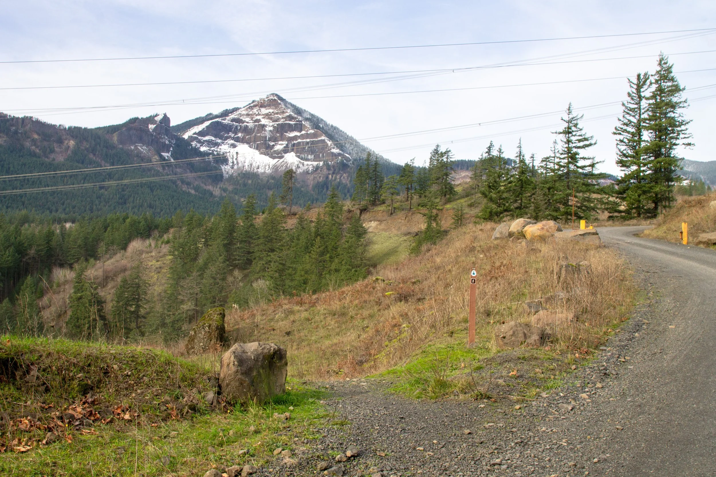
Cross here
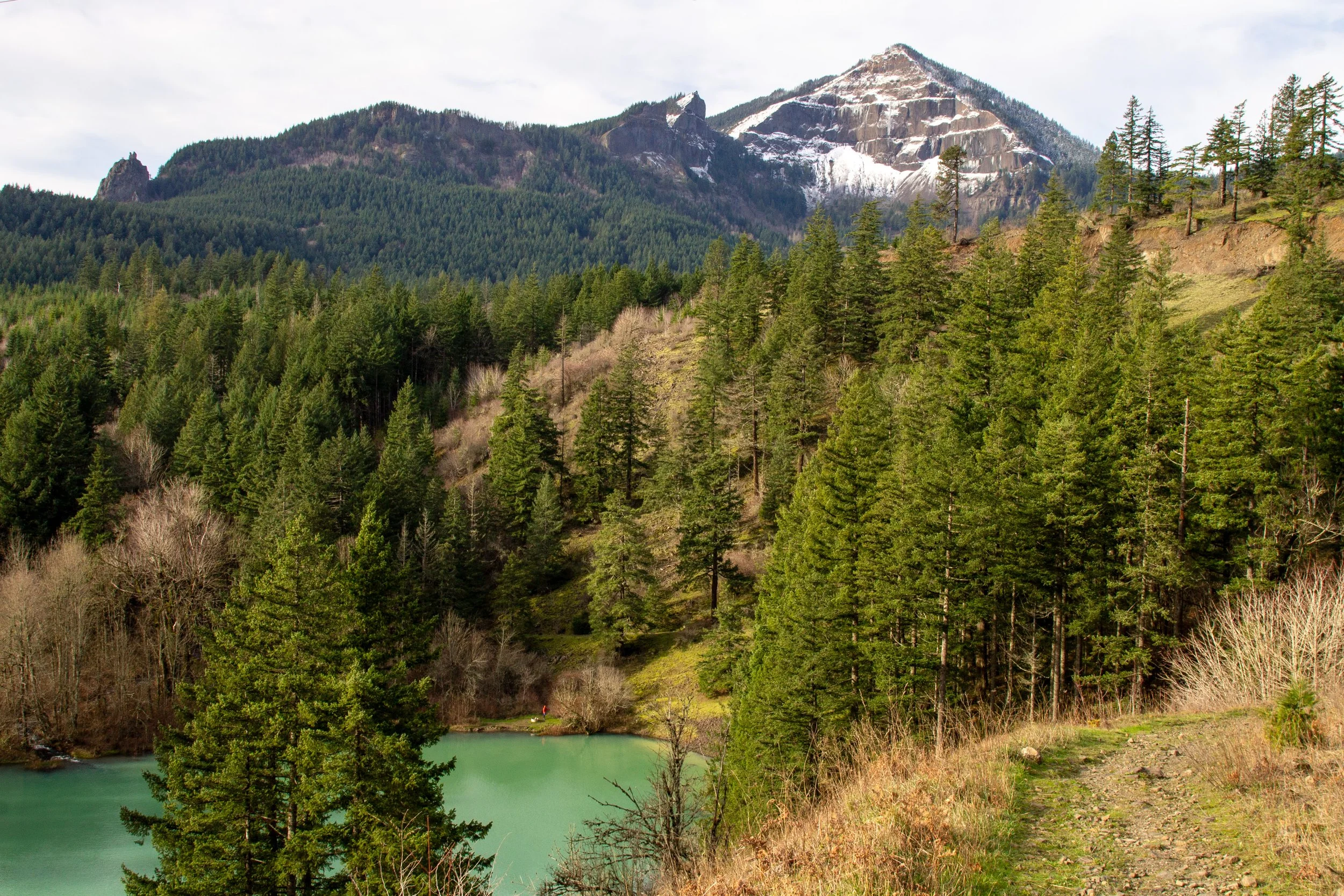
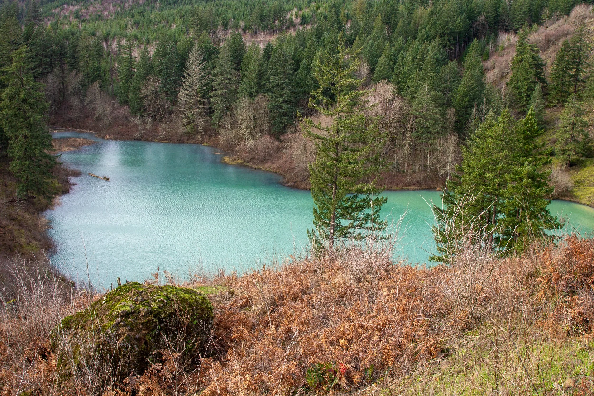
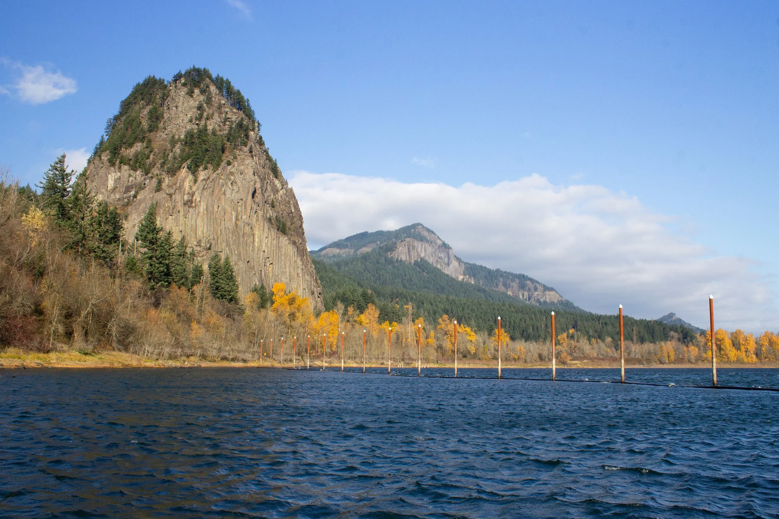
Gillette Lake is a surreal-looking turquoise pool at the base of a landslide. You’ll start on the lake’s south side, which I think has the most impressive views. Table Mountain rises majestically behind it. A dusting of snow during my midwinter hike emphasized the mountain’s non-table-like pyramid shape.
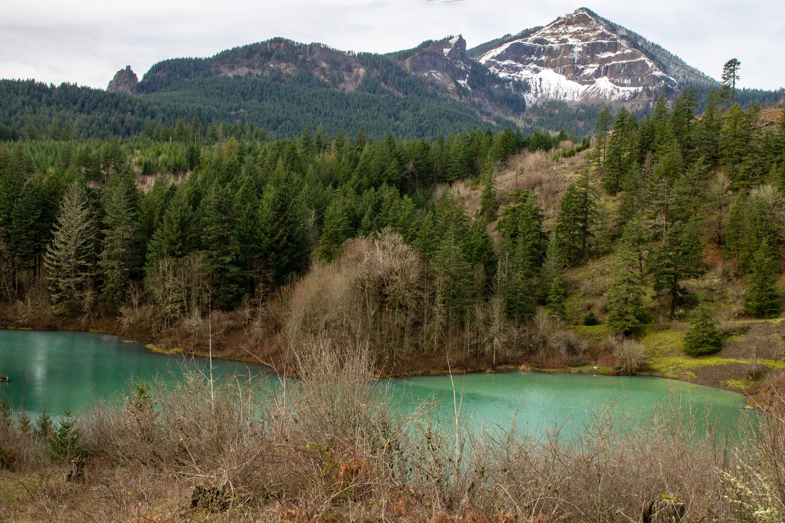
Gillette Lake and Table Mountain
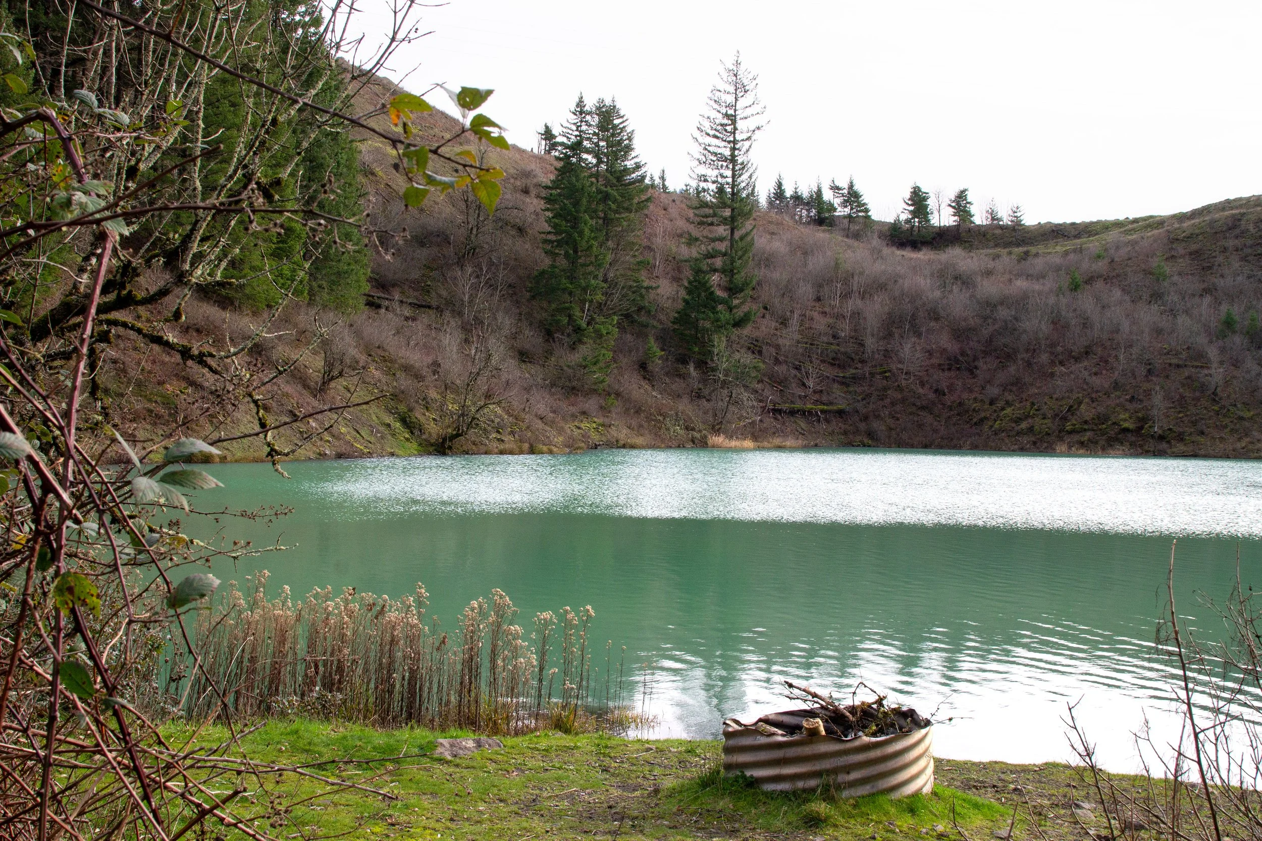
The south side of Gillette Lake is too steep and brambly to get down to the water. Keep going on the PCT for easier access in about a quarter mile.
Gillette Lake
The trail wraps around the east side of the lake as it descends to the water level. Once you reach the north side, a little spur trail will take you to a campsite next to the lakeshore. Look for ducks out on the water.
Campsite at Gillette Lake
At this point, you’ve seen the best lake views. You can turn around here, or continue another quarter mile or so to the pretty footbridge across Gillette Creek, which makes a good turnaround point. You’re not missing anything just ahead. For a challenge, you could continue on the trail up Table Mountain.
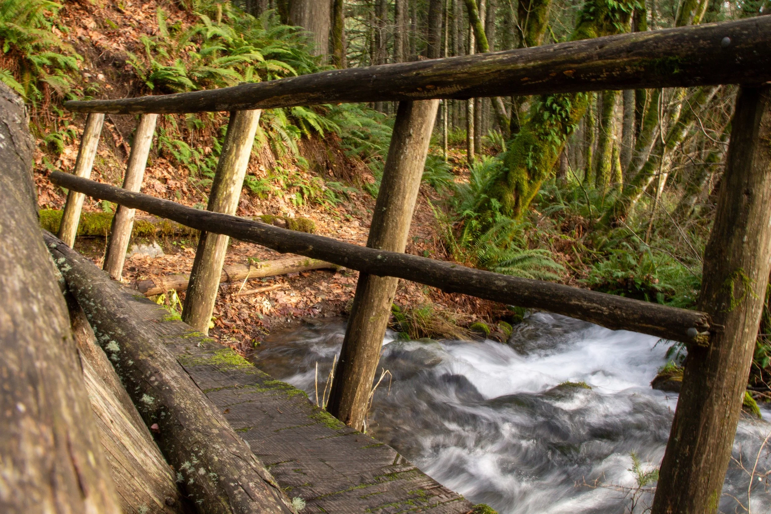
Footbridge over Gillette Creek
Table Mountain hike
The trail continues up Table Mountain
Distance: 15.5 miles
Elevation gain: 4,200 feet
Difficulty: Hard
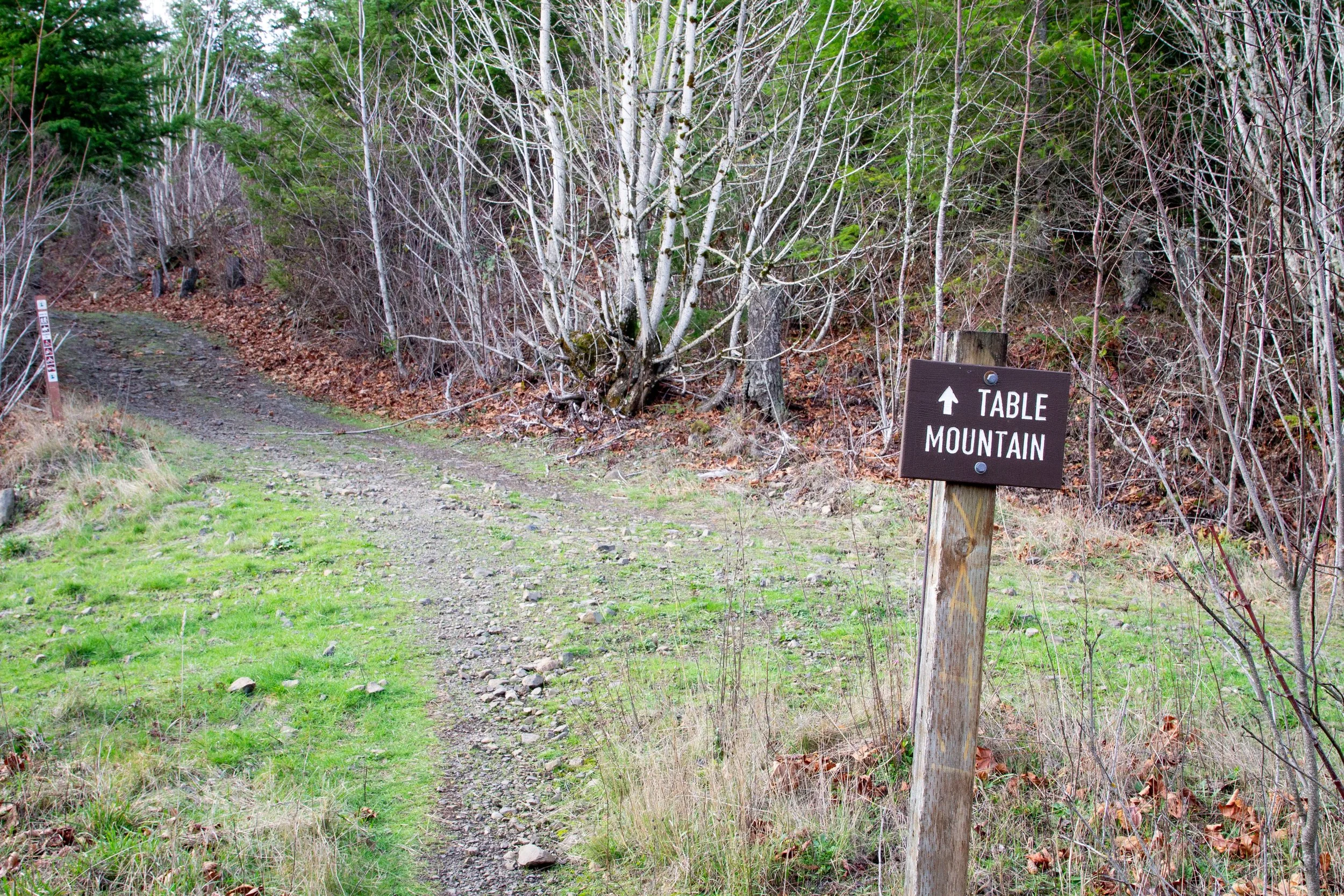
First off, there’s a shorter and easier way to hike up Table Mountain than starting from the North Bonneville Trailhead. If you start from Bonneville Hot Springs Resort, it’s more like 8.5 miles round-trip. Since we’re at Gillette Lake, I’ll mention the Table Mountain hike to give you your options. After the footbridge over Gillette Creek, continue on the PCT. You’ll merge briefly with a gravel road. Then, the PCT continues off to the right. In a little less than a half mile, you’ll reach the small and overgrown Greenleaf Pond. From here, you’ll have to tell me how it goes. My bum leg and I turned around.
Keep right for the PCT
Getting there
The parking lot for the North Bonneville Trailhead is directly off Highway 14, across from the Bonneville Dam. To get there from Portland, you can drive to Vancouver and take Highway 14 the whole way, or take I-84 and cross at the Bridge of the Gods. Crossing at Bridge of the Gods costs $3 and saves about 10 minutes each way. The drive from Portland takes about an hour. The parking lot is paved, and no problem with a low-clearance vehicle.
Enjoy your hike to Gillette Lake!
With love,
Emma
Explore nearby
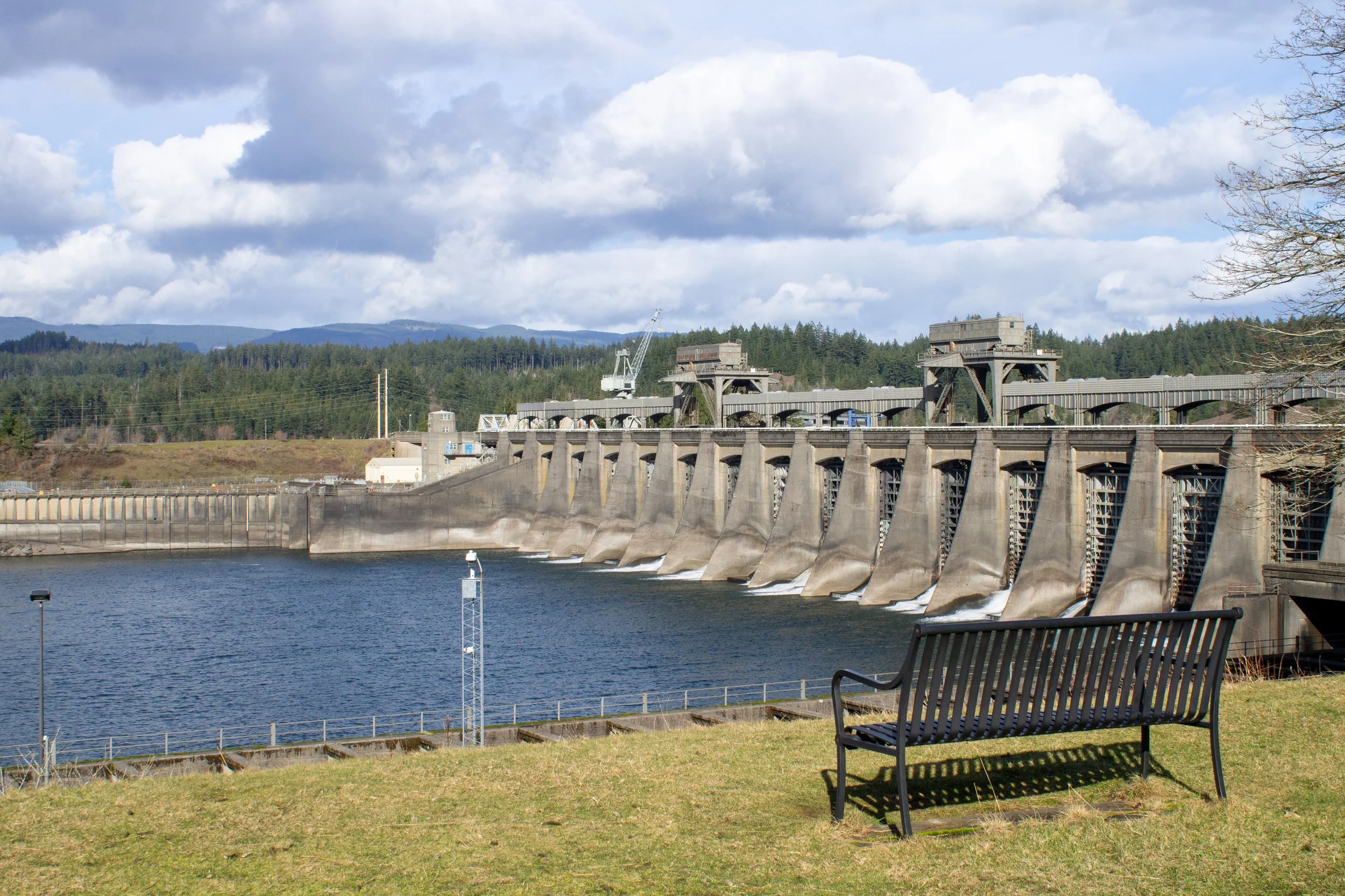
After your hike, head across the road to Bonneville Dam.

Check out the trails in Beacon Rock State Park.

See incredible Columbia Gorge views from Wind Mountain.