

11 Hikes for Hot Days near Portland

Here’s my vision for a hike on a hot day: you check out an easy trail with lots of shade and without much hill climbing. There’s a lake or a river at some point where you can dip your feet in the water and relax with drinks and snacks. A lot of the hikes on this list are around Mt Hood where it will be a little cooler than in the valley. I also added a couple on the coast where it will probably be about 20 degrees cooler. Here are hikes near Portland, Oregon, to try out on hot summer days.
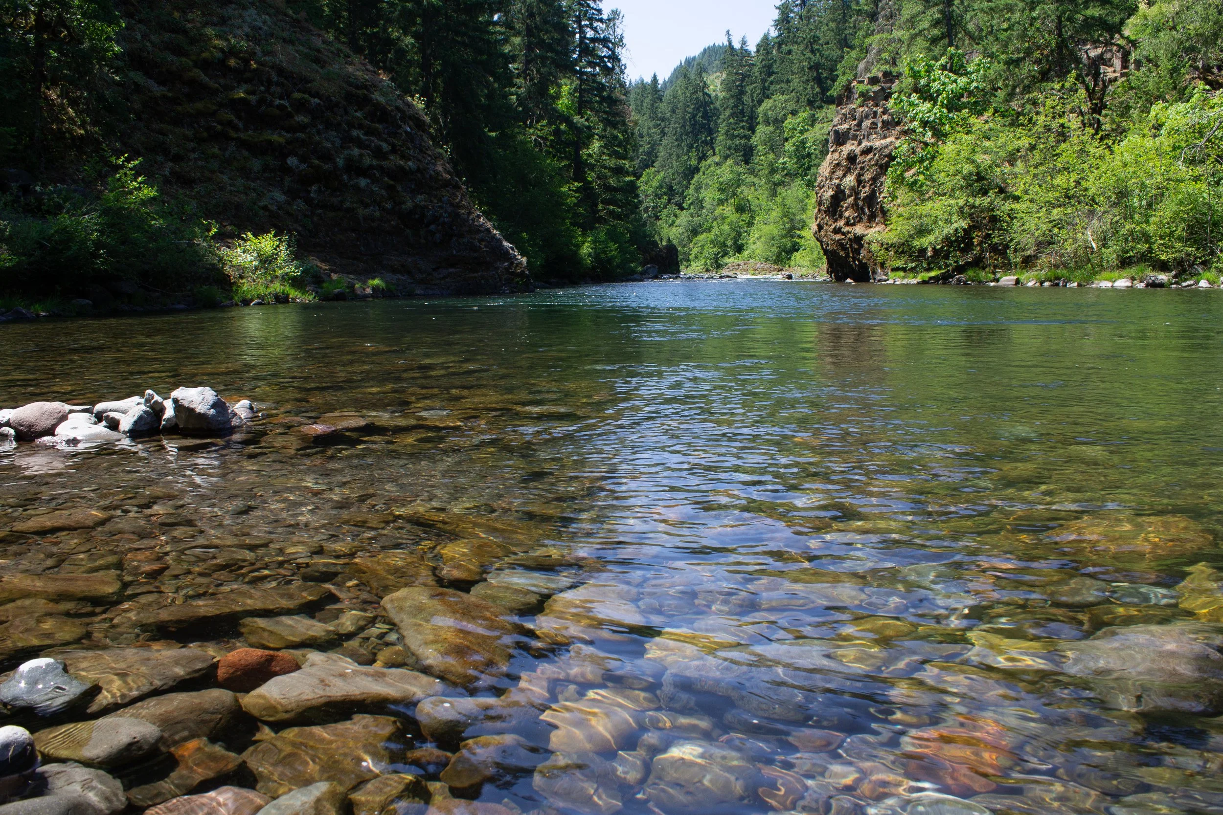
1. Punchbowl Falls

Punchbowl Falls
Distance: 2-mile loop with spurs
Elevation gain: 200 feet
Difficulty: Easy
Dog friendly: Yes, leashed dogs are welcome on the trail.
Pass required: None
ADA access: No
Restrooms: Yes, port-a-potty.
Driving distance from Portland: 80 minutes
West Fork of Hood River
The Punchbowl Falls hike near Hood River keeps a low profile, likely because it gets confused with the very popular and similarly-named Punch Bowl Falls on the Eagle Creek Trail (which would also be a good hike for a hot day, although crowded). Despite the similar names, Hood River’s Punchbowl Falls has its own character and is just as worth exploring as the western Columbia Gorge trails.
The hike begins in the woods and has shade almost the entire way. From the trailhead, you’ll see a couple of narrow dirt trails to the right and left of a wide unpaved service road. Take the trail on the left, the West Fork Trail, to reach views of the waterfalls. As you hike, you’ll see several places where people have left the trail to get a better view of the West Fork of Hood River. Go ahead and ignore these detours. You’ll get better and safer views up ahead on the main trail.
Most wildflowers here bloom in spring, but you may spot some late-blooming flowers like yarrow and tiger lilies in summer. This hike is also a great place to see the leaves change in the fall. After about 0.4 miles, you’ll reach a viewpoint for Punchbowl Falls and Dead Point Falls. Looking upriver, you can see a glimpse of Mt Hood’s summit. The crumbling staircase and fish ladder across the canyon are legacies of an old hatchery.
Shortly after the falls, you’ll reach a trail junction marked with a sign. Head left to take the spur trail down the confluence where the West and East Forks of the Hood River meet. At the confluence, you’ll find a tranquil beach with water perfect for wading. From here, you can return to the trail junction and either explore the 0.3-mile spur that follows the East Fork of Hood River or head back to the car. Look for the Dogwood Trail on the way back that will make the end of the hike into a loop.
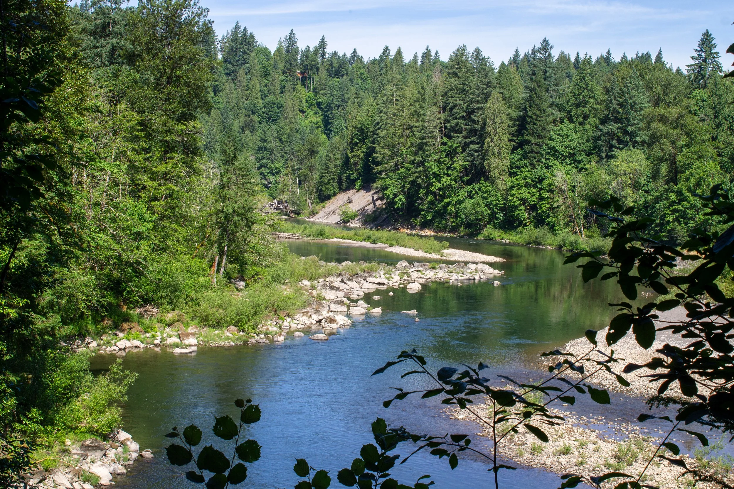
2. Oxbow Regional Park

Sandy River
Distance: Multiple trails with options between 0.7 - 7 miles
Elevation gain: Minimal except for the Alder Ridge Trail
Difficulty: Easy
Dog friendly: No, dogs are not allowed in the park.
Pass required: Metro park fee, $5/day. There is a machine at the park entrance that accepts credit cards.
ADA access: No
Restrooms: Yes, several. The first is next to the welcome center.
Driving distance from Portland: 40 minutes
Ancient Forest Trail
Oxbow Regional Park surrounds distinctive, U-shaped bends in the Sandy River that give the park its name. It’s a great place to see wildlife like salmon that come here to spawn in the fall. You might also spot Roosevelt elk, beavers, river otters, bald eagles, ospreys, squirrels, chipmunks, amphibians, snakes, and songbirds while you’re here. Oxbow has around 12 miles of hiking trails that explore the forest near the river, which includes some of the closest old-growth forests to Portland. Along the trails, there are many opportunities to head down to the water.
You can hike as little or as much as you want at Oxbow Park. Here are some options that I like:
The Ancient Forest Trail will take you on a 1.5-mile loop past some 700-year-old trees.
The Floodplain Trail is an easy, 0.7-mile loop near the park entrance and is the first place you can reach the river.
The Alder Ridge Trail is a 2-mile loop that goes through a lovely, shady forest with some large sword ferns along the trail. You can make a short spur to see Elk Meadows from here.
Follow the trail that runs next to the Sandy River for great views and river access points. The trail follows the river for about 2 miles one-way.
After your hike, you can have lunch at one of the picnic areas or find a sandy beach to relax and watch the river. Besides hiking, Oxbow Park is also one of the best spots near Portland for floating, kayaking, and paddleboarding.
3. Milo McIver State Park
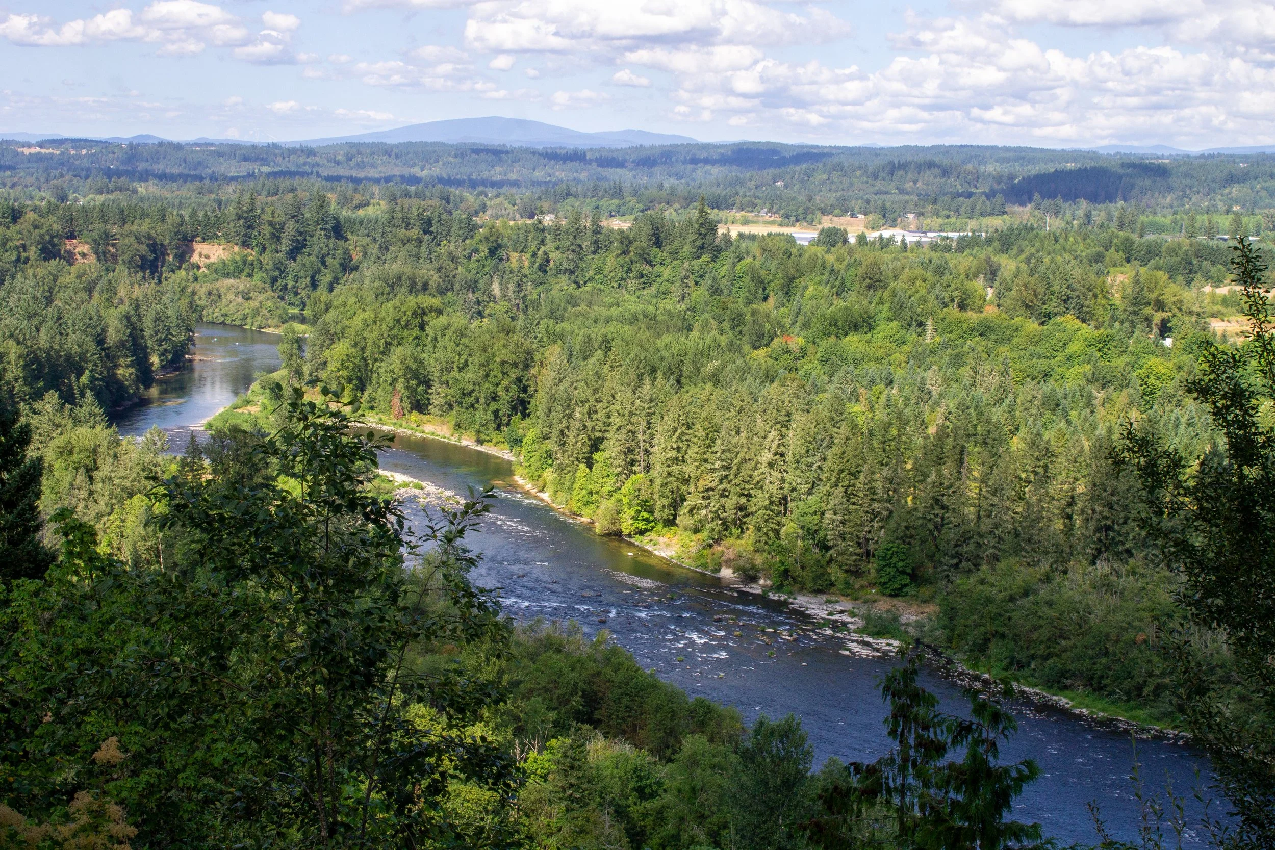
Milo McIver Viewpoint
Distance: About 14 miles of trails with hike options starting from less than 1 mile long.
Elevation gain: Variable but usually minimal and nothing intense.
Difficulty: Easy
Dog friendly: Yes, leashed dogs are welcome on the trails. There is also a nice off-leash dog area.
Pass required: Oregon State Park Pass, $10/day. There is a machine at the park entrance that accepts credit cards.
ADA access: Not so much the hiking trails, which are unpaved and often uneven, but look for the fish hatchery, the accessible fishing dock and kayak launch on Estacada Lake, and the Milo McIver viewpoint. Accessible parking and restrooms.
Restrooms: Yes, in multiple locations in the park.
Driving distance from Portland: 40 minutes

Clackamas River
Milo McIver State Park is a large, sprawling park with many amenities but without a clear focal point. There are two main areas in the park, the Riverbend Day-use Area to the west and the Riverside Day-use Area to the east. Both have parking lots, restrooms, picnic tables, river access, and shaded hiking trails. At the Riverbend Day-use Area, look for a 27-hole disc golf course. The Riverside Day-use Area has a salmon hatchery and access to Estacada Lake. Between the two areas, you can visit the off-leash dog park and the park’s coolest feature, a viewpoint overlooking the Clackamas River.
Like at Oxbow Park, interconnecting hiking trails at Milo McIver offer loop hikes of different lengths. All are family-friendly and none are particularly strenuous on a hot day.
The Rivermill Loop starts at the Milo McIver Viewpoint and makes a 4.7-mile loop that includes access to the Clackamas River and the fish hatchery.
The Clackamas Riverbend Loop is a 3.5-mile hike that circles the west section of the park. Much of the hike is along the Clackamas River.
4. Wildwood Recreation Site
Salmon River
Distance: 0.75 - 2.3 miles
Elevation gain: Minimal
Difficulty: Easy
Dog friendly: Yes, leashed dogs are welcome on the trails.
Pass required: America the Beautiful Pass. You can buy a day pass on-site for $5. NW Forest Pass is not accepted.
ADA access: The Cascade Streamwatch Trail and Boardwalk Trail (0.75 miles each) are wide, flat, and even without steps or steep grades. There are benches along the trails.
Restrooms: Yes, in multiple locations.
Driving distance from Portland: 60 minutes
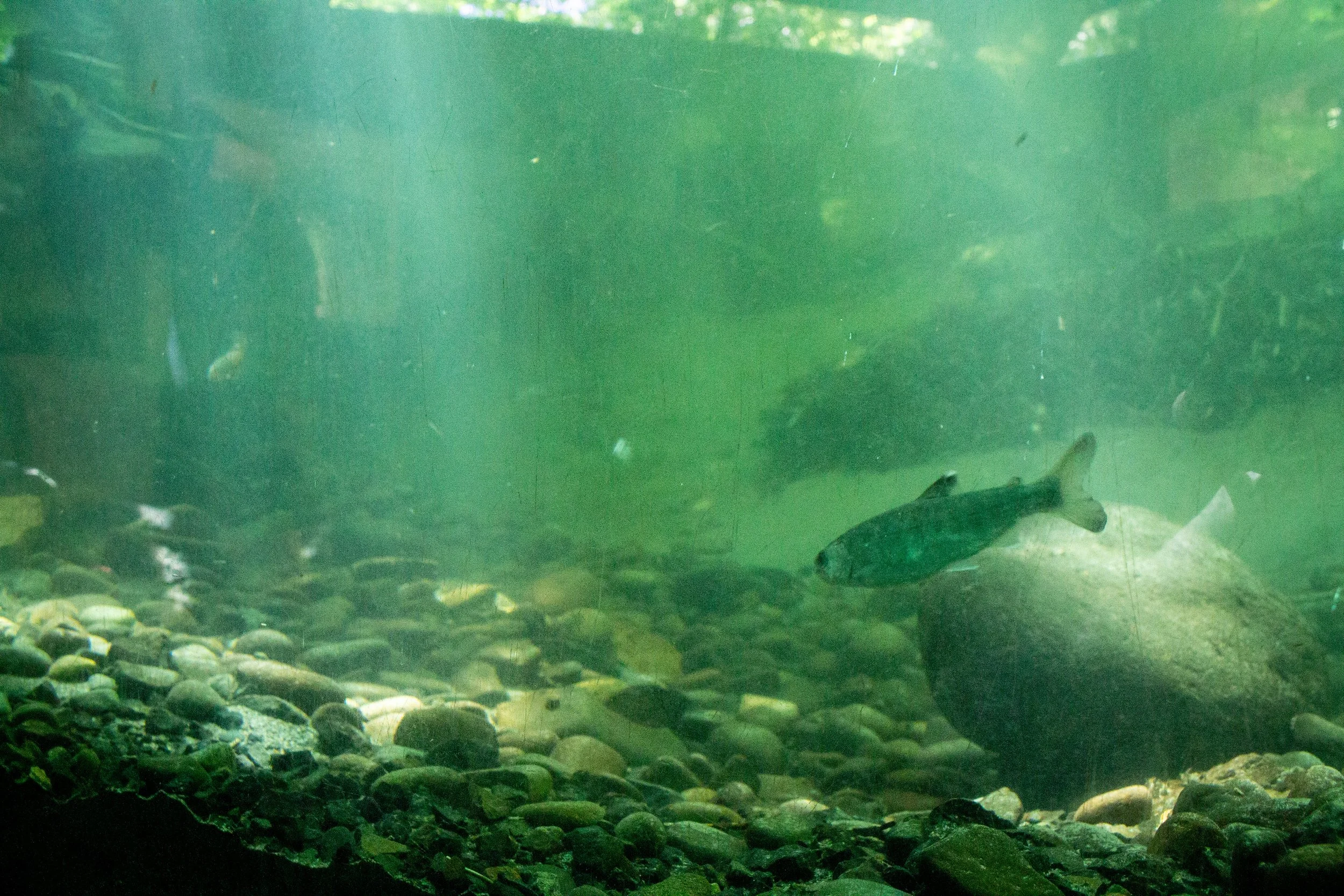
Fish viewing window
The trails at Wildwood Recreation Site are some of the easiest to reach and easiest to hike in the Mt Hood National Forest. From the paved parking lot just off Highway 26, look for the start of the 0.75-mile Cascade Streamwatch Trail. This lowkey hike will take you on a loop through a forest of towering Douglas firs next to the Salmon River. You’ll have a couple of opportunities to get down to the water and you might see salmon here in the late summer and fall. Along the trail, you’ll find regular interpretive displays, benches, and many shaded picnic tables. The highlight of the hike is the underwater fish viewing window that offers a glimpse into one of the Salmon River’s tributaries. Look for juvenile salmon and steelhead trout here year-round and adult salmon in the fall.
Near the Cascade Streamwatch Trail, you’ll find the start of the 0.75-mile Boardwalk Trail that explores the park’s wetlands. Several observation decks along the way are good places to look for birds perched on the cattails and rough-skinned newts in the water. You’ll also pass a ghost forest where fallen logs remain after a beaver dam flooded the area.
The Cascade Streamwatch and Boardwalk Trails are the only barrier-free hiking options in the park, but you can find more trails if you are okay with uneven terrain. Try out the 0.8-mile Old Mill Trail to see the remains of an old sawmill and find the playground. You can also connect to the Salmon River Trail or even tackle the 11-mile hike up Huckleberry Mountain if you’re looking for a challenge, hopefully on a not-so-hot day.
Check out my article about the things to do at Wildwood Recreation Site for more info.
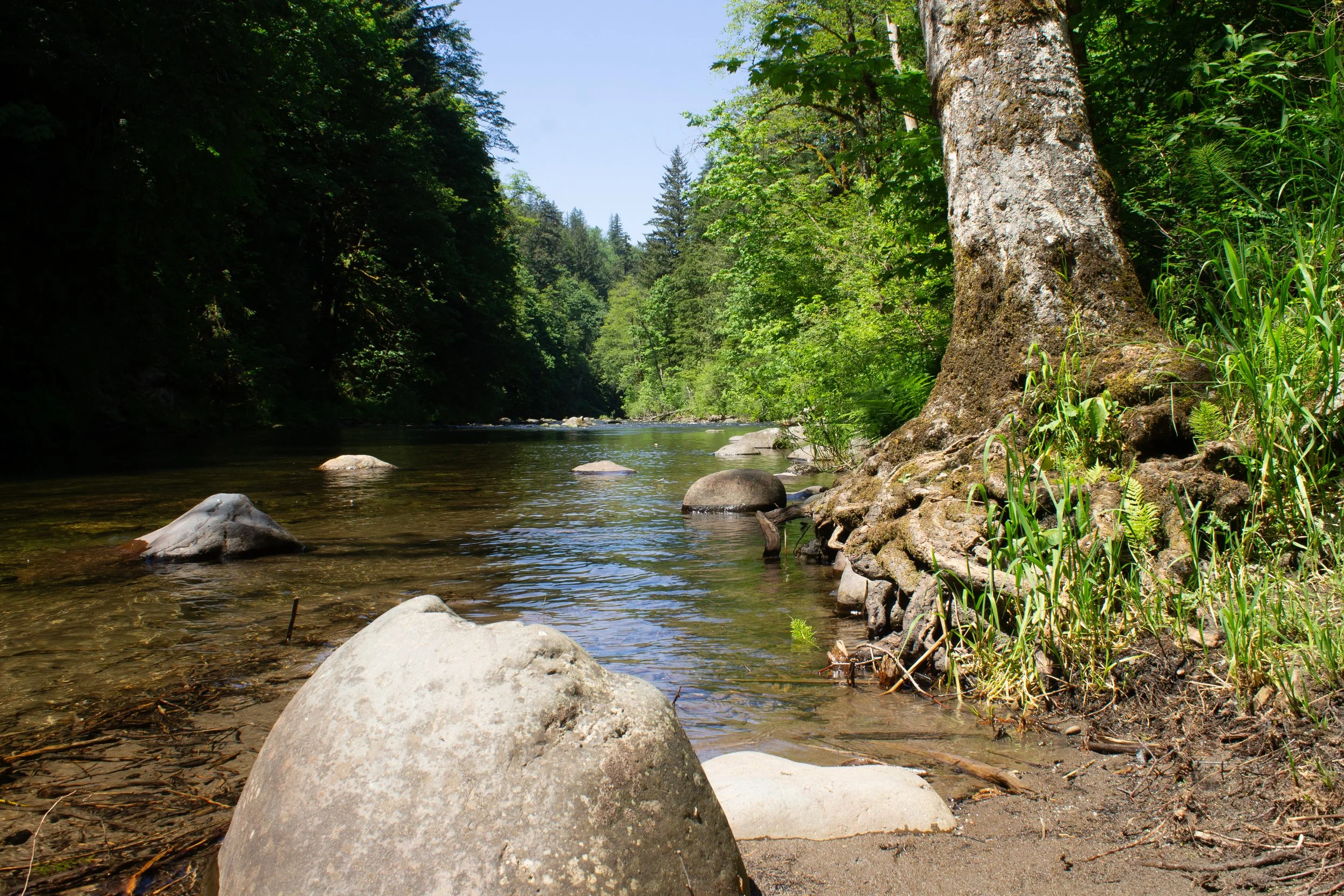
5. Salmon River Trail

Salmon River
Distance: 4+ miles out and back
Elevation gain: 300 feet
Difficulty: Yes
Dog friendly: Yes
Pass required: Northwest Forest Pass or America the Beautiful Pass, $5/day. Purchase a pass before arriving at the trailhead.
ADA access: No
Restrooms: Yes, port-a-potty.
Driving distance from Portland: 70 minutes
Salmon River
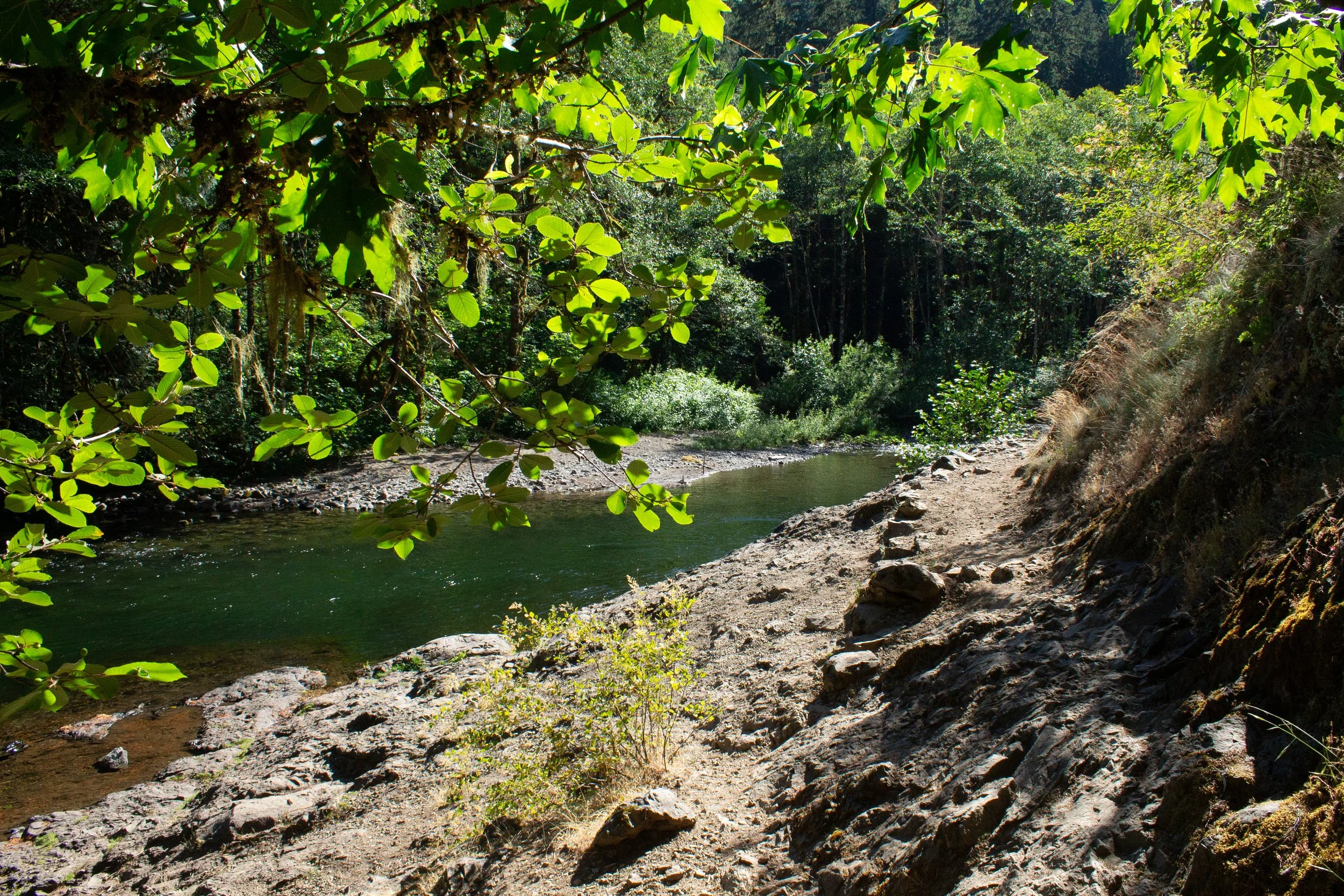
A stunning hiking trail follows the Salmon River through one of the most impressive old-growth forests near Mt Hood. The lower section is a 2.5-mile stretch known as the Old Salmon River Trail, while the upstream section is just called the Salmon River Trail. I did hear a reason for the distinction, though I can’t claim to have understood it. Either or both trails would be good options for a summer hike near Portland, but I prefer the Salmon River Trail since it takes you away from the road and feels more remote.
To reach the Salmon River Trail, start at the Salmon River West Trailhead. The road to get there is paved but has some cavernous potholes. On the trail, you’ll make your way through a forest of enormous, moss-covered Douglas firs and Western red cedars. The first two miles are mostly flat and have several places where you can access the river. If you visit in September or October, look for salmon that come here to spawn. You’ll cross a few lovely wooden footbridges over cascading tributaries along the way.
The Salmon River Trail continues for miles and is a potential backpacking trail, but the Rolling Riffle campground is a good place to turn around on a hot day to avoid the more intense uphill climbing. I managed to walk right past the campground without noticing, so I suggest using the self-issued wilderness permit station located smack dab in the middle of the trail as a turnaround point. It will be about 4 miles roundtrip. If you would like to go farther, the trail leads to a great viewpoint of the Salmon River Canyon. It would be close to 8 miles roundtrip with 1,000 feet of elevation gain to reach the viewpoint.
6. Little Zigzag Falls

A latticework of roots grows next to Little Zigzag Falls
Distance: 0.8 miles out and back
Elevation gain: 200 feet
Difficulty: Easy
Dog friendly: Yes, leashed dogs are welcome on the trail.
Pass required: Northwest Forest Pass or America the Beautiful Pass, $5/day. Purchase a pass before arriving at the trailhead.
ADA access: No
Restrooms: No
Driving distance from Portland: 65 minutes
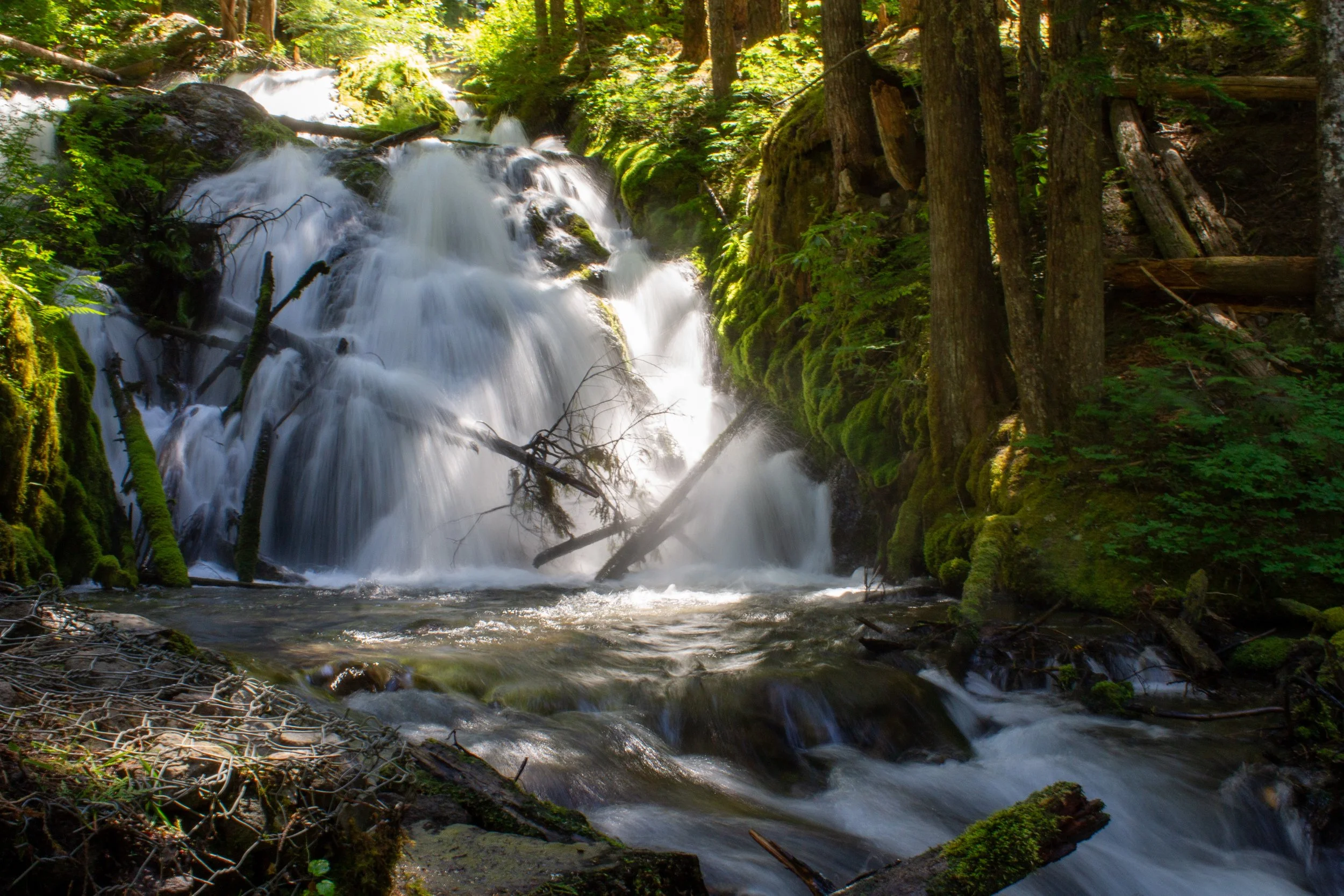
Little Zigzag Falls
You might hesitate to drive from Portland to Mt Hood for a trail that’s less than a mile long, but Little Zigzag Falls is a cool waterfall hike that’s easy to combine with spots nearby like Wildwood Recreation Area or Trillium Lake. It’s also a great option if the day turns out to be hotter than you expected and you want to cool down in a beautiful place that’s easy to reach.
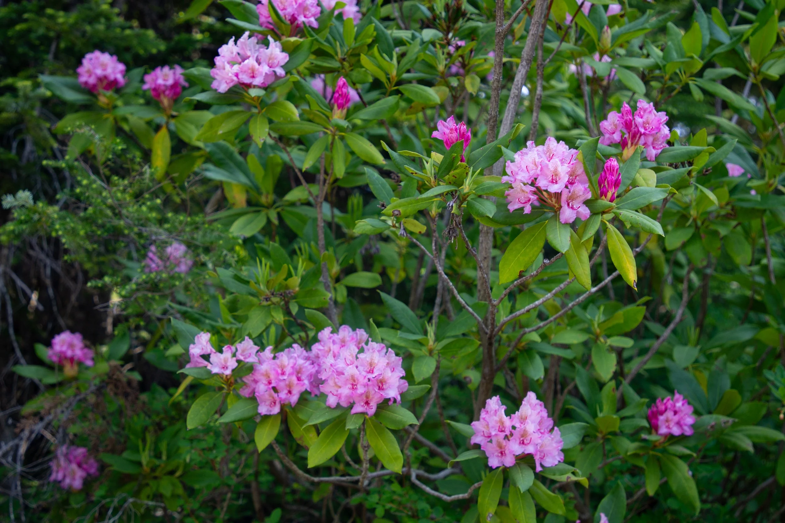
The trail is a shady stroll through a forested canyon that stays next to the cooling waters of the Little Zigzag River from start to finish. There is a picnic table next to the river near the trailhead and several chances to get down to the water along the way. You may spot blooming rhododendrons in July and a few wildflowers in summer. Look for some impressive boulders that fell from the cliff next to the trail.
Once you reach Little Zigzag Falls, you’ll feel a refreshing spray of fine mist. The icy water beneath the falls will cool you off after about three seconds of wading. Because snowmelt from Mt Hood feeds the falls, it will still have plenty of water tumbling over its several tiers in midsummer even without recent rainfall. The views are best from the base of the falls, but you can continue up a short scramble to reach the top.
7. Trillium Lake

Mallards swim at Trillium Lake
Distance: 2-mile loop
Elevation gain: Minimal
Difficulty: Easy
Dog friendly: Yes, leashed dogs are welcome on the trail.
Pass required: Northwest Forest Pass, $10/day. America the Beautiful Pass is not accepted. There are envelopes for on-site payment.
ADA access: Look for a few short barrier-free trails near the campground.
Restrooms: Yes
Driving distance from Portland: 70 minutes
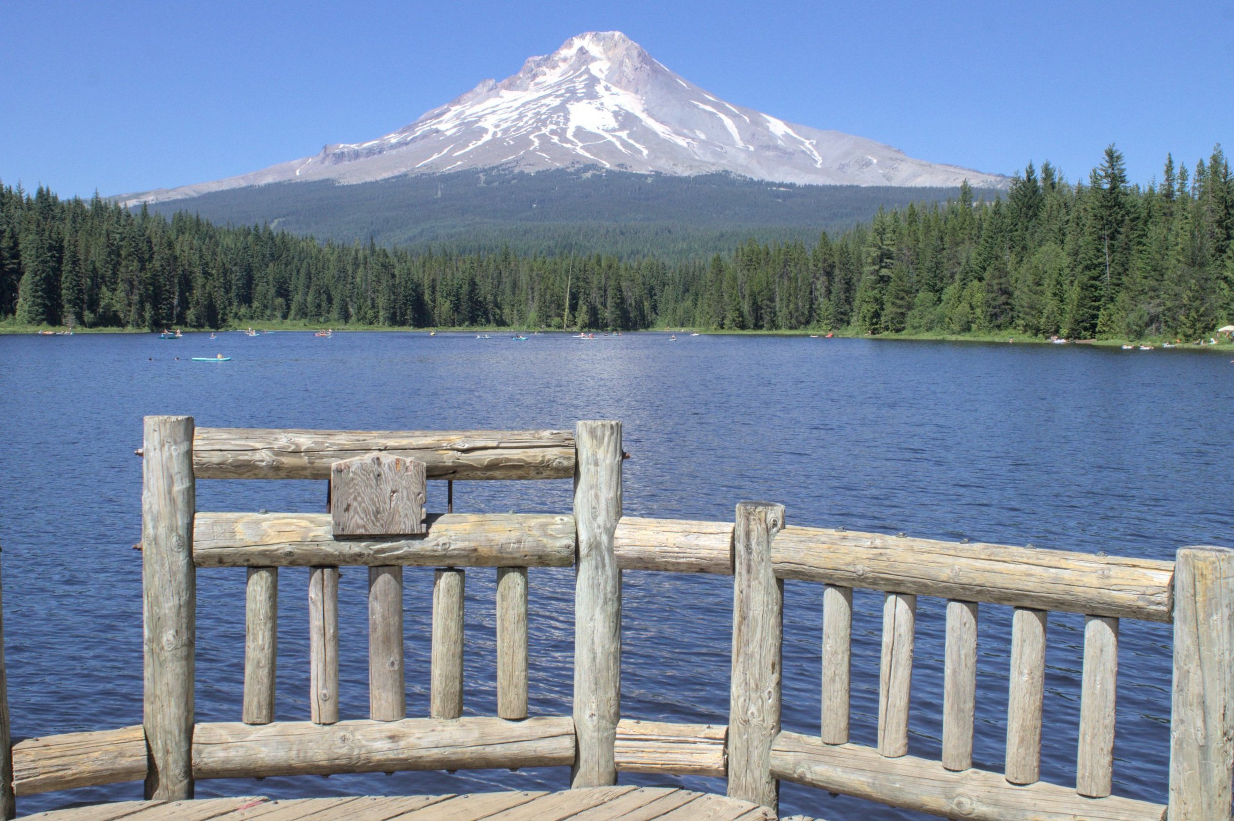
Dock at Trillium Lake
I have some reservations about adding Trillium Lake to the list because although it checks all the boxes for a great summer hike near Portland, everyone knows it, and everyone goes. My last visit was on a weekday, and it was still packed. If you can overlook the crowds, the hike has a lot to recommend it. On a calm day, the lake is a perfect mirror for Mt Hood’s reflection. The trail that circles it is easy and shaded with tons of wildflowers. When the snow melts in spring, look for trillium and skunk cabbage. In midsummer, it’s a wildflower bonanza with yarrow, paintbrush, columbine, daisies, lupines, monkeyflower, cow parsley, bunchberry, and western spirea growing along the trail. Look for damselflies flying in the marshes surrounding the lake and Steller’s jays up in the trees. The 2-mile hiking trail around the lake has a new boardwalk portion that was completed in 2023. Expect lots of people near the small beach at the entrance and in the campground, but the trail was pretty deserted once I got away from these areas. If you’d like to get out onto the water, you can rent a kayak or paddleboard while you’re there.
8. Mirror Lake

Mirror Lake
Distance: 4-mile lollipop loop
Elevation gain: 700 feet
Difficulty: Moderate
Dog friendly: Yes, leashed dogs are welcome on the trail.
Pass required: NW Forest Pass or America the Beautiful Pass, $5/day. Purchase before arriving at the trailhead.
ADA access: Accessible parking area and restrooms. The first 0.2 miles of the trail are paved, but then it becomes unpaved, uneven, and at times narrow. Find details here.
Restrooms: Yes
Driving distance from Portland: 65 minutes
Wild rhododendrons on the Mirror Lake Trail
Unlike Trillium Lake, which has a dam, the water of Mirror Lake pools naturally in a glacial cirque. On clear, calm days, the lake reflects Mt Hood’s peak and the surrounding conifer forest. It takes a little work to get there. From the parking area just off Highway 26, you’ll hike a little less than 2 miles to reach the lake. Although the trail does gain some elevation, it never gets very strenuous and has good shade throughout. If you hike in early summer, look for wild rhododendrons blooming. Once you reach Mirror Lake, you can make a 0.4-mile loop around it to reach the best views of Mt Hood and Tom Dick and Harry Mountain. This trail is popular and easy to reach from Portland, so expect to see others while you hike.
If you’re up for more, the trail continues to the top of Tom Dick and Harry Mountain, where you’ll find excellent views of Mt Hood. You can also see the peaks of Mt Saint Helens, Mt Jefferson, and Mt Rainier on a clear day. Although a great destination, I wouldn’t necessarily recommend it for a hot day because there is much less shade once you get a little past the lake.
9. Wilson River Trail

Suspension bridge from the Tillamook Forest Center
Distance: 4+ miles out and back
Elevation gain: 200 feet
Difficulty: Easy
Dog friendly: Yes, leashed dogs are welcome on the trails. The Tillamook Forest Center only allows service animals inside.
Pass required: None. Visiting the Tillamook Forest Center is free with donations welcome.
ADA access: Not on the Wilson River Trail, but the Tillamook Forest Center has accessible parking, restrooms, exhibits, and paths including the suspension bridge.
Restrooms: Yes
Driving distance from Portland: 65 minutes

Wilson River
The full Wilson River Trail extends over 20 miles through the Coast Range, but it’s hot out, so we’re not trying to do all that. The section I’m highlighting is a short stretch of the trail that starts at the Tillamook Forest Center and winds through the woods next to the Wilson River. Although you can turn around at any point, Wilson Falls makes a good destination that keeps the hike at a low-key distance, about 4 miles total. There won’t be much water going over the falls in summer, so it lacks the wow factor of some of the other Coast Range waterfalls, but I find it hard to turn around without a stopping point. If you’re up for more, continue to the Footbridge Trailhead and views of 35-foot Bridge Creek Falls for a 7-mile round-trip hike.
The Tillamook Forest Center reopened to the public in 2023 and has exhibits you can explore before or after your hike, including a 40-foot climbable fire tower replica. From here, a 250-foot suspension bridge crosses the Wilson River to reach the hiking trail. Make sure to check on the hours of the Tillamook Forest Center before leaving your car there, since the gate is locked when the center is closed. Park at the nearby Jones Creek day-use area if you plan on being there outside of the Forest Center’s hours. You can find picnic tables near the river in the day-use area, although the competition was stiff when I visited. The hiking trail, however, had no one on it but me.
10. Neahkahnie Mountain

Looking south from Neahkahnie Mountain
Distance: 3 miles out and back
Elevation gain: 900 feet
Difficulty: Moderate
Dog friendly: Yes, leashed dogs are welcome on the trail.
Pass required: None
ADA access: No
Restrooms: Yes
Driving distance from Portland: 1 hour 50 minutes

Neahkahnie Mountain Trail
When it’s 100 degrees in Portland, there’s a good chance it’s still 65 degrees on the coast. Even if you do visit on one of the rare warm days, the hike up Neahkahnie Mountain has good shade from the Sitka spruce canopy until the clearing at its summit where you’ll feel cool winds blowing from the ocean. This hike is pleasant throughout, but the real treat is the view from the top. You’ll see waves rolling in at Manzanita Beach, as well as views of Nehalem Bay, Cape Meares, and Cape Lookout to the south. It’s a good hike to try out in summer when there is a slightly better chance of a clear, sunny day.
There are several ways to hike Neahkahnie Mountain depending on where you start. The shortest and easiest route starts from the South Neahkahnie Mountain Trailhead and climbs 1.5 miles to the summit. A longer and more difficult route begins at the North Neahkahnie Mountain Trailhead just off Highway 101 which is shared with the Elk Flats Trailhead. Starting here makes for a 5-mile roundtrip hike with about 1,600 feet of elevation gain.
11. Short Sand Beach

Hike through a coastal forest to reach Short Sand Beach
Distance: 1.2 miles out and back
Elevation gain: 100 feet
Difficulty: Easy
Dog friendly: Yes, leashed dogs are welcome on the trail.
Pass required: Oregon State Park Pass, $10/day or $60/year.
ADA access: No
Restrooms: Yes, at the parking lot and the beach.
Driving distance from Portland: 1 hour 40 minutes
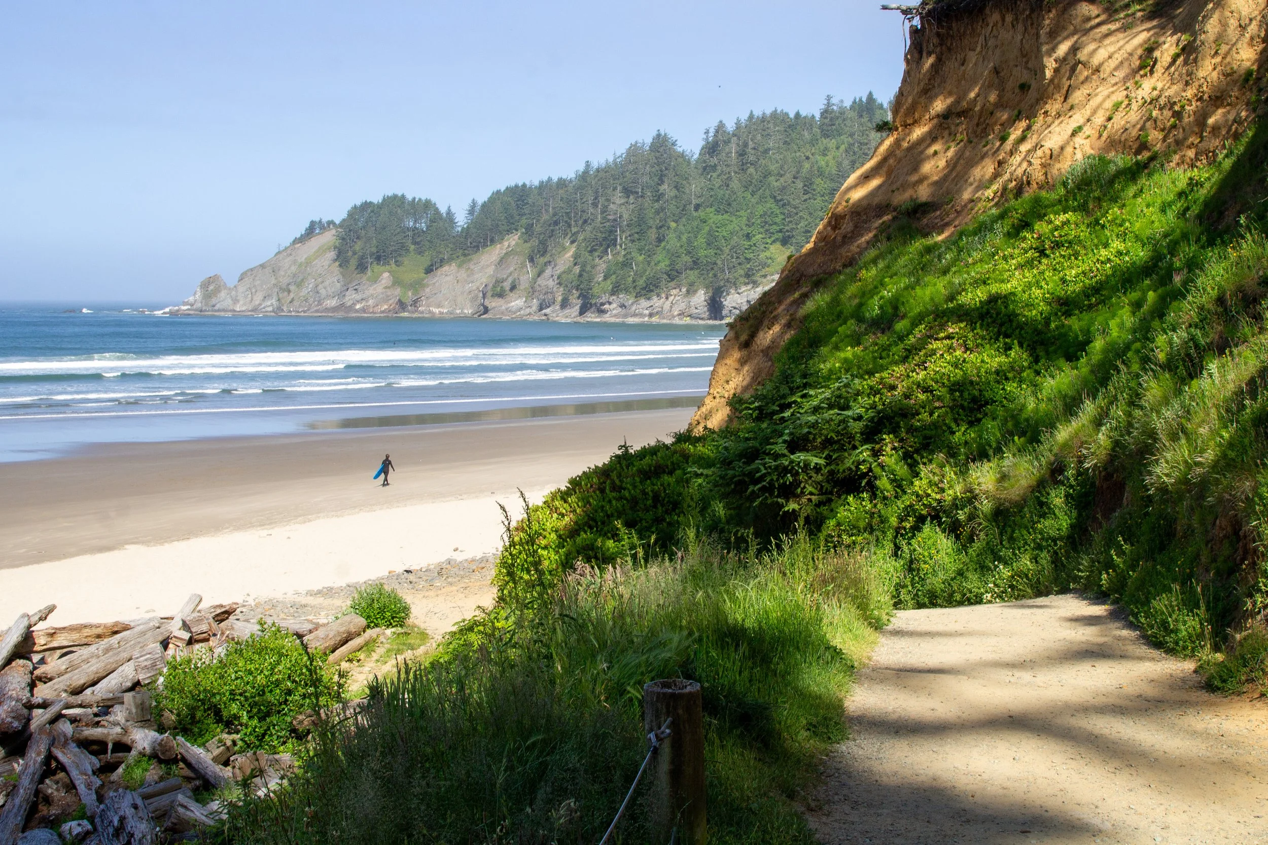
Short Sand Beach
Whether or not it’s a hot day, Short Sand Beach is one of the most pleasant beaches to visit on the Oregon Coast thanks to the protection it receives from the headlands surrounding it. Looking north, you’ll see the basaltic slope of Cape Falcon where the small but lovely Blumenthal Falls tumbles into the ocean. You can find some good tidepools near the falls at low tide. To the south are the cliffs of Devil’s Cauldron. Out in the water, surfers enjoy the waves.
An easy, 0.6-mile hike leads from the parking lot off Highway 101 down to the beach. Expect shade from large Sitka spruce and cedars along the way. There are restrooms and picnic tables just before you get to the beach. If you’d like a longer hike, you can find options here. The best is a trail that will take you out to the end of Cape Falcon where you can see great views of Smugglers Cove, Neahkahnie Mountain, and Manzanita on a clear day. The total distance is about 5 miles and the trail is pretty flat throughout but may be very muddy.

Lined shore crab near Blumenthal Falls
Best hikes near Portland for hot days, the summary:
Punchbowl Falls
Oxbow Regional Park
Milo McIver State Park
Wildwood Recreation Site
Salmon River Trail
Little Zigzag Falls
Trillium Lake
Mirror Lake
Wilson River Trail
Neahkahnie Mountain
Short Sand Beach
Have a great hike and stay cool!
With love,
Emma
Find more hikes for summer

Try out the swimming holes and hiking trails at Moulton Falls Regional Park.

Find more short hikes on the north Oregon Coast.
Most of the waterfall hikes near Multnomah Falls are good for hot days.