

Lemolo Falls Hike
Sometimes, traveling spontaneously, you can stumble upon incredible places by happy accident. Lemolo Falls isn’t one of them. You have to look for it, and look hard. First, head to the Highway of Waterfalls in southern Oregon’s High Cascades. Then, leave the highway, following forest service roads past campgrounds and hydroelectric infrastructure, navigating without GPS like it’s the 90s. Park at the easy-to-miss trailhead with no other cars. Follow the trail along the North Umpqua River, seeing no one, until you reach a roaring waterfall in a moss-covered amphitheater. Here’s how to find Lemolo Falls. It’s worth it.
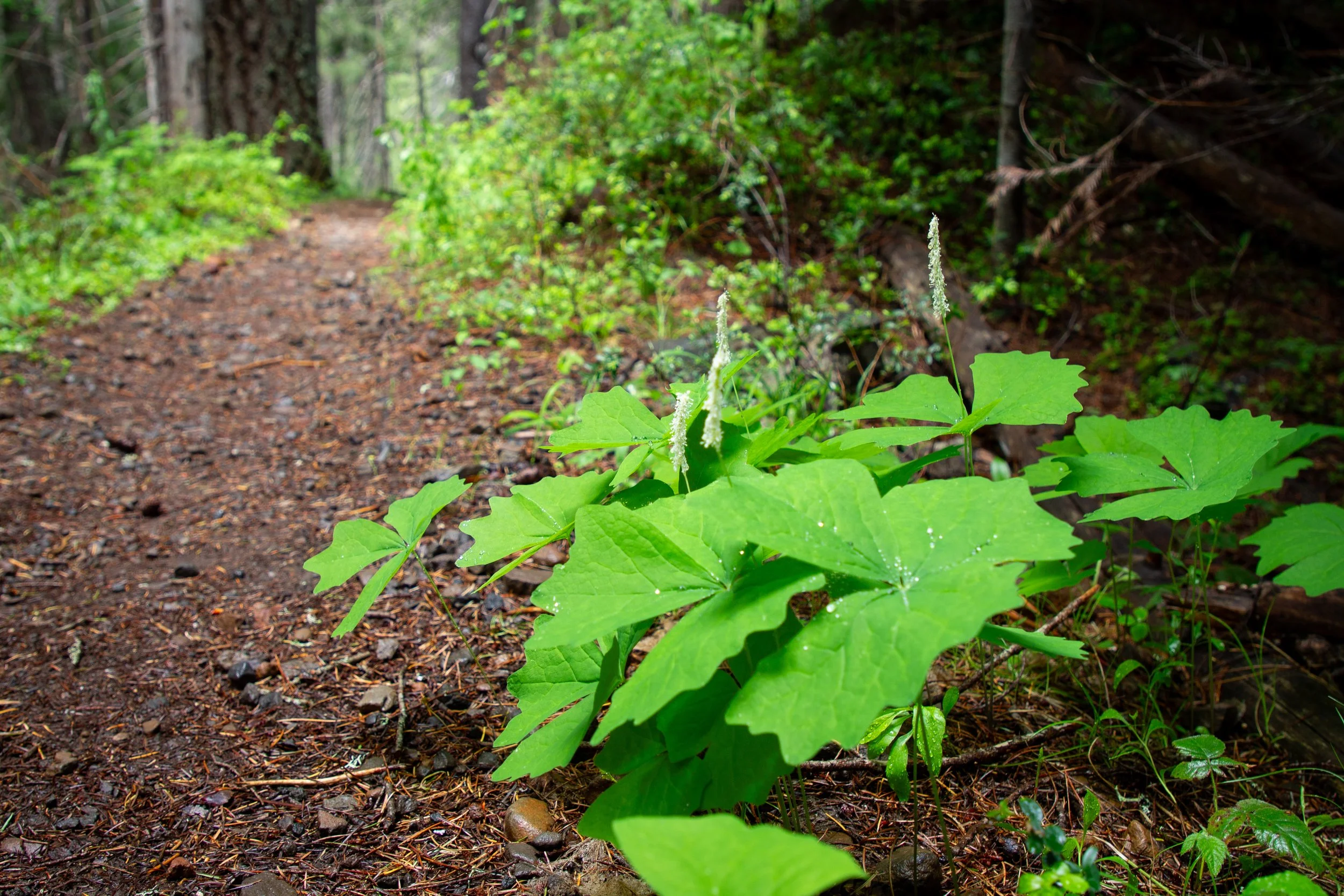
Vanilla leaf along the North Umpqua Trail
The versions
Two trails lead to Lemolo Falls. They’re on different sides of the North Umpqua River and would be separate excursions.
1. Upper Trail - to the top of Lemolo Falls
Easier (but not easy) to find
Paved roads to the trailhead
Fine in a low-clearance vehicle
Longer, less steep trail
Limited waterfall views
On the way to Warm Springs Falls
2. Lower Trail - to the base of Lemolo Falls
Harder to find
Rough dirt roads to the trailhead, high clearance vehicle recommended
Shorter, steeper trail
Better view of Lemolo Falls
In the same area as Warm Springs Falls, but not on the way
I did the upper trail based on advice I read online before visiting. If you’re not familiar with the area, the upper trail may be the better choice, especially if you have a low-clearance vehicle. You start at the White Mule Trailhead, which is easier to find and accessible by paved roads. If you’re going to Warm Springs Falls afterwards, it’s on the way. Up until the waterfall view at the end, the hike also has an easier and prettier route, following the North Umpqua River.
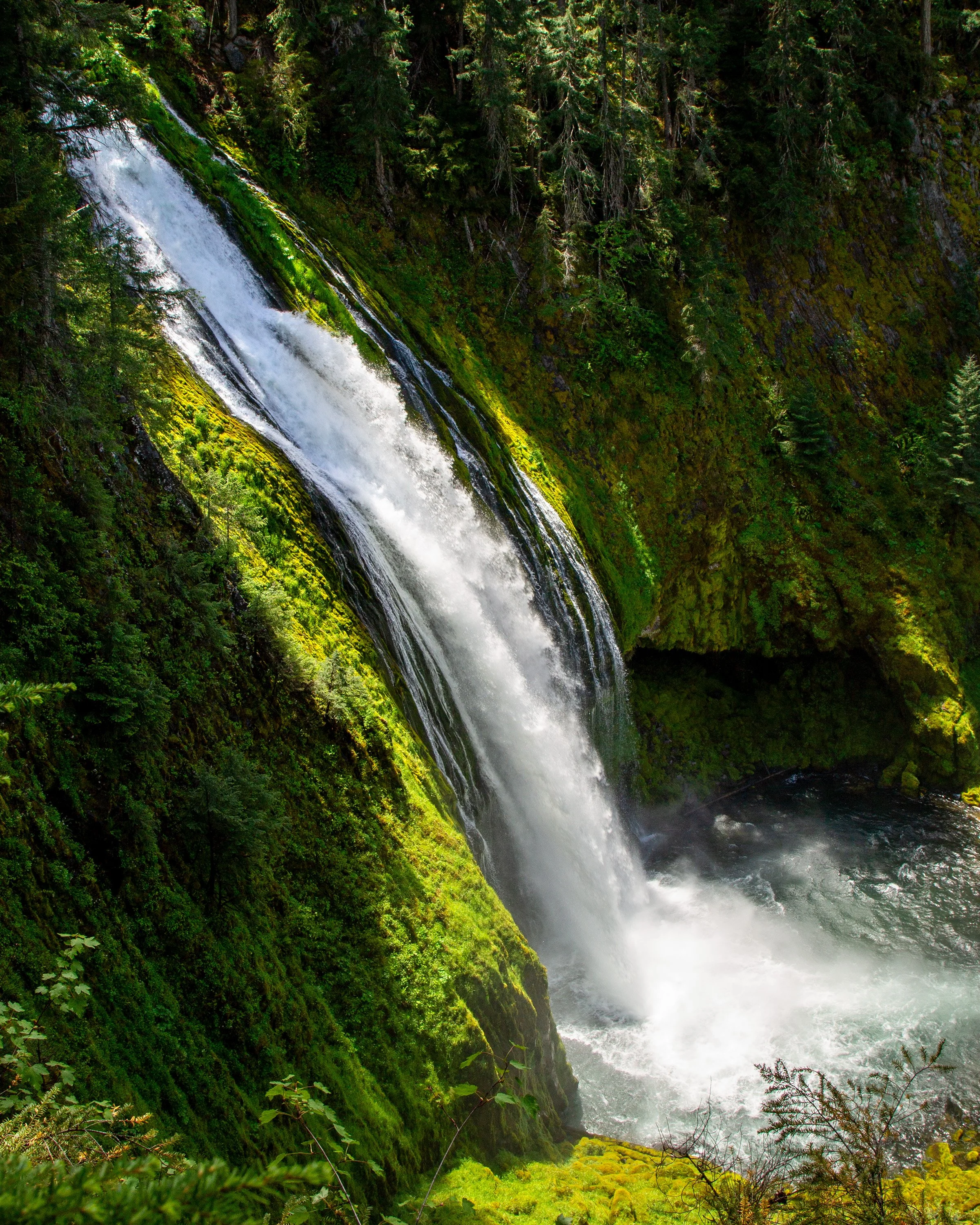
If I went again, I’d try the lower trail. I feel more comfortable with the navigation now and would love to take some photos of Lemolo Falls from the base. The major advantage of the lower trail is the view at the end. It looks straight at Lemolo Falls, making the photography easier, safer, and with more satisfying results.
The upper trail follows the North Umpqua River to Lemolo Falls
Quick stats
Distance: 3.5 miles (upper trail) or 2 miles (lower trail) out and back
Elevation gain: 400 feet (upper) or 600 feet (lower)
Difficulty: Moderate (upper) or hard (lower)
Pass required: None
ADA access: No
Know before you go
Cost: It’s free to visit Lemolo Falls.
Amenities: None (at either trailhead)
Dog-friendly: Yes, leashed dogs are welcome on the trails.
Hazards: Stay out of the river when the currents are high. To see an unobstructed view of Lemolo Falls on the upper trail, you’ll get close to steep drop-offs.
Season: Late spring through fall.
What to bring: Waterproof hiking boots. In the summer, bugs can be a nuisance, and it’s a good idea to wear bug spray. If you take the lower trail to Lemolo Falls, trekking poles could be helpful.
Navigation: Expect to have no cell service or GPS navigation starting long before you reach Lemolo Falls. Even the offline navigation on All Trails stopped working for me. Have a trail map printed or downloaded and written/screenshot driving directions. I have detailed directions at the end.
Lemolo Falls Hike (upper trail)
You’ve made it to the trailhead, huzzah! A sign at the White Mule Trailhead advertises Lemolo Falls in 1.5 miles. Someone wrote a correction in marker: 2 miles one way. I’m siding with the marker person. The hike felt more like four miles than three.
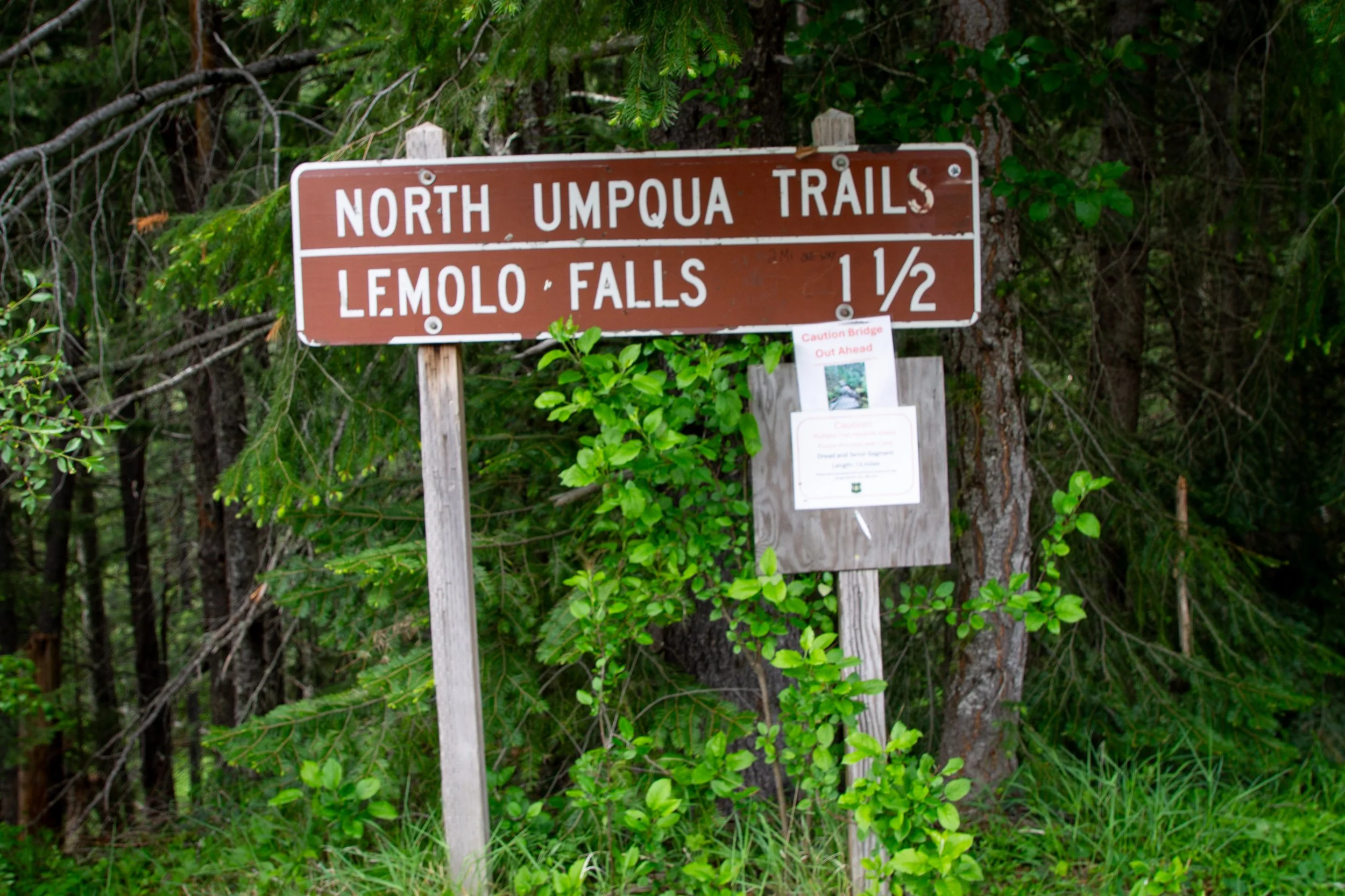
White Mule Trailhead
The hike to Lemolo Falls is on a section of the North Umpqua Trail called Dread and Terror. Oh my. It begins with neither, in a lovely Doug fir and western hemlock forest where vanilla leaf, irises, columbine, and small false Solomon’s seal bloom in the undergrowth in late spring. The name, I read in the BLM brochure, comes from the dread and terror forest rangers felt in 1908 at the thought of fighting wildfires in the dense brush.
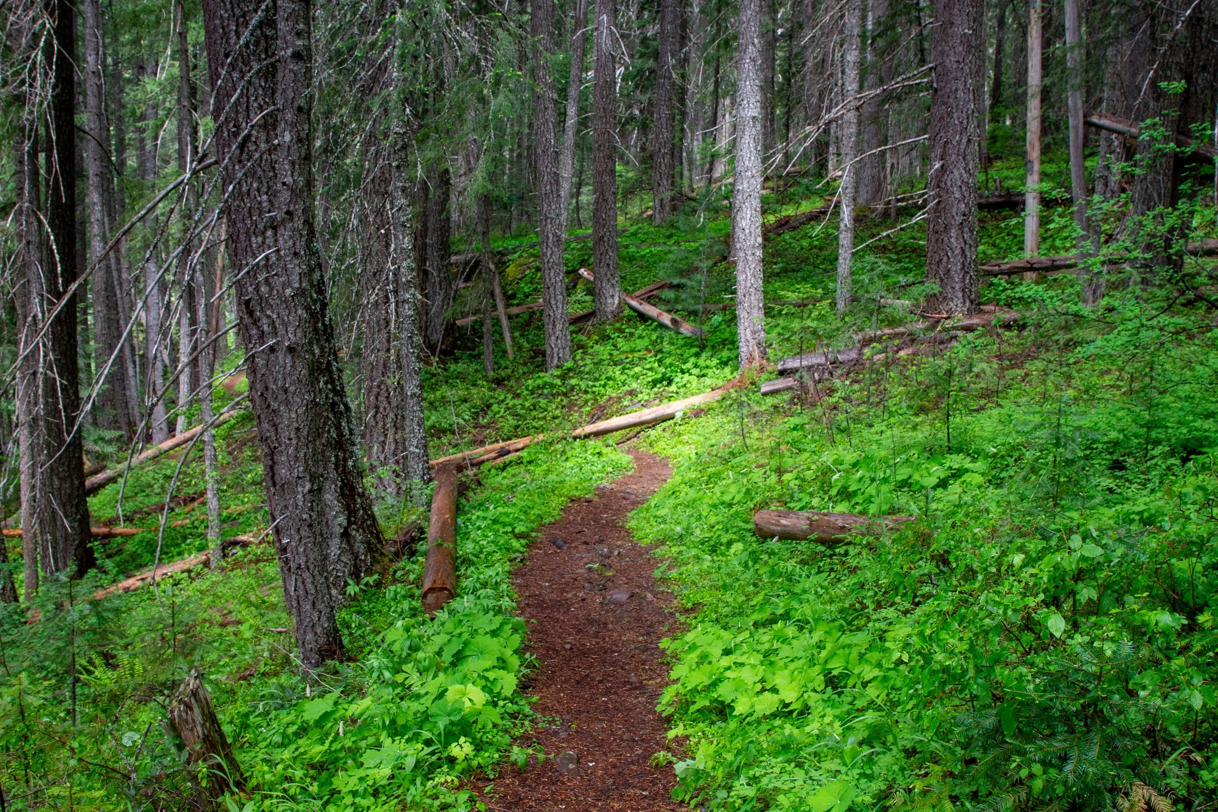
Dread and terror abound
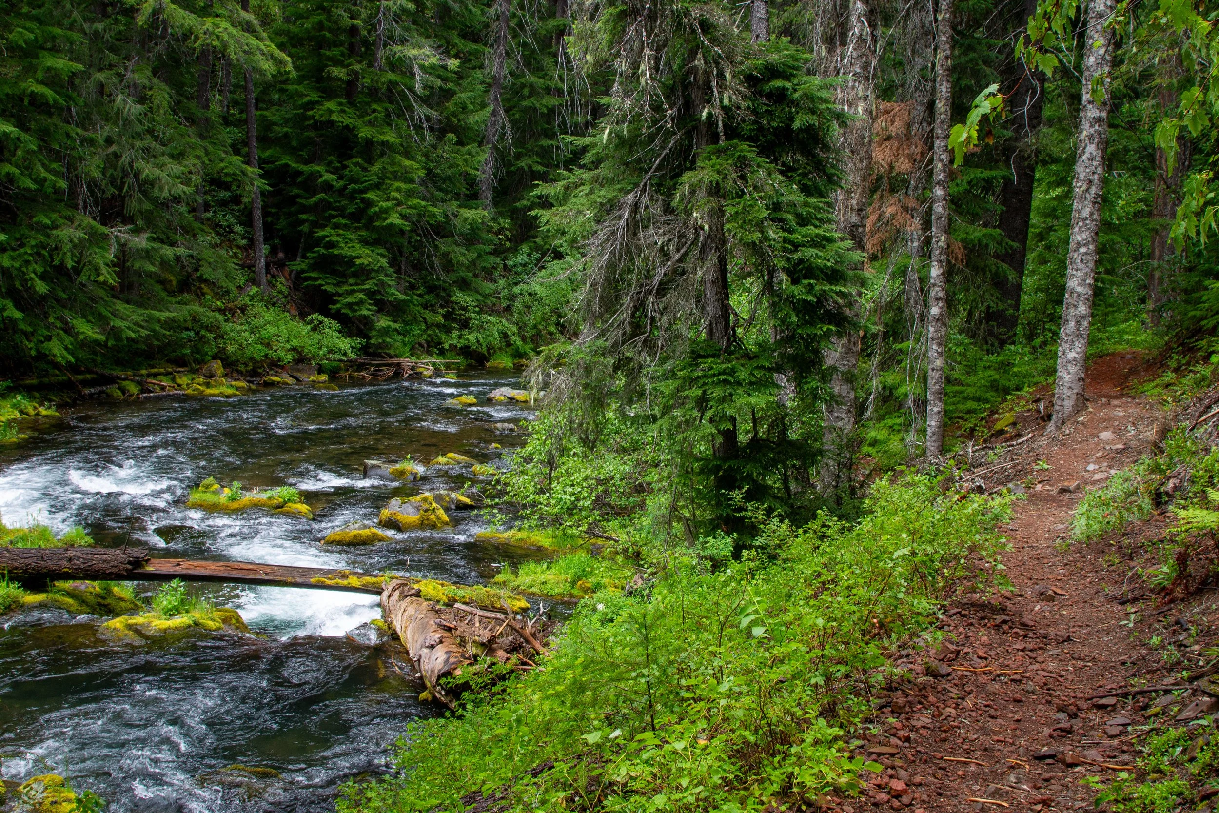
The trail heads steadily downhill throughout the hike. It’s in good condition and easy to follow. You’ll stay along the North Umpqua River all the way to Lemolo Falls, and there aren’t any intersecting trails to create confusion. A good thing, too, since my offline navigation was acting up by now.
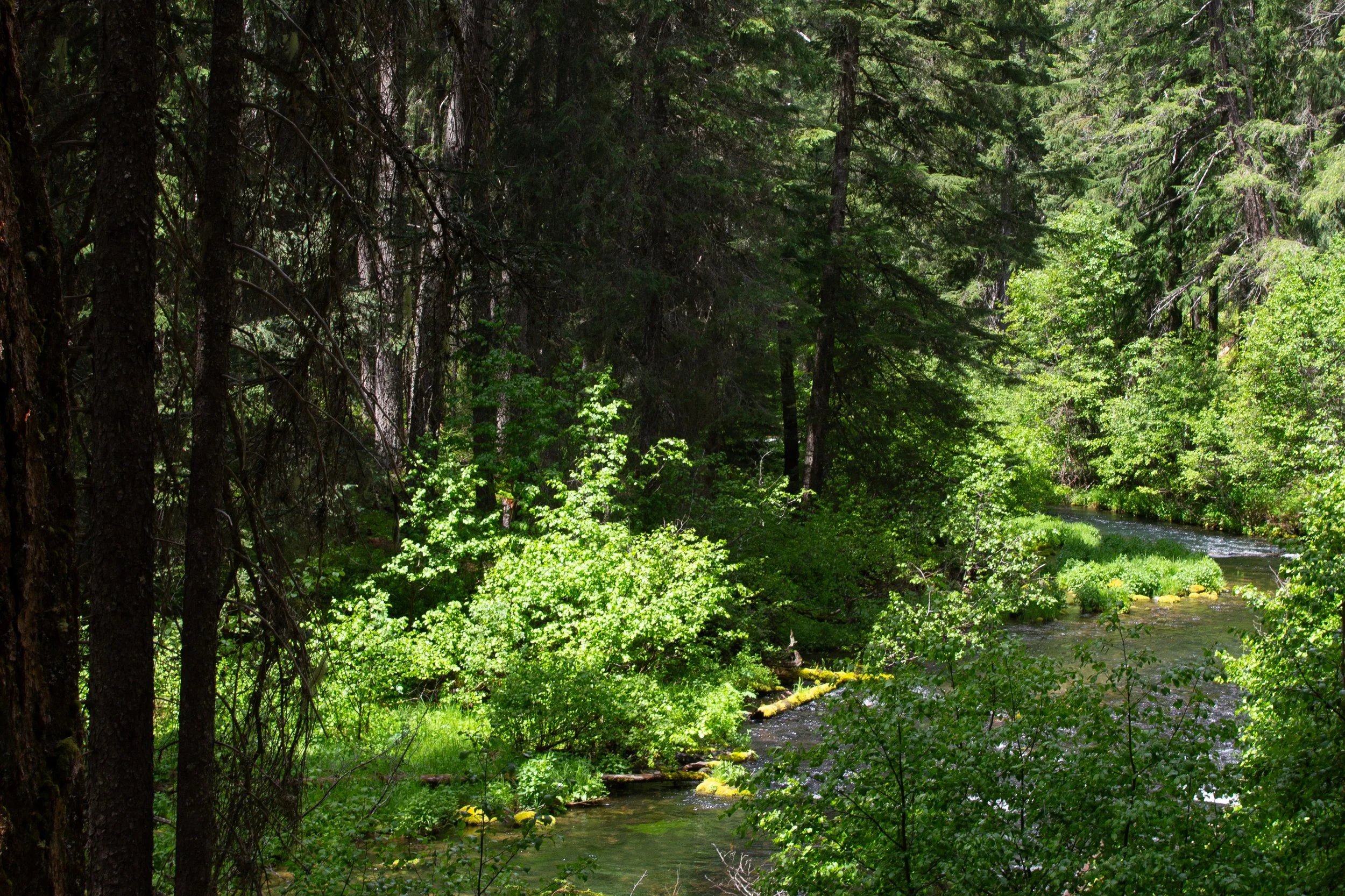
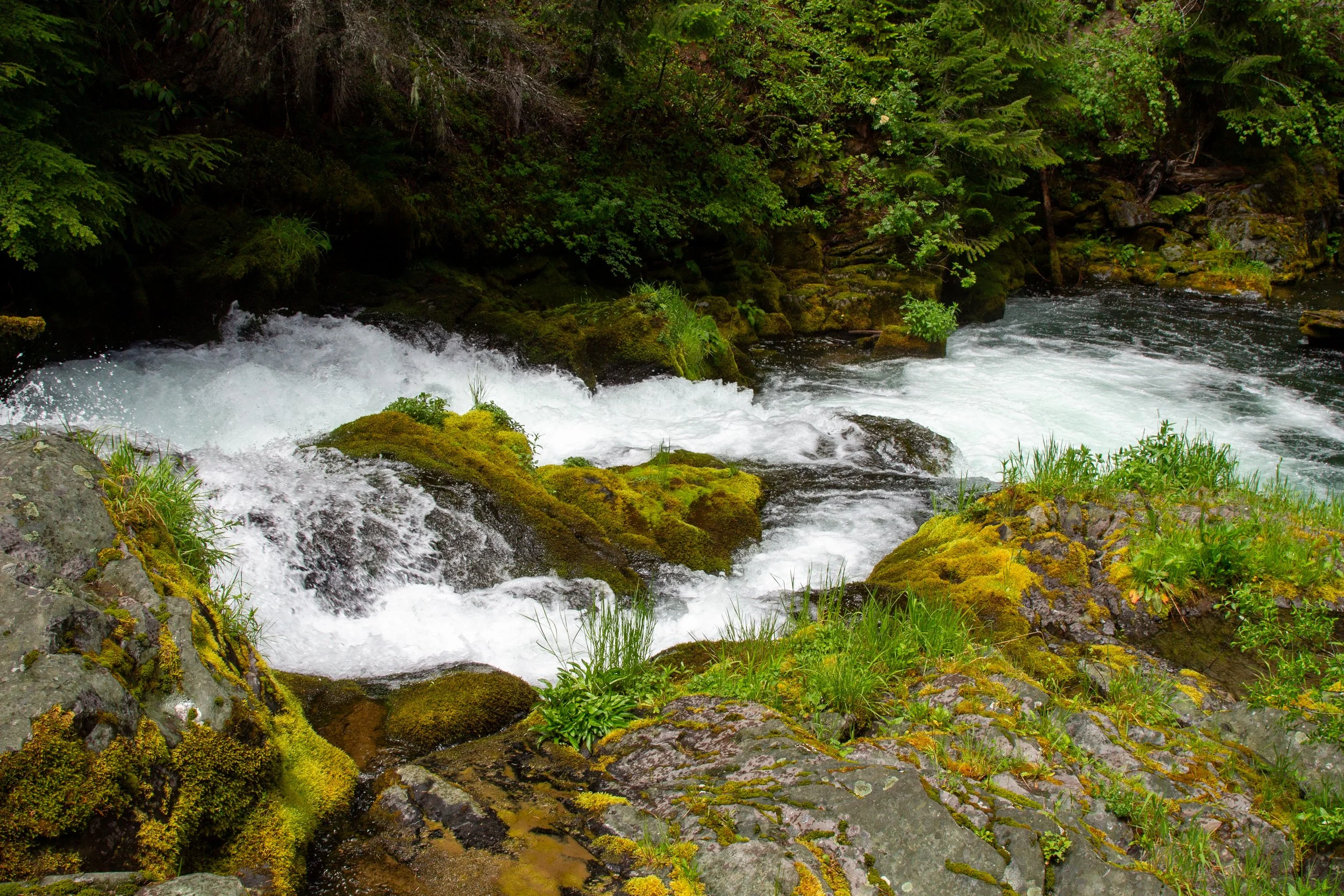
North Umpqua River
One of the advantages of taking the North Umpqua Trail to Lemolo Falls is the chance to walk along the river, even if the views take some imagination. Through the dense tree cover, you’ll see rapids and a few small waterfalls on the way to the finale. Even when you can get down to the water, I wouldn’t go wading, at least when the currents are as strong as when I visited.
Cascades on the North Umpqua River
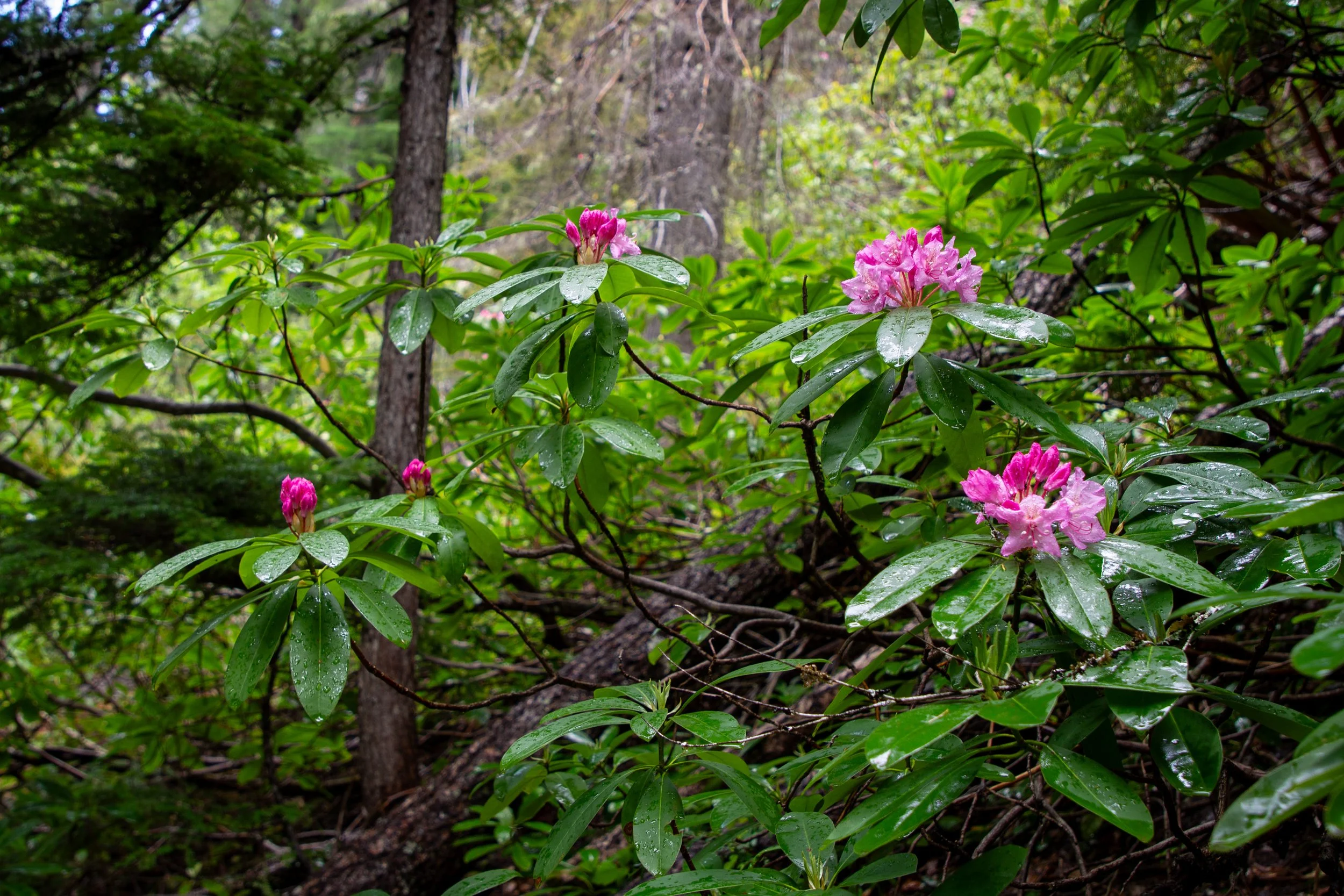
Many wild rhododendrons grow along the North Umpqua Trail. The buds were closed at the beginning of the hike on my late May visit. As I got close to Lemolo Falls, some of the first blooms were open, perhaps a quirk of the elevation change. June would be a great time to see them in their full glory.
Wild rhodies
The hike to Lemolo Falls is a great way to find solitude. I saw no one on the way out. On the return trip, I passed one couple. They said they visit often and were surprised to see another person on the trail. Despite the remote location, the trail maintenance is excellent. It has some rocks and roots, a few small logs. At one point, a stream ran over the trail, making me glad I had waterproof boots. Otherwise, a gentle walk along the river.
North Umpqua River
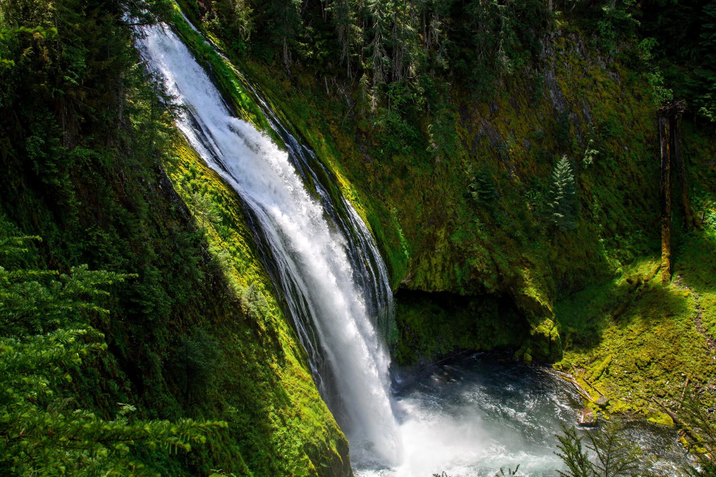
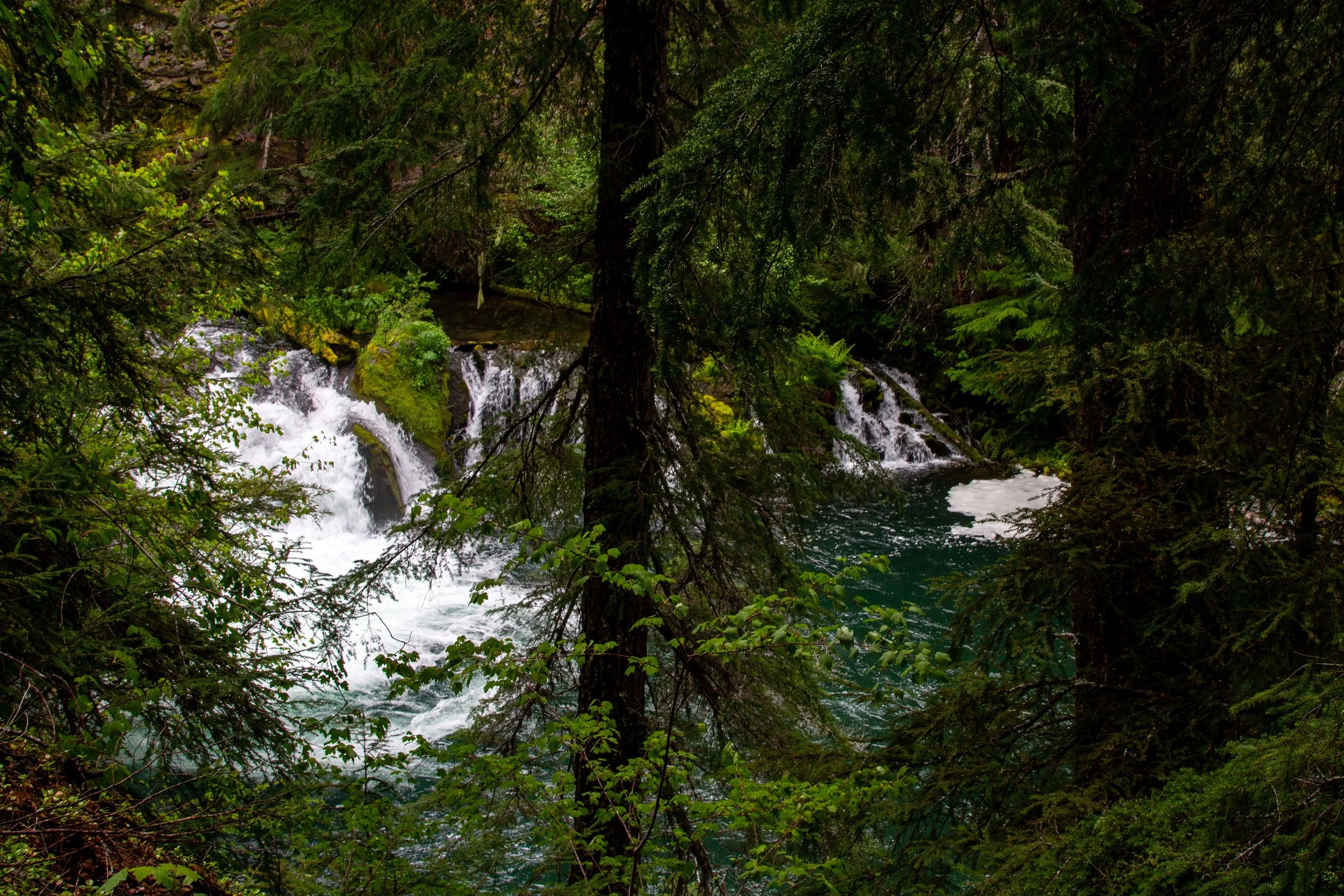
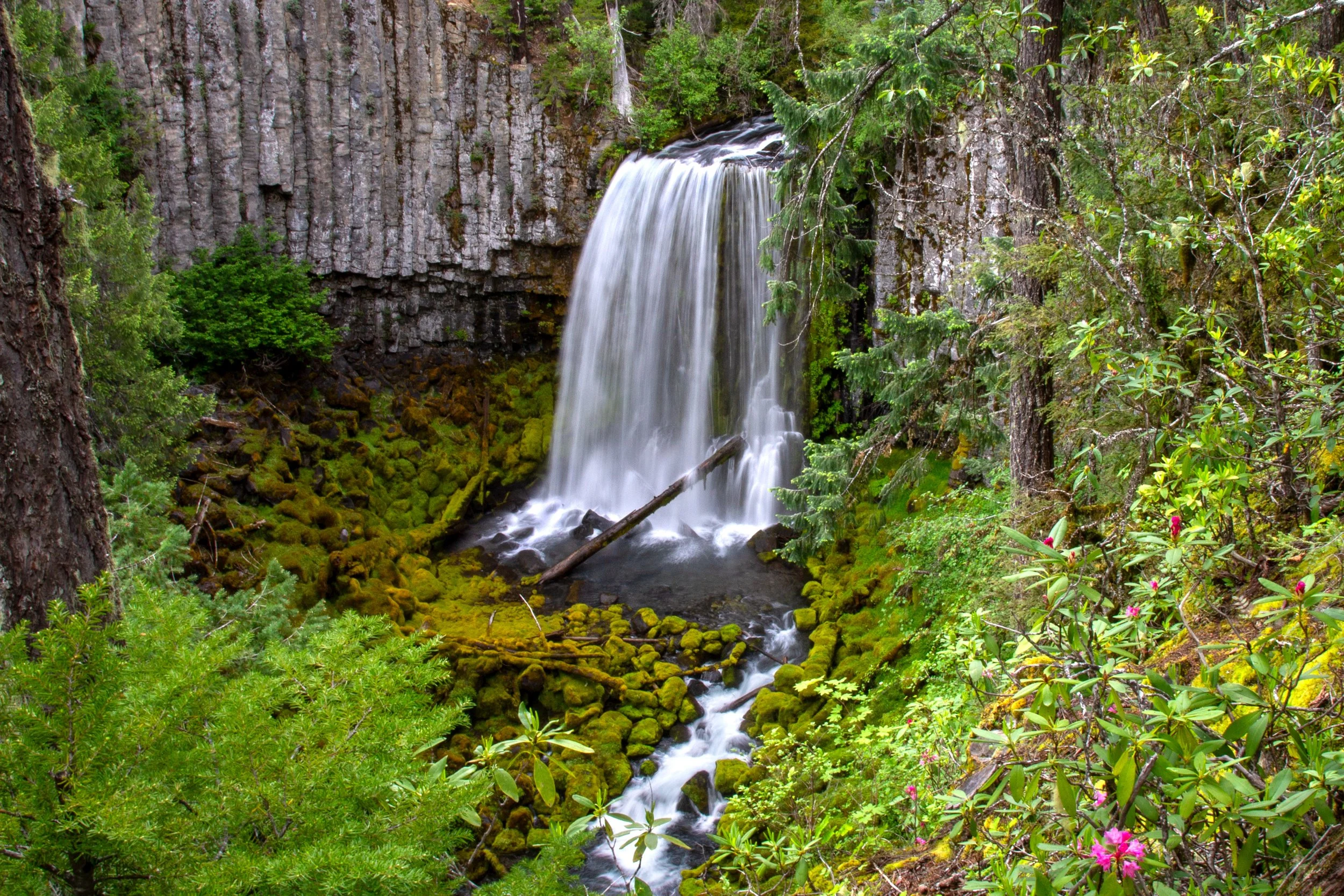
After what I strongly suspect is two miles rather than one and a half (the sign vandal is vindicated), you’ll reach Lemolo Falls. The major downside to this version of the hike is the limited view at the end. Tree cover keeps you from seeing the whole waterfall from the trail. You’ll see a few places where people have left the trail in search of a better view. Most looked quite dangerous: crumbling dirt next to steep drop-offs. One rocky outcropping, the one closest to Lemolo Falls, was at least solid ground.
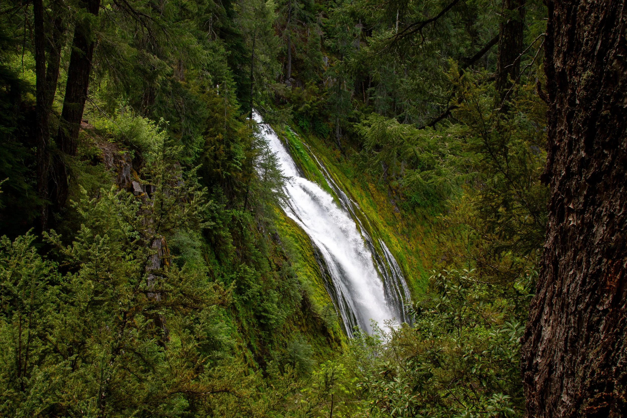
Best view of Lemolo Falls from the trail
It’s hard not to want to see more of Lemolo Falls, the tallest waterfall on the North Umpqua River. The exact height is a bit of an open question. It’s around 150 feet, depending on the source, but its visual impact is about more than size. Lemolo Falls has both raw power and delicate beauty as it surges over a basalt cliff in a horsetail shape, flanked by thin rivulets. Beneath Lemolo Falls is a turquoise pool. Around it, bright green moss covers sloping cliffs topped with a conifer forest. The name Lemolo, meaning “wild” or “untamed” in Chinook Jargon, has a poignant irony today. The Lemolo Lake Dam affects the falls more than the season. My pictures are from usual, low-flow times. When it flows freely, over five times as much water can pass over the falls.
Lemolo Falls
The North Umpqua Trail continues long past Lemolo Falls. The Dread and Terror segment is 13 miles, one way. You can turn around at the first view of Lemolo Falls or continue to a bridge over the river. It has a distant view of the falls and adds about 1.5 miles to the hike, round-trip.
Getting there
Upper trail
The upper trail to Lemolo Falls starts at the White Mule Trailhead.
From Highway 138, turn onto Bird Point Rd (NF-2610) at milepost 72.8, following signs for Lemolo Lake.
Follow Bird Point Rd for 5.2 miles, using the one-lane road to cross the Lemolo Lake Dam.
Look for the White Mule Trailhead on your left. It’s hard to spot the sign from the road. It’s across a little bridge that connects the paved road to the unpaved road running parallel to it. Park on the unpaved road.
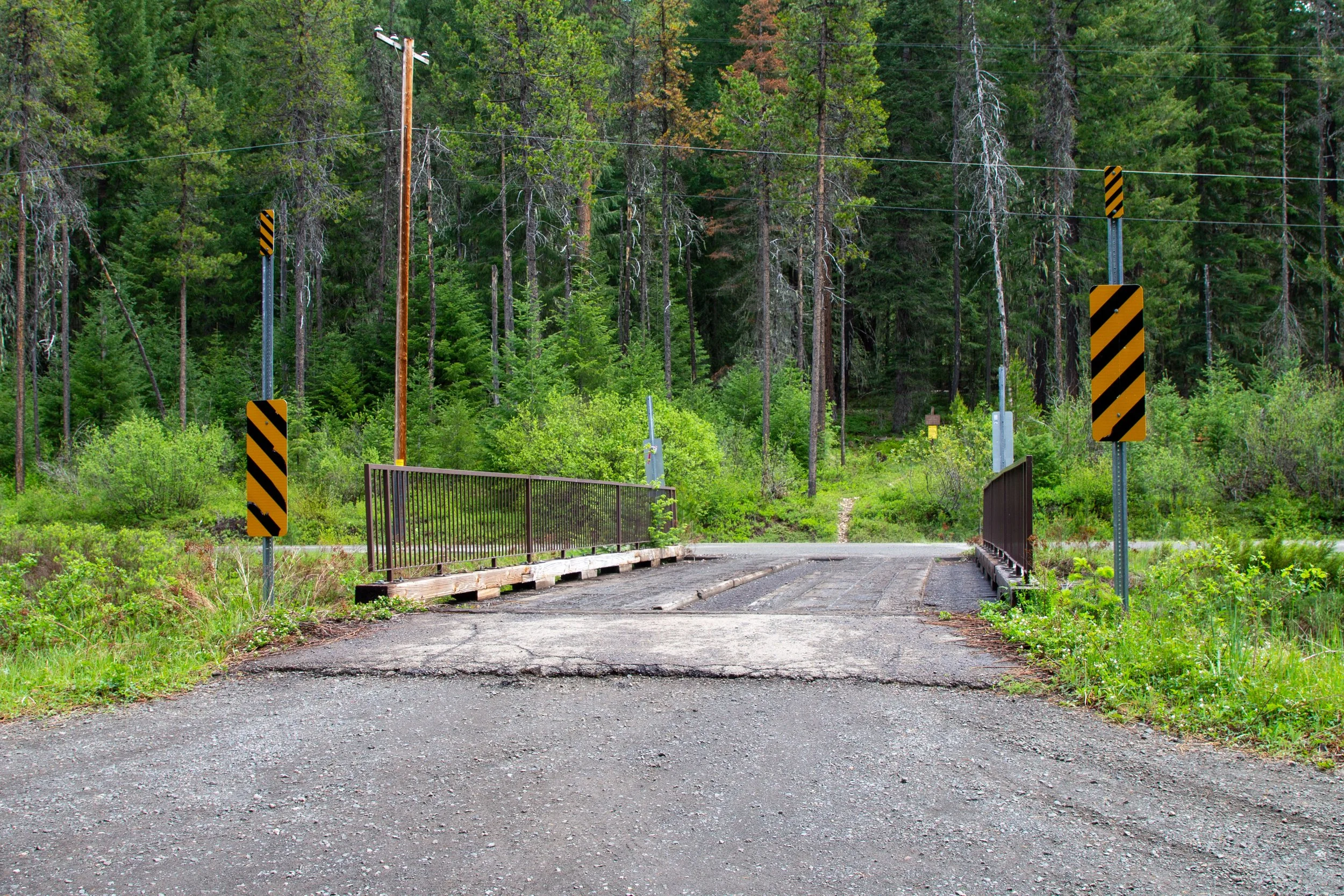
Cross the bridge to reach the White Mule Trailhead
Lower trail
From Highway 138, turn onto Bird Point Rd (NF-2610) at milepost 72.8, following signs for Lemolo Lake.
In 4.3 miles, keep left onto NF-3401. If you cross the dam, you’ve gone the wrong way.
In 0.5 miles, turn right onto Road 3401-800. Continue for 1.75 miles.
Turn right onto Road 3401-840. Continue for 0.25 miles to the trailhead.
The drive to either trailhead takes about 1.5 hours from Roseberg, 2 hours from Bend or Medford, or 4.5 hours from Portland.
Warm Springs Falls
Warm Springs Falls
While you’re in the area, Warm Springs Falls is a great stop after your hike to Lemolo Falls. The easy, 0.6-mile out-and-back trail to Warm Springs Falls is less than 10 minutes from the White Mule Trailhead. It ends at a fenced viewing platform that overlooks a beautiful 70-foot curtain of water plunging over giant basalt columns. Lichen hangs from the branches of Doug firs and hemlocks. Wild rhododendrons bloom in the undergrowth in early summer.
Enjoy your hike to Lemolo Falls and Warm Springs Falls!
With love,
Emma
Explore nearby
Check out the best short hikes in Crater Lake National Park.