Southern Oregon’s Highway of Waterfalls: Road Trip Guide
Disclosure: I may earn a small commission on links at no cost to you
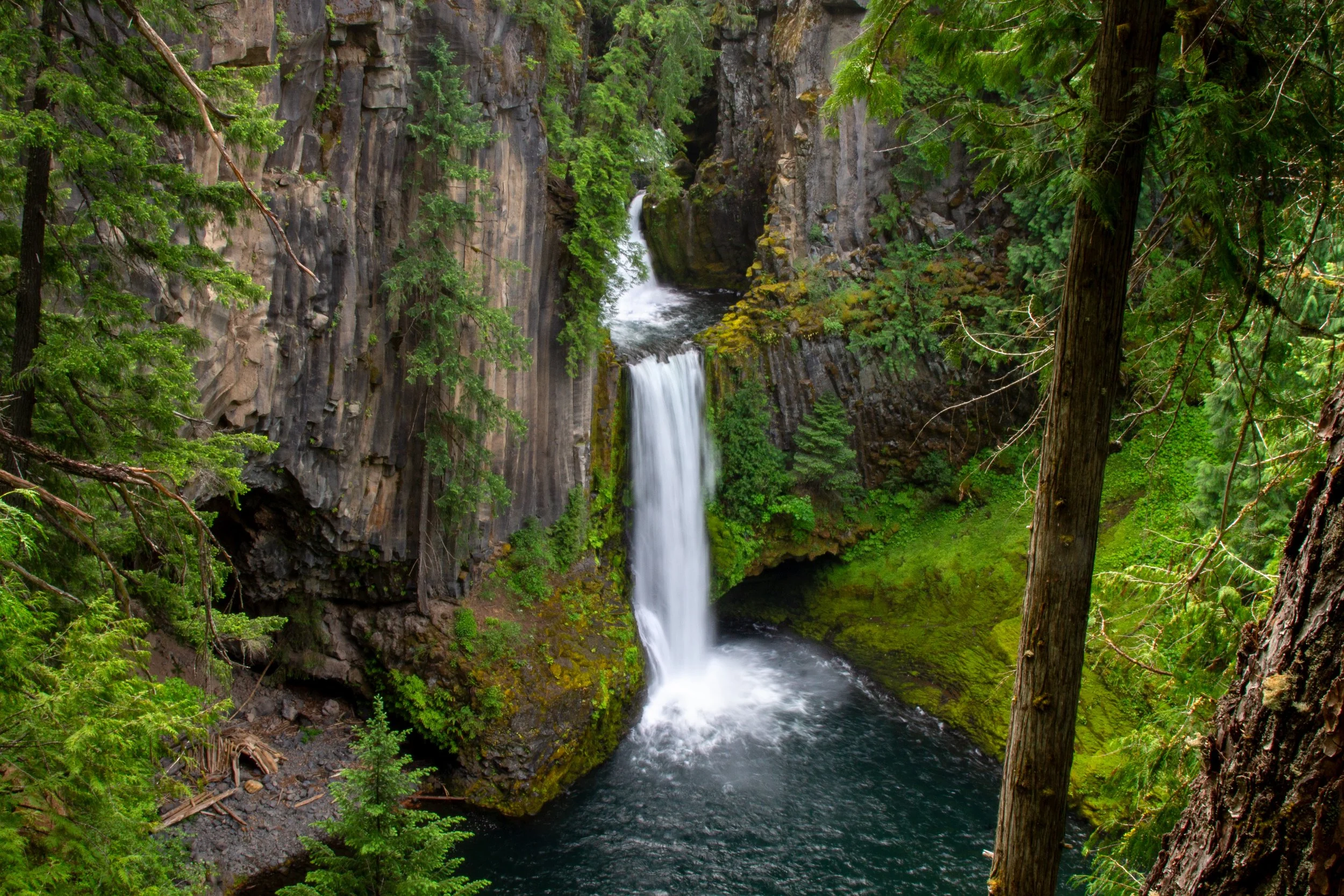
First, let’s make sure we’re thinking of the same place. Oregon’s Highway of Waterfalls is a stretch of Highway 138 between Roseburg and the north entrance to Crater Lake National Park. The most famous sight is Toketee Falls, the waterfall that inspired my trip. When I planned my itinerary, I found that information about the area was scattered and often out of date. Anything before 2020 won’t account for the Archie Creek wildfire. Now that I’ve been, here’s my detailed guide to the Highway of Waterfalls. It’s everything I wish I’d known before my trip in one place.
See salmon and steelhead at Deadline Falls from May through October
What to see on the Highway of Waterfalls
Most impressive waterfalls: Toketee Falls, Watson Falls, and Lemolo Falls
Quick and easy stops: Whitehorse Falls and Clearwater Falls
Worth it, if you have time: Deadline Falls, Susan Creek Falls, Falls Creek Falls, Little Falls, Steamboat Falls, Slide Creek Falls, and Warm Springs Falls
Non-waterfall attractions: Umpqua Hot Springs and Diamond Lake
Itinerary suggestions
If you’re visiting the Highway of Waterfalls as part of a trip to Crater Lake National Park, I’d allow at least one full day to see the park. Before or after visiting Crater Lake, here’s how I’d spend the remaining time exploring the Highway of Waterfalls:
Less than one day: Do the short hikes to Toketee Falls and Watson Falls, then stop at Whitehorse Falls and Clearwater Falls.
Full day: If you’re down for more hiking, add a detour to Lemolo Falls and Warm Springs Falls. For less hiking, check out the Umpqua Hot Springs instead.
2-3 days: Add stops at the lesser-known waterfalls on the “worth it” list: Deadline Falls, Susan Creek Falls, Falls Creek Falls, Slide Creek Falls, and the Steamboat Creek waterfalls.
Longer trips: Diamond Lake is a great place to spend the afternoon, or even a full day. If you’re in it mostly for the waterfalls, the Little River has more. They’re more secluded and harder to find than those on the North Umpqua River. Not better, just more variety.
Whitehorse Falls
Tips for visiting the Highway of Waterfalls
Reception: I had no cell service east of Glide, including GPS navigation. Have offline maps and directions with you. The better-known waterfalls have signs from Highway 138. Others, you have to know where to look. I have detailed directions to the waterfalls toward the end.
Recreation passes: None of the waterfalls I visited on the Highway of Waterfalls required a parking pass. The Umpqua Hot Springs charges a $5 fee unless you have the NW Forest Pass or America the Beautiful Pass. If you have an America the Beautiful Pass, it also covers Crater Lake National Park.
Limited services: Plan on being as independent as possible while visiting the Highway of Waterfalls. Have food, water, a full gas tank, and offline directions with you. There’s a gas station in Dry Creek.
Dogs: Leashed dogs are welcome at the trails and stops that I’ll be talking about on the Highway of Waterfalls. If you’re visiting Crater Lake National Park as part of your trip, dogs can be in certain areas of the park.
Wildfire recovery
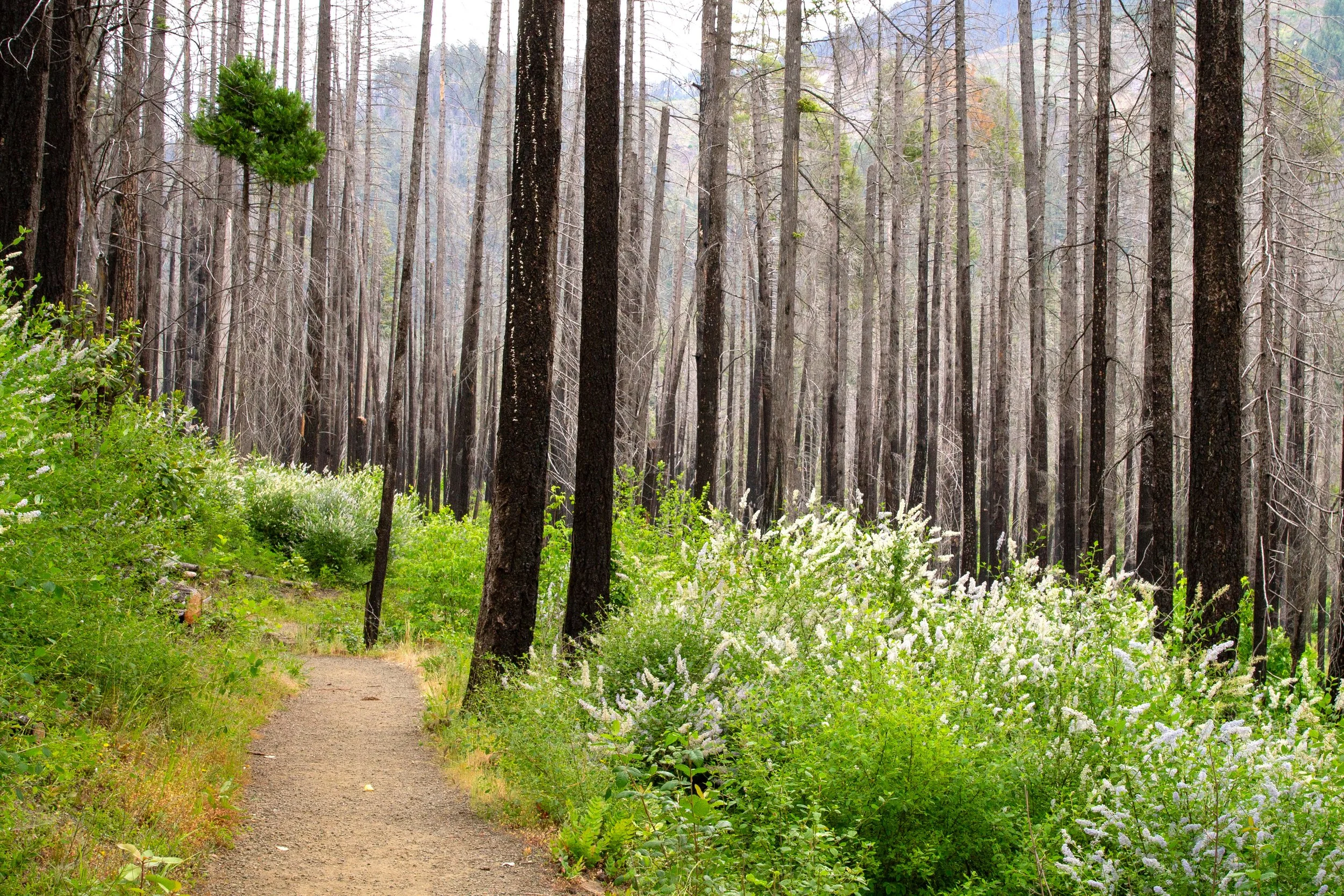
Susan Creek Falls Trail
I did a lot of research before visiting the Highway of Waterfalls. Information online is limited compared to most Oregon tourist destinations, and much of it was written before the 2020 Archie Creek wildfire. Today, it’s a tale of two forests: the one that burned and the one that didn’t. The western stretch of the drive, between Glide and Steamboat, is where you’ll see the most fire damage. Once you get a little east of Steamboat, the forest is unaffected, including Toketee Falls and Watson Falls.
When I visited the burned area in 2026, the undergrowth was back, and some baby trees were growing. Most hiking trails were open again. When you’re there, be aware that the conditions are unstable and respect any trail closures. If you’re reading travel information from before 2020, know that things may be different now. Of the waterfall hikes, fire impacted the area around Susan Creek Falls and Falls Creek Falls. Parts of the North Umpqua Trail, the 79-mile hike between Swiftwater Park and the headwaters of the North Umpqua River, were closed due to hazardous conditions during my trip.
When to visit
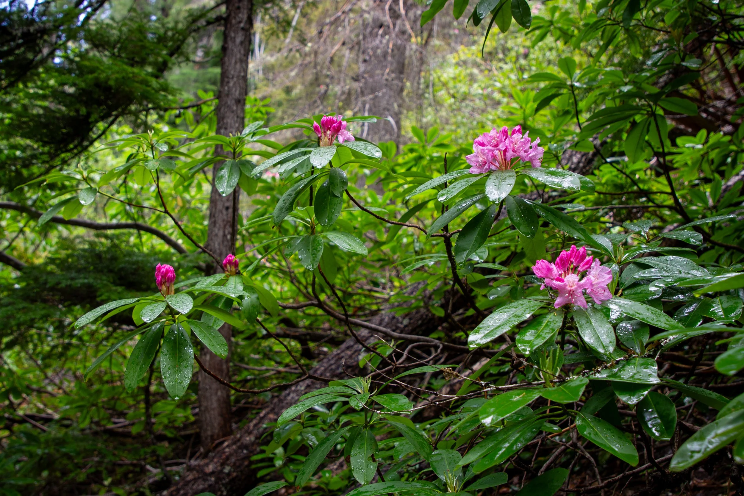
The first wild rhododendrons open in late May
Most people visit the Highway of Waterfalls as part of a trip to Crater Lake National Park. It connects Roseburg to the park’s north entrance, which is open from late May or early June until November 1st, weather permitting.
Late spring is a great time to visit if you’re not going to Crater Lake. The crowds are few, the waterfalls are powerful, and you’ll see some wildflowers along the hiking trails.
Summer is peak season. Expect good weather, more people, and access to Crater Lake. Wild rhododendrons bloom in June.
Early fall is a less crowded time to visit the Highway of Waterfalls and Crater Lake. The weather is usually very pleasant. Expect fall color starting around October.
From late fall to early spring, be prepared for winter driving conditions. Crater Lake’s north entrance will be closed. You might not be able to reach the trails and waterfalls.
Where to eat

Th Pizza Bus at Two Shy Brewing
Restaurants are few along the Highway of Waterfalls. The small town of Glide has several. Once you reach the waterfalls, options are limited.
The Steamboat Inn has a cozy restaurant with windows looking out onto greenery. The food is a step above your typical roadside stop.
Depending on your itinerary, the Diamond Lake Resort may be a little out of the way, but it’s a great lunch stop. The restaurant patio has a view of Diamond Lake. The atmosphere has a lively summer-vacation feel.
The Dry Creek Store is a gas station and convenience store with some takeaway food, like hot dogs and sandwiches.
West of the waterfalls, Roseburg has many restaurants. I didn’t do a deep dive, but I do want to give a shout-out to a couple of places. Too Shy Brewing has a patio, great local wine and beer, and a friendly ambiance. Rotating food carts visit. The India Grill has an unassuming exterior and fantastic food.
Where to stay
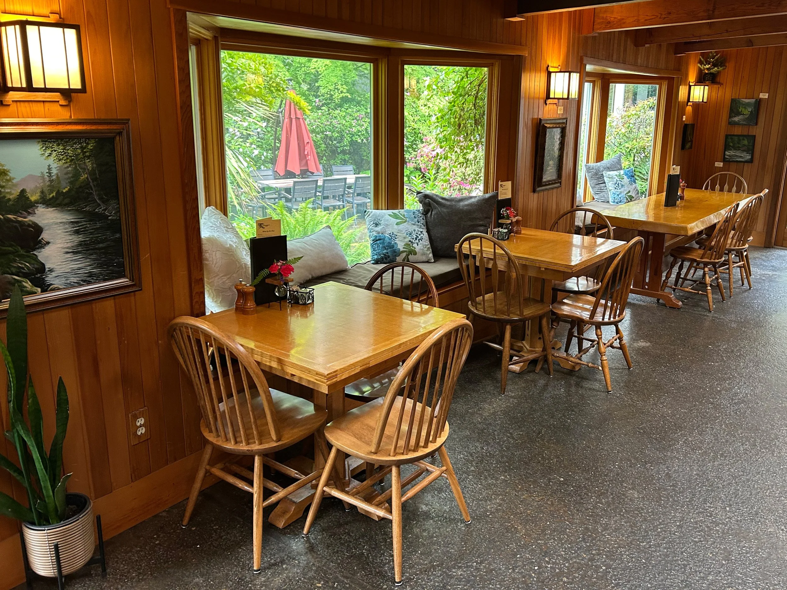
Steamboat Inn
Most of the lodging options along the Highway of Waterfalls are campgrounds. You can find campsites and make reservations through recreation.gov. If, like me, you love a mattress, here are some good alternatives.
If your budget allows it, the Steamboat Inn is a charming stay in the Umpqua National Forest. The location is fantastic. It’s right on the Umpqua River and very close to the waterfalls. The inn’s restaurant serves farm-to-table meals.
Cabin stays can be easier and more comfortable than tent camping. Check out these cabins in the Umpqua National Forest.
I stayed in Roseburg when I visited. It’s less scenic than the national forest, but more budget-friendly and near conveniences like gas stations. It’s about 30 minutes from the first waterfall and an hour from the famous waterfalls. The Comfort Inn was clean and comfortable, with nice extras like breakfast and a hot tub.
The Riverfront Inn in Roseburg is reasonably priced and has a scenic location on the South Umpqua River. Breakfast is included, and some rooms have river views.
Waterfalls
Deadline Falls
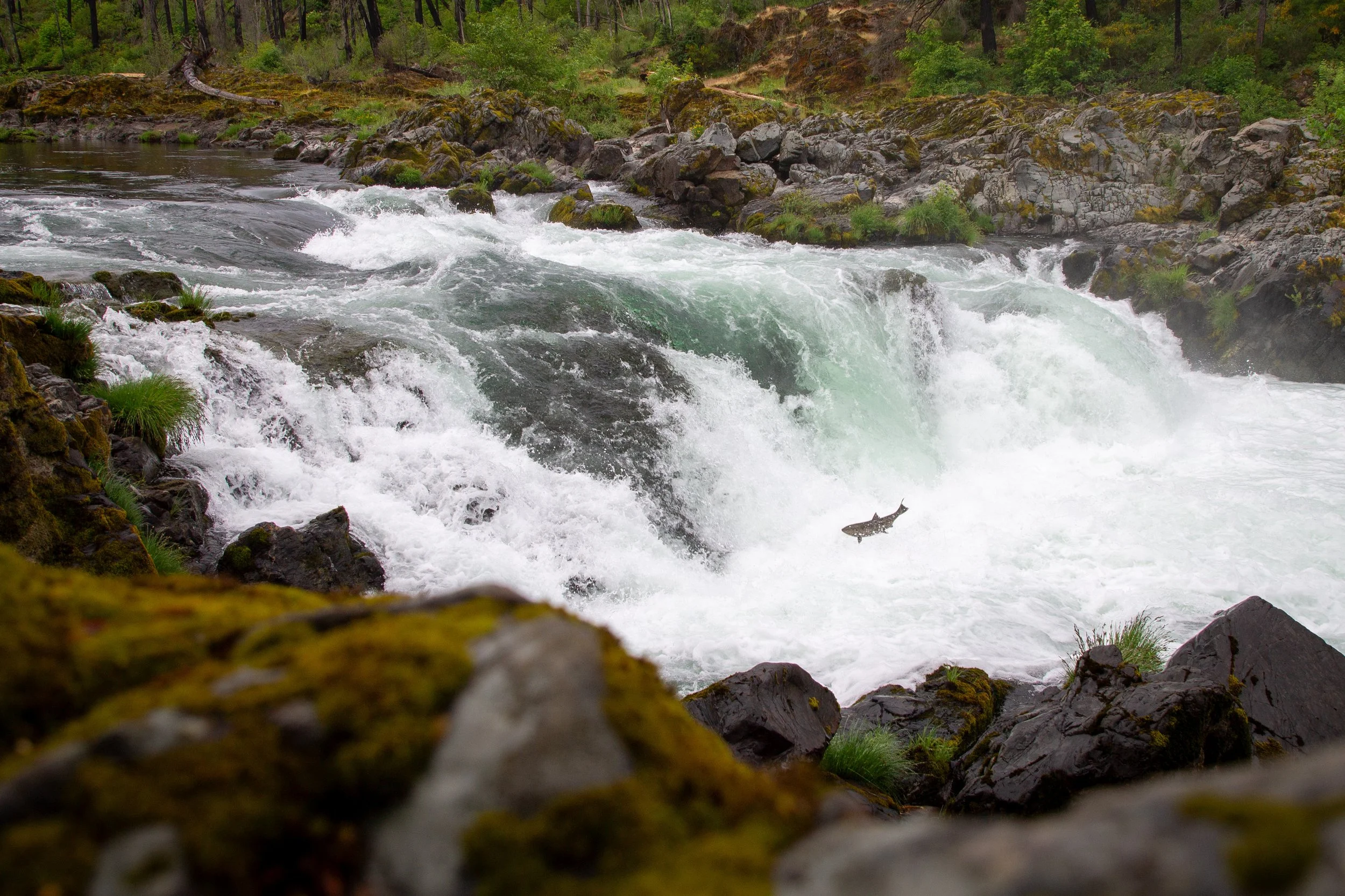
Hiking: No, pending wildfire recovery
Driving detour: No
Amenities: Restrooms and picnic tables at Swiftwater Day Use Area
Pass required: None
Burn area: Yes
ADA access: Not really, but you can see the waterfall from the road.
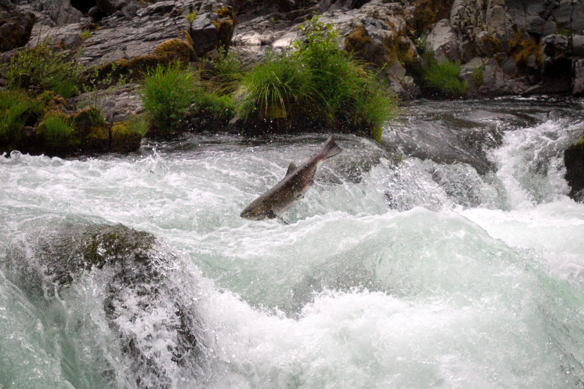
The waterfall: By itself, Deadline Falls isn’t one of the most impressive sights on Highway 138. Only 12 feet high, it looks like a large rapid on the North Umpqua River. What makes it special is the likelihood of seeing migrating salmon and steelhead between May and October as they return from the ocean to spawn. Seeing them was an experience beyond what I can describe in words. On a 3-day trip, I went twice. The first time I cried.
Directions: You’ll see Deadline Falls from the car as you drive on Highway 138. Ignore any directions from before 2020 about how to get closer. Wildfire damage changed things. Previously, you’d cross the bridge by the Swiftwater Day Use Area and walk 0.25 miles on a hiking trail to a wildlife viewing area. The trail was closed when I visited in 2026, and it was very unsafe. Standing in the parking lot, I saw three dead trees fall within a few minutes. If you want to check it out for yourself, the parking lot isn’t close to any trees, so it’s not dangerous unless you start the trail.
A safer option is to park on the shoulder of Highway 138 while driving east. The spot closest to Deadline Falls is just past the sign that says “Entering North Umpqua Fly Only Area.” You can see a partially obstructed waterfall view from the road. If you scramble down some rocks (slippery after rain), you can get up close.
Susan Creek Falls
Hiking: 1.6 miles, easy
Driving detour: No
Amenities: Restrooms and picnic area
Pass required: None
Burn area: Yes
ADA access: No
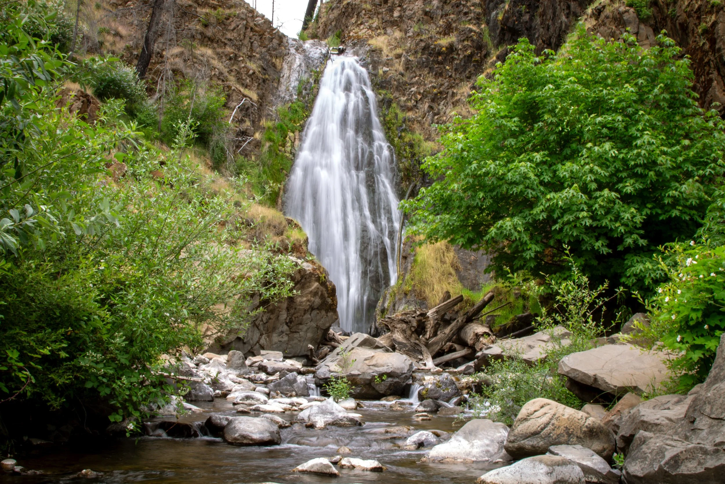
The waterfall: Susan Creek Falls is a lovely, 50-foot fan-shaped waterfall in an area recovering from wildfire damage. Visiting is bittersweet. Most of the trees are dead. The undergrowth has regrown and the trail restored. Signs along the hike identify plants, many of which are charred remains. An exception is poison oak. It’s thriving, alas. Deerbrush blooms in late spring, along with some trailside irises, as though nature laid flowers on the graves of the trees.
The hike: The trail to Susan Creek Falls is well-maintained and family-friendly, but be aware that wildfire recovery makes the area more unstable. I’ve seen older trail guides call it ADA-accessible, which I’d say isn’t the case anymore because of some narrow, uneven sections.
Directions: The parking area for the Susan Creek Falls Trailhead is just off Highway 138 (milepost 28.2). A sign points the way. If you’re driving east, the trailhead will be on your left. It has a vault toilet and a picnic table. Across the highway is a day-use area with indoor restrooms, running water, maps of the area, and a prettier picnic area overlooking the North Umpqua River.
Falls Creek Falls
Hiking: 2 miles, moderate
Driving detour: No
Amenities: None
Pass required: None
Burn area: Yes
ADA access: No
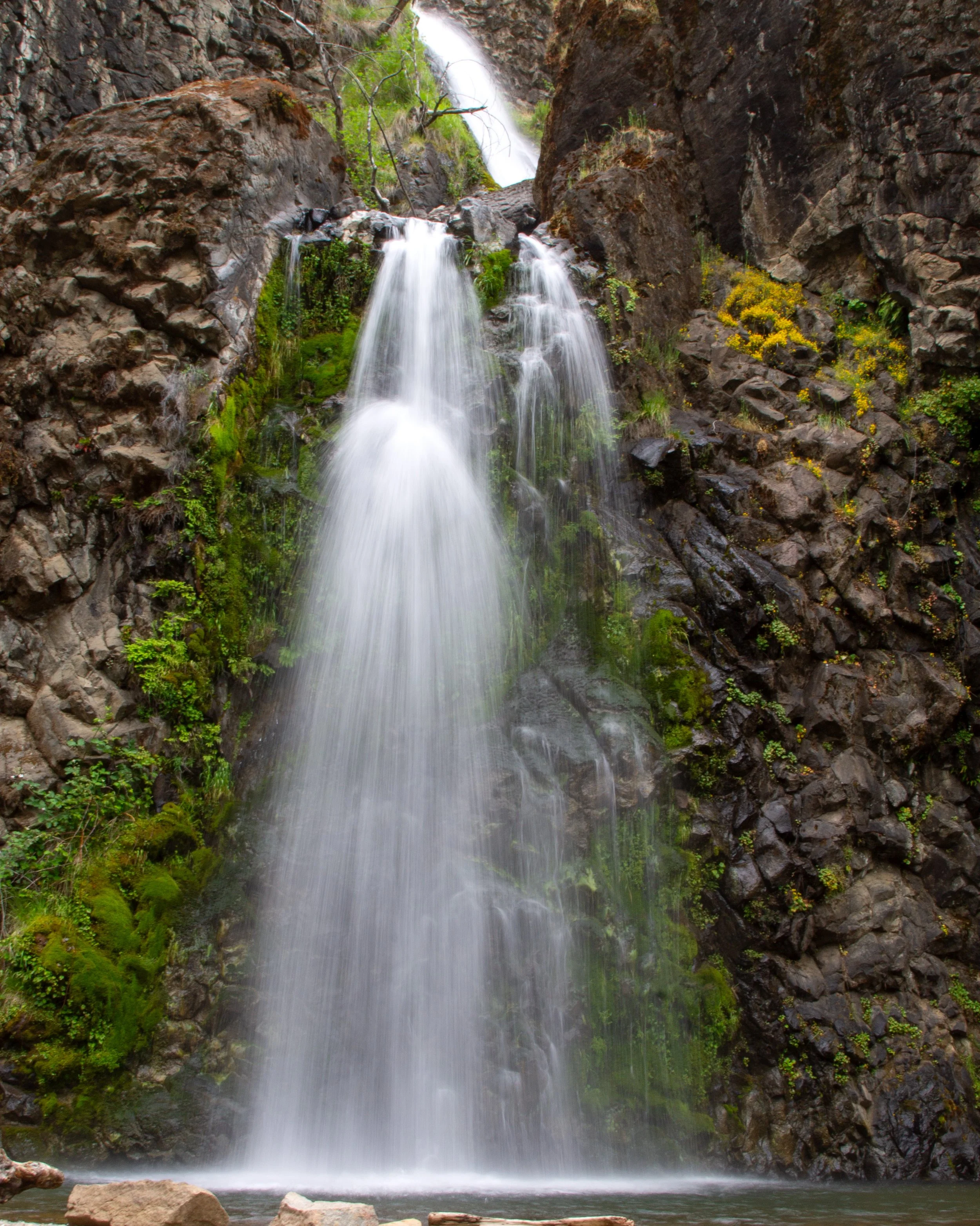
The waterfall: Falls Creek Falls looks like a slightly taller version of Susan Creek Falls. The 120-foot waterfall has four tiers. You can see two of them from the trail, about 70 feet. They plunge over a mossy cliff into a shallow pool perfect for wading on a hot day. Just be sure to wear long pants and closed-toed shoes on the way. The narrow trail has tons of poison oak.
The hike: The trail to the falls is well-maintained, but it’s in an area with difficult terrain and wildfire damage. It might be challenging for younger kids. Prepare to walk over rocks and logs, at one point passing through a cool slot canyon and the rock formations of Job’s Garden. In 0.75 miles, you’ll be at the base of the falls. Another 0.25 miles will take you to a second, less interesting viewpoint at the top.
Directions: The parking area for the Falls Creek Falls Trailhead is just off Highway 138 (milepost 32.2), about 5 minutes east of the Susan Creek Falls Trailhead. A sign points the way. If you’re driving east, the trailhead will be on your left.
Little Falls and Steamboat Falls
Little Falls
Hiking: No
Driving detour: Yes, about 5 miles
Amenities: Restrooms and picnic tables at Steamboat Falls
Pass required: None
Burn area: No
ADA access: No
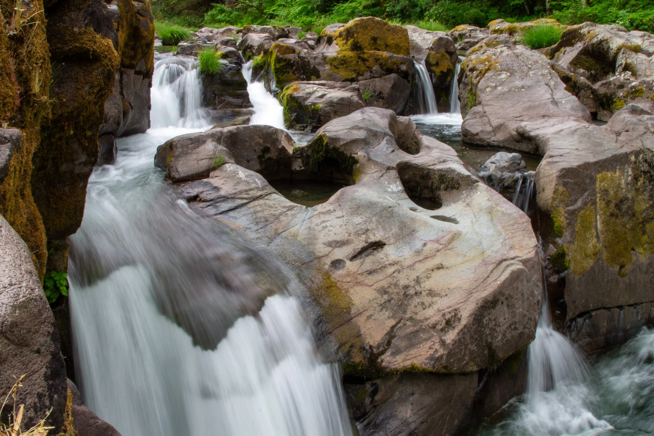
The waterfalls: A short detour on Steamboat Road will take you to two waterfalls on Steamboat Creek. The first is Little Falls, a 10-foot waterfall that cascades in several streams through torturous rock formations. A few miles down the road is Steamboat Falls, tumbling 20 feet over a broad ledge. These waterfalls are more about spending time in beautiful scenery than the wow factor. Lizards scurry over sun-kissed rocky ledges along the creek. Butterflies flit past. I read that steelhead swim up the creek from May through July, although I didn’t see any when I visited. Steamboat Creek has good wading spots if you stay well upstream of the waterfalls and avoid areas with strong currents.
Directions: From Highway 138, turn north onto Steamboat Rd at milepost 38. In 1.3 miles, you’ll see a place to pull over on the side of the road. It’s the parking area for Little Falls (no amenities). For Steamboat Falls, continue on Steamboat Rd for another 4 miles (the pavement ends, but the road is in good shape), then turn right onto Road #3810. Continue 0.6 miles and park at the Steamboat Falls Campground.
Slide Creek Falls
Hiking: No
Driving detour: Not really, but it’s a little hard to find.
Amenities: None
Pass required: None
Burn area: No
ADA access: You can see the waterfall from the road.
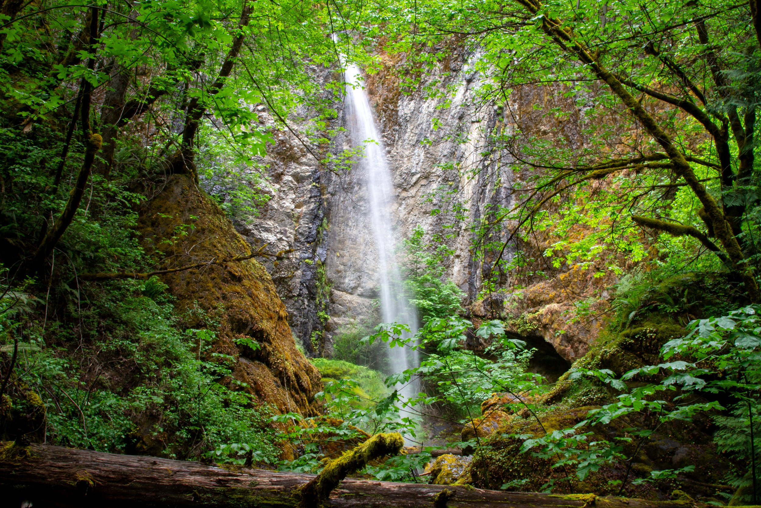
The waterfall: It’s all but guaranteed you’ll drive past Slide Creek Falls if you’re not looking for it. Although close to Highway 138, you can’t see it from the road, and no signs point the way. Set back in a forested grotto, the tall and thin waterfall makes a 137-foot single drop into a pool full of mossy boulders. It’s not the most powerful plunge in the Highway of Waterfalls, especially later in the summer, but it has an undeniable charm. The feeling of finding something hidden adds excitement to the visit.
Directions: I thought Slide Creek Falls was the hardest to find of the stops in the Highway of Waterfalls, partly because of the lack of signage and partly because Google Maps directed me to a road that doesn’t exist. Here’s how to find it:
Take Highway 138 to NF-4775 (milepost 55.1). Turn north onto it as though you’re going to the Medicine Creek Campground.
After turning from the highway, make an immediate right.
In 0.2 miles, turn left onto Slide Creek Rd.
In 200 feet, make a slight left onto Toketee Village Loop.
In 500 feet, Toketee Village Loop becomes Nat For Dev Rd 010. Continue for 0.3 miles until you see Slide Creek Falls. Park on the side of the road.
Once you leave the highway, the roads are unpaved but in good condition. There’s a steep section that would be easier with 4WD. You could make it in a sedan, but not an RV.
Toketee Falls
Hiking: 0.8 miles, easy/moderate
Driving detour: No
Amenities: Restroom and picnic table
Pass required: None
Burn area: No
ADA access: No
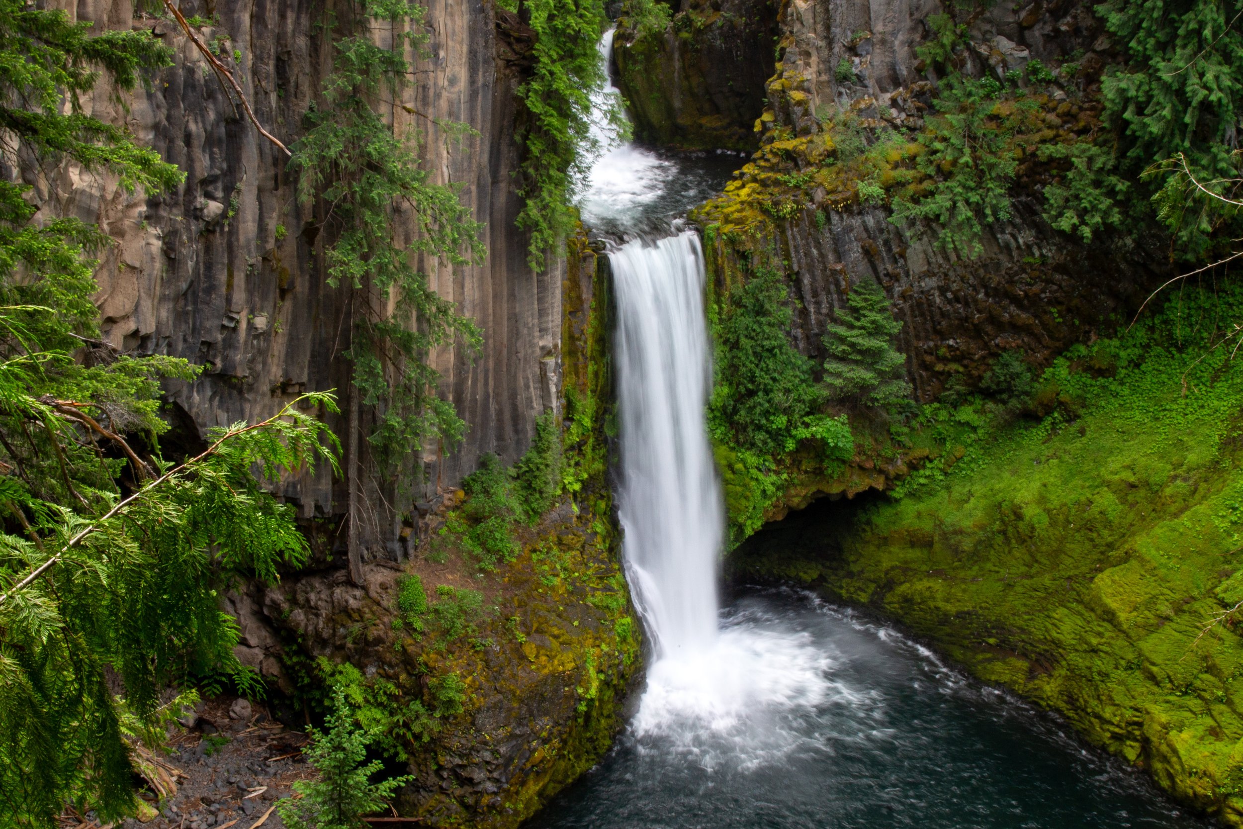
The waterfall: Toketee Falls is what brought me to the Highway of Waterfalls. Once I saw a picture, I was hooked. One of Oregon’s most photogenic waterfalls, the beauty of Toketee Falls is at least as much about its setting as the fairly modest 89-foot height. From a fenced overlook, you’ll see the North Umpqua River tumble in two tiers over a cliff of tall basalt columns. The upper tier makes a short plunge into a recessed pool before spilling over as the lower tier. Around the waterfall’s mossy amphitheater is an old-growth forest where wild rhododendrons bloom in early summer.
The hike: The trail to the falls is a little under a half mile. It’s well-maintained and kid-friendly, although expect many stairs. Please stay on the trail and don’t bushwhack to the base of the falls. It’s dangerous and increases erosion.
Directions: The easiest way to find Toketee Falls is to watch for the sign on Highway 138. Turn north on Road #34. Then, take an immediate left. Continue about 200 feet to the parking area. It’s unpaved, but no problem with a low-clearance vehicle.
Find details in my Toketee Falls hiking guide.
Watson Falls
Hiking: 0.9 miles, moderate
Driving detour: No
Amenities: Restroom
Pass required: None
Burn area: No
ADA access: No
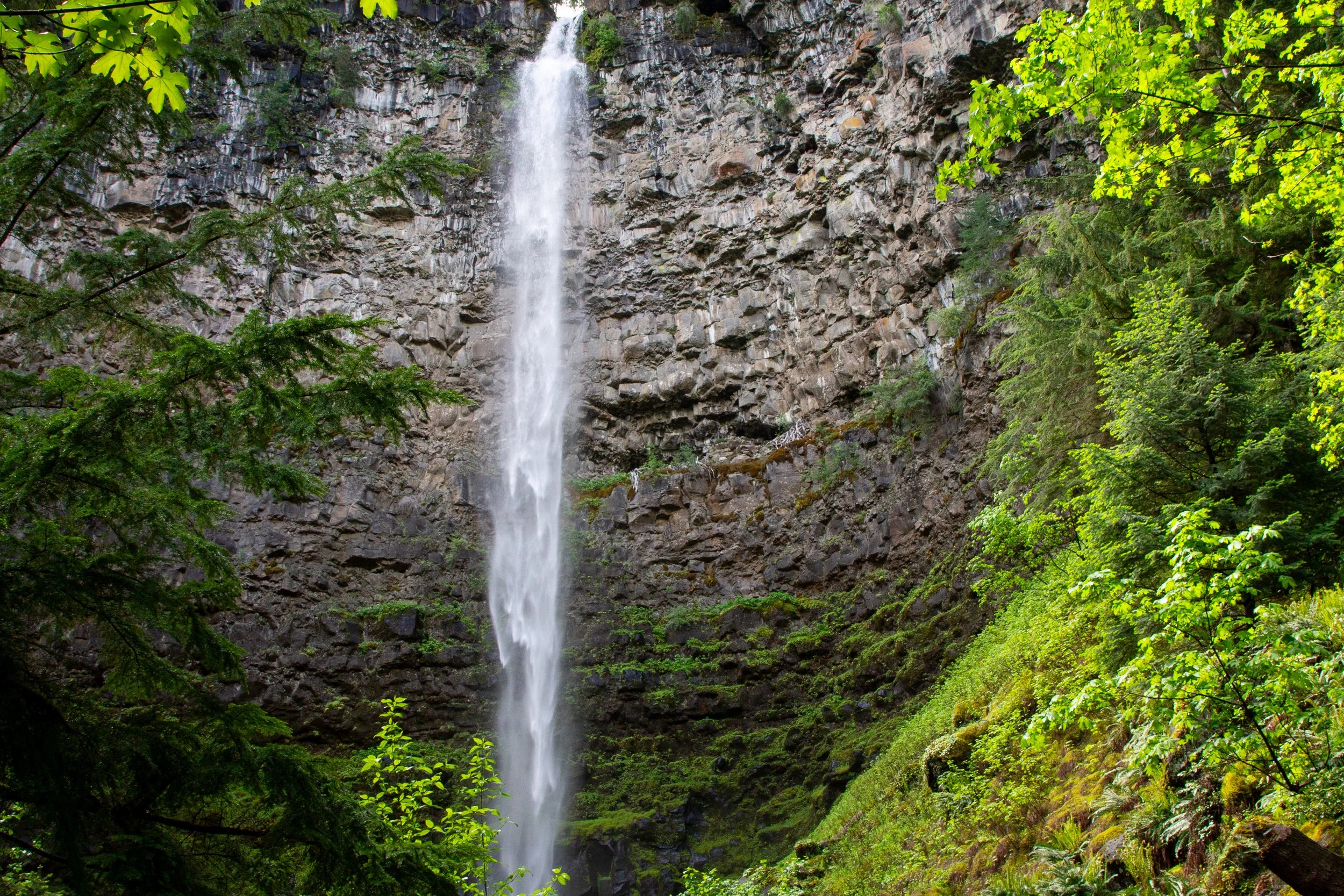
The waterfall: I didn’t anticipate the grandeur of Watson Falls before I was standing below it. Along with Toketee Falls, it’s tied for my favorite in the Highway of Waterfalls. I liked the two for different reasons. Rather than a photogenic amphitheater like Toketee Falls, the scale of Watson Falls makes it memorable. The 293-foot waterfall makes a straight single plunge in front of a sheer basalt cliff. The best place to appreciate its height and power is the base, where you stand with your neck stiff from craning upward.
The hike: The trail to Watson Falls is about the same distance as Toketee Falls, but harder. It’s steeper and has more rocks and roots. It’s still a beginner-friendly trail without major hazards, and would be fine with kids. For a shorter hike, you can turn around after 0.3 miles at the lower viewpoint, which I thought was more interesting than the upper viewpoint at the end.
Directions: Take Highway 138 to milepost 60.5, then turn south onto NF-37 (Fish Creek Rd), following the sign for the Watson Falls picnic area. Parking will be on the right. Cross the road to start the trail.
Learn more in my Watson Falls hiking guide.
Whitehorse Falls
Hiking: No
Driving detour: No
Amenities: Restroom and picnic tables
Pass required: None
Burn area: No
ADA access: A boardwalk viewing platform next to the parking lot overlooks the waterfall.
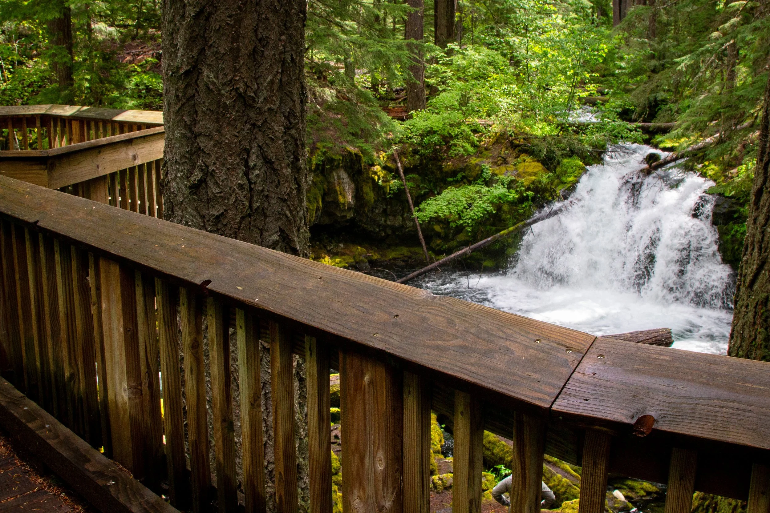
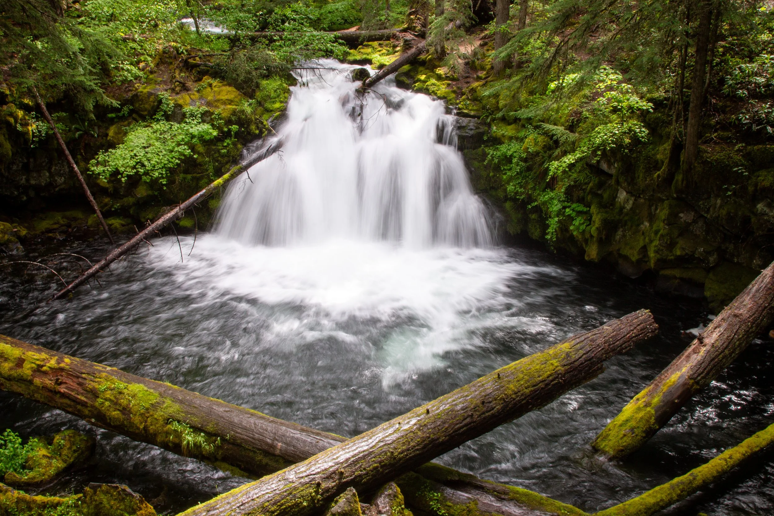
The waterfall: At 15 feet, Whitehorse Falls is a large cascade on the Clearwater River. The main draws are the convenience of the viewpoint and the beauty of the setting. You pull off the highway and walk a few steps to see the waterfall splash down a rocky ledge in a lush forest.
Directions: This one’s easy. Take Highway 138 until milepost 65.9, then turn north toward the Whitehorse Falls Campground. A sign points the way from the highway. You’ll see the waterfall parking right away, before you make it to the campground. Whitehorse Falls is visible from an ADA-accessible viewing platform next to the parking area.
Clearwater Falls
Hiking: No
Driving detour: No
Amenities: Restroom and picnic tables
Pass required: None
Burn area: No
ADA access: A 400-foot trail leads to an accessible viewing platform. The dirt trail is wide, even, and flat, without barriers like steps. Benches available.
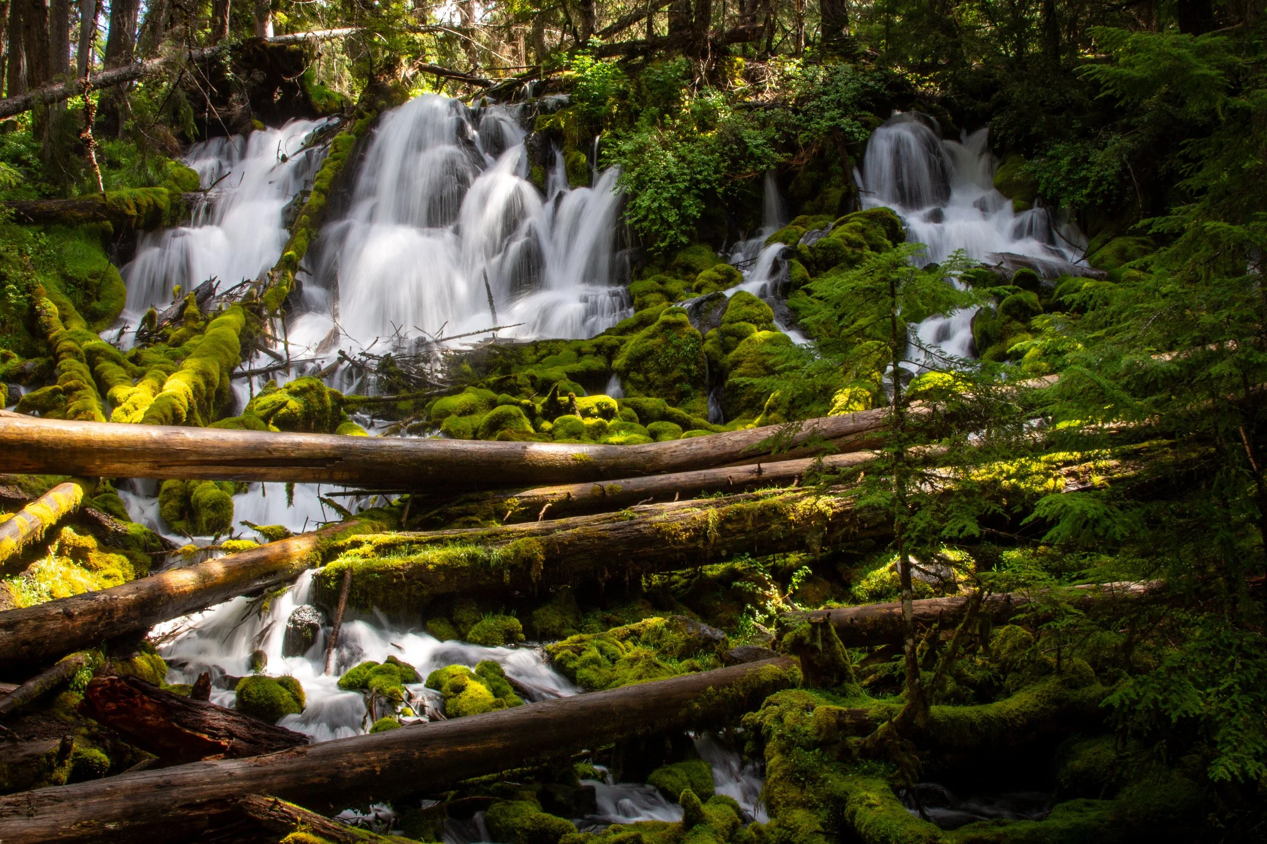
The waterfall: Much like Whitehorse Falls, Clearwater Falls is an easy and satisfying stop on the Highway of Waterfalls. The 30-foot waterfall on the Clearwater River cascades in multiple streams over mossy rocks and logs. The viewing platform has a couple of benches. Nearby is a nice picnic area.
Directions: Take Highway 138 until milepost 69.5, then turn north toward the Clearwater Falls Campground. A sign points the way from the highway. Continue 0.2 miles to the parking area. It’s no problem with a low-clearance vehicle.
Lemolo Falls
Hiking: 2-4 miles, moderate
Driving detour: Yes, about 5-6 miles
Amenities: None
Pass required: None
Burn area: No
ADA access: No
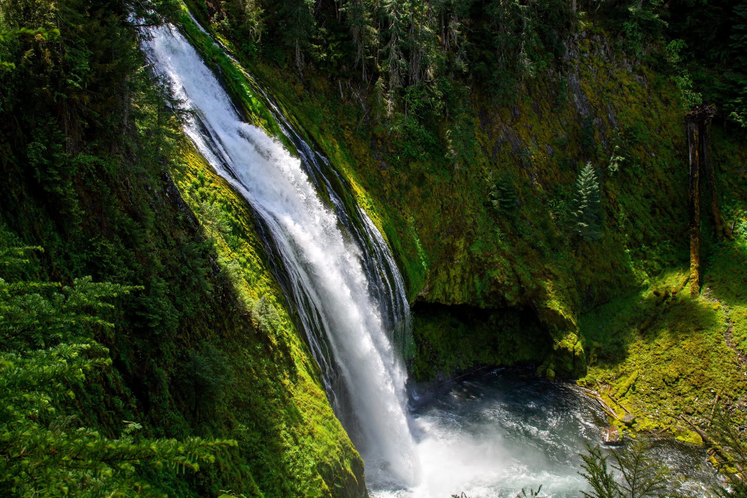
The waterfall: Of all the waterfalls along Highway 138, Lemolo Falls takes the most work to see. Make sure to have offline driving directions. The area has no cell reception and poor signage. If you have enough time and are up for a hike, I’d say it’s worth the effort. The roaring waterfall is the tallest on the North Umpqua River, somewhere around 150 feet, depending on who you ask. It’s interesting all year, but most impressive when the Lemolo Lake Dam doesn’t limit the river’s flow. One of the most complex waterfalls in the Umpqua National Forest, delicate rivulets trickle alongside chutes of water surging over a mossy cliff.
The hike: Two trails lead to Lemolo Falls, one on either side of the North Umpqua River.
The lower trail is a short and steep descent to the base of Lemolo Falls, about 2 miles round-trip. It has a clear view of the falls at the end. The roads to the trailhead are rough. I wouldn’t bring a low-clearance vehicle.
The upper trail is longer but less difficult, about 4 miles round-trip on a section of the North Umpqua Trail called Dread and Terror. It’s neither dreadful nor terrible, but it is hard to see Lemolo Falls at the end. You can make it to the trailhead in a low-clearance vehicle. I wouldn’t bring an RV.
Lower trail directions:
From Highway 138, turn onto Bird Point Rd (NF-2610) at milepost 72.8.
In 4.3 miles, keep left onto NF-3401.
In 0.5 miles, turn right onto Road 3401-800 and continue for 1.75 miles.
Turn right onto Road 3401-840. Continue for 0.25 miles to the trailhead.
Upper trail directions:
From Highway 138, turn onto Bird Point Rd (NF-2610) at milepost 72.8.
Follow Bird Point Rd for 5.2 miles. You’ll cross the Lemolo Lake Dam on the way.
Look for the White Mule Trailhead on your left. It’s across a little wooden bridge to an unpaved road. Park on the unpaved road.
Find details in my Lemolo Falls hiking guide.
Warm Springs Falls
Hiking: 0.6 miles, easy
Driving detour: Yes, about 8 miles
Amenities: None
Pass required: None
Burn area: No
ADA access: Potentially. The dirt trail is flat and well-maintained. It does get narrow at times. The viewpoint at the end is an accessible platform.
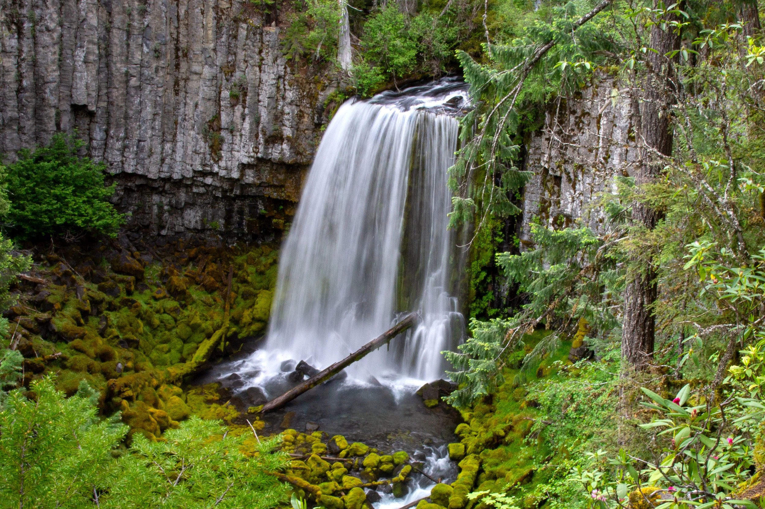
The waterfall: Warm Springs Falls tumbles as a picturesque 60-foot curtain over a cliff of chunky basalt columns. The waterfall is interesting all year. Early summer is a great time to see wild rhododendrons blooming around the viewpoint. You can’t get very close to the falls, but you do get a clear view from the platform.
The hike: After tackling other trails in the Umpqua National Forest, the easy jaunt to Warm Springs Falls is like eating dessert. Short, flat, and over before you know it, the family-friendly hike ends at a fenced viewing platform overlooking the waterfall.
Directions:
From Highway 138, turn onto Bird Point Rd (NF-2610) at milepost 72.8.
Continue on Bird Point Rd for 6 miles.
Just after the dam, turn left onto NF 2610-680. It’s gravel, but okay with a low-clearance vehicle. Continue for 1.7 miles to the trailhead, which has a nice big sign.
If you go to the Lemolo Falls upper trail, it’s on the way to Warm Springs Falls.
Non-waterfalls attractions
Diamond Lake
Umpqua Hot Springs is probably more popular than the waterfalls of the Umpqua National Forest. Arrive early, especially on summer weekends. The terraced natural pools range in temperature from about 100 to 115 degrees F. The hike is 0.6 miles out and back from May to November. You can visit the rest of the year, but you’ll have a longer hike in. The hot springs are clothing-optional and cost $5 to visit (or use the NW Forest Pass or America the Beautiful Pass). Expect a rough road to the trailhead and many other visitors.
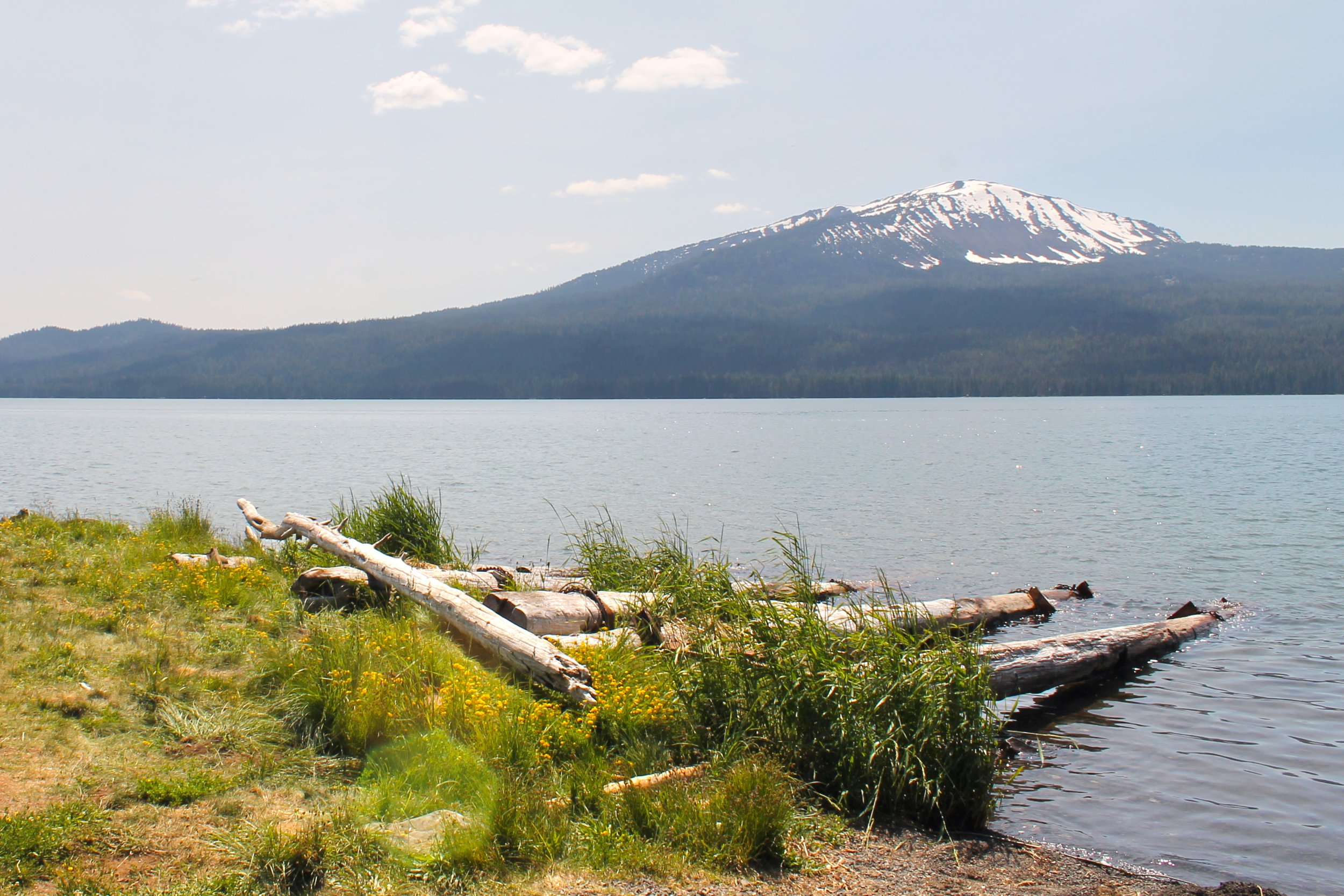
Diamond Lake is a beautiful lake with views of Mt Bailey and Mt Thielsen. The Diamond Lake Resort has a marina that rents boats. The restaurant has an outdoor patio overlooking the lake.
Colliding Rivers is a quick and easy viewpoint stop where you can see the Little River and North Umpqua River come together. An information center with helpful brochures and maps of the area is open from May through September.
The Narrows Wayside overlooks a pinch point in the North Umpqua River. An informal trail from the viewpoint leads down to the water, which is a popular fishing spot. No amenities.
Fishing draws many visitors to the North Umpqua River. A large portion of the river is for fly fishing only. Find the latest regulations on the ODFW website.
What to bring
Snacks
Camera
Offline driving and hiking directions
Swimsuit and towel (optional, for the hot springs)
Layers and rain gear
Map
Enjoy your trip to southern Oregon’s Highway of Waterfalls!
With love,
Emma