Watson Falls Hiking Guide
Measuring waterfall heights, I’m learning, is as much an art as a science. The most recent survey of Watson Falls in the Umpqua National Forest has it at 293 feet. While not Oregon’s third-tallest waterfall as it’s been called in the past, waterfalls are more about the feeling than the numbers. Standing at the base of Watson Falls is exhilarating. You feel like a puny ant in the best way. The short hike to reach it passes through an old-growth forest that adds more than a small amount of magic to the free-falling chute of water. Here’s everything you need to know about visiting Watson Falls.
Watson Falls
Quick stats
Distance: 0.9-mile loop with a tail
Elevation gain: 400 feet
Difficulty: Moderate
Pass required: None
ADA access: No
Know before you go
Cost: It’s free to visit Watson Falls.
Parking is at the Watson Falls Picnic Area. I hear it can fill up on summer weekends. I was one of three cars when I visited in late spring. Getting there is no problem in a low-clearance vehicle.
Amenities: A vault toilet is next to the parking lot. If there are picnic tables, they are well hidden.
Dog-friendly: Yes, leashed dogs are welcome on the trail.
Hazards: A footbridge on the Watson Falls Trail was out when I visited. It’s still possible to do the hike as an out-and-back rather than a loop.
Season: Late spring through fall. Best in spring.
Navigation: Expect to have no cell service or GPS navigation. Watch for the sign pointing to Watson Falls to find the parking area from Highway 138.
How hard is the Watson Falls hike?
Watson Falls Trail
If you’ve hiked to Toketee Falls, the Watson Falls Trail is the same distance, but steeper and harder. It’s uphill all the way to the final viewpoint, with some rocks and logs to negotiate. It’s still a good beginner hike and doable at any fitness level. The trail is family-friendly and doesn’t have hazards like unfenced drop-offs. The short distance helps keep it manageable. If you want to turn around early, I thought the lower viewpoint was more impressive than the upper viewpoint.
Watson Falls Trail
From the parking lot, look for steps heading up to Fish Creek Road to start the Watson Falls Trail.
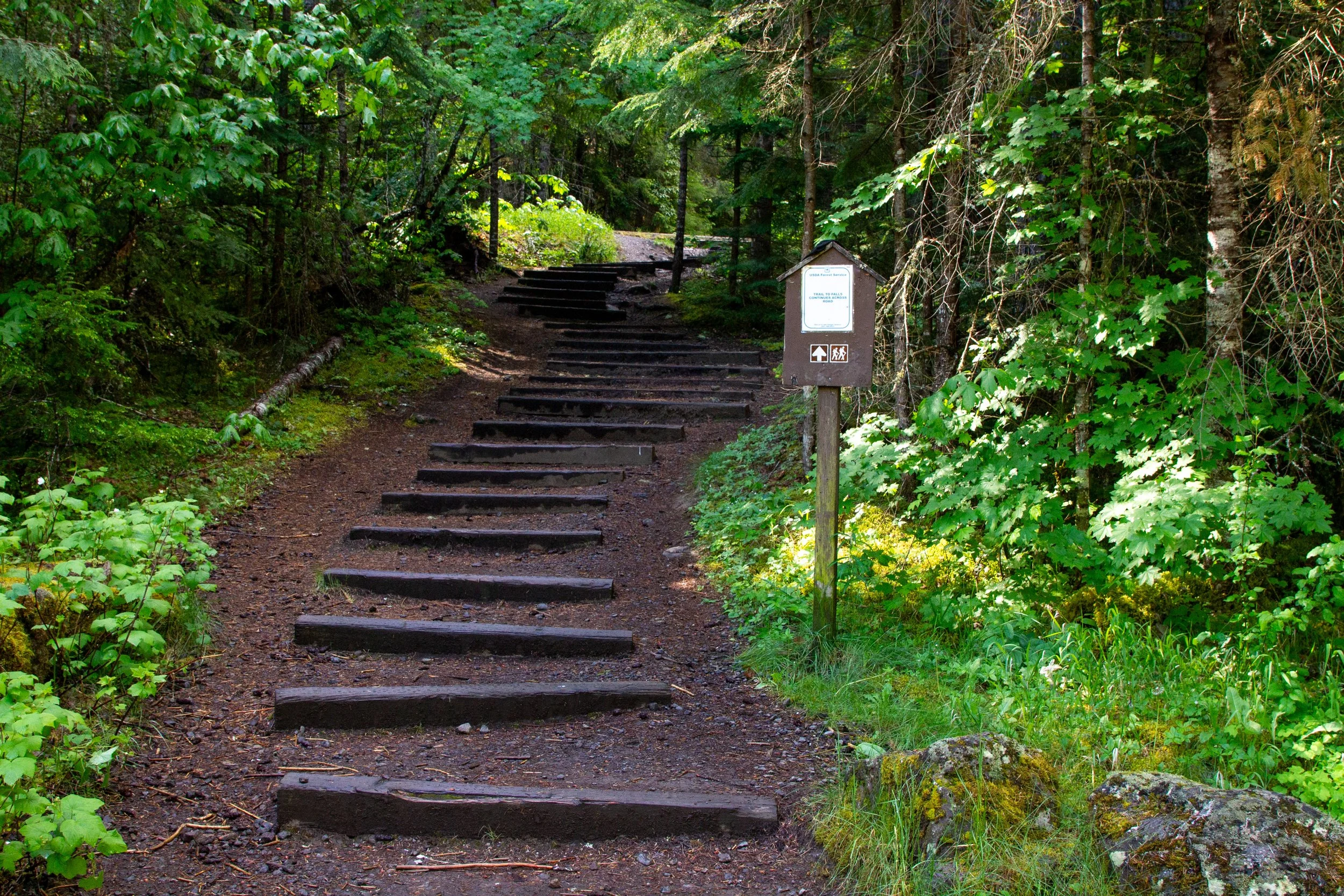
Start here
Across the road is the trail you’d normally take to start the hike to Watson Falls. When I visited, this side of the loop was closed due to a collapsed footbridge. If you run into the same thing, you’ll still be able to reach Watson Falls. Follow the arrow to the trail about 100 feet down the road. It’s the other side of the loop.
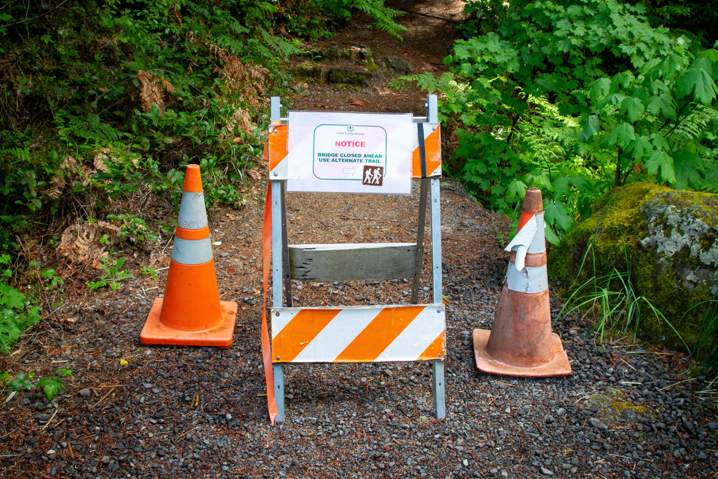
Sign for the trail detour
This side of the loop begins with picture-perfect cascades along Watson Creek. Very promising.
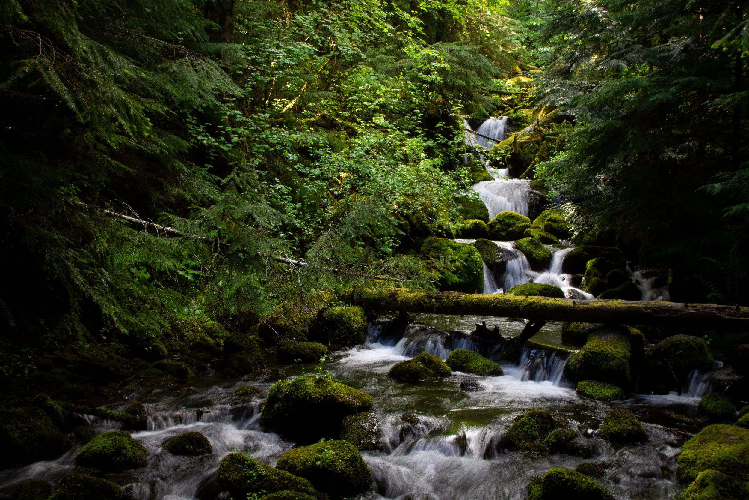
Watson Creek
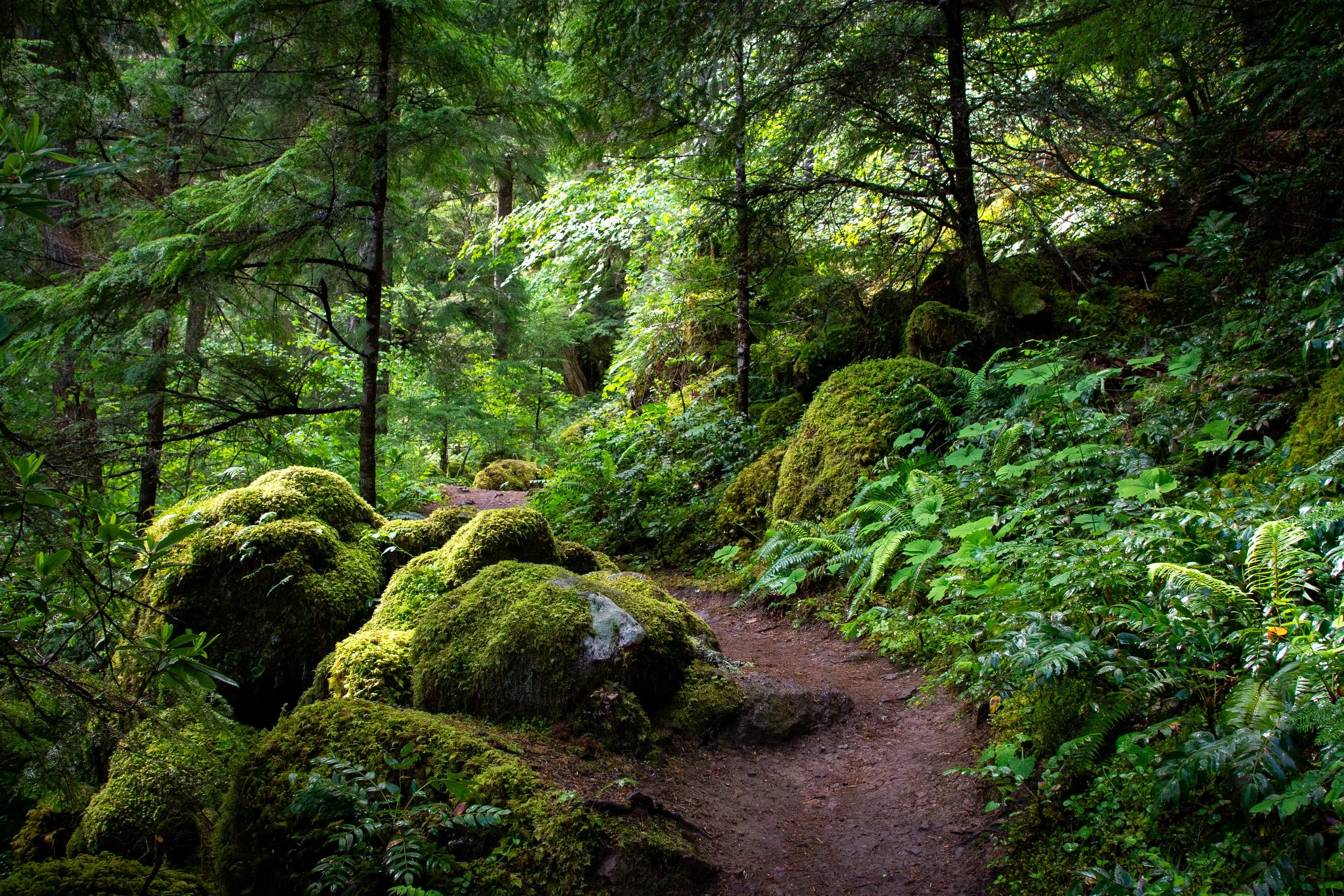
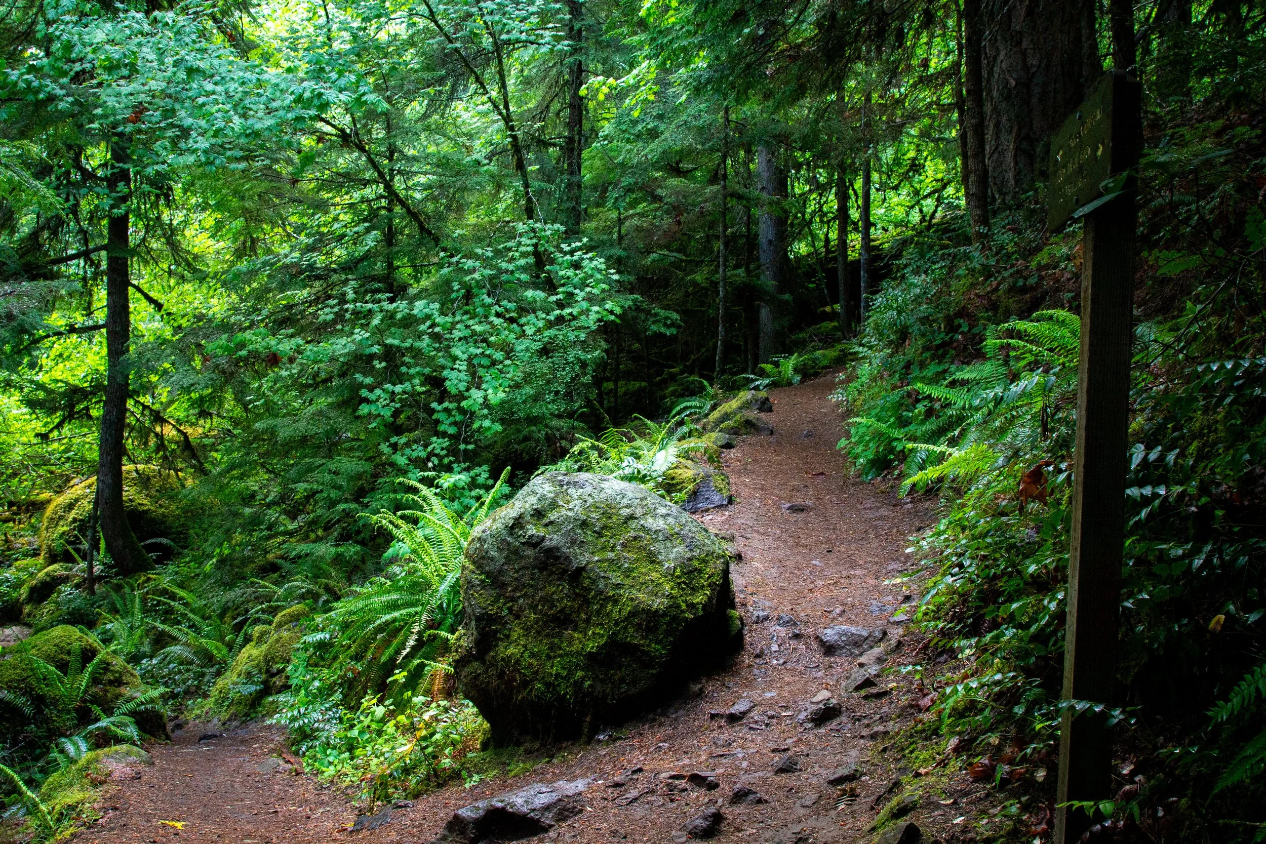
From here, the Watson Falls Trail begins climbing through a beautiful old-growth forest. After seeing the damage from the 2020 Archie Creek wildfire farther west, it was a relief to find the forest around Watson Falls unaffected. The canopy is Doug firs, western hemlock, big-leaf maples, and vine maples. Trillium, vanilla leaf, and Oregon grape bloom in the spring. Moss and ferns cover the boulders surrounding the trail.
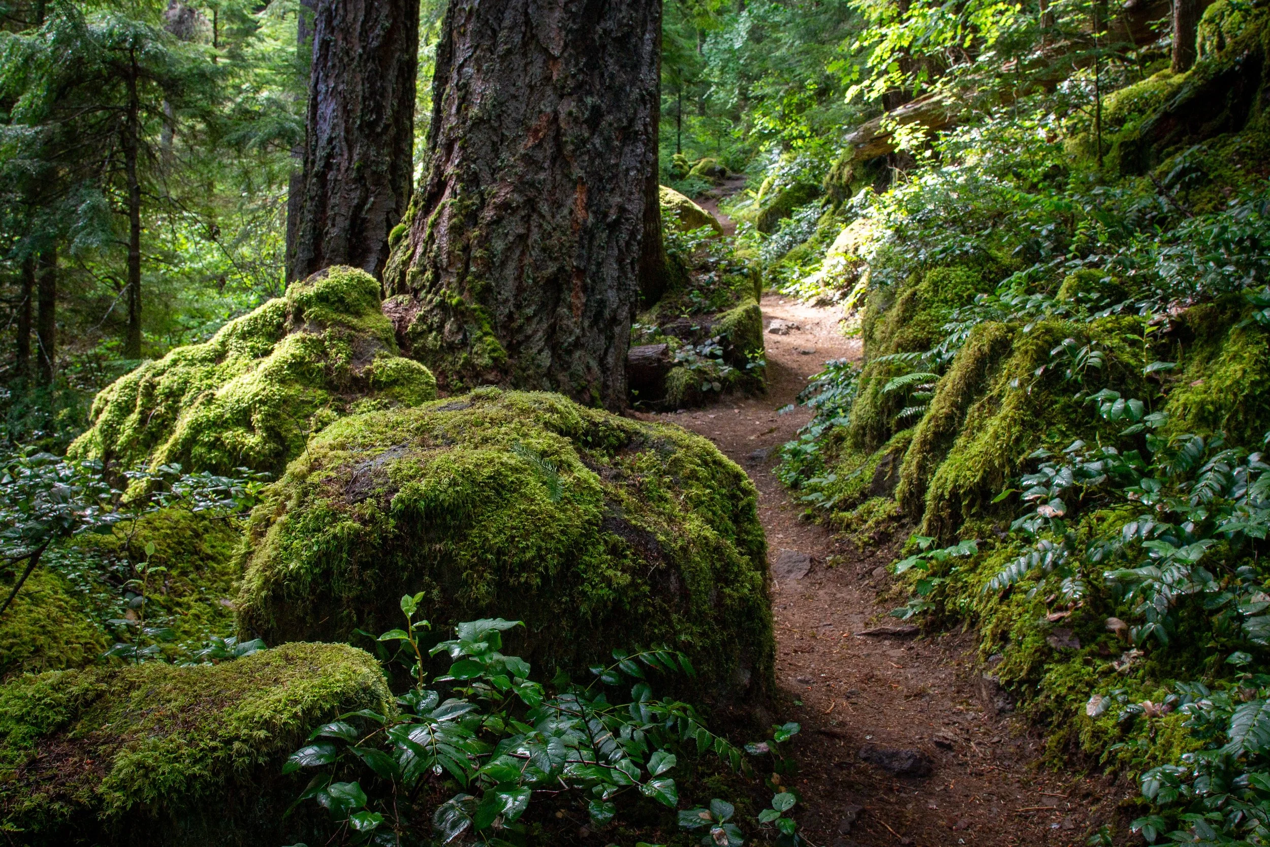
Watson Falls Trail
Around a quarter mile, you’ll reach a trail junction where the two sides of the loop meet. If you head left, you can have a look at the collapsed footbridge and Watson Creek. Otherwise, follow the sign towards the falls viewpoint.
Keep right for Watson Falls
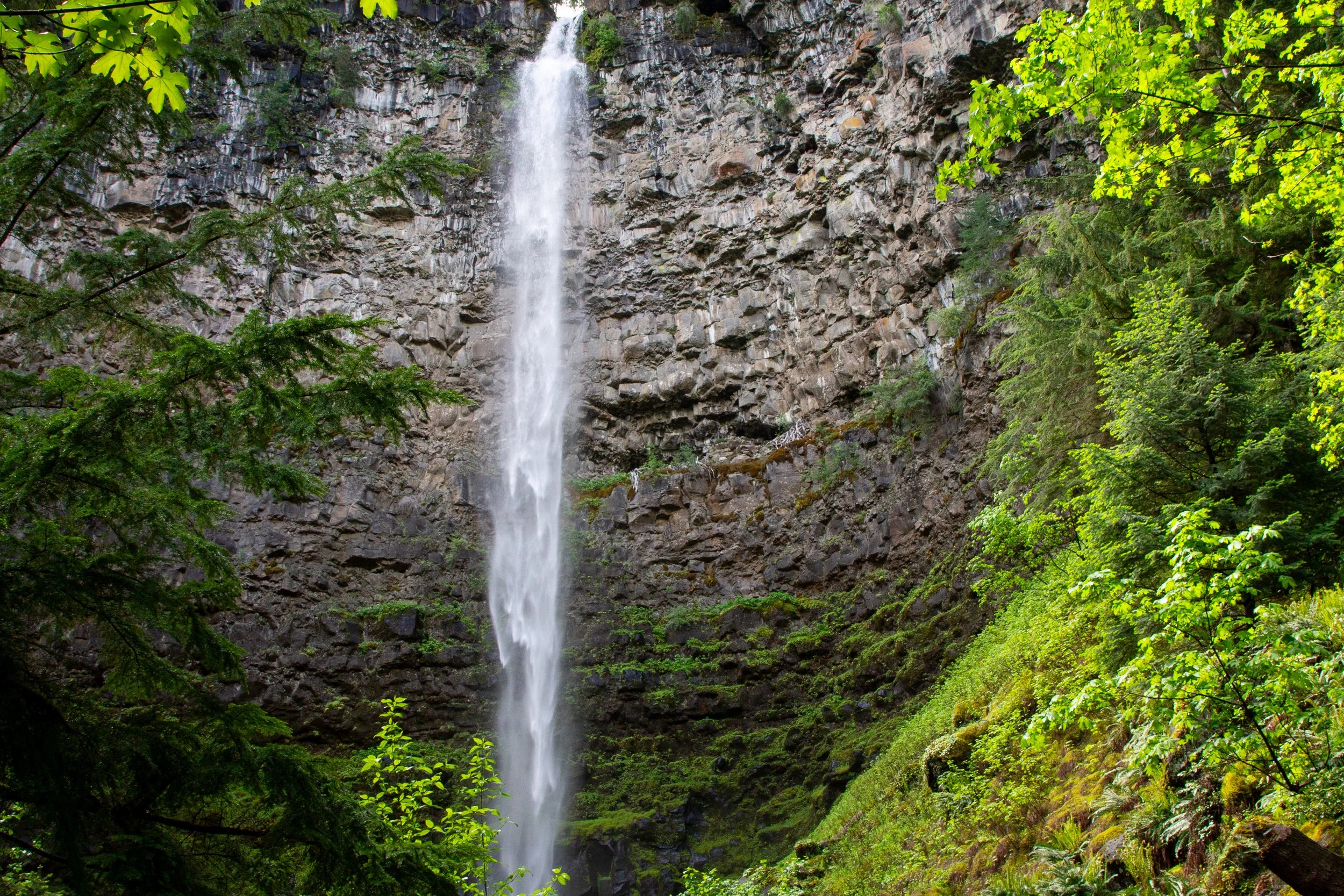
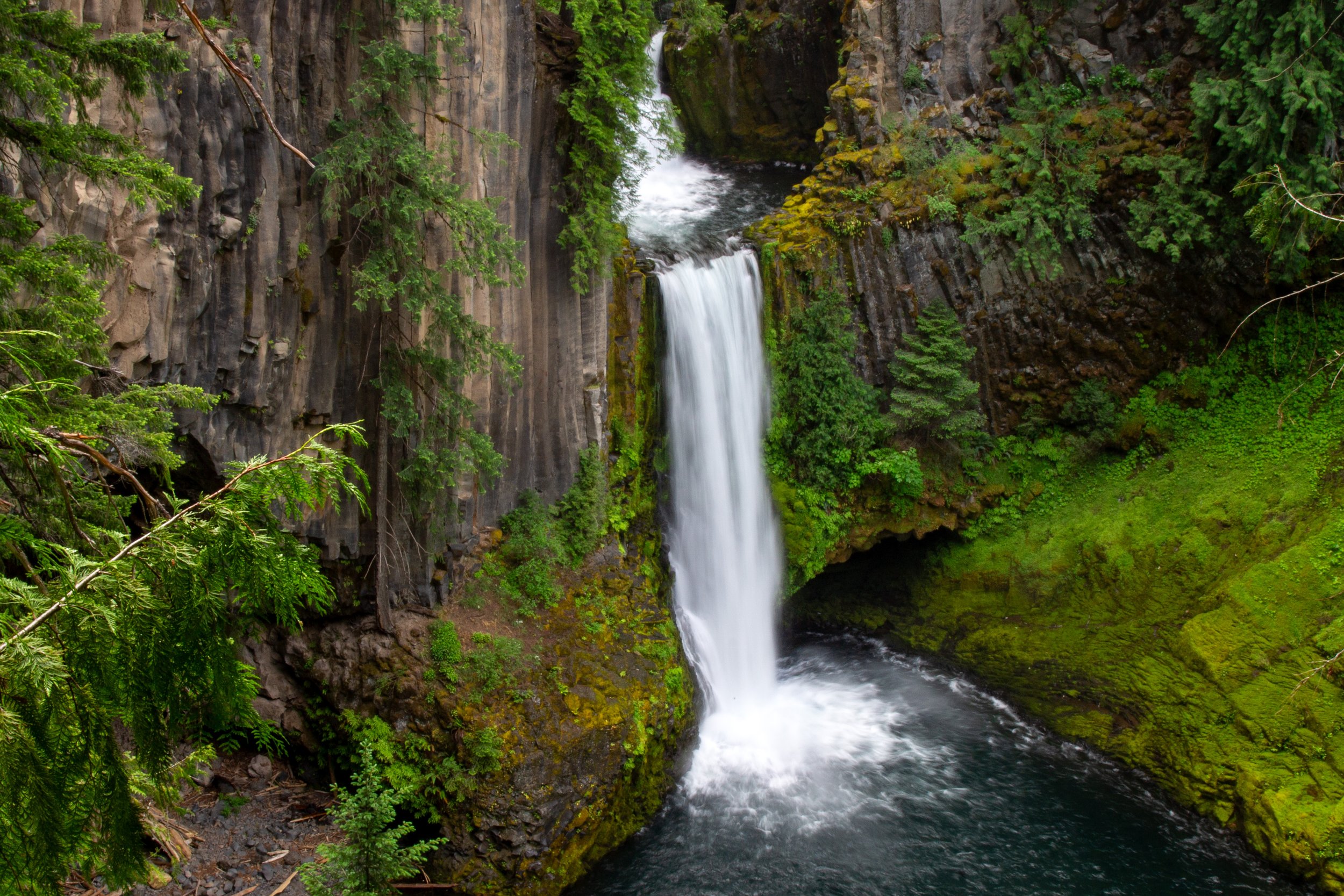
Just ahead is the viewpoint at the base of Watson Falls, which I thought was the best of the hike. Some waterfalls, like Toketee Falls down the road, photograph well. Watson Falls doesn’t. On camera, it’s a larger-than-usual sink tap. In person, the massive scale and power of the falls are incredible. The free fall of the tumbling water is hypnotic. Mist sprays over piles of mossy boulders. Your neck aches from craning upward to see the top of the 293-foot basalt cliff.
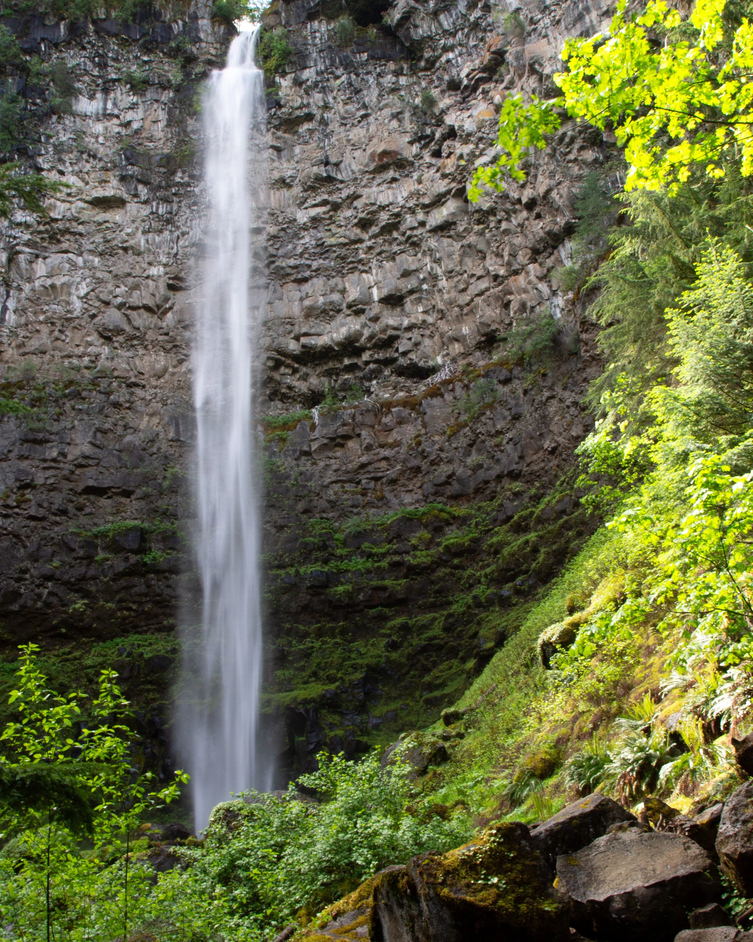
Watson Falls
The Watson Falls Trail continues about 0.2 miles past the lower viewpoint. It stays steep and gets a little rougher towards the end. I ran into a couple of minor obstacles, like a downed tree.
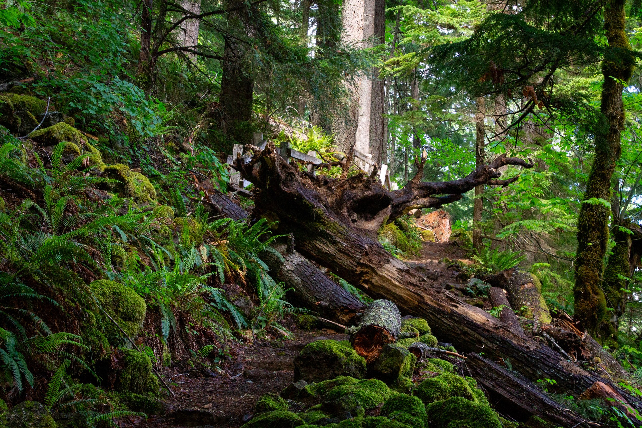
Downed tree on the way to the upper viewpoint
As a reward for the log scramble, some Pacific starflowers.
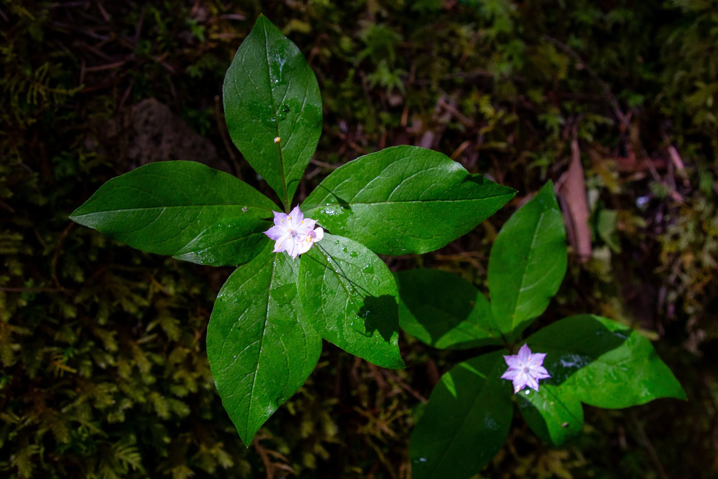
Pacific starflowers
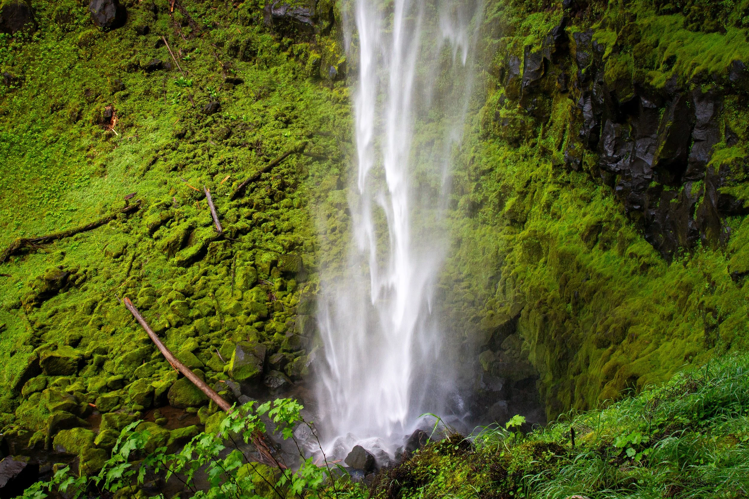
The trail ends at the fenced upper viewpoint for Watson Falls. You won’t want to sit on the mist-soaked bench, but you will want to linger and watch the water splash down into the moss-covered boulder field below. The upper viewpoint is about 200 feet up from the base of the falls. It gives you an up-close look at the cliff, which formed about 750,000 years ago after basaltic lava erupted from Mt Bailey.
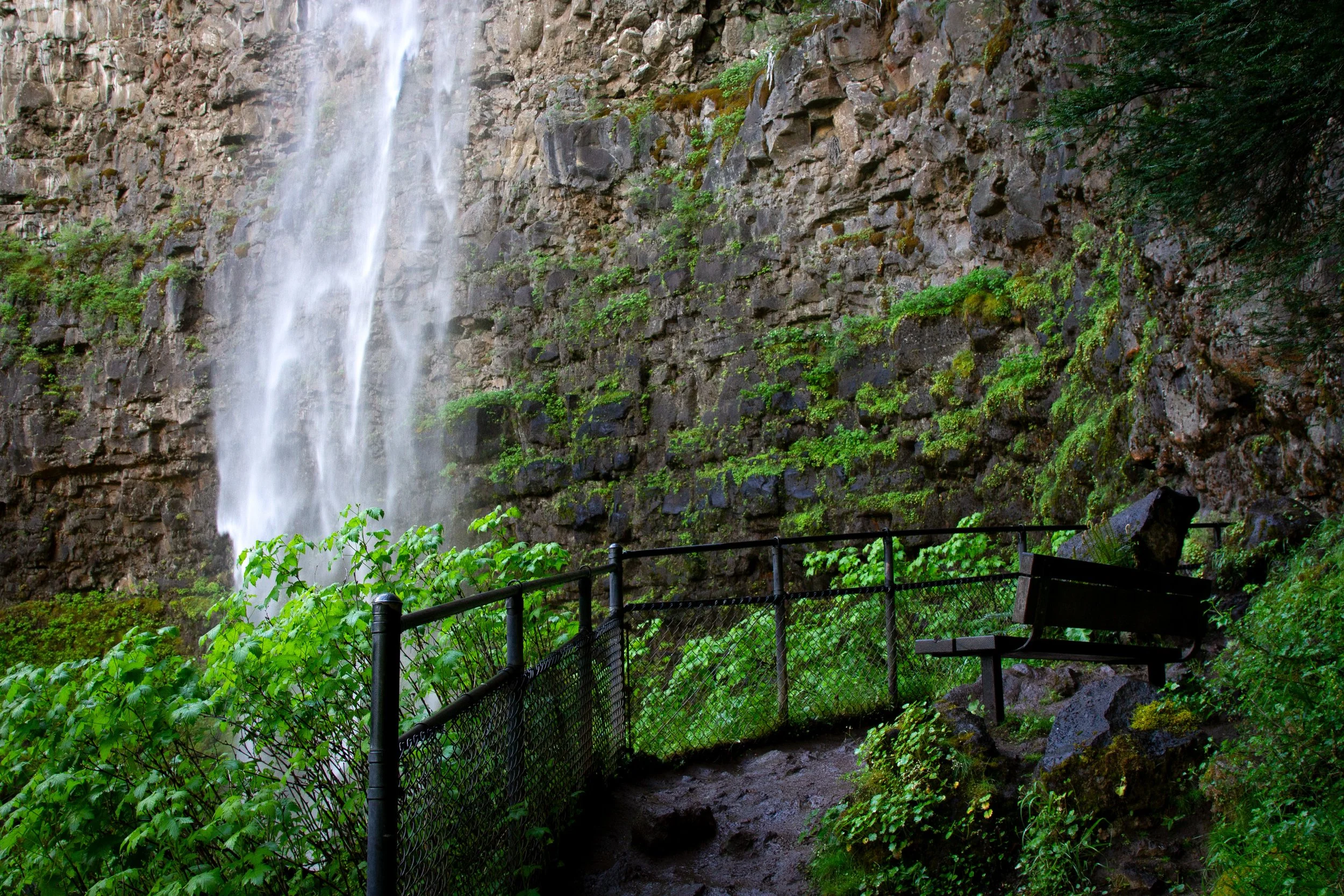
Upper viewpoint
After seeing the upper viewpoint, return to the trail junction. If the footbridge is still closed, head back the way you came. If it’s repaired, take the side of the loop you didn’t do on the way out.
Getting there
Parking for the Watson Falls Trail is off Highway 138, about 60 miles east of Roseburg, Oregon. If you lose GPS navigation on the drive, watch for the sign. It’ll be a quarter mile before the turn. Park in the Watson Falls Picnic Area lot.
Watson Falls is about an hour from Roseburg. From Eugene, a little over 2 hours. From Portland, about 4 hours.
Waterfalls near Watson Falls
Toketee Falls
Watson Falls is the tallest waterfall along southern Oregon’s Highway of Waterfalls, but it’s not the only one worth visiting. Here are the closest and easiest to reach from Watson Falls:
Toketee Falls is the most famous waterfall on the North Umpqua River. Although not as tall as Watson Falls, it’s at least as visually stunning. A short hike, less than a mile, will get you there. The trailhead is 5 minutes west of Watson Falls.
Whitehorse Falls is an easy viewpoint stop, 5 minutes east of Watson Falls.
Clearwater Falls is a lovely cascading waterfall 10 minutes east of Watson Falls. Like Whitehorse Falls, it’s a quick viewpoint stop rather than a hike.
Enjoy your hike to Watson Falls!
With love,
Emma