

Salt Creek Falls and Diamond Creek Falls
Salt Creek Falls is one of Oregon’s ultimate road trip stops. A few steps from the parking lot is a towering and majestic waterfall that tumbles over a sheer cliff into a glacially carved canyon. A short and easy hike to the lower waterfall viewpoint is a great way to stretch your legs after a long drive. Longer hike options take you to breathtaking Diamond Creek Falls and secluded Vivian Lake. If it were closer to Portland, it would be overrun. As it is, I had no trouble finding parking on a beautiful summer Saturday. Here’s everything you need to know about visiting Salt Creek Falls and Diamond Creek Falls.
Diamond Creek Falls
Know before you go
Parking at Salt Creek Falls requires the NW Forest Pass ($5/day) or America the Beautiful Pass. You can buy a day pass on-site with a credit card.
There’s a wooded picnic area near Salt Creek Falls. Huckleberries ripen near the tables in summer.
Restrooms are next to the parking lot, but they were “closed for winter” according to a sign on the door when I visited in July. I’m not optimistic about August.
Leashed dogs are welcome at Salt Creek Falls and Diamond Creek Falls.
You can see Salt Creek Falls from a viewpoint near the parking lot. The walkway to reach it is wide and flat without barriers like steps. Past the viewpoint, the trails have stairs and uneven terrain.
Salt Creek Falls and Diamond Creek Falls are year-round destinations if you’re prepared for winter driving conditions. Visit in summer or fall to avoid the snow. To reach Diamond Creek Falls in the winter, you’ll need snowshoes or cross-country skis.

Salt Creek Falls Observation Site
Hike options
Salt Creek Falls is a place where you can hike as much or as little as you want. Honestly, I think the most impressive views are those from the viewpoint, no hiking required, but the trails are worth the effort if you have the time. Here are the options:
Salt Creek Falls Observation Site (no hiking)
Salt Creek Falls Trail, 0.6 miles out-and-back
Diamond Creek Falls Trail, 3.7-mile loop
Vivian Lake Trail, 8-mile lollipop loop
Salt Creek Falls Observation Site
Once you park, you’ll see a big sign pointing toward Salt Creek Falls. A trail starts to the right of the sign, behind large panels with interpretive information. Once you start, it’s about 100 feet to the viewpoint.
Head right for the Salt Creek Falls viewpoint
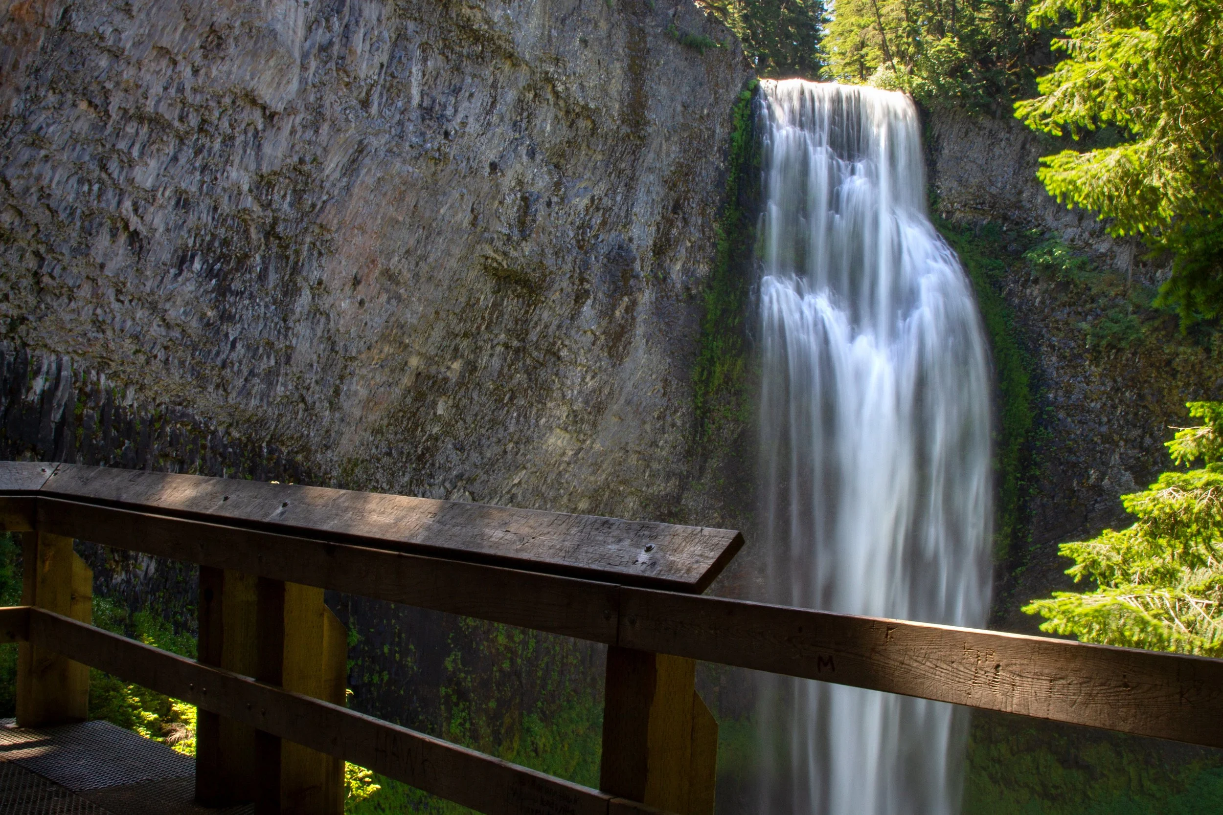
The Salt Creek Falls Observation Site is one of the most dramatic viewpoints in Oregon. Between the massive waterfall and the sprawling forested canyon, the scale of the scenery is hard to capture in pictures. There was no hope with my 24mm lens. I’m throwing in a zoomed-out phone picture to give you an idea of the panorama.

Salt Creek Falls Observation Site
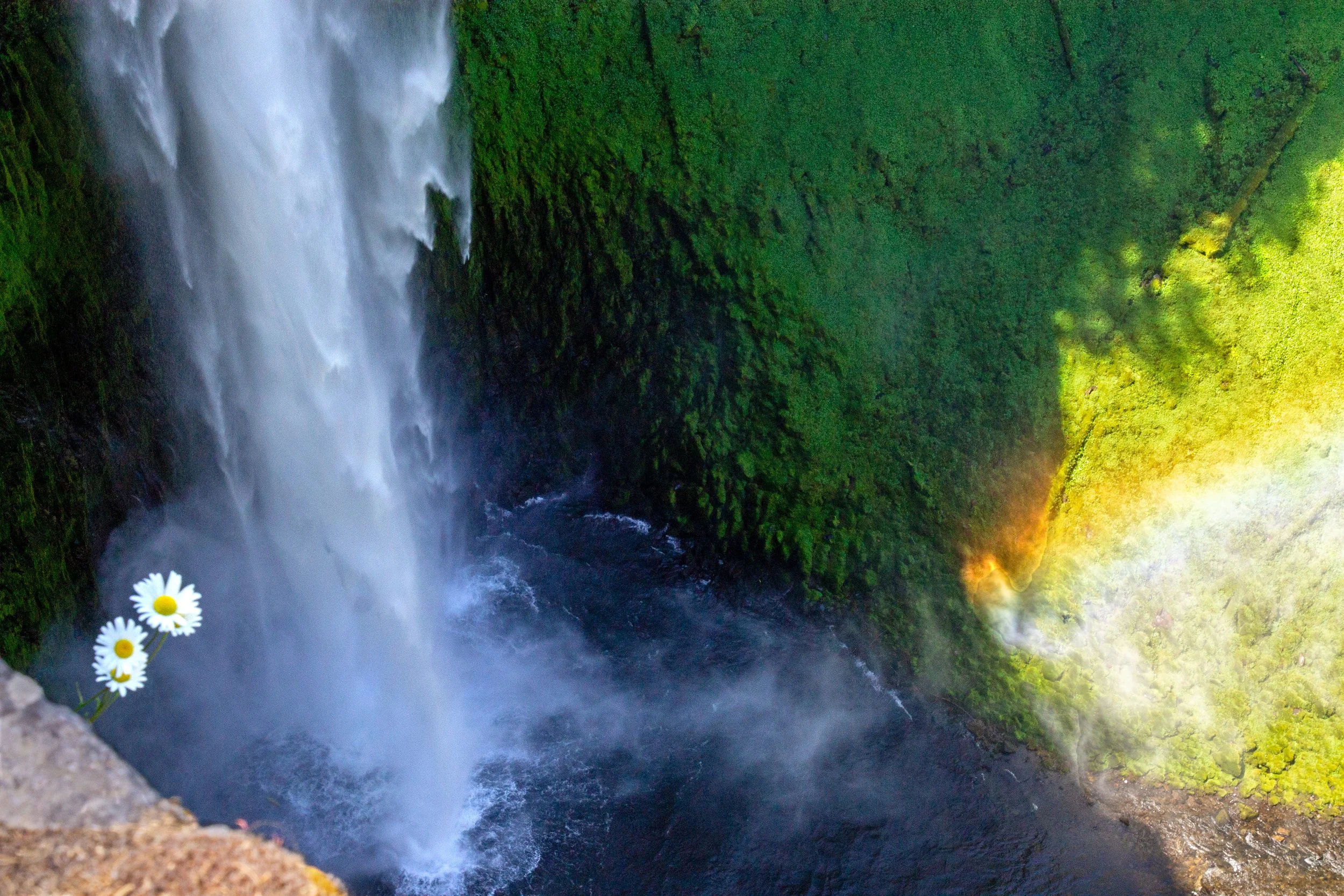
Salt Creek Falls makes a roaring 286-foot plunge over a basalt cliff with a mossy grotto at its base. On sunny days, light hitting the mist from the waterfall creates a rainbow over the cascades of Salt Creek. This waterfall has been called the second-tallest in Oregon after Multnomah Falls, which is overstating things. Off the top of my head, Watson Falls (293 feet) and Munson Creek Falls (319 feet) are taller, among others. Calling it the second most impressive waterfall in Oregon, I think, would be a fair argument. Its power does as much to make it memorable as its height. Surrounding the falls is a wide amphitheater that’s green enough to look almost fluorescent. Unlike many Oregon waterfalls, no trees or boulders obscure the view, making it easy to appreciate the scale of the surging water.
Salt Creek Falls
The Salt Creek Falls Observation Site has a short walkway with fences that keep it safe and family-friendly. To the right is a set of stairs that begins the Salt Creek Falls Trail to a lower viewpoint. To the left is a barrier-free walkway to the top of the falls. If you keep going, you can connect to the Diamond Creek Falls Trail, but the universal access portion ends at the observation site.
Salt Creek Falls Trail
Distance: 0.6 miles out and back
Elevation gain: 200 feet
Difficulty: Easy
ADA access: No, not beyond the observation site.
Salt Creek Falls has two more overlooks past the observation site. The views are similar, just lower down and from different angles. If you’re stopping on a road trip, it’s an easy walk to stretch your legs that doesn’t take long, I’d say 30 minutes tops. To see the other viewpoints, head up the stairs and start the Salt Creek Falls Trail.

Take the stairs to the Salt Creek Falls Trail
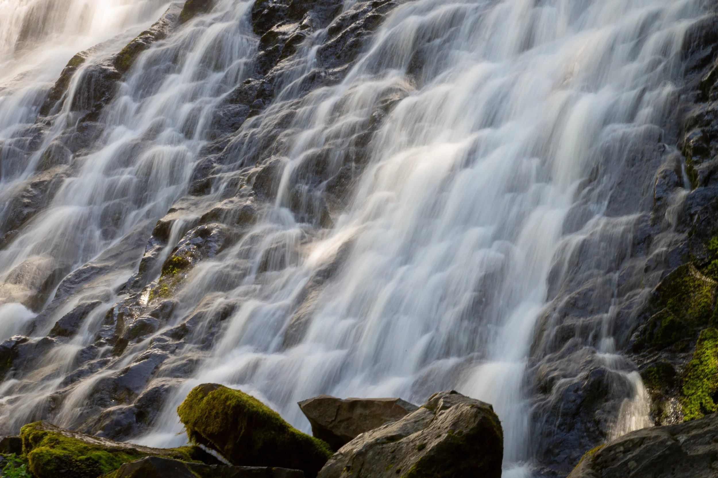
The Salt Creek Falls Trail is a shady walk that heads gradually downhill for a little over a quarter mile. About halfway down, you’ll reach the first of two fenced viewpoints overlooking Salt Creek Falls. The second is at the end of the trail. You’ll have a better view of the mossy recessed grotto behind the falls. When you reach the second viewpoint, head back the way you came.

Salt Creek Falls from the lower viewpoint
Diamond Creek Falls Trail
Distance: 3.7-mile loop
Elevation gain: 500 feet
Difficulty: Easy/moderate
ADA access: No
Diamond Creek Falls has its own trailhead from the parking lot, but it’s more direct to connect from the Salt Creek Falls Observation Site. Head to the top of Salt Creek Falls and keep going. You’ll pass the picnic area as you follow Salt Creek upstream.

Top of Salt Creek Falls
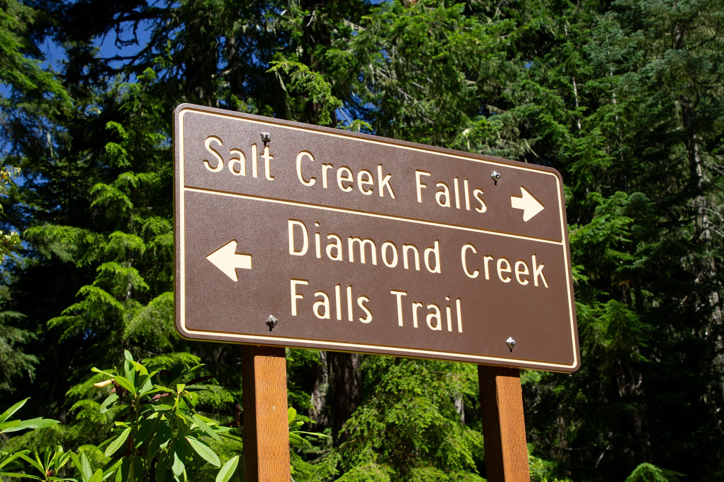
Past the picnic area, you’ll see a sign with potential hiking destinations in front of a footbridge over Salt Creek. Cross the bridge to start the Diamond Creek Falls Loop.

Diamond Creek Falls Trail
In the winter, the Diamond Creek Falls Loop becomes a snowshoeing trail. Blue arrows mark the route. You can go right or left to start it. We’ll go right to do it counterclockwise.

Head right at the loop
Doug fir and Western hemlock shade most of the Diamond Creek Falls Trail. Wild rhododendrons grow in the understory. Look for blooms around June. They were done by my mid-July hike. The north side of the loop brings you to several viewpoints overlooking the dramatic cliffs of the Salt Creek Canyon. Take care if you’re hiking with small children. The drop-offs are easy to avoid, but they don’t have fences.

Approaching the first viewpoint
You’ll reach the first viewpoint just after starting the Diamond Creek Falls Loop. It’s a great place to admire the Salt Creek Canyon. Over a million years ago, a glacier carved a broad valley here. Later, lava flowed through and deposited about 300 feet of basalt. Glaciers and glacial floods from subsequent ice ages eroded a channel in the rock, helping to create the canyon we see today.

Salt Creek Canyon
Just past the first viewpoint is Too Much Bear Lake, a name that raises many questions and answers none. A Google search suggests that a man tried to fish here before becoming discouraged by all the bears. I didn’t see any when I stopped. The lake is small and pretty, but too murky to be appealing for wading. Spirea blooms lingered by the lakeshore after the rhododendrons had faded.

Spirea blooms at Too Much Bear Lake
After the lake, the Diamond Creek Falls Trail passes a few more viewpoints, ranging from spectacular to overgrown. One gives you a glimpse of a waterfall, Lower Diamond Creek Falls, although the tree cover makes it no more than a hint. The great views are up ahead.

Trailside viewpoint
About a mile into the loop, you’ll see a sign pointing toward Lower Diamond Creek Falls. It’s really Upper Diamond Creek Falls, but for navigation purposes, just follow the arrow. It points to the start of the spur trail to the base of the falls.

At the bottom of the hill, take the beautiful log footbridge over Diamond Creek. The waterfall is just ahead.

Cross here
I’d call Diamond Creek Falls one of Oregon’s most underrated waterfalls. It’s over 100 feet shorter than Salt Creek Falls but looks huge once you get up close. The 120-foot waterfall forms many small streams as it tumbles in a broad fan shape over several tiers of a gently sloping cliffside. Moss grows on every surface not covered by flowing water. Logs beneath the waterfall are great places for a snack break.

Diamond Creek Falls
Once you’ve taken in the grandeur of Diamond Creek Falls, head back up the hill. Take a right at the trail junction to continue the loop. You’ll get another partial view of Diamond Creek Falls through the trees before reaching an unmarked trail junction, the only confusing part of the hike. Keep left to continue on the Diamond Creek Falls Trail and return to the parking lot. If you look carefully, you can spot a blue arrow high up on a tree trunk pointing the way.

Head left at the junction to finish the loop
If you’re continuing to Vivian Lake, keep right at the junction instead. I didn’t go to the lake, but I did accidentally start the trail to it thanks to my terrible sense of direction. If you go this way, intentionally or unintentionally, look for a cute little chair carved from a tree stump a little past the junction.

The little chair
To finish the Diamond Creek Falls Loop, the rest of the hike is straightforward. You’ll keep going straight across an access road before returning to the start of the loop. Keep right to cross the bridge. Then, you'll be back at the Salt Creek Falls picnic area.
Getting there
Salt Creek Falls is directly off OR-58. It’s paved and no problem in any kind of vehicle, including RVs. The drive from Portland takes 3 hours. From Eugene, it’s a little over an hour.
Enjoy your day at Salt Creek Falls!
With love,
Emma
Explore nearby

Find the best short hikes near Bend.

See the volcanic marvels at Newberry National Volcanic Monument.