Toketee Falls Hiking Guide
Toketee Falls is the most remote of Oregon’s famous waterfalls, located about halfway between Roseburg and the seasonal entrance to Crater Lake. After finally accepting that I wasn’t likely to end up there by happy coincidence anytime soon, I planned a trip around seeing it. And what a trip it was. Although not one of Oregon’s tallest waterfalls, Toketee Falls is captivating. Once you make the long drive out, the hike is a short, stair-heavy trek on a well-maintained trail, leaving plenty of time for more stops on the Highway of Waterfalls. Here’s what to know before visiting.
Toketee Falls Trailhead
Quick stats
Distance: 0.8 miles out and back
Elevation gain: 100 feet
Difficulty: Easy/moderate
Pass required: None
ADA access: No
Know before you go
Cost: It’s free to visit Toketee Falls.
Parking is in a small gravel lot off Highway 138. It’s in good shape and not a problem in a low-clearance vehicle. It can fill up during the day on summer weekends. I was one of two cars on a weekday in late spring.
Amenities: Vault toilet (closed when I visited) and picnic table at the trailhead.
Dog-friendly: Yes, leashed dogs are welcome on the trail.
Season: Late spring through fall.
Reception: I had no service, including GPS navigation, starting about an hour from Toketee Falls. Have offline driving directions with you. Watch for the sign on Highway 138 that points to Toketee Falls.
Hazards: The trail gets near some drop-offs that are easy to avoid. The viewpoint at the end is fenced and family-friendly. Please stay on the trail. You’ll see pictures online taken from the bottom of Toketee Falls. Getting there requires an off-trail scramble, which has two downsides. One is that it’s not very safe. The other is the impact on the land by increasing erosion.
How hard is the Toketee Falls Trail?
Expect as many stairs as trail on the way to Toketee Falls
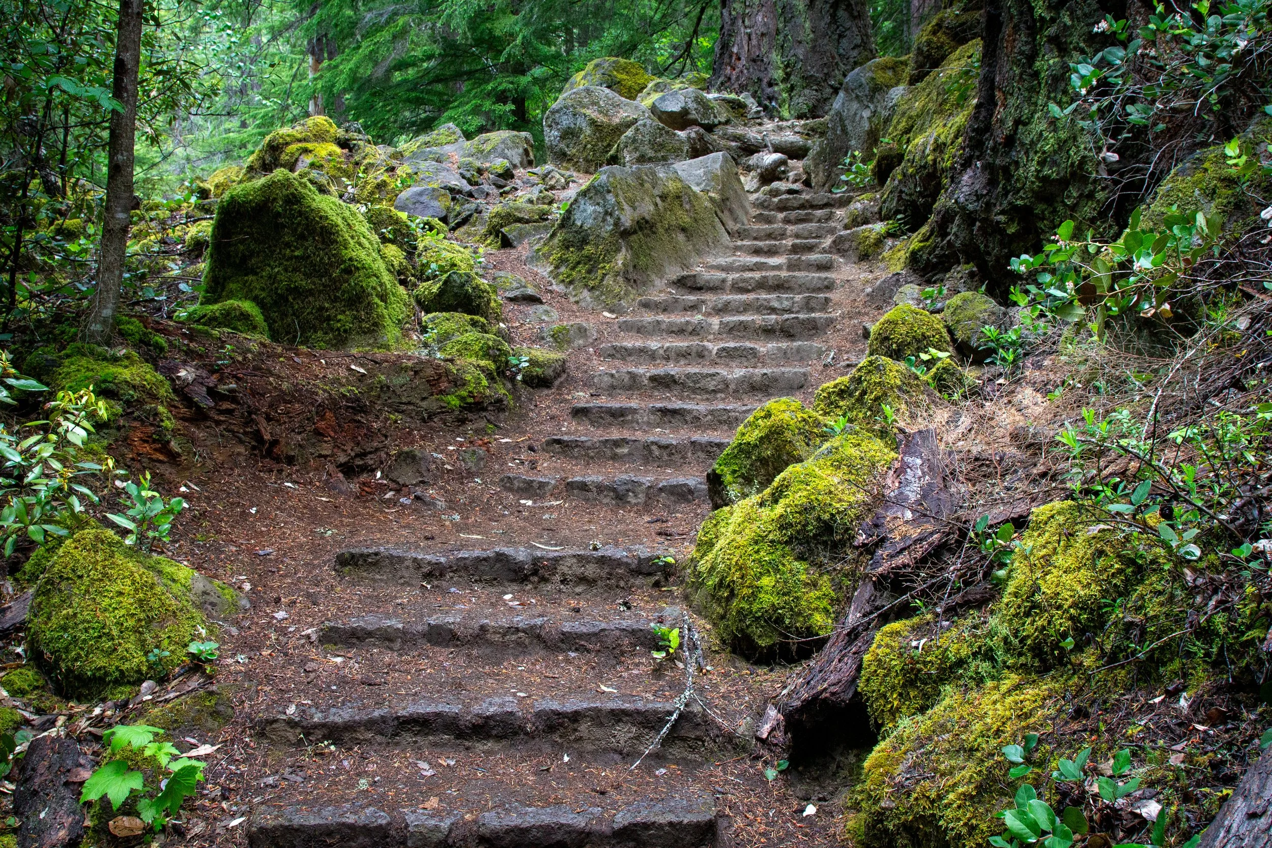
The Toketee Falls Trail is well-maintained and fairly easy. It’s a great place to stretch your legs on a road trip, taking about 30 minutes to an hour to complete. It doesn’t have difficult terrain like large tree roots. I’m calling it easy/moderate intensity because of the many stairs. Most but not all have railings. There’s a bench at the end of the hike and another around halfway. Hiking boots would be ideal, but you could get by with sneakers.
Toketee Falls Trail
If you parked near the giant pipe spraying water through its seams, you’re in the right place. Workers constructed the 12-foot-diameter penstock from redwood beams in 1947 as part of a hydroelectric project. Despite a few comically obvious leaks, it’s holding up surprisingly well.
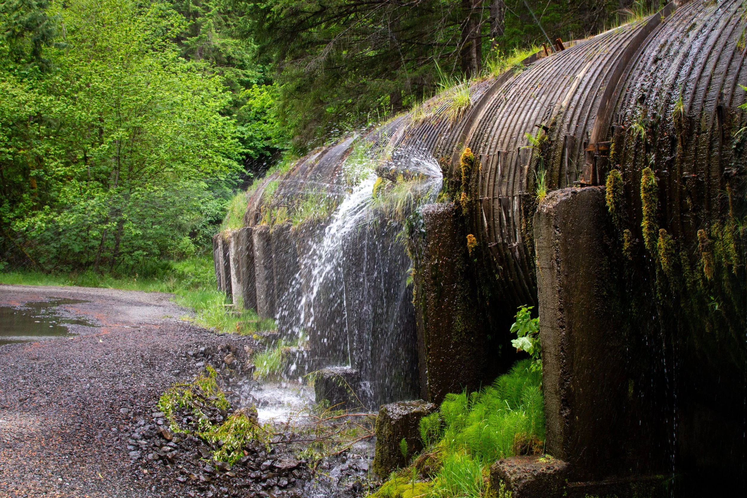
Redwood pipe in the parking lot
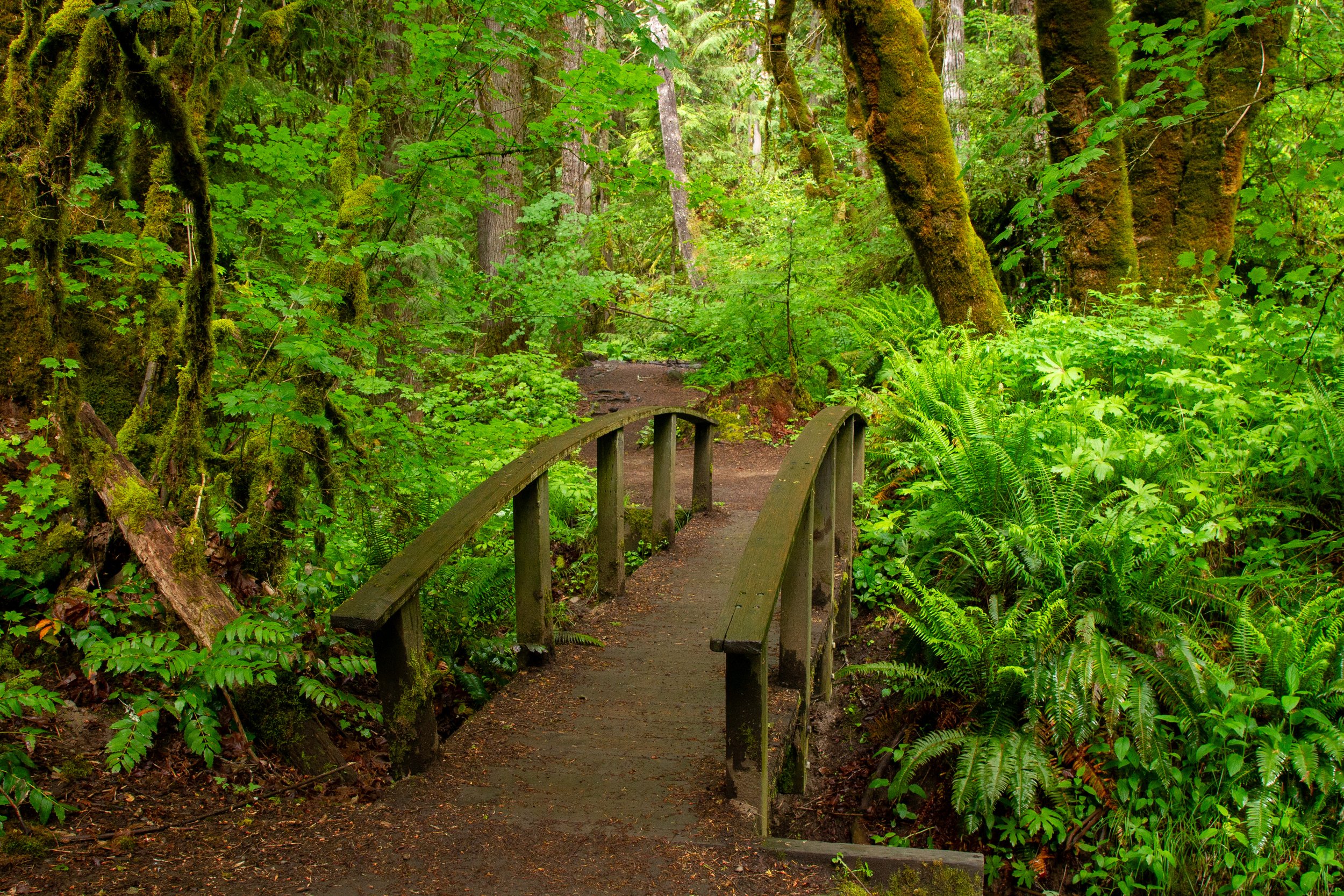
Look for the Toketee Falls Trailhead next to the sign with the trail map. The route is simple: straight out and back without crossing any other trails. To begin, you’ll walk over the littlest footbridge as you enter the forest.
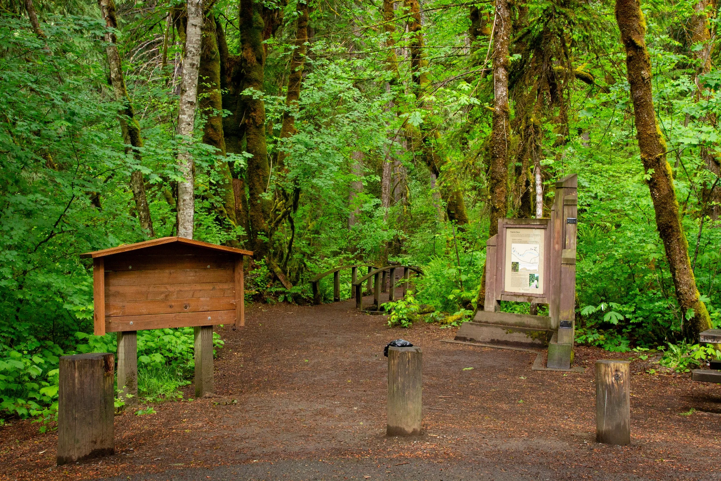
Start here
Despite being in an undeveloped area, the Toketee Falls Trail is in great shape. I came prepared to stumble over rocks and roots on an overgrown trail. Instead, I found a clear path without a single stick to step over.
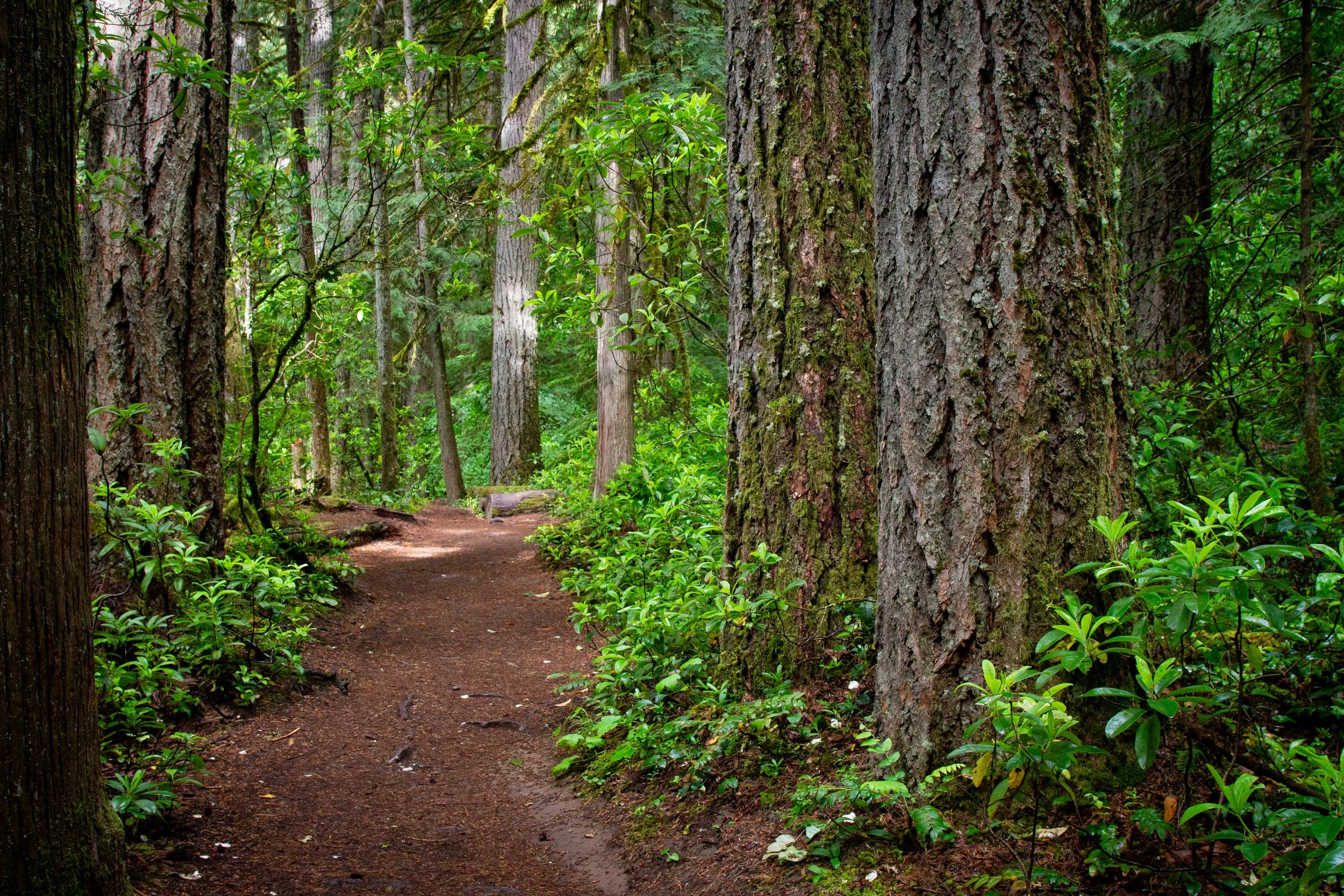
Toketee Falls Trail
Unlike areas along Highway 138 to the west, the forest around Toketee Falls escaped damage from the 2020 wildfires. Tall Doug firs, cedars, and western hemlock shade the trail. The many vine maples tell me that the fall color here is fantastic. In late spring, the first flowers were opening on the wild rhododendrons. June would be a great time to see them in full bloom.
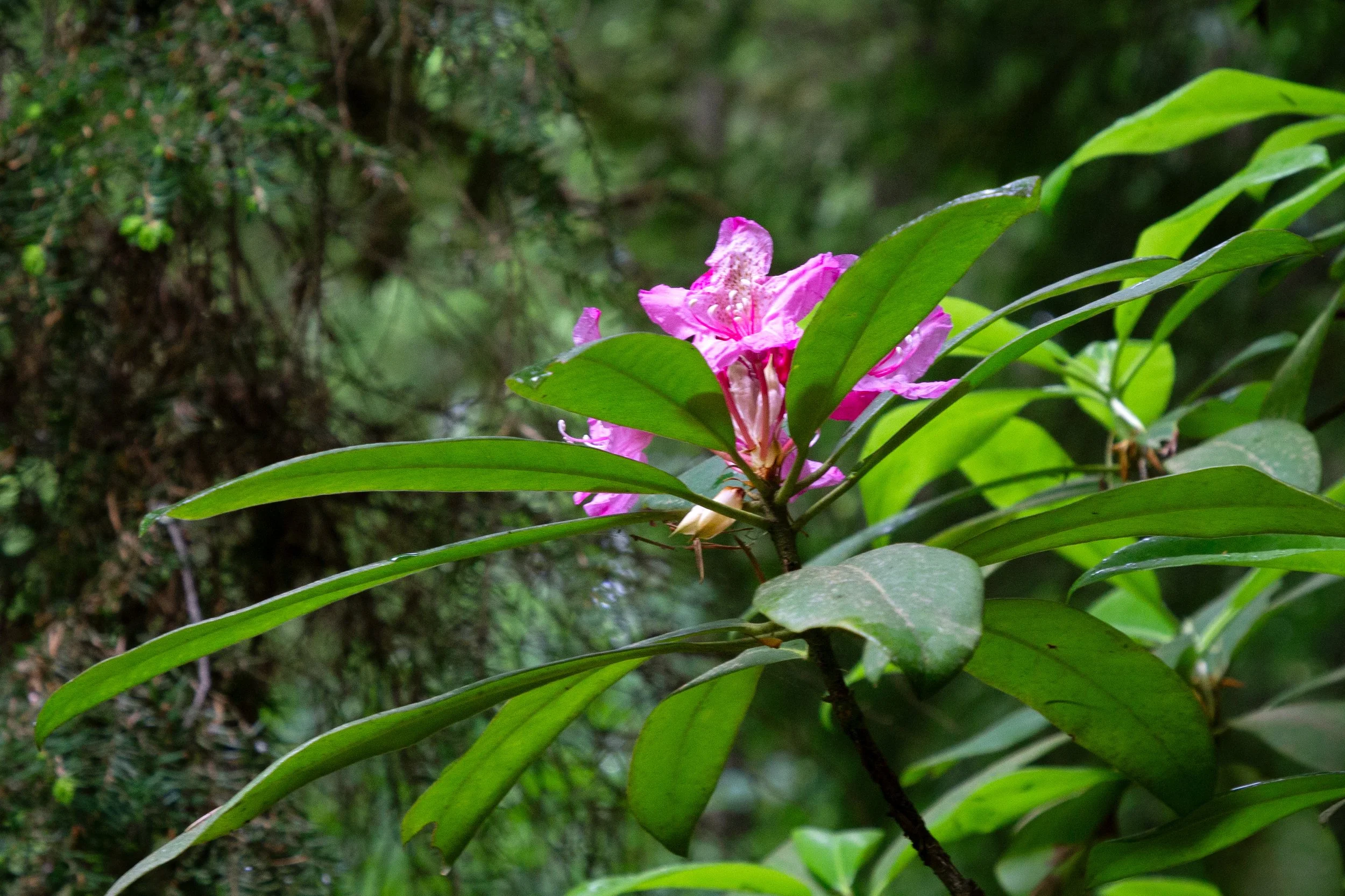
First of the rhododendron blooms
Shortly after starting the Toketee Falls Trail, you get the first good look at the North Umpqua River as it rounds a little bend and cascades over mossy rocks.
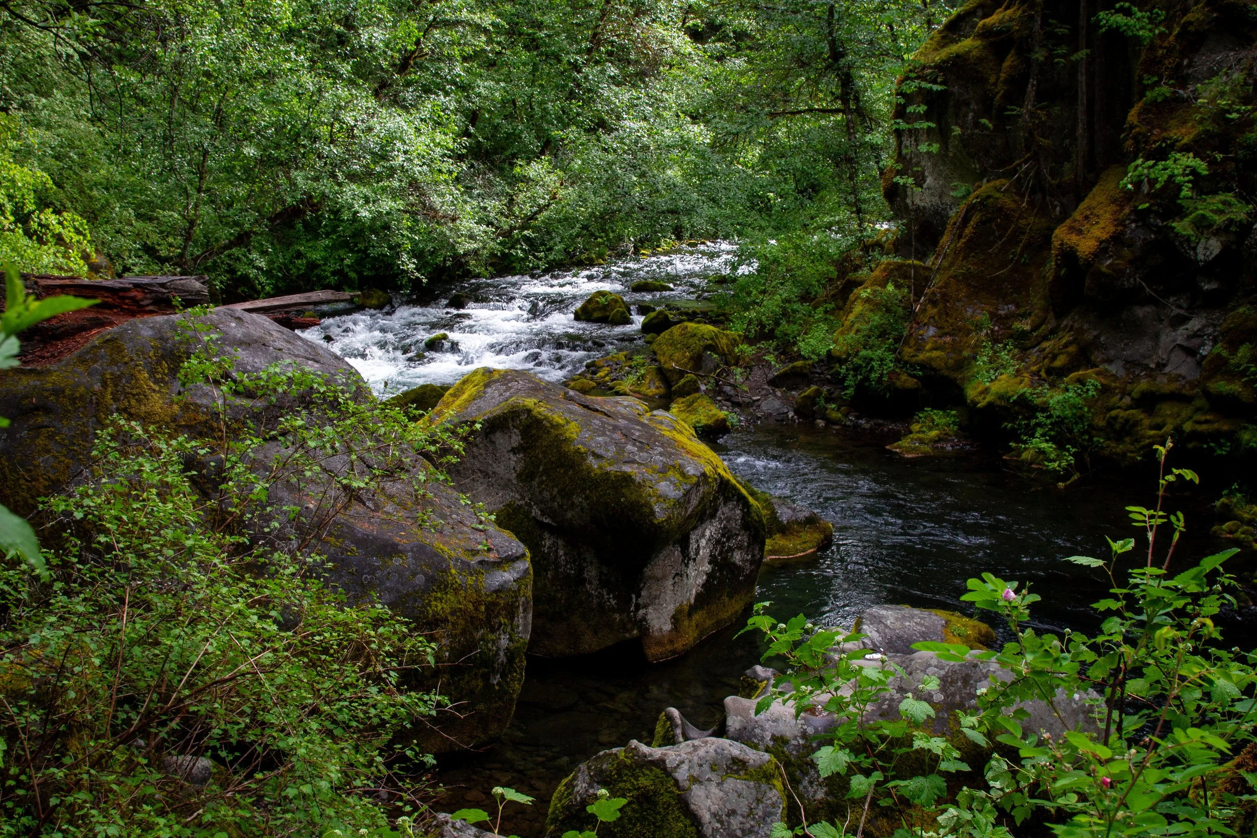
First river view
After climbing beautiful stone stairs, you can walk onto an outcropping to see the river from above. If you’re hiking with younger kids, it’s a rare place near unfenced drop-offs, but easy to avoid by continuing on the trail.
North Umpqua River
From here on, most of the hike to Toketee Falls has railings for safety and many sets of stairs. Please don’t cross the fence. People have fallen trying to reach the base of the falls.
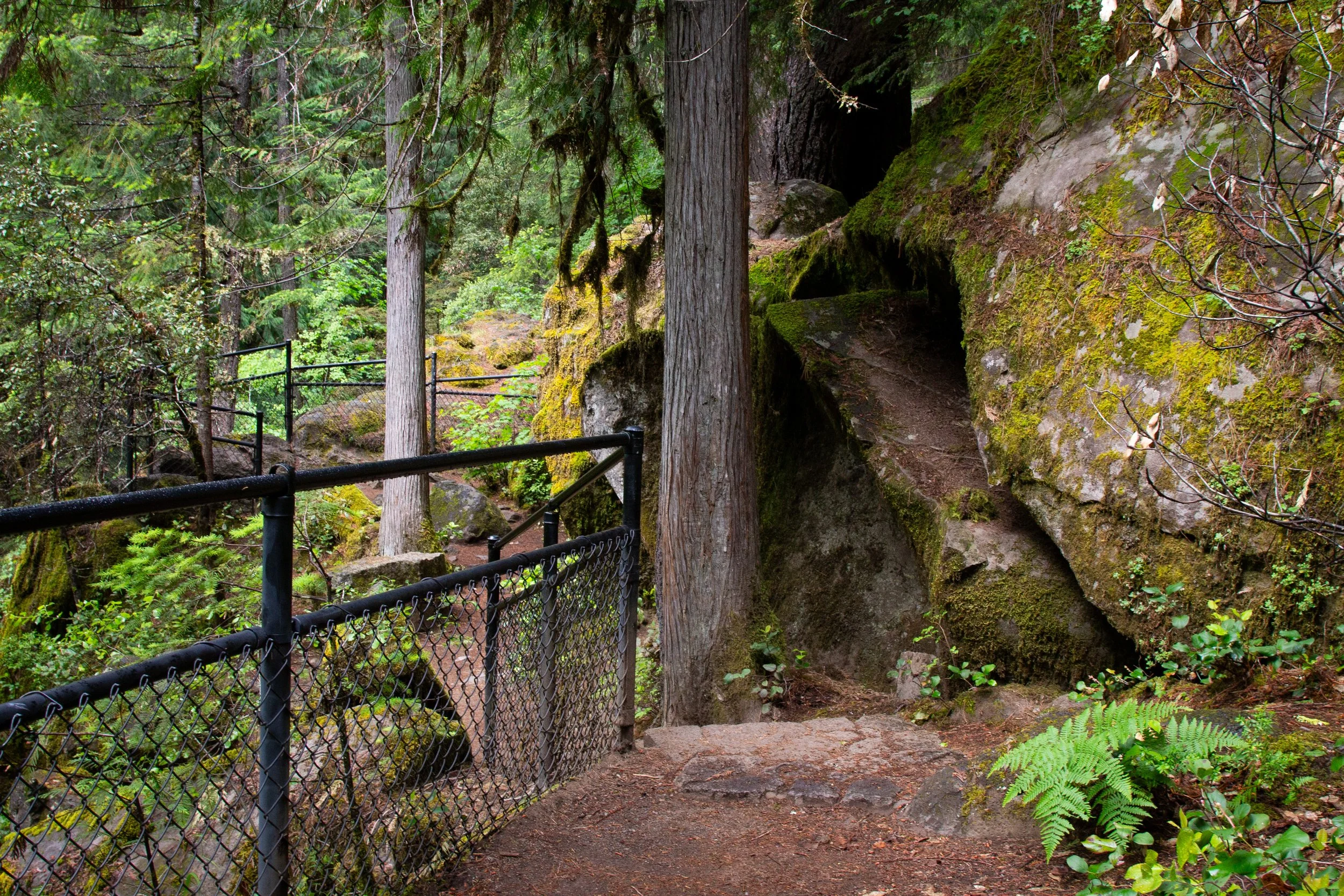
Toketee Falls Trail
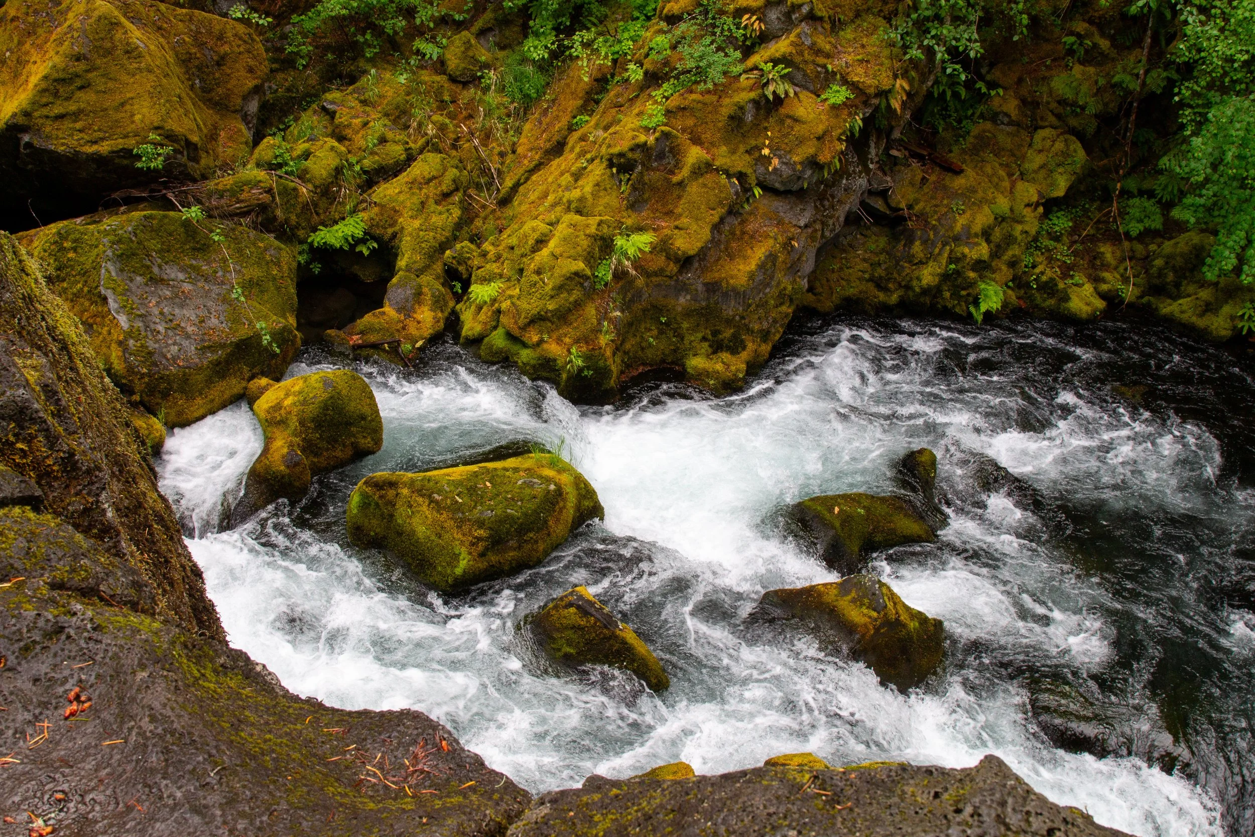
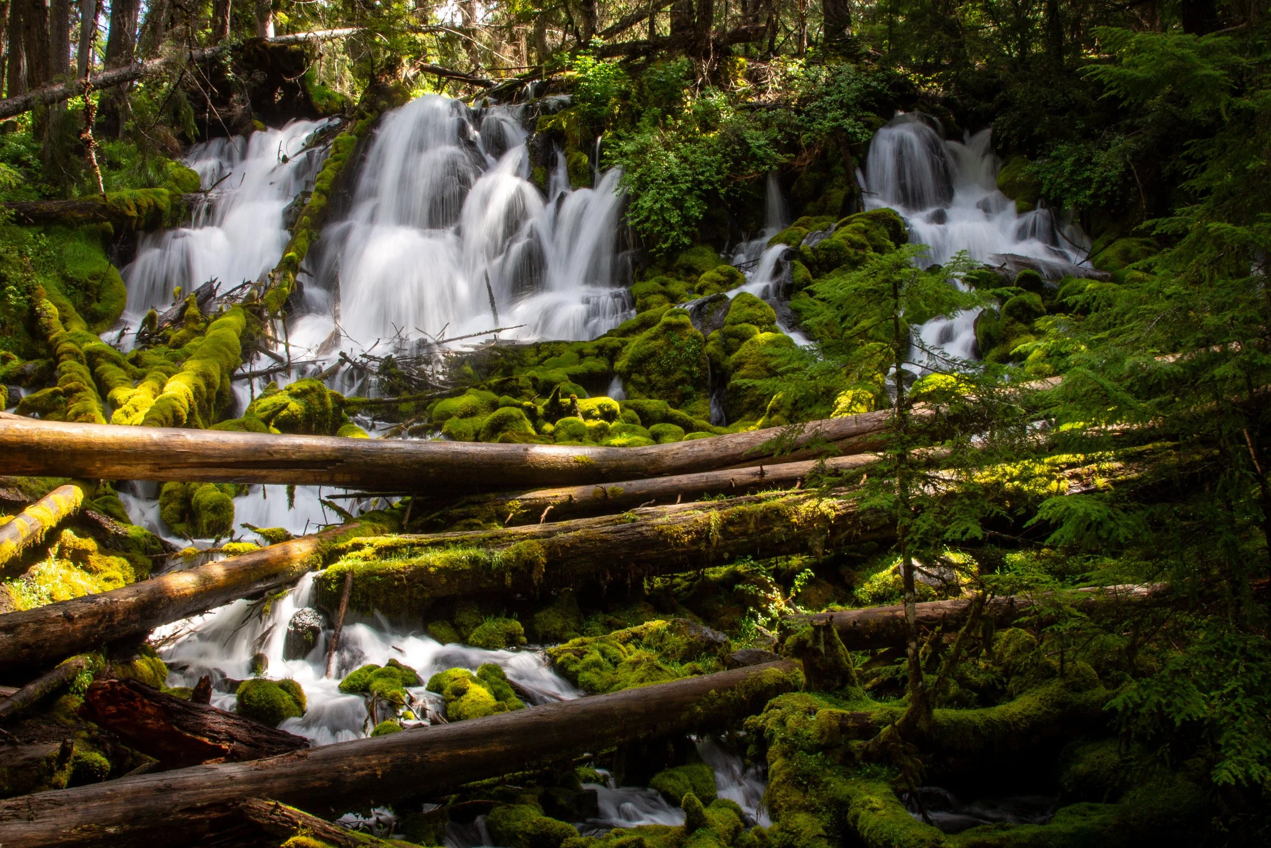
The next viewpoint overlooks a mini waterfall pouring through a mossy canyon on the North Umpqua River, a prelude of things to come.
Small waterfall on the way to Toketee Falls
The rest of the Toketee Falls hike is mostly stairs broken up by short stretches of trail. They’re in great condition, and most have railings.
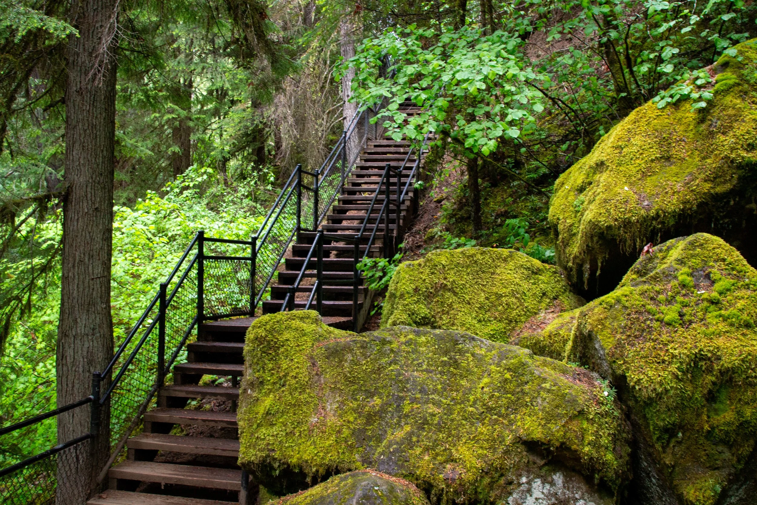
Some of the many stairs
Towards the end of the hike, the Toketee Falls Trail heads away from the North Umpqua River. You’ll pass a spot where a gap in the trees opens up a view of the forest.

Views from the trail
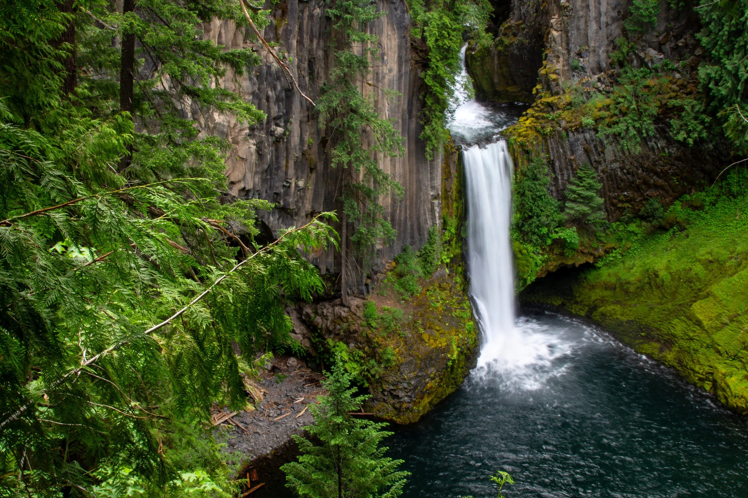
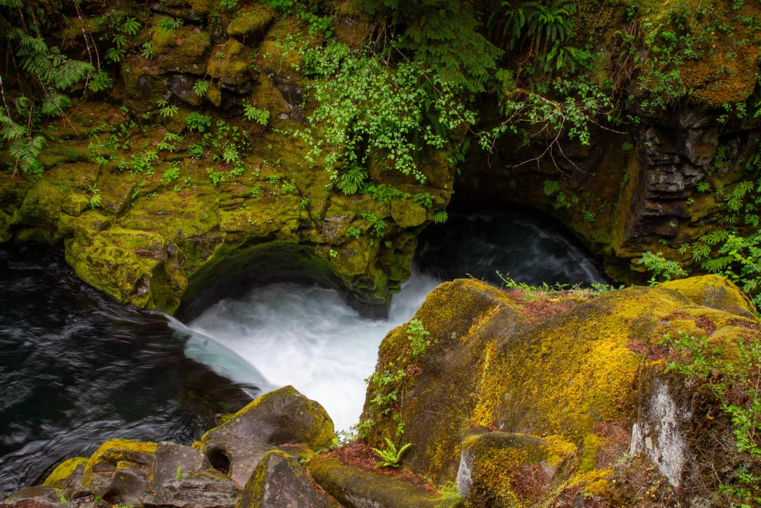
The trail ends at a viewing platform overlooking Toketee Falls. If you’re lucky enough to find it free, the bench on the platform is a great place to take your time with the falls.
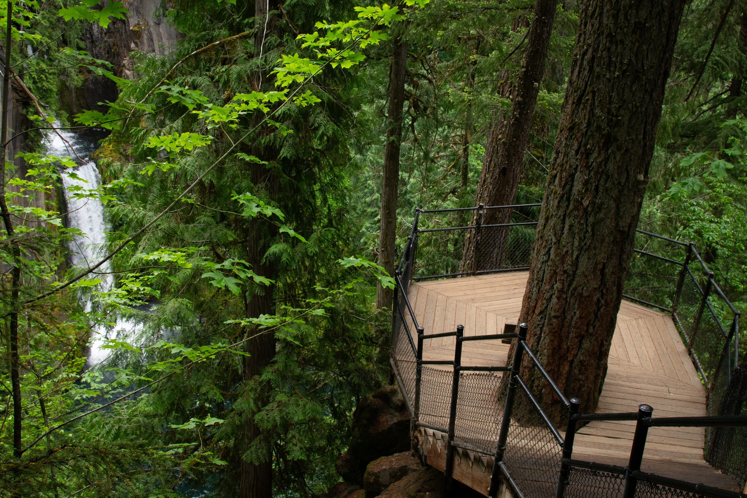
Toketee Falls viewpoint
Toketee Falls is one of Oregon’s most breathtaking waterfalls. More than the rather ho-hum height (around 100 feet, depending on the source), the harmony between the falls and the setting makes it unforgettable. From the viewpoint, you’ll see two tiers tumble over a deeply recessed cliff. The smaller upper tier drops into an idyllic pool before spilling over a U-shaped lip of broken basalt columns as a taller lower tier. When the sun hits it, the water looks aquamarine. Cloudy days bring out the rich greens of the forest around the basalt amphitheater. Enough water flows over Toketee Falls to keep it interesting, even in the driest months.
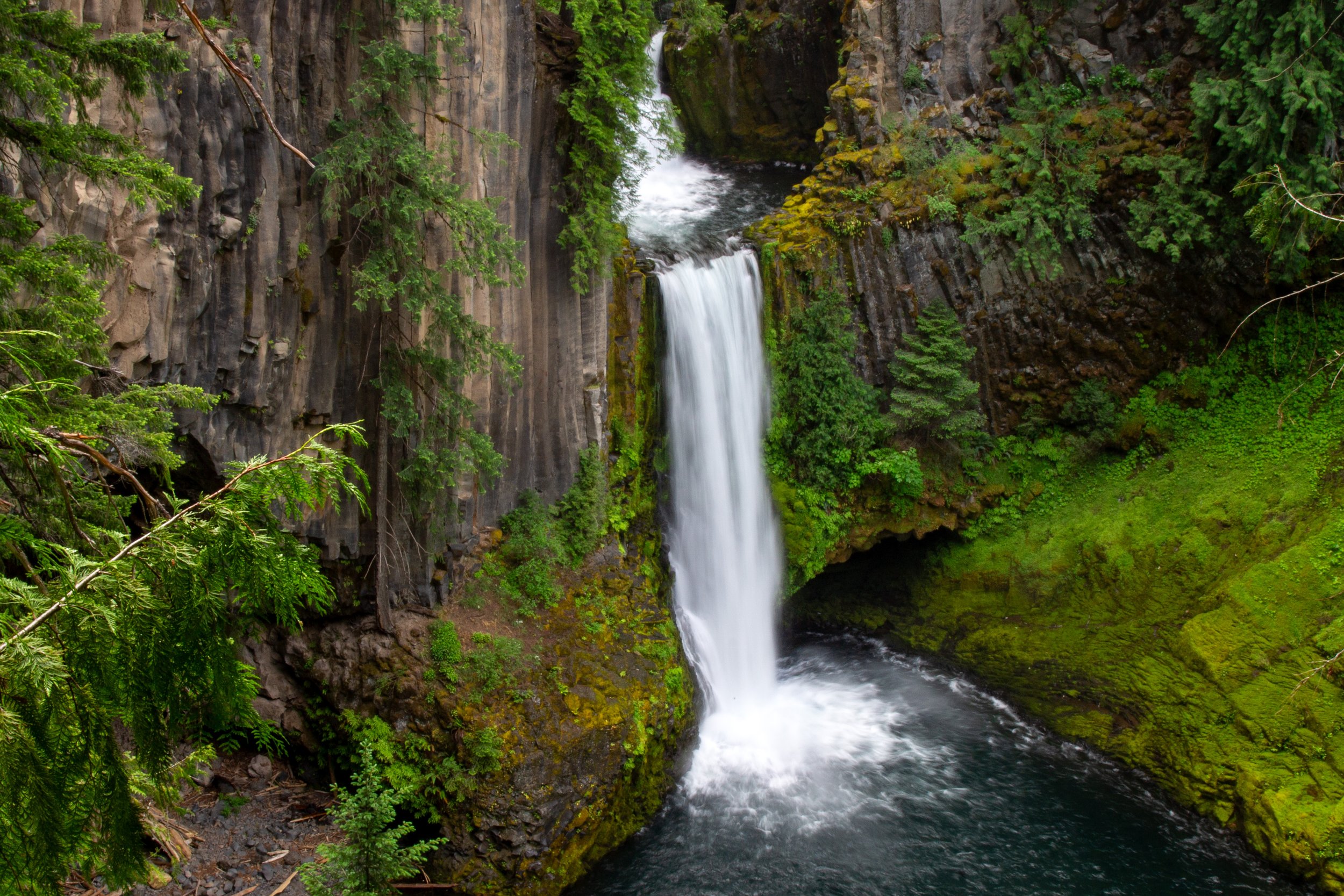
Toketee Falls
The basalt around Toketee Falls is a bit of an anomaly. It’s much younger than its surroundings in the High Cascades. Around 25,000 years ago, Mt Bailey erupted, sending lava flows down the ancestral Clearwater and Umpqua Rivers. This lava hardened into basalt several hundred feet thick. The river has since re-carved a channel, exposing the magnificent columns behind Toketee Falls. Together, the waterfall and the cliffs create a stunning scene that lives up to the name Toketee, meaning “beautiful” or “graceful” in Chinook jargon.
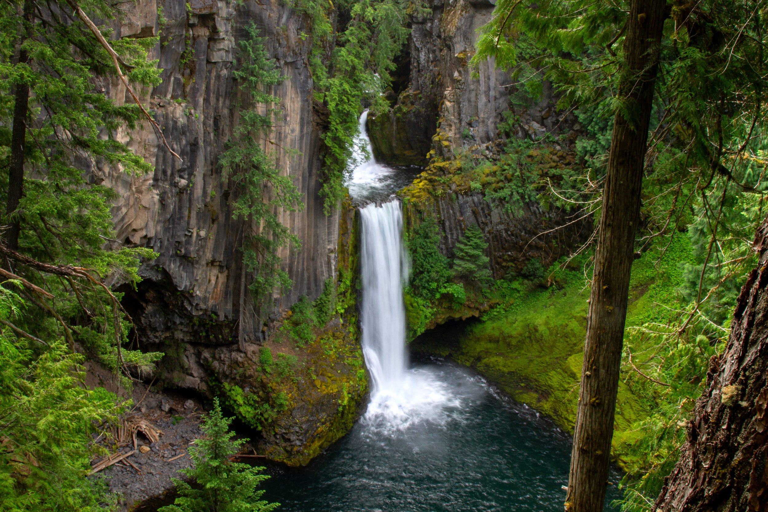
Toketee Falls
Getting there
The Toketee Falls Trailhead is just off Highway 138, around 60 miles east of Roseburg. A sign marks the turn a quarter mile before you arrive. You’ll turn onto NF-34, then make an immediate left into the parking area.
The drive from Roseburg takes about 70 minutes. From Eugene, a little over 2 hours. From Portland, about 4 hours.
Waterfalls near Toketee Falls
Clearwater Falls
Toketee Falls is close to more incredible waterfalls on southern Oregon’s Highway of Waterfalls. These are the closest and easiest to combine with a trip to Toketee Falls:
Watson Falls is the waterfall I’d call top priority. I liked it as much as Toketee Falls, for different reasons. It’s very tall, almost 300 feet, with a wispy, ethereal beauty. Unlike Toketee Falls, you can hike to the base. The hike is a little under a mile round-trip. It’s a little harder than Toketee Falls, but still a beginner-friendly route. The trailhead is 5 minutes away from Toketee Falls.
Whitehorse Falls is an easy stop just off Highway 138. It’s 10 minutes from Toketee Falls. No hike here. You pull over and see a small, pretty waterfall from the viewpoint.
Clearwater Falls is similar to Whitehorse Falls with more cascades. It’s another easy viewpoint stop, this time with benches, 15 minutes from Toketee Falls.
Enjoy your trip to Toketee Falls!
With love,
Emma