

Best 10 Hikes Within 1 Hour of Portland
These are the rockstar hikes - the best views, tallest waterfalls, and most wow factor within an hour’s drive from Portland, Oregon. Given their impressive attributes and convenient distance from the city, none of these hikes fly under the radar, and they do get crowded. Visit during an off time if you can. Otherwise, they are still fun even when braving the crowds. Hikes are listed from shortest to longest, and drive times are estimated from roughly the center of the city.
Beacon Rock
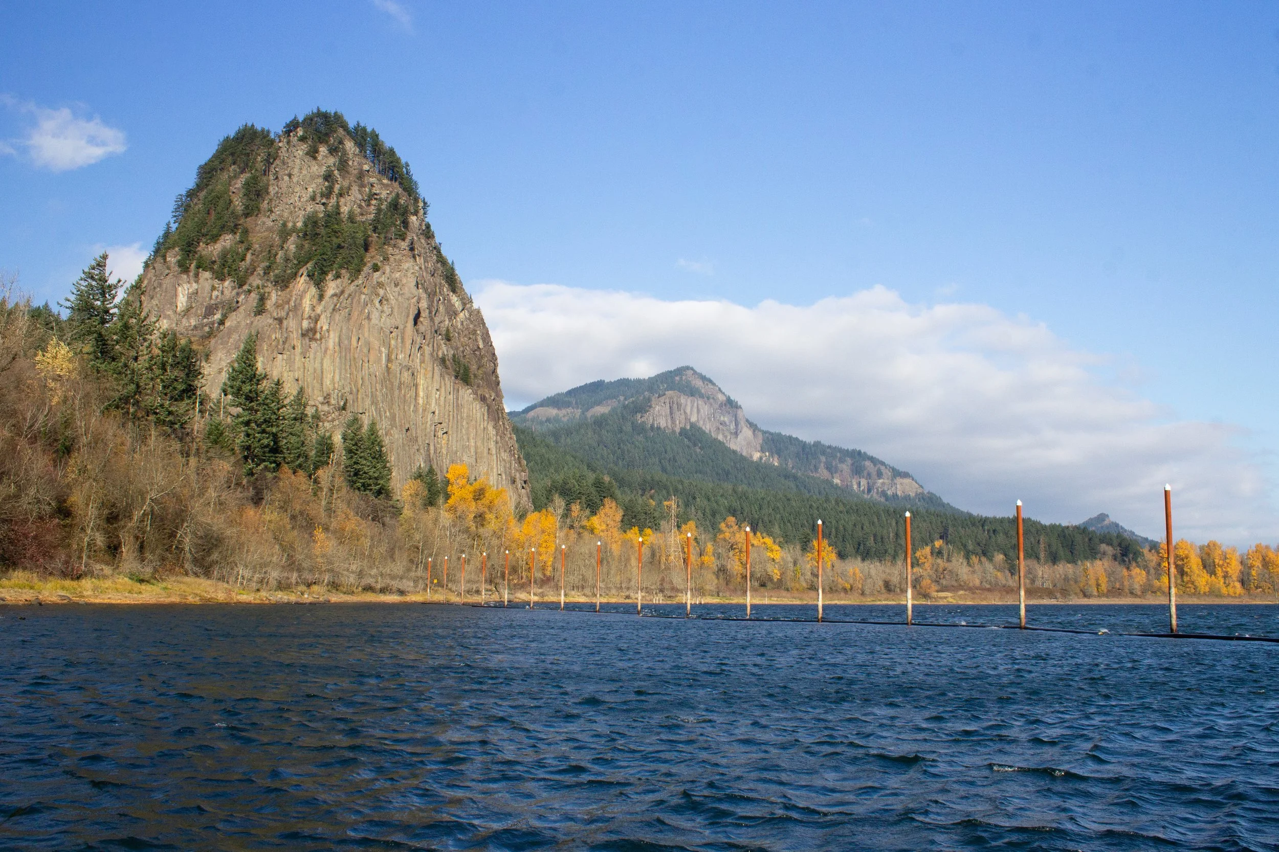
Distance: 1.8 miles out and back
Difficulty: Moderate
Elevation: 680 feet
Drive time: 50-60 minutes
Dog friendly: Leashed dogs allowed. Be aware that there are steep drop-offs and narrow sections of the trail.
Pass required: Washington Discover Pass, $10/day. You can buy a pass on-site.

Trail highlights
The hike up Beacon Rock is all about the views from start to finish, making it one of the best hikes near Portland. One of the most impressive parts of this hike is the trail itself, which is made of rocky switchbacks framed by a protective metal railing up a spire of basaltic andesite. The railing makes the hike family-friendly despite the steep drop-offs.
There are several viewpoints along the trail, some of them more impressive than Beacon Rock’s summit, which is somewhat obscured by pine trees growing at the top. The viewpoints provide great Columbia Gorge vistas to both the east and west.
Beacon Rock is popular amongst climbers as well as hikers. Don’t be surprised to see them clinging to rocky cliff faces.

Bonus hike option
A second trailhead at the base of Beacon Rock leads through the forest below the rocky spire. This trail is less popular than the climb up Beacon Rock and is a good place to spot some wildlife. In spring, look for larkspur along the trail. The hike is a fairly flat 1.5-mile out-and-back trail out to a marina, which offers a good view of Beacon Rock from its base. Look for the frame of a little stone building shortly before you reach the road to the marina.
For more trails, check out my article on the 5 Best Hikes in Beacon Rock State Park.

Fairytale that should take place here
At the summit of Beacon Rock, there is a former ruby mine that had to be abandoned after a dragon took over the mine for its lair. You, a famous dragon slayer, have journeyed from the valley of the West to slay the dragon and release the miners from their current poverty. You must climb to the summit of Beacon Rock, where the dragon dwells, and engage it in a battle to the death.
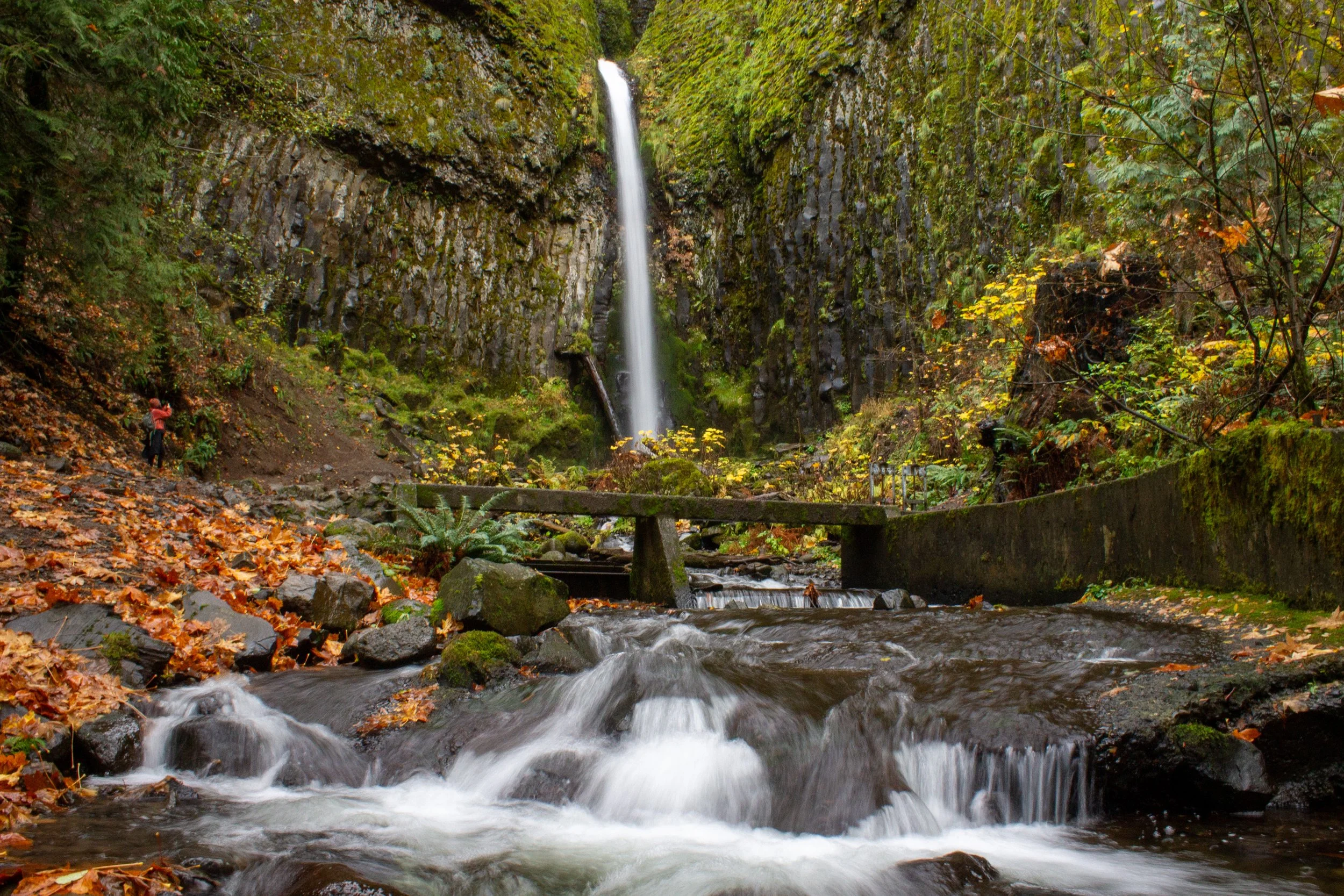
Wahclella Falls
Distance: 2-mile lollipop loop
Difficulty: Easy
Elevation: 300 feet
Drive time: 60 minutes
Dog friendly: Yes
Pass required: Northwest Forest Pass, or use $5 fee station at trailhead

Trail highlights
The Wahclella Falls Trail is one of the most iconic waterfall hikes in the Columbia Gorge. A short, easy 1-mile trek leads you along Tanner Creek toward the falls. Steep pine-covered hills of basalt rise steeply from the creek throughout the hike, lending it impressive drama and beauty over its short distance. Wahclella Falls is a jaw-dropping, multitiered waterfall that plunges into a pool surrounded by impressive piles of driftwood. It is a great place to stop for a snack or some pictures before returning via the lollipop loop.
Fairytale that should take place here
Your True Love has been cursed into an eternal sleep by an evil warlock. Your only chance of reviving your beloved is with the mystical waters of Wahclella Falls, which must be collected at the moment when the sun is at its zenith. Timing will be difficult, however, because trolls that populate the surrounding forest are likely to impede your quest.
Latourell Falls

Distance: 2.4-mile loop
Difficulty: Easy
Elevation: 600 feet
Drive time: 35 minutes
Dog friendly: Yes
Pass required: Oregon State Park Pass, $10/day

Trail highlights
The hike at Latourell packs in two incredible and photogenic waterfalls in a short 2-mile loop. Lower Latourell Falls is visible almost immediately from the parking area, with an unobstructed view of its 224-foot plunge. From here, you can continue to the two-tiered Upper Latourell Falls and its amphitheater of moss and lichen-covered basalt. Finish up the trail back at the Lower Falls, this time taking in the view from the base of the falls.
Fairytale that should take place here
You have been sent on a quest by the dying king of Nowhyria to find the rare four-petaled blue trillium flower that is rumored to grow at the base of an enchanted waterfall. A tea brewed with the flower can extend life even after the gravest of injuries. The king was wounded by his evil stepbrother in a battle over control of the lands of Nowhyria. It is up to you to find the flower that will cure him, thus saving the kingdom from the rule of a tyrant. However, the temptation of keeping the flower for yourself may prove to be too great…
Disclaimer: Pines and Vines only endorses picking imaginary flowers for magical quests, not real flowers.
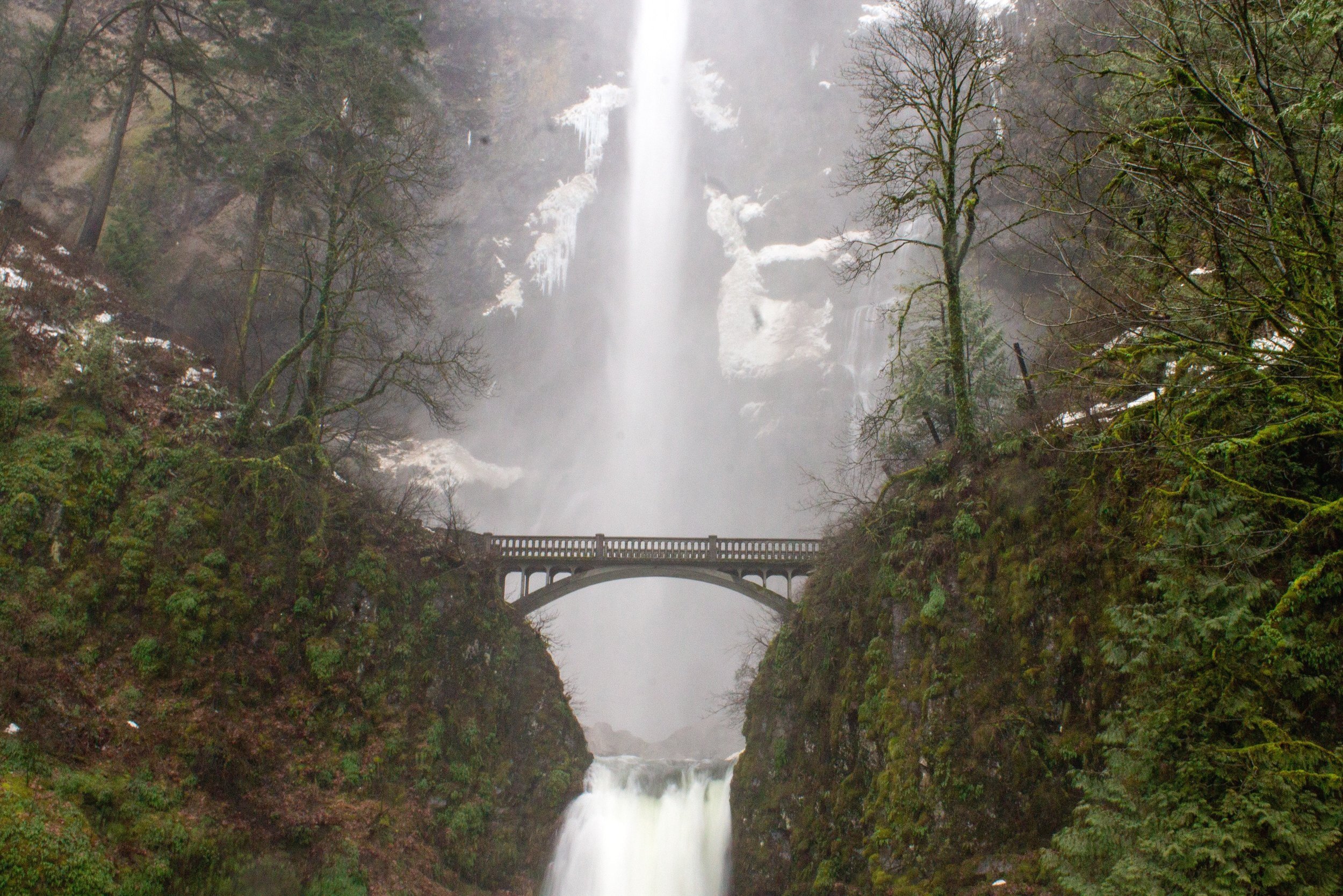
Multnomah Falls
Distance: 2.4 miles out and back
Difficulty: Moderate
Elevation: 900 feet
Drive time: 35 minutes
Dog friendly: Yes
Pass required: Multnomah Falls Reservation Permit, $2 - book online in advance. Find details here. Required seasonally.

Trail highlights
It would be impossible to exclude Multnomah Falls from a list of the best hikes near Portland. Even in a land of waterfalls, Multnomah Falls is a standout. It is not so much a waterfall hike as THE waterfall hike. Yes, it’s hard to park. Yes, it’s crowded even during off times. Yes, you need a reservation ahead of time now, which still doesn’t guarantee parking. However, these falls live up to the hype and are worth a visit and many revisits despite the hoops involved.
You’ll begin at the base of the falls, the best place to photograph its entire height. Then, head uphill on a paved path, crossing the famous Benson footbridge between the tiers of the falls. Continue up switchbacks to the top of the falls. The hike is paved throughout and is not very long, although it is a steady uphill climb to the top.
Optional bonus hike
For maximum waterfalls, try out the Multnomah-Wahkeena Falls loop trail. This 5-mile loop will take you to six waterfalls. After reaching the viewpoint at the top of Multnomah Falls, return to the main trail and continue onto the Larch Mountain trail rather than returning downhill. Then, take the Wahkeena Trail, which will bring you to the trail to return to Multnomah Falls.
Fairytale that should take place here
You are looking for an enigmatic matriarchal society of warriors, largely believed to be mythical, in hopes of joining their community. After years of searching, you learn they live at the top of Multnomah Falls. Climbing to the top is the first of many tasks that make up their ancient and grueling initiation rituals. You begin your climb, mentally preparing for the tests of strength, skill, and wit yet to come.
Washington Park Loop

Distance: 3.9-mile loop
Difficulty: Easy
Elevation: 600 feet
Drive time: 10-15 minutes - also accessible by bus and Max!
Dog friendly: Yes
Pass required: None, metered parking at many access points

Trail highlights
There’s no need to leave the city to enjoy the best hikes near Portland! Washington Park offers a fusion of tranquil forest trails with popular urban attractions. See the living tree museum at Hoyt Arboretum, take in the splendor of the International Rose Test Garden, and check out statues, sculptures, and memorials, all linked by wooded trails through Doug firs, alders, and maples. No need to drive at all for this one. It’s accessible by public transportation.
Fairytale that should take place here
A rare stone made from a fusion of emerald and petrified dragon blood allows its bearer to shapeshift. Because of its dangerous powers, the stone was broken into a dozen pieces by an alliance of wizards and hidden across the wilds of Washington Park. You long for this terrible power and begin a quest to seek out and unite the pieces.
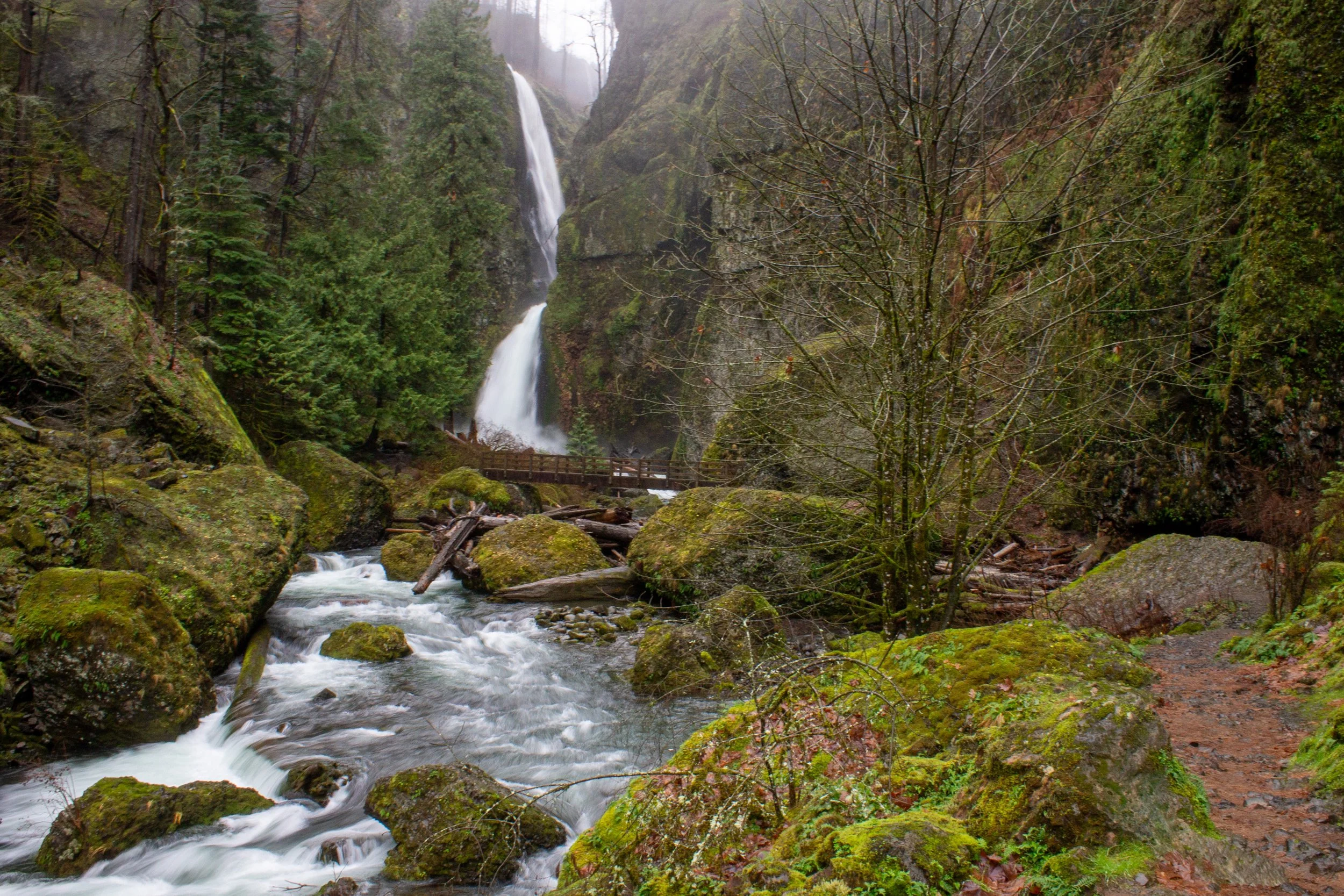
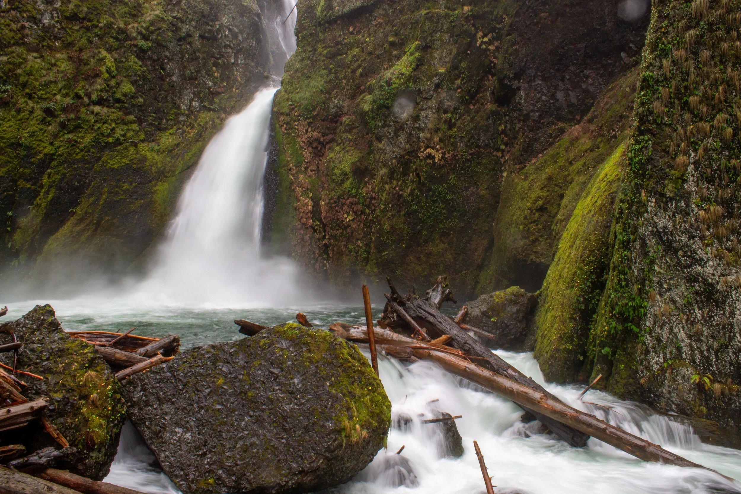
Eagle Creek to Punch Bowl Falls

Distance: 4.2 miles out and back
Difficulty: Moderate
Elevation: 500 feet
Drive time: 45 minutes
Dog friendly: Dogs are allowed, but be aware there are steep drop offs and narrow sections of the trail
Pass required: Northwest Forest Pass, or use the $5 fee station at the trailhead

Trail highlights
The Eagle Creek Trail is an adventure. Walk along sheer basalt cliffs above Eagle Creek to reach the picturesque Punch Bowl Falls. Portions of this unforgettable trail were created in the early 20th century by dynamiting a path along the cliff. Although the 2017 wildfire left its imprint on this area, it is still incredible and showing good recovery. Besides Punch Bowl Falls, there are a few smaller waterfalls that can be glimpsed through the trees, as well as some seasonal waterfalls in wetter months.
The trail has metal safety cables along its more hazardous portions. There are many steep drop-offs, and it isn’t a good destination with younger children.
The Eagle Creek Trail continues past Punch Bowl Falls. If you’re up for a long hike, you can continue to Tunnel Falls for a 12-mile round-trip.
Fairytale that should take place here
You are the sole survivor of a volcanic eruption that decimated your peaceful and idyllic village. You’ve heard rumors that a powerful sorceress bewitched a clock with the power to reverse time. The clock is said to be hidden deep within the Rabid Pterodactyl Forest at the base of a mighty waterfall. You must brave the exposed cliff faces of the forest, risking a Pterodactyl attack from above, to retrieve the clock. With it, you can travel back in time and evacuate your village before the fatal eruption.
Dry Creek Falls

Distance: 4.4 miles out and back
Difficulty: Easy
Elevation: 700 feet
Drive time: 45 minutes
Dog friendly: Yes
Pass required: Northwest Forest Pass, or buy the $5 day pass at the fee station

Trail highlights
Follow the Pacific Crest Trail to reach the stunning and unique Dry Creek Falls. The vegetation along the trail shows signs of recovery following fire damage, with dense ferns growing around charred trunks of still-living trees. Doug-firs predominate on this hike and provide good shade throughout.
The trail begins with a steady uphill climb and levels out temporarily, only to end with a short, steep uphill march to the falls. You will see a footbridge over Dry Creek at a fork in the path. Turn right at the fork (away from the footbridge) to reach the falls. A wall of columnar basalt frames Dry Creek Falls as it makes a single plunge and flows out from the pool at its base to become the scenic Dry Creek. After enjoying the majesty of the falls, the trail will be mostly downhill back to the parking area. I’d suggest stopping in the town of Cascade Locks for post-hike refreshments.
Fairytale that should take place here
Legend tells of a golden stag that feeds only on new fern leaves and drinks only the enchanted waters of the pool beneath Dry Creek Falls. A single hair from this stag is said to impart the secrets of the afterlife to its holder. You are determined to find the stag and retrieve one of its hairs to obtain this forbidden knowledge. Beware, however, that the stag is no gentle beast and has been known to impale wild boar with its colossal antlers.
Angel’s Rest

Distance: 4.8 miles out and back
Difficulty: Moderate
Elevation: 1500 feet
Drive time: 35 minutes
Dog friendly: Yes
Pass required: Oregon State Park Pass, $10/day

Trail highlights
If you ask a local about the best hikes near Portland, chances are they will suggest Angel’s Rest. This regular, steady 2.5-mile uphill climb has plenty of rewards along the way to make it worth the effort. Begin in a pine forest with a dense understory that reflects regrowth after fire damage years ago. Soon you will come across a clearing in the trees and a view of the Columbia River. About a mile into the hike, you’ll arrive at Coopey Falls. Take the spur from the left of the trail to reach the base of the falls (note that it gets muddy and slick). Return to the main trail, cross the footbridge over the creek, and continue up the switchbacks.
As you get closer to the top, the trees thin and reveal views of the Gorge below. Wildflowers line this trail in summer, including columbine, larkspur, iris, and hawksbeard. The top of Angel’s Rest is an impressive andesite plateau that provides views of the Gorge in three directions. Best of all, the walk back is an easy downhill stroll.
Fairytale that should take place here
Your village’s wise woman has predicted an impending invasion of the village by the dreaded Shadow Army. Your fellow townspeople have begun building fortifications to help protect the village, but they need to know what they’re facing. You must climb to the top of Angel’s Rest and report back on the Shadow Army’s numbers, arms, and distance from the village. Forewarned is forearmed.
Cape Horn Overlook

Distance: 5.2 miles out and back (or 7.2-mile loop, seasonally)
Difficulty: Moderate
Elevation: 1200 feet
Drive time: 40 minutes
Dog friendly: Yes
Pass required: None

Trail highlights
While the fantastic views of the Columbia Gorge make the Cape Horn Trail one of the best hikes near Portland, the wildflowers alone are worth the trip in spring and summer. Look for columbine, larkspur, foxglove, tiger lilies, buttercups, and iris lining the trail in summer. Towards the end of the hike, you’ll walk past a colorful field of lupines, daisies, clover, and hawksbeard.
The trail begins with a series of switchbacks to Pioneer Point, which offers a rewarding view of the Columbia River after your climb. Watch the falcons circling as you take in the views. From here, the trail gets considerably easier. Continue on a relatively flat, well-maintained trail through the forest, pass through a grassy field full of flowers, reenter the woods briefly, and then reach your destination: the Nancy Russell Overlook, with views all the way to Beacon Rock.
Bonus hike option
While this trail is technically part of a loop, the lower part is closed for part of the year to accommodate the peregrine falcons that nest there. If you visit Jul 16th - Jan 31st, you can do the 7.2-mile loop rather than the 5.2-mile out-and-back. The lower portion of the loop includes a waterfall.
Alternatively, you can still see the waterfall during nesting season if you do a longer, 9-mile out-and-back. Rather than turning back at the Nancy Russell Overlook, continue on the trail to reach the Upper Waterfall and Windblown Fir viewpoints.
For more wildflowers, check out my article on the best wildflower hikes in the Columbia Gorge.
Fairytale that should happen here
You are a legendary gunslinger and assassin who is fed up with carnage and bloodshed. You renounce your profession and all your worldly goods in hopes of a fresh start. You journey deep into the forest to find a place of seclusion and begin a peaceful life as a farmer. Although the Cape Horn Forest is said to have enchantments to protect its inhabitants, you can only hope that your former life does not catch up with you. Better check the viewpoints to scan the area for any vigilantes bent on revenge.
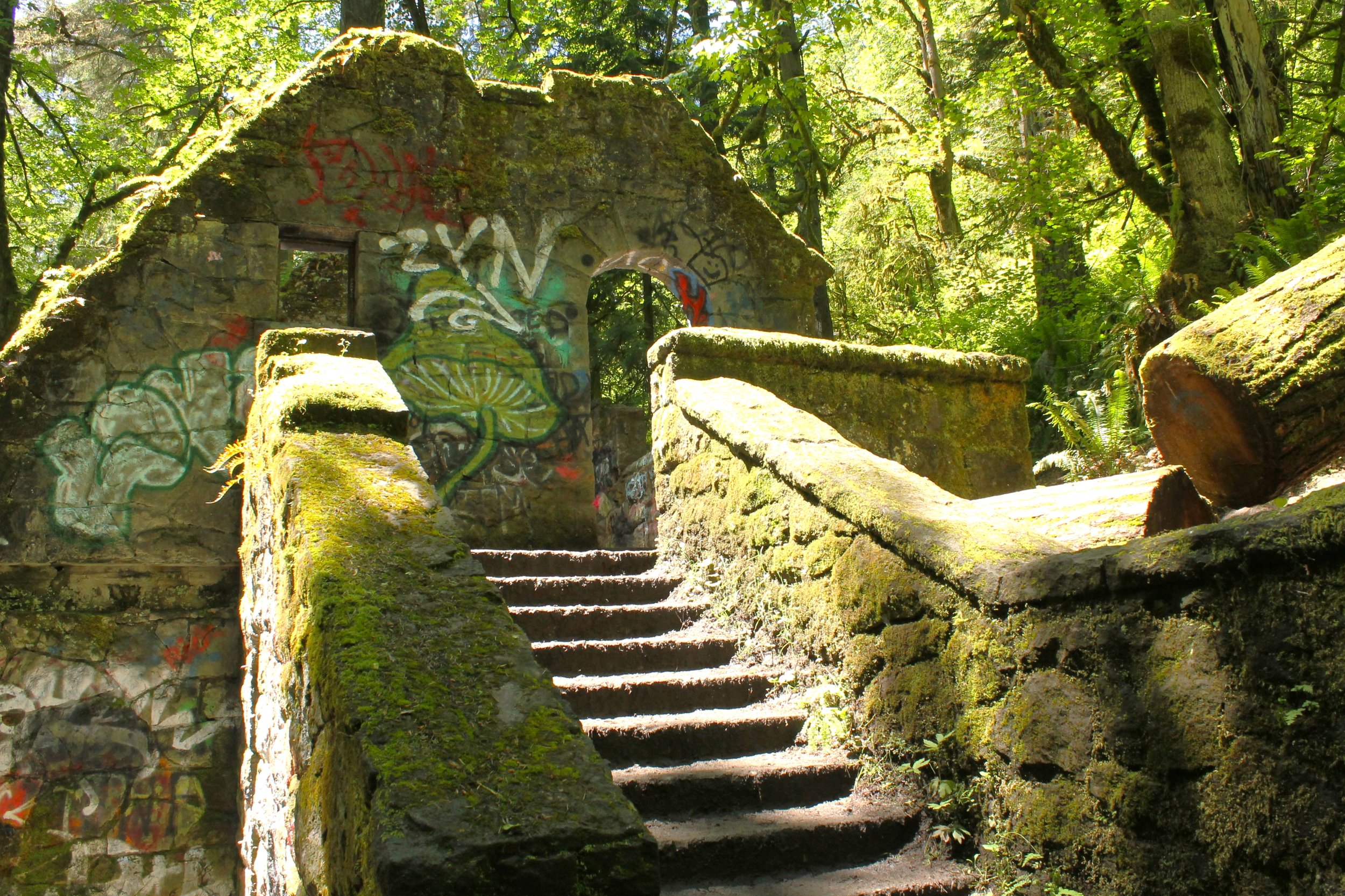
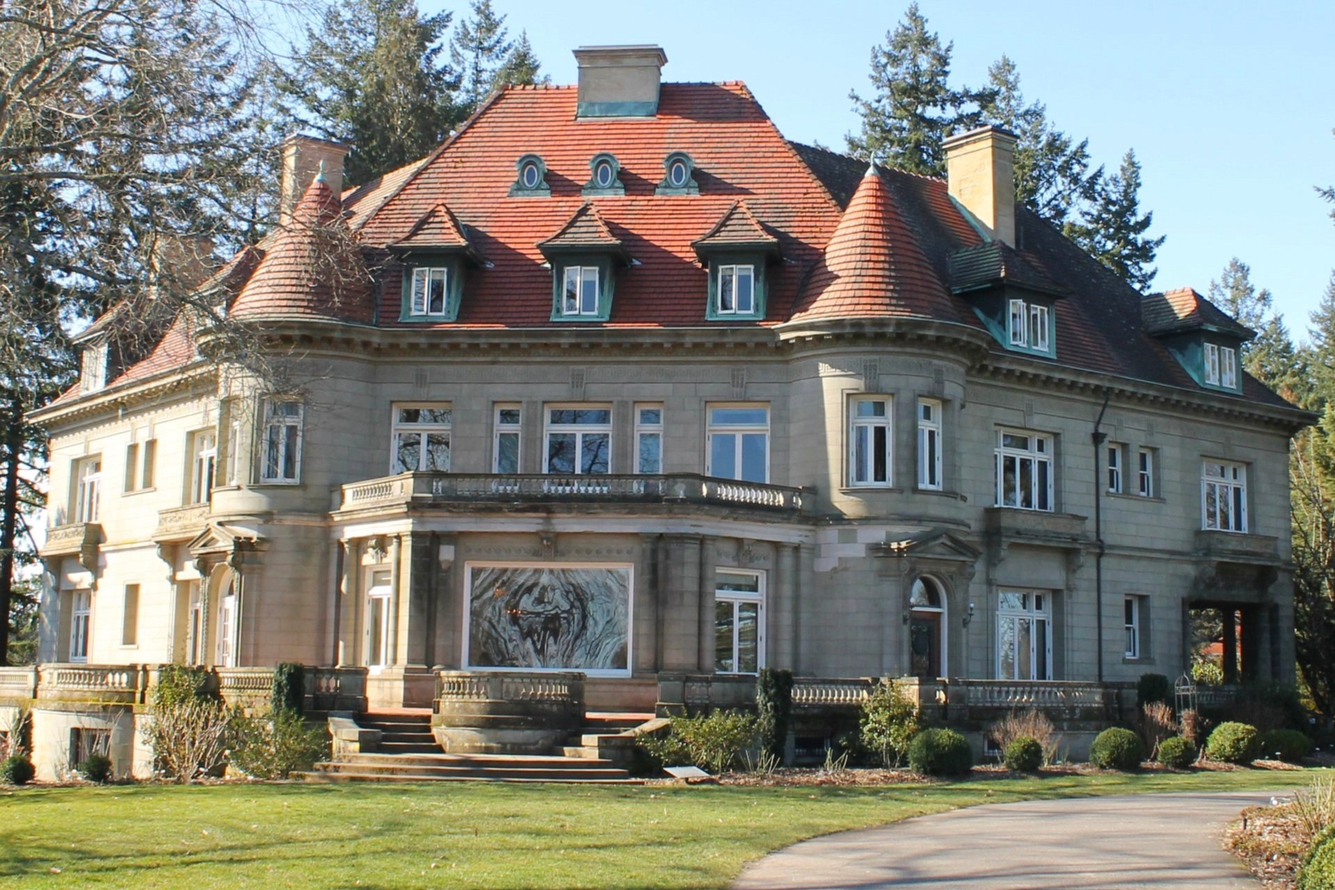
Lower Macleay to Pittock Mansion
Distance: 5.7 miles out and back
Difficulty: Moderate
Elevation: 950 feet
Drive time: 10-15 minutes - also accessible by bus!
Dog friendly: Yes
Pass required: None, there is limited free street parking near the trailhead at McLeay Park. There is a fee to tour Pittock Mansion, but the grounds are free to explore.
Trail highlights
This urban hike will make you forget you are still in the city. The trail starts at Lower Macleay Park in NW Portland, which begins with a flat, paved path. The trail passes under the Thurman Street Bridge, through a grassy field, then into Forest Park. The first part of the trail follows tranquil Balch Creek, which includes a tiny waterfall. The pavement ends after about a quarter mile, but the trail continues flat and gentle until the iconic Witch’s Castle (officially called Stone House), the remains of an atmospheric stone building that was once a restroom.
After the castle, continue onto the Wildwood Trail. The trail will cross Balch Creek on a footbridge and then begin climbing in switchbacks up to Cornell Rd. Cross the road and continue uphill through the forested trail to reach Pittock Mansion. Take the short, paved path around the mansion to enjoy the gardens and reach the viewpoint that overlooks the city of Portland. On a clear day, Mount Hood is visible.

Optional bonus hike
This hike passes by the Audubon Society of Portland. In addition to its facility that houses rescued birds, the Society has about 4 miles of hiking trails beginning at its visitor’s center. These trails are less trafficked than the well-known Wildwood trail and offer a chance for a quieter experience with nature.
Fairytale that should take place here
Forest pixies have been playing tricks on city dwellers for centuries, but lately, things have escalated. People who tread too close to the forest emerge with all sorts of enchantments, like donkey’s ears, or speaking only in birdsong. You are tasked with finding the leaders of the woodland pixies and brokering a peace agreement if you can escape un-hexed. You may want to recruit the help of the local witch for protection.
Best hikes within an hour of Portland, the summary:
Beacon Rock
Wahclella Falls
Latourell Falls
Multnomah Falls
Washington Park
Eagle Creek
Dry Creek Falls
Angel’s Rest
Cape Horn Overlook
Lower Macleay to Pittock Mansion
Enjoy the trails and cheers to your next adventure!
With love,
Emma
Explore nearby

Trying to escape the crowds? Check out these hidden gem hikes near Portland.

Find the best waterfall hikes near Portland.