

15 Best Hikes near Hood River
Hood River, Oregon, is at an interesting tipping point in the Columbia Gorge. To the west are waterfalls and conifer forests. To the east, grasslands and wide open vistas. In terms of natural beauty, it’s right in the heart of the action. I live in Portland and have written hiking guides about the Columbia Gorge before. For this one, I’m focusing on places that highlight what’s special about the area right around Hood River. Most trails are within a 20-minute drive from town. The farthest is an hour. Here’s where to hike in and around Hood River.
Quick suggestions
The hikes are ordered by their distance from Hood River. Depending on what you’re in the mood for, here are my quick suggestions:
Short and easy/kid-friendly: 1-Hood River Pipeline, 2-Indian Creek Trail, 6-Mitchell Point Tunnels, and 13-Catherine Creek
Less crowded: 2-Indian Creek Trail, 9-Punchbowl Falls, 11-Chinidere Mountain, and 15-Wind Mountain
Hikes to swimming holes: 1-Hood River Pipeline and 9-Punchbowl Falls
Best Mount Hood views: 4-Hood River Mountain and 11-Chinidere Mountain
Hard: 14-Dog Mountain and 15-Wind Mountain
Hikes in Hood River
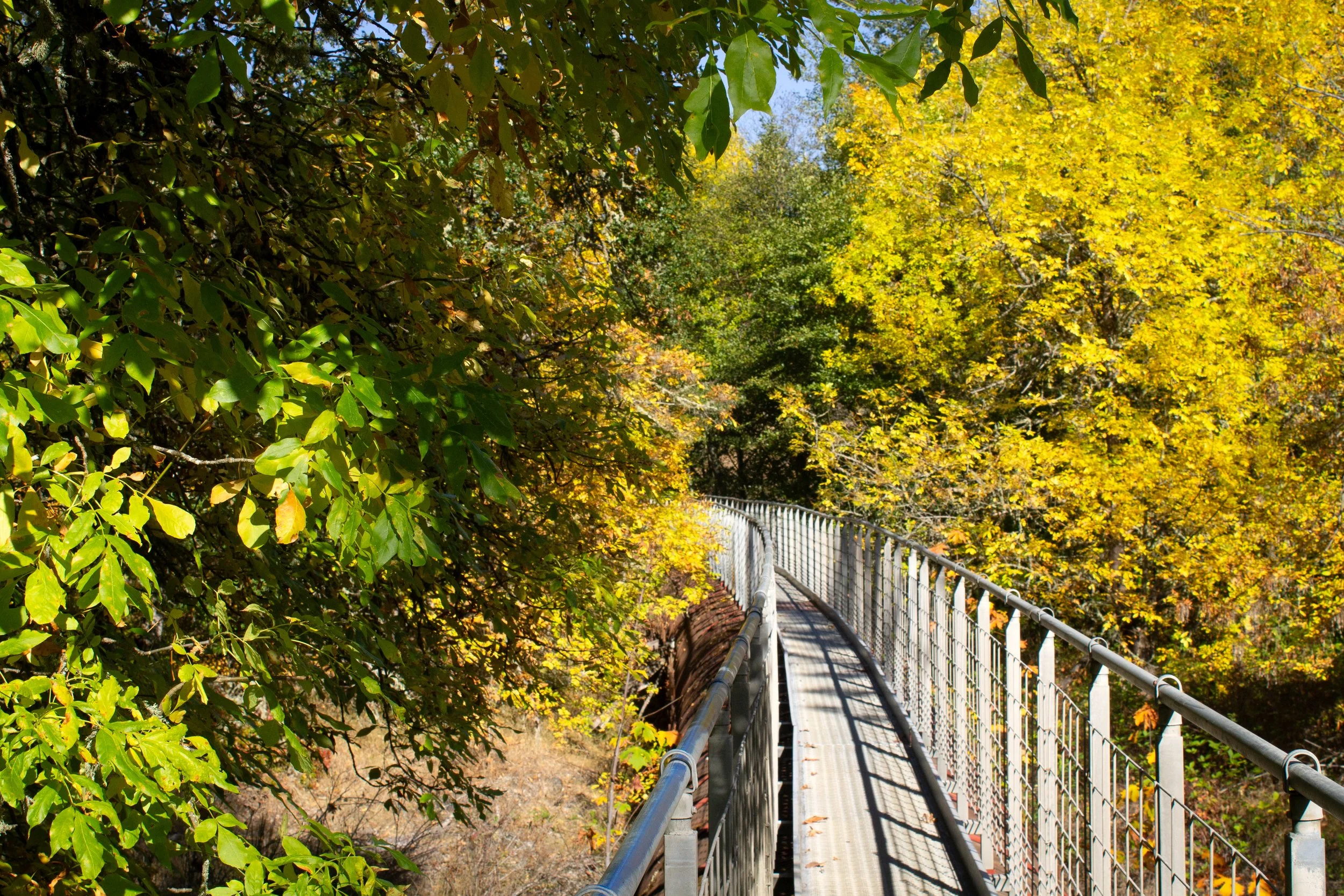
1. Hood River Pipeline Trail
Distance: 3 miles
Elevation gain: 100 feet
Difficulty: Easy
Pass required: None
Dog-friendly: Dogs are allowed on the trail, but it’s not a great hike for them. The metal grating of the walkway is hard on their paws.
ADA access: No
Restrooms: No
Season: All year, best from spring through fall.
The Hood River Pipeline Trail is the quirkiest hike in Hood River or, come to think of it, anywhere in Oregon. You park by an abandoned power station that’s become a canvas for graffiti artists. From here, you follow an active railroad track while watching for trains. Then, you move to a normal trail for a short stretch before reaching the unlikely finale, a long metal catwalk along the Hood River. In summer, you’ll pass a few good wading spots. In the fall, the mostly deciduous forest has good color. In any season, it’s an oddity that will keep you guessing.
2. Indian Creek Trail
Distance: 3 miles
Elevation gain: 250 feet
Difficulty: Easy
Pass required: None
Dog-friendly: Yes, leashed dogs are welcome on the trail.
ADA access: No
Restrooms: No
Season: All year, best from spring through fall.
Across the river from the Hood River Pipeline Trail is a different, more conventional hike. The Indian Creek Trail is a local favorite rather than a tourist draw, more about quiet beauty than show-stopping vistas. Scenic and uncrowded, it’s a place to go for an easy stroll, look for birds and lizards, then head to town for lunch. The trail has two sections, each about three miles round-trip. They may connect someday. Until then, I’d pick one or the other. The north section is close enough to downtown Hood River that you could walk there. The south section is just outside town.
Hikes near Hood River — Oregon
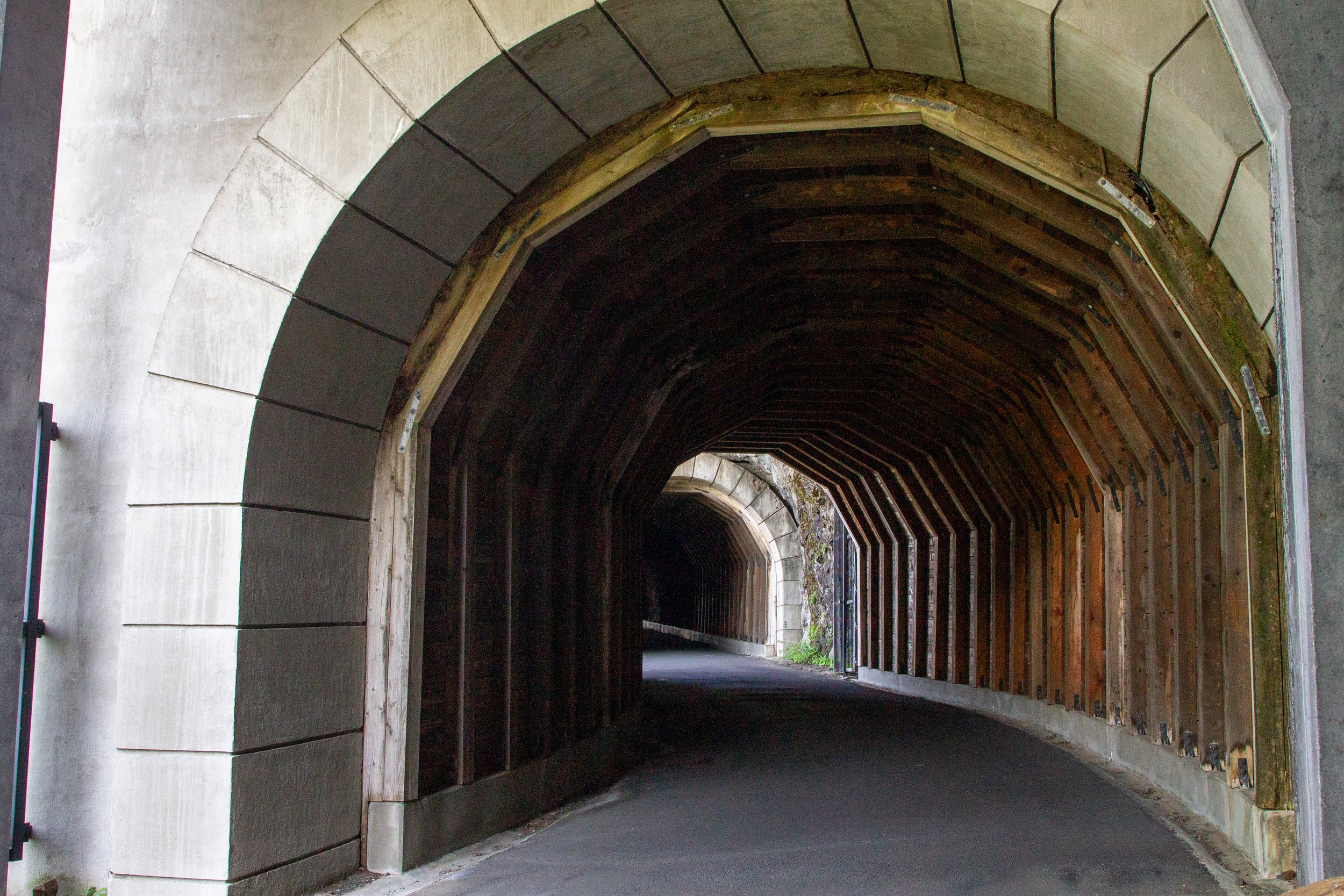
3. Twin Tunnels Hike
Distance: 9 miles
Elevation gain: 400 feet
Difficulty: Easy
Pass required: Oregon State Park Pass
Dog-friendly: Yes, leashed dogs are welcome on the trail.
ADA access: The trail is paved with grades up to 5%. The width is 10+ feet. Both trailheads have accessible parking. The west trailhead has easier parking and bathroom access.
Restrooms: Yes
Season: All year
Drive time from Hood River: 5 minutes
Before the construction of I-84, cars traveled through the Columbia Gorge on the Historic Columbia River Highway. Today, a 4.5-mile stretch of the former highway is now a car-free road for hiking and biking. It has two trailheads: one only 5 minutes from downtown Hood River and another in Mosier. The highlight of the trail is passing through the Mosier Twin Tunnels. Starting on the Hood River side, the trail begins in the forest and ends along a grassy plateau where wildflowers bloom in spring. Several viewpoints overlook the Columbia River and Washington’s diagonally slanted cliffs. If you do the whole thing, it makes sense to start on the Hood River side. For a shorter hike, I’d start in Mosier. The east trailhead is closer to the Twin Tunnels and the more impressive viewpoints.
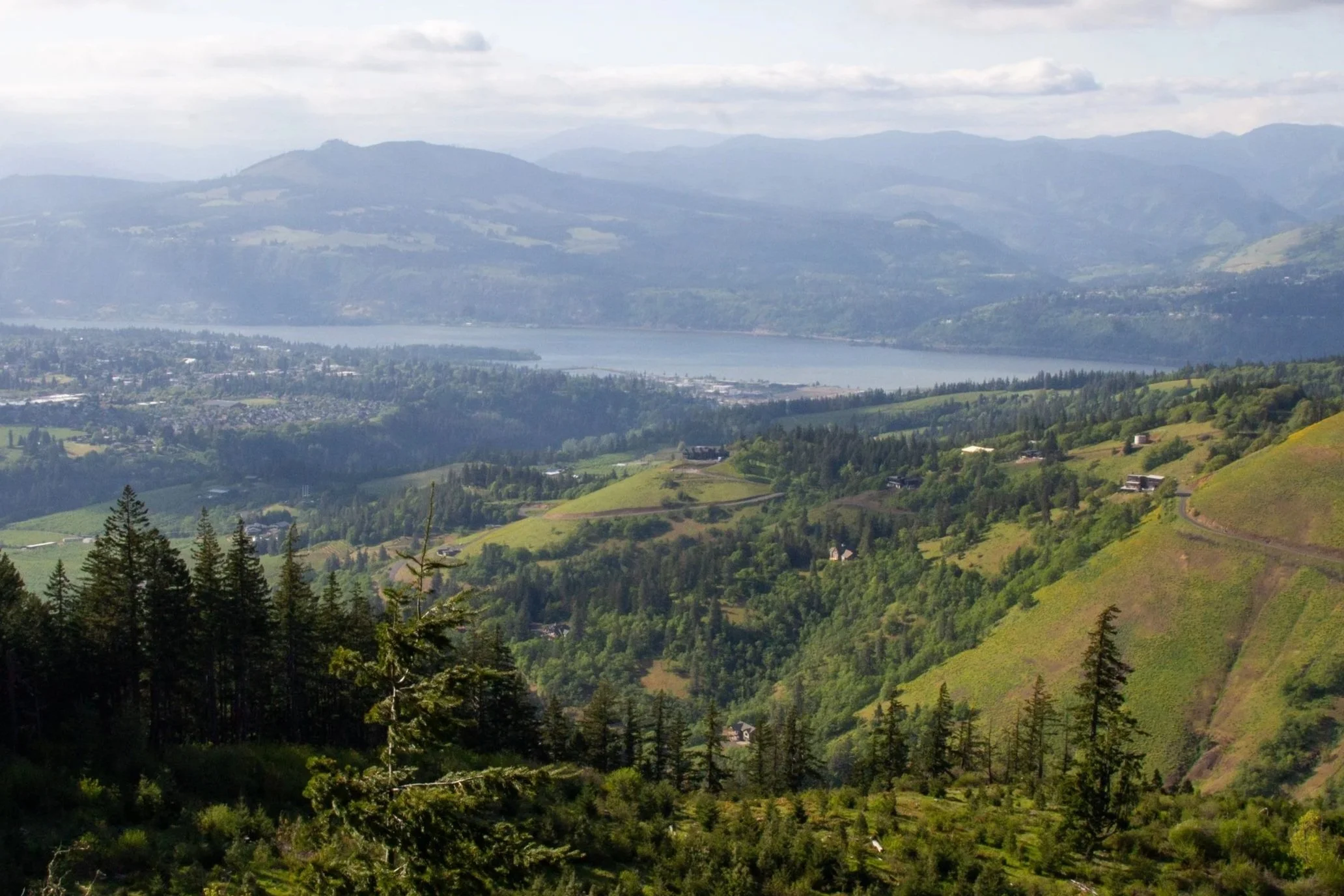
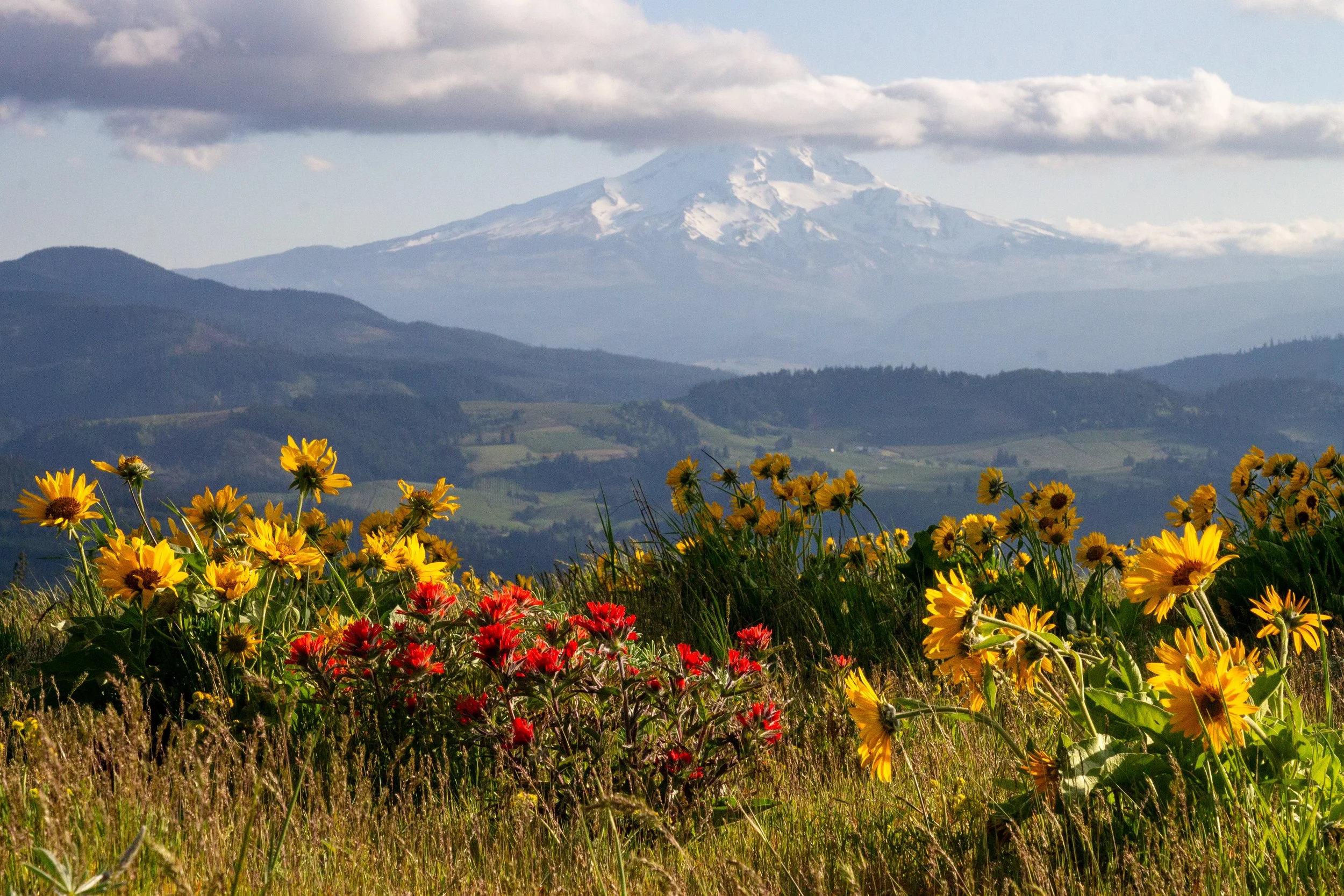
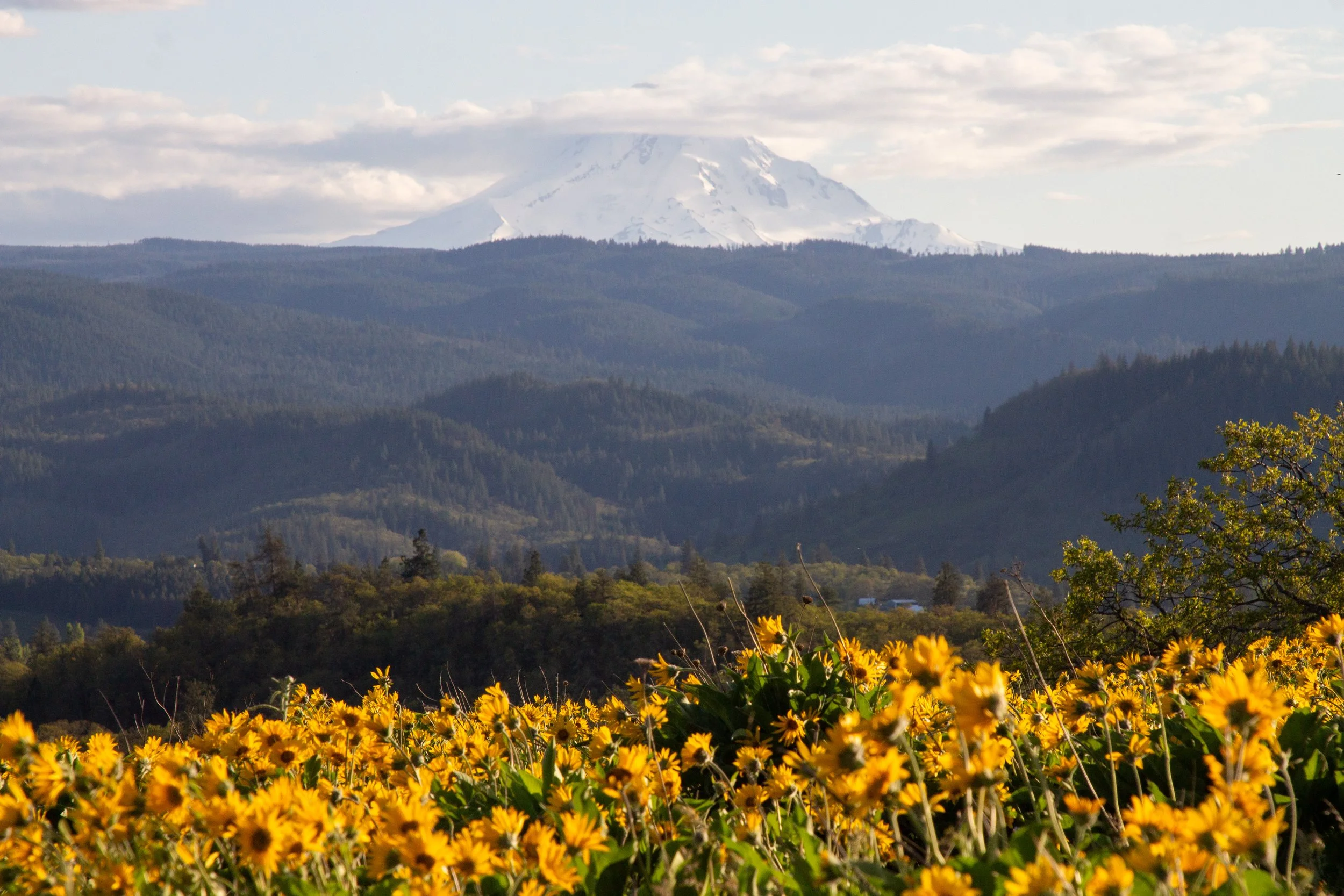
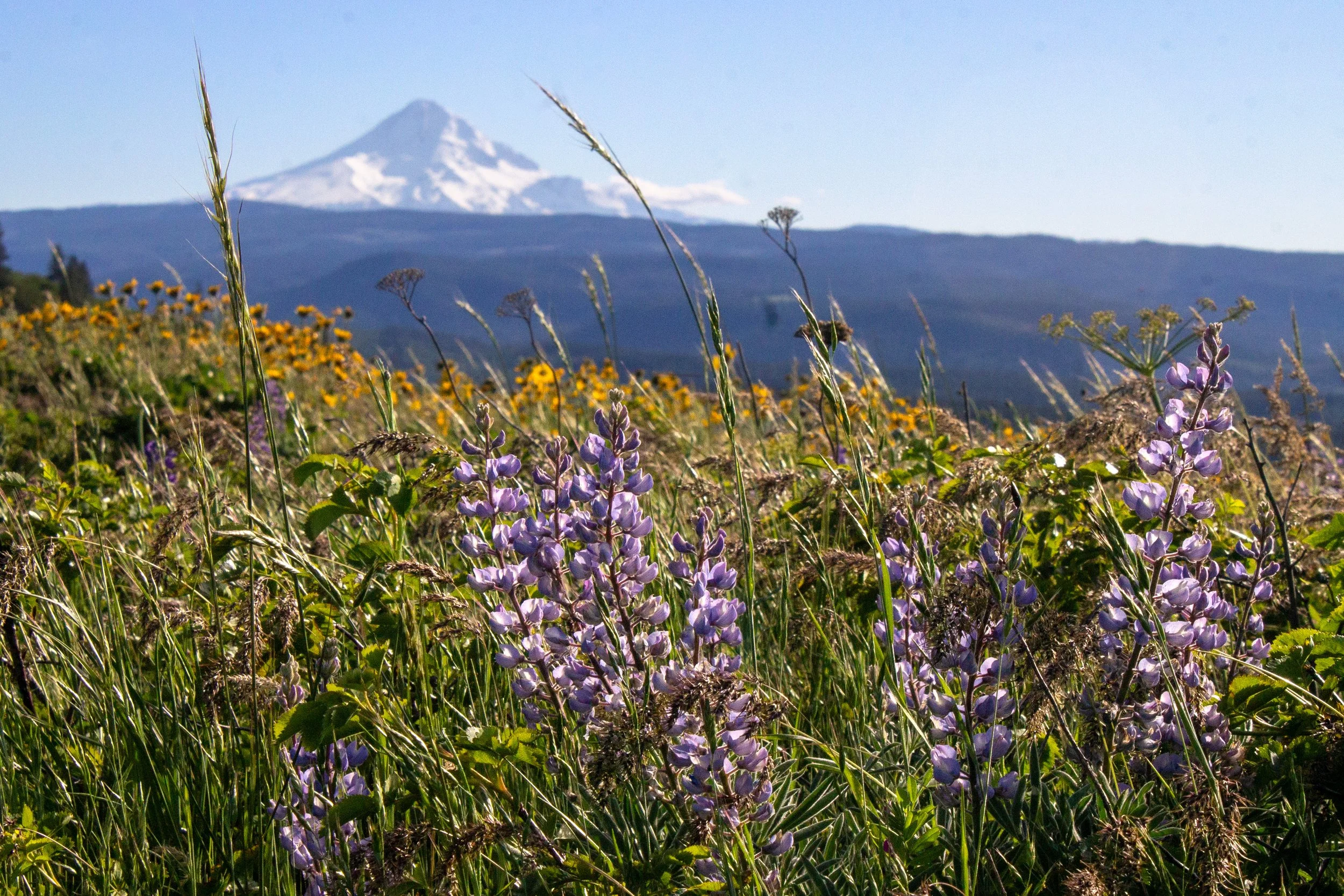
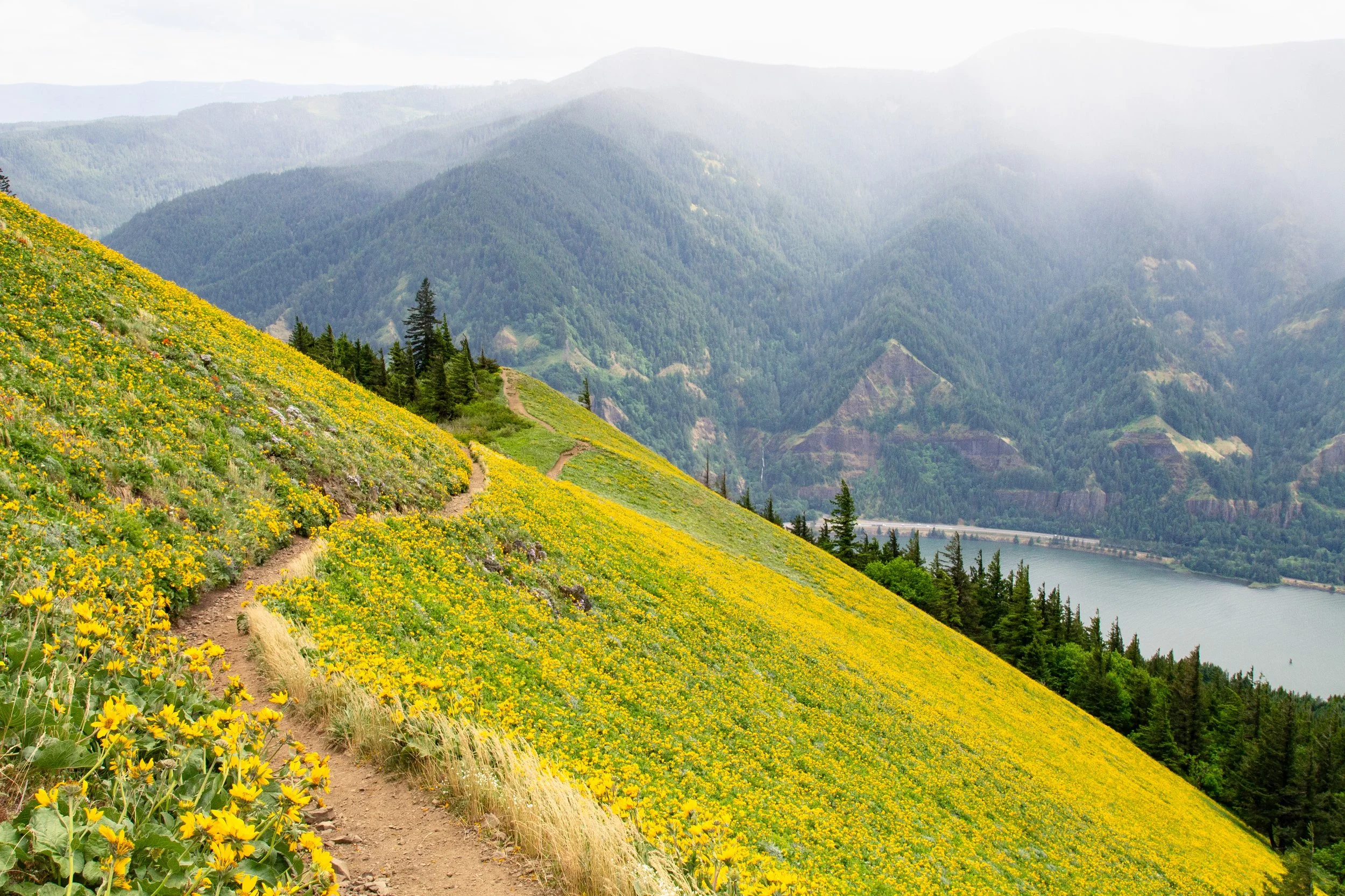
4. Hood River Mountain
Distance: 3 miles
Elevation gain: 600 feet
Difficulty: Moderate
Pass required: None
Dog-friendly: Yes, leashed dogs are welcome on the trail.
ADA access: No
Restrooms: No
Season: Spring through fall. Best in late spring.
Drive time from Hood River: 10 minutes
The hike on Hood River Mountain offers big rewards for the effort. After a fairly short uphill climb, you’ll walk along a ridge at the summit with incredible panoramic views overlooking the Hood River Valley, the Cascade Mountains, and the Columbia River. On clear days, Mount Adams and Mount Hood add to the grandeur of the scenery. The best time to visit is in mid to late spring when wildflowers cover the slopes of Hood River Mountain. Although not very crowded compared to many hikes near Hood River, the trailhead parking is limited, and it’s a good idea to arrive early on weekends in the spring. Bring layers for the almost certain chance of strong winds.
5. Mosier Plateau Trail
Distance: 3 miles
Elevation gain: 700 feet
Difficulty: Easy/moderate
Pass required: None
Dog-friendly: Yes, leashed dogs are welcome on the trail.
ADA access: No
Restrooms: Yes
Season: All year, best in spring.
Drive time from Hood River: 10 minutes
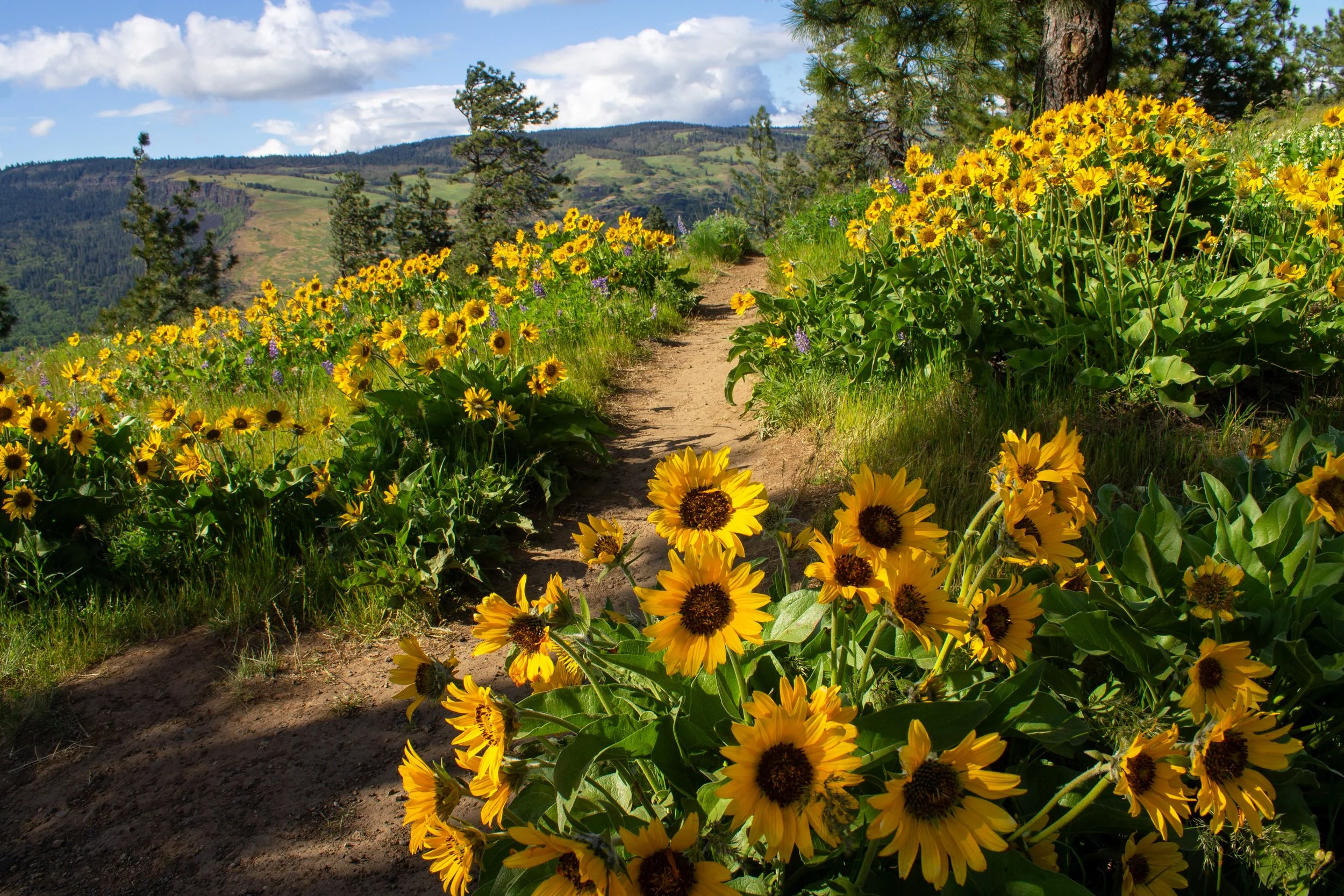
The Mosier Plateau Trail is one of the best hikes near Hood River year-round, but springtime takes it to another level. The trail begins through a historic cemetery with graves dating back to the 1800s. Next is Mosier Creek Falls, one of the few Columbia Gorge waterfalls east of Hood River. After climbing up a few switchbacks, you reach the magnificent views at the top of the plateau. For a short time each year, balsamroot and lupines bloom in the grasses. Something I like about this trail is that it has one of the better parking situations of the wildflower hikes near Hood River, with a larger lot and fewer visitors than Memaloose Hills or Rowena Crest down the road. It’s by no means obscure, but I would call it underrated.
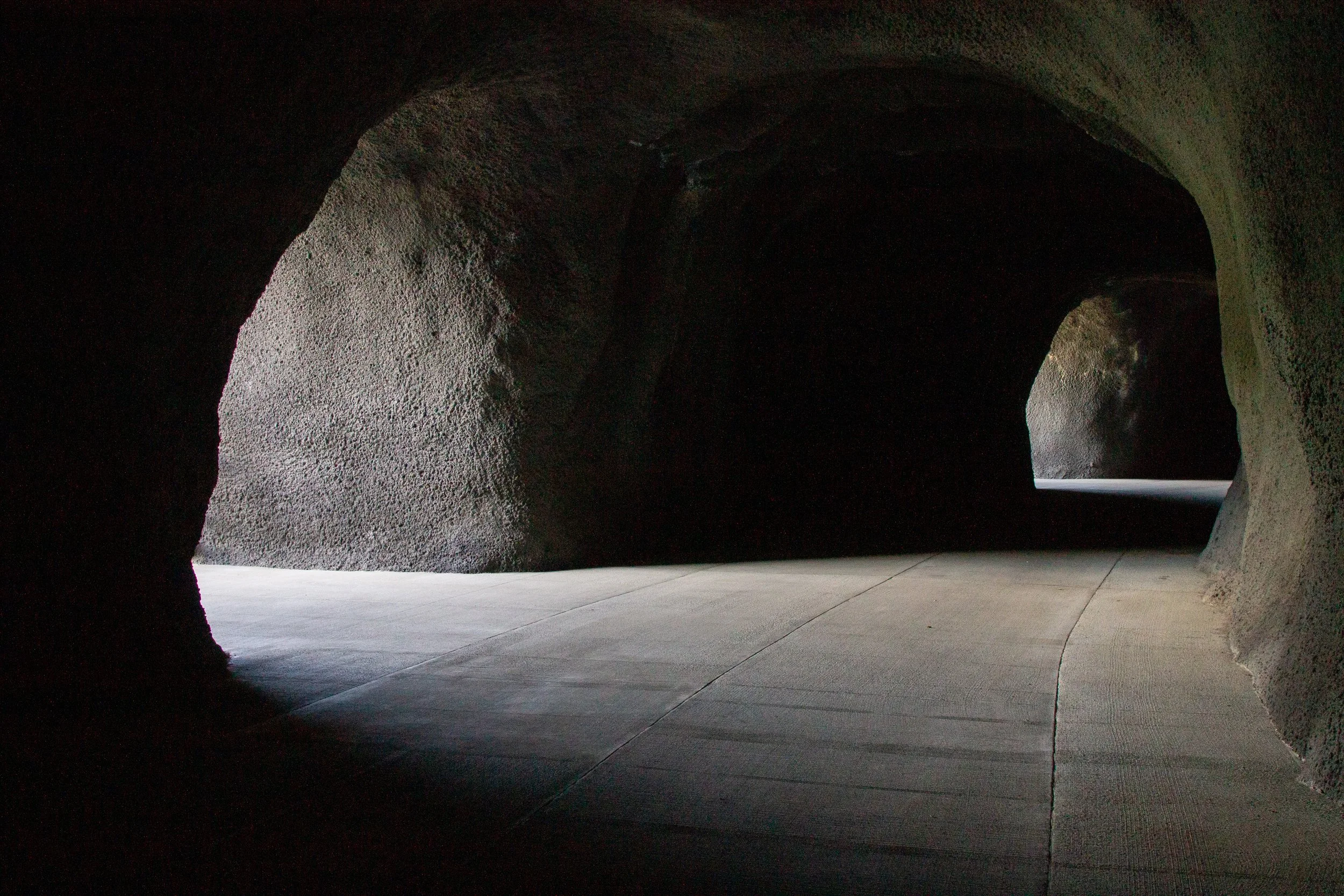
6. Mitchell Point
Distance: 1.5 - 3.5 miles
Elevation gain: Minimal to 1,000 feet
Difficulty: Easy (the tunnels) or moderate/hard (Mitchell Point)
Pass required: No
Dog-friendly: Yes, leashed dogs are welcome on the trails.
ADA access: The trail through the Mitchell Point Tunnels is wide, flat, and paved, without barriers like steps. It has a few benches. Accessible parking and restrooms. The Mitchell Point Trail is unpaved, narrow, and steep.
Restrooms: Yes
Season: All year
Drive time from Hood River: 10 minutes
Just west of Hood River, Mitchell Point has two short hikes, each a very different experience:
For everyone, I’d recommend the trail through the Mitchell Point Tunnels. Easy, family-friendly, and wheelchair-accessible, this paved trail recreates a section of the Historic Columbia River Highway, including tunnels with viewing windows that overlook the Columbia Gorge. Unlike the Mosier Twin Tunnels, they’re just around the corner from the parking lot.
For a challenge, you could also hike up Mitchell Point. Although short, the trail is steep and ends on a ridge with steep drop-offs on either side. The payoff is the panoramic views at the top. If you’re hiking with kids or dogs, I’d recommend stopping before the ridge.
7. Memaloose Hills
Distance: 3 miles
Elevation gain: 600 feet
Difficulty: Moderate
Pass required: None
Dog-friendly: Yes, leashed dogs are welcome on the trail.
ADA access: No
Restrooms: No
Season: All year, best in spring.
Drive time from Hood River: 15 minutes
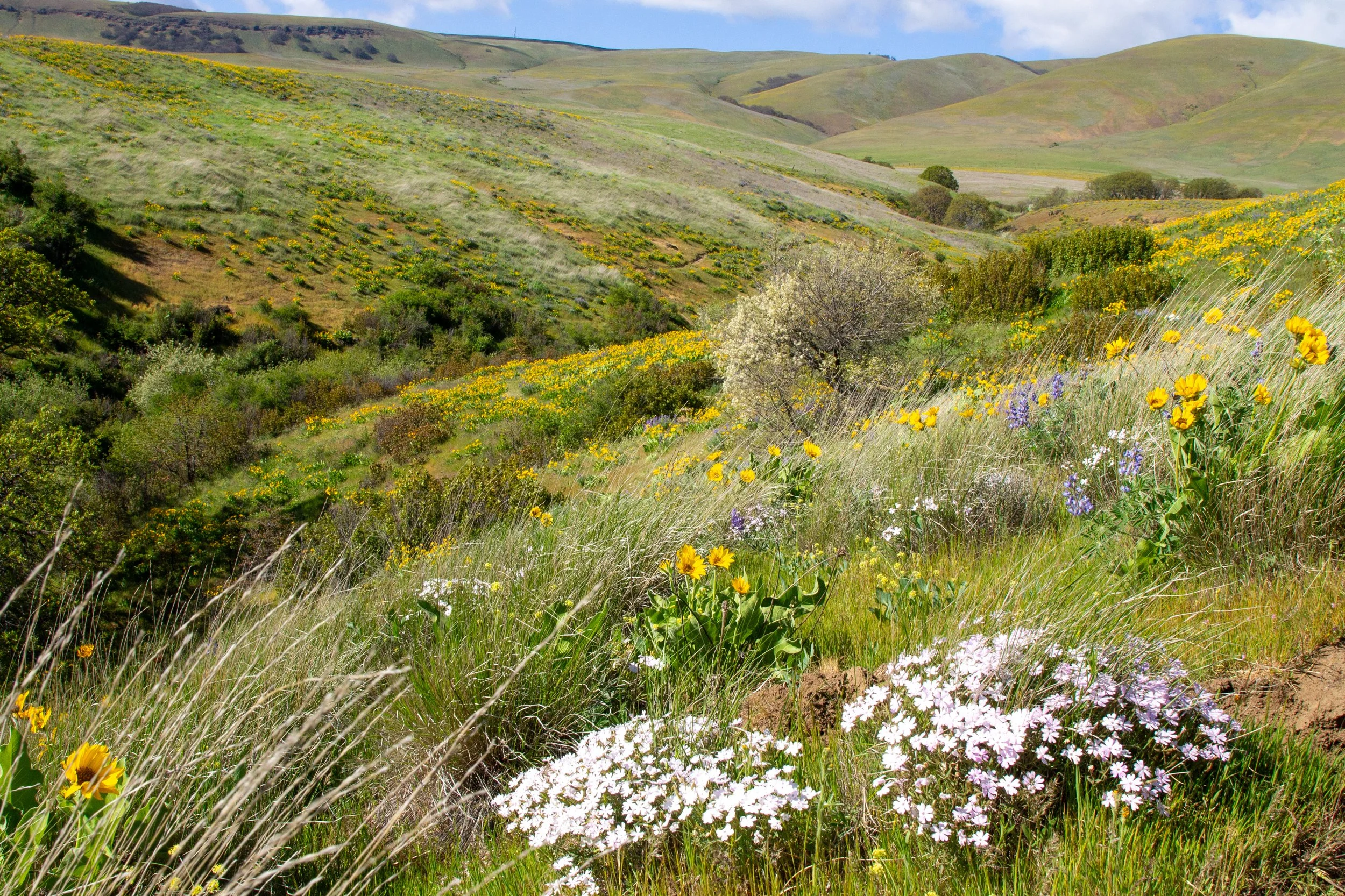
Memaloose Hills is a spectacular wildflower hike near Hood River. I’d call it the most popular on the Oregon side of the Columbia Gorge. The major catch is that the tiny parking lot falls way short of demand in the spring. Even on weekdays, I’ve seen a lot of unsafe parking during peak season. If you arrive early or get lucky and find a spot as someone is leaving, the hike is stunning. Balsamroot, lupines, and paintbrush cover rolling hills with excellent views of Mount Hood. Please stay on the trail. Make sure to park at the Memaloose Overlook on the Historic Columbia River Highway, not at the rest stop off I-84.
8. Rowena Crest trails
Distance: 2 - 5.5 miles
Elevation gain: Up to 1,200 feet
Difficulty: Easy (Rowena Plateau) or moderate (Tom McCall)
Pass required: None
Dog-friendly: No, dogs are not allowed on the trails.
ADA access: No, not beyond Rowena Crest Viewpoint.
Restrooms: No
Season: Best in spring. Rowena Plateau is open all year. Tom McCall Point is closed from November 1st until March 1st.
Drive time from Hood River: 20 minutes
Hood River has easy access to one of the most impressive sights in the Columbia Gorge, the Rowena Crest Viewpoint. Beneath it is the famous section of the Historic Columbia River Highway that curves so sharply it forms a teardrop. Around it are tall basalt cliffs on either side of the Columbia River. Two hiking trails begin from the viewpoint. The flat and easy 2-mile Rowena Plateau Trail explores the plateau near the river. The 3.5-mile trail to the top of Tom McCall Point brings you to far-reaching views where you can see Mount Hood and Mount Adams on clear days. In spring, it’s one of the great wildflower hikes near Hood River. Some rare species grow here, especially at Tom McCall. At any time of year, the contours of the eastern Columbia Gorge have an undeniable grandeur.
9. Punchbowl Falls
Distance: 1 mile
Elevation gain: 100 feet
Difficulty: Easy
Pass required: None
Dog-friendly: Yes, leashed dogs are welcome on the trail.
ADA access: No
Restrooms: No
Season: All year, best from spring through fall.
Drive time from Hood River: 20 minutes
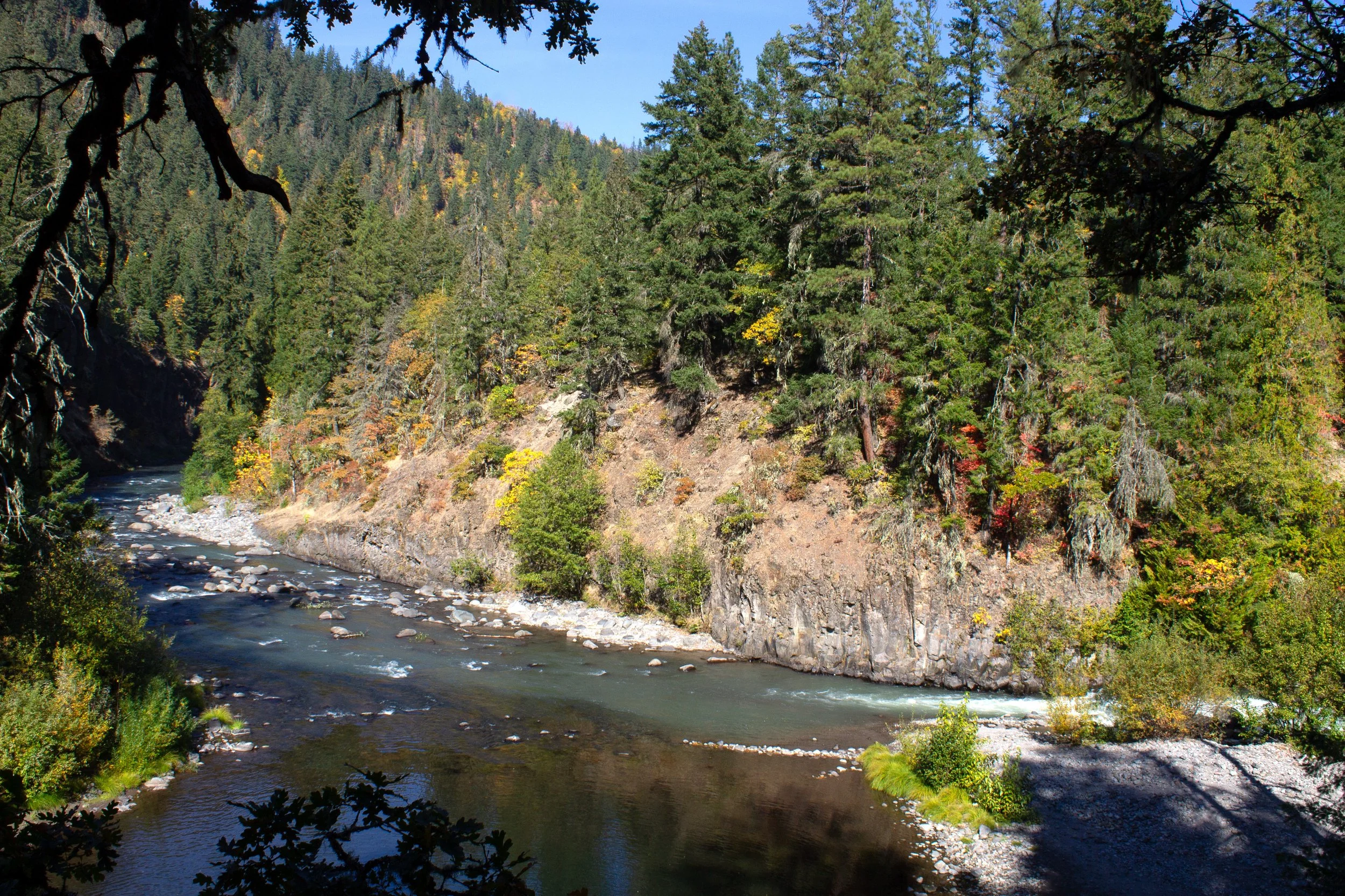
Hood River is close to two very different waterfall hikes with almost the same name. The famous one is Punch Bowl Falls on the Eagle Creek Trail. Since I’m focusing on the transitional area of the Columbia Gorge around Hood River, I’ll talk instead about the more obscure Punchbowl Falls hike south of town. Although it doesn’t have the same majesty as Eagle Creek, the short and easy loop through Punchbowl Falls Park takes you to two cool waterfalls and a great wading spot at the confluence of the east and west forks of the Hood River. Other than some easy-to-avoid drop-offs, it’s a good hike with kids. In the fall, the leaves have some of the best color I’ve seen near Hood River.
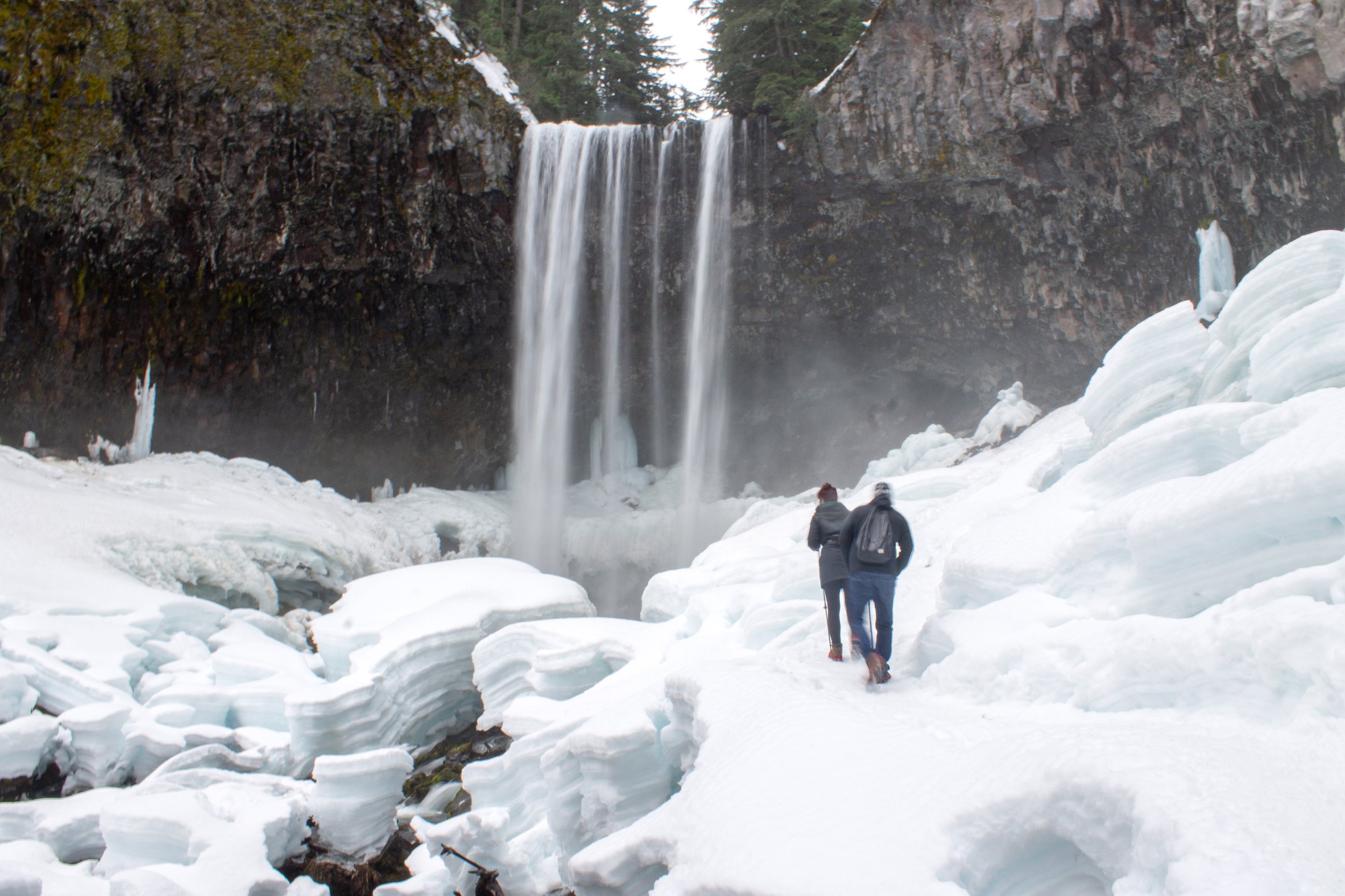
10. Tamanawas Falls
Distance: 3.5 miles
Elevation gain: 600 feet
Difficulty: Moderate
Pass required: NW Forest Pass or America the Beautiful Pass
Dog-friendly: Yes, leashed dogs are welcome on the trails.
ADA access: No
Restrooms: Yes
Season: May - October. In the winter, Tamanawas Falls is also a great snowshoe trail.
Drive time from Hood River: 30 minutes
Of Mount Hood’s waterfalls, I find Tamanawas Falls the most dramatic. It’s also the closest to Hood River. The trail to the falls begins through the woods next to Cold Spring Creek, which has pretty cascades along its course. Towards the end, you pass through a boulder field, where giant chunks of andesite make even the tallest hikers look tiny. The trail ends at the base of Tamanawas Falls and its clouds of billowing mist. Behind the waterfall is a broad cliff that adds to the wow factor at least as much as the 110-foot plunge. The drive from Hood River to Tamanawas Falls is a lovely trip through the orchards and vineyards of the Hood River Fruit Loop.
11. Chinidere Mountain

Distance: 4 miles
Elevation gain: 1,100 feet
Difficulty: Moderate
Pass required: NW Forest Pass or America the Beautiful Pass
Dog-friendly: Yes, leashed dogs are welcome on the trail.
ADA access: No
Restrooms: Yes
Season: Late spring through fall.
Drive time from Hood River: 60 minutes
Despite the incredible views at the summit, the hike up Chinidere Mountain is surprisingly uncrowded. I’m guessing the 2-hour drive time from Portland discourages most visitors. Given the hike’s relatively short distance, you’d spend more time in the car than on the trail. Coming from Hood River, it’s a different story. The hike begins at peaceful Wahtum Lake. From here, a short but steep trail brings you to the top of Chinidere Mountain, where a 360-degree Cascade Mountain panorama awaits. Mount Hood, the closest peak, looks huge and impressive. On clear days, you can also see Mount St Helens, Mount Adams, and Mount Rainier.
Hikes near Hood River — Washington
It’s easy to reach hiking trails in Washington from Hood River by crossing the Hood River Bridge. Two caveats. The bridge is narrow and somewhat stressful to cross. The other is the $3.50 toll each way.
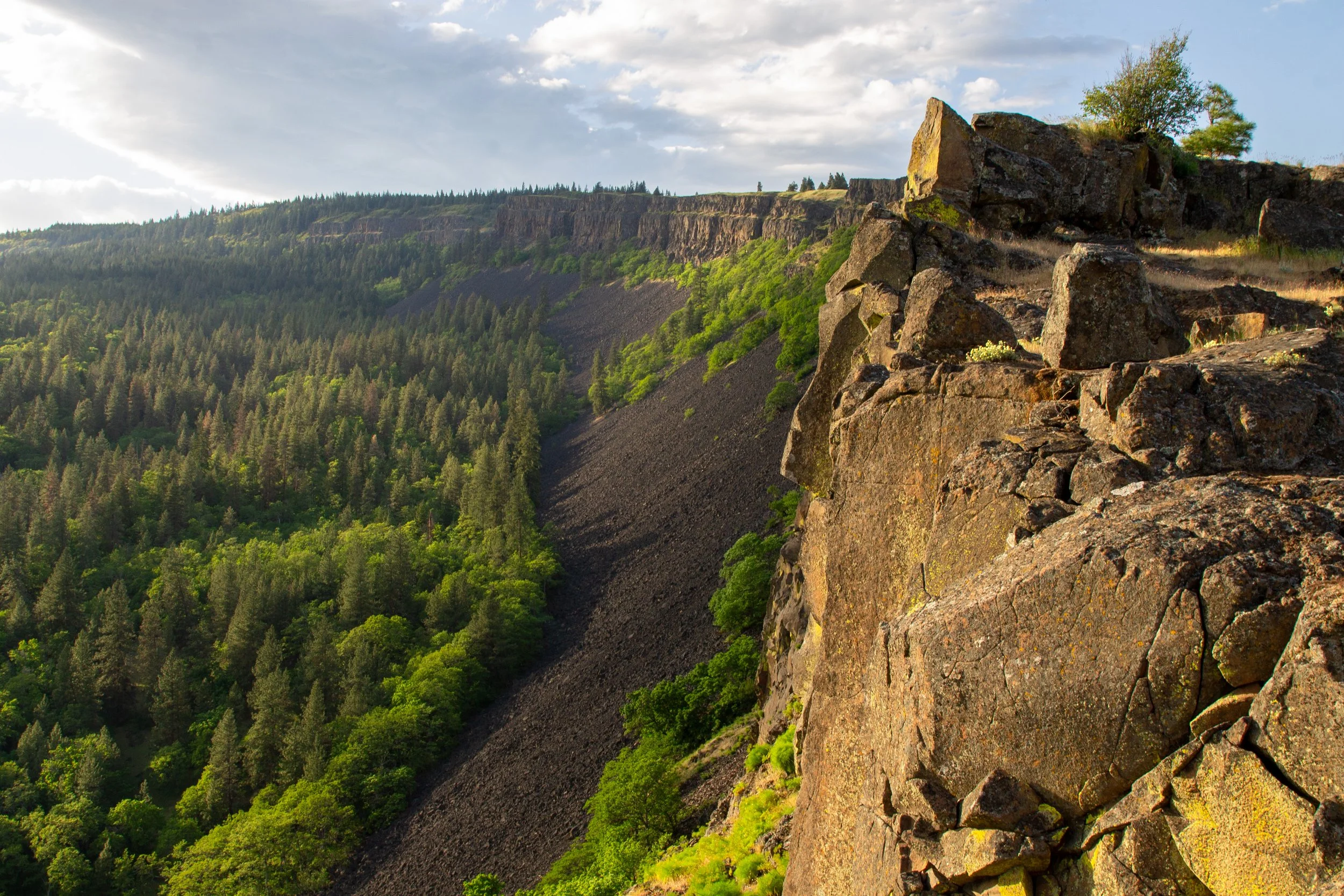
12. Coyote Wall - Labyrinth Loop
Distance: 6.5 miles
Elevation gain: 1,500 feet
Difficulty: Moderate
Pass required: None
Dog-friendly: Yes, dogs are welcome on the trail. They must be on a leash from December through the end of June.
ADA access: No
Restrooms: Yes
Season: All year. Best in spring.
Drive time from Hood River: 15 minutes
If you head across the Hood River Bridge into Washington, the Coyote Wall trail network is only a few minutes east on WA-14. Although one of the closest hikes to Hood River, the land looks very different. The trees thin, revealing big vistas. As you start the hike on an old decommissioned road, you’ll see Coyote Wall, a dramatic wall of cliffs. From here, you can follow a trail along a ridge at the top. The trail network allows for many potential routes. One of the most popular connects Coyote Wall and the Labyrinth, which has curious rock formations and a few little waterfalls. On clear days, you’ll see Mount Hood across the river, which becomes more impressive as you gain elevation.
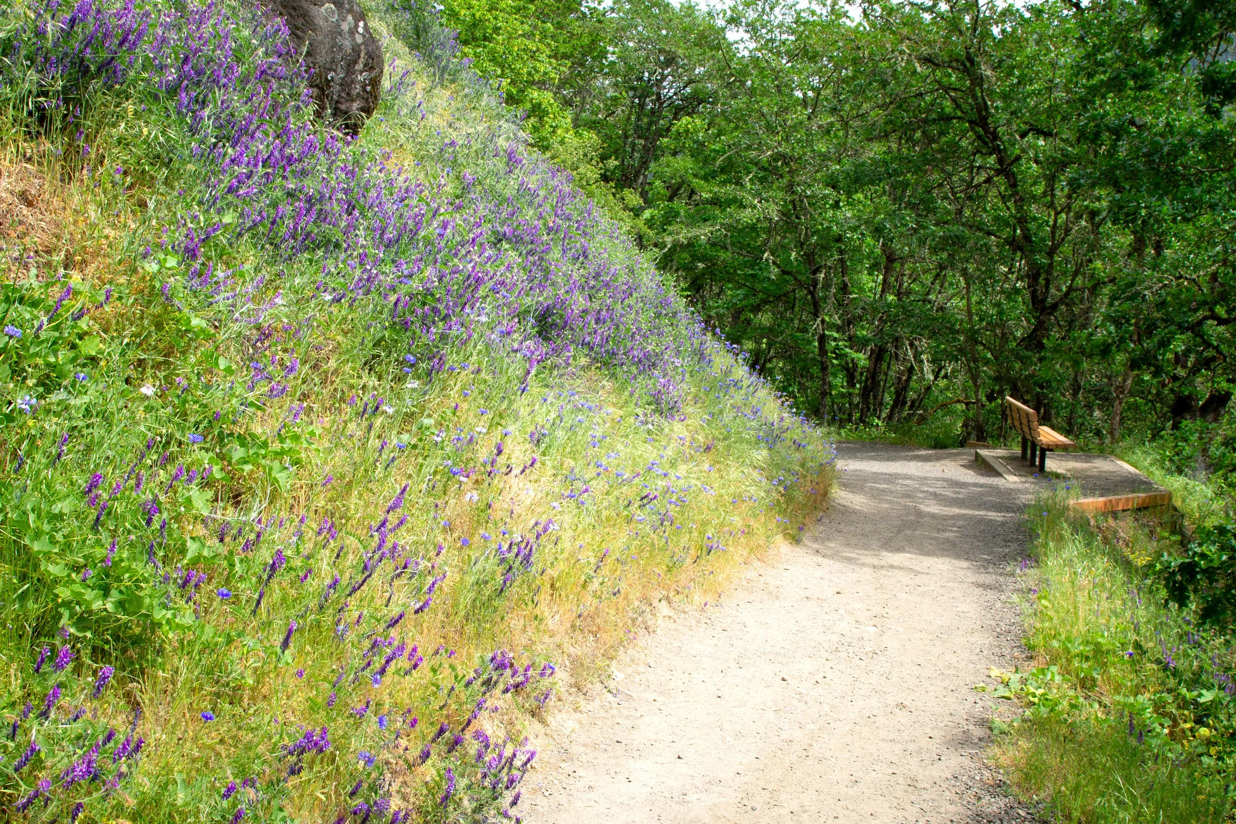
13. Catherine Creek

Distance: 1.2+ miles
Elevation gain: 100+ feet
Difficulty: Easy to moderate
Pass required: None
Dog-friendly: Yes, leashed dogs are welcome on the trails.
ADA access: The Catherine Creek Universal Access Trail is wide, even, and paved without obstacles like steps or tree roots. The grades get steep at times. It has benches. The gravel parking lot could be challenging with a wheelchair. The other trails are unpaved, uneven, and steep.
Restrooms: Yes
Season: All year. Best in spring.
Drive time from Hood River: 20 minutes
Catherine Creek is so close to Coyote Wall that their trail networks connect. You could potentially visit both in a loop hike, but it would be a long one. Instead, I prefer the shorter hike options. The 1.2-mile Catherine Creek Universal Access Loop is one of the most kid-friendly hikes near Hood River. This laid-back paved trail explores a plateau overlooking the Columbia River. Several benches along the hike are great places to pause and admire the views. In spring, camas blooms are a treat. On clear days, you can see Mount Hood sticking up above the hills. Across the road are the longer and steeper hikes. A good moderate option is the Catherine Creek Arch Loop, which takes you past an eye-catching recess in a basalt cliff. Wear layers and sunscreen when you visit. These trails have little shade and lots of wind.
14. Dog Mountain
Distance: 6 miles
Elevation gain: 2,800 feet
Difficulty: Hard
Pass required: NW Forest Pass all year. Seasonal permits are required on Memorial Day and weekends from mid-April to early June.
Dog-friendly: Yes, leashed dogs are welcome on the trail.
ADA access: No
Restrooms: Yes
Season: All year, best in late spring. Expect snow on the trail in winter.
Drive time from Hood River: 20 minutes
One of the most famous and beloved hikes in the Columbia Gorge is a short drive from Hood River. Among locals, the Dog Mountain Trail gets about as much attention as Multnomah Falls. Most visitors come in late spring when wildflowers cover the upper slopes of the mountain. The trail is challenging and one of the steepest hikes near Hood River. Bring plenty of water, sturdy shoes, and an offline map. If you visit on the weekend from mid-April to early June, reserve a parking permit in advance or plan on taking the free shuttle. On weekdays in spring, arrive before 9 AM or after 4 PM. Parking is much less competitive the rest of the year, although the views at the top don’t have quite the same magic as when the balsamroot is out.
15. Wind Mountain

Distance: 2.5 miles
Elevation gain: 1,100 feet
Difficulty: Moderate
Pass required: None
Dog-friendly: Yes, leashed dogs are welcome on the trail.
ADA access: No
Restrooms: No
Season: All year
Drive time from Hood River: 25 minutes
The Wind Mountain Trail is one of the most overlooked hikes near Hood River. With great views but no balsamroot, it’s a great alternative to Dog Mountain in every season but late spring. The trail is about as steep, but it ends much sooner, bringing you to similar scenery with more solitude and less uphill trudging. The human history of Wind Mountain is an added draw. An informational sign near the summit describes the vision quests that people performed here long ago. Given its cultural significance to the local tribes, it’s especially important to visit respectfully. Look for a map near the end of the trail that shows which areas are open to hikers. The talus slopes on Wind Mountain’s summit overlook sweeping Columbia Gorge vistas to both the east and west.
Waterfall hikes and the Multnomah Falls area
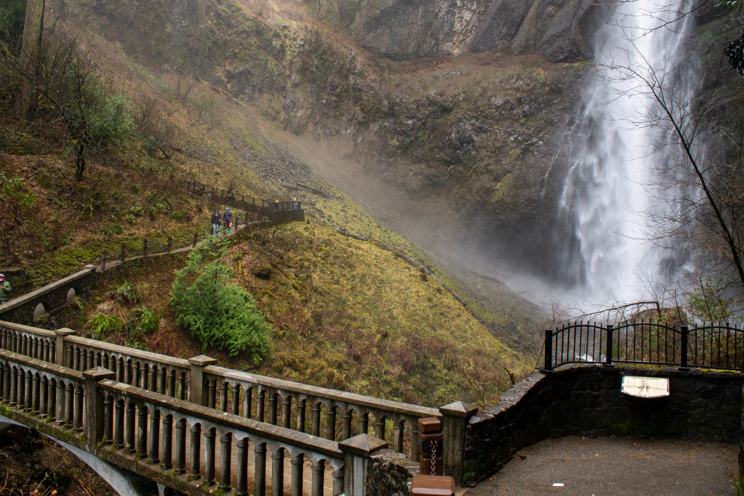
If it seems like I’m ignoring the western Columbia Gorge, it’s only to focus on the hikes closest to Hood River. I guess I’m thinking that if you made it to this article, you’ve probably already explored the area around Multnomah Falls. If it’s your first time visiting, I’d highly suggest making the waterfalls of the western Columbia Gorge part of your trip. Hood River is a convenient home base, about the same distance as Portland. Here are the hikes to check out:
Best hikes near Hood River, the summary:
Hood River Pipeline Trail
Indian Creek Trail
Twin Tunnels Hike
Hood River Mountain
Mosier Plateau
Mitchell Point
Memaloose Hills
Rowena Crest trails
Punchbowl Falls
Tamanawas Falls
Chinidere Mountain
Coyote Wall
Catherine Creek
Dog Mountain
Wind Mountain
Explore nearby

Find the best things to do in Hood River.

Find the best short hikes in the Columbia Gorge.

Try the best short hikes near Mount Hood.
Check out the best wildflower hikes in the Columbia Gorge.